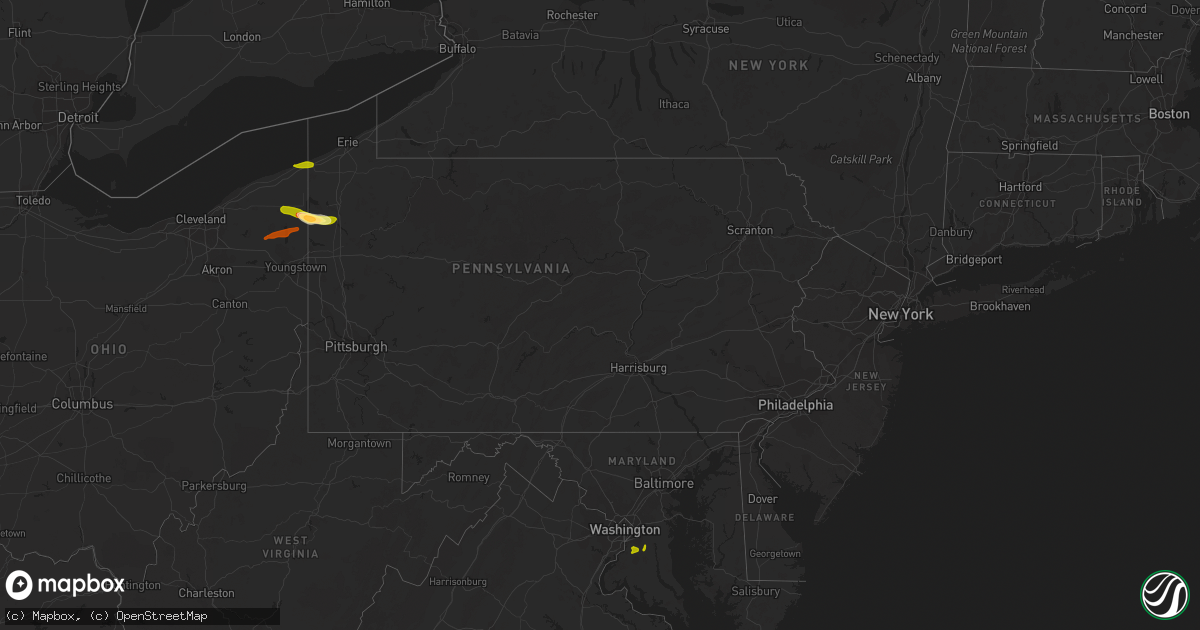
Hail Map in Pennsylvania on May 28, 2013
Get this storm
May 28 map
$229
one time, instant access
Download today. No call, no setup
Keep the $229
Bought the map and want the full workflow? Apply the entire $229 to a subscription within 7 days. None of it is wasted.
Every map, not just this one
This buys you this map. Subscription and you get every map we run, in the markets you choose from a few cities to whole states to nationwide. Plus real-time alerts the moment a storm fires.
Contact data
Name, contact info, occupancy, even credit band for addresses in the footprint. You go from where it hit to who to call.
Become the source they trust
Unlimited branding weather history reports on demand. You already have the documented answer ready for the property owner, and you are the one who showed up with it.
Property data and RoofTrace estimates
Pull up any address you have got, its value and the exact code rules for that jurisdiction, straight from One Click Code. Then RoofTrace estimates the squares, pitch, and roof value, priced the way you price.
Storm reports in Pennsylvania
Pennsylvania
| Date | Description |
|---|---|
| 05/28/20136:59 PM CDT | Mobile home destroyed in washington township by possible tornado. Reported by pema. |
| 05/28/20136:53 PM CDT | Structure damage to houses and down power lines. |
| 05/28/20136:53 PM CDT | *** 2 inj *** nws survey team confirmed an ef1 tornado touched down 2 miles north of edinboro and was on the ground intermittently for 18 miles as it tracked east throu |
| 05/28/20136:35 PM CDT | *** 5 inj *** nws survey team confirmed a ef1 tornado touched down 2 miles north of cranesville and was on the ground for approximately 2 miles. The tornado hit a mobil |
| 05/27/201310:25 PM CDT | Trees down on dennis lane |
| 05/27/20139:50 PM CDT | Tree and wires down on structure on dennis lane |
| 05/27/20139:00 PM CDT | Trees down on swamp road |
| 05/27/20139:00 PM CDT | Nws survey determined an ef1 tornado occurred in pine grove and elk townships. The tornado began west of cole hill road about 3 miles southeast of russell and moved eas |
| 05/27/20138:55 PM CDT | Trees and wires down on route 62 and colony drive |
| 05/27/20138:55 PM CDT | A nws survey determined that straight line winds collapsed a light pole and a flag pole and removed a roof covering from a large building at a baseball field located ju |
| 05/27/20138:41 PM CDT | Trees down on route 62 near blueberry golf course. Power outage from 920 pm to 935 pm. |
| 05/27/20138:28 PM CDT | Nws survey determined a small tornado occurred just west of brown hill road in sugar grove township moving east for a minute before lifting up west of the road. The sma |
| 05/27/20138:15 PM CDT | Several trees lopped off 8 feet above ground. |
| 05/27/20137:58 PM CDT | Multiple trees down |
| 05/27/20137:55 PM CDT | Multiple trees down |
| 05/27/20137:50 PM CDT | A local report indicates 1.00 inch wind near 4 N GREENVILLE |
| 05/27/20137:46 PM CDT | A local report indicates 1.50 inch wind near JAMESTOWN |
| 05/27/20137:45 PM CDT | Numerous trees down north of the city of jamestown. |
| 05/27/20137:41 PM CDT | 3 trees down and half dollar size hail reported at golf course on east lake road southwest of hartstown. |
| 05/27/20137:39 PM CDT | Quarter to half dollar size hail reported from williamsfield to east lake road. |
| 05/27/20137:18 PM CDT | Damage in the city of union city by possible tornado. Reported by pema. |
All States Impacted by Hail Map on May 28, 2013
Cities Impacted by Hail Map on May 28, 2013
- Lewellen, NE
- Arthur, NE
- Kinsman, OH
- Jamestown, PA
- Williamsfield, OH
- Greenville, PA
- Atlantic, PA
- Adamsville, PA
- Hartstown, PA
- Andover, OH
- Hadley, PA
- Torrington, WY
- Amarillo, TX
- Wildorado, TX
- Tescott, KS
- Bennington, KS
- Minneapolis, KS
- Iliff, CO
- Crook, CO
- Plains, KS
- Forgan, OK
- Meade, KS
- Lingle, WY
- Ovid, CO
- Brownville, NE
- Rock Port, MO
- Tarkio, MO
- Westboro, MO
- Nemaha, NE
- Barnard, KS
- Friona, TX
- Seneca, KS
- Baileyville, KS
- Goff, KS
- Oneida, KS
- Sabetha, KS
- Corning, KS
- Centralia, KS
- Wetmore, KS
- Allerton, IA
- Corydon, IA
- Humeston, IA
- Sublette, KS
- Satanta, KS
- Julesburg, CO
- Victoria, KS
- Walker, KS
- Hereford, TX
- Vega, TX
- Ashland, KS
- Rosston, OK
- Buffalo, OK
- Protection, KS
- Auburn, NE
- Watson, MO
- Beloit, KS
- Lincoln, KS
- Solomon, KS
- Lucas, KS
- Tipton, KS
- Hunter, KS
- Beverly, KS
- Osborne, KS
- Lenox, IA
- Creston, IA
- Hiawatha, KS
- Highland, KS
- Robinson, KS
- Venango, NE
- Gurley, NE
- Sidney, NE
- Sedgwick, CO
- Chappell, NE
- Muleshoe, TX
- Farwell, TX
- Fleming, CO
- Newcastle, WY
- Vermillion, KS
- Axtell, KS
- Havensville, KS
- Frankfort, KS
- Home, KS
- Powhattan, KS
- Onaga, KS
- Beattie, KS
- Fairview, KS
- Hays, KS
- Schoenchen, KS
- Sterling, CO
- Chariton, IA
- Oshkosh, NE
- Tryon, NE
- Columbus Junction, IA
- Crawfordsville, IA
- Mount Pleasant, IA
- Wapello, IA
- Wayland, IA
- Winfield, IA
- Coldwater, KS
- Lodgepole, NE
- Panhandle, TX
- Adrian, TX
- Potter, NE
- Dalton, NE
- Harrison, NE
- Morrill, NE
- Circleville, KS
- Blue Rapids, KS
- Summerfield, KS
- Netawaka, KS
- Soldier, KS
- Marysville, KS
- Haxtun, CO
- Hershey, NE
- Sutherland, NE
- White Cloud, KS
- Clearfield, IA
- Diagonal, IA
- Brighton, IA
- Bovina, TX
- Pampa, TX
- San Jon, NM
- White Deer, TX
- Groom, TX
- Gate, OK
- Englewood, KS
- Albia, IA
- Eddyville, IA
- Ottumwa, IA
- Pattonsburg, MO
- Maysville, MO
- Weatherby, MO
- Afton, IA
- Parkston, SD
- Dimock, SD
- Lancaster, KS
- Wathena, KS
- Bendena, KS
- Denton, KS
- Oregon, MO
- Troy, KS
- Atchison, KS
- Everest, KS
- Pickering, MO
- Blockton, IA
- Sheridan, MO
- Hatfield, MO
- Redding, IA
- Grant City, MO
- Parnell, MO
- Maryville, MO
- Mount Ayr, IA
- Ravenwood, MO
- Hopkins, MO
- Paxton, NE
- Richland, IA
- Fairfield, IA
- Packwood, IA
- Hallam, NE
- Pickrell, NE
- Clatonia, NE
- Fairbury, NE
- Martell, NE
- Plymouth, NE
- Jansen, NE
- Cortland, NE
- De Witt, NE
- Diller, NE
- Beatrice, NE
- Endicott, NE
- Fort Laramie, WY
- Jay Em, WY
- Yoder, WY
- Wilmore, KS
- Ulysses, KS
- Grant, NE
- Kilgore, NE
- Dix, NE
- Padroni, CO
- Lemoyne, NE
- Peetz, CO
- Lisco, NE
- Lake City, KS
- Saint Joseph, MO
- Savannah, MO
- McFall, MO
- Rea, MO
- Amazonia, MO
- King City, MO
- Union Star, MO
- Cosby, MO
- Amity, MO
- Helena, MO
- Otis, CO
- Big Springs, NE
- Madrid, NE
- Ogallala, NE
- Holyoke, CO
- Kellerton, IA
- Eagleville, MO
- Lamoni, IA
- Mukwonago, WI
- Tripp, SD
- Delmont, SD
- Burlington Junction, MO
- Elmo, MO
- Skidmore, MO
- Clearmont, MO
- Chillicothe, MO
- Wheeling, MO
- Linneus, MO
- Purdin, MO
- Laverne, OK
- Alva, OK
- Freedom, OK
- Deer Trail, CO
- Agate, CO
- Keystone, NE
- Bristolville, OH
- Southington, OH
- Warren, OH
- Farmdale, OH
- Cortland, OH
- West Farmington, OH
- Cochranton, PA
- Orwell, OH
- Rome, OH
- Jefferson, OH
- West Springfield, PA
- Albion, PA
- Conneaut, OH
- Accokeek, MD
- Clinton, MD
- Brandywine, MD
- Upper Marlboro, MD
- Texico, NM
- Skellytown, TX
- Gruver, TX
- Spearman, TX
- Stratford, TX
- Fowler, KS
- Horton, KS
- McCracken, KS
- Agenda, KS
- Haddam, KS
- Clifton, KS
- Mahaska, KS
- Concordia, KS
- Washington, KS
- Morrowville, KS
- Clyde, KS
- Wilber, NE
- Downs, KS
- Glen Elder, KS
- Hemingford, NE
- Alliance, NE
- McCamey, TX
- Crane, TX
- Eagle, WI
- Lovilia, IA
- Cedar, IA
- Oskaloosa, IA
- Hedrick, IA
- Fremont, IA
- Sigourney, IA
- Bedford, IA
- Osceola, IA
- Weldon, IA
- Woodburn, IA
- Grand River, IA
- Blakesburg, IA
- Promise City, IA
- Russell, IA
- Lockridge, IA
- Keithsburg, IL
- Oakville, IA
- Mediapolis, IA
- Seaton, IL
- Washington, IA


