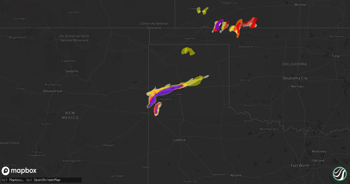
Hail Map on May 28, 2013
Get this storm
May 28 map
$229
one time, instant access
Download today. No call, no setup
Keep the $229
Bought the map and want the full workflow? Apply the entire $229 to a subscription within 7 days. None of it is wasted.
Every map, not just this one
This buys you this map. Subscription and you get every map we run, in the markets you choose from a few cities to whole states to nationwide. Plus real-time alerts the moment a storm fires.
Contact data
Name, contact info, occupancy, even credit band for addresses in the footprint. You go from where it hit to who to call.
Become the source they trust
Unlimited branding weather history reports on demand. You already have the documented answer ready for the property owner, and you are the one who showed up with it.
Property data and RoofTrace estimates
Pull up any address you have got, its value and the exact code rules for that jurisdiction, straight from One Click Code. Then RoofTrace estimates the squares, pitch, and roof value, priced the way you price.
States Impacted by Hail Map on May 28, 2013
Storm reports
Kansas
| Date | Description |
|---|---|
| 05/28/20136:58 PM CDT | A local report indicates 65 MPH wind near 4 ESE MINNEAPOLIS |
| 05/28/20136:54 PM CDT | A local report indicates 2.00 inch wind near 3 N ROBINSON |
| 05/28/20136:45 PM CDT | A local report indicates 1.00 inch wind near MORROWVILLE |
| 05/28/20136:45 PM CDT | A local report indicates 1.75 inch wind near 4 ESE MINNEAPOLIS |
| 05/28/20136:45 PM CDT | A local report indicates 1.00 inch wind near 4 SW ROBINSON |
| 05/28/20136:45 PM CDT | A local report indicates 1.00 inch wind near 4 N FRANKFORT |
| 05/28/20136:45 PM CDT | Small tree limbs down |
| 05/28/20136:42 PM CDT | A local report indicates a tornado near 7 W GREAT BEND |
| 05/28/20136:40 PM CDT | Rope tornado reported south of otis. |
| 05/28/20136:35 PM CDT | A local report indicates 1.00 inch wind near 6 E AGENDA |
| 05/28/20136:33 PM CDT | A local report indicates 1.25 inch wind near 3 W BUTTERMILK |
| 05/28/20136:22 PM CDT | A local report indicates 1.00 inch wind near 3 WNW CLYDE |
| 05/28/20136:14 PM CDT | A local report indicates 1.00 inch wind near 6 S CLYDE |
| 05/28/20136:11 PM CDT | A local report indicates 1.50 inch wind near 4 W FRANKFORT |
| 05/28/20136:00 PM CDT | A local report indicates 1.75 inch wind near 20 SE COLDWATER |
| 05/28/20135:52 PM CDT | Large wedge nearly stationary. |
| 05/28/20135:49 PM CDT | A local report indicates 1.25 inch wind near SE MINNEAPOLIS |
| 05/28/20135:40 PM CDT | A local report indicates 1.00 inch wind near 6 SSW MEADE |
| 05/28/20135:36 PM CDT | A local report indicates 1.75 inch wind near 4 ESE MINNEAPOLIS |
| 05/28/20135:34 PM CDT | A local report indicates a tornado near 4 W BENNINGTON |
| 05/28/20135:32 PM CDT | A local report indicates 1.75 inch wind near 4 ESE MINNEAPOLIS |
| 05/28/20135:30 PM CDT | The hail was reported to covering the ground about 2 inches deep. |
| 05/28/20135:30 PM CDT | Nickle to quarter sized hail was reported. |
| 05/28/20134:50 PM CDT | New tornado developed 1.5 miles west of goff. |
| 05/28/20134:45 PM CDT | The caller reported mostly dime sized hail. |
| 05/28/20134:37 PM CDT | A local report indicates 1.00 inch wind near 7 ESE SENECA |
| 05/28/20134:32 PM CDT | Large tornado lasted several mintues. Nearly stationary. |
| 05/28/20134:30 PM CDT | Old barns were damaged. A roof was torn off of a lean-to. |
| 05/28/20134:30 PM CDT | Two to three inch diameter tree limbs blown down. |
| 05/28/20134:30 PM CDT | Tree damage reported across the city of englewood. |
| 05/28/20134:30 PM CDT | Old church in englewood had tin blown off of it. A few old outbuildings were blown down. Twelve inch tree branches were broken. |
| 05/28/20134:20 PM CDT | Time estimated from radar |
| 05/28/20134:20 PM CDT | A local report indicates 1.75 inch wind near 20 SSW MEADE |
| 05/28/20134:16 PM CDT | A local report indicates a tornado near 4 W CORNING |
| 05/28/20134:05 PM CDT | A local report indicates 2.50 inch wind near 1 S CENTRALIA |
| 05/28/20133:35 PM CDT | Delayed report |
| 05/27/20139:45 PM CDT | Power lines blown down. |
| 05/27/20139:45 PM CDT | 6 to 8 inch tree limbs blown down. |
| 05/27/20138:58 PM CDT | A local report indicates 1.00 inch wind near TIPTON |
| 05/27/20138:49 PM CDT | A local report indicates 1.00 inch wind near TIPTON |
| 05/27/20138:49 PM CDT | A local report indicates 1.00 inch wind near 1 ESE TIPTON |
| 05/27/20138:12 PM CDT | These ping-pong size hail stones were found just north of victoria off of i-70 interstate. |
| 05/27/20137:55 PM CDT | A local report indicates 1.00 inch wind near SCHOENCHEN |
| 05/27/20137:48 PM CDT | A local report indicates 1.75 inch wind near 9 NE HUNTER |
| 05/27/20137:36 PM CDT | A local report indicates 1.75 inch wind near 6 W BARNARD |
| 05/27/20137:19 PM CDT | A local report indicates 1.50 inch wind near 4 NE LINCOLN |
| 05/27/20137:15 PM CDT | A local report indicates 1.00 inch wind near 16 SE MEADE |
Iowa
| Date | Description |
|---|---|
| 05/28/20136:55 PM CDT | Lasted for less than two minutes. |
| 05/28/20136:32 PM CDT | Hail lasted for 1 minute |
| 05/28/20136:25 PM CDT | Social media report of quarter to half dollar size hail in humeston |
| 05/28/20136:08 PM CDT | A local report indicates 1.50 inch wind near CRESTON |
| 05/28/20136:07 PM CDT | A local report indicates 1.00 inch wind near 4 NNW CRESTON AIRPORT |
| 05/28/20136:05 PM CDT | A local report indicates 1.00 inch wind near CRESTON |
| 05/28/20135:50 PM CDT | A local report indicates 1.00 inch wind near 2 E GERMANVILLE |
| 05/28/20135:11 PM CDT | Hail lasted for 10 minutes. |
| 05/28/20134:42 PM CDT | A few stones slightly larger. Hail piled up in drifts. Some wind with half inch diameter tree limbs down. Hail lasted 10 minutes. |
| 05/27/20138:35 PM CDT | Centerville airport awos |
| 05/27/20137:42 PM CDT | Spotter estimated wind speeds of 60 to 70 mph. Visibility in heavy rain estimated to be around a quarter of a mile. |
| 05/27/20137:40 PM CDT | Late report. Siding blown off of house. A 4 inch diameter limb blown down. Several other smaller branches also blown down. Barn damaged by a fallen limb. Time estimated |
| 05/27/20137:32 PM CDT | Reported trees and branches down all over fairfield. |
Ohio
| Date | Description |
|---|---|
| 05/28/20136:06 PM CDT | Very heavy rain |
| 05/28/20133:35 PM CDT | A local report indicates 1.00 inch wind near BRISTOLVILLE |
| 05/27/20137:32 PM CDT | Large tree limbs down on route 322 east of route 7 along with quarter size hail |
Wisconsin
| Date | Description |
|---|---|
| 05/27/20139:07 PM CDT | Mostly a mix of dime/quarter sized hailstones. Plastic window well covers were broken. |
South Dakota
| Date | Description |
|---|---|
| 05/27/20137:27 PM CDT | 0.5 mile s of allen roof off house. |
Michigan
| Date | Description |
|---|---|
| 05/28/20134:56 PM CDT | 24 inch diameter live tree down. Had some rot in the center. Snapped at 10 feet off ground. |
| 05/28/20134:56 PM CDT | 8 inch diameter live tree down. |
| 05/28/20136:13 AM CDT | Branches down along mayer rd between ravenswood and lambs. Some large branches and one possible tree.7 |
| 05/27/201310:02 PM CDT | Large branches reported down in the milwood neighborhood of kalamazoo. |
| 05/27/201310:02 PM CDT | Numerous large tree limbs down up to a foot in diameter on gardner rd |
| 05/27/20139:55 PM CDT | 911 dispatch reports numerous tree downs across southern portions of the county |
| 05/27/20139:40 PM CDT | Tree uprooted near hill road east of m15. Time of event is estimated. |
| 05/27/20139:03 PM CDT | Homes destroyed on hegel road. People reported trapped in homes. |
| 05/27/20139:00 PM CDT | Reports of significant damage to homes near hegal and gale roads. One home was reported leveled. |
| 05/27/20139:00 PM CDT | Trees and wires downed on east hegel. Unable to go north towards atlas due to trees and wires down. People reported trapped in high school |
| 05/27/20138:56 PM CDT | Tree downed across mccandlish road |
| 05/27/20138:54 PM CDT | The tornado was rated ef2 with a maximum wind speed of 130 mph. The maximum path width was 300 yards with a total path length of 4.6 miles. The tornado started near the |
| 05/27/20138:37 PM CDT | Barn collapse on torrey road between baldwin and ray roads |
| 05/27/20138:35 PM CDT | Over a dozen trees downed across a quarter mile stretch of baldwin road just west of fenton road. Possible tornado damage. |
| 05/27/20138:30 PM CDT | The tornado was rated ef2 with maximum wind speeds of 115 mph. The maximum path width was 500 yards with a total path length 2.8 miles. The tornado started along odell |
| 05/27/20138:29 PM CDT | House leveled on south jennings road |
| 05/27/20138:28 PM CDT | Large tree limbs downed as well as trees downed on thompson road between linden and jennings roads. |
| 05/27/20138:09 PM CDT | The tornado was rated ef1 with maximum winds to 100 mph. Path width 400 yards...path lenth 10 miles. Tornado started just south of the britton and grand river roads int |
| 05/27/20138:09 PM CDT | Power out along dort highway from i-475 to stanley |
| 05/27/20138:05 PM CDT | Trees sheered off top |
| 05/27/20138:02 PM CDT | Tornado reported on the ground at saginaw and cornell roads |
| 05/27/20138:01 PM CDT | The tornado was rated an ef1 with maximum wind speeds of 105 mph. The maximum path width was 300 yards with a total path length of 2.3 miles. The tornado started at the |
| 05/27/20137:52 PM CDT | The tornado was rated ef0 with maximum winds to 75 mph. Path width was 50 yards...path length 1/2 mile. The tornado started at bethemy cemetary and moved northeast...en |
| 05/27/20137:48 PM CDT | Downed tree pulled wires from house. Possible tornado damage. |
| 05/27/20137:47 PM CDT | The tornado was rated ef0 with maximum winds to 75 mph. Path width was 50 yards...path length 3/4 mile. The tornado started at lansing and warner roads. It followed lan |
| 05/27/20137:47 PM CDT | Multiple trees and wires downed in the 7000 block of lansing road in perry. Possible tornado damage. |
| 05/27/20137:43 PM CDT | Trees downed on beard road |
| 05/27/20137:25 PM CDT | Strong thundestorm winds below down several trees on the road by center and east herbison road. The time is based on radar images. |
| 05/27/20137:07 PM CDT | Major damage reported at mpc cashway lumberyard in delta township. Semi truck rolled over as well. Time is radar estimated. |
Pennsylvania
| Date | Description |
|---|---|
| 05/28/20136:59 PM CDT | Mobile home destroyed in washington township by possible tornado. Reported by pema. |
| 05/28/20136:53 PM CDT | *** 2 inj *** nws survey team confirmed an ef1 tornado touched down 2 miles north of edinboro and was on the ground intermittently for 18 miles as it tracked east throu |
| 05/28/20136:53 PM CDT | Structure damage to houses and down power lines. |
| 05/28/20136:35 PM CDT | *** 5 inj *** nws survey team confirmed a ef1 tornado touched down 2 miles north of cranesville and was on the ground for approximately 2 miles. The tornado hit a mobil |
| 05/27/201310:25 PM CDT | Trees down on dennis lane |
| 05/27/20139:50 PM CDT | Tree and wires down on structure on dennis lane |
| 05/27/20139:00 PM CDT | Nws survey determined an ef1 tornado occurred in pine grove and elk townships. The tornado began west of cole hill road about 3 miles southeast of russell and moved eas |
| 05/27/20139:00 PM CDT | Trees down on swamp road |
| 05/27/20138:55 PM CDT | Trees and wires down on route 62 and colony drive |
| 05/27/20138:55 PM CDT | A nws survey determined that straight line winds collapsed a light pole and a flag pole and removed a roof covering from a large building at a baseball field located ju |
| 05/27/20138:41 PM CDT | Trees down on route 62 near blueberry golf course. Power outage from 920 pm to 935 pm. |
| 05/27/20138:28 PM CDT | Nws survey determined a small tornado occurred just west of brown hill road in sugar grove township moving east for a minute before lifting up west of the road. The sma |
| 05/27/20138:15 PM CDT | Several trees lopped off 8 feet above ground. |
| 05/27/20137:58 PM CDT | Multiple trees down |
| 05/27/20137:55 PM CDT | Multiple trees down |
| 05/27/20137:50 PM CDT | A local report indicates 1.00 inch wind near 4 N GREENVILLE |
| 05/27/20137:46 PM CDT | A local report indicates 1.50 inch wind near JAMESTOWN |
| 05/27/20137:45 PM CDT | Numerous trees down north of the city of jamestown. |
| 05/27/20137:41 PM CDT | 3 trees down and half dollar size hail reported at golf course on east lake road southwest of hartstown. |
| 05/27/20137:39 PM CDT | Quarter to half dollar size hail reported from williamsfield to east lake road. |
| 05/27/20137:18 PM CDT | Damage in the city of union city by possible tornado. Reported by pema. |
Texas
| Date | Description |
|---|---|
| 05/28/20136:55 PM CDT | A local report indicates 1.75 inch wind near 6 W BOOTLEG |
| 05/28/20136:45 PM CDT | Rope tornado reported west of his location. |
| 05/28/20136:42 PM CDT | A local report indicates 2.50 inch wind near 5 W BOOTLEG |
| 05/28/20136:21 PM CDT | Relayed report of golfball size hail and bigger |
| 05/28/20136:13 PM CDT | A local report indicates 66 MPH wind near 7 ENE AMARILLO |
| 05/28/20136:13 PM CDT | A local report indicates 1.75 inch wind near RHEA |
| 05/28/20136:11 PM CDT | A local report indicates 60 MPH wind near 5 W AMARILLO |
| 05/28/20136:09 PM CDT | A local report indicates 61 MPH wind near 5 NNW AMARILLO |
| 05/28/20136:06 PM CDT | A local report indicates 58 MPH wind near 7 SW PANTEX |
| 05/28/20136:05 PM CDT | A local report indicates 64 MPH wind near 2 W AMARILLO |
| 05/28/20136:05 PM CDT | A local report indicates 66 MPH wind near 7 ENE AMARILLO |
| 05/28/20136:02 PM CDT | A local report indicates 60 MPH wind near 7 ENE AMARILLO |
| 05/28/20135:57 PM CDT | Roof blown off a metal building at 6th and osage |
| 05/28/20135:57 PM CDT | A local report indicates 66 MPH wind near 5 SSW AMARILLO |
| 05/28/20135:57 PM CDT | A local report indicates 2.50 inch wind near 4 NNW RHEA |
| 05/28/20135:57 PM CDT | Power lines down in the fairgrounds area. |
| 05/28/20135:56 PM CDT | A local report indicates 60 MPH wind near 2 E PERRYTON |
| 05/28/20135:44 PM CDT | A local report indicates 58 MPH wind near 6 ENE AMARILLO |
| 05/28/20135:44 PM CDT | A local report indicates 61 MPH wind near 3 NW AMARILLO |
| 05/28/20135:42 PM CDT | Spotter found melted hail and is expected to have been as large as golf ball. |
| 05/28/20135:36 PM CDT | A local report indicates 58 MPH wind near 6 ENE AMARILLO |
| 05/28/20135:28 PM CDT | A local report indicates 58 MPH wind near 2 WSW AMARILLO |
| 05/28/20135:27 PM CDT | A local report indicates 1.00 inch wind near 2 N GRUVER |
| 05/28/20135:26 PM CDT | A local report indicates 1.75 inch wind near FRIONA |
| 05/28/20135:20 PM CDT | Tractor trailer rig blown over on u.s. Highway 287 about five miles east of the interstate 40 and u.s. Highway 287 split |
| 05/28/20135:18 PM CDT | A local report indicates 1.75 inch wind near FRIONA |
| 05/28/20135:18 PM CDT | Power poles down west of canyon on highway 60. Winds estimated at 50 to 60 mph. |
| 05/28/20135:16 PM CDT | Two power poles snapped at washington street and farmers |
| 05/28/20135:14 PM CDT | Relayed via media |
| 05/28/20135:10 PM CDT | Relayed from wfo amarillo |
| 05/28/20135:09 PM CDT | A local report indicates 1.00 inch wind near FRIONA |
| 05/28/20135:00 PM CDT | A local report indicates 62 MPH wind near 7 ENE AMARILLO |
| 05/28/20135:00 PM CDT | Tree limbs blown off - most around three to four inches in diameter with some five to seven inch diameter limbs |
| 05/28/20134:59 PM CDT | A local report indicates 58 MPH wind near 6 W AMARILLO |
| 05/28/20134:57 PM CDT | A local report indicates 69 MPH wind near 5 WNW TIMBERCREEK CANYO |
| 05/28/20134:52 PM CDT | A local report indicates 60 MPH wind near 3 E BUSHLAND |
| 05/28/20134:46 PM CDT | A local report indicates 58 MPH wind near 6 ENE AMARILLO |
| 05/28/20134:44 PM CDT | A local report indicates 1.00 inch wind near FRIONA |
| 05/28/20134:40 PM CDT | Per west texas mesonet |
| 05/28/20134:34 PM CDT | Measured 2.21 inch hail with digital caliper |
| 05/28/20134:33 PM CDT | A local report indicates 61 MPH wind near 5 SSW AMARILLO |
| 05/28/20134:30 PM CDT | Per west texas mesonet |
| 05/28/20134:25 PM CDT | Pea to quarter size |
| 05/28/20134:19 PM CDT | A local report indicates 1.25 inch wind near 12 S FRIONA |
| 05/28/20133:45 PM CDT | A local report indicates 1.00 inch wind near 8 W LAZBUDDIE |
| 05/28/20133:37 PM CDT | Short lived hail via coop observer |
| 05/28/201312:53 AM CDT | Quarter size hail and 50-60 mph winds |
| 05/28/201312:39 AM CDT | Delayed report...del rio asos measured wind gust of 63 mph from thunderstorm outflow |
| 05/28/201312:39 AM CDT | Corrected wind speed...wind gust of 63 mph from thunderstorm outflow damaged buildings at weather service office...delayed report |
| 05/28/201312:30 AM CDT | Peas to half dollar size hail |
| 05/28/201312:15 AM CDT | Hail covering roadway. |
| 05/28/201312:14 AM CDT | Hail nearly the ground. |
| 05/28/201312:05 AM CDT | Pea to quarter size hail fell at the nws office. Hail was nearly covering the ground. |
| 05/28/201312:00 AM CDT | A local report indicates 1.75 inch wind near 4 NNW AMARILLO |
| 05/27/201311:52 PM CDT | 1.5 inches of hail covering ground. |
| 05/27/201311:50 PM CDT | A local report indicates 1.50 inch wind near 2 SW AMARILLO |
| 05/27/201311:47 PM CDT | A local report indicates 1.00 inch wind near AMARILLO |
| 05/27/201311:47 PM CDT | A local report indicates 1.75 inch wind near 6 WSW AMARILLO |
| 05/27/201311:41 PM CDT | Large 2 to 3 foot diameter tree was split with the split part peeling down and southward facing windows and skylights were broken at an apartment complex. |
| 05/27/201311:41 PM CDT | A local report indicates 1.25 inch wind near AMARILLO |
| 05/27/201311:40 PM CDT | Hail broke windows at a restaurant at 34th and soncy. |
| 05/27/201311:39 PM CDT | Golfball size hail at the loop and western |
| 05/27/201311:38 PM CDT | A local report indicates 1.25 inch wind near 7 WSW AMARILLO |
| 05/27/201311:38 PM CDT | Golfball size hail at i-40 and coulter |
| 05/27/201311:35 PM CDT | A local report indicates 1.75 inch wind near 4 WSW AMARILLO |
| 05/27/201311:11 PM CDT | Power flashes also reported at this location |
| 05/27/201311:09 PM CDT | Storm is also reporting a lot of pea to marble size hail. |
| 05/27/201311:03 PM CDT | A local report indicates 1.75 inch wind near WILDORADO |
| 05/27/201310:36 PM CDT | A local report indicates 1.75 inch wind near 6 S VEGA |
| 05/27/20139:07 PM CDT | A local report indicates a tornado near 9 W SIMMS |
| 05/27/20139:06 PM CDT | A local report indicates a tornado near 9 W SIMMS |
| 05/27/20138:47 PM CDT | Hail collecting on roadway and nearby fields flooded. |
| 05/27/20138:32 PM CDT | A local report indicates 1.50 inch wind near 15 S ADRIAN |
| 05/27/20138:18 PM CDT | Hail covering the road 2 inches deep. |
| 05/27/20138:00 PM CDT | A local report indicates 2.00 inch wind near 10 N BOOTLEG |
Illinois
| Date | Description |
|---|---|
| 05/28/20135:40 PM CDT | Several trees down. Time estimated by radar. |
| 05/28/20135:40 PM CDT | Time estimated by radar. |
| 05/28/201310:45 AM CDT | Power poles and lines down along a 2 to 3 mile stretch of highway 67. Time was estimated from radar data. |
| 05/28/20136:15 AM CDT | Several tree branches a few were approximately 5 inches in diameter down as well as several parts of fences laying on the ground just west of the intersection of naperv |
| 05/28/20132:50 AM CDT | 5 trees down along with one power pole damaged |
| 05/28/20131:26 AM CDT | 8-10 power poles blown down. A few sheds were blown down. A big evergreen tree was blown down along with numerous large branches. Time approx from radar. |
| 05/28/201312:15 AM CDT | Tree down on a house...limbs down on several other homes. Roof blown off an old barn. |
| 05/27/201310:48 PM CDT | Several power poles down along hwy 67. |
| 05/27/201310:45 PM CDT | Power poles and lines down along a 2 to 3 mile stretch of highway 67. Time was estimated from radar data. |
| 05/27/20139:44 PM CDT | Bell rd in lemont. A tree fell damaging power lines causing a roadway hazard. Bell rd was shut down in lemont from mccarthy st to 131st ave. Report relayed by cook coun |
| 05/27/20138:45 PM CDT | Via facebook. |
| 05/27/20138:42 PM CDT | Tree down blocking pulaski at 92nd. |
| 05/27/20138:39 PM CDT | Powerlines down blocking 108th and major |
| 05/27/20138:27 PM CDT | Tree down blocking road |
| 05/27/20138:20 PM CDT | Uprooted large trees. South of the il-113 and gorman rd intersection. |
| 05/27/20138:18 PM CDT | An ef-0 tornado with maximum estimated winds of 85 mph touched down northeast of mazon near reed road and higgins road...where a power pole was blown down. The tornado |
| 05/27/20137:55 PM CDT | Roof off machine building...large branches down...debris wrapped around trees |
Virginia
| Date | Description |
|---|---|
| 05/28/20135:39 PM CDT | Large tree down on little river turnpike at woodburn road. |
Oklahoma
| Date | Description |
|---|---|
| 05/28/20136:58 PM CDT | 8 power poles down |
| 05/28/20136:45 PM CDT | A local report indicates 1.75 inch wind near 11 NW BUFFALO |
| 05/28/20135:20 PM CDT | A local report indicates 1.00 inch wind near 2 S BUFFALO |
| 05/28/20134:43 PM CDT | A local report indicates 1.00 inch wind near 2 E FLORIS |
| 05/28/20134:08 PM CDT | A local report indicates 1.50 inch wind near 3 N FORGAN |
| 05/28/20133:29 PM CDT | A local report indicates a tornado near 4 N BEAVER |
| 05/28/20133:08 PM CDT | A local report indicates a tornado near 4 ESE BEAVER |
| 05/27/20137:21 PM CDT | A local report indicates 68 MPH wind near 1 SSW BEAVER |
| 05/27/20137:10 PM CDT | A local report indicates 59 MPH wind near 1 SSW BEAVER |
New York
| Date | Description |
|---|---|
| 05/27/20138:20 PM CDT | Tree down on dry brook rd... Kennedy. |
| 05/27/20137:50 PM CDT | Large tree down. |
Missouri
| Date | Description |
|---|---|
| 05/28/20135:41 PM CDT | A local report indicates 1.00 inch wind near WESTBORO |
| 05/28/20135:05 PM CDT | Relayed from nodaway county 911. |
| 05/28/20134:35 PM CDT | Relayed to dispatch |
| 05/27/20137:10 PM CDT | Delayed report. Time estimated from radar. |
Wyoming
| Date | Description |
|---|---|
| 05/28/20135:40 PM CDT | Peas to golf balls. Wind gusts 40 mph. |
| 05/28/20135:25 PM CDT | Nickel to quarter sized hail currently |
| 05/28/20135:15 PM CDT | Pea to golfball hail |
| 05/28/20134:00 PM CDT | Tornado was on the ground for 1 to 2 minutes |
Maryland
| Date | Description |
|---|---|
| 05/28/20136:59 PM CDT | Tree down on molly berry road near north keys |
| 05/28/20136:59 PM CDT | Tree down near intersection of cross road trail and north keys road |
| 05/28/20136:50 PM CDT | Large tree down on transformer and power lines |
| 05/28/20136:45 PM CDT | Multiple tree branches about 4 inches in diameter broken off and on the ground |
| 05/28/20136:41 PM CDT | 8500 block of timothy road |
| 05/28/20136:40 PM CDT | Tree down near 13200 block of brandywind road. |
| 05/28/20136:40 PM CDT | 2 large trees down near 6700 block of floral park rd |
| 05/28/20136:38 PM CDT | Quarter size hail along mary catherine drive |
Colorado
| Date | Description |
|---|---|
| 05/28/20136:40 PM CDT | A local report indicates 1.00 inch wind near NNW PEETZ |
| 05/28/20136:31 PM CDT | A local report indicates 1.00 inch wind near 9 W PEETZ |
| 05/27/201311:20 PM CDT | A local report indicates 1.00 inch wind near 2 NNW ST PETERSBURG |
| 05/27/201311:20 PM CDT | Accumulating to a depth of three inches with twelve inch drifts. Very heavy rain and minor flooding. |
| 05/27/201310:54 PM CDT | A local report indicates 1.50 inch wind near E FLEMING |
| 05/27/20139:20 PM CDT | A local report indicates 1.00 inch wind near NNW PEETZ |
| 05/27/20139:05 PM CDT | A local report indicates 60 MPH wind near 5 NNE PADRONI |
| 05/27/20138:40 PM CDT | A local report indicates 2.00 inch wind near OVID |
| 05/27/20138:33 PM CDT | A local report indicates 1.50 inch wind near 4 ESE OVID |
| 05/27/20138:32 PM CDT | A local report indicates 1.00 inch wind near 2 E DEER TRAIL |
Indiana
| Date | Description |
|---|---|
| 05/27/201310:30 PM CDT | Portion of large tree snapped near base on n main street |
| 05/27/201310:26 PM CDT | A local report indicates 64 MPH wind near 4 SSE MISHAWAKA |
| 05/27/201310:25 PM CDT | Large tree broken at base |
| 05/27/201310:15 PM CDT | Multiple powerpoles snapped in the middle... Several trees uprooted |
| 05/27/201310:12 PM CDT | A local report indicates 62 MPH wind near 3 NW SOUTH BEND |
| 05/27/201310:11 PM CDT | A local report indicates 60 MPH wind near 4 NW SOUTH BEND |
| 05/27/201310:10 PM CDT | Relayed by abc57 meteorologist |
| 05/27/20139:53 PM CDT | Power poles down along us 421 north of lacrosse...widespread trees down across laporte county |
| 05/27/20139:27 PM CDT | A few large tree branches down...spotter report relayed by nws chicago |
Nebraska
| Date | Description |
|---|---|
| 05/28/20136:59 PM CDT | Pea to quarters. |
| 05/28/20136:30 PM CDT | Event duration 20 minutes. |
| 05/28/20136:15 PM CDT | A local report indicates 1.00 inch wind near 3 NW LORENZO |
| 05/28/20135:05 PM CDT | Tornado was reported. Has been going up and down. Relayed via alliance warning point. |
| 05/28/20135:00 PM CDT | Golfball to baseball size hail reported in brownville |
| 05/28/20134:45 PM CDT | Delayed report-time estimated by radar. |
| 05/28/20134:35 PM CDT | Hail did not totally cover the ground. Also received one inch of rain from the storm. |
| 05/28/20134:33 PM CDT | Numerous reports of a tornado on the ground 10 to 15 miles north of scottsbluff. Tornado is near state highway 71 north of scottsbluff |
| 05/28/20134:23 PM CDT | Spotter seeing debris 1 mile north of his location. Spotter is located 8n of highway 71. |
| 05/28/20132:30 AM CDT | Winds were estimated at 60 mph. Large limbs were down and metal tractor rim blown 20 ft. |
| 05/28/20131:16 AM CDT | Straightline winds between 65 to 90 mph destroyed a pole barn that measured 73 by 30 feet.the debris hit a second building where visible damage occurred to the roof...s |
| 05/28/201312:50 AM CDT | A local report indicates 1.00 inch wind near 1 NW HERSHEY |
| 05/28/201312:25 AM CDT | Reports of small twigs blown down with wind estimated at 50 mph. |
| 05/28/201312:25 AM CDT | Reports of multiple 4inch diameter tree limbs down. Winds estimated at 60 mph. |
| 05/28/201312:25 AM CDT | Estimated quarter size hail. |
| 05/27/201311:50 PM CDT | Quarter size hail |
| 05/27/201311:30 PM CDT | A local report indicates 1.00 inch wind near 3 NW GRANT |
| 05/27/201310:37 PM CDT | A local report indicates 1.50 inch wind near 18 NNE LEWELLEN |
| 05/27/201310:10 PM CDT | A local report indicates 1.75 inch wind near 1 W OSHKOSH |
| 05/27/20138:57 PM CDT | Estimated 50 to 60 mph wind gusts. Heavy rain. Lots of pea size hail in drifts. |
| 05/27/20138:43 PM CDT | A local report indicates 1.00 inch wind near 2 NNE HALLAM |
| 05/27/20138:40 PM CDT | A local report indicates 60 MPH wind near GURLEY |
| 05/27/20138:02 PM CDT | A local report indicates 1.00 inch wind near PLYMOUTH |
| 05/27/20137:54 PM CDT | A local report indicates 58 MPH wind near 2 E PLYMOUTH |
| 05/27/20137:30 PM CDT | Event duration 10 minutes. |
| 05/27/20137:24 PM CDT | Nickel to quarters |
| 05/27/20137:20 PM CDT | Event duration 25 minutes. |
| 05/27/20137:20 PM CDT | Event duration 10 minutes. |
| 05/27/20137:15 PM CDT | Penny to golf ball sized hail |
| 05/27/20137:13 PM CDT | A local report indicates 1.75 inch wind near 6 W SIDNEY |
| 05/27/20137:07 PM CDT | Numerous reports of quarter sized hail in west sidney |
| 05/27/20137:05 PM CDT | A local report indicates 1.00 inch wind near 1 W SIDNEY |
Cities Impacted by Hail Map on May 28, 2013
- Lewellen, NE
- Arthur, NE
- Kinsman, OH
- Jamestown, PA
- Williamsfield, OH
- Greenville, PA
- Atlantic, PA
- Adamsville, PA
- Hartstown, PA
- Andover, OH
- Hadley, PA
- Torrington, WY
- Amarillo, TX
- Wildorado, TX
- Tescott, KS
- Bennington, KS
- Minneapolis, KS
- Iliff, CO
- Crook, CO
- Plains, KS
- Forgan, OK
- Meade, KS
- Lingle, WY
- Ovid, CO
- Brownville, NE
- Rock Port, MO
- Tarkio, MO
- Westboro, MO
- Nemaha, NE
- Barnard, KS
- Friona, TX
- Seneca, KS
- Baileyville, KS
- Goff, KS
- Oneida, KS
- Sabetha, KS
- Corning, KS
- Centralia, KS
- Wetmore, KS
- Allerton, IA
- Corydon, IA
- Humeston, IA
- Sublette, KS
- Satanta, KS
- Julesburg, CO
- Victoria, KS
- Walker, KS
- Hereford, TX
- Vega, TX
- Ashland, KS
- Rosston, OK
- Buffalo, OK
- Protection, KS
- Auburn, NE
- Watson, MO
- Beloit, KS
- Lincoln, KS
- Solomon, KS
- Lucas, KS
- Tipton, KS
- Hunter, KS
- Beverly, KS
- Osborne, KS
- Lenox, IA
- Creston, IA
- Hiawatha, KS
- Highland, KS
- Robinson, KS
- Venango, NE
- Gurley, NE
- Sidney, NE
- Sedgwick, CO
- Chappell, NE
- Muleshoe, TX
- Farwell, TX
- Fleming, CO
- Newcastle, WY
- Vermillion, KS
- Axtell, KS
- Havensville, KS
- Frankfort, KS
- Home, KS
- Powhattan, KS
- Onaga, KS
- Beattie, KS
- Fairview, KS
- Hays, KS
- Schoenchen, KS
- Sterling, CO
- Chariton, IA
- Oshkosh, NE
- Tryon, NE
- Columbus Junction, IA
- Crawfordsville, IA
- Mount Pleasant, IA
- Wapello, IA
- Wayland, IA
- Winfield, IA
- Coldwater, KS
- Lodgepole, NE
- Panhandle, TX
- Adrian, TX
- Potter, NE
- Dalton, NE
- Harrison, NE
- Morrill, NE
- Circleville, KS
- Blue Rapids, KS
- Summerfield, KS
- Netawaka, KS
- Soldier, KS
- Marysville, KS
- Haxtun, CO
- Hershey, NE
- Sutherland, NE
- White Cloud, KS
- Clearfield, IA
- Diagonal, IA
- Brighton, IA
- Bovina, TX
- Pampa, TX
- San Jon, NM
- White Deer, TX
- Groom, TX
- Gate, OK
- Englewood, KS
- Albia, IA
- Eddyville, IA
- Ottumwa, IA
- Pattonsburg, MO
- Maysville, MO
- Weatherby, MO
- Afton, IA
- Parkston, SD
- Dimock, SD
- Lancaster, KS
- Wathena, KS
- Bendena, KS
- Denton, KS
- Oregon, MO
- Troy, KS
- Atchison, KS
- Everest, KS
- Pickering, MO
- Blockton, IA
- Sheridan, MO
- Hatfield, MO
- Redding, IA
- Grant City, MO
- Parnell, MO
- Maryville, MO
- Mount Ayr, IA
- Ravenwood, MO
- Hopkins, MO
- Paxton, NE
- Richland, IA
- Fairfield, IA
- Packwood, IA
- Hallam, NE
- Pickrell, NE
- Clatonia, NE
- Fairbury, NE
- Martell, NE
- Plymouth, NE
- Jansen, NE
- Cortland, NE
- De Witt, NE
- Diller, NE
- Beatrice, NE
- Endicott, NE
- Fort Laramie, WY
- Jay Em, WY
- Yoder, WY
- Wilmore, KS
- Ulysses, KS
- Grant, NE
- Kilgore, NE
- Dix, NE
- Padroni, CO
- Lemoyne, NE
- Peetz, CO
- Lisco, NE
- Lake City, KS
- Saint Joseph, MO
- Savannah, MO
- McFall, MO
- Rea, MO
- Amazonia, MO
- King City, MO
- Union Star, MO
- Cosby, MO
- Amity, MO
- Helena, MO
- Otis, CO
- Big Springs, NE
- Madrid, NE
- Ogallala, NE
- Holyoke, CO
- Kellerton, IA
- Eagleville, MO
- Lamoni, IA
- Mukwonago, WI
- Tripp, SD
- Delmont, SD
- Burlington Junction, MO
- Elmo, MO
- Skidmore, MO
- Clearmont, MO
- Chillicothe, MO
- Wheeling, MO
- Linneus, MO
- Purdin, MO
- Laverne, OK
- Alva, OK
- Freedom, OK
- Deer Trail, CO
- Agate, CO
- Keystone, NE
- Bristolville, OH
- Southington, OH
- Warren, OH
- Farmdale, OH
- Cortland, OH
- West Farmington, OH
- Cochranton, PA
- Orwell, OH
- Rome, OH
- Jefferson, OH
- West Springfield, PA
- Albion, PA
- Conneaut, OH
- Accokeek, MD
- Clinton, MD
- Brandywine, MD
- Upper Marlboro, MD
- Texico, NM
- Skellytown, TX
- Gruver, TX
- Spearman, TX
- Stratford, TX
- Fowler, KS
- Horton, KS
- McCracken, KS
- Agenda, KS
- Haddam, KS
- Clifton, KS
- Mahaska, KS
- Concordia, KS
- Washington, KS
- Morrowville, KS
- Clyde, KS
- Wilber, NE
- Downs, KS
- Glen Elder, KS
- Hemingford, NE
- Alliance, NE
- McCamey, TX
- Crane, TX
- Eagle, WI
- Lovilia, IA
- Cedar, IA
- Oskaloosa, IA
- Hedrick, IA
- Fremont, IA
- Sigourney, IA
- Bedford, IA
- Osceola, IA
- Weldon, IA
- Woodburn, IA
- Grand River, IA
- Blakesburg, IA
- Promise City, IA
- Russell, IA
- Lockridge, IA
- Keithsburg, IL
- Oakville, IA
- Mediapolis, IA
- Seaton, IL
- Washington, IA