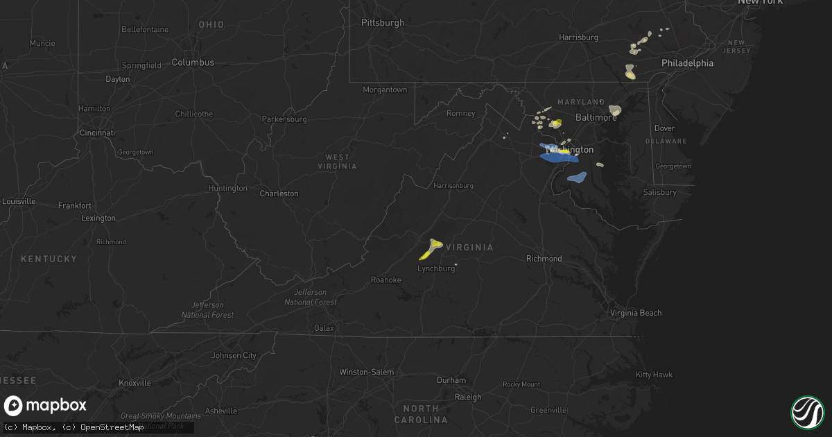
Hail Map in Virginia on May 22, 2022
Get this storm
May 22 map
$229
one time, instant access
Download today. No call, no setup
Keep the $229
Bought the map and want the full workflow? Apply the entire $229 to a subscription within 7 days. None of it is wasted.
Every map, not just this one
This buys you this map. Subscription and you get every map we run, in the markets you choose from a few cities to whole states to nationwide. Plus real-time alerts the moment a storm fires.
Contact data
Name, contact info, occupancy, even credit band for addresses in the footprint. You go from where it hit to who to call.
Become the source they trust
Unlimited branding weather history reports on demand. You already have the documented answer ready for the property owner, and you are the one who showed up with it.
Property data and RoofTrace estimates
Pull up any address you have got, its value and the exact code rules for that jurisdiction, straight from One Click Code. Then RoofTrace estimates the squares, pitch, and roof value, priced the way you price.
Storm reports in Virginia
Virginia
| Date | Description |
|---|---|
| 05/22/20226:48 PM CDT | Tree down near us 301 and poplar neck rd |
| 05/22/20226:37 PM CDT | Power pole and wires down near the intersection of south jefferson street and leesburg pike |
| 05/22/20226:26 PM CDT | A local report indicates 68 MPH wind near 1 WSW CENTREVILLE |
| 05/22/20226:23 PM CDT | Large tree down blocking roadway in reston. |
| 05/22/20226:07 PM CDT | Recorded on personal wx station. Large tree and large branches down nearby. |
| 05/22/20226:06 PM CDT | A local report indicates 59 MPH wind near DULLES INTL AIRPORT |
| 05/22/20225:56 PM CDT | A local report indicates 58 MPH wind near DULLES INTL AIRPORT |
| 05/22/20225:50 PM CDT | 2 trees downed along lee hwy |
| 05/22/20225:48 PM CDT | Tree down on 4300 block of sanders lane in catharpin... Va |
| 05/22/20225:48 PM CDT | Tree down on the 4000 block of sanders lane |
| 05/22/20225:27 PM CDT | Tree downed and a few shingles blown off a house on ridge top ln. Report via mping. Time radar estimated. |
| 05/22/20225:26 PM CDT | Tree reported down on telegraph springs road near shoemaker school road. |
| 05/22/20225:18 PM CDT | Tree down near stony point rd and watts passage |
| 05/22/20225:15 PM CDT | 3 trees downed near markham. |
| 05/22/20225:12 PM CDT | Tree down near james monroe pkwy and ashlawn-highland dr. |
| 05/22/20225:08 PM CDT | A few large trees uprooted... Large branch snapped... Shingle and siding damage in the twin lakes subdivision. |
| 05/22/20225:00 PM CDT | Tree down in 2100 blk of morgantown rd |
| 05/22/20224:58 PM CDT | Tree down in arlington va. |
| 05/22/20224:39 PM CDT | Pole damage at leesburg pike and south jefferson street reported by capital weather gang |
| 05/22/20224:39 PM CDT | Numerous trees down throughout the county per 911 center |
| 05/22/20224:31 PM CDT | Tree downed blocking left lane of i-64 w |
| 05/22/20224:26 PM CDT | Tree down. Time estimated from radar. |
| 05/22/20224:22 PM CDT | Tree down. Time estimated from radar. |
| 05/22/20224:21 PM CDT | Tree down on road. Time estimated from radar. |
| 05/22/20224:13 PM CDT | Two trees down. Time estimated from radar. |
| 05/22/20224:10 PM CDT | 3 trees down. Time estimated from radar. |
| 05/22/20224:10 PM CDT | Tree down. Time estimated from radar. |
| 05/22/20224:08 PM CDT | Tree down on road. Time estimated from radar. |
| 05/22/20224:03 PM CDT | Tree down. Time estimated from radar. |
| 05/22/20223:58 PM CDT | Quarter-size hail was observed along carpenter road. |
| 05/22/20223:30 PM CDT | Multiple trees were blown down by thunderstorm winds near the intersection of harmony road and boones mill road. |
| 05/22/20223:30 PM CDT | 911 center reports 1 tree down on river road. Time estimated from radar. |
| 05/22/20223:30 PM CDT | A tree was blown down by thunderstorm winds along wildway road. |
| 05/22/20223:02 PM CDT | Trees blew down near the intersection of va-748 sam fred road and va-734 snickersville turnpike |
| 05/22/20222:48 PM CDT | Report from mping: trees uprooted or snapped; roof blown off. Time estimated from radar. |
| 05/22/20222:40 PM CDT | Tree down. |
| 05/22/20222:27 PM CDT | Tree down on highway. |
| 05/22/20222:23 PM CDT | Tree down. |
| 05/22/20221:03 AM CDT | At 602 PM EDT, severe thunderstorms were located along a line extending from 7 miles south of Stanardsville to near Charlottesville to near Shipman, moving east at 25 mph. HAZARD...60 mph wind gusts. SOURCE...Radar indicated. IMPACT...Expect damage to trees and powerlines. Severe thunderstorms will be near... Lake Monticello around 615 PM EDT. Troy around 625 PM EDT. Boswells Tavern around 635 PM EDT.Other locations impacted by these severe thunderstorms include Nahor,Green Springs, Zion Crossroads, Antioch, Union Mills, Wildwood,Bybee, Waldrop, Byrd Mill and Trevilians. |
| 05/22/202212:48 AM CDT | At 547 PM EDT, severe thunderstorms were located along a line extending from 6 miles west of Stanardsville to 7 miles southeast of Crozet, moving east at 25 mph. HAZARD...60 mph wind gusts. SOURCE...Radar indicated. IMPACT...Damaging winds will cause some trees and large branches to fall. This could injure those outdoors, as well as damage homes and vehicles. Roadways may become blocked by downed trees. Localized power outages are possible. Unsecured light objects may become projectiles. Locations impacted include... Charlottesville, Crozet, Stanardsville, Free Union, Campbell, Westmoreland, Hollymead, Gordonsville, Ruckersville, Ivy, Quinque, Eheart, Barboursville, Stony Point, Flordon, Haneytown, Montpelier Station, Newtown, Madison Mills and Montford. |
| 05/22/202212:03 AM CDT | At 503 PM EDT, severe thunderstorms were located along a line extending from Stuarts Draft to near Lowesville to near Pleasant View, moving east at 40 mph. HAZARD...60 mph wind gusts and quarter size hail. SOURCE...Radar indicated. IMPACT...Damaging winds will cause some trees and large branches to fall. This could injure those outdoors, as well as damage homes and vehicles. Roadways may become blocked by downed trees. Localized power outages are possible. Unsecured light objects may become projectiles. Locations impacted include... Stuarts Draft, Sherando, Shipman, Schuyler, Wintergreen, Montebello, Lyndhurst, Nellysford, Arrington, Scottsville, Esmont, Lovingston, Allens Creek, North Garden, Covesville, Tyro, Buffalo Springs, Norwood, Jonesboro and Gladstone. |
| 05/22/202212:01 AM CDT | At 501 PM EDT, a severe thunderstorm was located over Pleasant View, or 7 miles northeast of Big Island, moving northeast at 30 mph. HAZARD...60 mph wind gusts. SOURCE...Radar indicated. IMPACT...Expect damage to roofs, siding, and trees. Locations impacted include... Amherst... Forks Of Buffalo... Clifford... Pleasant View... New Glasgow... Lowesville... and Naola. |
| 05/21/202211:46 PM CDT | At 446 PM EDT, severe thunderstorms were located along a line extending from Big Island to Goode to near Moneta, moving east at 25 mph. HAZARD...60 mph wind gusts. SOURCE...Radar indicated. IMPACT...Expect damage to roofs, siding, and trees. Locations impacted include... Lynchburg... Bedford... Big Island... Forest... Evington... Rustburg... and Coleman Falls.This includes The following Locations Liberty University andLynchburg Airport. |
| 05/21/202211:25 PM CDT | At 425 PM EDT, a severe thunderstorm was located over Tower Hill, or near Bent Creek, moving east at 30 mph. HAZARD...60 mph wind gusts. SOURCE...Radar indicated. IMPACT...Expect damage to roofs, siding, and trees. Locations impacted include... Buckingham... Dillwyn... Bent Creek... Toga... Andersonville... Oakville... and Tower Hill. |
| 05/21/20229:16 PM CDT | At 216 PM EDT, a severe thunderstorm was located near Sylvatus, or near Hillsville, moving east at 20 mph. HAZARD...60 mph wind gusts and quarter size hail. SOURCE...Radar indicated. IMPACT...Hail damage to vehicles is expected. Expect wind damage to roofs, siding, and trees. Locations impacted include... Hillsville... Floyd... Indian Valley... Patterson... Woolwine... Willis... and Dugspur. |
All States Impacted by Hail Map on May 22, 2022
Cities Impacted by Hail Map on May 22, 2022
- Dickerson, MD
- Adamstown, MD
- Hillsboro, AL
- Trinity, AL
- Moulton, AL
- Brooks, ME
- Gilbertsville, PA
- Pottstown, PA
- Morgantown, PA
- Birdsboro, PA
- Douglassville, PA
- Mohnton, PA
- Hudson, FL
- Jesup, GA
- Thorndike, ME
- Monroe, ME
- Honey Brook, PA
- Narvon, PA
- Phoenix, MD
- Glen Arm, MD
- Winn, ME
- Burlington, ME
- Springfield, ME
- Danforth, ME
- Wytopitlock, ME
- Lincoln, ME
- Orient, ME
- Lee, ME
- Claxton, GA
- Uvalda, GA
- Mount Vernon, GA
- Clayton, AL
- Gunpowder, MD
- Middle River, MD
- Hoboken, GA
- Riviera, TX
- Aberdeen Proving Ground, MD
- Boyds, MD
- Germantown, MD
- Clarksburg, MD
- Jay, ME
- Livermore Falls, ME
- Livermore, ME
- Farmington, ME
- Kents Hill, ME
- Mount Vernon, ME
- Vienna, ME
- Canton, ME
- Peach Bottom, PA
- Quarryville, PA
- Christiana, PA
- Oxford, PA
- Kirkwood, PA
- Nottingham, PA
- San Ygnacio, TX
- Bronson, FL
- Zapata, TX
- Brooklet, GA
- Falls Church, VA
- Arlington, VA
- Fort Myer, VA
- Collins, GA
- Morriston, FL
- Dunnellon, FL
- Upatoi, GA
- Columbus, GA
- Owings, MD
- Friendship, MD
- Chesapeake Beach, MD
- North Beach, MD
- Harrison, GA
- Wrightsville, GA
- Laredo, TX
- Mattawamkeag, ME
- Temple Hills, MD
- Suitland, MD
- Leesburg, VA
- Kingsville, TX
- Williston, FL
- Rockwood, ME
- Greenville Junction, ME
- Greenville, ME
- Peru, ME
- Alexandria, VA
- Premont, TX
- Boyce, VA
- Bartow, GA
- Davisboro, GA
- Corpus Christi, TX
- Belgrade, ME
- Alamo, GA
- Fort Benning, GA
- Roma, TX
- Monroe, VA
- Arrington, VA
- Big Island, VA
- Vesuvius, VA
- Amherst, VA
- Roseland, VA
- Tarrytown, GA
- Soperton, GA
- Lutz, FL
- McRae Helena, GA
- Gap, PA
- Tuckahoe, NY
- Eastchester, NY
- Yonkers, NY
- Scarsdale, NY
- White Post, VA
- Millen, GA
- Fort Stewart, GA
- New Rochelle, NY
- Sylvania, GA
- Rocky Ford, GA
- Bell, FL
- Trenton, FL
- Rockville, MD
- Vienna, VA
- Fairfax, VA
- Oakton, VA
- Chiefland, FL
- Aiken, SC
- Jackson, SC
- New Ellenton, SC
- Lumber City, GA
- East Earl, PA
- New Holland, PA
- Bethesda, MD
- McLean, VA
- Chevy Chase, MD
- Glen Echo, MD
- Cabin John, MD
- Harmony, ME
- Terre Hill, PA
- Oakland, ME
- Inglis, FL
- Barto, PA
- Bechtelsville, PA
- Frederick, MD
- Jefferson, MD
- Lyons, GA
- Lovettsville, VA
- Point Of Rocks, MD
- Tuscarora, MD
- Vidalia, GA
- Dexter, ME
- Cambridge, ME
- Newington, GA
- Statesboro, GA
- Unity, ME
- Albion, ME
- Troy, ME
- Rhine, GA
- Eastman, GA
- Swainsboro, GA
- Sumner, ME
- Buckfield, ME
- Bryant Pond, ME
- Greenwood, ME
- Bethel, ME
- Dixfield, ME
- Savannah, GA
- Joppa, MD
- Kingsville, MD
- White Marsh, MD
- Edgewood, MD
- Denver, PA
- Kinzers, PA
- New Market, MD
- Bishop, TX
- Ludowici, GA
- Oley, PA
- Boyertown, PA
- Atglen, PA
- Herndon, VA
- Reston, VA
- Reidsville, GA
- Milan, GA
- Falfurrias, TX
- Waycross, GA
- Montgomery Village, MD
- Gaithersburg, MD
- La Plata, MD
- Ellabell, GA
- Dunn Loring, VA
- Annandale, VA
- Washington, DC
- Waterford, VA
- Richmond Hill, GA
- Green Lane, PA
- Pennsburg, PA
- Red Hill, PA
- Louisville, AL
- Silver Spring, MD
- Glennville, GA
- Appomattox, VA
- Damascus, MD
- Eufaula, AL
- Midway, AL
- Becket, MA
- Worthington, MA
- Huntington, MA
- Williamsburg, MA
- Chester, MA
- West Chesterfield, MA
- Cummington, MA
- Chesterfield, MA
- Middlefield, MA
- Hinsdale, MA
- Belgrade Lakes, ME
- Sterling, VA
- Chantilly, VA
- Fairfax Station, VA
- Lothian, MD
- Centreville, VA
- Clifton, VA
- Manassas, VA
- Brandywine, MD
- Springfield, VA
- Upper Marlboro, MD
- Clinton, MD
- Andrews Air Force Base, MD
- Fort Washington, MD
- Cheltenham, MD
- Burke, VA
- Oxon Hill, MD
- Hughesville, MD
- Bryantown, MD
- Pomfret, MD
- Port Tobacco, MD
- Waldorf, MD
- White Plains, MD
- Greenfield, NH
- Francestown, NH
- Weare, NH
- New Boston, NH
- Clyo, GA
- Guyton, GA
- Springfield, GA


