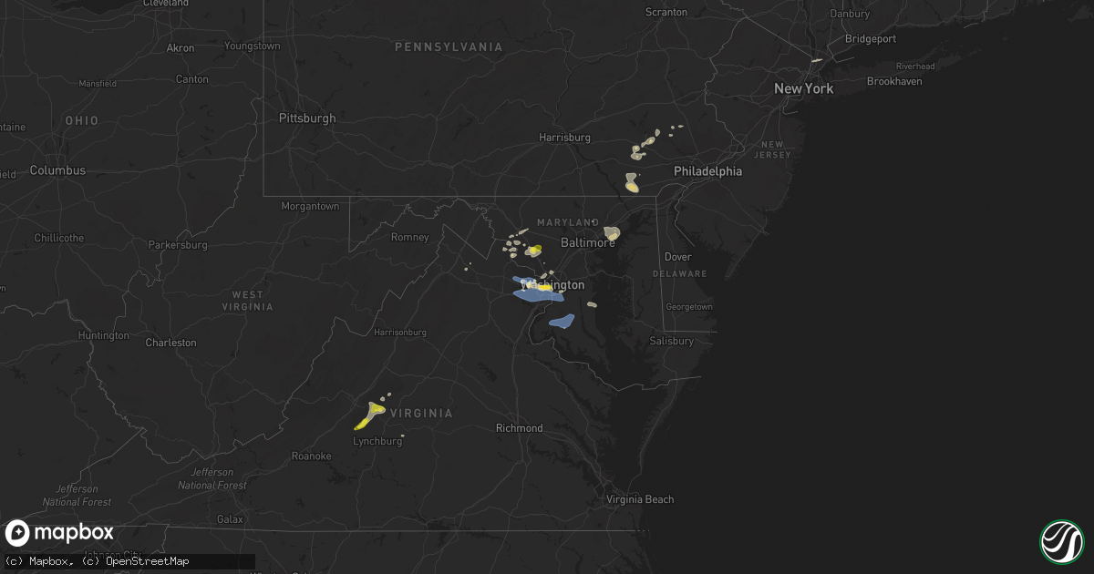
Hail Map on May 22, 2022
Get this storm
May 22 map
$229
one time, instant access
Download today. No call, no setup
Keep the $229
Bought the map and want the full workflow? Apply the entire $229 to a subscription within 7 days. None of it is wasted.
Every map, not just this one
This buys you this map. Subscription and you get every map we run, in the markets you choose from a few cities to whole states to nationwide. Plus real-time alerts the moment a storm fires.
Contact data
Name, contact info, occupancy, even credit band for addresses in the footprint. You go from where it hit to who to call.
Become the source they trust
Unlimited branding weather history reports on demand. You already have the documented answer ready for the property owner, and you are the one who showed up with it.
Property data and RoofTrace estimates
Pull up any address you have got, its value and the exact code rules for that jurisdiction, straight from One Click Code. Then RoofTrace estimates the squares, pitch, and roof value, priced the way you price.
States Impacted by Hail Map on May 22, 2022
Storm reports
District of Columbia
| Date | Description |
|---|---|
| 05/22/20225:02 PM CDT | A local report indicates 59 MPH wind near REAGAN NATIONAL ARPT |
| 05/22/20224:31 PM CDT | Tree down on the 1600 block of myrtle avenue nw |
| 05/22/20222:26 AM CDT | At 725 PM EDT, severe thunderstorms were located along a line extending from near Milford Mill to 7 miles east of Massaponax, moving east at 40 mph. HAZARD...60 mph wind gusts. SOURCE...Radar indicated. IMPACT...Damaging winds will cause some trees and large branches to fall. This could injure those outdoors, as well as damage homes and vehicles. Roadways may become blocked by downed trees. Localized power outages are possible. Unsecured light objects may become projectiles. Locations impacted include... Baltimore, Columbia, Waldorf, Bowie, Severn, Annapolis, Clinton, Pikesville, Crofton, Middle River, Fort Washington, Greenbelt, Elkridge, Riviera Beach, Forestville, Largo, Coral Hills, Bladensburg, La Plata and Mayo. |
| 05/22/202212:56 AM CDT | At 556 PM EDT, a severe thunderstorm was located over Arlington, moving east at 15 mph. HAZARD...60 mph wind gusts and quarter size hail. SOURCE...Radar indicated. IMPACT...Damaging winds will cause some trees and large branches to fall. This could injure those outdoors, as well as damage homes and vehicles. Roadways may become blocked by downed trees. Localized power outages are possible. Unsecured light objects may become projectiles. Locations impacted include... Arlington, Alexandria, Clinton, Fort Washington, Groveton, Forestville, Huntington, Largo, Coral Hills, National Harbor, Nationals Park, Howard University, Gallaudet University, Reagan National Airport, Rosslyn, Crystal City, RFK Stadium, Andrews Air Force Base, Lincolnia and Camp Springs. |
| 05/22/202212:09 AM CDT | At 509 PM EDT, a severe thunderstorm was located over Oakton, or over Fairfax, moving east at 15 mph. HAZARD...60 mph wind gusts and quarter size hail. SOURCE...Radar indicated. IMPACT...Damaging winds will cause some trees and large branches to fall. This could injure those outdoors, as well as damage homes and vehicles. Roadways may become blocked by downed trees. Localized power outages are possible. Unsecured light objects may become projectiles. Locations impacted include... Arlington, Alexandria, Bethesda, Reston, Annandale, Springfield, Fairfax, Langley Park, Vienna, Groveton, Falls Church, Huntington, Mantua, Pimmit Hills, Mclean, Howard University, American Legion Bridge, Fort Totten, Rosslyn and Crystal City. |
New Jersey
| Date | Description |
|---|---|
| 05/22/20226:54 PM CDT | Right lane of garden state parkway blocked with tree debris. |
| 05/22/20226:30 PM CDT | Large mature oak uprooted. |
| 05/22/202212:46 AM CDT | At 545 PM EDT, severe thunderstorms were located along a line extending from near Pleasant Valley to Perkasie to near Lansdale, moving east at 35 mph. HAZARD...60 mph wind gusts and penny size hail. SOURCE...Radar indicated. IMPACT...Damage to roofs, siding, trees, and power lines is possible. Locations impacted include... Trenton, Ewing, Lansdale, Quakertown, Perkasie, Doylestown, Byram, Hatboro, Souderton, Bedminster, Flemington, Chalfont, Tinicum, Hatfield, Clinton, Pennington, New Hope, Yardley, Newtown and Dublin.This includes the following highways... Northeast Extension between mile markers 26 and 32. Interstate 78 in New Jersey between mile markers 16 and 17. Interstate 295 in New Jersey between mile markers 72 and 76. |
| 05/22/202212:02 AM CDT | At 502 PM EDT, severe thunderstorms were located along a line extending from Lyons to 6 miles west of Bechtelsville to near Birdsboro, moving east at 25 mph. HAZARD...60 mph wind gusts and nickel size hail. SOURCE...Radar indicated. IMPACT...Damage to roofs, siding, trees, and power lines is possible. Locations impacted include... Allentown, Bethlehem, Pottstown, Lansdale, Emmaus, Quakertown, Perkasie, Doylestown, Hatboro, Souderton, Bedminster, Hellertown, Birdsboro, Collegeville, Kutztown, Royersford, Chalfont, Trappe, Hatfield and East Greenville.This includes the following highways... Northeast Extension between mile markers 26 and 55. Interstate 78 in Pennsylvania between mile markers 57 and 64. |
Maine
| Date | Description |
|---|---|
| 05/22/20226:12 PM CDT | Time estimated by radar. Reported my town of dixmont. |
| 05/22/20226:12 PM CDT | Relayed from nws gray. Time estimated by radar. |
| 05/22/20225:13 PM CDT | Trees down. Report from penobscot rcc. |
| 05/22/20224:55 PM CDT | Corrects previous tstm wnd dmg report from dexter. Trees down. Report from penobscot rcc. |
| 05/22/20224:42 PM CDT | Tree fell on wire and is on fire.time estimated based on radar. |
| 05/22/20224:39 PM CDT | Dispatch reports multiple trees down on ripley rd/stream rd near the intersection of page hill rd. Time estimated from radar. |
| 05/22/20224:34 PM CDT | Dispatch reports one tree down blocking e. Benton rd. Time estimated from radar. |
| 05/22/20224:01 PM CDT | A local report indicates 1.50 inch wind near 2 W VIENNA |
| 05/22/20224:00 PM CDT | Delayed report...several trees down near the intersection of crash rd and goding rd. Also... A report of 200f the shingles on one home were blown off. Time approximat |
| 05/22/20223:45 PM CDT | Off-duty nws employee reports golf ball sized hail in jay. |
| 05/22/20223:45 PM CDT | Franklin county dispatch reported trees down in the town of jay. Time estimated from radar. |
| 05/22/20223:41 PM CDT | 1-2 inch hail reported. |
| 05/22/20223:41 PM CDT | Quarter sized hail. |
| 05/22/20223:35 PM CDT | Tree reported down on e. Shore rd. Time estimated by radar. |
| 05/22/20223:30 PM CDT | Dispatch reports a tree was blown down onto powerlines. Time estimated by radar. |
| 05/22/20223:08 PM CDT | Roughly quarter size hail reported. |
| 05/22/20222:02 AM CDT | At 701 PM EDT, a severe thunderstorm was located over Unity, or near Thorndike, moving east at 25 mph. HAZARD...60 mph wind gusts and quarter size hail. SOURCE...Radar indicated. IMPACT...Minor hail damage to vehicles is possible. Expect wind damage to trees and power lines. Locations impacted include... Hampden, Hermon, Orrington, Carmel, Newburgh, Etna and Dixmont. |
| 05/22/20221:55 AM CDT | At 654 PM EDT, a severe thunderstorm was located over Unity, or near Thorndike, moving east at 35 mph. HAZARD...60 mph wind gusts and quarter size hail. SOURCE...Radar indicated. IMPACT...Hail damage to vehicles is expected. Expect wind damage to roofs, siding, and trees. Locations impacted include... Waterville, Fairfield, Thorndike, Searsport, Clinton, Winterport, Unity, Prospect, Knox, Benton, Albion, Burnham, Frankfort, Brooks, Freedom, Jackson, Monroe, Troy, Winslow and Swanville.This includes Interstate 95 between mile markers 131 and 141. |
| 05/22/20221:13 AM CDT | At 612 PM EDT, a severe thunderstorm was located near East Corinth, or 8 miles east of Dexter, moving east at 35 mph. HAZARD...60 mph wind gusts and quarter size hail. SOURCE...Radar indicated. IMPACT...Minor hail damage to vehicles is possible. Expect wind damage to trees and power lines. Locations impacted include... Dover-Foxcroft, Corinth, Hudson, Charleston, Bradford, Garland and Exeter. |
| 05/22/20221:08 AM CDT | At 608 PM EDT, a severe thunderstorm was located near Orneville, or 13 miles southwest of Howland, moving east at 25 mph. HAZARD...60 mph wind gusts and quarter size hail. SOURCE...Radar indicated. IMPACT...Minor hail damage to vehicles is possible. Expect wind damage to trees and power lines. Locations impacted include... Howland, Orneville, Enfield, Hudson, Greenbush, Bradford, Alton, Lagrange, Passadumkeag, Lowell and Argyle. |
| 05/22/202212:38 AM CDT | At 537 PM EDT, a severe thunderstorm was located near Clinton, or near Fairfield, moving east at 40 mph. HAZARD...60 mph wind gusts and quarter size hail. SOURCE...Radar indicated. IMPACT...Hail damage to vehicles is expected. Expect wind damage to roofs, siding, and trees. Locations impacted include... Thorndike, Searsport, China, Clinton, Winterport, Unity, Prospect, Knox, Benton, Albion, Burnham, Frankfort, Brooks, Detroit, Freedom, Jackson, Monroe, Troy, Winslow and Swanville.This includes Interstate 95 between mile markers 134 and 141. |
| 05/22/202212:36 AM CDT | At 536 PM EDT, a severe thunderstorm was located 7 miles west of Dexter, moving east at 25 mph. HAZARD...Quarter size hail. SOURCE...Radar indicated. IMPACT...Minor damage to vehicles is possible. Locations impacted include... Dover-Foxcroft, Dexter, Newport, Corinth, Corinna, Charleston, Sangerville, Stetson, Garland, Exeter, Parkman, Atkinson and Wellington. |
| 05/22/202212:34 AM CDT | At 533 PM EDT, a severe thunderstorm was located 15 miles north of Pittsfield, moving east at 20 mph. HAZARD...Quarter size hail. SOURCE...Radar indicated. IMPACT...Damage to vehicles is expected. Locations impacted include... Hartland, Athens, Harmony, Brighton Plantation, Saint Albans, Ripley and Palmyra. |
| 05/22/202212:33 AM CDT | At 533 PM EDT, a severe thunderstorm was located near Millinocket, moving east at 35 mph. HAZARD...60 mph wind gusts and quarter size hail. SOURCE...Radar indicated. IMPACT...Minor hail damage to vehicles is possible. Expect wind damage to trees and power lines. Locations impacted include... Millinocket, East Millinocket, Medway, Mattawamkeag, Chester, Winn, Woodville, Macwahoc, Grindstone, Cedar Lake, West Seboeis, Norcross, Molunkus, Silver Ridge and Benedicta. |
| 05/22/202212:04 AM CDT | At 504 PM EDT, a severe thunderstorm was located near White Cap Mountain, or 15 miles north of Brownville Junction, moving east at 25 mph. HAZARD...60 mph wind gusts and quarter size hail. SOURCE...Radar indicated. IMPACT...Minor hail damage to vehicles is possible. Expect wind damage to trees and power lines. Locations impacted include... Millinocket, White Cap Mountain, Frenchtown, Ebeemee, southwestern Katahdin Woods and Waters National Monument, West Seboeis, Norcross, Cedar Lake and Grindstone. |
| 05/22/202212:00 AM CDT | At 459 PM EDT, a severe thunderstorm was located 9 miles east of Livermore Falls, or 12 miles southeast of Farmington, moving east at 30 mph. HAZARD...Golf ball size hail and 60 mph wind gusts. SOURCE...Radar indicated. IMPACT...People and animals outdoors will be injured. Expect hail damage to roofs, siding, windows, and vehicles. Expect wind damage to roofs, siding, and trees. Locations impacted include... Waterville, Fairfield, Oakland, China, Clinton, Belgrade, Benton, Chesterville, Fayette, Smithfield, Rome, Winslow, Mount Vernon, Vassalboro, Vienna, Sidney, Readfield, New Sharon and Mercer.This includes Interstate 95 between mile markers 118 and 135. |
| 05/21/202211:42 PM CDT | At 442 PM EDT, a severe thunderstorm was located near Canton, or 10 miles southeast of Rumford, moving east at 30 mph. HAZARD...Golf ball size hail and 60 mph wind gusts. SOURCE...Radar indicated. IMPACT...People and animals outdoors will be injured. Expect hail damage to roofs, siding, windows, and vehicles. Expect wind damage to roofs, siding, and trees. Locations impacted include... Farmington, Jay, Livermore Falls, Dixfield, Canton, Wilton, Livermore, Chesterville, Hartford, Fayette, Mount Vernon, Sumner, Peru, Vienna and New Sharon. |
| 05/21/202211:29 PM CDT | At 428 PM EDT, a severe thunderstorm was located near Dixfield, or 7 miles southeast of Rumford, moving east at 30 mph. HAZARD...60 mph wind gusts and half dollar size hail. SOURCE...Radar indicated. IMPACT...Hail damage to vehicles is expected. Expect wind damage to roofs, siding, and trees. Locations impacted include... Rumford, Jay, Livermore Falls, Dixfield, Canton, Wilton, Livermore, Hartford, Peru, Sumner, Woodstock and Milton. |
| 05/21/202210:59 PM CDT | At 359 PM EDT, a severe thunderstorm was located near Bethel, moving east at 25 mph. HAZARD...60 mph wind gusts and quarter size hail. SOURCE...Radar indicated. IMPACT...Hail damage to vehicles is expected. Expect wind damage to roofs, siding, and trees. Locations impacted include... Bethel, Rumford, Greenwood, Sumner, Milton, Woodstock, West Paris, Albany and Peru. |
| 05/21/20229:21 PM CDT | At 221 PM EDT, a severe thunderstorm was located 7 miles northeast of Kokadjo, or 12 miles southwest of Ripogenus, moving east at 35 mph. HAZARD...60 mph wind gusts and quarter size hail. SOURCE...Radar indicated. IMPACT...Minor hail damage to vehicles is possible. Expect wind damage to trees and power lines. Locations impacted include... Millinocket, Frenchtown, southwestern Katahdin Woods and Waters National Monument, Baxter State Park and Beaver Cove. |
| 05/21/20228:44 PM CDT | At 144 PM EDT, a severe thunderstorm was located near Rockwood, or 15 miles northwest of Greenville, moving east at 25 mph. HAZARD...60 mph wind gusts and quarter size hail. SOURCE...Radar indicated. IMPACT...Minor hail damage to vehicles is possible. Expect wind damage to trees and power lines. Locations impacted include... Kokadjo, Rockwood, Frenchtown, Beaver Cove, Spencer Bay, Mount Kineo and Lily Bay. |
| 05/21/20228:43 PM CDT | At 143 PM EDT, a severe thunderstorm was located 18 miles east of Jackman, moving east at 25 mph. HAZARD...60 mph wind gusts and quarter size hail. SOURCE...Radar indicated. IMPACT...Hail damage to vehicles is expected. Expect wind damage to roofs, siding, and trees. Locations impacted include... Sapling, Rockwood Strip, Misery Gore, Sandwich Academy Grant, Taunton And Raynham Academy Grant, Brassua, Misery and Tomhegan. |
Maryland
| Date | Description |
|---|---|
| 05/22/20226:55 PM CDT | Wires down on 4500 block of dallas place |
| 05/22/20226:41 PM CDT | Tree reported down near the intersection of westbard ave and river road. |
| 05/22/20226:37 PM CDT | Tree down on the 17000 block of pinebrook drive |
| 05/22/20226:18 PM CDT | Powerline wires down on the 15000 block of darnestown road |
| 05/22/20226:04 PM CDT | Tree reported down on town center blvd. |
| 05/22/20225:05 PM CDT | Tree down near the intersection of creswell rd and carsins run rd |
| 05/22/20224:55 PM CDT | Tree reported down on frist road near honey bee drive. Time estimated by radar. |
| 05/22/20224:49 PM CDT | Wires down on 2200 block of cool spring rd. |
| 05/22/20224:39 PM CDT | Tree down blocking roadway |
| 05/22/20224:35 PM CDT | Tree down at 2208 connolly rd |
| 05/22/20224:30 PM CDT | Several tree branches down along east franklin ave |
| 05/22/20224:21 PM CDT | Tree down on the 13000 block of manor road |
| 05/22/20224:13 PM CDT | Large trees down at 8400 block of greenspring avenue |
| 05/22/20223:55 PM CDT | Tree down on car near the intersection of new hampshire avenue and brighton knolls drive |
| 05/22/20223:46 PM CDT | Large tree down on the 21000 block of georgia avenue |
| 05/22/20223:46 PM CDT | Tree down near the intersection of georgia avenue and new hampshire avenue |
| 05/22/20223:17 PM CDT | Tree down at 6000 block of yeagertown rd |
| 05/22/20223:12 PM CDT | Trees blew down near the intersection of md-25 falls road and miller rd |
| 05/22/20223:05 PM CDT | A local report indicates 60 MPH wind near 2 WNW NEW MARKET |
| 05/22/20223:00 PM CDT | Tree down at 6400 block of linganore rd |
| 05/22/20223:00 PM CDT | Tree down at 9600 block of gas house pike rd and dance hall rd |
| 05/22/20227:02 AM CDT | A local report indicates 59 MPH wind near 3 ENE DAHLGREN |
| 05/22/20223:28 AM CDT | At 828 PM EDT, a severe thunderstorm was located over Greenwell State Park, moving east at 40 mph. HAZARD...60 mph wind gusts. SOURCE...Radar indicated. IMPACT...Damaging winds will cause some trees and large branches to fall. This could injure those outdoors, as well as damage homes and vehicles. Roadways may become blocked by downed trees. Localized power outages are possible. Unsecured light objects may become projectiles. Locations impacted include... Lexington Park, Chesapeake Ranch Estates, Leonardtown, Prince Frederick, Cuckold Creek, Sheridan Point, Calvert Cliffs, Greenwell State Park, Saint Leonard Creek, Town Creek, Flag Harbor, White Point Beach, California, Lusby, Patuxent River Naval Air Station, Saint Leonard, Hollywood, Drum Point, Long Beach and Mechanicsville. |
| 05/22/20222:41 AM CDT | At 741 PM EDT, a severe thunderstorm was located near Tilghman Island, or 7 miles southeast of Deale, moving east at 25 mph. HAZARD...60 mph wind gusts and nickel size hail. SOURCE...Radar indicated. IMPACT...Damage to roofs, siding, trees, and power lines is possible. Locations impacted include... Easton, Talbot, Trappe, St. Michaels, Oxford, Queen Anne, Tilghman Island, Skipton, Copperville, Matthews, Hambleton, Windyhill and Cordova. |
| 05/22/20221:37 AM CDT | At 637 PM EDT, a severe thunderstorm was located over Andrews Air Force Base, moving east at 20 mph. HAZARD...60 mph wind gusts. SOURCE...Radar indicated. IMPACT...Damaging winds will cause some trees and large branches to fall. This could injure those outdoors, as well as damage homes and vehicles. Roadways may become blocked by downed trees. Localized power outages are possible. Unsecured light objects may become projectiles. Locations impacted include... Clinton, Largo, Upper Marlboro, Andrews Air Force Base, Kettering, Rosaryville, Marlton and Dunkirk. |
| 05/22/20221:13 AM CDT | At 612 PM EDT, severe thunderstorms were located along a line extending from 7 miles northeast of Bowleys Quarters to near Magothy River to near Upper Marlboro, moving southeast at 20 mph. HAZARD...60 mph wind gusts and nickel size hail. SOURCE...Radar indicated. IMPACT...Damage to roofs, siding, trees, and power lines is possible. Locations impacted include... Centerville, Chestertown, Centreville, Romancoke, Rock Hall, Church Hill, Betterton, Old Town, Grasonville, Stevensville, Langford, Chester, Newtown, Overton, Starkey Corner, Morgnec, Kennedyville, Queenstown, Galena and Stevensville South. |
| 05/22/202212:55 AM CDT | At 554 PM EDT, severe thunderstorms were located along a line extending from Gradyville to near Elam to Farmington, moving east at 30 mph. HAZARD...60 mph wind gusts and nickel size hail. SOURCE...Radar indicated. IMPACT...Damage to roofs, siding, trees, and power lines is possible. Locations impacted include... Wilmington, Newark, West Chester, Chester, Westtown, Folcroft, Swarthmore, Elsmere, Kennett Square, New Castle, Oxford, West Grove, Newport, Arden, Glen Roy, Darby Township, Stanton, Cheyney, Glasgow and Talleyville.This includes the following highways... Interstate 95 in Pennsylvania between mile markers 0 and 10. Interstate 95 in Delaware between mile markers 1 and 23. Interstate 476 in Pennsylvania between mile markers 0 and 3. |
| 05/22/202212:30 AM CDT | At 530 PM EDT, a severe thunderstorm was located over Fort Meade, or near Severn, moving east at 25 mph. HAZARD...60 mph wind gusts. SOURCE...Radar indicated. IMPACT...Damaging winds will cause some trees and large branches to fall. This could injure those outdoors, as well as damage homes and vehicles. Roadways may become blocked by downed trees. Localized power outages are possible. Unsecured light objects may become projectiles. Locations impacted include... Columbia, Bowie, Severn, Annapolis, College Park, Crofton, Greenbelt, Beltsville, Elkridge, Riviera Beach, Naval Academy, Baltimore-Washington Airport, Severn River, Fort Smallwood State Park, Gibson Island, Sillery Bay, Bodkin Point, Magothy River, Dobbins Island and Pinehurst. |
| 05/22/202212:08 AM CDT | At 507 PM EDT, severe thunderstorms were located along a line extending from Elverson to near Holtwood, moving east at 30 mph. HAZARD...60 mph wind gusts and nickel size hail. SOURCE...Radar indicated. IMPACT...Damage to roofs, siding, trees, and power lines is possible. Locations impacted include... West Chester, Norristown, Phoenixville, West Norriton, East Norriton, Coatesville, Westtown, Downingtown, Conshohocken, Ambler, Kennett Square, Collegeville, Oxford, Royersford, Parkesburg, Trappe, West Grove, Honey Brook, Elverson and Glen Roy.This includes the following highways... Pennsylvania Turnpike between mile markers 300 and 338. Northeast Extension between mile markers 21 and 26. Interstate 76 in Pennsylvania between mile markers 327 and 334. Interstate 476 in Pennsylvania between mile markers 15 and 19. |
| 05/22/202212:02 AM CDT | At 502 PM EDT, a severe thunderstorm was located over Rossmoor, or near Olney, moving east at 20 mph. HAZARD...60 mph wind gusts. SOURCE...Radar indicated. IMPACT...Damaging winds will cause some trees and large branches to fall. This could injure those outdoors, as well as damage homes and vehicles. Roadways may become blocked by downed trees. Localized power outages are possible. Unsecured light objects may become projectiles. Locations impacted include... Rockville, Bowie, Olney, College Park, Crofton, Greenbelt, Beltsville, Aspen Hill, Potomac, North Bethesda, Severna Park, Odenton, Laurel, Fairland, Arnold, White Oak, Redland, Parole, Adelphi and Colesville. |
| 05/21/202211:46 PM CDT | At 445 PM EDT, a severe thunderstorm was located near Columbia, moving east at 30 mph. HAZARD...60 mph wind gusts. SOURCE...Radar indicated. IMPACT...Damaging winds will cause some trees and large branches to fall. This could injure those outdoors, as well as damage homes and vehicles. Roadways may become blocked by downed trees. Localized power outages are possible. Unsecured light objects may become projectiles. Locations impacted include... Baltimore, Columbia, Severn, Elkridge, Riviera Beach, Baltimore-Washington Airport, Historic Ellicott City, Glen Burnie, Ellicott City, Dundalk, Catonsville, Woodlawn, Severna Park, Odenton, Milford Mill, Lochearn, Laurel, Pasadena, Arbutus and Lake Shore. |
| 05/21/202211:21 PM CDT | At 421 PM EDT, a severe thunderstorm was located near Leesburg, moving east at 20 mph. HAZARD...60 mph wind gusts and quarter size hail. SOURCE...Radar indicated. IMPACT...Damaging winds will cause some trees and large branches to fall. This could injure those outdoors, as well as damage homes and vehicles. Roadways may become blocked by downed trees. Localized power outages are possible. Unsecured light objects may become projectiles. Locations impacted include... Leesburg, Poolesville, Barnesville, Lucketts, Dickerson and Beallsville. |
| 05/21/202211:11 PM CDT | At 411 PM EDT, a severe thunderstorm was located near Green Valley, or near Damascus, moving east at 25 mph. HAZARD...60 mph wind gusts and quarter size hail. SOURCE...Radar indicated. IMPACT...Damaging winds will cause some trees and large branches to fall. This could injure those outdoors, as well as damage homes and vehicles. Roadways may become blocked by downed trees. Localized power outages are possible. Unsecured light objects may become projectiles. Locations impacted include... Germantown, Frederick, Gaithersburg, Olney, Damascus, Montgomery Village, Eldersburg, Ballenger Creek, Redland, Mount Airy, Sykesville, New Market, Boyds, Green Valley, Linganore-Bartonsville, Discovery-Spring Garden, Cloverly, Clarksburg, Burtonsville and Spencerville. |
| 05/21/202210:58 PM CDT | At 358 PM EDT, a severe thunderstorm was located over Middleburg, or 8 miles west of Brambleton, moving east at 15 mph. HAZARD...60 mph wind gusts and quarter size hail. SOURCE...Radar indicated. IMPACT...Damaging winds will cause some trees and large branches to fall. This could injure those outdoors, as well as damage homes and vehicles. Roadways may become blocked by downed trees. Localized power outages are possible. Unsecured light objects may become projectiles. Locations impacted include... Reston, Leesburg, Herndon, Broadlands, Lansdowne, Lowes Island, Brambleton, Poolesville, Ashburn, Sterling, Great Falls, Countryside, Middleburg, Oatlands, Belmont, Gleedsville, Aldie, Sterling Park and Philomont. |
| 05/21/202210:35 PM CDT | At 334 PM EDT, a severe thunderstorm was located over Point Of Rocks, or 9 miles southwest of Harry Grove Stadium, moving east at 15 mph. HAZARD...60 mph wind gusts and quarter size hail. SOURCE...Radar indicated. IMPACT...Damaging winds will cause some trees and large branches to fall. This could injure those outdoors, as well as damage homes and vehicles. Roadways may become blocked by downed trees. Localized power outages are possible. Unsecured light objects may become projectiles. Locations impacted include... Frederick, Harry Grove Stadium, Ballenger Creek, Brunswick, Braddock Heights, New Market, Point Of Rocks, Linganore-Bartonsville, Adamstown, Jefferson, Buckeystown, Monrovia, Rosemont, Ijamsville, Doubs, Park Mills, Petersville, Tuscarora and Taylorstown. |
| 05/21/20227:27 PM CDT | Wires down on 1100 block of baltimore lane |
| 05/21/20227:27 PM CDT | Wires down on 1100 block of baltimore lane |
| 05/21/20227:18 PM CDT | Trees down at plum point rd and cox rd |
| 05/21/20227:15 PM CDT | A large tree was reported down on llandaff rd. Time estimated from radar. |
| 05/21/20227:13 PM CDT | Tree reported down on northbrook drive near jewell road. |
| 05/21/20227:13 PM CDT | Tree reported down on southern maryland boulevard. |
| 05/21/20227:02 PM CDT | Corrected time |
New Hampshire
| Date | Description |
|---|---|
| 05/22/20226:40 PM CDT | Delayed report. Numerous trees reported down on tucker mill rd and bunker hill rd in new boston. Time estimated from radar. |
| 05/22/20226:37 PM CDT | Delayed report...hail between 1.25 and 1.5 inches near route 101 in roxbury... Nh. Time estimated by radar. |
| 05/22/20226:34 PM CDT | Delayed report...hail measured between 1 and 1.25 in nelson... Nh. Time estimated by radar. |
| 05/22/20226:22 PM CDT | Delayed report...observed hail as large as 1.5. Hail slowed traffic on highway 13 in goffstown... Nh. Time estimated by radar. |
| 05/22/20226:22 PM CDT | Delayed report...large branches down along parts of black brook rd north of goffstown. Time estimated by radar. |
| 05/22/20226:00 PM CDT | Reported by weather spotter. |
| 05/22/20221:24 AM CDT | At 622 PM EDT, severe thunderstorms were located along a line extending from near Salem to near Pittsfield, moving east at 50 mph. HAZARD...60 mph wind gusts and nickel size hail. SOURCE...Radar indicated. IMPACT...Expect damage to roofs, siding, and trees. Locations impacted include... Pittsfield, Bennington, North Adams, Brattleboro, Hoosick Falls, Arlington, Londonderry, Townshend, Salem, Manchester, Stratton, Adams, Williamstown, Shaftsbury, Pownal, Cheshire, Dorset, Berlin, Wilmington and Cambridge. |
Georgia
| Date | Description |
|---|---|
| 05/22/20225:49 PM CDT | Tree down on roberts bridge road. Time estimated by radar. |
| 05/22/20224:42 PM CDT | Two trees down on clyo-kildare road. Time estimated by radar |
| 05/22/20224:39 PM CDT | Several trees down along highway 21 near the screven county/effingham county line. Time estimated from radar. |
| 05/22/20224:36 PM CDT | Trees down and blocking the roadway on oliver kildare road between pryor road and simpson town road. Report received via twitter. |
| 05/22/20224:22 PM CDT | Trees down and blocking the roadway on ivanhoe road between hw-119 and mud road. Report received via twitter. |
| 05/22/20223:35 PM CDT | Several trees down along a 4-mile stretch of nevils daisy road and daisy nevils highway. Time estimated by radar. |
| 05/22/20223:35 PM CDT | Large tree down on d anderson road. Time estimated by radar. |
| 05/22/20223:32 PM CDT | Tree down and blocking the southbound lane of ga-169 in between james o waters road and us-301. Time estimated by radar. |
| 05/22/20223:24 PM CDT | Tree down near the intersection of kennedy bridge road and old anderson church road. Time estimated by radar. |
| 05/22/20223:22 PM CDT | Tree down on red clay road. Time estimated by radar. |
| 05/22/20221:18 PM CDT | Trees and power lines down in albany... Generally on the west side of town. |
| 05/22/202212:26 PM CDT | One tree down near the clay county line. |
| 05/22/202212:20 PM CDT | 8 trees down and 1 powerline down across clay county. |
| 05/22/20227:30 AM CDT | At 1229 PM CDT, a severe thunderstorm was located near Hawkinsville, or 8 miles northwest of Eufaula, moving north at 50 mph. HAZARD...60 mph wind gusts and quarter size hail. SOURCE...Radar indicated. IMPACT...Hail damage to vehicles is expected. Expect wind damage to roofs, siding, and trees. Locations impacted include... Phenix City, Hurtsboro, Hawkinsville, Russell County Sports Complex, Uchee, Spring Hill, Seale, Comer, Ladonia, Lakepoint Resort State Park, Batesville, Twin Springs, Rutherford, Hatchechubbe, Uchee Creek, Fort Mitchell, Ladonia Sports Complex, Fort Mitchell Activity Center, Carter Acres and Phenix Drag Strip. |
| 05/22/20226:55 AM CDT | At 1155 AM CDT, a severe thunderstorm was located 10 miles east of Ozark, moving north at 50 mph. HAZARD...60 mph wind gusts. SOURCE...Radar indicated. IMPACT...Expect damage to roofs, siding, and trees. Locations impacted include... Eufaula, Clayton, Blue Springs, Tyler Crossroads, Gaino, Barbour County Public Lake Dam, Blue Springs State Park, Osco, Texasville, Richards Crossroads, White Oak, Millers Ford, Batesville, Clayton Municipal Airport, Lugo and Baker Hill. |
| 05/22/20221:37 AM CDT | At 636 PM EDT, a severe thunderstorm was located near Woodcliff, moving northeast at 40 mph. HAZARD...60 mph wind gusts and quarter size hail. SOURCE...Radar indicated. IMPACT...Minor hail damage to vehicles is possible. Expect wind damage to trees and powerlines. Locations impacted include: Hiltonia, Woodcliff, Millhaven, Burtons Ferry Landing and Hilltonia. |
| 05/22/20221:24 AM CDT | At 624 PM EDT, a severe thunderstorm was located near Stellaville, or 8 miles northeast of Louisville, moving northeast at 50 mph. HAZARD...60 mph wind gusts and quarter size hail. SOURCE...Radar indicated. IMPACT...Hail damage to vehicles is expected. Expect wind damage to roofs, siding, and trees. Locations impacted include... Louisville, Wrens, Stapleton, Matthews, Stellaville and Stapletons Crossroads. |
| 05/22/202212:35 AM CDT | At 534 PM EDT, a severe thunderstorm was located over Donovan, or near Wrightsville, moving northeast at 15 mph. HAZARD...60 mph wind gusts and quarter size hail. SOURCE...Radar indicated. IMPACT...Hail damage to vehicles is expected. Expect wind damage to roofs, siding, and trees. Locations impacted include... Wrightsville, Wadley, Davisboro, Harrison, Bartow, Riddleville, Moxley, Donovan, New Home and Pringle. |
| 05/21/202211:52 PM CDT | At 451 PM EDT, a severe thunderstorm was located over Alamo, moving east at 25 mph. HAZARD...60 mph wind gusts and quarter size hail. SOURCE...Radar indicated. IMPACT...Hail damage to vehicles is expected. Expect wind damage to roofs, siding, and trees. Locations impacted include... Alamo, Mount Vernon, Glenwood, Ailey, Scotland, Higgston, Alston, Landsburg and Little Ocmulgee State Park. |
| 05/21/202211:43 PM CDT | At 443 PM EDT, severe thunderstorms were located along a line extending from near Register to near Nevils to near Daisy, moving east at 25 mph. HAZARD...60 mph wind gusts and penny size hail. SOURCE...Radar indicated. IMPACT...Expect damage to trees and powerlines. Locations impacted include: Pembroke, Brooklet, Daisy, Nevils, Denmark, Bay, Groveland and Stilson.This warning includes I-16 between mile markers 115 and 138. |
| 05/21/202211:37 PM CDT | At 437 PM EDT, a severe thunderstorm was located over Gillis Springs, or 8 miles northeast of Soperton, moving northeast at 25 mph. HAZARD...60 mph wind gusts and quarter size hail. SOURCE...Radar indicated. IMPACT...Hail damage to vehicles is expected. Expect wind damage to roofs, siding, and trees. Locations impacted include... Swainsboro, Oak Park, Nunez, Norristown Junction, Covena, Lexsy, Norristown, Zaidee and Gillis Springs. |
| 05/21/202211:11 PM CDT | At 411 PM EDT, a severe thunderstorm was located over Five Points, or 7 miles south of Eastman, moving northeast at 35 mph. HAZARD...60 mph wind gusts and quarter size hail. SOURCE...Radar indicated. IMPACT...Hail damage to vehicles is expected. Expect wind damage to roofs, siding, and trees. Locations impacted include... McRae, Eastman, Helena, Milan, Rhine, Chauncey, Union, Jay Bird Springs, Five Points, Achord and Godwinsville. |
| 05/21/202210:51 PM CDT | At 350 PM EDT, a severe thunderstorm was located near Gordonia Altamaha State Park, moving east at 25 mph. HAZARD...60 mph wind gusts and penny size hail. SOURCE...Radar indicated. IMPACT...Expect damage to trees and powerlines. Locations impacted include: Reidsville, Collins, Manassas and Gordonia Altamaha State Park. |
| 05/21/202210:29 PM CDT | At 329 PM EDT, a severe thunderstorm was located over Uvalda, or 10 miles northwest of Plant Hatch, moving northeast at 20 mph. HAZARD...60 mph wind gusts and quarter size hail. SOURCE...Radar indicated. IMPACT...Hail damage to vehicles is expected. Expect wind damage to roofs, siding, and trees. Locations impacted include... Lyons, Vidalia, Uvalda, Santa Claus, Alston, Center, Toombs Central, Ohoopee, New Branch, Ponderosa, McNatt Falls, South Thompson, English Eddy, Grays Landing, Rock Springs, Cedar Crossing, Johnson Corner and Charlotteville. |
| 05/21/20229:17 PM CDT | At 217 PM EDT, severe thunderstorms were located along a line extending from near Weston to 6 miles west of Leesburg, moving northeast at 40 mph. HAZARD...60 mph wind gusts and penny size hail. SOURCE...Radar indicated. IMPACT...Expect damage to roofs, siding, and trees. Locations impacted include... Dawson, Smithville, Sasser, Bronwood, Parrott, Bridges Crossroad, Oakville, Chambliss, Olivers Mill and Yeomans. |
| 05/21/20229:03 PM CDT | At 203 PM EDT, severe thunderstorms were located along a line extending from 9 miles west of Albany to 11 miles southwest of Newton, moving northeast at 15 mph. HAZARD...60 mph wind gusts and penny size hail. SOURCE...Radar indicated. IMPACT...Expect damage to roofs, siding, and trees. Locations impacted include... Newton, Leesburg, Albany, Baconton, East Albany, Turner City, Walker, Stocks, Radium Springs, Red Store Crossroads, Forrester, Lockett Crossing, South Albany, Southwest Ga Regional A/P, Palmyra, Century, Jordan Place, Ducker, Starksville and Byne Crossroads. |
| 05/21/20228:35 PM CDT | At 135 PM EDT, severe thunderstorms were located along a line extending from near Cuthbert to near Leary, moving north at 40 mph. HAZARD...60 mph wind gusts and penny size hail. SOURCE...Radar indicated. IMPACT...Expect damage to roofs, siding, and trees. Locations impacted include... Morgan, Dawson, Cuthbert, Edison, Arlington, Shellman, Leary, Sasser, Bronwood, Parrott, Iveys Mill, Carnegie, Holt, Randolph Co A/p, Clarks Mill, Dawson Municipal A/P, Aycock Mill, Chambliss, Olivers Mill and Martins Crossroads. |
West Virginia
| Date | Description |
|---|---|
| 05/22/20221:48 PM CDT | Trees down. One pine tree fell on power line. |
Alabama
| Date | Description |
|---|---|
| 05/22/20224:57 PM CDT | Tree down near the intersection of 3rd ave se and 4th st se in decatur. |
| 05/22/20224:31 PM CDT | Quarter size hail was reported at east lawrence elementary school. |
| 05/22/20224:22 PM CDT | 10 to 12 trees were reported down on cr 434 to cr 214 along a stretch 2 miles east of this location near cr 214. |
| 05/22/20221:32 PM CDT | Tree down along cr 36. |
| 05/22/20221:20 PM CDT | Roof damage to a couple businesses near the intersection of opelika rd and crawford rd. |
| 05/22/20221:07 PM CDT | Trees down on power lines along owens rd. |
| 05/22/202212:52 PM CDT | Trees down along hwy 110. |
| 05/22/202212:45 PM CDT | Trees down along hwy 239. |
| 05/22/202212:30 PM CDT | Via 911 center... Many reports of trees down across portions of barbour county. Details to come. |
| 05/22/202212:25 PM CDT | Multiple trees down in troy... Including on franklin dr at lawson dr... And on cr 5511... And smart rd. |
| 05/22/202212:18 PM CDT | Trees reported down in brundidge... Including along cr 4430 and on galloway rd at pierson st. |
| 05/22/202212:03 PM CDT | Big swingset blown over near capps. Social media report. |
| 05/22/202211:57 AM CDT | Estimated 60+ mph gust in headland. Report via social media. |
| 05/22/202211:55 AM CDT | Trees down... Blocking roadway. |
| 05/22/202211:55 AM CDT | Trees down near hwy 231 and bivins dr... Blocking a roadway. |
| 05/22/202211:50 AM CDT | Trees and powerlines down across road in henry county in the capps area. |
| 05/22/202211:47 AM CDT | Tree down on power line along skipperville road... Closing the road. |
| 05/22/202211:32 AM CDT | Tree down near midtown motors in midland city. Report via social media. |
| 05/22/202211:30 AM CDT | A tree fell on a powerline near denton road and junaluska avenue in north dothan. Closure of denton road. Courtesy wdhn news facebook. |
| 05/22/202211:25 AM CDT | Multiple trees and powerlines down on the east side of dothan near the ashford and columbia areas. Structure damage in the area and roof off of one business near the fa |
| 05/22/20227:56 AM CDT | At 1255 PM EDT/1155 AM CDT/, severe thunderstorms were located along a line extending from 8 miles northeast of Ozark to 7 miles north of Columbia, moving northeast at 50 mph. HAZARD...60 mph wind gusts and penny size hail. SOURCE...Radar indicated. IMPACT...Expect damage to roofs, siding, and trees. Locations impacted include... Abbeville, Fort Gaines, Georgetown, Ozark, Cuthbert, Headland, Fort Rucker, Ariton, Newville, Bellville, Haleburg, Shorterville, Wire Bridge, Hayes, Watson Crossroads, Scottsboro Crossroads, Ricks Place, Pecan, Ewell and Dale County Lake. |
| 05/22/20227:37 AM CDT | At 1236 PM CDT, a severe thunderstorm was located near Beans Crossroads, or 11 miles south of Union Springs, moving north at 35 mph. HAZARD...60 mph wind gusts and nickel size hail. SOURCE...Radar indicated. IMPACT...Expect damage to roofs, siding, and trees. Locations impacted include... Tuskegee, Union Springs, Midway, Shorter, Pine Level, Aberfoil, Franklin Field, Lake Tuskegee, Beans Crossroads, Guerryton, Shopton, Davisville, Waugh, Liverpool, Hardaway, Tysonville, Victoryland, Warriorstand, High Ridge and Fort Davis. |
| 05/22/20227:05 AM CDT | At 1205 PM CDT, a severe thunderstorm was located over Brundidge, moving north at 45 mph. HAZARD...60 mph wind gusts and quarter size hail. SOURCE...Radar indicated. IMPACT...Hail damage to vehicles is expected. Expect wind damage to roofs, siding, and trees. Locations impacted include... Troy, Brundidge, Clio, Louisville, Banks, Pickett, Beans Crossroads, Linwood, Boot Hill, Doster, Antioch, Troy Municipal Airport, Troy University, Tennille, Perote, Josie, Mount Andrew, Tanyard, Hamilton Crossroads and Monticello. |
| 05/22/20226:27 AM CDT | At 1126 AM CDT, severe thunderstorms were located along a line extending from 6 miles southeast of Daleville to near Taylor, moving northeast at 45 mph. HAZARD...60 mph wind gusts and penny size hail. SOURCE...Radar indicated. IMPACT...Expect damage to roofs, siding, and trees. Locations impacted include... Headland, Dothan, Ozark, Fort Rucker, Taylor, Midland City, Kinsey, Cowarts, Newton, Webb, Pinckard, Malvern, Rehobeth, Grimes, Newville, Napier Field, Haleburg, Memphis, Waterford and Wilson Mill. |
| 05/21/202211:42 PM CDT | At 442 PM CDT, a severe thunderstorm was located over Trinity, or near Decatur, moving northeast at 25 mph. HAZARD...60 mph wind gusts and quarter size hail. SOURCE...Radar indicated. IMPACT...Hail damage to vehicles is expected. Expect wind damage to roofs, siding, and trees. Locations impacted include... Decatur, Madison, Athens, Trinity, Tanner, Huntsville International Airport, Mooresville, Belle Mina, French Mill and Capshaw. |
| 05/21/202211:21 PM CDT | At 420 PM CDT, a severe thunderstorm was located near Moulton, moving northeast at 15 mph. HAZARD...60 mph wind gusts and quarter size hail. SOURCE...Radar indicated. IMPACT...Hail damage to vehicles is expected. Expect wind damage to roofs, siding, and trees. Locations impacted include... Decatur, Moulton, Trinity, Hillsboro, Chalybeate Springs, Caddo and Wheeler. |
| 05/21/20228:44 PM CDT | At 144 PM EDT, severe thunderstorms were located along a line extending from 6 miles east of Lakepoint Resort State Park to 11 miles south of Lumpkin to near Cuthbert, moving northeast at 40 mph. HAZARD...60 mph wind gusts and penny size hail. SOURCE...Radar indicated. IMPACT...Expect damage to roofs, siding, and trees. Locations impacted include... Georgetown, Springvale Station, Wire Bridge, Hatcher, Morris, Peterson Hill, Coles, Crossroads and Springvale. |
Pennsylvania
| Date | Description |
|---|---|
| 05/22/20224:45 PM CDT | Report from mping: 3-inch tree limbs broken; power poles broken. |
| 05/22/20224:45 PM CDT | Utility poles damaged. |
| 05/22/20224:30 PM CDT | Tree down blocking geryville pike. |
| 05/22/20224:24 PM CDT | Corrects previous tstm wnd dmg report from 6 ene wakefield. Report from mping: 3-inch tree limbs broken; power poles broken. |
| 05/22/20224:12 PM CDT | Report of several large tree limbs and one tree down across a road in east coventry twp. Time estimated from radar. Report via facebook. |
| 05/22/20224:10 PM CDT | Trees down. |
| 05/22/20224:00 PM CDT | Trees and wires down. |
| 05/22/20223:45 PM CDT | Tree down across road. |
| 05/22/20223:05 PM CDT | Report from mping: trees uprooted or snapped; roof blown off. |
| 05/22/20223:05 PM CDT | Multiple trees down. |
| 05/22/20223:00 PM CDT | Several trees and wires down. |
| 05/22/20223:00 PM CDT | Trees and wires down in vicinity of syner road and valley glen road west of steelstown. |
| 05/22/20223:00 PM CDT | Multiple trees down. |
| 05/22/20223:00 PM CDT | Enclosed 6 ft x 12 ft trailer blown into ditch. |
| 05/22/20222:26 PM CDT | Several trees down in the watsontown area. |
| 05/22/20222:26 PM CDT | Trees on wires. |
| 05/22/20222:25 PM CDT | Tree on house. |
| 05/22/20222:21 PM CDT | Trees and wires down. |
| 05/22/20221:50 PM CDT | Several trees down in sunbury... Metal roof partially taken off of a building. |
| 05/22/20221:45 PM CDT | Tree reported down... Blocking sheshequin road in sheshequin township. |
| 05/22/202212:01 AM CDT | At 501 PM EDT, severe thunderstorms were located along a line extending from Honey Brook to Quarryville, moving east at 30 mph. HAZARD...60 mph wind gusts and penny size hail. SOURCE...Radar indicated. IMPACT...Expect damage to roofs, siding, and trees. Locations impacted include... Paradise, Quarryville, Gap, Churchtown, Holtwood, Intercourse, Christiana, Georgetown, Kirkwood, Buck, White Horse and Rawlinsville. |
| 05/21/202211:34 PM CDT | At 434 PM EDT, a severe thunderstorm was located over Churchtown, or 7 miles east of New Holland, moving east at 25 mph. HAZARD...60 mph wind gusts and nickel size hail. SOURCE...Radar indicated. IMPACT...Damage to roofs, siding, trees, and power lines is possible. Locations impacted include... Pottstown, Phoenixville, West Norriton, Collegeville, Royersford, Trappe, Honey Brook, Schwenksville, Elverson, New Morgan, Pughtown, Spring Mount, Valley Forge, Glenmoore, Chester Springs, Cedarville, King Of Prussia, Stowe, Spring City and Pottsgrove.This includes the following highways... Pennsylvania Turnpike between mile markers 296 and 312. Interstate 176 in Pennsylvania between mile markers 1 and 5. |
| 05/21/202211:28 PM CDT | At 428 PM EDT, a severe thunderstorm was located over New Holland, moving east at 25 mph. HAZARD...60 mph wind gusts and nickel size hail. SOURCE...Radar indicated. IMPACT...Expect damage to roofs, siding, and trees. Locations impacted include... New Holland, Terre Hill, Churchtown, Intercourse, Blue Ball, Goodville and White Horse.This includes The Pennsylvania Turnpike from mile markers 293 to 295. |
| 05/21/202211:08 PM CDT | At 408 PM EDT, severe thunderstorms were located along a line extending from near Fredericksburg to near Avon to Mount Joy, moving east at 40 mph. HAZARD...60 mph wind gusts and penny size hail. SOURCE...Radar indicated. IMPACT...Damage to roofs, siding, trees, and power lines is possible. Locations impacted include... Reading, Wyomissing, Birdsboro, Kutztown, Hamburg, Fleetwood, Sinking Spring, Laureldale, Womelsdorf, Wernersville, Robesonia, Leesport, Shoemakersville, Elverson, Bernville, Lyons, Strausstown, Lenhartsville, New Morgan and Spring Ridge.This includes the following highways... Pennsylvania Turnpike between mile markers 296 and 300. Interstate 78 in Pennsylvania between mile markers 10 and 43. Interstate 176 in Pennsylvania between mile markers 1 and 11. |
| 05/21/202211:02 PM CDT | At 401 PM EDT, severe thunderstorms were located along a line extending from Lickdale to Lawn, moving east at 35 mph. HAZARD...60 mph wind gusts and penny size hail. SOURCE...Radar indicated. IMPACT...Expect damage to roofs, siding, and trees. Locations impacted include... Lebanon, Ephrata, Elizabethtown, Lititz, Palmyra, Manheim, Annville, Cornwall, Akron, Myerstown, Denver and Campbelltown.This includes the following Interstates... The Pennsylvania Turnpike from mile markers 259 to 295. Interstate 78 from mile markers 0 to 8. Interstate 81 from mile markers 86 to 93. |
| 05/21/202210:35 PM CDT | At 335 PM EDT, severe thunderstorms were located along a line extending from Dehart Dam to Paxtonia to Lower Allen to Dillsburg, moving east at 25 mph. HAZARD...60 mph wind gusts and penny size hail. SOURCE...Radar indicated. IMPACT...Expect damage to roofs, siding, and trees. Locations impacted include... Harrisburg, Lower Allen, Hershey, Colonial Park, Progress, Middletown, Camp Hill, Palmyra, New Cumberland, Linglestown, Steelton and Annville.This includes the following Interstates... The Pennsylvania Turnpike from mile markers 235 to 259. Interstate 78 from mile markers 0 to 4. Interstate 81 from mile markers 68 to 96. Interstate 83 from mile markers 29 to 50. Interstate 283 from mile markers 0 to 2. |
| 05/21/202210:16 PM CDT | At 315 PM EDT, a severe thunderstorm was located over Carlisle, moving east at 40 mph. HAZARD...60 mph wind gusts and penny size hail. SOURCE...Radar indicated. IMPACT...Expect damage to roofs, siding, and trees. Locations impacted include... Harrisburg, Carlisle, Lower Allen, Colonial Park, Progress, Mechanicsburg, Camp Hill, New Cumberland, Linglestown, Enola, Steelton and Lemoyne.This includes the following Interstates... The Pennsylvania Turnpike from mile markers 215 to 239. Interstate 81 from mile markers 38 to 72. Interstate 83 from mile markers 40 to 50. Interstate 283 from mile markers 1 to 2. |
| 05/21/202210:00 PM CDT | At 259 PM EDT, a severe thunderstorm was located over Shermansdale, moving east at 35 mph. HAZARD...60 mph wind gusts and penny size hail. SOURCE...Radar indicated. IMPACT...Expect damage to roofs, siding, and trees. Locations impacted include... Harrisburg, Colonial Park, Linglestown, Paxtonia, Skyline View, Marysville, Duncannon, New Buffalo, Rockville, Shermansdale, Penn National Race Course and Dehart Dam.This includes Interstate 81 near mile marker 66...and from milemarkers 71 to 81. |
North Carolina
| Date | Description |
|---|---|
| 05/22/20226:13 PM CDT | Tree damage and siding torn off an outbuilding. |
| 05/22/20226:00 PM CDT | Dime to quarter size hail observed in beargrass. |
| 05/22/20225:10 PM CDT | Tree down on earpsboro road and route 96. Time estimated by radar. |
| 05/22/20223:50 PM CDT | Report of numerous trees and power lines down in the northwestern parts of marion. Time estimated from radar. |
| 05/22/202212:49 AM CDT | At 549 PM EDT, a severe thunderstorm was located near Smithfield, moving northeast at 20 mph. HAZARD...60 mph wind gusts. SOURCE...Radar indicated. IMPACT...Expect damage to roofs, siding, and trees. Locations impacted include... Smithfield, Clayton, Selma, Four Oaks, Emit, Flowers and Buckhorn Reservoir. |
South Carolina
| Date | Description |
|---|---|
| 05/22/20226:46 PM CDT | Tree fell on a house on davenport lane just ne of new ellenton. Time estimated. |
| 05/22/20222:42 AM CDT | At 742 PM EDT, a severe thunderstorm was located over New Ellenton, or near Aiken Mall, moving northeast at 25 mph. HAZARD...60 mph wind gusts and quarter size hail. SOURCE...Radar indicated. IMPACT...Hail damage to vehicles is expected. Expect wind damage to trees and powerlines. Locations impacted include... Aiken, Aiken Mall, New Ellenton, Citizens Park, Aiken State Park, Wagener, Salley, Perry, Windsor, Aiken Gopher Tortoise Heritage Preserve, Perry Airport, Savannah River Site Badge Office, Savannah River Site H Canyon, Boyd Pond Park and New Holland. |
| 05/22/202212:33 AM CDT | At 532 PM EDT, a severe thunderstorm was located over Shawnee, moving northeast at 30 mph. HAZARD...60 mph wind gusts and penny size hail. SOURCE...Radar indicated. Several downed trees have been reported across Bullock county with this storm. IMPACT...Expect damage to trees and powerlines. Locations impacted include: Springfield, Oliver, Furman, Scotia, Egypt, Shawnee, Tarboro, Garnett, Pineland, Shirley, Tillman, Robertville, Clyo and Kildare. |
| 05/21/20227:20 PM CDT | Aiken dispatch reported a tree down in roadway on columbia rd in wagener. Time estimated. |
| 05/21/20227:20 PM CDT | Aiken dispatch reported a tree down on carriage lane dr and wagener rd. Time estimated. |
Massachusetts
| Date | Description |
|---|---|
| 05/22/20226:40 PM CDT | Tree down across southampton road in westhampton at the southampton border. Also... Large branches down in southampton... Route 10 near the center of town and on rattle |
| 05/22/20226:26 PM CDT | Spotter had a tree down in his neighbors backyard. |
| 05/22/20226:25 PM CDT | Downed powerlines at bridge st near jerico rd. |
| 05/22/20226:22 PM CDT | Pictures show part of a flat roof off smith vocational school. Related by amateur radio. |
| 05/22/20226:22 PM CDT | Tree down on washington ave. |
| 05/22/20226:15 PM CDT | Tree down on wires on south street. |
| 05/22/20226:15 PM CDT | Tree down on wires on north st. Relayed by amateur radio. |
| 05/22/20226:12 PM CDT | Tree down on wires on water street. |
| 05/22/20226:12 PM CDT | 3 trees down on route 20 near huntington. Relayed by amateur radio. |
| 05/22/20226:12 PM CDT | Tree down on wires on summit drive. |
| 05/22/20226:12 PM CDT | Trees and powerlines downed on route 2 near the greenfield/shelburne town line. Time radar estimated. |
| 05/22/20225:51 PM CDT | Law enforcement reported a downed tree in becket. Time eestimated from radar. |
| 05/22/20225:47 PM CDT | Tree limbs downed. Relayed by amateur radio. |
| 05/22/20225:39 PM CDT | Law enforcement reported a couple of trees down in the town of lee. Time estimated from radar. |
| 05/22/20225:35 PM CDT | Law enforcement reported a tree down near the town of alford. Time estimated from radar. |
| 05/22/20225:29 PM CDT | Large tree down blocking old cheshire rd. |
| 05/22/20225:18 PM CDT | Large tree down blocking old cheshire rd |
| 05/22/20225:18 PM CDT | Large tree down blocking old cheshire rd. |
| 05/22/20224:54 PM CDT | Tree down on crane street. |
| 05/22/20224:43 PM CDT | Tree down on wires on blossom street. |
| 05/22/20224:37 PM CDT | Tree down on bridge street in front of the pumping station. Relayed by amateur radio. |
| 05/22/20224:37 PM CDT | Limb down on power lines on acorn lane. |
| 05/22/20224:34 PM CDT | Large tree down on top of 3 parked cars on columbia st. No one was reported injured. Relayed by amateur radio. |
| 05/22/20224:30 PM CDT | Tree down on far reach road. |
| 05/22/20224:30 PM CDT | Multiple telephone poles down and a very large tree down on grove street. Road completely blocked. Relayed by amateur radio. |
| 05/22/20224:18 PM CDT | Tree down. Relayed by amateur radio. |
| 05/22/20221:56 AM CDT | At 655 PM EDT, a severe thunderstorm was located near Becket, or 7 miles southeast of Pittsfield, moving east at 45 mph. HAZARD...60 mph wind gusts and quarter size hail. SOURCE...Radar indicated. IMPACT...Expect wind damage to trees and power lines. Minor hail damage to vehicles is possible. Locations impacted include... Westfield, Holyoke, Amherst, Northampton, Easthampton, Southampton, Hadley, Sunderland, Hatfield, Williamsburg, Huntington, Leverett, Russell, Westhampton, Whately, Chester, Blandford, Chesterfield, Worthington and Goshen. |
| 05/22/20221:47 AM CDT | At 647 PM EDT, a severe thunderstorm was located near Becket, or 10 miles southeast of Pittsfield, moving east at 30 mph. HAZARD...60 mph wind gusts and nickel size hail. SOURCE...Radar indicated. IMPACT...Expect damage to roofs, siding, and trees. Locations impacted include... Great Barrington, Lee, Becket, Otis, Washington, Tyringham, Otis Wood Lanes, Lenox Station, Leisure Lee, Algerie Four Corners, Bonny Rigg Corners, North Otis, Eastover, Becket Center, Lenox Dale, East Lee, Belcher Square, West Becket, South Lee and West Otis. |
| 05/22/20221:44 AM CDT | At 644 PM EDT, a severe thunderstorm was located over Savoy, or 10 miles southeast of North Adams, moving east at 40 mph. HAZARD...60 mph wind gusts and quarter size hail. SOURCE...Radar indicated. IMPACT...Expect wind damage to trees and power lines. Minor hail damage to vehicles is possible. Locations impacted include... Greenfield, Deerfield, Monroe, Montague, Sunderland, Northfield, Williamsburg, Bernardston, Buckland, Conway, Shelburne, Leverett, Erving, Ashfield, Colrain, Gill, Whately, Charlemont, Goshen and Cummington. |
| 05/22/20221:04 AM CDT | At 603 PM EDT, a severe thunderstorm was located over Kinderhook, or near Chatham, moving east at 20 mph. HAZARD...60 mph wind gusts and quarter size hail. SOURCE...Radar indicated. IMPACT...Hail damage to vehicles is expected. Expect wind damage to roofs, siding, and trees. Locations impacted include... Pittsfield, Chatham, Lee, Lenox, New Lebanon, Valatie, Austerlitz, Kinderhook, Lorenz Park, Ghent, Lanesborough, Stockport, Stuyvesant, Stockbridge, Canaan, Richmond, West Stockbridge, East Nassau, Barkerville and Rossman. |
| 05/21/202211:59 PM CDT | At 458 PM EDT, a severe thunderstorm was located over Dover, or near Natick, moving northeast at 30 mph. HAZARD...60 mph wind gusts and quarter size hail. SOURCE...Radar indicated. IMPACT...Expect wind damage to trees and power lines. Minor hail damage to vehicles is possible. Locations impacted include... Boston, Cambridge, Quincy, Newton, Somerville, Framingham, Waltham, Malden, Brookline, Medford, Weymouth, Revere, Arlington, Everett, Woburn, Braintree, Chelsea, Natick, Randolph and Watertown. |
| 05/21/20227:45 PM CDT | Large tree... Powerlines... And one utility pole down in the area of 127 douglas road. |
| 05/21/20227:40 PM CDT | Large oak tree down and took down three telephone poles. Relayed by amateur radio. |
| 05/21/20227:40 PM CDT | Tree down on route 140 at pinewood drive blocking southbound lane. |
| 05/21/20227:24 PM CDT | Tree down blocking one land of the road on route 2a in front of ritter building. |
| 05/21/20227:24 PM CDT | Tree down blocking one lane... Large enough dpw needed to remove it. Relayed by amateur radio. |
| 05/21/20227:15 PM CDT | Large tree down on crescent st in warren. |
| 05/21/20227:11 PM CDT | Tree down on north road. |
Texas
| Date | Description |
|---|---|
| 05/22/20228:05 AM CDT | Shed blown over. |
| 05/22/20227:55 AM CDT | At 1255 AM CDT, a severe thunderstorm was located near Normandy, or near Quemado, moving northeast at 35 mph. HAZARD...70 mph wind gusts and quarter size hail. SOURCE...Radar indicated. IMPACT...Hail damage to vehicles is expected. Expect considerable tree damage. Wind damage is also likely to mobile homes, roofs, and outbuildings. Locations impacted include... Spofford, Quemado, Paloma, Radar Base, Normandy, Darling and Laughlin AFB Aux Field. |
| 05/22/20227:10 AM CDT | At 1207 PM CDT, a severe thunderstorm was located over Lopeno, moving south at 20 to 25 mph. HAZARD...Ping pong ball size hail and 60 mph wind gusts. SOURCE...Radar indicated. IMPACT...People and animals outdoors will be injured. Expect hail damage to roofs, siding, windows, and vehicles. Expect wind damage to roofs, siding, and trees. Locations impacted include... Lopeno, New Falcon, Falcon Dam, Morales-Sanchez, Salineno, Falcon Heights and Falcon State Park.This includes US Highway 83 between mile markers 774 and 800. |
| 05/22/20226:26 AM CDT | At 1123 AM CDT, a severe thunderstorm was located over Zapata County Airport, or near Zapata, moving southeast at 15 to 20 mph. HAZARD...60 mph wind gusts and quarter size hail. SOURCE...Radar indicated. IMPACT...Hail damage to vehicles is expected. Expect wind damage to roofs, siding, and trees. Locations impacted include... Zapata, Bustamante, Medina, Zapata High School, Zapata County Fire Department, Zapata Middle School, Siesta Shores, Zapata County Public Library, Las Palmas and Falcon Mesa.This includes US Highway 83 between mile markers 756 and 780. |
| 05/22/20225:57 AM CDT | At 1056 AM CDT, a severe thunderstorm was located 10 miles north of Zapata County Airport, or 11 miles northwest of Bustamante, moving southeast at 20 mph. HAZARD...60 mph wind gusts and quarter size hail. SOURCE...Radar indicated. IMPACT...Hail damage to vehicles is expected. Expect wind damage to roofs, siding, and trees. Locations impacted include... Zapata, Bustamante, Medina, Zapata High School, Zapata County Fire Department, Escobas, Zapata Middle School, Zapata County Public Library, Las Palmas and Zapata County Airport.This includes US Highway 83 between mile markers 748 and 750, betweenmile markers 754 and 758, and between mile markers 762 and 768. |
| 05/22/20225:32 AM CDT | At 1032 AM CDT, a severe thunderstorm was located 13 miles northwest of Bustamante, moving southeast at 30 mph. HAZARD...60 mph wind gusts and quarter size hail. SOURCE...Radar indicated. IMPACT...Hail damage to vehicles is expected. Expect wind damage to roofs, siding, and trees. Locations impacted include... Bustamante and Escobas. |
| 05/22/20222:40 AM CDT | At 740 AM CDT, severe thunderstorms were located along a line extending from 6 miles west of Driscoll to Premont, moving southeast at 15 mph. HAZARD...60 mph wind gusts and quarter size hail. SOURCE...Radar indicated. IMPACT...Hail damage to vehicles is expected. Expect wind damage to roofs, siding, and trees. Locations impacted include... Kingsville, Premont, Bishop, Ben Bolt, Riviera, Palito Blanco, La Gloria, Ricardo, Kingsville Naval Air Station and Loyola Beach.This includes the following highways... US Highway 281 between mile markers 682 and 708. US Highway 77 between mile markers 682 and 708. |
| 05/21/202210:53 PM CDT | At 352 AM CDT, a severe thunderstorm was located near Columbia Bridge, or 23 miles northwest of Laredo, moving east at 30 mph. HAZARD...60 mph wind gusts and quarter size hail. SOURCE...Radar indicated. IMPACT...Hail damage to vehicles is expected. Expect wind damage to roofs, siding, and trees. Locations impacted include... Laredo, Ranchos Penitas West, Columbia Bridge, Botines and Unitec Industrial Park.This includes the following highways... Interstate 35 between mile markers 10 and 23. US Highway 83 between mile markers 690 and 698. |
| 05/21/20229:48 PM CDT | At 245 AM CDT, a severe thunderstorm was located over Victoria Mall, or near Victoria, moving east at 30 mph. HAZARD...60 mph wind gusts. SOURCE...Radar indicated. IMPACT...Expect damage to roofs, siding, and trees. Locations impacted include... Victoria, Guadalupe, Victoria Colony Creek Country Club, Wood Hi, Mission Valley, Victoria Detar Hospital North, Nursery, Victoria Riverside Park, Victoria College, Victoria Mall, Saxet Lakes, Brentwood Subdivision, Inez, Victoria Regional Airport, Telferner, Ball Airport Area and Downtown Victoria.This includes the following highways... US Highway 59 between mile markers 624 and 646. US Highway 77 between mile markers 566 and 584. US Highway 87 between mile markers 798 and 818. |
| 05/21/20228:02 PM CDT | At 101 PM CDT, a severe thunderstorm was located over Falcon State Park, or 9 miles south of Lopeno, moving south at 15 mph. HAZARD...60 mph wind gusts and quarter size hail. SOURCE...Radar indicated. IMPACT...Hail damage to vehicles is expected. Expect wind damage to roofs, siding, and trees. Locations impacted include... Roma, New Falcon, Roma Creek, Fronton, Roma High School, Salineno, Falcon State Park, Falcon Dam, Roma City Hall and Roma City Police Department.This includes US Highway 83 between mile markers 786 and 808. |
Connecticut
| Date | Description |
|---|---|
| 05/22/20226:45 PM CDT | One large tree limb down. |
| 05/22/20226:44 PM CDT | Large tree down at reservoir rd and patridge lane. |
| 05/22/20226:44 PM CDT | One tree down at paper mill rd and van car rd. |
| 05/22/20226:43 PM CDT | One large tree down. |
| 05/22/20223:00 AM CDT | At 800 PM EDT, severe thunderstorms were located along a line extending from near Belchertown to Enfield, moving east at 30 mph. HAZARD...60 mph wind gusts and quarter size hail. SOURCE...Radar indicated. IMPACT...Expect wind damage to trees and power lines. Minor hail damage to vehicles is possible. Locations impacted include... Worcester, Springfield, Chicopee, Enfield, Shrewsbury, Agawam, Ludlow, Grafton, Holden, Webster, Southbridge, Auburn, Longmeadow, Suffield, East Longmeadow, Belchertown, Wilbraham, Oxford, Millbury and Charlton. |
| 05/22/20222:42 AM CDT | At 741 PM EDT, a severe thunderstorm was located near Litchfield, or 7 miles southwest of Torrington, moving east at 35 mph. HAZARD...60 mph wind gusts and quarter size hail. SOURCE...Radar indicated. IMPACT...Hail damage to vehicles is expected. Expect wind damage to roofs, siding, and trees. Locations impacted include... Torrington, New Milford, Thomaston, Litchfield, Northwest Harwinton, Oakville, New Preston, Terryville, Woodbury Center, New Hartford Center, Watertown, Plymouth, Woodbury, Harwinton, Bethlehem, Washington, Goshen, Morris, Roxbury and Bridgewater. |
| 05/22/20222:40 AM CDT | At 739 PM EDT, severe thunderstorms were located along a line extending from Paterson to near Caldwell to near East Hanover, moving northeast at 25 mph. HAZARD...60 mph wind gusts and quarter size hail. SOURCE...Radar indicated. IMPACT...Minor hail damage to vehicles is possible. Expect wind damage to trees and power lines. Severe thunderstorms will be near... Paterson and Wayne around 745 PM EDT. Paramus and Ridgewood around 755 PM EDT. Kearny and Oradell around 800 PM EDT. Passaic and Lyndhurst around 805 PM EDT. Union City around 810 PM EDT. Bergenfield and Ridgefield around 815 PM EDT. Hackensack and Orangeburg around 820 PM EDT. Dobbs Ferry and Nyack around 825 PM EDT. Mott Haven and Tarrytown around 830 PM EDT. East Tremont and Riverdale around 835 PM EDT. Hawthorne around 840 PM EDT. Yonkers and New Rochelle around 845 PM EDT. |
| 05/22/20222:36 AM CDT | At 734 PM EDT, a severe thunderstorm was located over Mahopac, moving east at 15 mph. HAZARD...60 mph wind gusts and quarter size hail. SOURCE...Radar indicated. IMPACT...Minor hail damage to vehicles is possible. Expect wind damage to trees and power lines. This severe thunderstorm will be near... Lake Carmel around 745 PM EDT. Brewster around 750 PM EDT. Ridgefield around 820 PM EDT. Danbury and Newtown around 830 PM EDT. |
| 05/22/20221:37 AM CDT | At 637 PM EDT, a severe thunderstorm was located over Modena, or near Walden, moving east at 30 mph. HAZARD...60 mph wind gusts and penny size hail. SOURCE...Radar indicated. IMPACT...Expect damage to roofs, siding, and trees. Locations impacted include... Poughkeepsie, Beacon, New Paltz, Pawling, Wallkill, Plattekill, Pleasant Valley, Wappingers Falls, Amenia, Highland, Fishkill, Millbrook, Modena, Fairview, Hopewell Junction, Marlboro, Red Oaks Mill, Myers Corner, Wingdale and Dover Plains. |
| 05/21/20227:00 PM CDT | Large tree down on flanders rd. |
Virginia
| Date | Description |
|---|---|
| 05/22/20226:48 PM CDT | Tree down near us 301 and poplar neck rd |
| 05/22/20226:37 PM CDT | Power pole and wires down near the intersection of south jefferson street and leesburg pike |
| 05/22/20226:26 PM CDT | A local report indicates 68 MPH wind near 1 WSW CENTREVILLE |
| 05/22/20226:23 PM CDT | Large tree down blocking roadway in reston. |
| 05/22/20226:07 PM CDT | Recorded on personal wx station. Large tree and large branches down nearby. |
| 05/22/20226:06 PM CDT | A local report indicates 59 MPH wind near DULLES INTL AIRPORT |
| 05/22/20225:56 PM CDT | A local report indicates 58 MPH wind near DULLES INTL AIRPORT |
| 05/22/20225:50 PM CDT | 2 trees downed along lee hwy |
| 05/22/20225:48 PM CDT | Tree down on 4300 block of sanders lane in catharpin... Va |
| 05/22/20225:48 PM CDT | Tree down on the 4000 block of sanders lane |
| 05/22/20225:27 PM CDT | Tree downed and a few shingles blown off a house on ridge top ln. Report via mping. Time radar estimated. |
| 05/22/20225:26 PM CDT | Tree reported down on telegraph springs road near shoemaker school road. |
| 05/22/20225:18 PM CDT | Tree down near stony point rd and watts passage |
| 05/22/20225:15 PM CDT | 3 trees downed near markham. |
| 05/22/20225:12 PM CDT | Tree down near james monroe pkwy and ashlawn-highland dr. |
| 05/22/20225:08 PM CDT | A few large trees uprooted... Large branch snapped... Shingle and siding damage in the twin lakes subdivision. |
| 05/22/20225:00 PM CDT | Tree down in 2100 blk of morgantown rd |
| 05/22/20224:58 PM CDT | Tree down in arlington va. |
| 05/22/20224:39 PM CDT | Pole damage at leesburg pike and south jefferson street reported by capital weather gang |
| 05/22/20224:39 PM CDT | Numerous trees down throughout the county per 911 center |
| 05/22/20224:31 PM CDT | Tree downed blocking left lane of i-64 w |
| 05/22/20224:26 PM CDT | Tree down. Time estimated from radar. |
| 05/22/20224:22 PM CDT | Tree down. Time estimated from radar. |
| 05/22/20224:21 PM CDT | Tree down on road. Time estimated from radar. |
| 05/22/20224:13 PM CDT | Two trees down. Time estimated from radar. |
| 05/22/20224:10 PM CDT | 3 trees down. Time estimated from radar. |
| 05/22/20224:10 PM CDT | Tree down. Time estimated from radar. |
| 05/22/20224:08 PM CDT | Tree down on road. Time estimated from radar. |
| 05/22/20224:03 PM CDT | Tree down. Time estimated from radar. |
| 05/22/20223:58 PM CDT | Quarter-size hail was observed along carpenter road. |
| 05/22/20223:30 PM CDT | Multiple trees were blown down by thunderstorm winds near the intersection of harmony road and boones mill road. |
| 05/22/20223:30 PM CDT | A tree was blown down by thunderstorm winds along wildway road. |
| 05/22/20223:30 PM CDT | 911 center reports 1 tree down on river road. Time estimated from radar. |
| 05/22/20223:02 PM CDT | Trees blew down near the intersection of va-748 sam fred road and va-734 snickersville turnpike |
| 05/22/20222:48 PM CDT | Report from mping: trees uprooted or snapped; roof blown off. Time estimated from radar. |
| 05/22/20222:40 PM CDT | Tree down. |
| 05/22/20222:27 PM CDT | Tree down on highway. |
| 05/22/20222:23 PM CDT | Tree down. |
| 05/22/20221:03 AM CDT | At 602 PM EDT, severe thunderstorms were located along a line extending from 7 miles south of Stanardsville to near Charlottesville to near Shipman, moving east at 25 mph. HAZARD...60 mph wind gusts. SOURCE...Radar indicated. IMPACT...Expect damage to trees and powerlines. Severe thunderstorms will be near... Lake Monticello around 615 PM EDT. Troy around 625 PM EDT. Boswells Tavern around 635 PM EDT.Other locations impacted by these severe thunderstorms include Nahor,Green Springs, Zion Crossroads, Antioch, Union Mills, Wildwood,Bybee, Waldrop, Byrd Mill and Trevilians. |
| 05/22/202212:48 AM CDT | At 547 PM EDT, severe thunderstorms were located along a line extending from 6 miles west of Stanardsville to 7 miles southeast of Crozet, moving east at 25 mph. HAZARD...60 mph wind gusts. SOURCE...Radar indicated. IMPACT...Damaging winds will cause some trees and large branches to fall. This could injure those outdoors, as well as damage homes and vehicles. Roadways may become blocked by downed trees. Localized power outages are possible. Unsecured light objects may become projectiles. Locations impacted include... Charlottesville, Crozet, Stanardsville, Free Union, Campbell, Westmoreland, Hollymead, Gordonsville, Ruckersville, Ivy, Quinque, Eheart, Barboursville, Stony Point, Flordon, Haneytown, Montpelier Station, Newtown, Madison Mills and Montford. |
| 05/22/202212:03 AM CDT | At 503 PM EDT, severe thunderstorms were located along a line extending from Stuarts Draft to near Lowesville to near Pleasant View, moving east at 40 mph. HAZARD...60 mph wind gusts and quarter size hail. SOURCE...Radar indicated. IMPACT...Damaging winds will cause some trees and large branches to fall. This could injure those outdoors, as well as damage homes and vehicles. Roadways may become blocked by downed trees. Localized power outages are possible. Unsecured light objects may become projectiles. Locations impacted include... Stuarts Draft, Sherando, Shipman, Schuyler, Wintergreen, Montebello, Lyndhurst, Nellysford, Arrington, Scottsville, Esmont, Lovingston, Allens Creek, North Garden, Covesville, Tyro, Buffalo Springs, Norwood, Jonesboro and Gladstone. |
| 05/22/202212:01 AM CDT | At 501 PM EDT, a severe thunderstorm was located over Pleasant View, or 7 miles northeast of Big Island, moving northeast at 30 mph. HAZARD...60 mph wind gusts. SOURCE...Radar indicated. IMPACT...Expect damage to roofs, siding, and trees. Locations impacted include... Amherst... Forks Of Buffalo... Clifford... Pleasant View... New Glasgow... Lowesville... and Naola. |
| 05/21/202211:46 PM CDT | At 446 PM EDT, severe thunderstorms were located along a line extending from Big Island to Goode to near Moneta, moving east at 25 mph. HAZARD...60 mph wind gusts. SOURCE...Radar indicated. IMPACT...Expect damage to roofs, siding, and trees. Locations impacted include... Lynchburg... Bedford... Big Island... Forest... Evington... Rustburg... and Coleman Falls.This includes The following Locations Liberty University andLynchburg Airport. |
| 05/21/202211:25 PM CDT | At 425 PM EDT, a severe thunderstorm was located over Tower Hill, or near Bent Creek, moving east at 30 mph. HAZARD...60 mph wind gusts. SOURCE...Radar indicated. IMPACT...Expect damage to roofs, siding, and trees. Locations impacted include... Buckingham... Dillwyn... Bent Creek... Toga... Andersonville... Oakville... and Tower Hill. |
| 05/21/20229:16 PM CDT | At 216 PM EDT, a severe thunderstorm was located near Sylvatus, or near Hillsville, moving east at 20 mph. HAZARD...60 mph wind gusts and quarter size hail. SOURCE...Radar indicated. IMPACT...Hail damage to vehicles is expected. Expect wind damage to roofs, siding, and trees. Locations impacted include... Hillsville... Floyd... Indian Valley... Patterson... Woolwine... Willis... and Dugspur. |
New York
| Date | Description |
|---|---|
| 05/22/20226:18 PM CDT | Trees and wires down along harmony road in pawling. |
| 05/22/20226:16 PM CDT | Tree and wieres downed along lakeside drive in pawling. |
| 05/22/20226:14 PM CDT | Law enforcement reported a tree down on train tracks. Time estimated from radar. |
| 05/22/20226:14 PM CDT | Tree down on the southbound lane of the taconic state parkway near exit 43a. |
| 05/22/20226:13 PM CDT | Law enforcement reported a tree down on harmony hill rd. Time estiamted from radar. |
| 05/22/20226:09 PM CDT | Tree down on rushmore road near east fishkill. |
| 05/22/20226:00 PM CDT | Large tree branch downed near market street and church street in poughkeepsie. |
| 05/22/20225:31 PM CDT | Tree down on mitchell street in hillsdale. Damage due to strong winds from an outflow boundary. |
| 05/22/20225:29 PM CDT | Law enforcement reported 2 trees down near new paltz. Time estimated from radar. |
| 05/22/20225:20 PM CDT | Multiple trees down across new paltz... Some of which near route 32 and henry w dubois drive. One tree fell onto a vehicle. |
| 05/22/20225:20 PM CDT | Tree down on the northbound lane of the taconic state parkway near ghent. |
| 05/22/20225:12 PM CDT | Tree down on roxbury road in claverack. Damage due to strong winds from an outflow boundary. |
| 05/22/20225:11 PM CDT | Tree down on route 217 near coons road. Damage due to strong winds from an outflow boundary. |
| 05/22/20225:05 PM CDT | One tree down in schodack. |
| 05/22/20224:48 PM CDT | Tree down on pinewoods ave in troy. |
| 05/22/20224:45 PM CDT | Tree down in bethlehem on the delmar bypass. |
| 05/22/20224:40 PM CDT | Large tree limb down with localized street flooding. |
| 05/22/20224:30 PM CDT | Tree down on wires along devitt road in waterford. |
| 05/22/20224:30 PM CDT | Wires down on north 3rd street in cohoes. |
| 05/22/20223:46 PM CDT | Tree down with wires involved... Near intersection of ny-206 and trout brook road. |
| 05/22/20222:42 PM CDT | Several trees down/uprooted along farm to market road. |
| 05/22/20222:42 PM CDT | Tree and wires down on farm to market road. Time estimated from radar. |
| 05/22/20222:38 PM CDT | Large tree uprooted. Time estimated from radar. |
| 05/22/20222:33 PM CDT | Large pine tree down in a yard. Time estimated from radar. |
| 05/22/20221:29 AM CDT | At 629 PM EDT, a severe thunderstorm was located near Staatsburg, or near Kingston, moving east at 35 mph. HAZARD...60 mph wind gusts and quarter size hail. SOURCE...Radar indicated. IMPACT...Hail damage to vehicles is expected. Expect wind damage to roofs, siding, and trees. Locations impacted include... Rhinebeck, Hyde Park, Amenia, Pine Plains, Millerton, Stanfordville, Staatsburg, Tillson, Port Ewen, Esopus, Rosendale, Bethel, Smithfield, Salt Point, Norrie Heights, Maple Hill, Lithgow, Haviland, Shunpike and Shekomeko. |
| 05/22/202212:33 AM CDT | At 533 PM EDT, a severe thunderstorm was located over Feura Bush, or near Delmar, moving east at 20 mph. HAZARD...60 mph wind gusts and quarter size hail. SOURCE...Radar indicated. IMPACT...Hail damage to vehicles is expected. Expect wind damage to roofs, siding, and trees. Locations impacted include... Albany, East Greenbush, Rensselaer, Nassau, Delmar, Menands, Voorheesville, Castleton-On-Hudson, West Sand Lake, Wyantskill, Averill Park, Feura Bush, Selkirk, Wynantskill, North Greenbush, New Scotland, Sand Lake, Poestenkill, Bleecker Stadium and Brookview. |
| 05/21/202211:36 PM CDT | At 435 PM EDT, a severe thunderstorm was located near Colchester, or near Walton, moving east at 40 mph. HAZARD...60 mph wind gusts and penny size hail. SOURCE...Radar indicated. IMPACT...Expect damage to roofs, siding, and trees. Locations impacted include... Walton, Roxbury, Colchester, Hamden, Andes, Margaretville, Fleischmanns, Arkville, Bovina Center and Downsville. |
| 05/21/202210:42 PM CDT | At 342 PM EDT, a severe thunderstorm was located over Greater Binghamton Airport, moving northeast at 40 mph. HAZARD...60 mph wind gusts and quarter size hail. SOURCE...Radar indicated. IMPACT...Hail damage to vehicles is expected. Expect wind damage to roofs, siding, and trees. Locations impacted include... Binghamton, Johnson City, Endicott, Maine, Port Dickinson, Greene, Greater Binghamton Airport, Chenango Forks, West Corners and Union Center. |
| 05/21/20227:30 PM CDT | 1-inch tree limbs broken. Shingles blown off. |
Florida
| Date | Description |
|---|---|
| 05/22/20226:12 AM CDT | At 1111 PM EDT, severe thunderstorms were located along a line extending from near Stephen Foster State Park to Folkston, moving north at 35 mph. HAZARD...60 mph wind gusts and penny size hail. SOURCE...Radar indicated. IMPACT...Expect damage to roofs, siding, and trees. Locations impacted include... Waycross, Folkston, Stephen Foster State Park, Homeland, Hickox, Boggy Bay, Braganza, Race Pond, Fort Mudge and Winokur. |
| 05/22/20225:09 AM CDT | At 1008 PM EDT, a severe thunderstorm was located near Suwannee River State Park, moving north at 30 mph. HAZARD...60 mph wind gusts and penny size hail. SOURCE...Radar indicated. IMPACT...Expect damage to roofs, siding, and trees. Locations impacted include... Jennings, Suwannee River State Park, Blue Springs and Crossroads. |
Delaware
| Date | Description |
|---|---|
| 05/22/20224:14 AM CDT | At 914 PM EDT, a severe thunderstorm was located over Harrington, or 16 miles northwest of Georgetown, moving east at 30 mph. HAZARD...60 mph wind gusts. SOURCE...Radar indicated. IMPACT...Damage to roofs, siding, trees, and power lines is possible. Locations impacted include... Dover, Milford, Harrington, Ellendale, Bowers, Big Stone Beach, Andrewsville, Felton, Greenwood, Frederica, Houston, Magnolia, Farmington, Riverview and Woodside East. |
| 05/22/20223:51 AM CDT | At 850 PM EDT, a severe thunderstorm was located over Denton, or 14 miles southeast of Centerville, moving northeast at 35 mph. HAZARD...60 mph wind gusts and penny size hail. SOURCE...Radar indicated. IMPACT...Damage to roofs, siding, trees, and power lines is possible. Locations impacted include... Denton, Harrington, Greensboro, Ridgely, Goldsboro, Queen Anne, Griffin, Sandtown, Andrewsville and Hillsboro. |
| 05/22/20221:16 AM CDT | At 616 PM EDT, severe thunderstorms were located along a line extending from Glen Westover to near Newtown, moving east at 30 mph. HAZARD...60 mph wind gusts and quarter size hail. SOURCE...Radar indicated. IMPACT...Damaging winds will cause some trees and large branches to fall. This could injure those outdoors, as well as damage homes and vehicles. Roadways may become blocked by downed trees. Localized power outages are possible. Unsecured light objects may become projectiles. Locations impacted include... Elkton, Aberdeen, Havre De Grace, Aberdeen Proving Ground, Calvert, Riverside, North East, Rising Sun, Perryman, Charlestown, Cecilton, Warwick, Zion, Blake, Barksdale, Bohemias Mills, West Nottingham, Brantwood, Fair Hill and Glen Westover. |
| 05/22/202212:36 AM CDT | At 536 PM EDT, severe thunderstorms were located along a line extending from Richardsmere to Baltimore-Washington Airport, moving east at 25 mph. HAZARD...60 mph wind gusts. SOURCE...Radar indicated. IMPACT...Damaging winds will cause some trees and large branches to fall. This could injure those outdoors, as well as damage homes and vehicles. Roadways may become blocked by downed trees. Localized power outages are possible. Unsecured light objects may become projectiles. Locations impacted include... Baltimore, Columbia, Newark, Middle River, Elkridge, Elkton, Aberdeen, Havre De Grace, Riviera Beach, Aberdeen Proving Ground, Fort Smallwood State Park, Millers Island, North Point State Park, Sparrows Point, Back River, Calvert, Glen Burnie, Ellicott City, Dundalk and Towson. |
| 05/21/20229:15 PM CDT | County received a couple of calls for downed trees and wires in the harrington area. Time estimated from radar. |
| 05/21/20228:15 PM CDT | Corrects time of previous tstm wnd dmg report from harrington. County received a couple of calls for downed trees and wires in the harrington area. Time estimated from |
Cities Impacted by Hail Map on May 22, 2022
- Dickerson, MD
- Adamstown, MD
- Hillsboro, AL
- Trinity, AL
- Moulton, AL
- Brooks, ME
- Gilbertsville, PA
- Pottstown, PA
- Morgantown, PA
- Birdsboro, PA
- Douglassville, PA
- Mohnton, PA
- Hudson, FL
- Jesup, GA
- Thorndike, ME
- Monroe, ME
- Honey Brook, PA
- Narvon, PA
- Phoenix, MD
- Glen Arm, MD
- Winn, ME
- Burlington, ME
- Springfield, ME
- Danforth, ME
- Wytopitlock, ME
- Lincoln, ME
- Orient, ME
- Lee, ME
- Claxton, GA
- Uvalda, GA
- Mount Vernon, GA
- Clayton, AL
- Gunpowder, MD
- Middle River, MD
- Hoboken, GA
- Riviera, TX
- Aberdeen Proving Ground, MD
- Boyds, MD
- Germantown, MD
- Clarksburg, MD
- Jay, ME
- Livermore Falls, ME
- Livermore, ME
- Farmington, ME
- Kents Hill, ME
- Mount Vernon, ME
- Vienna, ME
- Canton, ME
- Peach Bottom, PA
- Quarryville, PA
- Christiana, PA
- Oxford, PA
- Kirkwood, PA
- Nottingham, PA
- San Ygnacio, TX
- Bronson, FL
- Zapata, TX
- Brooklet, GA
- Falls Church, VA
- Arlington, VA
- Fort Myer, VA
- Collins, GA
- Morriston, FL
- Dunnellon, FL
- Upatoi, GA
- Columbus, GA
- Owings, MD
- Friendship, MD
- Chesapeake Beach, MD
- North Beach, MD
- Harrison, GA
- Wrightsville, GA
- Laredo, TX
- Mattawamkeag, ME
- Temple Hills, MD
- Suitland, MD
- Leesburg, VA
- Kingsville, TX
- Williston, FL
- Rockwood, ME
- Greenville Junction, ME
- Greenville, ME
- Peru, ME
- Alexandria, VA
- Premont, TX
- Boyce, VA
- Bartow, GA
- Davisboro, GA
- Corpus Christi, TX
- Belgrade, ME
- Alamo, GA
- Fort Benning, GA
- Roma, TX
- Monroe, VA
- Arrington, VA
- Big Island, VA
- Vesuvius, VA
- Amherst, VA
- Roseland, VA
- Tarrytown, GA
- Soperton, GA
- Lutz, FL
- McRae Helena, GA
- Gap, PA
- Tuckahoe, NY
- Eastchester, NY
- Yonkers, NY
- Scarsdale, NY
- White Post, VA
- Millen, GA
- Fort Stewart, GA
- New Rochelle, NY
- Sylvania, GA
- Rocky Ford, GA
- Bell, FL
- Trenton, FL
- Rockville, MD
- Vienna, VA
- Fairfax, VA
- Oakton, VA
- Chiefland, FL
- Aiken, SC
- Jackson, SC
- New Ellenton, SC
- Lumber City, GA
- East Earl, PA
- New Holland, PA
- Bethesda, MD
- McLean, VA
- Chevy Chase, MD
- Glen Echo, MD
- Cabin John, MD
- Harmony, ME
- Terre Hill, PA
- Oakland, ME
- Inglis, FL
- Barto, PA
- Bechtelsville, PA
- Frederick, MD
- Jefferson, MD
- Lyons, GA
- Lovettsville, VA
- Point Of Rocks, MD
- Tuscarora, MD
- Vidalia, GA
- Dexter, ME
- Cambridge, ME
- Newington, GA
- Statesboro, GA
- Unity, ME
- Albion, ME
- Troy, ME
- Rhine, GA
- Eastman, GA
- Swainsboro, GA
- Sumner, ME
- Buckfield, ME
- Bryant Pond, ME
- Greenwood, ME
- Bethel, ME
- Dixfield, ME
- Savannah, GA
- Joppa, MD
- Kingsville, MD
- White Marsh, MD
- Edgewood, MD
- Denver, PA
- Kinzers, PA
- New Market, MD
- Bishop, TX
- Ludowici, GA
- Oley, PA
- Boyertown, PA
- Atglen, PA
- Herndon, VA
- Reston, VA
- Reidsville, GA
- Milan, GA
- Falfurrias, TX
- Waycross, GA
- Montgomery Village, MD
- Gaithersburg, MD
- La Plata, MD
- Ellabell, GA
- Dunn Loring, VA
- Annandale, VA
- Washington, DC
- Waterford, VA
- Richmond Hill, GA
- Green Lane, PA
- Pennsburg, PA
- Red Hill, PA
- Louisville, AL
- Silver Spring, MD
- Glennville, GA
- Appomattox, VA
- Damascus, MD
- Eufaula, AL
- Midway, AL
- Becket, MA
- Worthington, MA
- Huntington, MA
- Williamsburg, MA
- Chester, MA
- West Chesterfield, MA
- Cummington, MA
- Chesterfield, MA
- Middlefield, MA
- Hinsdale, MA
- Belgrade Lakes, ME
- Sterling, VA
- Chantilly, VA
- Fairfax Station, VA
- Lothian, MD
- Centreville, VA
- Clifton, VA
- Manassas, VA
- Brandywine, MD
- Springfield, VA
- Upper Marlboro, MD
- Clinton, MD
- Andrews Air Force Base, MD
- Fort Washington, MD
- Cheltenham, MD
- Burke, VA
- Oxon Hill, MD
- Hughesville, MD
- Bryantown, MD
- Pomfret, MD
- Port Tobacco, MD
- Waldorf, MD
- White Plains, MD
- Greenfield, NH
- Francestown, NH
- Weare, NH
- New Boston, NH
- Clyo, GA
- Guyton, GA
- Springfield, GA