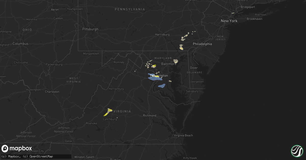
Hail Map in Maryland on May 22, 2022
Get this storm
May 22 map
$229
one time, instant access
Download today. No call, no setup
Keep the $229
Bought the map and want the full workflow? Apply the entire $229 to a subscription within 7 days. None of it is wasted.
Every map, not just this one
This buys you this map. Subscription and you get every map we run, in the markets you choose from a few cities to whole states to nationwide. Plus real-time alerts the moment a storm fires.
Contact data
Name, contact info, occupancy, even credit band for addresses in the footprint. You go from where it hit to who to call.
Become the source they trust
Unlimited branding weather history reports on demand. You already have the documented answer ready for the property owner, and you are the one who showed up with it.
Property data and RoofTrace estimates
Pull up any address you have got, its value and the exact code rules for that jurisdiction, straight from One Click Code. Then RoofTrace estimates the squares, pitch, and roof value, priced the way you price.
Storm reports in Maryland
Maryland
| Date | Description |
|---|---|
| 05/22/20226:55 PM CDT | Wires down on 4500 block of dallas place |
| 05/22/20226:41 PM CDT | Tree reported down near the intersection of westbard ave and river road. |
| 05/22/20226:37 PM CDT | Tree down on the 17000 block of pinebrook drive |
| 05/22/20226:18 PM CDT | Powerline wires down on the 15000 block of darnestown road |
| 05/22/20226:04 PM CDT | Tree reported down on town center blvd. |
| 05/22/20225:05 PM CDT | Tree down near the intersection of creswell rd and carsins run rd |
| 05/22/20224:55 PM CDT | Tree reported down on frist road near honey bee drive. Time estimated by radar. |
| 05/22/20224:49 PM CDT | Wires down on 2200 block of cool spring rd. |
| 05/22/20224:39 PM CDT | Tree down blocking roadway |
| 05/22/20224:35 PM CDT | Tree down at 2208 connolly rd |
| 05/22/20224:30 PM CDT | Several tree branches down along east franklin ave |
| 05/22/20224:21 PM CDT | Tree down on the 13000 block of manor road |
| 05/22/20224:13 PM CDT | Large trees down at 8400 block of greenspring avenue |
| 05/22/20223:55 PM CDT | Tree down on car near the intersection of new hampshire avenue and brighton knolls drive |
| 05/22/20223:46 PM CDT | Large tree down on the 21000 block of georgia avenue |
| 05/22/20223:46 PM CDT | Tree down near the intersection of georgia avenue and new hampshire avenue |
| 05/22/20223:17 PM CDT | Tree down at 6000 block of yeagertown rd |
| 05/22/20223:12 PM CDT | Trees blew down near the intersection of md-25 falls road and miller rd |
| 05/22/20223:05 PM CDT | A local report indicates 60 MPH wind near 2 WNW NEW MARKET |
| 05/22/20223:00 PM CDT | Tree down at 6400 block of linganore rd |
| 05/22/20223:00 PM CDT | Tree down at 9600 block of gas house pike rd and dance hall rd |
| 05/22/20227:02 AM CDT | A local report indicates 59 MPH wind near 3 ENE DAHLGREN |
| 05/22/20223:28 AM CDT | At 828 PM EDT, a severe thunderstorm was located over Greenwell State Park, moving east at 40 mph. HAZARD...60 mph wind gusts. SOURCE...Radar indicated. IMPACT...Damaging winds will cause some trees and large branches to fall. This could injure those outdoors, as well as damage homes and vehicles. Roadways may become blocked by downed trees. Localized power outages are possible. Unsecured light objects may become projectiles. Locations impacted include... Lexington Park, Chesapeake Ranch Estates, Leonardtown, Prince Frederick, Cuckold Creek, Sheridan Point, Calvert Cliffs, Greenwell State Park, Saint Leonard Creek, Town Creek, Flag Harbor, White Point Beach, California, Lusby, Patuxent River Naval Air Station, Saint Leonard, Hollywood, Drum Point, Long Beach and Mechanicsville. |
| 05/22/20222:41 AM CDT | At 741 PM EDT, a severe thunderstorm was located near Tilghman Island, or 7 miles southeast of Deale, moving east at 25 mph. HAZARD...60 mph wind gusts and nickel size hail. SOURCE...Radar indicated. IMPACT...Damage to roofs, siding, trees, and power lines is possible. Locations impacted include... Easton, Talbot, Trappe, St. Michaels, Oxford, Queen Anne, Tilghman Island, Skipton, Copperville, Matthews, Hambleton, Windyhill and Cordova. |
| 05/22/20221:37 AM CDT | At 637 PM EDT, a severe thunderstorm was located over Andrews Air Force Base, moving east at 20 mph. HAZARD...60 mph wind gusts. SOURCE...Radar indicated. IMPACT...Damaging winds will cause some trees and large branches to fall. This could injure those outdoors, as well as damage homes and vehicles. Roadways may become blocked by downed trees. Localized power outages are possible. Unsecured light objects may become projectiles. Locations impacted include... Clinton, Largo, Upper Marlboro, Andrews Air Force Base, Kettering, Rosaryville, Marlton and Dunkirk. |
| 05/22/20221:13 AM CDT | At 612 PM EDT, severe thunderstorms were located along a line extending from 7 miles northeast of Bowleys Quarters to near Magothy River to near Upper Marlboro, moving southeast at 20 mph. HAZARD...60 mph wind gusts and nickel size hail. SOURCE...Radar indicated. IMPACT...Damage to roofs, siding, trees, and power lines is possible. Locations impacted include... Centerville, Chestertown, Centreville, Romancoke, Rock Hall, Church Hill, Betterton, Old Town, Grasonville, Stevensville, Langford, Chester, Newtown, Overton, Starkey Corner, Morgnec, Kennedyville, Queenstown, Galena and Stevensville South. |
| 05/22/202212:55 AM CDT | At 554 PM EDT, severe thunderstorms were located along a line extending from Gradyville to near Elam to Farmington, moving east at 30 mph. HAZARD...60 mph wind gusts and nickel size hail. SOURCE...Radar indicated. IMPACT...Damage to roofs, siding, trees, and power lines is possible. Locations impacted include... Wilmington, Newark, West Chester, Chester, Westtown, Folcroft, Swarthmore, Elsmere, Kennett Square, New Castle, Oxford, West Grove, Newport, Arden, Glen Roy, Darby Township, Stanton, Cheyney, Glasgow and Talleyville.This includes the following highways... Interstate 95 in Pennsylvania between mile markers 0 and 10. Interstate 95 in Delaware between mile markers 1 and 23. Interstate 476 in Pennsylvania between mile markers 0 and 3. |
| 05/22/202212:30 AM CDT | At 530 PM EDT, a severe thunderstorm was located over Fort Meade, or near Severn, moving east at 25 mph. HAZARD...60 mph wind gusts. SOURCE...Radar indicated. IMPACT...Damaging winds will cause some trees and large branches to fall. This could injure those outdoors, as well as damage homes and vehicles. Roadways may become blocked by downed trees. Localized power outages are possible. Unsecured light objects may become projectiles. Locations impacted include... Columbia, Bowie, Severn, Annapolis, College Park, Crofton, Greenbelt, Beltsville, Elkridge, Riviera Beach, Naval Academy, Baltimore-Washington Airport, Severn River, Fort Smallwood State Park, Gibson Island, Sillery Bay, Bodkin Point, Magothy River, Dobbins Island and Pinehurst. |
| 05/22/202212:08 AM CDT | At 507 PM EDT, severe thunderstorms were located along a line extending from Elverson to near Holtwood, moving east at 30 mph. HAZARD...60 mph wind gusts and nickel size hail. SOURCE...Radar indicated. IMPACT...Damage to roofs, siding, trees, and power lines is possible. Locations impacted include... West Chester, Norristown, Phoenixville, West Norriton, East Norriton, Coatesville, Westtown, Downingtown, Conshohocken, Ambler, Kennett Square, Collegeville, Oxford, Royersford, Parkesburg, Trappe, West Grove, Honey Brook, Elverson and Glen Roy.This includes the following highways... Pennsylvania Turnpike between mile markers 300 and 338. Northeast Extension between mile markers 21 and 26. Interstate 76 in Pennsylvania between mile markers 327 and 334. Interstate 476 in Pennsylvania between mile markers 15 and 19. |
| 05/22/202212:02 AM CDT | At 502 PM EDT, a severe thunderstorm was located over Rossmoor, or near Olney, moving east at 20 mph. HAZARD...60 mph wind gusts. SOURCE...Radar indicated. IMPACT...Damaging winds will cause some trees and large branches to fall. This could injure those outdoors, as well as damage homes and vehicles. Roadways may become blocked by downed trees. Localized power outages are possible. Unsecured light objects may become projectiles. Locations impacted include... Rockville, Bowie, Olney, College Park, Crofton, Greenbelt, Beltsville, Aspen Hill, Potomac, North Bethesda, Severna Park, Odenton, Laurel, Fairland, Arnold, White Oak, Redland, Parole, Adelphi and Colesville. |
| 05/21/202211:46 PM CDT | At 445 PM EDT, a severe thunderstorm was located near Columbia, moving east at 30 mph. HAZARD...60 mph wind gusts. SOURCE...Radar indicated. IMPACT...Damaging winds will cause some trees and large branches to fall. This could injure those outdoors, as well as damage homes and vehicles. Roadways may become blocked by downed trees. Localized power outages are possible. Unsecured light objects may become projectiles. Locations impacted include... Baltimore, Columbia, Severn, Elkridge, Riviera Beach, Baltimore-Washington Airport, Historic Ellicott City, Glen Burnie, Ellicott City, Dundalk, Catonsville, Woodlawn, Severna Park, Odenton, Milford Mill, Lochearn, Laurel, Pasadena, Arbutus and Lake Shore. |
| 05/21/202211:21 PM CDT | At 421 PM EDT, a severe thunderstorm was located near Leesburg, moving east at 20 mph. HAZARD...60 mph wind gusts and quarter size hail. SOURCE...Radar indicated. IMPACT...Damaging winds will cause some trees and large branches to fall. This could injure those outdoors, as well as damage homes and vehicles. Roadways may become blocked by downed trees. Localized power outages are possible. Unsecured light objects may become projectiles. Locations impacted include... Leesburg, Poolesville, Barnesville, Lucketts, Dickerson and Beallsville. |
| 05/21/202211:11 PM CDT | At 411 PM EDT, a severe thunderstorm was located near Green Valley, or near Damascus, moving east at 25 mph. HAZARD...60 mph wind gusts and quarter size hail. SOURCE...Radar indicated. IMPACT...Damaging winds will cause some trees and large branches to fall. This could injure those outdoors, as well as damage homes and vehicles. Roadways may become blocked by downed trees. Localized power outages are possible. Unsecured light objects may become projectiles. Locations impacted include... Germantown, Frederick, Gaithersburg, Olney, Damascus, Montgomery Village, Eldersburg, Ballenger Creek, Redland, Mount Airy, Sykesville, New Market, Boyds, Green Valley, Linganore-Bartonsville, Discovery-Spring Garden, Cloverly, Clarksburg, Burtonsville and Spencerville. |
| 05/21/202210:58 PM CDT | At 358 PM EDT, a severe thunderstorm was located over Middleburg, or 8 miles west of Brambleton, moving east at 15 mph. HAZARD...60 mph wind gusts and quarter size hail. SOURCE...Radar indicated. IMPACT...Damaging winds will cause some trees and large branches to fall. This could injure those outdoors, as well as damage homes and vehicles. Roadways may become blocked by downed trees. Localized power outages are possible. Unsecured light objects may become projectiles. Locations impacted include... Reston, Leesburg, Herndon, Broadlands, Lansdowne, Lowes Island, Brambleton, Poolesville, Ashburn, Sterling, Great Falls, Countryside, Middleburg, Oatlands, Belmont, Gleedsville, Aldie, Sterling Park and Philomont. |
| 05/21/202210:35 PM CDT | At 334 PM EDT, a severe thunderstorm was located over Point Of Rocks, or 9 miles southwest of Harry Grove Stadium, moving east at 15 mph. HAZARD...60 mph wind gusts and quarter size hail. SOURCE...Radar indicated. IMPACT...Damaging winds will cause some trees and large branches to fall. This could injure those outdoors, as well as damage homes and vehicles. Roadways may become blocked by downed trees. Localized power outages are possible. Unsecured light objects may become projectiles. Locations impacted include... Frederick, Harry Grove Stadium, Ballenger Creek, Brunswick, Braddock Heights, New Market, Point Of Rocks, Linganore-Bartonsville, Adamstown, Jefferson, Buckeystown, Monrovia, Rosemont, Ijamsville, Doubs, Park Mills, Petersville, Tuscarora and Taylorstown. |
| 05/21/20227:27 PM CDT | Wires down on 1100 block of baltimore lane |
| 05/21/20227:27 PM CDT | Wires down on 1100 block of baltimore lane |
| 05/21/20227:18 PM CDT | Trees down at plum point rd and cox rd |
| 05/21/20227:15 PM CDT | A large tree was reported down on llandaff rd. Time estimated from radar. |
| 05/21/20227:13 PM CDT | Tree reported down on southern maryland boulevard. |
| 05/21/20227:13 PM CDT | Tree reported down on northbrook drive near jewell road. |
| 05/21/20227:02 PM CDT | Corrected time |
All States Impacted by Hail Map on May 22, 2022
Cities Impacted by Hail Map on May 22, 2022
- Dickerson, MD
- Adamstown, MD
- Hillsboro, AL
- Trinity, AL
- Moulton, AL
- Brooks, ME
- Gilbertsville, PA
- Pottstown, PA
- Morgantown, PA
- Birdsboro, PA
- Douglassville, PA
- Mohnton, PA
- Hudson, FL
- Jesup, GA
- Thorndike, ME
- Monroe, ME
- Honey Brook, PA
- Narvon, PA
- Phoenix, MD
- Glen Arm, MD
- Winn, ME
- Burlington, ME
- Springfield, ME
- Danforth, ME
- Wytopitlock, ME
- Lincoln, ME
- Orient, ME
- Lee, ME
- Claxton, GA
- Uvalda, GA
- Mount Vernon, GA
- Clayton, AL
- Gunpowder, MD
- Middle River, MD
- Hoboken, GA
- Riviera, TX
- Aberdeen Proving Ground, MD
- Boyds, MD
- Germantown, MD
- Clarksburg, MD
- Jay, ME
- Livermore Falls, ME
- Livermore, ME
- Farmington, ME
- Kents Hill, ME
- Mount Vernon, ME
- Vienna, ME
- Canton, ME
- Peach Bottom, PA
- Quarryville, PA
- Christiana, PA
- Oxford, PA
- Kirkwood, PA
- Nottingham, PA
- San Ygnacio, TX
- Bronson, FL
- Zapata, TX
- Brooklet, GA
- Falls Church, VA
- Arlington, VA
- Fort Myer, VA
- Collins, GA
- Morriston, FL
- Dunnellon, FL
- Upatoi, GA
- Columbus, GA
- Owings, MD
- Friendship, MD
- Chesapeake Beach, MD
- North Beach, MD
- Harrison, GA
- Wrightsville, GA
- Laredo, TX
- Mattawamkeag, ME
- Temple Hills, MD
- Suitland, MD
- Leesburg, VA
- Kingsville, TX
- Williston, FL
- Rockwood, ME
- Greenville Junction, ME
- Greenville, ME
- Peru, ME
- Alexandria, VA
- Premont, TX
- Boyce, VA
- Bartow, GA
- Davisboro, GA
- Corpus Christi, TX
- Belgrade, ME
- Alamo, GA
- Fort Benning, GA
- Roma, TX
- Monroe, VA
- Arrington, VA
- Big Island, VA
- Vesuvius, VA
- Amherst, VA
- Roseland, VA
- Tarrytown, GA
- Soperton, GA
- Lutz, FL
- McRae Helena, GA
- Gap, PA
- Tuckahoe, NY
- Eastchester, NY
- Yonkers, NY
- Scarsdale, NY
- White Post, VA
- Millen, GA
- Fort Stewart, GA
- New Rochelle, NY
- Sylvania, GA
- Rocky Ford, GA
- Bell, FL
- Trenton, FL
- Rockville, MD
- Vienna, VA
- Fairfax, VA
- Oakton, VA
- Chiefland, FL
- Aiken, SC
- Jackson, SC
- New Ellenton, SC
- Lumber City, GA
- East Earl, PA
- New Holland, PA
- Bethesda, MD
- McLean, VA
- Chevy Chase, MD
- Glen Echo, MD
- Cabin John, MD
- Harmony, ME
- Terre Hill, PA
- Oakland, ME
- Inglis, FL
- Barto, PA
- Bechtelsville, PA
- Frederick, MD
- Jefferson, MD
- Lyons, GA
- Lovettsville, VA
- Point Of Rocks, MD
- Tuscarora, MD
- Vidalia, GA
- Dexter, ME
- Cambridge, ME
- Newington, GA
- Statesboro, GA
- Unity, ME
- Albion, ME
- Troy, ME
- Rhine, GA
- Eastman, GA
- Swainsboro, GA
- Sumner, ME
- Buckfield, ME
- Bryant Pond, ME
- Greenwood, ME
- Bethel, ME
- Dixfield, ME
- Savannah, GA
- Joppa, MD
- Kingsville, MD
- White Marsh, MD
- Edgewood, MD
- Denver, PA
- Kinzers, PA
- New Market, MD
- Bishop, TX
- Ludowici, GA
- Oley, PA
- Boyertown, PA
- Atglen, PA
- Herndon, VA
- Reston, VA
- Reidsville, GA
- Milan, GA
- Falfurrias, TX
- Waycross, GA
- Montgomery Village, MD
- Gaithersburg, MD
- La Plata, MD
- Ellabell, GA
- Dunn Loring, VA
- Annandale, VA
- Washington, DC
- Waterford, VA
- Richmond Hill, GA
- Green Lane, PA
- Pennsburg, PA
- Red Hill, PA
- Louisville, AL
- Silver Spring, MD
- Glennville, GA
- Appomattox, VA
- Damascus, MD
- Eufaula, AL
- Midway, AL
- Becket, MA
- Worthington, MA
- Huntington, MA
- Williamsburg, MA
- Chester, MA
- West Chesterfield, MA
- Cummington, MA
- Chesterfield, MA
- Middlefield, MA
- Hinsdale, MA
- Belgrade Lakes, ME
- Sterling, VA
- Chantilly, VA
- Fairfax Station, VA
- Lothian, MD
- Centreville, VA
- Clifton, VA
- Manassas, VA
- Brandywine, MD
- Springfield, VA
- Upper Marlboro, MD
- Clinton, MD
- Andrews Air Force Base, MD
- Fort Washington, MD
- Cheltenham, MD
- Burke, VA
- Oxon Hill, MD
- Hughesville, MD
- Bryantown, MD
- Pomfret, MD
- Port Tobacco, MD
- Waldorf, MD
- White Plains, MD
- Greenfield, NH
- Francestown, NH
- Weare, NH
- New Boston, NH
- Clyo, GA
- Guyton, GA
- Springfield, GA


