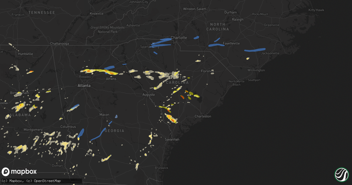
Hail Map in South Carolina on May 22, 2020
Get this storm
May 22 map
$229
one time, instant access
Download today. No call, no setup
Keep the $229
Bought the map and want the full workflow? Apply the entire $229 to a subscription within 7 days. None of it is wasted.
Every map, not just this one
This buys you this map. Subscription and you get every map we run, in the markets you choose from a few cities to whole states to nationwide. Plus real-time alerts the moment a storm fires.
Contact data
Name, contact info, occupancy, even credit band for addresses in the footprint. You go from where it hit to who to call.
Become the source they trust
Unlimited branding weather history reports on demand. You already have the documented answer ready for the property owner, and you are the one who showed up with it.
Property data and RoofTrace estimates
Pull up any address you have got, its value and the exact code rules for that jurisdiction, straight from One Click Code. Then RoofTrace estimates the squares, pitch, and roof value, priced the way you price.
Storm reports in South Carolina
South Carolina
| Date | Description |
|---|---|
| 05/22/20206:50 PM CDT | Social media report and picture of baseball sized hail at the corner of 4th street and lawton avenue. |
| 05/22/20206:40 PM CDT | Orangeburg co em reported quarter size hail near the community of wells. Time estimated. |
| 05/22/20206:24 PM CDT | Schp reported trees down on beacon tree rd at us hwy 178... North of bowman. Time estimated. |
| 05/22/20206:10 PM CDT | Trees down near the intersection of belvedere dr and moncks corner rd. |
| 05/22/20206:05 PM CDT | Warning point reported golf ball sized hail in fairfax. |
| 05/22/20205:44 PM CDT | Warning point reported tree down that brought down a powerline at the intersection of highway 278 and concord church road. Time estimated based on radar. |
| 05/22/20205:42 PM CDT | 2-3 trees down in the town of elko. Nickle size hail also reported. Time estimated based on radar. |
| 05/22/20205:24 PM CDT | Air force weather observer at shaw afb near sumter observed one inch hail. |
| 05/22/20205:09 PM CDT | Sc highway patrol reported downed trees on elliotts landing rd at old river rd. Time estimated by radar. |
| 05/22/20205:04 PM CDT | Ema reported quarter to ping pong ball sized hail along stumphole rd. Time estimated by radar. |
| 05/22/20205:04 PM CDT | Schp reported trees down on ashland rd and gardendale dr. Time estimated. |
| 05/22/20204:45 PM CDT | Large tree down in the area of mary's lane in the mccoll community |
| 05/22/20204:41 PM CDT | Tree on roadway. Highway patrol report |
| 05/22/20204:39 PM CDT | Tree in roadway. Report from sc highway patrol |
| 05/22/20204:35 PM CDT | Schp reported trees down on green meadow dr. Time estimated. |
| 05/22/20204:29 PM CDT | Highway patrol reported tree in roadway at green meadow dr and amicks ferry rd. |
| 05/22/20204:28 PM CDT | Tree down on power line and across roadway on old forge road near willow cove road. |
| 05/22/20204:26 PM CDT | Tree down on power line on heimatsweg road at old lexington road. |
| 05/22/20204:20 PM CDT | Public reported quarter size hail. |
| 05/22/20204:19 PM CDT | Trees and power lines down on mellow woods ln near pine meadow dr. |
| 05/22/20204:18 PM CDT | Trees and power lines down near the intersection of woodlake cir and lakemont dr. |
| 05/22/20204:18 PM CDT | 1.5 inch diameter hail reported on riley road near burke road. |
| 05/22/20204:16 PM CDT | Highway patrol reported tree in roadway at evans mill road and zion church road. |
| 05/22/20204:05 PM CDT | Trees down at big creek rd and morris rd. Time estimated. |
| 05/22/20204:04 PM CDT | Schp reported trees down at evans mill rd and zion church rd. Time estimated. |
| 05/22/20204:00 PM CDT | Trees reported down on hwy 265 about 1 mile east of jefferson... Near fork creek. |
| 05/22/20203:54 PM CDT | Spotter relayed a report from the public of a tree down on a vehicle on turnip seed rd east of heath springs. No injuries. Photo shared via social media. Exact location |
| 05/22/20203:42 PM CDT | Trained spotter and assistant fire chief reported trees down at willie usher rd and robert usher rd... With estimated wind gusts around 60 mph. Time estimated. |
| 05/22/20203:36 PM CDT | Power pole and lines down on us hwy 521 just south of lancaster. Photo provided via social media. Time estimated. |
| 05/22/20203:36 PM CDT | County dispatch reported trees and power lines down all over the county. |
| 05/22/20203:30 PM CDT | *** 1 fatal *** corrects previous tstm wnd dmg report from springdale. Charlotte media informed us that a fatality occurred when a tree and power pole fell on a motor v |
| 05/22/20203:14 PM CDT | Quarter size hail reported at a convenience store on us hwy 1 near exit 22 on interstate 20. |
| 05/22/20203:11 PM CDT | Trees down on sc 72 and 193 s. Time esimated from radar. |
| 05/22/20203:08 PM CDT | Trees down on us 321 at sky line dr. Time estimated from radar. |
| 05/22/20203:00 PM CDT | Amateur radio reported trees down along the highway 274 corridor. |
| 05/22/20202:55 PM CDT | Trees down on brattonsville rd near chappell rd. Time estimated from radar. |
| 05/22/20202:55 PM CDT | Amateur radio reported trees down and a porta john tossed around along seaside rd... Allison rd... Brandt rd... And sassana rd. |
| 05/22/20202:46 PM CDT | Public reported trees down along lawrence rd. |
| 05/22/20202:43 PM CDT | Nws storm survey found ef0 tornado damage that was either a continuation of the tornado that moved across cherokee and york counties in south carolina... Or was a separ |
| 05/22/20202:43 PM CDT | Public reported trees down and building knocked over on lilly dr. |
| 05/22/20202:40 PM CDT | Public reported trees down on houses and power lines down on monarch mill |
| 05/22/20202:40 PM CDT | Power lines down on sc 72 at cambridge st. Extension |
| 05/22/20202:36 PM CDT | Nws storm survey reported an ef1 tornado that began in cherokee county passed through kings mountain national military park in york county. The tornado continued east/n |
| 05/22/20202:35 PM CDT | Public reported multiple trees and power lines down in buffalo |
| 05/22/20202:32 PM CDT | Multiple trees and some power lines down along jumping branch road and rambler lane. Large tree uprooted onto power lines near mcentire and bridges. Possible tornado. |
| 05/22/20202:29 PM CDT | Nws storm survey reported ef1 tornado damage embedded within a larger area of downburst damage across northeast cherokee county. Many trees were snapped and uprooted as |
| 05/22/20202:20 PM CDT | Tree down on raintree ln at coach hill dr. Time estimated from radar. |
| 05/22/20202:20 PM CDT | Tree down on sc 18 at pleasant school rd. Time estimated from radar. |
| 05/22/20202:15 PM CDT | Numerous limbs down over a 100 yard distance along webster drive. A large oak tree uprooted and another oak snapped about half way up. A third oak had all the branches |
| 05/22/20202:03 PM CDT | Trees down on elberton hwy at hwy 187. Time estimated from radar. |
| 05/22/20202:03 PM CDT | Large hardwood tree uprooted. Time estimated from radar. |
| 05/22/20202:01 PM CDT | Trees down on brice rd at chapel dr. Time estimated from radar. |
| 05/22/20202:00 PM CDT | Public reported trees down that damaged metal chain link fence on parris bridge rd and sandifer rd. |
| 05/22/20202:00 PM CDT | Numerous trees toppled along a straight line path near lake stone road. |
| 05/22/20201:55 PM CDT | Public reported 10-12 trees down on windover ln. |
| 05/22/20201:50 PM CDT | Emergency mngr reported trees and powerlines down near west georgia rd and hwy 418 |
| 05/22/20201:50 PM CDT | Trees down on halls bridge rd. Time estimated from radar. |
| 05/22/20201:35 PM CDT | Trained spotter reported fence sections blown down... Along with 4 inch limbs from the top of trees...on feversham ct. |
| 05/22/20201:30 PM CDT | Social media reported trees down on car off of coolidge ave |
| 05/22/20201:29 PM CDT | Tree down on jackson grove rd. Time estimated from radar. |
| 05/22/20201:26 PM CDT | Power lines down on us 25 and blue ridge dr. Time estimated from radar. |
| 05/22/20203:24 AM CDT | At 823 PM EDT, a severe thunderstorm was located over Furman, moving southeast at 10 mph. HAZARD...60 mph wind gusts and quarter size hail. SOURCE...Radar indicated. IMPACT...Minor hail damage to vehicles is possible. Expect wind damage to trees and powerlines. Locations impacted include... Ridgeland, Furman, Scotia, Coosawhatchie, Pineland, Gillisonville and Grays.This warning includes I-95 in South Carolina between mile markers 23and 34. |
| 05/22/20202:32 AM CDT | At 731 PM EDT, a severe thunderstorm was located over Luray, moving east at 20 mph. HAZARD...60 mph wind gusts and quarter size hail. SOURCE...Radar indicated. IMPACT...Minor hail damage to vehicles is possible. Expect wind damage to trees and powerlines. Locations impacted include... Hampton, Lake Warren State Park, Varnville, Estill, Gifford, Luray, Lena, Early Branch, Cummings, McPhersonville and Almeda Intersection. |
| 05/22/20202:17 AM CDT | At 716 PM EDT, a severe thunderstorm was located 7 miles northeast of Holly Hill, moving southeast at 15 mph. HAZARD...60 mph wind gusts and quarter size hail. SOURCE...Radar indicated. IMPACT...Minor hail damage to vehicles is possible. Expect wind damage to trees and powerlines. Locations impacted include... Bonneau, Southern Lake Moultrie, Eadytown, Cross, Northern Lake Moultrie, Bonneau Beach, Eastern Lake Marion and Pinopolis.This warning includes I-26 between mile markers 190 and 195. |
| 05/22/20202:15 AM CDT | At 715 PM EDT, a severe thunderstorm was located near Orangeburg County Airport, or near Orangeburg, moving southeast at 20 mph. HAZARD...60 mph wind gusts and quarter size hail. SOURCE...Radar indicated. IMPACT...Hail damage to vehicles is expected. Expect wind damage to roofs, siding, and trees. Locations impacted include... Orangeburg, Bamberg, Holly Hill, Branchville, Bowman, Orangeburg County Airport, Eutawville, Rowesville, Cordova, Cope, Yonder Field and Edisto.This includes the following highways... Interstate 26 between mile markers 152 and 169. Interstate 95 between mile markers 85 and 94. |
| 05/22/20202:01 AM CDT | At 701 PM EDT, a severe thunderstorm was located near Claussen, or 10 miles west of Marion, moving east at 15 mph. HAZARD...60 mph wind gusts and quarter size hail. SOURCE...Radar indicated. IMPACT...Minor hail damage to vehicles is possible. Expect wind damage to trees and power lines. Locations impacted include... Marion, Blue Brick, Zion, Mars Bluff, Claussen, Rains, Smithboro and Carolinas Hospital System - Marion. |
| 05/22/20201:38 AM CDT | At 635 PM EDT, a severe thunderstorm was located near Brookdale, and another was located over Lake Moultrie east of Santee State Park. Both storms were moving east at 25 mph. HAZARD...60 mph wind gusts and quarter size hail. SOURCE...Radar indicated. IMPACT...Hail damage to vehicles is expected. Expect wind damage to roofs, siding, and trees. Locations impacted include... Orangeburg, Manning, Brookdale, St. Matthews, Summerton, Elloree, Alcolu, Santee State Park, Santee Cooper Regional Airport, Claflin College, South Carolina State University, Orangeburg County Airport, Edisto Gardens, Santee, Pinewood, Cameron, Eutawville, Paxville, Vance and Cordova.This includes the following highways... Interstate 26 between mile markers 138 and 158. Interstate 95 between mile markers 93 and 127. |
| 05/22/20201:32 AM CDT | At 632 PM EDT, a severe thunderstorm was located over Appleton, or near Allendale, moving east at 15 mph. HAZARD...60 mph wind gusts and quarter size hail. SOURCE...Radar indicated. IMPACT...Hail damage to vehicles is expected. Expect wind damage to roofs, siding, and trees. Locations impacted include... Barnwell, Bamberg, Denmark, Williston, Blackville, Barnwell State Park, Rivers Bridge State Park, Ehrhardt, Hilda, Snelling, Olar, Kline, Elko, Govan, Bamberg County Airport and Barnwell County Airport. |
| 05/22/20201:09 AM CDT | At 609 PM EDT, severe thunderstorms were located along a line extending from near Goodale State Park to Sumter, moving east at 30 mph. HAZARD...60 mph wind gusts and quarter size hail. SOURCE...Radar indicated. IMPACT...Hail damage to vehicles is expected. Expect wind damage to roofs, siding, and trees. Locations impacted include... Sumter, Bishopville, South Sumter, Shaw Air Base, Woods Bay State Park, Elliott, Mulberry, Lee State Park, Sumter County Airport, Millwood, Oakland, Turbeville, Mayesville, Lynchburg, Cane Savannah, Lucknow, Dalzell, Manville, Spring Hill and Brogdon.This includes the following highways... Interstate 20 in South Carolina between mile markers 106 and 125. Interstate 95 between mile markers 124 and 146. |
| 05/22/202012:59 AM CDT | At 559 PM EDT, severe thunderstorms were located along a line extending from Dentsville to Lexington, moving east at 35 mph. HAZARD...60 mph wind gusts and quarter size hail. SOURCE...Radar indicated. IMPACT...Hail damage to vehicles is expected. Expect wind damage to roofs, siding, and trees. Locations impacted include... Columbia, Sumter, Lexington, West Columbia, Cayce, Irmo, Forest Acres, Camden, Springdale, St. Andrews, Dentsville, Oak Grove, Shaw Air Base, McEntire Air Base, Red Bank, South Congaree, Pine Ridge, Arcadia Lakes, Eastover and Lugoff.This includes the following highways... Interstate 126 between mile markers 0 and 3. Interstate 20 in South Carolina between mile markers 51 and 105. Interstate 26 between mile markers 104 and 117. Interstate 77 between mile markers 0 and 25. |
| 05/22/202012:52 AM CDT | At 552 PM EDT, a severe thunderstorm was located near Elloree, or 12 miles northeast of Brookdale, moving east at 25 mph. HAZARD...60 mph wind gusts and quarter size hail. SOURCE...Radar indicated. IMPACT...Hail damage to vehicles is expected. Expect wind damage to roofs, siding, and trees. Locations impacted include... Sumter, Manning, South Sumter, Summerton, Alcolu, Santee State Park, Mulberry, Millwood, Poinsett State Park, Pinewood, Cameron, Paxville, Cane Savannah, Poplar Creek Landing, Rimini, Fort Motte, Stumphole Landing, Brogdon, Wedgewood and Lone Star.This includes Interstate 95 between mile markers 105 and 124. |
| 05/22/202012:42 AM CDT | Trees down near sc 261 and richbow road. Time estimated from radar. |
| 05/22/202012:36 AM CDT | At 536 PM EDT, severe thunderstorms were located along a line extending from 8 miles northwest of Hoffman to near Chavistown, moving east at 50 mph. HAZARD...60 mph wind gusts and nickel size hail. SOURCE...Radar indicated. IMPACT...Expect wind damage to trees and power lines. Locations impacted include... Lumberton, Dillon, Red Springs, Pembroke, Fairmont, Maxton, St. Pauls, Rowland, Rex, Hamer, South Of The Border, Hestertown, Shannon, Buie, Robeson Community College, Wakulla, Minturn, Elrod, Smiths and Howellsville. |
| 05/22/202012:29 AM CDT | At 527 PM EDT, severe thunderstorms were located along a line extending from near Ballentine to 6 miles south of Dreher Island State Park to near Ridge Spring, moving east at 25 mph. The strongest winds were east of Putnam's Landing over Lake Murray. HAZARD...70 mph wind gusts. SOURCE...Radar indicated. IMPACT...Expect considerable tree damage. Damage is likely to mobile homes, roofs, and outbuildings. Locations impacted include... Columbia, Lexington, West Columbia, Cayce, Irmo, Batesburg-Leesville, Springdale, St. Andrews, Oak Grove, Highway 6 at Lake Murray Dam, Red Bank, South Congaree, Pine Ridge, Ridge Spring, Columbia International University, Harbison State Forest, West Columbia Riverwalk, Dreher Island State Park, Saluda County Airport and Riverbanks Zoo.This includes the following highways... Interstate 126 between mile markers 0 and 3. Interstate 20 in South Carolina between mile markers 33 and 71. Interstate 26 between mile markers 88 and 116. Interstate 77 near mile marker 0, and between mile markers 21 and28. |
| 05/22/202012:27 AM CDT | At 527 PM EDT, severe thunderstorms were located along a line extending from Troy to 11 miles north of Rockingham to near Wallace, moving east at 45 mph. HAZARD...60 mph wind gusts and penny size hail. SOURCE...Radar indicated. IMPACT...Expect damage to roofs, siding, and trees. Locations impacted include... Fayetteville, Sanford, Laurinburg, Southern Pines, Rockingham, Raeford, Troy, Carthage, Fort Bragg and Pinehurst. |
| 05/22/202012:17 AM CDT | Richland county reported trees and power lines down along leesburg road. Time estimated from radar. |
| 05/22/202012:15 AM CDT | Trees down and blocking roadway at the intersection of oakcrest drive and windsor lake blvd. Time estimated from radar. |
| 05/22/202012:13 AM CDT | At 513 PM EDT, severe thunderstorms were located along a line extending from 9 miles southwest of Troy to 6 miles northwest of Clyde, moving east at 50 mph. HAZARD...60 mph wind gusts and penny size hail. SOURCE...Radar indicated. IMPACT...Expect wind damage to trees and power lines. Locations impacted include... Bennettsville, Hartsville, Mccoll, Clio, North Hartsville, Dovesville, Mont Clare, Brownsville, Auburn, Wallace, Clyde, Chavistown, Floyd, Dunbar, Society Hill, Blenheim and Tatum. |
| 05/22/202012:10 AM CDT | At 510 PM EDT, a severe thunderstorm was located over Dentsville, moving northeast at 20 mph. HAZARD...60 mph wind gusts and quarter size hail. SOURCE...Radar indicated. IMPACT...Hail damage to vehicles is expected. Expect wind damage to roofs, siding, and trees. Locations impacted include... Columbia, Forest Acres, Camden, Dentsville, Arcadia Lakes, Lugoff, Woodfield, Sesquicentennial State Park, Lake Carolina, Villages at Sandhill, Fort Jackson, Elgin, Killian, Fort Jackson Wildcat Road, Pine Grove Fire Station and Fort Jackson Cantonment Area.This includes the following highways... Interstate 20 in South Carolina between mile markers 68 and 96. Interstate 77 between mile markers 9 and 24. |
| 05/22/202012:09 AM CDT | At 508 PM EDT, severe thunderstorms were located along a line extending from near Chesterfield to near Cassatt, moving east at 55 mph. HAZARD...60 mph wind gusts. SOURCE...Radar indicated. IMPACT...Expect damage to roofs, siding, and trees. Locations impacted include... Cheraw, Cheraw State Park, Cheraw Municipal Airport, Northeastern Technical College, Patrick, Cheraw Fish Hatchery, Alligator Fire Station and Middendorf. |
| 05/22/202012:07 AM CDT | Trees down at main street and i-20. Time estimated from radar. |
| 05/22/202012:01 AM CDT | Trees down on i-26 near mile marker 100. Time estimated from radar. |
| 05/22/202012:01 AM CDT | Trees down on i-26 near mile marker 96. Time estimated from radar. |
| 05/21/202011:55 PM CDT | At 454 PM EDT, a severe thunderstorm was located 9 miles west of Edisto Gardens, or 9 miles west of Orangeburg, moving northeast at 20 mph. HAZARD...60 mph wind gusts and half dollar size hail. SOURCE...Radar indicated. IMPACT...Hail damage to vehicles is expected. Expect wind damage to roofs, siding, and trees. Locations impacted include... Orangeburg, Brookdale, St. Matthews, Orangeburg County Airport, Claflin College, Edisto Gardens, South Carolina State University, Cameron, Neeses, Norway, Cordova, Livingston, Wilkinson Heights, Prince of Orange Mall and Edisto.This includes Interstate 26 between mile markers 134 and 151. |
| 05/21/202011:36 PM CDT | At 435 PM EDT, severe thunderstorms were located along a line extending from Newberry County Airport to near Mccormick County Airport, moving east at 40 mph. HAZARD...60 mph wind gusts and quarter size hail. SOURCE...Radar indicated. IMPACT...Hail damage to vehicles is expected. Expect wind damage to roofs, siding, and trees. Locations impacted include... Columbia, Lexington, Irmo, Newberry, Batesburg-Leesville, Winnsboro, VC Summer Nuclear Station, Highway 6 at Lake Murray Dam, St. Andrews, Saluda, McCormick, Prosperity, Jenkinsville, Harbison State Forest, Dreher Island State Park, Fairfield County Airport, Saluda County Airport, Newberry College, Newberry County Airport and Longtown.This includes the following highways... Interstate 26 between mile markers 72 and 104. Interstate 77 between mile markers 25 and 38. |
| 05/21/202011:32 PM CDT | At 432 PM EDT, severe thunderstorms were located along a line extending from West Concord to Fairview In Union County to near Lancaster, moving northeast at 55 mph. HAZARD...60 mph wind gusts and nickel size hail. SOURCE...Radar indicated. IMPACT...Expect damage to roofs, siding, and trees. Locations impacted include... Albemarle, Rockingham, Wadesboro, Troy, Badin Lake, Hamlet, Biscoe, Ansonville, Plyler and Midland. |
| 05/21/202011:30 PM CDT | At 430 PM EDT, severe thunderstorms were located along a line extending from 14 miles south of Downtown Concord to 3 miles north of Lancaster, moving east at 40 mph. HAZARD...60 mph wind gusts and penny size hail. SOURCE...Radar indicated. IMPACT...Expect damage to trees and power lines. Locations impacted include... Monroe, Unionville, Wesley Chapel, Wingate, Marshville, Lake Park, Mineral Springs, Hemby Bridge, Fairview In Union County and Sturdivants. |
| 05/21/202011:21 PM CDT | At 421 PM EDT, a severe thunderstorm was located 11 miles east of Greenwood, or over Lake Greenwood State Park, moving east at 45 mph. HAZARD...60 mph wind gusts and quarter size hail. SOURCE...Radar indicated. IMPACT...Minor hail damage to vehicles is expected. Expect wind damage to trees and power lines. Locations impacted include... Ninety Six, Ninety Six Historic Site, Lake Greenwood State Park, Greenwood State Park, Dyson and Lake Greenwood. |
| 05/21/202011:17 PM CDT | At 417 PM EDT, severe thunderstorms were located along a line extending from 6 miles south of Indian Land to 10 miles south of Chester, moving east at 45 mph. HAZARD...60 mph wind gusts and penny size hail. SOURCE...Radar indicated. IMPACT...Expect damage to trees and power lines. Locations impacted include... Great Falls, Fort Lawn, Richburg, Blackstock, Cornwell, Edgemoor and Fishing Creek Reservoir. |
| 05/21/202011:13 PM CDT | At 412 PM EDT, a severe thunderstorm was located over Aiken Municipal Airport, or near Aiken, moving east at 20 mph. HAZARD...60 mph wind gusts and half dollar size hail. SOURCE...Radar indicated. IMPACT...Hail damage to vehicles is expected. Expect wind damage to roofs, siding, and trees. Locations impacted include... Aiken, Aiken Municipal Airport, Aiken State Park, Steedman and New Holland.This includes Interstate 20 in South Carolina between mile markers 16and 38. |
| 05/21/202011:11 PM CDT | At 411 PM EDT, a severe thunderstorm was located 11 miles south of Gaston, or 17 miles northwest of Orangeburg, moving east at 15 mph. HAZARD...60 mph wind gusts and quarter size hail. SOURCE...Radar indicated. IMPACT...Hail damage to vehicles is expected. Expect wind damage to roofs, siding, and trees. Locations impacted include... Sandy Run, Swansea, North, Woodford and Livingston. This includes Interstate 26 between mile markers 126 and 142. |
| 05/21/202011:03 PM CDT | At 403 PM EDT, a severe thunderstorm was located over Eastern Lake Marion, moving east at 15 mph. HAZARD...60 mph wind gusts and quarter size hail. SOURCE...Radar indicated. IMPACT...Minor hail damage to vehicles is possible. Expect wind damage to trees and powerlines. Locations impacted include... Saint Stephen, Bonneau, Eadytown, Eastern Lake Marion, Northern Lake Moultrie and Bonneau Beach. |
| 05/21/202011:01 PM CDT | At 400 PM EDT, severe thunderstorms were located along a line extending from near Fort Mill to 6 miles southwest of Chester State Park, moving east at 60 mph. HAZARD...60 mph wind gusts and penny size hail. SOURCE...Radar indicated. IMPACT...Expect damage to roofs, siding, and trees. Locations impacted include... Lancaster, Indian Land, Elgin, Andrew Jackson State Park, USC Lancaster, Van Wyck, Irwin, Bell Town Fire Station, Arrowood Estates, Camp Creek Fire Station, Community of Almond Glen, Unity Fire Station, Lancaster Mill, Carolina Commons Shopping Center, McWhirter Airfield and McDonald Green Elementary School. |
| 05/21/202010:53 PM CDT | At 353 PM EDT, a severe thunderstorm was located near Eastern Lake Marion, or 19 miles south of Manning, moving east at 20 mph. HAZARD...60 mph wind gusts and quarter size hail. SOURCE...Radar indicated. IMPACT...Hail damage to vehicles is expected. Expect wind damage to roofs, siding, and trees. Locations impacted include... Eautaw Springs, Rocks Pond Campground and Marina and Blounts Landing. |
| 05/21/202010:51 PM CDT | At 350 PM EDT, severe thunderstorms were located along a line extending from near Gastonia to 5 miles east of York, moving east at 50 mph. HAZARD...60 mph wind gusts and penny size hail. SOURCE...Radar indicated. IMPACT...Expect damage to trees and power lines. Locations impacted include... Gastonia, Uptown Charlotte, Huntersville, Central Charlotte, South Charlotte, Northeast Charlotte, Southwest Charlotte, East Charlotte, Northwest Charlotte and Matthews. |
| 05/21/202010:49 PM CDT | At 349 PM EDT, severe thunderstorms were located along a line extending from near Carlisle to near Joanna, moving east at 45 mph. HAZARD...60 mph wind gusts and quarter size hail. SOURCE...Radar indicated. IMPACT...Hail damage to vehicles is expected. Expect wind damage to roofs, siding, and trees. Locations impacted include... Newberry, VC Summer Nuclear Station, Whitmire, Prosperity, Jenkinsville, Newberry College, Monticello, Newberry County Airport, Blair, Pomaria, Silverstreet, Peak, Lebanon Fire Station, US-176 and SC- 34 Crossroads, Henderson Island, Belfast Wildlife Management Area, Mitford, Chappells Fire Station, White Oak and Enoree Ranger District Office.This includes the following highways... Interstate 26 between mile markers 62 and 86. Interstate 77 between mile markers 45 and 50. |
| 05/21/202010:37 PM CDT | At 337 PM EDT, severe thunderstorms were located along a line extending from 10 miles northeast of Union to 18 miles east of Laurens, moving east at 45 mph. HAZARD...60 mph wind gusts and penny size hail. SOURCE...Radar indicated. IMPACT...Expect damage to trees and power lines. Locations impacted include... Union, Chester, Great Falls, Monarch Mill, Fort Lawn, Lockhart, Carlisle, Mcconnells, Richburg and Lowrys. |
| 05/21/202010:25 PM CDT | At 325 PM EDT, a severe thunderstorm was located 11 miles west of Abbeville, or 4 miles southeast of Lowndesville, moving east at 30 mph. HAZARD...60 mph wind gusts and quarter size hail. SOURCE...Radar indicated. IMPACT...Minor hail damage to vehicles is expected. Expect wind damage to trees and power lines. Locations impacted include... Greenwood, Abbeville, Promised Land, Bradley and Lake Russell. |
| 05/21/202010:23 PM CDT | At 323 PM EDT, a severe thunderstorm was located 9 miles east of Clarks Hill Recreation Area, or 9 miles northwest of Belvedere, moving east at 25 mph. HAZARD...60 mph wind gusts and quarter size hail. SOURCE...Radar indicated. IMPACT...Hail damage to vehicles is expected. Expect wind damage to roofs, siding, and trees. Locations impacted include... Edgefield, Johnston, Edgefield County Airport, Aiken Municipal Airport, Trenton, Lick Fork Campground, Strom Thurmond High School, Harmony, Colliers, Mt Vintage, Edgefield Federal Correction Institution and Murphys Estates.This includes Interstate 20 in South Carolina between mile markers 19and 24. |
| 05/21/20209:24 PM CDT | At 224 PM EDT, a severe thunderstorm was located 5 miles northwest of Greenville Downtown, or over Furman University, moving east at 45 mph. HAZARD...60 mph wind gusts and quarter size hail. SOURCE...Radar indicated. IMPACT...Minor hail damage to vehicles is expected. Expect wind damage to trees and power lines. Locations impacted include... Greenville Downtown, Spartanburg, Easley, Greenville Eastside, West Greenville, Greer, Mauldin, Taylors, Simpsonville and Berea. |
| 05/21/20207:40 PM CDT | Spotter relayed report of quarter to golf ball sized hail. Hail lasted approximately 5 minutes. |
| 05/21/20207:05 PM CDT | Media relayed video of hail approximately 1 inch in diameter. Time estimated based on radar. |
All States Impacted by Hail Map on May 22, 2020
Cities Impacted by Hail Map on May 22, 2020
- Sherwood, AR
- Jacksonville, AR
- Richton, MS
- Waynesboro, MS
- Ovett, MS
- Sarasota, FL
- Wister, OK
- Heavener, OK
- Alabaster, AL
- Vernon, TX
- Davidson, OK
- Claxton, GA
- Goodwater, AL
- Weogufka, AL
- Sylacauga, AL
- White Cloud, KS
- Highland, KS
- Laurel, MS
- Iowa Park, TX
- Sheppard Afb, TX
- Burkburnett, TX
- Wichita Falls, TX
- Wagoner, OK
- Chouteau, OK
- Parthenon, AR
- Ponca, AR
- Broken Bow, OK
- Seymour, TX
- Blackville, SC
- Allendale, SC
- Ulmer, SC
- Olar, SC
- Fort Towson, OK
- Valliant, OK
- Stigler, OK
- Red Oak, OK
- Alvord, TX
- Sunset, TX
- Forestburg, TX
- Talladega, AL
- Alpine, AL
- Gadsden, SC
- Eastover, SC
- Louisville, AL
- Griffithville, AR
- Oden, AR
- Mount Ida, AR
- Norman, AR
- Huntsville, TX
- Calhoun Falls, SC
- Abbeville, SC
- Iva, SC
- Richland, GA
- Preston, GA
- Des Arc, AR
- Addison, AL
- Bamberg, SC
- Hugo, OK
- Marion, AL
- Bowie, TX
- Bellevue, TX
- Harrold, TX
- Hollister, OK
- Frederick, OK
- Randlett, OK
- Loveland, OK
- Electra, TX
- Devol, OK
- Grandfield, OK
- Oklaunion, TX
- Huntington, AR
- Hackett, AR
- Greenwood, AR
- Jesup, GA
- Odum, GA
- Donalsonville, GA
- Waldron, AR
- Soso, MS
- Taylorsville, MS
- Maysville, GA
- Colbert, GA
- Nicholson, GA
- Commerce, GA
- Pendergrass, GA
- Hull, GA
- Danielsville, GA
- Jefferson, GA
- Huntsville, AR
- Goodspring, TN
- Prospect, TN
- Nocona, TX
- Saint Jo, TX
- Shelby, AL
- Columbiana, AL
- Montevallo, AL
- Randolph, AL
- Brierfield, AL
- Jemison, AL
- Calera, AL
- West Blocton, AL
- Winslow, AR
- West Fork, AR
- Prairie Grove, AR
- Gilbertown, AL
- Melvin, AL
- Whigham, GA
- Gainesville, TX
- Valley View, TX
- Lovelady, TX
- Vilonia, AR
- Mount Vernon, AR
- El Paso, AR
- Pineville, SC
- Eutawville, SC
- Cross, SC
- Rule, TX
- Aspermont, TX
- Old Glory, TX
- Haskell, TX
- Santee, SC
- Tifton, GA
- Sumner, GA
- Omega, GA
- Ty Ty, GA
- Arkadelphia, AR
- Comer, GA
- Carlton, GA
- Elberton, GA
- Bowman, GA
- Dewy Rose, GA
- Jayess, MS
- Scooba, MS
- Durant, OK
- Telephone, TX
- Bennington, OK
- Childersburg, AL
- Eutaw, AL
- Louin, MS
- Glenwood, AL
- Fort Smith, AR
- Quincy, FL
- Chattahoochee, FL
- Cumming, GA
- Canton, GA
- Alpharetta, GA
- Georgetown, GA
- Greenville, GA
- Yates Center, KS
- Wilson, OK
- Aiken, SC
- Ridge Spring, SC
- Estill, SC
- Monetta, SC
- Batesburg, SC
- Bokchito, OK
- Sumiton, AL
- Cordova, AL
- Dora, AL
- Anniston, AL
- Pine Apple, AL
- Howe, OK
- Poteau, OK
- Hodgen, OK
- Columbia, SC
- Blythewood, SC
- Elgin, SC
- Cape Coral, FL
- Quinton, OK
- Cuthbert, GA
- Locust Grove, OK
- Pryor, OK
- Conway, AR
- De Kalb, MS
- Shuqualak, MS
- Preston, MS
- Clopton, AL
- Ryan, OK
- Henrietta, TX
- Byers, TX
- Petrolia, TX
- Mena, AR
- Grady, AL
- Ramer, AL
- Jacksboro, TX
- Luray, SC
- Birmingham, AL
- Chesterfield, SC
- Ball Ground, GA
- Burneyville, OK
- Overbrook, OK
- Surrency, GA
- Chillicothe, TX
- Odell, TX
- Cullman, AL
- Falkville, AL
- Vinemont, AL
- Union Springs, AL
- Midway, AL
- Elkmont, AL
- Okolona, AR
- Harpersville, AL
- Windthorst, TX
- Eufaula, AL
- Clayton, AL
- Abbeville, AL
- Fort Gaines, GA
- Caddo Gap, AR
- Opelika, AL
- Cusseta, AL
- Valley, AL
- Sylvania, GA
- Pembroke, GA
- Booneville, AR
- Buford, GA
- Suwanee, GA
- Havana, AR
- Belleville, AR
- Mansfield, AR
- Fairfax, SC
- Danville, AR
- Cotton Plant, AR
- Iuka, MS
- Haworth, OK
- Gainesville, GA
- Talmo, GA
- Rosston, TX
- Montague, TX
- Decatur, TX
- Bay Springs, MS
- Stringer, MS
- Pearl River, LA
- Bryson, TX
- Monticello, MS
- Sontag, MS
- Newhebron, MS
- Caddo, OK
- Girard, GA
- Greenville, AL
- North Fort Myers, FL
- Horton, AL
- Boaz, AL
- Altus, OK
- Glenwood, AR
- Amity, AR
- Minor Hill, TN
- Perrin, TX
- Springdale, AR
- Hindsville, AR
- Rockford, AL
- Kellyton, AL
- Brooklet, GA
- Talihina, OK
- Ringgold, TX
- Elloree, SC
- Millry, AL
- Silas, AL
- Ellisville, MS
- Holliday, TX
- Saluda, SC
- Bottineau, ND
- Hatfield, AR
- Hartselle, AL
- Axson, GA
- Beebe, AR
- Roosevelt, OK
- Mountain Park, OK
- Snyder, OK
- Pottsboro, TX
- Lavaca, AR
- Ridgeland, SC
- Coosawhatchie, SC
- Yemassee, SC
- Lester, AL
- Brookwood, AL
- Glennville, GA
- Mccomb, MS
- Summit, MS
- Porterville, MS
- Ardmore, OK
- Springer, OK
- Dardanelle, AR
- Plainview, AR
- Ola, AR
- Dorchester, SC
- Harleyville, SC
- Nacogdoches, TX
- Dryden, TX
- Medicine Park, OK
- Petty, TX
- Roxton, TX
- Pittsview, AL
- Oregon, MO
- Forest Home, AL
- Georgiana, AL
- Carlisle, AR
- Lonoke, AR
- Middleburg, FL
- Bigelow, AR
- Mayflower, AR
- Varnville, SC
- Pineland, SC
- Early Branch, SC
- Reevesville, SC
- Lone Oak, TX
- Point, TX
- Troy, SC
- Bradley, SC
- Casa, AR
- Greenwood, SC
- Chappells, SC
- Silverstreet, SC
- Ninety Six, SC
- Cross Hill, SC
- Evergreen, AL
- Leesville, SC
- Newberry, SC
- Lexington, SC
- Chapin, SC
- Gilbert, SC
- Prosperity, SC
- Apache, OK
- Fort Cobb, OK
- Wyandotte, OK
- Lone Grove, OK
- Olney, TX
- Grant, OK
- Lincoln, AL
- Eastaboga, AL
- Boswell, OK
- Arthur City, TX
- Paris, TX
- Blossom, TX
- Detroit, TX
- Sawyer, OK
- Keota, OK
- Bokoshe, OK
- Spiro, OK
- Lugoff, SC
- York, AL
- Screven, GA
- Falls City, NE
- Hiawatha, KS
- Hurtsboro, AL
- Iron City, GA
- Garvin, OK
- Hartford, AR
- Ben Wheeler, TX
- Camden, AL
- Saint Matthews, SC
- Banks, AL
- Sterrett, AL
- Vincent, AL
- Jacksonville, GA
- Ocilla, GA
- Norman Park, GA
- Hartsville, SC
- Orangeburg, SC
- Atoka, OK
- Lane, OK
- Riverside, AL
- Pell City, AL
- Sheffield, TX
- Sabetha, KS
- Morrill, KS
- Muenster, TX
- Ariton, AL
- Skipperville, AL
- Weatherford, TX
- Whitt, TX
- Rosendale, MO
- King City, MO
- Union Star, MO
- Guilford, MO
- Rea, MO
- Helena, MO
- Savannah, MO
- Broken Arrow, OK
- Bridgeport, TX
- Fitzpatrick, AL
- Mathews, AL
- Fort Myers, FL
- Sims, AR
- Cache, OK
- Indiahoma, OK
- Epes, AL
- Livingston, AL
- Emelle, AL
- Troy, AL
- North, SC
- Swansea, SC
- Augusta, AR
- Ellabell, GA
- Little Rock, AR
- Blackshear, GA
- Waycross, GA
- Hatchechubbee, AL
- Clanton, AL
- McCrory, AR
- Wynne, AR
- Hickory Ridge, AR
- Kinta, OK
- Mccurtain, OK
- Loving, TX
- Chico, TX
- Jermyn, TX
- Newville, AL
- Elmer, OK
- Graham, TX
- Colquitt, GA
- Marbury, AL
- Verbena, AL
- Bogue Chitto, MS
- Ruth, MS
- Flowery Branch, GA
- Archer City, TX
- Scotland, TX
- Neeses, SC
- Honey Grove, TX
- Sumner, TX
- Fosters, AL
- Moundville, AL
- Flower Mound, TX
- Lewisville, TX
- Hampton, SC
- Ocoee, FL
- Apopka, FL
- Bokeelia, FL
- Davis, OK
- Sulphur, OK
- Irmo, SC
- Keysville, GA
- Pocola, OK
- Fort Davis, AL
- Hardaway, AL
- Martin, SC
- Equality, AL
- Headland, AL
- Paradise, TX
- Grapeland, TX
- Crockett, TX
- Jakin, GA
- Protem, MO
- Florence, SC
- Newington, GA
- Leesburg, GA
- Albany, GA
- Lagrange, GA
- Rembert, SC
- Brinkley, AR
- Knoxville, AL
- Selma, AL
- Tyler, AL
- Thomasville, AL
- Leoma, TN
- Lawrenceburg, TN
- Peterman, AL
- Beatrice, AL
- Little Mountain, SC
- Sumter, SC
- Cameron, OK
- Harrisburg, AR
- Bagwell, TX
- Powderly, TX
- Oakwood, GA
- Alexander City, AL
- Warwick, GA
- Ashburn, GA
- Tipton, OK
- Delta, AL
- Oxford, AL
- Munford, AL
- Heflin, AL
- Tuscaloosa, AL
- Walters, OK
- Danville, AL
- Marietta, OK
- Thackerville, OK
- Nicholls, GA
- Fillmore, MO
- McRae, AR
- Ivanhoe, NC
- Blountsville, AL
- Boligee, AL
- Keota, IA
- Washington, IA
- Mcalester, OK
- Wilburton, OK
- Lapine, AL
- Johnston, SC
- Anderson, MO
- Henderson, TX
- Barnwell, SC
- Wynnewood, OK
- Cheraw, SC
- Denmark, SC
- Sallisaw, OK
- Headrick, OK
- Inola, OK
- Carnegie, OK
- Seneca, MO
- Goodman, MO
- Jasper, GA
- Baxley, GA
- Boles, AR
- Magnolia, MS
- Forest City, MO
- Craig, MO
- Ludowici, GA
- Jacksonville, FL
- Pencil Bluff, AR
- Bogata, TX
- Register, GA
- Harvey, AR
- Newton, MS
- Decatur, MS
- Cherry Valley, AR
- Dothan, AL
- Atkinson, NC
- Aliceville, AL
- Dry Branch, GA
- Macon, GA
- Ridgeway, SC
- McCormick, SC
- Mount Carmel, SC
- Annona, TX
- Columbia, AL
- Damascus, GA
- Norway, SC
- McKenzie, AL
- Heidelberg, MS
- Muldrow, OK
- Butler, AL
- Neosho, MO
- Jay, OK
- Grove, OK
- Rogers, AR
- Athens, AL
- Brundidge, AL
- Biscoe, AR
- Stella, MO
- Nashville, AR
- Naples, FL
- Fairview, KS
- Gay, GA
- Pine Mountain, GA
- Bascom, FL
- Trussville, AL
- Porum, OK
- Checotah, OK
- Wheatley, AR
- Watson, OK
- Houston, AR
- Montgomery, AL
- Highland Home, AL
- Luverne, AL
- Bessemer, AL
- Fairfield, AL
- Dolomite, AL
- Ozark, AL
- Cades, SC
- Seminary, MS
- Ashland, AL
- Kingston, OK
- Mead, OK
- Calera, OK
- Safford, AL
- Orrville, AL
- Wagarville, AL
- Chandler, TX
- Brownsboro, TX
- Doerun, GA
- Bluffton, AR
- Parks, AR
- Rover, AR
- Midland, AR
- Shady Point, OK
- Briggsville, AR
- Gravelly, AR
- Colbert, OK
- Meridian, MS
- Alto, TX
- Collinsville, TX
- Omaha, GA
- Lumpkin, GA
- Cusseta, GA
- Buena Vista, GA
- De Queen, AR
- Campbell, TX
- Oskaloosa, IA
- Mineral Wells, TX
- Murfreesboro, AR
- Mound City, MO
- Maitland, MO
- Lenox, TN
- Dyersburg, TN
- Bowdon, GA
- Newcastle, TX
- Shellman, GA
- Johnson, NE
- Searcy, AR
- Cabot, AR
- Little Rock Air Force Base, AR
- North Little Rock, AR
- Brent, AL
- Zellwood, FL
- Marion Junction, AL
- Uniontown, AL
- Sarcoxie, MO
- Diamond, MO
- Granby, MO
- Canehill, AR
- Dawsonville, GA
- Charleston, AR
- Ringling, OK
- Pettigrew, AR
- Letohatchee, AL
- Poulan, GA
- Lawton, OK
- Vance, SC
- Wills Point, TX
- Mershon, GA
- Dunseith, ND
- Shubuta, MS
- Lawrence, MS
- Goshen, AL
- Pelham, AL
- Statesboro, GA
- Cayce, SC
- West Columbia, SC
- Hopkins, SC
- Franklin, GA
- Macon, MS
- Athens, GA
- Moody, AL
- Leeds, AL
- Petal, MS
- Trinity, TX
- Guntersville, AL
- Joplin, MO
- Dierks, AR
- Andalusia, AL
- Ward, AR
- Everton, AR
- Rulo, NE
- Duncanville, AL
- Hobart, OK
- Branchville, SC
- Era, TX
- Ehrhardt, SC
- Crowell, TX
- Sanger, TX
- Eldorado, OK
- Rutledge, AL
- Tuskegee, AL
- Marked Tree, AR
- Trumann, AR
- Trenton, SC
- Coweta, OK
- Lauderdale, MS
- Patrick, SC
- McBee, SC
- Leslie, GA
- Americus, GA
- Eufaula, OK
- Lowndesville, SC
- Smithville, OK
- Dawson, GA
- Weston, GA
- Parrott, GA
- Woodstock, GA
- Lockesburg, AR
- Stark City, MO
- Pierce City, MO
- Washburn, MO
- Edgefield, SC
- Witter, AR
- Combs, AR
- Saint Paul, AR
- Brookston, TX
- Holly Pond, AL
- Arab, AL
- Troy, KS
- Amazonia, MO
- Winter Garden, FL
- Garnett, SC
- Collins, MS
- Morris, GA
- Coleman, GA
- Fisher, AR
- Whitefield, OK
- Canadian, OK
- Elba, AL
- Scott, AR
- Jack, AL
- Loretto, TN
- Pinson, AL
- Springville, AL
- Arlington, TN
- Millington, TN
- Memphis, TN
- Earle, AR
- Turrell, AR
- Crawfordsville, AR
- West Memphis, AR
- Parkin, AR
- Proctor, AR
- Marion, AR
- Forrest City, AR
- Colt, AR
- Tyronza, AR
- Gans, OK
- Salina, OK
- Ivanhoe, TX
- Wathena, KS
- Salem, NE
- Pinola, MS
- Homer, GA
- Royston, GA
- Carnesville, GA
- Gillsville, GA
- Hartwell, GA
- Starr, SC
- Anderson, SC
- Hogansville, GA
- Byromville, GA
- Elko, GA
- Hawkinsville, GA
- Unadilla, GA
- Vienna, GA
- Pinehurst, GA
- Perry, GA
- Jeffersonville, GA
- Cochran, GA
- Danville, GA
- Irwinton, GA
- Gainesville, AL
- Brunson, SC
- Cameron, SC
- Summerton, SC
- Dalzell, SC
- Shaw Afb, SC
- Bowman, SC
- Rowesville, SC
- Holly Hill, SC
- Van, TX
- O'Brien, TX
- Paducah, TX
- Knox City, TX
- Temple, OK
- Saint Petersburg, FL
- Orlando, FL
- Denton, TX
- Ponder, TX
- Rhome, TX
- Krum, TX
- Justin, TX
- Whitesboro, TX
- Throckmorton, TX
- Teachey, NC
- Clinton, NC
- Garland, NC
- Beulaville, NC
- Wallace, NC
- Magnolia, NC
- Richlands, NC
- Chinquapin, NC
- Rose Hill, NC
- Aberdeen, NC
- Rockingham, NC
- Hoffman, NC
- Raeford, NC
- Marston, NC
- Wagram, NC
- Hamlet, NC
- Pinebluff, NC
- Southern Pines, NC
- Vass, NC
- Spartanburg, SC
- Pacolet, SC
- Gaffney, SC
- Cowpens, SC
- Gastonia, NC
- Blacksburg, SC
- Clover, SC
- Kings Mountain, NC
- Smyrna, SC
- Hickory Grove, SC
- York, SC
- Sharon, SC
- Buffalo, SC
- Union, SC
- Jonesville, SC
- Pauline, SC
- Grover, NC
- Polkton, NC
- Oakboro, NC
- Mount Gilead, NC
- Norwood, NC


