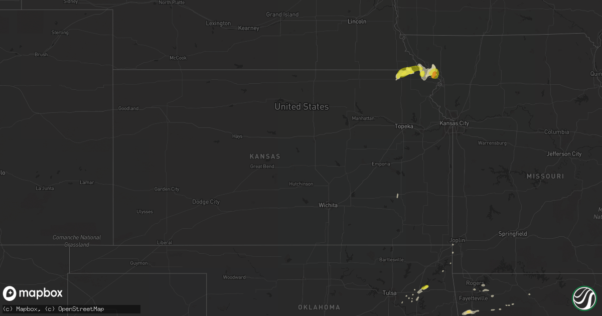
Hail Map in Kansas on May 22, 2020
Get this storm
May 22 map
$229
one time, instant access
Download today. No call, no setup
Keep the $229
Bought the map and want the full workflow? Apply the entire $229 to a subscription within 7 days. None of it is wasted.
Every map, not just this one
This buys you this map. Subscription and you get every map we run, in the markets you choose from a few cities to whole states to nationwide. Plus real-time alerts the moment a storm fires.
Contact data
Name, contact info, occupancy, even credit band for addresses in the footprint. You go from where it hit to who to call.
Become the source they trust
Unlimited branding weather history reports on demand. You already have the documented answer ready for the property owner, and you are the one who showed up with it.
Property data and RoofTrace estimates
Pull up any address you have got, its value and the exact code rules for that jurisdiction, straight from One Click Code. Then RoofTrace estimates the squares, pitch, and roof value, priced the way you price.
Storm reports in Kansas
Kansas
| Date | Description |
|---|---|
| 05/22/20204:45 AM CDT | At 945 PM CDT, severe thunderstorms were located along a line extending from 6 miles southeast of Blanchard to near Burlington Junction to 8 miles east of Maitland to near Fillmore, moving northeast at 25 mph. HAZARD...60 mph wind gusts and quarter size hail. SOURCE...Radar indicated. IMPACT...Hail damage to vehicles is expected. Expect wind damage to roofs, siding, and trees. Locations impacted include... Savannah, Troy, Maitland, Amazonia, Fillmore, Barnard, Bolckow, Graham, Rosendale, Arkoe and Rea.This includes the following highways... Interstate 29 between mile markers 55 and 72. Interstate 229 between mile markers 12 and 14. |
| 05/22/20204:07 AM CDT | At 907 PM CDT, a severe thunderstorm was located near Oregon, or 8 miles northeast of Highland, moving northeast at 30 mph. HAZARD...60 mph wind gusts and quarter size hail. SOURCE...Radar indicated. IMPACT...Hail damage to vehicles is expected. Expect wind damage to roofs, siding, and trees. Locations impacted include... Savannah, Oregon, Forest City and Fillmore. This includes Interstate 29 between mile markers 60 and 77. |
| 05/22/20203:38 AM CDT | At 838 PM CDT, severe thunderstorms were located along a line extending from near Falls City to near White Cloud, moving northeast at 30 mph. HAZARD...60 mph wind gusts and quarter size hail. SOURCE...Radar indicated. IMPACT...Hail damage to vehicles is expected. Expect wind damage to roofs, siding, and trees. Locations impacted include... Mound City, Highland, Oregon, Forest City, Craig, White Cloud, Big Lake, Fortescue, Bigelow and Iowa Point.This includes Interstate 29 between mile markers 69 and 97. |
| 05/22/20203:09 AM CDT | At 807 PM CDT, a severe thunderstorm was located over Morrill, or 5 miles northeast of Sabetha, moving northeast at 30 mph. HAZARD...Quarter size hail. SOURCE...Radar indicated. IMPACT...Damage to vehicles is expected. Locations impacted include... Falls City, Rulo and Preston. |
| 05/21/202010:19 PM CDT | At 319 AM CDT, severe thunderstorms were located along a line extending from 4 miles east of Manchester to near Jet, moving east at 20 mph. These are very dangerous storms. HAZARD...80 mph wind gusts and nickel size hail. SOURCE...Radar indicated. IMPACT...Flying debris will be dangerous to those caught without shelter. Mobile homes will be heavily damaged. Expect considerable damage to roofs, windows, and vehicles. Extensive tree damage and power outages are likely. Locations impacted include... Medford, Pond Creek, Wakita, Nash, Renfrow and Jefferson. |
| 05/21/20208:10 PM CDT | Nickel to quarter size hail in morrill. |
All States Impacted by Hail Map on May 22, 2020
Cities Impacted by Hail Map on May 22, 2020
- Sherwood, AR
- Jacksonville, AR
- Richton, MS
- Waynesboro, MS
- Ovett, MS
- Sarasota, FL
- Wister, OK
- Heavener, OK
- Alabaster, AL
- Vernon, TX
- Davidson, OK
- Claxton, GA
- Goodwater, AL
- Weogufka, AL
- Sylacauga, AL
- White Cloud, KS
- Highland, KS
- Laurel, MS
- Iowa Park, TX
- Sheppard Afb, TX
- Burkburnett, TX
- Wichita Falls, TX
- Wagoner, OK
- Chouteau, OK
- Parthenon, AR
- Ponca, AR
- Broken Bow, OK
- Seymour, TX
- Blackville, SC
- Allendale, SC
- Ulmer, SC
- Olar, SC
- Fort Towson, OK
- Valliant, OK
- Stigler, OK
- Red Oak, OK
- Alvord, TX
- Sunset, TX
- Forestburg, TX
- Talladega, AL
- Alpine, AL
- Gadsden, SC
- Eastover, SC
- Louisville, AL
- Griffithville, AR
- Oden, AR
- Mount Ida, AR
- Norman, AR
- Huntsville, TX
- Calhoun Falls, SC
- Abbeville, SC
- Iva, SC
- Richland, GA
- Preston, GA
- Des Arc, AR
- Addison, AL
- Bamberg, SC
- Hugo, OK
- Marion, AL
- Bowie, TX
- Bellevue, TX
- Harrold, TX
- Hollister, OK
- Frederick, OK
- Randlett, OK
- Loveland, OK
- Electra, TX
- Devol, OK
- Grandfield, OK
- Oklaunion, TX
- Huntington, AR
- Hackett, AR
- Greenwood, AR
- Jesup, GA
- Odum, GA
- Donalsonville, GA
- Waldron, AR
- Soso, MS
- Taylorsville, MS
- Maysville, GA
- Colbert, GA
- Nicholson, GA
- Commerce, GA
- Pendergrass, GA
- Hull, GA
- Danielsville, GA
- Jefferson, GA
- Huntsville, AR
- Goodspring, TN
- Prospect, TN
- Nocona, TX
- Saint Jo, TX
- Shelby, AL
- Columbiana, AL
- Montevallo, AL
- Randolph, AL
- Brierfield, AL
- Jemison, AL
- Calera, AL
- West Blocton, AL
- Winslow, AR
- West Fork, AR
- Prairie Grove, AR
- Gilbertown, AL
- Melvin, AL
- Whigham, GA
- Gainesville, TX
- Valley View, TX
- Lovelady, TX
- Vilonia, AR
- Mount Vernon, AR
- El Paso, AR
- Pineville, SC
- Eutawville, SC
- Cross, SC
- Rule, TX
- Aspermont, TX
- Old Glory, TX
- Haskell, TX
- Santee, SC
- Tifton, GA
- Sumner, GA
- Omega, GA
- Ty Ty, GA
- Arkadelphia, AR
- Comer, GA
- Carlton, GA
- Elberton, GA
- Bowman, GA
- Dewy Rose, GA
- Jayess, MS
- Scooba, MS
- Durant, OK
- Telephone, TX
- Bennington, OK
- Childersburg, AL
- Eutaw, AL
- Louin, MS
- Glenwood, AL
- Fort Smith, AR
- Quincy, FL
- Chattahoochee, FL
- Cumming, GA
- Canton, GA
- Alpharetta, GA
- Georgetown, GA
- Greenville, GA
- Yates Center, KS
- Wilson, OK
- Aiken, SC
- Ridge Spring, SC
- Estill, SC
- Monetta, SC
- Batesburg, SC
- Bokchito, OK
- Sumiton, AL
- Cordova, AL
- Dora, AL
- Anniston, AL
- Pine Apple, AL
- Howe, OK
- Poteau, OK
- Hodgen, OK
- Columbia, SC
- Blythewood, SC
- Elgin, SC
- Cape Coral, FL
- Quinton, OK
- Cuthbert, GA
- Locust Grove, OK
- Pryor, OK
- Conway, AR
- De Kalb, MS
- Shuqualak, MS
- Preston, MS
- Clopton, AL
- Ryan, OK
- Henrietta, TX
- Byers, TX
- Petrolia, TX
- Mena, AR
- Grady, AL
- Ramer, AL
- Jacksboro, TX
- Luray, SC
- Birmingham, AL
- Chesterfield, SC
- Ball Ground, GA
- Burneyville, OK
- Overbrook, OK
- Surrency, GA
- Chillicothe, TX
- Odell, TX
- Cullman, AL
- Falkville, AL
- Vinemont, AL
- Union Springs, AL
- Midway, AL
- Elkmont, AL
- Okolona, AR
- Harpersville, AL
- Windthorst, TX
- Eufaula, AL
- Clayton, AL
- Abbeville, AL
- Fort Gaines, GA
- Caddo Gap, AR
- Opelika, AL
- Cusseta, AL
- Valley, AL
- Sylvania, GA
- Pembroke, GA
- Booneville, AR
- Buford, GA
- Suwanee, GA
- Havana, AR
- Belleville, AR
- Mansfield, AR
- Fairfax, SC
- Danville, AR
- Cotton Plant, AR
- Iuka, MS
- Haworth, OK
- Gainesville, GA
- Talmo, GA
- Rosston, TX
- Montague, TX
- Decatur, TX
- Bay Springs, MS
- Stringer, MS
- Pearl River, LA
- Bryson, TX
- Monticello, MS
- Sontag, MS
- Newhebron, MS
- Caddo, OK
- Girard, GA
- Greenville, AL
- North Fort Myers, FL
- Horton, AL
- Boaz, AL
- Altus, OK
- Glenwood, AR
- Amity, AR
- Minor Hill, TN
- Perrin, TX
- Springdale, AR
- Hindsville, AR
- Rockford, AL
- Kellyton, AL
- Brooklet, GA
- Talihina, OK
- Ringgold, TX
- Elloree, SC
- Millry, AL
- Silas, AL
- Ellisville, MS
- Holliday, TX
- Saluda, SC
- Bottineau, ND
- Hatfield, AR
- Hartselle, AL
- Axson, GA
- Beebe, AR
- Roosevelt, OK
- Mountain Park, OK
- Snyder, OK
- Pottsboro, TX
- Lavaca, AR
- Ridgeland, SC
- Coosawhatchie, SC
- Yemassee, SC
- Lester, AL
- Brookwood, AL
- Glennville, GA
- Mccomb, MS
- Summit, MS
- Porterville, MS
- Ardmore, OK
- Springer, OK
- Dardanelle, AR
- Plainview, AR
- Ola, AR
- Dorchester, SC
- Harleyville, SC
- Nacogdoches, TX
- Dryden, TX
- Medicine Park, OK
- Petty, TX
- Roxton, TX
- Pittsview, AL
- Oregon, MO
- Forest Home, AL
- Georgiana, AL
- Carlisle, AR
- Lonoke, AR
- Middleburg, FL
- Bigelow, AR
- Mayflower, AR
- Varnville, SC
- Pineland, SC
- Early Branch, SC
- Reevesville, SC
- Lone Oak, TX
- Point, TX
- Troy, SC
- Bradley, SC
- Casa, AR
- Greenwood, SC
- Chappells, SC
- Silverstreet, SC
- Ninety Six, SC
- Cross Hill, SC
- Evergreen, AL
- Leesville, SC
- Newberry, SC
- Lexington, SC
- Chapin, SC
- Gilbert, SC
- Prosperity, SC
- Apache, OK
- Fort Cobb, OK
- Wyandotte, OK
- Lone Grove, OK
- Olney, TX
- Grant, OK
- Lincoln, AL
- Eastaboga, AL
- Boswell, OK
- Arthur City, TX
- Paris, TX
- Blossom, TX
- Detroit, TX
- Sawyer, OK
- Keota, OK
- Bokoshe, OK
- Spiro, OK
- Lugoff, SC
- York, AL
- Screven, GA
- Falls City, NE
- Hiawatha, KS
- Hurtsboro, AL
- Iron City, GA
- Garvin, OK
- Hartford, AR
- Ben Wheeler, TX
- Camden, AL
- Saint Matthews, SC
- Banks, AL
- Sterrett, AL
- Vincent, AL
- Jacksonville, GA
- Ocilla, GA
- Norman Park, GA
- Hartsville, SC
- Orangeburg, SC
- Atoka, OK
- Lane, OK
- Riverside, AL
- Pell City, AL
- Sheffield, TX
- Sabetha, KS
- Morrill, KS
- Muenster, TX
- Ariton, AL
- Skipperville, AL
- Weatherford, TX
- Whitt, TX
- Rosendale, MO
- King City, MO
- Union Star, MO
- Guilford, MO
- Rea, MO
- Helena, MO
- Savannah, MO
- Broken Arrow, OK
- Bridgeport, TX
- Fitzpatrick, AL
- Mathews, AL
- Fort Myers, FL
- Sims, AR
- Cache, OK
- Indiahoma, OK
- Epes, AL
- Livingston, AL
- Emelle, AL
- Troy, AL
- North, SC
- Swansea, SC
- Augusta, AR
- Ellabell, GA
- Little Rock, AR
- Blackshear, GA
- Waycross, GA
- Hatchechubbee, AL
- Clanton, AL
- McCrory, AR
- Wynne, AR
- Hickory Ridge, AR
- Kinta, OK
- Mccurtain, OK
- Loving, TX
- Chico, TX
- Jermyn, TX
- Newville, AL
- Elmer, OK
- Graham, TX
- Colquitt, GA
- Marbury, AL
- Verbena, AL
- Bogue Chitto, MS
- Ruth, MS
- Flowery Branch, GA
- Archer City, TX
- Scotland, TX
- Neeses, SC
- Honey Grove, TX
- Sumner, TX
- Fosters, AL
- Moundville, AL
- Flower Mound, TX
- Lewisville, TX
- Hampton, SC
- Ocoee, FL
- Apopka, FL
- Bokeelia, FL
- Davis, OK
- Sulphur, OK
- Irmo, SC
- Keysville, GA
- Pocola, OK
- Fort Davis, AL
- Hardaway, AL
- Martin, SC
- Equality, AL
- Headland, AL
- Paradise, TX
- Grapeland, TX
- Crockett, TX
- Jakin, GA
- Protem, MO
- Florence, SC
- Newington, GA
- Leesburg, GA
- Albany, GA
- Lagrange, GA
- Rembert, SC
- Brinkley, AR
- Knoxville, AL
- Selma, AL
- Tyler, AL
- Thomasville, AL
- Leoma, TN
- Lawrenceburg, TN
- Peterman, AL
- Beatrice, AL
- Little Mountain, SC
- Sumter, SC
- Cameron, OK
- Harrisburg, AR
- Bagwell, TX
- Powderly, TX
- Oakwood, GA
- Alexander City, AL
- Warwick, GA
- Ashburn, GA
- Tipton, OK
- Delta, AL
- Oxford, AL
- Munford, AL
- Heflin, AL
- Tuscaloosa, AL
- Walters, OK
- Danville, AL
- Marietta, OK
- Thackerville, OK
- Nicholls, GA
- Fillmore, MO
- McRae, AR
- Ivanhoe, NC
- Blountsville, AL
- Boligee, AL
- Keota, IA
- Washington, IA
- Mcalester, OK
- Wilburton, OK
- Lapine, AL
- Johnston, SC
- Anderson, MO
- Henderson, TX
- Barnwell, SC
- Wynnewood, OK
- Cheraw, SC
- Denmark, SC
- Sallisaw, OK
- Headrick, OK
- Inola, OK
- Carnegie, OK
- Seneca, MO
- Goodman, MO
- Jasper, GA
- Baxley, GA
- Boles, AR
- Magnolia, MS
- Forest City, MO
- Craig, MO
- Ludowici, GA
- Jacksonville, FL
- Pencil Bluff, AR
- Bogata, TX
- Register, GA
- Harvey, AR
- Newton, MS
- Decatur, MS
- Cherry Valley, AR
- Dothan, AL
- Atkinson, NC
- Aliceville, AL
- Dry Branch, GA
- Macon, GA
- Ridgeway, SC
- McCormick, SC
- Mount Carmel, SC
- Annona, TX
- Columbia, AL
- Damascus, GA
- Norway, SC
- McKenzie, AL
- Heidelberg, MS
- Muldrow, OK
- Butler, AL
- Neosho, MO
- Jay, OK
- Grove, OK
- Rogers, AR
- Athens, AL
- Brundidge, AL
- Biscoe, AR
- Stella, MO
- Nashville, AR
- Naples, FL
- Fairview, KS
- Gay, GA
- Pine Mountain, GA
- Bascom, FL
- Trussville, AL
- Porum, OK
- Checotah, OK
- Wheatley, AR
- Watson, OK
- Houston, AR
- Montgomery, AL
- Highland Home, AL
- Luverne, AL
- Bessemer, AL
- Fairfield, AL
- Dolomite, AL
- Ozark, AL
- Cades, SC
- Seminary, MS
- Ashland, AL
- Kingston, OK
- Mead, OK
- Calera, OK
- Safford, AL
- Orrville, AL
- Wagarville, AL
- Chandler, TX
- Brownsboro, TX
- Doerun, GA
- Bluffton, AR
- Parks, AR
- Rover, AR
- Midland, AR
- Shady Point, OK
- Briggsville, AR
- Gravelly, AR
- Colbert, OK
- Meridian, MS
- Alto, TX
- Collinsville, TX
- Omaha, GA
- Lumpkin, GA
- Cusseta, GA
- Buena Vista, GA
- De Queen, AR
- Campbell, TX
- Oskaloosa, IA
- Mineral Wells, TX
- Murfreesboro, AR
- Mound City, MO
- Maitland, MO
- Lenox, TN
- Dyersburg, TN
- Bowdon, GA
- Newcastle, TX
- Shellman, GA
- Johnson, NE
- Searcy, AR
- Cabot, AR
- Little Rock Air Force Base, AR
- North Little Rock, AR
- Brent, AL
- Zellwood, FL
- Marion Junction, AL
- Uniontown, AL
- Sarcoxie, MO
- Diamond, MO
- Granby, MO
- Canehill, AR
- Dawsonville, GA
- Charleston, AR
- Ringling, OK
- Pettigrew, AR
- Letohatchee, AL
- Poulan, GA
- Lawton, OK
- Vance, SC
- Wills Point, TX
- Mershon, GA
- Dunseith, ND
- Shubuta, MS
- Lawrence, MS
- Goshen, AL
- Pelham, AL
- Statesboro, GA
- Cayce, SC
- West Columbia, SC
- Hopkins, SC
- Franklin, GA
- Macon, MS
- Athens, GA
- Moody, AL
- Leeds, AL
- Petal, MS
- Trinity, TX
- Guntersville, AL
- Joplin, MO
- Dierks, AR
- Andalusia, AL
- Ward, AR
- Everton, AR
- Rulo, NE
- Duncanville, AL
- Hobart, OK
- Branchville, SC
- Era, TX
- Ehrhardt, SC
- Crowell, TX
- Sanger, TX
- Eldorado, OK
- Rutledge, AL
- Tuskegee, AL
- Marked Tree, AR
- Trumann, AR
- Trenton, SC
- Coweta, OK
- Lauderdale, MS
- Patrick, SC
- McBee, SC
- Leslie, GA
- Americus, GA
- Eufaula, OK
- Lowndesville, SC
- Smithville, OK
- Dawson, GA
- Weston, GA
- Parrott, GA
- Woodstock, GA
- Lockesburg, AR
- Stark City, MO
- Pierce City, MO
- Washburn, MO
- Edgefield, SC
- Witter, AR
- Combs, AR
- Saint Paul, AR
- Brookston, TX
- Holly Pond, AL
- Arab, AL
- Troy, KS
- Amazonia, MO
- Winter Garden, FL
- Garnett, SC
- Collins, MS
- Morris, GA
- Coleman, GA
- Fisher, AR
- Whitefield, OK
- Canadian, OK
- Elba, AL
- Scott, AR
- Jack, AL
- Loretto, TN
- Pinson, AL
- Springville, AL
- Arlington, TN
- Millington, TN
- Memphis, TN
- Earle, AR
- Turrell, AR
- Crawfordsville, AR
- West Memphis, AR
- Parkin, AR
- Proctor, AR
- Marion, AR
- Forrest City, AR
- Colt, AR
- Tyronza, AR
- Gans, OK
- Salina, OK
- Ivanhoe, TX
- Wathena, KS
- Salem, NE
- Pinola, MS
- Homer, GA
- Royston, GA
- Carnesville, GA
- Gillsville, GA
- Hartwell, GA
- Starr, SC
- Anderson, SC
- Hogansville, GA
- Byromville, GA
- Elko, GA
- Hawkinsville, GA
- Unadilla, GA
- Vienna, GA
- Pinehurst, GA
- Perry, GA
- Jeffersonville, GA
- Cochran, GA
- Danville, GA
- Irwinton, GA
- Gainesville, AL
- Brunson, SC
- Cameron, SC
- Summerton, SC
- Dalzell, SC
- Shaw Afb, SC
- Bowman, SC
- Rowesville, SC
- Holly Hill, SC
- Van, TX
- O'Brien, TX
- Paducah, TX
- Knox City, TX
- Temple, OK
- Saint Petersburg, FL
- Orlando, FL
- Denton, TX
- Ponder, TX
- Rhome, TX
- Krum, TX
- Justin, TX
- Whitesboro, TX
- Throckmorton, TX
- Teachey, NC
- Clinton, NC
- Garland, NC
- Beulaville, NC
- Wallace, NC
- Magnolia, NC
- Richlands, NC
- Chinquapin, NC
- Rose Hill, NC
- Aberdeen, NC
- Rockingham, NC
- Hoffman, NC
- Raeford, NC
- Marston, NC
- Wagram, NC
- Hamlet, NC
- Pinebluff, NC
- Southern Pines, NC
- Vass, NC
- Spartanburg, SC
- Pacolet, SC
- Gaffney, SC
- Cowpens, SC
- Gastonia, NC
- Blacksburg, SC
- Clover, SC
- Kings Mountain, NC
- Smyrna, SC
- Hickory Grove, SC
- York, SC
- Sharon, SC
- Buffalo, SC
- Union, SC
- Jonesville, SC
- Pauline, SC
- Grover, NC
- Polkton, NC
- Oakboro, NC
- Mount Gilead, NC
- Norwood, NC


