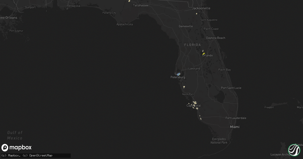
Hail Map in Florida on May 22, 2020
Get this storm
May 22 map
$229
one time, instant access
Download today. No call, no setup
Keep the $229
Bought the map and want the full workflow? Apply the entire $229 to a subscription within 7 days. None of it is wasted.
Every map, not just this one
This buys you this map. Subscription and you get every map we run, in the markets you choose from a few cities to whole states to nationwide. Plus real-time alerts the moment a storm fires.
Contact data
Name, contact info, occupancy, even credit band for addresses in the footprint. You go from where it hit to who to call.
Become the source they trust
Unlimited branding weather history reports on demand. You already have the documented answer ready for the property owner, and you are the one who showed up with it.
Property data and RoofTrace estimates
Pull up any address you have got, its value and the exact code rules for that jurisdiction, straight from One Click Code. Then RoofTrace estimates the squares, pitch, and roof value, priced the way you price.
Storm reports in Florida
Florida
| Date | Description |
|---|---|
| 05/22/20206:42 PM CDT | Asos station kspg st peters albert. |
| 05/22/20206:42 PM CDT | Spotter estimated 60 mph winds with large 5 inch diameter branches down. |
| 05/22/20205:00 PM CDT | Ham operator reports his jacaranda tree was blown over. Time estimated by radar. |
| 05/22/20204:50 PM CDT | Hail up to quarter size near the intersection of mccormick road and apopka-vineland road. From video posted to social media. |
| 05/22/20204:48 PM CDT | Public reported nickel to quarter size hail falling in the crown point area of winter garden. |
| 05/22/20204:47 PM CDT | Public report of dime to quarter size hail in winter garden. Time estimated from radar. |
| 05/22/20204:02 PM CDT | Broadcast media relayed report and video of dime to quarter sized hail in cape coral. Time estimated by radar. |
| 05/22/20203:10 PM CDT | Damage to carport metal sheet covering... And a toppled medium sized palm tree onto at naples estates off rattlesnake hammock road. Winds in the general area gusted to |
| 05/22/20202:55 PM CDT | Large tree down on flat creek road near the intersection of audie clark road. |
| 05/22/20202:55 PM CDT | Multiple trees down on i-10 between mm 166 and 169. |
| 05/22/20202:37 AM CDT | At 736 PM EDT, a severe thunderstorm was located near Downtown Saint Petersburg, moving west at 15 mph. HAZARD...60 mph wind gusts. SOURCE...Radar indicated. IMPACT...Expect damage to roofs, siding, and trees. Locations impacted include... Pinellas Park, Saint Petersburg, Downtown Saint Petersburg, St. Petersburg, St. Pete Beach, West And East Lealman, Bay Pines, Gulfport, Treasure Island, Kenneth City, South Pasadena, Albert Whitted Airport, Tropicana Field, Venetian Isles, Sawgrass Lake Park, Lealman, Vinoy Park, Lake Maggiore, Boyd Hill Nature Preserve and Crescent Lake. |
| 05/22/20202:28 AM CDT | At 727 PM EDT, a severe thunderstorm was located near Gandy, or 7 miles southwest of Tampa, moving northwest at 20 mph. HAZARD...60 mph wind gusts. SOURCE...Radar indicated. IMPACT...Expect damage to roofs, siding, and trees. Locations impacted include... Tampa, Pinellas Park, St. Petersburg, Feather Sound, Macdill Air Force Base, Gandy, South Tampa, Weedon Island State Preserve and Sawgrass Lake Park. |
| 05/22/20201:23 AM CDT | At 623 PM EDT, a severe thunderstorm was located near Four Corners, or near Bay Lake, moving west-northwest at 15 mph. HAZARD...Quarter size hail. SOURCE...Radar indicated. IMPACT...Damage to vehicles is expected. Locations impacted include... South Clermont and Lake Louisa. |
| 05/22/202012:38 AM CDT | At 537 PM EDT, severe thunderstorms were located along a line extending from near Sorrento to Bay Hill, moving northwest at less than 10 mph. HAZARD...60 mph wind gusts and quarter size hail. SOURCE...Radar indicated. IMPACT...Hail damage to vehicles is expected. Expect wind damage to roofs, siding, and trees. Locations impacted include... Apopka, Ocoee, Winter Garden and Eustis. |
| 05/22/202012:00 AM CDT | At 500 PM EDT, a severe thunderstorm was located near Oakleaf Plantation, or near Middleburg, and is nearly stationary. HAZARD...60 mph wind gusts and quarter size hail. SOURCE...Radar indicated. IMPACT...Hail damage to vehicles is expected. Expect wind damage to roofs, siding, and trees. Locations impacted include... Oakleaf Plantation. |
All States Impacted by Hail Map on May 22, 2020
Cities Impacted by Hail Map on May 22, 2020
- Sherwood, AR
- Jacksonville, AR
- Richton, MS
- Waynesboro, MS
- Ovett, MS
- Sarasota, FL
- Wister, OK
- Heavener, OK
- Alabaster, AL
- Vernon, TX
- Davidson, OK
- Claxton, GA
- Goodwater, AL
- Weogufka, AL
- Sylacauga, AL
- White Cloud, KS
- Highland, KS
- Laurel, MS
- Iowa Park, TX
- Sheppard Afb, TX
- Burkburnett, TX
- Wichita Falls, TX
- Wagoner, OK
- Chouteau, OK
- Parthenon, AR
- Ponca, AR
- Broken Bow, OK
- Seymour, TX
- Blackville, SC
- Allendale, SC
- Ulmer, SC
- Olar, SC
- Fort Towson, OK
- Valliant, OK
- Stigler, OK
- Red Oak, OK
- Alvord, TX
- Sunset, TX
- Forestburg, TX
- Talladega, AL
- Alpine, AL
- Gadsden, SC
- Eastover, SC
- Louisville, AL
- Griffithville, AR
- Oden, AR
- Mount Ida, AR
- Norman, AR
- Huntsville, TX
- Calhoun Falls, SC
- Abbeville, SC
- Iva, SC
- Richland, GA
- Preston, GA
- Des Arc, AR
- Addison, AL
- Bamberg, SC
- Hugo, OK
- Marion, AL
- Bowie, TX
- Bellevue, TX
- Harrold, TX
- Hollister, OK
- Frederick, OK
- Randlett, OK
- Loveland, OK
- Electra, TX
- Devol, OK
- Grandfield, OK
- Oklaunion, TX
- Huntington, AR
- Hackett, AR
- Greenwood, AR
- Jesup, GA
- Odum, GA
- Donalsonville, GA
- Waldron, AR
- Soso, MS
- Taylorsville, MS
- Maysville, GA
- Colbert, GA
- Nicholson, GA
- Commerce, GA
- Pendergrass, GA
- Hull, GA
- Danielsville, GA
- Jefferson, GA
- Huntsville, AR
- Goodspring, TN
- Prospect, TN
- Nocona, TX
- Saint Jo, TX
- Shelby, AL
- Columbiana, AL
- Montevallo, AL
- Randolph, AL
- Brierfield, AL
- Jemison, AL
- Calera, AL
- West Blocton, AL
- Winslow, AR
- West Fork, AR
- Prairie Grove, AR
- Gilbertown, AL
- Melvin, AL
- Whigham, GA
- Gainesville, TX
- Valley View, TX
- Lovelady, TX
- Vilonia, AR
- Mount Vernon, AR
- El Paso, AR
- Pineville, SC
- Eutawville, SC
- Cross, SC
- Rule, TX
- Aspermont, TX
- Old Glory, TX
- Haskell, TX
- Santee, SC
- Tifton, GA
- Sumner, GA
- Omega, GA
- Ty Ty, GA
- Arkadelphia, AR
- Comer, GA
- Carlton, GA
- Elberton, GA
- Bowman, GA
- Dewy Rose, GA
- Jayess, MS
- Scooba, MS
- Durant, OK
- Telephone, TX
- Bennington, OK
- Childersburg, AL
- Eutaw, AL
- Louin, MS
- Glenwood, AL
- Fort Smith, AR
- Quincy, FL
- Chattahoochee, FL
- Cumming, GA
- Canton, GA
- Alpharetta, GA
- Georgetown, GA
- Greenville, GA
- Yates Center, KS
- Wilson, OK
- Aiken, SC
- Ridge Spring, SC
- Estill, SC
- Monetta, SC
- Batesburg, SC
- Bokchito, OK
- Sumiton, AL
- Cordova, AL
- Dora, AL
- Anniston, AL
- Pine Apple, AL
- Howe, OK
- Poteau, OK
- Hodgen, OK
- Columbia, SC
- Blythewood, SC
- Elgin, SC
- Cape Coral, FL
- Quinton, OK
- Cuthbert, GA
- Locust Grove, OK
- Pryor, OK
- Conway, AR
- De Kalb, MS
- Shuqualak, MS
- Preston, MS
- Clopton, AL
- Ryan, OK
- Henrietta, TX
- Byers, TX
- Petrolia, TX
- Mena, AR
- Grady, AL
- Ramer, AL
- Jacksboro, TX
- Luray, SC
- Birmingham, AL
- Chesterfield, SC
- Ball Ground, GA
- Burneyville, OK
- Overbrook, OK
- Surrency, GA
- Chillicothe, TX
- Odell, TX
- Cullman, AL
- Falkville, AL
- Vinemont, AL
- Union Springs, AL
- Midway, AL
- Elkmont, AL
- Okolona, AR
- Harpersville, AL
- Windthorst, TX
- Eufaula, AL
- Clayton, AL
- Abbeville, AL
- Fort Gaines, GA
- Caddo Gap, AR
- Opelika, AL
- Cusseta, AL
- Valley, AL
- Sylvania, GA
- Pembroke, GA
- Booneville, AR
- Buford, GA
- Suwanee, GA
- Havana, AR
- Belleville, AR
- Mansfield, AR
- Fairfax, SC
- Danville, AR
- Cotton Plant, AR
- Iuka, MS
- Haworth, OK
- Gainesville, GA
- Talmo, GA
- Rosston, TX
- Montague, TX
- Decatur, TX
- Bay Springs, MS
- Stringer, MS
- Pearl River, LA
- Bryson, TX
- Monticello, MS
- Sontag, MS
- Newhebron, MS
- Caddo, OK
- Girard, GA
- Greenville, AL
- North Fort Myers, FL
- Horton, AL
- Boaz, AL
- Altus, OK
- Glenwood, AR
- Amity, AR
- Minor Hill, TN
- Perrin, TX
- Springdale, AR
- Hindsville, AR
- Rockford, AL
- Kellyton, AL
- Brooklet, GA
- Talihina, OK
- Ringgold, TX
- Elloree, SC
- Millry, AL
- Silas, AL
- Ellisville, MS
- Holliday, TX
- Saluda, SC
- Bottineau, ND
- Hatfield, AR
- Hartselle, AL
- Axson, GA
- Beebe, AR
- Roosevelt, OK
- Mountain Park, OK
- Snyder, OK
- Pottsboro, TX
- Lavaca, AR
- Ridgeland, SC
- Coosawhatchie, SC
- Yemassee, SC
- Lester, AL
- Brookwood, AL
- Glennville, GA
- Mccomb, MS
- Summit, MS
- Porterville, MS
- Ardmore, OK
- Springer, OK
- Dardanelle, AR
- Plainview, AR
- Ola, AR
- Dorchester, SC
- Harleyville, SC
- Nacogdoches, TX
- Dryden, TX
- Medicine Park, OK
- Petty, TX
- Roxton, TX
- Pittsview, AL
- Oregon, MO
- Forest Home, AL
- Georgiana, AL
- Carlisle, AR
- Lonoke, AR
- Middleburg, FL
- Bigelow, AR
- Mayflower, AR
- Varnville, SC
- Pineland, SC
- Early Branch, SC
- Reevesville, SC
- Lone Oak, TX
- Point, TX
- Troy, SC
- Bradley, SC
- Casa, AR
- Greenwood, SC
- Chappells, SC
- Silverstreet, SC
- Ninety Six, SC
- Cross Hill, SC
- Evergreen, AL
- Leesville, SC
- Newberry, SC
- Lexington, SC
- Chapin, SC
- Gilbert, SC
- Prosperity, SC
- Apache, OK
- Fort Cobb, OK
- Wyandotte, OK
- Lone Grove, OK
- Olney, TX
- Grant, OK
- Lincoln, AL
- Eastaboga, AL
- Boswell, OK
- Arthur City, TX
- Paris, TX
- Blossom, TX
- Detroit, TX
- Sawyer, OK
- Keota, OK
- Bokoshe, OK
- Spiro, OK
- Lugoff, SC
- York, AL
- Screven, GA
- Falls City, NE
- Hiawatha, KS
- Hurtsboro, AL
- Iron City, GA
- Garvin, OK
- Hartford, AR
- Ben Wheeler, TX
- Camden, AL
- Saint Matthews, SC
- Banks, AL
- Sterrett, AL
- Vincent, AL
- Jacksonville, GA
- Ocilla, GA
- Norman Park, GA
- Hartsville, SC
- Orangeburg, SC
- Atoka, OK
- Lane, OK
- Riverside, AL
- Pell City, AL
- Sheffield, TX
- Sabetha, KS
- Morrill, KS
- Muenster, TX
- Ariton, AL
- Skipperville, AL
- Weatherford, TX
- Whitt, TX
- Rosendale, MO
- King City, MO
- Union Star, MO
- Guilford, MO
- Rea, MO
- Helena, MO
- Savannah, MO
- Broken Arrow, OK
- Bridgeport, TX
- Fitzpatrick, AL
- Mathews, AL
- Fort Myers, FL
- Sims, AR
- Cache, OK
- Indiahoma, OK
- Epes, AL
- Livingston, AL
- Emelle, AL
- Troy, AL
- North, SC
- Swansea, SC
- Augusta, AR
- Ellabell, GA
- Little Rock, AR
- Blackshear, GA
- Waycross, GA
- Hatchechubbee, AL
- Clanton, AL
- McCrory, AR
- Wynne, AR
- Hickory Ridge, AR
- Kinta, OK
- Mccurtain, OK
- Loving, TX
- Chico, TX
- Jermyn, TX
- Newville, AL
- Elmer, OK
- Graham, TX
- Colquitt, GA
- Marbury, AL
- Verbena, AL
- Bogue Chitto, MS
- Ruth, MS
- Flowery Branch, GA
- Archer City, TX
- Scotland, TX
- Neeses, SC
- Honey Grove, TX
- Sumner, TX
- Fosters, AL
- Moundville, AL
- Flower Mound, TX
- Lewisville, TX
- Hampton, SC
- Ocoee, FL
- Apopka, FL
- Bokeelia, FL
- Davis, OK
- Sulphur, OK
- Irmo, SC
- Keysville, GA
- Pocola, OK
- Fort Davis, AL
- Hardaway, AL
- Martin, SC
- Equality, AL
- Headland, AL
- Paradise, TX
- Grapeland, TX
- Crockett, TX
- Jakin, GA
- Protem, MO
- Florence, SC
- Newington, GA
- Leesburg, GA
- Albany, GA
- Lagrange, GA
- Rembert, SC
- Brinkley, AR
- Knoxville, AL
- Selma, AL
- Tyler, AL
- Thomasville, AL
- Leoma, TN
- Lawrenceburg, TN
- Peterman, AL
- Beatrice, AL
- Little Mountain, SC
- Sumter, SC
- Cameron, OK
- Harrisburg, AR
- Bagwell, TX
- Powderly, TX
- Oakwood, GA
- Alexander City, AL
- Warwick, GA
- Ashburn, GA
- Tipton, OK
- Delta, AL
- Oxford, AL
- Munford, AL
- Heflin, AL
- Tuscaloosa, AL
- Walters, OK
- Danville, AL
- Marietta, OK
- Thackerville, OK
- Nicholls, GA
- Fillmore, MO
- McRae, AR
- Ivanhoe, NC
- Blountsville, AL
- Boligee, AL
- Keota, IA
- Washington, IA
- Mcalester, OK
- Wilburton, OK
- Lapine, AL
- Johnston, SC
- Anderson, MO
- Henderson, TX
- Barnwell, SC
- Wynnewood, OK
- Cheraw, SC
- Denmark, SC
- Sallisaw, OK
- Headrick, OK
- Inola, OK
- Carnegie, OK
- Seneca, MO
- Goodman, MO
- Jasper, GA
- Baxley, GA
- Boles, AR
- Magnolia, MS
- Forest City, MO
- Craig, MO
- Ludowici, GA
- Jacksonville, FL
- Pencil Bluff, AR
- Bogata, TX
- Register, GA
- Harvey, AR
- Newton, MS
- Decatur, MS
- Cherry Valley, AR
- Dothan, AL
- Atkinson, NC
- Aliceville, AL
- Dry Branch, GA
- Macon, GA
- Ridgeway, SC
- McCormick, SC
- Mount Carmel, SC
- Annona, TX
- Columbia, AL
- Damascus, GA
- Norway, SC
- McKenzie, AL
- Heidelberg, MS
- Muldrow, OK
- Butler, AL
- Neosho, MO
- Jay, OK
- Grove, OK
- Rogers, AR
- Athens, AL
- Brundidge, AL
- Biscoe, AR
- Stella, MO
- Nashville, AR
- Naples, FL
- Fairview, KS
- Gay, GA
- Pine Mountain, GA
- Bascom, FL
- Trussville, AL
- Porum, OK
- Checotah, OK
- Wheatley, AR
- Watson, OK
- Houston, AR
- Montgomery, AL
- Highland Home, AL
- Luverne, AL
- Bessemer, AL
- Fairfield, AL
- Dolomite, AL
- Ozark, AL
- Cades, SC
- Seminary, MS
- Ashland, AL
- Kingston, OK
- Mead, OK
- Calera, OK
- Safford, AL
- Orrville, AL
- Wagarville, AL
- Chandler, TX
- Brownsboro, TX
- Doerun, GA
- Bluffton, AR
- Parks, AR
- Rover, AR
- Midland, AR
- Shady Point, OK
- Briggsville, AR
- Gravelly, AR
- Colbert, OK
- Meridian, MS
- Alto, TX
- Collinsville, TX
- Omaha, GA
- Lumpkin, GA
- Cusseta, GA
- Buena Vista, GA
- De Queen, AR
- Campbell, TX
- Oskaloosa, IA
- Mineral Wells, TX
- Murfreesboro, AR
- Mound City, MO
- Maitland, MO
- Lenox, TN
- Dyersburg, TN
- Bowdon, GA
- Newcastle, TX
- Shellman, GA
- Johnson, NE
- Searcy, AR
- Cabot, AR
- Little Rock Air Force Base, AR
- North Little Rock, AR
- Brent, AL
- Zellwood, FL
- Marion Junction, AL
- Uniontown, AL
- Sarcoxie, MO
- Diamond, MO
- Granby, MO
- Canehill, AR
- Dawsonville, GA
- Charleston, AR
- Ringling, OK
- Pettigrew, AR
- Letohatchee, AL
- Poulan, GA
- Lawton, OK
- Vance, SC
- Wills Point, TX
- Mershon, GA
- Dunseith, ND
- Shubuta, MS
- Lawrence, MS
- Goshen, AL
- Pelham, AL
- Statesboro, GA
- Cayce, SC
- West Columbia, SC
- Hopkins, SC
- Franklin, GA
- Macon, MS
- Athens, GA
- Moody, AL
- Leeds, AL
- Petal, MS
- Trinity, TX
- Guntersville, AL
- Joplin, MO
- Dierks, AR
- Andalusia, AL
- Ward, AR
- Everton, AR
- Rulo, NE
- Duncanville, AL
- Hobart, OK
- Branchville, SC
- Era, TX
- Ehrhardt, SC
- Crowell, TX
- Sanger, TX
- Eldorado, OK
- Rutledge, AL
- Tuskegee, AL
- Marked Tree, AR
- Trumann, AR
- Trenton, SC
- Coweta, OK
- Lauderdale, MS
- Patrick, SC
- McBee, SC
- Leslie, GA
- Americus, GA
- Eufaula, OK
- Lowndesville, SC
- Smithville, OK
- Dawson, GA
- Weston, GA
- Parrott, GA
- Woodstock, GA
- Lockesburg, AR
- Stark City, MO
- Pierce City, MO
- Washburn, MO
- Edgefield, SC
- Witter, AR
- Combs, AR
- Saint Paul, AR
- Brookston, TX
- Holly Pond, AL
- Arab, AL
- Troy, KS
- Amazonia, MO
- Winter Garden, FL
- Garnett, SC
- Collins, MS
- Morris, GA
- Coleman, GA
- Fisher, AR
- Whitefield, OK
- Canadian, OK
- Elba, AL
- Scott, AR
- Jack, AL
- Loretto, TN
- Pinson, AL
- Springville, AL
- Arlington, TN
- Millington, TN
- Memphis, TN
- Earle, AR
- Turrell, AR
- Crawfordsville, AR
- West Memphis, AR
- Parkin, AR
- Proctor, AR
- Marion, AR
- Forrest City, AR
- Colt, AR
- Tyronza, AR
- Gans, OK
- Salina, OK
- Ivanhoe, TX
- Wathena, KS
- Salem, NE
- Pinola, MS
- Homer, GA
- Royston, GA
- Carnesville, GA
- Gillsville, GA
- Hartwell, GA
- Starr, SC
- Anderson, SC
- Hogansville, GA
- Byromville, GA
- Elko, GA
- Hawkinsville, GA
- Unadilla, GA
- Vienna, GA
- Pinehurst, GA
- Perry, GA
- Jeffersonville, GA
- Cochran, GA
- Danville, GA
- Irwinton, GA
- Gainesville, AL
- Brunson, SC
- Cameron, SC
- Summerton, SC
- Dalzell, SC
- Shaw Afb, SC
- Bowman, SC
- Rowesville, SC
- Holly Hill, SC
- Van, TX
- O'Brien, TX
- Paducah, TX
- Knox City, TX
- Temple, OK
- Saint Petersburg, FL
- Orlando, FL
- Denton, TX
- Ponder, TX
- Rhome, TX
- Krum, TX
- Justin, TX
- Whitesboro, TX
- Throckmorton, TX
- Teachey, NC
- Clinton, NC
- Garland, NC
- Beulaville, NC
- Wallace, NC
- Magnolia, NC
- Richlands, NC
- Chinquapin, NC
- Rose Hill, NC
- Aberdeen, NC
- Rockingham, NC
- Hoffman, NC
- Raeford, NC
- Marston, NC
- Wagram, NC
- Hamlet, NC
- Pinebluff, NC
- Southern Pines, NC
- Vass, NC
- Spartanburg, SC
- Pacolet, SC
- Gaffney, SC
- Cowpens, SC
- Gastonia, NC
- Blacksburg, SC
- Clover, SC
- Kings Mountain, NC
- Smyrna, SC
- Hickory Grove, SC
- York, SC
- Sharon, SC
- Buffalo, SC
- Union, SC
- Jonesville, SC
- Pauline, SC
- Grover, NC
- Polkton, NC
- Oakboro, NC
- Mount Gilead, NC
- Norwood, NC


