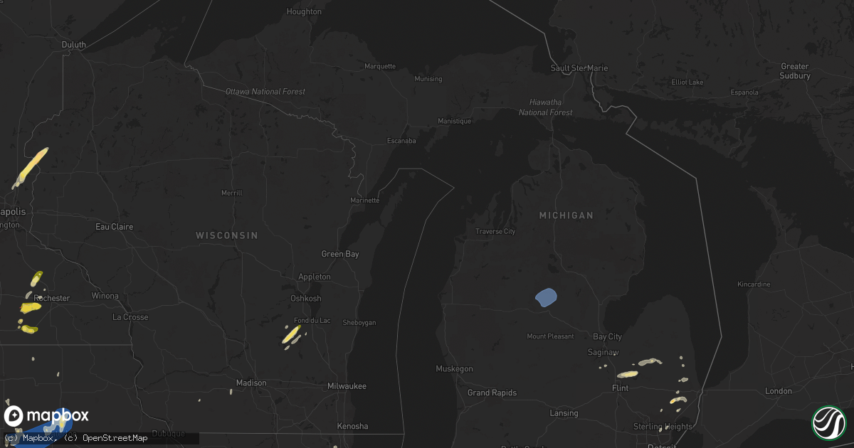
Hail Map in Michigan on May 20, 2024
Get this storm
May 20 map
$229
one time, instant access
Download today. No call, no setup
Keep the $229
Bought the map and want the full workflow? Apply the entire $229 to a subscription within 7 days. None of it is wasted.
Every map, not just this one
This buys you this map. Subscription and you get every map we run, in the markets you choose from a few cities to whole states to nationwide. Plus real-time alerts the moment a storm fires.
Contact data
Name, contact info, occupancy, even credit band for addresses in the footprint. You go from where it hit to who to call.
Become the source they trust
Unlimited branding weather history reports on demand. You already have the documented answer ready for the property owner, and you are the one who showed up with it.
Property data and RoofTrace estimates
Pull up any address you have got, its value and the exact code rules for that jurisdiction, straight from One Click Code. Then RoofTrace estimates the squares, pitch, and roof value, priced the way you price.
Storm reports in Michigan
Michigan
| Date | Description |
|---|---|
| 05/20/20246:10 PM CDT | Over 20 calls of trees and wires down in and around morley... Mi including damage to a transformer. |
| 05/20/20246:05 PM CDT | Trees and power lines down across the road. |
| 05/20/20246:04 PM CDT | Trees and wires down on the road on brady lake blvd. |
| 05/20/20245:18 PM CDT | Trees and power lines down north of fremont. |
| 05/20/20244:42 PM CDT | Photo sent via email of 1 inch hailstone. |
| 05/20/20243:10 PM CDT | Photo sent of tree down on chalmers and van dyke roads. |
| 05/20/20242:14 PM CDT | A local report indicates 1.50 inch wind near 1 NE Armada |
| 05/20/20241:25 PM CDT | Sporadic tree limbs and trees downed in sanilac county: including marlette... Deckerville... Sandusky... And cass city. |
| 05/20/202412:35 PM CDT | Trees reported down across the county... With the vassar area particulary the hardest hit. |
| 05/20/202411:40 AM CDT | 2-4 inch tree limbs downed... Along with a pine tree uprooted. |
| 05/19/20248:20 PM CDT | Delayed report: large tree uprooted at the corner of jackson and bliss roads. Time estimated from radar. |
| 05/19/20248:18 PM CDT | 60 mph thunderstorm wind gust measured at official nws observation at jackson airport. |
| 05/19/20247:21 PM CDT | Adams road closed north of m-18 due to downed power lines from thunderstorm winds. Time estimated by radar. |
| 05/19/20247:07 PM CDT | Time estimated based on radar. |
All States Impacted by Hail Map on May 20, 2024
Cities Impacted by Hail Map on May 20, 2024
- Mt Zion, IL
- Decatur, IL
- Marathon, FL
- Mineral Point, WI
- Waupun, WI
- Beaver Dam, WI
- Fox Lake, WI
- Oakfield, WI
- Marengo, IL
- Harvard, IL
- Burt, MI
- Montrose, MI
- Clio, MI
- Mount Morris, MI
- Saginaw, MI
- Frankenmuth, MI
- Millington, MI
- Rochelle, IL
- Steward, IL
- Otisville, MI
- Fostoria, MI
- Mayville, MI
- Bowling Green, OH
- Columbiaville, MI
- Otter Lake, MI
- Silverwood, MI
- Clifford, MI
- Marlette, MI
- Pemberville, OH
- Kingston, MI
- Port Clinton, OH
- Fremont, OH
- Brown City, MI
- Applegate, MI
- Croswell, MI
- Peck, MI
- Oak Harbor, OH
- Carsonville, MI
- Barrington, IL
- Saint Charles, IL
- South Elgin, IL
- Elgin, IL
- Bartlett, IL
- Wayne, IL
- Yale, MI
- Avoca, MI
- Armada, MI
- Wauconda, IL
- Lake Zurich, IL
- Streamwood, IL
- Hoffman Estates, IL
- Mundelein, IL
- Dundee, IL
- Palatine, IL
- Fox River Grove, IL
- Cary, IL
- Grayslake, IL
- Round Lake, IL
- Mchenry, IL
- Island Lake, IL
- Richmond, MI
- Carpentersville, IL
- Homer Glen, IL
- Lockport, IL
- New Haven, MI
- Orland Park, IL
- Palos Park, IL
- Goodells, MI
- Columbus, MI
- Memphis, MI
- Mayville, WI
- Burnett, WI
- Brandon, WI
- Vernon Hills, IL
- Libertyville, IL
- Washington, MI
- Potosi, MO
- Alsip, IL
- Chicago, IL
- Blue Island, IL
- Belgrade, MO
- Pompano Beach, FL
- Fort Lauderdale, FL
- Palos Heights, IL
- Crestwood, IL
- Cicero, IL
- Clinton Township, MI
- Sterling Heights, MI
- Fraser, MI
- Warren, MI
- Belleview, MO
- Bradley, IL
- Kankakee, IL
- Bourbonnais, IL
- Caledonia, MO
- Ironton, MO
- Beecher, IL
- Grant Park, IL
- Middle Brook, MO
- Pilot Knob, MO
- Cedar Lake, IN
- Lowell, IN
- Hebron, IN
- Crown Point, IN
- Valparaiso, IN
- Kouts, IN
- Thawville, IL
- Roberts, IL
- Lake Worth, FL
- Wellington, FL
- Onarga, IL
- Boynton Beach, FL
- Lake Village, IN
- Demotte, IN
- Thayer, IN
- Shelby, IN
- West Palm Beach, FL
- Gilman, IL
- Lindsey, OH
- Hayfield, MN
- Dodge Center, MN
- Phillips, NE
- Aurora, NE
- Sanborn, IA
- Primghar, IA
- Bradshaw, NE
- Waco, NE
- York, NE
- Stromsburg, NE
- Benedict, NE
- Wood River, NE
- Kasson, MN
- Marquette, NE
- Hartley, IA
- Polk, NE
- Byron, MN
- Schererville, IN
- Saint John, IN
- Central City, NE
- Chapman, NE
- Fort Morgan, CO
- Alda, NE
- Grand Island, NE
- Rising City, NE
- Wheatfield, IN
- Osceola, NE
- Shelton, NE
- Blooming Prairie, MN
- Remsen, IA
- Brush, CO
- Woodrow, CO
- Malcolm, NE
- Lincoln, NE
- Everly, IA
- Garland, NE
- Seward, NE
- Bellwood, NE
- Shelby, NE
- Clarks, NE
- Royal, IA
- Sutherland, IA
- Peterson, IA
- Spencer, IA
- Greenville, IA
- Sioux Rapids, IA
- Elm Creek, NE
- Akron, CO
- Milford, IA
- Pine Island, MN
- West Concord, MN
- Raymond, NE
- Mantorville, MN
- Clifton, IL
- Momence, IL
- Bee, NE
- Surprise, NE
- Watkins, CO
- Schneider, IN
- Hordville, NE
- Harrison, MI
- Lake, MI
- Farwell, MI
- Clare, MI
- Gladwin, MI
- Webb, IA
- Dickens, IA
- Marcus, IA
- Valparaiso, NE
- Dwight, NE
- Davey, NE
- Bennett, CO
- Chebanse, IL
- Sheldon, IA
- Silver Creek, NE
- Columbus, NE
- Creighton, NE
- Archer, IA
- Gillett Grove, IA
- Ruthven, IA
- Paullina, IA
- Granville, IA
- Cleghorn, IA
- Ashton, IA
- David City, NE
- Shelby, IA
- Byers, CO
- Strasburg, CO
- Fordyce, NE
- Crofton, NE
- Waltham, MN
- Wiggins, CO
- Roggen, CO
- Zumbrota, MN
- Orchard, NE
- Otis, CO
- Ayrshire, IA
- Winnetoon, NE
- Bloomfield, NE
- Harlan, IA
- Portsmouth, IA
- Verdigre, NE
- Colon, NE
- Brainard, NE
- Titonka, IA
- Aurora, CO
- Laurens, IA
- Curlew, IA
- Mazeppa, MN
- Melvin, IA
- Ames, NE
- Fremont, NE
- Cedar Bluffs, NE
- Deer Trail, CO
- Austin, MN
- Weston, NE
- Prague, NE
- Bruno, NE
- Larrabee, IA
- Meriden, IA
- Cherokee, IA
- Wesley, IA
- Oronoco, MN
- Alton, IA
- Leland, IA
- Forest City, IA
- Burns, WY
- Cheyenne, WY
- Blair, NE
- Worthington, MN
- Panama, IA
- Mallard, IA
- Havelock, IA
- Burt, IA
- Sibley, IA
- Brewster, MN
- Fulda, MN
- Hooper, NE
- Colorado Springs, CO
- Peyton, CO
- Elbert, CO
- Saint Anne, IL
- Linwood, NE
- Aurelia, IA
- Harrisburg, NE
- Vermillion, SD
- Herman, NE
- Malmo, NE
- Winslow, NE
- Center, NE
- Scarville, IA
- Martinton, IL
- Thompson, IA
- Lake Mills, IA
- Brownsdale, MN
- Yuma, CO
- Ulysses, NE
- Hartington, NE
- Pine Bluffs, WY
- Albin, WY
- Saint Helena, NE
- Wynot, NE
- Wahoo, NE
- Rolfe, IA
- Linn Grove, IA
- Alta, IA
- Earling, IA
- Heron Lake, MN
- Ceresco, NE
- Morse Bluff, NE
- Craig, NE
- Woden, IA
- Staplehurst, NE
- Tekamah, NE
- Newcastle, NE
- Westphalia, IA
- Lindon, CO
- Okabena, MN
- Uehling, NE
- Ashkum, IL
- Ravenna, NE
- Decatur, NE
- Volin, SD
- Eckley, CO
- Algona, IA
- Rembrandt, IA
- Onawa, IA
- Valley, NE
- Mead, NE
- Britt, IA
- Kirkman, IA
- Brewster, NE
- Rose Creek, MN
- Whiting, IA
- Maskell, NE
- Lakefield, MN
- Taylor, NE
- Albert Lea, MN
- Anton, CO
- Macy, NE
- Anselmo, NE
- Arnold, NE
- Marathon, IA
- Walthill, NE
- Winnebago, NE
- Dunning, NE
- Ponca, NE
- Elk Point, SD
- Homer, NE
- Rosalie, NE
- Oakland, NE
- Lyons, NE
- Salix, IA
- Sloan, IA
- Sergeant Bluff, IA
- Sioux City, IA
- Merna, NE
- Wray, CO
- Dakota City, NE
- South Sioux City, NE
- Bronson, IA
- Lawton, IA
- Hornick, IA
- Arlington, NE
- Bennington, NE
- Burwell, NE
- Pembroke Township, IL
- Donovan, IL
- Beaverville, IL
- Sleepy Eye, MN
- Swea City, IA
- Wallace, NE
- Dexter, MN
- Elkton, MN
- Broken Bow, NE
- Callaway, NE
- Ansley, NE
- Vernon, CO
- Cope, CO
- Bassett, NE
- Kennard, NE
- Dickens, NE
- Mapleton, IA
- Ithaca, NE
- Yutan, NE
- Lansing, MN
- Adams, MN
- New Ulm, MN
- Newell, IA
- Albert City, IA
- Ashland, NE
- Gibbon, MN
- Alpha, MN
- Anthon, IA
- Oto, IA
- Coleridge, NE
- Westfield, IA
- Moville, IA
- Westerville, NE
- Fort Calhoun, NE
- Omaha, NE
- Sherburn, MN
- Elkhorn, NE
- Menlo, IA
- Agate, CO
- Corwith, IA
- Waverly, NE
- Laurel, NE
- Danbury, IA
- Washington, NE
- Boys Town, NE
- Morgan, MN
- Jefferson, SD
- Casey, IA
- Comstock, NE
- Crescent, IA
- Missouri Valley, IA
- Kingsley, IA
- Hinton, IA
- Fairmont, MN
- Welcome, MN
- Saint Francis, KS
- Haigler, NE
- Holstein, IA
- Correctionville, IA
- Jackson, NE
- Merrill, IA
- Irwin, IA
- Manning, IA
- Manilla, IA
- Guthrie Center, IA
- Pierson, IA
- Ord, NE
- Gretna, NE
- Janesville, MN
- Pocahontas, IA
- Winnebago, MN
- Memphis, NE
- Honey Creek, IA
- Arcadia, NE
- Fairfax, MN
- Franklin, MN
- Whittemore, IA
- West Bend, IA
- Panora, IA
- Ceylon, MN
- Dixon, NE
- Ericson, NE
- Joes, CO
- Wellfleet, NE
- North Platte, NE
- Galva, IA
- Schaller, IA
- Templeton, IA
- Audubon, IA
- Akron, IA
- Le Mars, IA
- Waterloo, NE
- Kirk, CO
- Parks, NE
- Hector, MN
- Amboy, MN
- Coon Rapids, IA
- Dedham, IA
- Waseca, MN
- Bartlett, NE
- Niobrara, NE
- La Vista, NE
- Johnstown, NE
- Idalia, CO
- North Bend, NE
- Woodbine, IA
- Benkelman, NE
- Morristown, MN
- Waterville, MN
- Neola, IA
- Buffalo Lake, MN
- Maywood, NE
- Glidden, IA
- Carroll, IA
- Osage, IA
- Genoa, CO
- Bird City, KS
- Underwood, IA
- Maxwell, NE
- Persia, IA
- Logan, IA
- Faribault, MN
- Kilkenny, MN
- Nickerson, NE
- Winterset, IA
- Max, NE
- Wauneta, NE
- Cairo, NE
- Brady, NE
- Saint Charles, IA
- Prole, IA
- Norwalk, IA
- Ackley, IA
- Minden, IA
- Avoca, IA
- Dannebrog, NE
- Saint Paul, NE
- Enders, NE
- Stratton, NE
- Bevington, IA
- Patterson, IA
- Wellsburg, IA
- Van Meter, IA
- Indianola, IA
- Palisade, NE
- Saint Libory, NE
- Cumming, IA
- Belmond, IA
- Clarion, IA
- Doniphan, NE
- Oakland, IA
- Hancock, IA
- Iowa Falls, IA
- Des Moines, IA
- Alden, IA
- New Providence, IA
- Eldora, IA
- Gothenburg, NE
- Steamboat Rock, IA
- Aplington, IA
- Kanawha, IA
- Forest Lake, MN
- Circle Pines, MN
- Hayes Center, NE
- Carlisle, IA
- Trenton, NE
- Culbertson, NE
- Hugo, MN
- Mitchellville, IA
- McDonald, KS
- Cedar Falls, IA
- Scandia, MN
- Wyoming, MN
- Chisago City, MN
- Kimballton, IA
- Elk Horn, IA
- Runnells, IA
- Scribner, NE
- Greenwood, NE
- Eustis, NE
- McCook, NE
- Farnam, NE
- Stacy, MN
- Lindstrom, MN
- Center City, MN
- Brownsville, WI
- Schuyler, NE
- Walnut, IA
- New Hartford, IA
- Atwood, KS
- Exira, IA
- Hamlin, IA
- Defiance, IA
- Gray, IA
- Taylors Falls, MN
- Saint Croix Falls, WI
- Shafer, MN
- North Branch, MN
- Hampton, IA
- Sheffield, IA
- Curtis, NE
- Cozad, NE
- Hampton, NE
- Cushing, WI
- Luck, WI
- Lebanon, NE
- Bartley, NE
- Wilsonville, NE
- Indianola, NE
- Cambridge, NE
- Stockville, NE
- Moorefield, NE
- Adair, IA
- Montour, IA
- Toledo, IA
- Garwin, IA
- Tama, IA
- Giltner, NE
- Danbury, NE
- Abie, NE
- Frederic, WI
- Mingo, IA
- Morton, MN
- Overton, NE
- Elwood, NE
- Hendley, NE
- Norton, KS
- Holbrook, NE
- Beaver City, NE
- Gresham, NE
- Conrad, IA
- Beaman, IA
- Grundy Center, IA
- Liscomb, IA
- Reinbeck, IA
- Gladbrook, IA
- Holland, IA
- Morrison, IA
- Dike, IA
- Waterloo, IA
- Parkersburg, IA
- Hudson, IA
- Janesville, IA
- Stout, IA
- Dunkerton, IA
- Dewar, IA
- Evansdale, IA
- Denver, IA
- Waverly, IA
- Readlyn, IA
- Smithfield, NE
- Bertrand, NE
- New Hampton, IA
- Fairbank, IA
- Tripoli, IA
- Sumner, IA
- Oxford, NE
- Dow City, IA
- Stamford, NE
- Orleans, NE
- Dunlap, IA
- Alma, NE
- Republican City, NE
- Little Cedar, IA
- Hertel, WI
- Shell Lake, WI
- Webster, WI
- Spooner, WI
- Pemberton, MN
- Alta Vista, IA
- Utica, NE
- Stewartville, MN
- Jackson, MN
- Modale, IA
- Mondamin, IA
- Wolbach, NE
- Cedar Rapids, NE
- Newton, IA
- Kellogg, IA
- Plainview, NE
- Storm Lake, IA
- George, IA
- Smithland, IA
- Wausa, NE
- Fonda, IA
- Belgrade, NE
- Palmer, NE
- Redwood Falls, MN
- Cushing, IA
- Colfax, IA
- Greeley, NE
- Spalding, NE
- Scotia, NE
- Elba, NE
- Fullerton, NE
- Archer, NE
- Albion, NE
- Primrose, NE
- Saint Edward, NE
- Genoa, NE
- Monroe, NE
- Gilman, IA
- Grinnell, IA
- Mount Horeb, WI
- Platte Center, NE
- Lindsay, NE
- Duncan, NE
- Geneva, NE
- Fairmont, NE
- McCool Junction, NE
- Henderson, NE
- Exeter, NE
- Milligan, NE
- Beaver Crossing, NE
- Humphrey, NE
- Creston, NE
- Clarkson, NE
- Leigh, NE
- Friend, NE
- Cordova, NE
- Goehner, NE
- Swan, IA
- Otley, IA
- Monroe, IA
- Dodge, NE
- Howells, NE
- Rogers, NE
- Prairie City, IA
- Marshalltown, IA
- Reasnor, IA
- Snyder, NE
- West Point, NE
- Sully, IA
- Killduff, IA
- Pella, IA
- Lynnville, IA
- Bennet, NE
- Carter Lake, IA
- Walton, NE
- Council Bluffs, IA
- Sterling, NE
- Burr, NE
- Searsboro, IA
- Malcom, IA
- Palmyra, NE
- Montezuma, IA
- Treynor, IA
- McClelland, IA
- Papillion, NE
- Douglas, NE
- Pisgah, IA
- Little Sioux, IA
- Bellevue, NE
- Magnolia, IA
- Madison, NE
- Stanton, NE
- Pilger, NE
- Wisner, NE
- Beemer, NE
- Waterbury, NE
- Emerson, NE
- Wakefield, NE
- Hubbard, NE
- Bancroft, NE
- Thurston, NE
- Pender, NE
- Wayne, NE
- North Sioux City, SD
- Blencoe, IA
- Castana, IA
- Moorhead, IA
- Rodney, IA
- Climbing Hill, IA
- Soldier, IA
- Cook, NE
- Carson, IA
- Springfield, NE
- Tecumseh, NE
- New Sharon, IA
- Syracuse, NE
- Otoe, NE
- Unadilla, NE
- Chelsea, IA
- Brooklyn, IA
- Avoca, NE
- Elmwood, NE
- Plattsmouth, NE
- Louisville, NE
- Belle Plaine, IA
- Johnson, NE
- Brock, NE
- Auburn, NE
- Glenwood, IA
- Pacific Junction, IA
- Offutt Afb, NE
- Hartwick, IA
- Elberon, IA
- Talmage, NE
- Silver City, IA
- Ute, IA
- Macedonia, IA
- Griswold, IA
- Charter Oak, IA
- Battle Creek, IA
- Ricketts, IA
- Arion, IA
- Denison, IA
- Lewis, IA
- Henderson, IA
- Red Oak, IA
- Malvern, IA
- Mineola, IA
- Emerson, IA
- Hastings, IA
- Imogene, IA
- Marengo, IA
- Keystone, IA
- Luzerne, IA
- Victor, IA
- Brownville, NE
- Peru, NE
- Nemaha, NE
- Blairstown, IA
- Julian, NE
- Humboldt, NE


