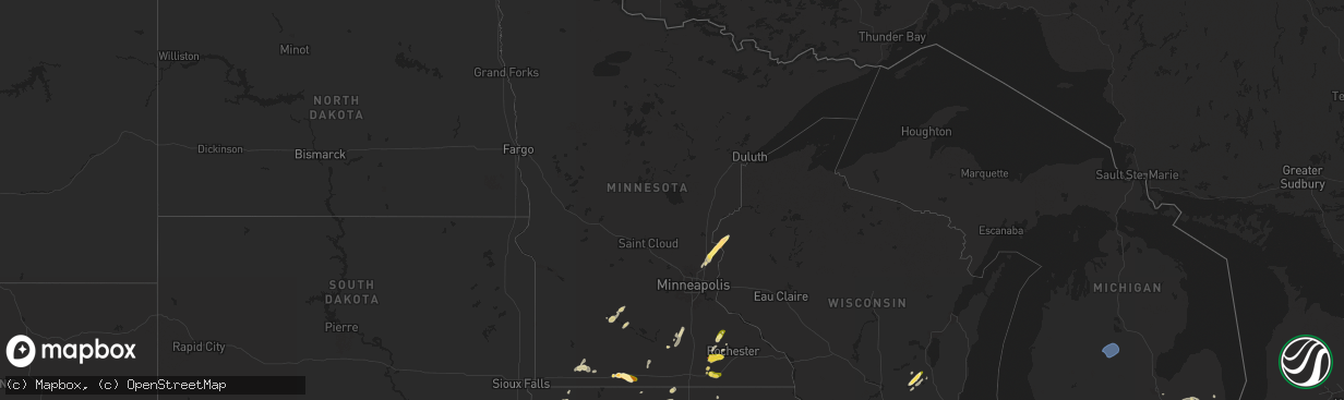
Hail Map in Minnesota on May 20, 2024
The weather event in Minnesota on May 20, 2024 includes Hail, Wind, and Tornado maps. 14 states and 770 cities were impacted and suffered possible damage. The total estimated number of properties impacted is 14,950.
Want more than just the map?
Turn this storm into a full workflow.
- Owner + property data so you know who to knock
- OnDemand branded weather history reports to win the "did we even have hail?" argument
- RoofTrace estimate so reps stop guessing numbers at the door
Bought this map? Upgrade within 7 days and we'll credit the $230. (10-15 min setup call)
Hail
Wind
Tornado
14,950
Estimated number of impacted properties by a 1.00" hail or larger468
Estimated number of impacted properties by a 1.75" hail or larger0
Estimated number of impacted properties by a 2.50" hail or largerStorm reports in Minnesota
Minnesota
| Date | Description |
|---|---|
| 05/20/20246:55 PM CDT | A local report indicates 1.00 inch wind near 4 N Hayfield |
| 05/20/20246:25 PM CDT | Brief non-supercell tornado reported by spotters and the public. |
| 05/20/20246:18 PM CDT | Brief non-supercell tornado reported by spotters and the public. |
| 05/19/202411:20 PM CDT | Relayed via dispatch. |
| 05/19/202411:15 PM CDT | A local report indicates 1.50 inch wind near Sherburn |
| 05/19/20249:28 PM CDT | A local report indicates 1.00 inch wind near Brewster |
| 05/19/20249:27 PM CDT | Time estimated from radar. |
| 05/19/20248:20 PM CDT | A local report indicates 1.00 inch wind near Zumbrota |
| 05/19/20247:39 PM CDT | Time estimated from radar. |
| 05/19/20247:35 PM CDT | Time estimated from radar. |
| 05/19/20247:32 PM CDT | Hail covering the ground. |
All States Impacted by Hail Map on May 20, 2024
Cities Impacted by Hail Map on May 20, 2024
- Mt Zion, IL
- Decatur, IL
- Marathon, FL
- Mineral Point, WI
- Waupun, WI
- Beaver Dam, WI
- Fox Lake, WI
- Oakfield, WI
- Marengo, IL
- Harvard, IL
- Burt, MI
- Montrose, MI
- Clio, MI
- Mount Morris, MI
- Saginaw, MI
- Frankenmuth, MI
- Millington, MI
- Rochelle, IL
- Steward, IL
- Otisville, MI
- Fostoria, MI
- Mayville, MI
- Bowling Green, OH
- Columbiaville, MI
- Otter Lake, MI
- Silverwood, MI
- Clifford, MI
- Marlette, MI
- Pemberville, OH
- Kingston, MI
- Port Clinton, OH
- Fremont, OH
- Brown City, MI
- Applegate, MI
- Croswell, MI
- Peck, MI
- Oak Harbor, OH
- Carsonville, MI
- Barrington, IL
- Saint Charles, IL
- South Elgin, IL
- Elgin, IL
- Bartlett, IL
- Wayne, IL
- Yale, MI
- Avoca, MI
- Armada, MI
- Wauconda, IL
- Lake Zurich, IL
- Streamwood, IL
- Hoffman Estates, IL
- Mundelein, IL
- Dundee, IL
- Palatine, IL
- Fox River Grove, IL
- Cary, IL
- Grayslake, IL
- Round Lake, IL
- Mchenry, IL
- Island Lake, IL
- Richmond, MI
- Carpentersville, IL
- Homer Glen, IL
- Lockport, IL
- New Haven, MI
- Orland Park, IL
- Palos Park, IL
- Goodells, MI
- Columbus, MI
- Memphis, MI
- Mayville, WI
- Burnett, WI
- Brandon, WI
- Vernon Hills, IL
- Libertyville, IL
- Washington, MI
- Potosi, MO
- Alsip, IL
- Chicago, IL
- Blue Island, IL
- Belgrade, MO
- Pompano Beach, FL
- Fort Lauderdale, FL
- Palos Heights, IL
- Crestwood, IL
- Cicero, IL
- Clinton Township, MI
- Sterling Heights, MI
- Fraser, MI
- Warren, MI
- Belleview, MO
- Bradley, IL
- Kankakee, IL
- Bourbonnais, IL
- Caledonia, MO
- Ironton, MO
- Beecher, IL
- Grant Park, IL
- Middle Brook, MO
- Pilot Knob, MO
- Cedar Lake, IN
- Lowell, IN
- Hebron, IN
- Crown Point, IN
- Valparaiso, IN
- Kouts, IN
- Thawville, IL
- Roberts, IL
- Lake Worth, FL
- Wellington, FL
- Onarga, IL
- Boynton Beach, FL
- Lake Village, IN
- Demotte, IN
- Thayer, IN
- Shelby, IN
- West Palm Beach, FL
- Gilman, IL
- Lindsey, OH
- Hayfield, MN
- Dodge Center, MN
- Phillips, NE
- Aurora, NE
- Sanborn, IA
- Primghar, IA
- Bradshaw, NE
- Waco, NE
- York, NE
- Stromsburg, NE
- Benedict, NE
- Wood River, NE
- Kasson, MN
- Marquette, NE
- Hartley, IA
- Polk, NE
- Byron, MN
- Schererville, IN
- Saint John, IN
- Central City, NE
- Chapman, NE
- Fort Morgan, CO
- Alda, NE
- Grand Island, NE
- Rising City, NE
- Wheatfield, IN
- Osceola, NE
- Shelton, NE
- Blooming Prairie, MN
- Remsen, IA
- Brush, CO
- Woodrow, CO
- Malcolm, NE
- Lincoln, NE
- Everly, IA
- Garland, NE
- Seward, NE
- Bellwood, NE
- Shelby, NE
- Clarks, NE
- Royal, IA
- Sutherland, IA
- Peterson, IA
- Spencer, IA
- Greenville, IA
- Sioux Rapids, IA
- Elm Creek, NE
- Akron, CO
- Milford, IA
- Pine Island, MN
- West Concord, MN
- Raymond, NE
- Mantorville, MN
- Clifton, IL
- Momence, IL
- Bee, NE
- Surprise, NE
- Watkins, CO
- Schneider, IN
- Hordville, NE
- Harrison, MI
- Lake, MI
- Farwell, MI
- Clare, MI
- Gladwin, MI
- Webb, IA
- Dickens, IA
- Marcus, IA
- Valparaiso, NE
- Dwight, NE
- Davey, NE
- Bennett, CO
- Chebanse, IL
- Sheldon, IA
- Silver Creek, NE
- Columbus, NE
- Creighton, NE
- Archer, IA
- Gillett Grove, IA
- Ruthven, IA
- Paullina, IA
- Granville, IA
- Cleghorn, IA
- Ashton, IA
- David City, NE
- Shelby, IA
- Byers, CO
- Strasburg, CO
- Fordyce, NE
- Crofton, NE
- Waltham, MN
- Wiggins, CO
- Roggen, CO
- Zumbrota, MN
- Orchard, NE
- Otis, CO
- Ayrshire, IA
- Winnetoon, NE
- Bloomfield, NE
- Harlan, IA
- Portsmouth, IA
- Verdigre, NE
- Colon, NE
- Brainard, NE
- Titonka, IA
- Aurora, CO
- Laurens, IA
- Curlew, IA
- Mazeppa, MN
- Melvin, IA
- Ames, NE
- Fremont, NE
- Cedar Bluffs, NE
- Deer Trail, CO
- Austin, MN
- Weston, NE
- Prague, NE
- Bruno, NE
- Larrabee, IA
- Meriden, IA
- Cherokee, IA
- Wesley, IA
- Oronoco, MN
- Alton, IA
- Leland, IA
- Forest City, IA
- Burns, WY
- Cheyenne, WY
- Blair, NE
- Worthington, MN
- Panama, IA
- Mallard, IA
- Havelock, IA
- Burt, IA
- Sibley, IA
- Brewster, MN
- Fulda, MN
- Hooper, NE
- Colorado Springs, CO
- Peyton, CO
- Elbert, CO
- Saint Anne, IL
- Linwood, NE
- Aurelia, IA
- Harrisburg, NE
- Vermillion, SD
- Herman, NE
- Malmo, NE
- Winslow, NE
- Center, NE
- Scarville, IA
- Martinton, IL
- Thompson, IA
- Lake Mills, IA
- Brownsdale, MN
- Yuma, CO
- Ulysses, NE
- Hartington, NE
- Pine Bluffs, WY
- Albin, WY
- Saint Helena, NE
- Wynot, NE
- Wahoo, NE
- Rolfe, IA
- Linn Grove, IA
- Alta, IA
- Earling, IA
- Heron Lake, MN
- Ceresco, NE
- Morse Bluff, NE
- Craig, NE
- Woden, IA
- Staplehurst, NE
- Tekamah, NE
- Newcastle, NE
- Westphalia, IA
- Lindon, CO
- Okabena, MN
- Uehling, NE
- Ashkum, IL
- Ravenna, NE
- Decatur, NE
- Volin, SD
- Eckley, CO
- Algona, IA
- Rembrandt, IA
- Onawa, IA
- Valley, NE
- Mead, NE
- Britt, IA
- Kirkman, IA
- Brewster, NE
- Rose Creek, MN
- Whiting, IA
- Maskell, NE
- Lakefield, MN
- Taylor, NE
- Albert Lea, MN
- Anton, CO
- Macy, NE
- Anselmo, NE
- Arnold, NE
- Marathon, IA
- Walthill, NE
- Winnebago, NE
- Dunning, NE
- Ponca, NE
- Elk Point, SD
- Homer, NE
- Rosalie, NE
- Oakland, NE
- Lyons, NE
- Salix, IA
- Sloan, IA
- Sergeant Bluff, IA
- Sioux City, IA
- Merna, NE
- Wray, CO
- Dakota City, NE
- South Sioux City, NE
- Bronson, IA
- Lawton, IA
- Hornick, IA
- Arlington, NE
- Bennington, NE
- Burwell, NE
- Pembroke Township, IL
- Donovan, IL
- Beaverville, IL
- Sleepy Eye, MN
- Swea City, IA
- Wallace, NE
- Dexter, MN
- Elkton, MN
- Broken Bow, NE
- Callaway, NE
- Ansley, NE
- Vernon, CO
- Cope, CO
- Bassett, NE
- Kennard, NE
- Dickens, NE
- Mapleton, IA
- Ithaca, NE
- Yutan, NE
- Lansing, MN
- Adams, MN
- New Ulm, MN
- Newell, IA
- Albert City, IA
- Ashland, NE
- Gibbon, MN
- Alpha, MN
- Anthon, IA
- Oto, IA
- Coleridge, NE
- Westfield, IA
- Moville, IA
- Westerville, NE
- Fort Calhoun, NE
- Omaha, NE
- Sherburn, MN
- Elkhorn, NE
- Menlo, IA
- Agate, CO
- Corwith, IA
- Waverly, NE
- Laurel, NE
- Danbury, IA
- Washington, NE
- Boys Town, NE
- Morgan, MN
- Jefferson, SD
- Casey, IA
- Comstock, NE
- Crescent, IA
- Missouri Valley, IA
- Kingsley, IA
- Hinton, IA
- Fairmont, MN
- Welcome, MN
- Saint Francis, KS
- Haigler, NE
- Holstein, IA
- Correctionville, IA
- Jackson, NE
- Merrill, IA
- Irwin, IA
- Manning, IA
- Manilla, IA
- Guthrie Center, IA
- Pierson, IA
- Ord, NE
- Gretna, NE
- Janesville, MN
- Pocahontas, IA
- Winnebago, MN
- Memphis, NE
- Honey Creek, IA
- Arcadia, NE
- Fairfax, MN
- Franklin, MN
- Whittemore, IA
- West Bend, IA
- Panora, IA
- Ceylon, MN
- Dixon, NE
- Ericson, NE
- Joes, CO
- Wellfleet, NE
- North Platte, NE
- Galva, IA
- Schaller, IA
- Templeton, IA
- Audubon, IA
- Akron, IA
- Le Mars, IA
- Waterloo, NE
- Kirk, CO
- Parks, NE
- Hector, MN
- Amboy, MN
- Coon Rapids, IA
- Dedham, IA
- Waseca, MN
- Bartlett, NE
- Niobrara, NE
- La Vista, NE
- Johnstown, NE
- Idalia, CO
- North Bend, NE
- Woodbine, IA
- Benkelman, NE
- Morristown, MN
- Waterville, MN
- Neola, IA
- Buffalo Lake, MN
- Maywood, NE
- Glidden, IA
- Carroll, IA
- Osage, IA
- Genoa, CO
- Bird City, KS
- Underwood, IA
- Maxwell, NE
- Persia, IA
- Logan, IA
- Faribault, MN
- Kilkenny, MN
- Nickerson, NE
- Winterset, IA
- Max, NE
- Wauneta, NE
- Cairo, NE
- Brady, NE
- Saint Charles, IA
- Prole, IA
- Norwalk, IA
- Ackley, IA
- Minden, IA
- Avoca, IA
- Dannebrog, NE
- Saint Paul, NE
- Enders, NE
- Stratton, NE
- Bevington, IA
- Patterson, IA
- Wellsburg, IA
- Van Meter, IA
- Indianola, IA
- Palisade, NE
- Saint Libory, NE
- Cumming, IA
- Belmond, IA
- Clarion, IA
- Doniphan, NE
- Oakland, IA
- Hancock, IA
- Iowa Falls, IA
- Des Moines, IA
- Alden, IA
- New Providence, IA
- Eldora, IA
- Gothenburg, NE
- Steamboat Rock, IA
- Aplington, IA
- Kanawha, IA
- Forest Lake, MN
- Circle Pines, MN
- Hayes Center, NE
- Carlisle, IA
- Trenton, NE
- Culbertson, NE
- Hugo, MN
- Mitchellville, IA
- McDonald, KS
- Cedar Falls, IA
- Scandia, MN
- Wyoming, MN
- Chisago City, MN
- Kimballton, IA
- Elk Horn, IA
- Runnells, IA
- Scribner, NE
- Greenwood, NE
- Eustis, NE
- McCook, NE
- Farnam, NE
- Stacy, MN
- Lindstrom, MN
- Center City, MN
- Brownsville, WI
- Schuyler, NE
- Walnut, IA
- New Hartford, IA
- Atwood, KS
- Exira, IA
- Hamlin, IA
- Defiance, IA
- Gray, IA
- Taylors Falls, MN
- Saint Croix Falls, WI
- Shafer, MN
- North Branch, MN
- Hampton, IA
- Sheffield, IA
- Curtis, NE
- Cozad, NE
- Hampton, NE
- Cushing, WI
- Luck, WI
- Lebanon, NE
- Bartley, NE
- Wilsonville, NE
- Indianola, NE
- Cambridge, NE
- Stockville, NE
- Moorefield, NE
- Adair, IA
- Montour, IA
- Toledo, IA
- Garwin, IA
- Tama, IA
- Giltner, NE
- Danbury, NE
- Abie, NE
- Frederic, WI
- Mingo, IA
- Morton, MN
- Overton, NE
- Elwood, NE
- Hendley, NE
- Norton, KS
- Holbrook, NE
- Beaver City, NE
- Gresham, NE
- Conrad, IA
- Beaman, IA
- Grundy Center, IA
- Liscomb, IA
- Reinbeck, IA
- Gladbrook, IA
- Holland, IA
- Morrison, IA
- Dike, IA
- Waterloo, IA
- Parkersburg, IA
- Hudson, IA
- Janesville, IA
- Stout, IA
- Dunkerton, IA
- Dewar, IA
- Evansdale, IA
- Denver, IA
- Waverly, IA
- Readlyn, IA
- Smithfield, NE
- Bertrand, NE
- New Hampton, IA
- Fairbank, IA
- Tripoli, IA
- Sumner, IA
- Oxford, NE
- Dow City, IA
- Stamford, NE
- Orleans, NE
- Dunlap, IA
- Alma, NE
- Republican City, NE
- Little Cedar, IA
- Hertel, WI
- Shell Lake, WI
- Webster, WI
- Spooner, WI
- Pemberton, MN
- Alta Vista, IA
- Utica, NE
- Stewartville, MN
- Jackson, MN
- Modale, IA
- Mondamin, IA
- Wolbach, NE
- Cedar Rapids, NE
- Newton, IA
- Kellogg, IA
- Plainview, NE
- Storm Lake, IA
- George, IA
- Smithland, IA
- Wausa, NE
- Fonda, IA
- Belgrade, NE
- Palmer, NE
- Redwood Falls, MN
- Cushing, IA
- Colfax, IA
- Greeley, NE
- Spalding, NE
- Scotia, NE
- Elba, NE
- Fullerton, NE
- Archer, NE
- Albion, NE
- Primrose, NE
- Saint Edward, NE
- Genoa, NE
- Monroe, NE
- Gilman, IA
- Grinnell, IA
- Mount Horeb, WI
- Platte Center, NE
- Lindsay, NE
- Duncan, NE
- Geneva, NE
- Fairmont, NE
- McCool Junction, NE
- Henderson, NE
- Exeter, NE
- Milligan, NE
- Beaver Crossing, NE
- Humphrey, NE
- Creston, NE
- Clarkson, NE
- Leigh, NE
- Friend, NE
- Cordova, NE
- Goehner, NE
- Swan, IA
- Otley, IA
- Monroe, IA
- Dodge, NE
- Howells, NE
- Rogers, NE
- Prairie City, IA
- Marshalltown, IA
- Reasnor, IA
- Snyder, NE
- West Point, NE
- Sully, IA
- Killduff, IA
- Pella, IA
- Lynnville, IA
- Bennet, NE
- Carter Lake, IA
- Walton, NE
- Council Bluffs, IA
- Sterling, NE
- Burr, NE
- Searsboro, IA
- Malcom, IA
- Palmyra, NE
- Montezuma, IA
- Treynor, IA
- McClelland, IA
- Papillion, NE
- Douglas, NE
- Pisgah, IA
- Little Sioux, IA
- Bellevue, NE
- Magnolia, IA
- Madison, NE
- Stanton, NE
- Pilger, NE
- Wisner, NE
- Beemer, NE
- Waterbury, NE
- Emerson, NE
- Wakefield, NE
- Hubbard, NE
- Bancroft, NE
- Thurston, NE
- Pender, NE
- Wayne, NE
- North Sioux City, SD
- Blencoe, IA
- Castana, IA
- Moorhead, IA
- Rodney, IA
- Climbing Hill, IA
- Soldier, IA
- Cook, NE
- Carson, IA
- Springfield, NE
- Tecumseh, NE
- New Sharon, IA
- Syracuse, NE
- Otoe, NE
- Unadilla, NE
- Chelsea, IA
- Brooklyn, IA
- Avoca, NE
- Elmwood, NE
- Plattsmouth, NE
- Louisville, NE
- Belle Plaine, IA
- Johnson, NE
- Brock, NE
- Auburn, NE
- Glenwood, IA
- Pacific Junction, IA
- Offutt Afb, NE
- Hartwick, IA
- Elberon, IA
- Talmage, NE
- Silver City, IA
- Ute, IA
- Macedonia, IA
- Griswold, IA
- Charter Oak, IA
- Battle Creek, IA
- Ricketts, IA
- Arion, IA
- Denison, IA
- Lewis, IA
- Henderson, IA
- Red Oak, IA
- Malvern, IA
- Mineola, IA
- Emerson, IA
- Hastings, IA
- Imogene, IA
- Marengo, IA
- Keystone, IA
- Luzerne, IA
- Victor, IA
- Brownville, NE
- Peru, NE
- Nemaha, NE
- Blairstown, IA
- Julian, NE
- Humboldt, NE


