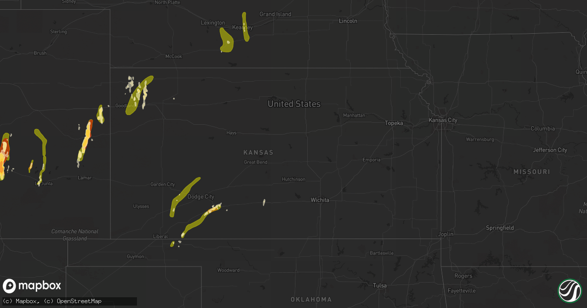
Hail Map in Kansas on May 9, 2015
Get this storm
May 9 map
$229
one time, instant access
Download today. No call, no setup
Keep the $229
Bought the map and want the full workflow? Apply the entire $229 to a subscription within 7 days. None of it is wasted.
Every map, not just this one
This buys you this map. Subscription and you get every map we run, in the markets you choose from a few cities to whole states to nationwide. Plus real-time alerts the moment a storm fires.
Contact data
Name, contact info, occupancy, even credit band for addresses in the footprint. You go from where it hit to who to call.
Become the source they trust
Unlimited branding weather history reports on demand. You already have the documented answer ready for the property owner, and you are the one who showed up with it.
Property data and RoofTrace estimates
Pull up any address you have got, its value and the exact code rules for that jurisdiction, straight from One Click Code. Then RoofTrace estimates the squares, pitch, and roof value, priced the way you price.
Storm reports in Kansas
Kansas
| Date | Description |
|---|---|
| 05/09/20152:10 PM CDT | Emergency manager reports pivots destroyed approximately 2 miles south of campus in nw gove county. Time is radar estimated. |
| 05/09/201511:48 AM CDT | A local report indicates 59 MPH wind near GARDEN CITY |
| 05/09/201511:35 AM CDT | A local report indicates 1.00 inch wind near 8 E PRATT |
| 05/08/201511:07 PM CDT | Trained spotter reports a tornado on the ground near traer. |
| 05/08/201511:02 PM CDT | Storm chaser reports power poles snapped along county rd 314 1 mile north of 346. |
| 05/08/201510:44 PM CDT | Tornado still on the ground sw of oberlin. |
| 05/08/201510:24 PM CDT | Tornado on the ground 7 miles nnw of selden. |
| 05/08/201510:22 PM CDT | A local report indicates 70 MPH wind near 2 E MACKSVILLE |
| 05/08/201510:20 PM CDT | Report of 1.25 inch hail. |
| 05/08/201510:17 PM CDT | Tornado on the ground nnw of selden. |
| 05/08/20159:55 PM CDT | Trained spotter reports a large... Multi-vortex tornado ese of rexford. |
| 05/08/20159:50 PM CDT | Trained spotter reports a tornado on the ground ne of menlo. |
| 05/08/20159:33 PM CDT | Trained spotter reports a large tornado on the ground with an intermittent small tornado as well. |
| 05/08/20159:23 PM CDT | Spotter reports a large wedge tornado on the ground 1 mile north of angelus. |
| 05/08/20159:12 PM CDT | Storm chaser reports a tornado on the ground northeast of oakley. |
| 05/08/20159:05 PM CDT | Law enforcement reports of road signs damaged 1 mile west of bird city. Time is radar estimated. |
| 05/08/20159:01 PM CDT | Trained spotter reports a tornado on the ground 1 mile northwest of grinnell. |
| 05/08/20158:54 PM CDT | A local report indicates 1.00 inch wind near BUCKLIN |
| 05/08/20158:51 PM CDT | Trained spotter reports a tornado on the ground 1 mile south of grinnell. |
| 05/08/20158:48 PM CDT | Emergency manager reports pivots destroyed approximately 2 miles south of campus in nw gove county. Time is radar estimated. |
| 05/08/20158:45 PM CDT | Trained spotter reports a tornado on the ground 3 miles east of oakley. |
| 05/08/20158:38 PM CDT | Tornado on the ground south of i-70 near grinnell. |
| 05/08/20158:38 PM CDT | Caller reports a tornado on the ground north of county road s. |
| 05/08/20158:38 PM CDT | Trained spotter reports a tornado on the ground 1 mile south of grinnell. |
| 05/08/20158:37 PM CDT | A local report indicates 1.00 inch wind near 1 N KINGSDOWN |
| 05/08/20158:16 PM CDT | Emergency manager reports a tornado on the ground intermittently. |
| 05/08/20158:12 PM CDT | Tornado on the ground. Live on kwch. |
| 05/08/20158:08 PM CDT | Caller reports a small tornado on the ground. |
| 05/08/20158:00 PM CDT | Spotter reports a large tornado on the ground. |
| 05/08/20157:58 PM CDT | Tornado on the ground. Reported by kwch. Also reported by local dispatch and spotters. |
| 05/08/20157:55 PM CDT | Spotter reports a tornado on the ground. |
| 05/08/20157:35 PM CDT | A local report indicates a tornado near 4 N COLLYER |
| 05/08/20157:32 PM CDT | Law enforcement reports a tornado north of interstate 70 mile marker 108. |
| 05/08/20157:28 PM CDT | A local report indicates a tornado near 2 N COLLYER |
| 05/08/20157:19 PM CDT | A local report indicates 1.00 inch wind near COPELAND |
Cities Impacted by Hail Map on May 9, 2015
- Avondale, CO
- Pueblo, CO
- Mingus, TX
- Gordon, TX
- Stephenville, TX
- Clarksville, TX
- Annona, TX
- Walters, OK
- Granbury, TX
- Bluff Dale, TX
- De Kalb, TX
- New Boston, TX
- Foreman, AR
- Marlow, OK
- Simms, TX
- Carlsbad, TX
- Robert Lee, TX
- Sterling City, TX
- Carbon, TX
- Eastland, TX
- Cisco, TX
- Ranger, TX
- Roosevelt, OK
- Iraan, TX
- Hico, TX
- Joshua, TX
- Cleburne, TX
- Eads, CO
- Desdemona, TX
- De Leon, TX
- Hugo, OK
- Boswell, OK
- Glen Rose, TX
- Duncan, OK
- Burlington, CO
- Arapahoe, CO
- Bogata, TX
- Dublin, TX
- Hooks, TX
- Kearney, NE
- Lipan, TX
- Stonewall, OK
- Ada, OK
- El Indio, TX
- Eagle Pass, TX
- Comanche, OK
- Randlett, OK
- Oklaunion, TX
- Devol, OK
- Electra, TX
- Temple, OK
- Vernon, TX
- Harrold, TX
- Lawton, OK
- Grandfield, OK
- Rush Springs, OK
- Tupelo, OK
- Ozona, TX
- Fort Stockton, TX
- Big Lake, TX
- Midkiff, TX
- Atoka, OK
- Colorado Springs, CO
- Avery, TX
- Bokchito, OK
- Caddo, OK
- Stratford, OK
- Bird City, KS
- Edson, KS
- Brewster, KS
- Woodson, TX
- Carrizo Springs, TX
- Ordway, CO
- Sidney, NE
- Meade, KS
- Throckmorton, TX
- Silverton, TX
- Pratt, KS
- McDonald, KS
- Colby, KS
- Levant, KS
- Roff, OK
- Fitzhugh, OK
- Ogden, AR
- Olney Springs, CO
- Quemado, TX
- Mullinville, KS
- Minneola, KS
- Rocky Ford, CO
- La Junta, CO
- Talco, TX
- Oxford, NE
- Tolar, TX
- Byars, OK
- Valley View, TX
- Collinsville, TX
- Kit Carson, CO
- Cheyenne Wells, CO
- San Angelo, TX
- Mertzon, TX
- Sanger, TX
- Denton, TX
- Allen, OK
- Sugar City, CO
- Ford, KS
- Bucklin, KS
- Breckenridge, TX
- Elmore City, OK
- Foster, OK
- Cement, OK
- Bronte, TX
- Boone, CO
- Forgan, OK
- Newcastle, TX
- Pilot Point, TX
- Tioga, TX
- Waurika, OK
- Ryan, OK
- Krum, TX
- Weatherford, TX
- Overton, NE
- Haworth, OK
- Minden, NE
- Sumner, TX
- Paris, TX
- Brookston, TX
- Powderly, TX
- Cyril, OK
- Godley, TX
- Tipton, OK
- Idabel, OK
- Turon, KS
- Honey Grove, TX
- Miles, TX
- Goodland, KS
- Loomis, NE
- Holdrege, NE
- Wynnewood, OK
- Pauls Valley, OK
- Rising Star, TX
- Shamrock, TX
- Moran, TX
- Stratton, CO
- Alma, AR
- Stringtown, OK
- Yoder, CO
- Cresson, TX
- Texarkana, TX
- Ashdown, AR
- Lindsay, OK
- Lockney, TX
- Quitaque, TX
- Turkey, TX
- Childress, TX
- Mount Pleasant, TX
- Ingalls, KS
- Hastings, OK
- Cross Plains, TX
- Fletcher, OK
- Saint Francis, KS
- Copeland, KS
- Caney, OK
- Selden, KS
- Mead, OK
- Calera, OK
- Sulphur, OK
- Van Buren, AR
- Rudy, AR
- Arthur City, TX
- Montezuma, KS
- Fittstown, OK
- Graham, TX
- Walnut Springs, TX
- Headrick, OK
- Mountain Park, OK
- Blair, OK
- Sublette, KS
- Maysville, OK
- Davidson, OK
- Hobart, OK
- Sweetwater, OK
- Sumner, NE
- Gorman, TX
- Baird, TX
- Peyton, CO
- Lane, OK
- Nemo, TX
- Rainbow, TX
- Iowa Park, TX
- Happy, TX
- Cartwright, OK
- Lone Wolf, OK
- Wingate, TX
- Parks, NE
- Santo, TX
- Wanette, OK
- Petty, TX
- Albany, TX
- Del Norte, CO
- Crowley, TX
- Windom, TX
- Calhan, CO
- Usaf Academy, CO
- Karval, CO
- Hugo, CO
- Ramah, CO
- Bethune, CO
- Swink, CO
- Arlington, CO
- Crowley, CO
- Grant, OK
- Thackerville, OK
- Gainesville, TX
- Marietta, OK
- Whitesboro, TX
- Fort Worth, TX
- Kingston, OK
- Madill, OK
- Gordonville, TX
- Durant, OK
- Sadler, TX
- Indiahoma, OK
- Mountain View, OK
- Altus, OK
- Burkburnett, TX
- Fowler, KS
- Englewood, KS
- Jetmore, KS
- Cimarron, KS
- Plains, KS
- Atwood, KS
- Atlanta, NE
- Orleans, NE
- Funk, NE
- Elm Creek, NE
- Alma, NE
- Bertrand, NE
- Riverdale, NE
- Pleasanton, NE


