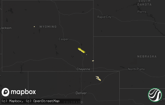
Hail Map in Wyoming on May 7, 2018
The weather event in Wyoming on May 7, 2018 includes Hail map. 10 states and 64 cities were impacted and suffered possible damage. The total estimated number of properties impacted is 895.

Hail
895
Estimated number of impacted properties by a 1.00" hail or larger0
Estimated number of impacted properties by a 1.75" hail or larger0
Estimated number of impacted properties by a 2.50" hail or largerStorm reports in Wyoming
Wyoming
| Date | Description |
|---|---|
| 05/07/20181:56 AM CDT | At 656 PM MDT, a severe thunderstorm was located near Pumpkin Buttes, or 22 miles west of Wright, moving southeast at 25 mph. HAZARD...Quarter size hail. SOURCE...Trained weather spotters. IMPACT...Damage to vehicles is expected. Locations impacted include... Pine Tree Junction and Pumpkin Buttes. |
| 05/07/20181:34 AM CDT | At 634 PM MDT, a severe thunderstorm was located over Keyhole Reservoir, or 24 miles west of Sundance, moving southeast at 45 mph. HAZARD...60 mph wind gusts and quarter size hail. SOURCE...Radar indicated. IMPACT...Hail damage to vehicles is expected. Expect wind damage to roofs, siding, and trees. Locations impacted include... Pine Haven and Keyhole Reservoir. This Includes Interstate 90 in Wyoming between Mile Markers 157 and179. |
| 05/06/201811:11 PM CDT | At 410 PM MDT, a severe thunderstorm was located near Aladdin, or 11 miles west of Belle Fourche, moving east at 15 mph. HAZARD...60 mph wind gusts and quarter size hail. SOURCE...Radar indicated. IMPACT...Hail damage to vehicles is expected. Expect wind damage to roofs, siding, and trees. Locations impacted include... Belle Fourche, Fruitdale and Belle Fourche Reservoir. |
| 05/06/20188:15 PM CDT | A local report indicates 1.00 inch wind near 12 SSW SUNDANCE |
| 05/06/20188:10 PM CDT | Facebook image shows hail ranging from half dollar to ping pong size |
| 05/06/20187:54 PM CDT | A local report indicates 1.00 inch wind near 10 WNW PINE TREE JUNCTI |
| 05/06/20187:42 PM CDT | A local report indicates 1.00 inch wind near PINE HAVEN |
| 05/06/20187:40 PM CDT | Facebook image shows hail ranging from half dollar to ping pong size |
All States Impacted by Hail Map on May 7, 2018
Cities Impacted by Hail Map on May 7, 2018
- Saint Francis, SD
- Kilgore, NE
- Valentine, NE
- Crookston, NE
- Custer, MT
- McLaughlin, SD
- Kaycee, WY
- Moorcroft, WY
- Jonesville, VA
- Johnstown, NE
- Hardin, MT
- Claremont, SD
- Belle Fourche, SD
- Aladdin, WY
- Beulah, WY
- Prairie City, SD
- Reva, SD
- Midland, SD
- Mission, SD
- Flasher, ND
- Carson, ND
- Eureka, SD
- Parmelee, SD
- Sundance, WY
- Upton, WY
- Worden, MT
- Kintyre, ND
- Bison, SD
- Decatur, AL
- Hartselle, AL
- Wood, SD
- Presho, SD
- Spearfish, SD
- Rushville, NE
- Forsyth, MT
- Closplint, KY
- Evarts, KY
- Wakpala, SD
- Devils Tower, WY
- Draper, SD
- Lemmon, SD
- Linton, ND
- Pikeville, KY
- Keldron, SD
- Blackwater, VA
- Duffield, VA
- Lodge Grass, MT
- Pompeys Pillar, MT
- Keokee, VA
- Elgin, ND
- Hebron, ND
- Mandan, ND
- Whitesburg, KY
- Rozet, WY
- Newland, NC
- Richardton, ND
- Strasburg, ND
- Kennebec, SD
- Kingsport, TN
- Hulett, WY
- Alva, WY
- Banner Elk, NC
- Bighorn, MT
- Gillette, WY


