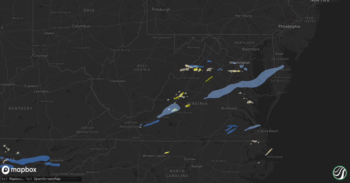
Hail Map in Virginia on May 4, 2021
Get this storm
May 4 map
$229
one time, instant access
Download today. No call, no setup
Keep the $229
Bought the map and want the full workflow? Apply the entire $229 to a subscription within 7 days. None of it is wasted.
Every map, not just this one
This buys you this map. Subscription and you get every map we run, in the markets you choose from a few cities to whole states to nationwide. Plus real-time alerts the moment a storm fires.
Contact data
Name, contact info, occupancy, even credit band for addresses in the footprint. You go from where it hit to who to call.
Become the source they trust
Unlimited branding weather history reports on demand. You already have the documented answer ready for the property owner, and you are the one who showed up with it.
Property data and RoofTrace estimates
Pull up any address you have got, its value and the exact code rules for that jurisdiction, straight from One Click Code. Then RoofTrace estimates the squares, pitch, and roof value, priced the way you price.
Storm reports in Virginia
Virginia
| Date | Description |
|---|---|
| 05/04/20216:32 PM CDT | Trees down along highway 17 south. Some small hail. |
| 05/04/20216:26 PM CDT | Numerous large tree branches down near the intersection of poplar neck road and teal lane |
| 05/04/20216:24 PM CDT | State route 3 closed at james b jones memorial hwy north of kilmarnock. |
| 05/04/20216:19 PM CDT | Wind damage along black stump road. |
| 05/04/20216:18 PM CDT | Trees down on houses along quarters cove drive. |
| 05/04/20216:15 PM CDT | Trees and power lines down across lancaster. |
| 05/04/20216:15 PM CDT | Large tree branch in roadway on 12000 block of jersey road |
| 05/04/20216:13 PM CDT | Wind damage at the end of merry point road. |
| 05/04/20216:12 PM CDT | Tree and a power line down. |
| 05/04/20215:56 PM CDT | Trees down. |
| 05/04/20215:55 PM CDT | Tree down at rainbow lane and water view rd in water view va. |
| 05/04/20215:40 PM CDT | Tree down on the 16000 block of james madison parkway |
| 05/04/20215:38 PM CDT | Tree and powerline down on the 6000 block of berry plains landing |
| 05/04/20215:35 PM CDT | Tree down blocking road near the intersection of washington mill road and windsor drive |
| 05/04/20215:33 PM CDT | 2 power poles broken along broad street rd. |
| 05/04/20215:28 PM CDT | Large branches down. Shingles off roofs. |
| 05/04/20215:20 PM CDT | Large tree branch down across road near the intersection of millbank road and st. Anthony's road |
| 05/04/20215:12 PM CDT | Tree and a power pole down near courtland. |
| 05/04/20215:05 PM CDT | Several trees down across eastern sussex county. |
| 05/04/20214:59 PM CDT | Tree down near the intersection of kings hwy and big timber road |
| 05/04/20214:58 PM CDT | Tree and powerline down on the 12400 block of beaver drive |
| 05/04/20214:57 PM CDT | Tree down on the 14300 block of millbank road |
| 05/04/20214:55 PM CDT | Trees and power lines are down at intersection of kings highway and leedstown rd. |
| 05/04/20214:53 PM CDT | Tree down. |
| 05/04/20214:52 PM CDT | Tree down on the 10000 block of indiantown road |
| 05/04/20214:52 PM CDT | Trees and power lines down blocking va route 3 near oak grove rd. |
| 05/04/20214:50 PM CDT | Trees are down and power lines are in the roadway on rt 634 claymont road. |
| 05/04/20214:47 PM CDT | Tree down on the 16000 block of nanzatico lane |
| 05/04/20214:43 PM CDT | Large tree downed. |
| 05/04/20214:42 PM CDT | Tree down blocking the westbound lane near the intersection of kings hwy and canterbury loop |
| 05/04/20214:40 PM CDT | Trees down along flatfoot rd. |
| 05/04/20214:38 PM CDT | Fencing was damaged at a plantation along ambassador ln. |
| 05/04/20214:38 PM CDT | Fencing was damaged at a plantation along ambassador ln. |
| 05/04/20214:35 PM CDT | Siding damaged on home. |
| 05/04/20214:35 PM CDT | Trees down along tidewater trail blocking several section of the highway. |
| 05/04/20214:28 PM CDT | Business 301 closed due to fallen trees. |
| 05/04/20214:25 PM CDT | Trees down widespread across caroline county. Fredericksburg highway blocked along with several other roads. |
| 05/04/20214:23 PM CDT | Trees down near i64. Winds estimated 60 mph. |
| 05/04/20214:22 PM CDT | Trees and power lines down. |
| 05/04/20214:22 PM CDT | Trees down along huguenot trail. |
| 05/04/20214:22 PM CDT | Trees and power lines down. |
| 05/04/20214:20 PM CDT | Chicken coop blown approximately 50 feet. Dog kennels were blown several feet. |
| 05/04/20214:18 PM CDT | Trees down. |
| 05/04/20214:04 PM CDT | *** 2 inj *** the goochland farmers market was hit with an estimated 65 mph thunderstorm wind gust. Two individuals were injured as a result of flying debris. Additiona |
| 05/04/20214:03 PM CDT | Multiple downed trees blocking roadways in southern spotsylvania county |
| 05/04/20214:03 PM CDT | Tree reported down on the 8600 block of fort hunt road. |
| 05/04/20214:02 PM CDT | *** 2 inj *** severe winds resulted in damage to the goochland farmers market. The market was open at the time and there where 2 injuries. Once person suffered a concus |
| 05/04/20214:01 PM CDT | Tree reported down on the 8600 block of stockton parkway. |
| 05/04/20214:01 PM CDT | Multiple trees down near lake anna in the holladay and kirk o'cliff neighborhoods. |
| 05/04/20214:00 PM CDT | Tree reported down on the 3200 block of woodland lane. |
| 05/04/20214:00 PM CDT | Pergola blown into an in-ground pool. |
| 05/04/20213:58 PM CDT | Two large trees reported down on spotters property. |
| 05/04/20213:56 PM CDT | Trees snapped along lake anna. |
| 05/04/20213:56 PM CDT | Oak trees uprooted off kentucky springs road near lake anna. |
| 05/04/20213:55 PM CDT | Corrects previous non-tstm wnd gst report from mineral. Mesonet station fw1208 mineral. |
| 05/04/20213:54 PM CDT | Large tree fell and crushed house. |
| 05/04/20213:54 PM CDT | Corrects previous tornado report from 1 wnw fredericks hall. Car flipped over. Silo and a barn damaged. Roofs are damaged. |
| 05/04/20213:50 PM CDT | Numerous trees down blocking roads. |
| 05/04/20213:48 PM CDT | Corrects previous tstm wnd gst report from 1 ese louisa airport. Airport manager reported peak wind of 77 kt. |
| 05/04/20213:47 PM CDT | Dozens of trees down blocking i64 east bound in western louisa. Numerous trees down blocking roads countrywide. |
| 05/04/20213:45 PM CDT | Tree on a home. |
| 05/04/20213:44 PM CDT | Downed tree blocking eastbound lanes of little river tpk |
| 05/04/20213:40 PM CDT | 2 power poles broken along broad street rd. Time corrected and estimated from radar. |
| 05/04/20213:39 PM CDT | Large tree uprooted at residence... Causing roof/wall/siding damage to corner of house |
| 05/04/20213:30 PM CDT | Downed tree blocking fox mill rd |
| 05/04/20213:30 PM CDT | 2 large trees downed. Many branches downed and blocking road. |
| 05/04/20213:28 PM CDT | Over 50 trees down across fluvanna. Widespread tree damage with many roads blocked across the county. |
| 05/04/20213:27 PM CDT | Numerous reports of trees down across roads... On houses... And on vehicles... And multiple power lines down around lake monticello. |
| 05/04/20213:26 PM CDT | A large tree fell and damaged a home in lake monticello. |
| 05/04/20213:24 PM CDT | Tree down along dixie hill road. |
| 05/04/20213:24 PM CDT | Tree down along holiday lake road. |
| 05/04/20213:20 PM CDT | Roof off of a barn... Porch roof lifted... Siding damage and numerous trees down. |
| 05/04/20213:20 PM CDT | Tree blew down on farmview road near intersection of route 28. |
| 05/04/20213:17 PM CDT | Tree blew down on 5000 block of catlett road. |
| 05/04/20213:15 PM CDT | Tree down in 7100 block of blenheim rd |
| 05/04/20213:15 PM CDT | Corrects previous tstm wnd dmg report from 5 nne centenary. Trees and power lines down near route 20. |
| 05/04/20213:14 PM CDT | Outbuilding damaged...roof removed. Updated to add several trees also downed in the area north of scottsville. |
| 05/04/20213:12 PM CDT | Tree down along liberty chapel road. |
| 05/04/20213:12 PM CDT | Pole and wires blew down on 4000 block of ringwood road. |
| 05/04/20213:11 PM CDT | Tree down along oakville road. |
| 05/04/20213:09 PM CDT | Measurement at fan mountain observatory |
| 05/04/20213:06 PM CDT | Large branches downed |
| 05/04/20213:00 PM CDT | Tree downed on green creek rd |
| 05/04/20212:59 PM CDT | Tree blew down onto turnbull road near intersection of springs road. |
| 05/04/20212:58 PM CDT | Tree down on i-64 near mm 108 |
| 05/04/20212:53 PM CDT | Downed trees blocking roadway near routes 620 and 831 |
| 05/04/20212:49 PM CDT | Multiple trees down on route 29 in lovingston. |
| 05/04/20212:49 PM CDT | Trees down in the fairview heights area. |
| 05/04/20212:49 PM CDT | Several trees down near the intersection of old allen creek ln. And richmond hwy. In gladstone... Va. |
| 05/04/20212:46 PM CDT | Two trees blew down on wilson hill road. |
| 05/04/20212:38 PM CDT | Trees down along wiggington road. |
| 05/04/20212:38 PM CDT | Two large trees downed. Some limbs downed as well. |
| 05/04/20212:31 PM CDT | *** 1 fatal *** tree down on car near b street causing 1 fatality. Time estimated from radar. |
| 05/04/20212:30 PM CDT | Several 4 inch diameter tree branches down. Power lines blown down. |
| 05/04/20212:30 PM CDT | Numerous very large trees down especially irvington springs rd at irvington park neighborhood. Time estimated by radar. |
| 05/04/20212:27 PM CDT | Multiple branches down on hopewell lane. |
| 05/04/20212:24 PM CDT | Multiple trees blew down on crabtree falls highway. |
| 05/04/20212:20 PM CDT | Tree reported down on the morgan ford road low river bridge. |
| 05/04/20212:19 PM CDT | Tree down along glasgow highway and bennetts run road. |
| 05/04/20212:17 PM CDT | Tree down along inch run ln. |
| 05/04/20212:17 PM CDT | Tree down along inch run ln. |
| 05/04/20212:15 PM CDT | Trees and power lines down near route 20. |
| 05/04/20212:14 PM CDT | Several trees down. |
| 05/04/20212:14 PM CDT | Tree down near intersection of river road and glasgow highway. |
| 05/04/20212:12 PM CDT | Mping report for quarter size hail. Radar time estimated |
| 05/04/20212:10 PM CDT | Tree reported down on cave hill road near general drive. |
| 05/04/20212:10 PM CDT | Tree blew down on us-211 west near intersection of us-340. |
| 05/04/20212:09 PM CDT | Tree reported down on the 3000 block of guard hill road. |
| 05/04/20212:07 PM CDT | Tree down on wines lane near kendrick ford road. |
| 05/04/20212:01 PM CDT | Tree blew down on 1600 block of egypt bend road. |
| 05/04/20212:00 PM CDT | Extensive damage to trees and structures at a farm along penicks mill road in the thaxton area. Several skylights blown out of a barn. A large shed moved 6 feet from it |
| 05/04/20212:00 PM CDT | At least two mobile homes blown off their foundation in the robincrest mobile home park between montvale and thaxton along the lynchburg-salem turnpike or u.s. 460. Sev |
| 05/04/20212:00 PM CDT | Spotter reports several large trees down blocking wildwood road near the food lion shopping center in the western part of salem city. |
| 05/04/20211:57 PM CDT | Large tree reported down on us 211 |
| 05/04/20211:57 PM CDT | Tree down along lithia road. |
| 05/04/20211:50 PM CDT | Tree down on a trailer along prease road. |
| 05/04/20211:50 PM CDT | The public reports a tree down on the northbound lane of the blue ridge parkway. |
| 05/04/20211:49 PM CDT | Tree reportdd down on edinburg gap road. |
| 05/04/20211:49 PM CDT | Tree down on the 100 block of lake rd. |
| 05/04/20211:49 PM CDT | Numerous trees reported down in the new market area. |
| 05/04/20211:49 PM CDT | A local report indicates 1.00 inch wind near 3 SSW MOUNT JACKSON |
| 05/04/20211:49 PM CDT | Tree blew down on river road near manor mill lane. |
| 05/04/20211:48 PM CDT | Updated hail size based on pictures received |
| 05/04/20211:47 PM CDT | Trees down along field ave in blue ridge. |
| 05/04/20211:47 PM CDT | Also 3 large trees down and power out. |
| 05/04/20211:47 PM CDT | Several trees down. |
| 05/04/20211:46 PM CDT | Tree reported down on jiggadly road near neese road. |
| 05/04/20211:45 PM CDT | A couple of trees and several limbs down along u.s. 11/460 in elliston. |
| 05/04/20211:43 PM CDT | Multiple trees reported down in the broadway area. |
| 05/04/20211:42 PM CDT | Trees down along archway road in blue ridge... Va. |
| 05/04/20211:40 PM CDT | Trees uprooted or snapped. Roof blown off. |
| 05/04/20211:39 PM CDT | Tree down atop mill mountain. |
| 05/04/20211:38 PM CDT | Tree down on the 800 block of spotswood rd. |
| 05/04/20211:37 PM CDT | One tree down along lakeview circle nw. |
| 05/04/20211:34 PM CDT | A tree was blown down at the intersection of brandon ave and canterbury road sw. |
| 05/04/20211:33 PM CDT | 3-inch tree limbs broken. Power poles broken. |
| 05/04/20211:33 PM CDT | Winds blew large limbs down in the 1900 block of greenwood road. |
| 05/04/20211:33 PM CDT | A tree was blown down at the intersection of 13th street sw and patterson ave. |
| 05/04/20211:32 PM CDT | A tree was blown down at the intersection of angus road and guernsey lane. |
| 05/04/20211:31 PM CDT | Tree down at the intersection of westside blvd nw and salem turnpike. |
| 05/04/20211:28 PM CDT | 30-50 foot tree snapped and felled. |
| 05/04/20211:27 PM CDT | Multiple limbs and two trees were blown down along apperson drive near the american legion. |
| 05/04/20211:25 PM CDT | Winds blew multiple limbs down along west riverside drive. |
| 05/04/20211:23 PM CDT | 2 large trees down along us-460 in the dixie caverns area. |
| 05/04/20211:20 PM CDT | Tree down on the 200 block of sugarloaf rd. |
| 05/04/20211:20 PM CDT | Large tree down in median of us 460 near big spring baptist church. |
| 05/04/20211:12 PM CDT | Tree down. |
| 05/04/20211:12 PM CDT | Two trees down. |
| 05/04/20211:12 PM CDT | One tree down. |
| 05/04/20211:08 PM CDT | Tree down in the 400 block of mount hermon rd. |
| 05/04/20211:06 PM CDT | Tree blew down on 400 block of mt hermon road. Road closed. |
| 05/04/20211:05 PM CDT | Large tree downed on residence along hemlock street. |
| 05/04/20211:00 PM CDT | Tree blown down on a house in the 5000 block of long shop road. |
| 05/04/202112:58 PM CDT | Lean-to display constructed with sheet metal and lumber at the intersection of centennial road and mccoy road destroyed. |
| 05/04/202112:58 PM CDT | Tree blown down across mccoy road between tipple road and centennial road. |
| 05/04/202112:57 PM CDT | Tree blown down across big falls road. |
| 05/04/20212:39 AM CDT | At 739 PM EDT, severe thunderstorms were located along a line extending from near Chesapeake to Elizabeth City, moving east at 45 mph. HAZARD...60 mph wind gusts and quarter size hail. SOURCE...Radar indicated. IMPACT...Minor damage to vehicles is possible. Expect wind damage to trees and powerlines. Severe thunderstorms will be near, Northwest around 745 PM EDT. Indiantown and Fentress around 750 PM EDT. Currituck around 755 PM EDT. Back Bay and Princess Anne around 800 PM EDT. Corolla around 805 PM EDT.Other locations impacted by these severe thunderstorms include PoplarBranch, Pierceville, Sigma, Tar Corner, Gregory, Sharon, Pungo,Barco, Spences Corner and Dam Neck. |
| 05/04/20212:15 AM CDT | At 715 PM EDT, a severe thunderstorm was located near Corapeake, or 9 miles northeast of Sunbury, moving east at 30 mph. HAZARD...60 mph wind gusts and quarter size hail. SOURCE...Radar indicated. IMPACT...Minor damage to vehicles is possible. Expect wind damage to trees and powerlines. This severe thunderstorm will be near, Northwest around 745 PM EDT.Other locations impacted by this severe thunderstorm includeHorseshoe, Pierceville, Tar Corner, Sharon, Lilly, Hickory andChesapeake Airport. |
| 05/04/20212:11 AM CDT | At 711 PM EDT, severe thunderstorms were located along a line extending from near Hayes to near Seaford to near Crittenden, moving east at 45 mph. HAZARD...60 mph wind gusts. SOURCE...Radar indicated. IMPACT...Expect damage to trees and powerlines. Severe thunderstorms will be near, Old Dominion University around 720 PM EDT. Hampton University, Fort Monroe and Norfolk NAS around 725 PM EDT. Ocean View, Norfolk, Buckroe Beach and Grand View around 730 PM EDT.Other locations impacted by these severe thunderstorms includeCarrollton, Lackey, Benns Church, Oriana, Huntersville, HiltonVillage, Chuckatuck, Newport News Golf Course, Wards Corner andOyster Point. |
| 05/04/20211:39 AM CDT | At 639 PM EDT, severe thunderstorms were located along a line extending from Claremont to near Elberon to near Ivor, moving east at 45 mph. HAZARD...60 mph wind gusts. SOURCE...Radar indicated. IMPACT...Expect damage to trees and powerlines. Severe thunderstorms will be near, Scotland around 650 PM EDT. Isle Of Wight, Fort Eustis, Kings Point and Jamestown around 655 PM EDT. Williamsburg, Smithfield, Christopher Newport University, Denbigh, York Terrace, Carver Gardens, Busch Gardens and Lee Hall around 700 PM EDT. Newport News, Patrick Henry Field, Tabb, Beaconsdale and Grove around 705 PM EDT. Hampton, Seaford, Langley AFB, Suffolk, Crittenden and Rescue around 710 PM EDT. Gloucester Point, Hampton University, Northampton and Grand View around 715 PM EDT.Other locations impacted by these severe thunderstorms includeRushmere, Pons, Carrollton, Chippokes State Park, Lackey, Longview,Benns Church, Oriana, Huntersville and Bethel Church. |
| 05/04/20211:12 AM CDT | At 612 PM EDT, severe thunderstorms were located along a line extending from near Disputanta to 8 miles southeast of Sussex, moving northeast at 40 mph. HAZARD...60 mph wind gusts and penny size hail. SOURCE...Radar indicated. IMPACT...Expect damage to trees and powerlines. Severe thunderstorms will be near, Waverly around 615 PM EDT. Wakefield and Ivor around 635 PM EDT. Surry around 640 PM EDT. Dendron, Scotland and Elberon around 645 PM EDT.Other locations impacted by these severe thunderstorms include BoothFork, Carsley, Pons, Chippokes State Park, Spring Grove, BethelChurch, Lumberton, Ellis Fork, Dory and Poolesville. |
| 05/04/202112:43 AM CDT | At 543 PM EDT, a severe thunderstorm was located near McKenney, moving east at 30 mph. HAZARD...60 mph wind gusts and penny size hail. SOURCE...Radar indicated. IMPACT...Expect damage to trees and powerlines. This severe thunderstorm will be near, Carson around 625 PM EDT.Other locations impacted by this severe thunderstorm includeTempleton, Reams and Prince George Golf. |
| 05/04/202112:35 AM CDT | At 535 PM EDT, a severe thunderstorm was located near Purdy, moving east at 30 mph. HAZARD...60 mph wind gusts and nickel size hail. SOURCE...Radar indicated. IMPACT...Expect damage to trees and powerlines. This severe thunderstorm will be near, Jarratt around 540 PM EDT. Stony Creek around 555 PM EDT. Sussex around 605 PM EDT. Homeville around 615 PM EDT.Other locations impacted by this severe thunderstorm include Gray,Newville, Booker, Yale, Fields Crossroads, Lumberton, Manry, Huske,Cowie Corner and Littleton. |
| 05/03/202111:59 PM CDT | At 459 PM EDT, severe thunderstorms were located along a line extending from near Sunnyside to near Rice, moving east at 45 mph. HAZARD...60 mph wind gusts. SOURCE...Radar indicated. IMPACT...Expect damage to trees and powerlines. Severe thunderstorms will be near, Ballsville, Tobaccoville and Sunnyside around 505 PM EDT. Macon around 515 PM EDT. Powhatan and Jetersville around 520 PM EDT. Morven around 525 PM EDT. Amelia Courthouse, Chula and Scotts Fork around 530 PM EDT.Other locations impacted by these severe thunderstorms includeAngola, Pilkinton, Winterham, Kingsville, Maplewood, Fine CreekMills, Grays Siding, Fergusonville, Deatonville and Holly Hills. |
| 05/03/202111:57 PM CDT | At 456 PM EDT, severe thunderstorms were located along a line extending from 12 miles east of Orange to near Mineral, moving east at 40 mph. HAZARD...60 mph wind gusts. SOURCE...Law enforcement. These storms have a history of producing tree damage. IMPACT...Damaging winds will cause some trees and large branches to fall. This could injure those outdoors, as well as damage homes and vehicles. Roadways may become blocked by downed trees. Localized power outages are possible. Unsecured light objects may become projectiles. Locations impacted include... Fredericksburg, Massaponax, Spotsylvania, Falmouth, Passapatanzy, Stones Corner, Leeland, Brokenburg, Snell, Spring Valley, Alsop, Gatewood, Chancellorsville, Partlow, Post Oak, Thornburg, White Oak, Brookfield and Cookstown. |
| 05/03/202111:52 PM CDT | At 451 PM EDT, severe thunderstorms were located along a line extending from 6 miles northeast of Louisa to near Bumpass to Trenholm, moving east at 60 mph. HAZARD...60 mph wind gusts and penny size hail. SOURCE...Radar indicated. IMPACT...Expect damage to trees and powerlines. Severe thunderstorms will be near, Bumpass around 500 PM EDT. Gum Spring around 505 PM EDT. Ladysmith, Oilville and Sabot around 510 PM EDT. Tuckahoe, Wyndham and Montpelier around 515 PM EDT. Bowling Green and Milford around 520 PM EDT. Ashland, Randolph Macon College, Fort A.p. Hill, Glen Allen and Laurel around 525 PM EDT. Hanover, Port Royal, Kings Dominion and Dawn around 530 PM EDT.Other locations impacted by these severe thunderstorms includeChilesburg, Orchid, Maidens, Gum Tree, Three Square, Fine CreekMills, Michaux, Atlee, West View and Ashcake. |
| 05/03/202111:41 PM CDT | At 440 PM EDT, a severe thunderstorm was located near Orange, moving east at 25 mph. HAZARD...60 mph wind gusts. SOURCE...Radar indicated. IMPACT...Damaging winds will cause some trees and large branches to fall. This could injure those outdoors, as well as damage homes and vehicles. Roadways may become blocked by downed trees. Localized power outages are possible. Unsecured light objects may become projectiles. Locations impacted include... Orange, Gordonsville, Mine Run, Rhoadesville, Parker, Everona, Verdiersville, Burr Hill, Madison Run, Locust Grove, Gold Dale, Thornhill, Nasons, Logan, Lahore, Glenora, Lake Of The Woods and Unionville. |
| 05/03/202111:12 PM CDT | At 412 PM EDT, severe thunderstorms were located along a line extending from 6 miles west of Lake Monticello to near Toga, moving east at 45 mph. HAZARD...60 mph wind gusts and penny size hail. SOURCE...Radar indicated. IMPACT...Expect damage to trees and powerlines. Severe thunderstorms will be near, Lake Monticello around 420 PM EDT. Palmyra and Troy around 425 PM EDT. Ferncliff, Boswells Tavern and Guinea Mills around 435 PM EDT. Cumberland around 440 PM EDT. Louisa and Sunnyside around 445 PM EDT. Tobaccoville and Lakeside Village around 450 PM EDT. Mineral, Cartersville, Trenholm and Ballsville around 455 PM EDT.Other locations impacted by these severe thunderstorms includeOrchid, Three Square, Central Plains, Bremo Bluff, Whiteville, WestView, Grays Siding, Wares Crossroads, Wilmington and Pemberton. |
| 05/03/202111:08 PM CDT | At 407 PM EDT, severe thunderstorms were located along a line extending from near Crozet to near Wingina, moving northeast at 55 mph. HAZARD...60 mph wind gusts. SOURCE...Law enforcement. Numerous trees have been downed in Nelson County. IMPACT...Damaging winds will cause some trees and large branches to fall. This could injure those outdoors, as well as damage homes and vehicles. Roadways may become blocked by downed trees. Localized power outages are possible. Unsecured light objects may become projectiles. Locations impacted include... Charlottesville, Campbell, Westmoreland, Hollymead, Ivy, Scottsville, Esmont, North Garden, Covesville, Stony Point, Flordon, Scott Stadium, Cobham, Cismont, Damon, Newcomb Hall, Batesville, Boyd Tavern, Monticello and Woodridge. |
| 05/03/202110:57 PM CDT | At 356 PM EDT, severe thunderstorms were located along a line extending from near The Plains to near Warrenton to 9 miles north of Culpeper, moving east at 35 mph. HAZARD...60 mph wind gusts. SOURCE...Radar indicated. IMPACT...Damaging winds will cause some trees and large branches to fall. This could injure those outdoors, as well as damage homes and vehicles. Roadways may become blocked by downed trees. Localized power outages are possible. Unsecured light objects may become projectiles. Locations impacted include... Warrenton, Linton Hall, Bull Run, Bealeton, Haymarket, Manassas, Sudley, Manassas Park, Gainesville, New Baltimore, Nokesville, Opal, Catlett, Calverton, Midland, Catharpin, Broken Hill, Amissville, Casanova and Jeffersonton. |
| 05/03/202110:50 PM CDT | At 349 PM EDT, a severe thunderstorm was located near Rustburg, moving east at 40 mph. HAZARD...60 mph wind gusts. SOURCE...Radar indicated. IMPACT...Expect damage to roofs, siding, and trees. Locations impacted include... Appomattox... Red House... Concord... Rustburg... Pamplin City... Madisonville... and Appomattox National Historic Park. |
| 05/03/202110:36 PM CDT | At 336 PM EDT, severe thunderstorms were located along a line extending from near Montebello to near Amherst, moving northeast at 45 mph. HAZARD...60 mph wind gusts. SOURCE...Radar indicated. IMPACT...Damaging winds will cause some trees and large branches to fall. This could injure those outdoors, as well as damage homes and vehicles. Roadways may become blocked by downed trees. Localized power outages are possible. Unsecured light objects may become projectiles. Locations impacted include... Crozet, Shipman, Schuyler, Wintergreen, Montebello, Afton, Nellysford, Arrington, Scottsville, Esmont, Lovingston, Allens Creek, North Garden, Covesville, Yancey Mills, Tyro, Buffalo Springs, Norwood, Jonesboro and Gladstone. |
| 05/03/202110:35 PM CDT | At 334 PM EDT, a severe thunderstorm was located near Amherst, moving east at 35 mph. HAZARD...60 mph wind gusts. SOURCE...Radar indicated. IMPACT...Expect damage to roofs, siding, and trees. Locations impacted include... Amherst... Forks Of Buffalo... Bent Creek... Concord... Clifford... Stonewall... and Tower Hill. |
| 05/03/202110:31 PM CDT | At 331 PM EDT, a severe thunderstorm was located over Madison, moving northeast at 30 mph. HAZARD...60 mph wind gusts and quarter size hail. SOURCE...Radar indicated. IMPACT...Damaging winds will cause some trees and large branches to fall. This could injure those outdoors, as well as damage homes and vehicles. Roadways may become blocked by downed trees. Localized power outages are possible. Unsecured light objects may become projectiles. Locations impacted include... Culpeper, Madison, Brightwood, Catalpa, Brandy Station, Oakpark, Pratts, Aroda, Cardova, Reva, Fordsville, Leon and Alanthus. |
| 05/03/202110:08 PM CDT | At 308 PM EDT, a severe thunderstorm was located 10 miles southwest of Front Royal, moving east at 30 mph. HAZARD...60 mph wind gusts. SOURCE...Radar indicated. IMPACT...Damaging winds will cause some trees and large branches to fall. This could injure those outdoors, as well as damage homes and vehicles. Roadways may become blocked by downed trees. Localized power outages are possible. Unsecured light objects may become projectiles. Locations impacted include... Front Royal, Hume, Linden, Chester Gap, Flint Hill, Washington, Huntly, Arco, Compton, Seven Fountains, Dilbeck, Hackleys Crossroads, Fourway, Cresthill, Orlean, Karo, Glen Echo, Bentonville, Markham and Browntown. |
| 05/03/202110:05 PM CDT | At 304 PM EDT, a severe thunderstorm was located over Collierstown, moving east at 65 mph. HAZARD...60 mph wind gusts. SOURCE...Radar indicated. IMPACT...Expect damage to roofs, siding, and trees. Locations impacted include... Lexington... Collierstown... Rockbridge Baths... Cornwall... Lowesville... Alto... and Fairfield.This includes The following Location VMI. |
| 05/03/20219:57 PM CDT | At 256 PM EDT, a severe thunderstorm was located over Vesuvius, or 10 miles east of Rockbridge Baths, moving east at 35 mph. HAZARD...60 mph wind gusts and quarter size hail. SOURCE...Radar indicated. IMPACT...Damaging winds will cause some trees and large branches to fall. This could injure those outdoors, as well as damage homes and vehicles. Roadways may become blocked by downed trees. Localized power outages are possible. Unsecured light objects may become projectiles. Locations impacted include... Stuarts Draft, Sherando, Wintergreen, Montebello, Afton, Lyndhurst, Nellysford, Greenfield, Spottswood and Afton Mountain. |
| 05/03/20219:53 PM CDT | At 253 PM EDT, a severe thunderstorm was located over Montvale, moving northeast at 30 mph. HAZARD...60 mph wind gusts. SOURCE...Radar indicated. IMPACT...Expect damage to roofs, siding, and trees. Locations impacted include... Lynchburg... Buena Vista... Bedford... Buchanan... Glasgow... Big Island... and Montvale.This includes The following Locations Liberty University, TheNational D-Day Memorial, and Lynchburg Airport. |
| 05/03/20219:32 PM CDT | At 231 PM EDT, a severe thunderstorm was located near Vesuvius, or 11 miles east of Rockbridge Baths, moving northeast at 25 mph. HAZARD...60 mph wind gusts and quarter size hail. SOURCE...Radar indicated. IMPACT...Damaging winds will cause some trees and large branches to fall. This could injure those outdoors, as well as damage homes and vehicles. Roadways may become blocked by downed trees. Localized power outages are possible. Unsecured light objects may become projectiles. Locations impacted include... Waynesboro, Stuarts Draft, Sherando, Fishersville, Lyndhurst, Greenville, Hermitage, Spottswood and Afton Mountain. |
| 05/03/20219:27 PM CDT | At 226 PM EDT, a severe thunderstorm was located near Basye-Bryce Mountain, or 18 miles southwest of Woodstock, moving east at 30 mph. HAZARD...60 mph wind gusts and quarter size hail. SOURCE...Radar indicated. IMPACT...Damaging winds will cause some trees and large branches to fall. This could injure those outdoors, as well as damage homes and vehicles. Roadways may become blocked by downed trees. Localized power outages are possible. Unsecured light objects may become projectiles. Locations impacted include... Woodstock, Luray, Timberville, Mount Jackson, Basye-Bryce Mountain, New Market, Basye, Edinburg, Orkney Springs, Kings Crossing, Shenandoah Caverns, Harmony, Hamburg, Quicksburg, Fairview, Saint Davids Church, Hawkinstown, Forestville and Mount Clifton. |
| 05/03/20219:22 PM CDT | At 222 PM EDT, a severe thunderstorm was located over Shawsville, moving northeast at 30 mph. HAZARD...60 mph wind gusts and quarter size hail. SOURCE...Radar indicated. IMPACT...Hail damage to vehicles is expected. Expect wind damage to roofs, siding, and trees. Locations impacted include... Roanoke... Blacksburg... Salem... Christiansburg... Vinton... Troutville... and Boones Mill.This includes The following Locations The Salem Fairgrounds andRoanoke Regional Airport. |
| 05/03/20219:15 PM CDT | At 215 PM EDT, a severe thunderstorm was located 10 miles north of Brownsburg, or 12 miles southwest of Staunton, moving northeast at 35 mph. HAZARD...60 mph wind gusts and quarter size hail. SOURCE...Radar indicated. IMPACT...Damaging winds will cause some trees and large branches to fall. This could injure those outdoors, as well as damage homes and vehicles. Roadways may become blocked by downed trees. Localized power outages are possible. Unsecured light objects may become projectiles. Locations impacted include... Staunton, Verona, Weyers Cave, New Hope, Mount Sidney, Middlebrook, Churchville, Moscow, Summerdean, Trimbles Mill, Christian, Fort Defiance, Swoope, Staunton Airport and Mint Spring. |
| 05/03/20219:15 PM CDT | At 215 PM EDT, a severe thunderstorm was located over Longdale Furnace, or near Clifton Forge, moving northeast at 30 mph. HAZARD...60 mph wind gusts and quarter size hail. SOURCE...Radar indicated. IMPACT...Hail damage to vehicles is expected. Expect wind damage to roofs, siding, and trees. Locations impacted include... Lexington... Clifton Forge... Goshen... Collierstown... Rockbridge Baths... Millboro... and Iron Gate.This includes The following Location VMI. |
| 05/03/20218:48 PM CDT | At 148 PM EDT, a severe thunderstorm was located over Rough Run, moving east at 35 mph. HAZARD...60 mph wind gusts and quarter size hail. SOURCE...Radar indicated. IMPACT...Damaging winds will cause some trees and large branches to fall. This could injure those outdoors, as well as damage homes and vehicles. Roadways may become blocked by downed trees. Localized power outages are possible. Unsecured light objects may become projectiles. Locations impacted include... Rough Run, Basye-Bryce Mountain, Mathias, Basye, Masonville, Orkney Springs, Milam, Lost City, Lost River, Landes, Dorcas and Brake. |
| 05/03/20218:41 PM CDT | At 141 PM EDT, a severe thunderstorm was located near Claytor Lake State Park, or near Allisonia, moving northeast at 25 mph. HAZARD...60 mph wind gusts. SOURCE...Radar indicated. IMPACT...Expect damage to roofs, siding, and trees. Locations impacted include... Blacksburg... Christiansburg... Radford... Pulaski... Dublin... Pilot... and Shawsville.This includes The following Location Virginia Tech. |
| 05/03/20218:05 PM CDT | Powerlines down across the intersection of beaver drive and thunder road |
All States Impacted by Hail Map on May 4, 2021
Cities Impacted by Hail Map on May 4, 2021
- Saulsbury, TN
- Walnut, MS
- Ashland, MS
- Michigan City, MS
- Morton, MS
- Pelahatchie, MS
- Sulphur, LA
- French Settlement, LA
- Maurepas, LA
- Saint Amant, LA
- Clanton, AL
- Verbena, AL
- Billingsley, AL
- Martindale, TX
- Milam, WV
- Bergton, VA
- Moorefield, WV
- Waterford, MS
- Como, MS
- Holly Springs, MS
- Abbeville, MS
- Ruleville, MS
- Doddsville, MS
- Cleveland, MS
- Valley, AL
- Opelika, AL
- Hamilton, GA
- Cusseta, AL
- West Point, GA
- Salem, AL
- Smithville, TX
- Palacios, TX
- Florence, MS
- Frierson, LA
- Stonewall, LA
- Quicksburg, VA
- New Market, VA
- Timberville, VA
- Mount Jackson, VA
- Weogufka, AL
- Equality, AL
- Eclectic, AL
- Rockford, AL
- Alexander City, AL
- Elmore, AL
- Titus, AL
- Prattville, AL
- Deatsville, AL
- Wetumpka, AL
- Millbrook, AL
- Marbury, AL
- Ashburn, GA
- Pheba, MS
- Maben, MS
- Lamar, MS
- Bastrop, TX
- Red Rock, TX
- Cedar Creek, TX
- Florien, LA
- Steeles Tavern, VA
- Greenville, VA
- Raphine, VA
- Heflin, AL
- Anniston, AL
- Sardis, MS
- Crenshaw, MS
- Wilsonville, AL
- Columbiana, AL
- Gary, TX
- Tenaha, TX
- Timpson, TX
- Cameron, SC
- Effie, LA
- Jonesville, LA
- Marksville, LA
- Pennington, TX
- Groveton, TX
- Apple Springs, TX
- Kennard, TX
- Nacogdoches, TX
- Lafayette, AL
- Camp Hill, AL
- Five Points, AL
- Lanett, AL
- Moorhead, MS
- Indianola, MS
- Bienville, LA
- Crosby, MS
- Brent, AL
- Williston, SC
- Bedford, VA
- Big Island, VA
- Rolling Fork, MS
- Glen Allan, MS
- Hollandale, MS
- Mayersville, MS
- Anguilla, MS
- Lumberton, TX
- Kountze, TX
- Lockhart, TX
- Caldwell, TX
- Jasper, AL
- Vesuvius, VA
- Tyro, VA
- Montebello, VA
- Draper, VA
- Hamburg, AR
- Ragley, LA
- Starks, LA
- Lake Charles, LA
- Longville, LA
- Mittie, LA
- Dequincy, LA
- Oakdale, LA
- Kinder, LA
- Singer, LA
- Oberlin, LA
- Dry Creek, LA
- Iowa, LA
- Reeves, LA
- Warrior, AL
- Dora, AL
- Empire, AL
- Brenham, TX
- Ruffin, SC
- Islandton, SC
- Lovelady, TX
- Trinity, TX
- Amite, LA
- Holden, LA
- Walker, LA
- Dale, TX
- Dermott, AR
- Goode, VA
- Fulks Run, VA
- Broadway, VA
- Mathias, WV
- Criders, VA
- Middlebrook, VA
- Kyle, TX
- Philadelphia, MS
- Carthage, MS
- Jemison, AL
- Luray, VA
- Gloster, MS
- Centreville, MS
- Baytown, TX
- Brandywine, WV
- Franklin, WV
- Greenville, MS
- Windsor, SC
- Blackville, SC
- Parrish, AL
- Cordova, AL
- Montrose, AR
- Crossett, AR
- Woodville, MS
- Batchelor, LA
- Bessemer, AL
- Birmingham, AL
- McCalla, AL
- Huntington, TX
- Dayton, TX
- Amissville, VA
- Sperryville, VA
- Flint Hill, VA
- Washington, VA
- Woodville, VA
- Castleton, VA
- Saltillo, MS
- Jackson, MS
- Crystal Springs, MS
- Giddings, TX
- La Grange, TX
- Summerton, SC
- Pinewood, SC
- Gibsland, LA
- Lufkin, TX
- Greensburg, LA
- Orangeburg, SC
- Pleasant Shade, TN
- Haughton, LA
- Elm Grove, LA
- Lake, MS
- Browns Summit, NC
- Greensboro, NC
- Summerfield, NC
- Canton, MS
- Brandon, MS
- Hiwassee, VA
- Roxie, MS
- Meadville, MS
- Pulaski, MS
- Forest, MS
- Raleigh, MS
- Fairfield, VA
- Buena Vista, VA
- Lexington, VA
- Ledbetter, TX
- Huffman, TX
- Lexington, TX
- Rockdale, TX
- Lagrange, GA
- Camden, SC
- Jamestown, LA
- Castor, LA
- Cary, MS
- Burton, TX
- Calera, AL
- Shelby, AL
- Potts Camp, MS
- Oxford, MS
- Shreveport, LA
- McDade, TX
- Elgin, TX
- Carmine, TX
- Satartia, MS
- Sylacauga, AL
- Vidalia, LA
- Ackerman, MS
- Eupora, MS
- Mathiston, MS
- Crosby, TX
- Hickory Flat, MS
- Myrtle, MS
- Madison, MS
- Ridgeland, MS
- Clinton, MS
- Camden, MS
- Woodbury, TN
- Summit, MS
- Smithdale, MS
- Simmesport, LA
- Lettsworth, LA
- Jacksonville, AL
- Eagle Rock, VA
- Clifton Forge, VA
- Booneville, MS
- Georgetown, MS
- Harrisville, MS
- Huger, SC
- Cordesville, SC
- Moncks Corner, SC
- Taylorsville, MS
- Eros, LA
- West Monroe, LA
- Hornbeck, LA
- Woodbridge, VA
- Keithville, LA
- Marietta, MS
- Bastrop, LA
- Saint Matthews, SC
- Jamaica, VA
- Lancaster, VA
- Little Plymouth, VA
- Church View, VA
- Urbanna, VA
- Water View, VA
- Bentonia, MS
- Vaughan, MS
- McCarley, MS
- Winona, MS
- Coila, MS
- Elloree, SC
- Collinston, LA
- Mer Rouge, LA
- Tallulah, LA
- Watson, AR
- Vidor, TX
- Hazlehurst, MS
- Kingsbury, TX
- San Marcos, TX
- Noxapater, MS
- New Albany, MS
- South Mills, NC
- Mendenhall, MS
- Magee, MS
- Cheneyville, LA
- Denham Springs, LA
- Murfreesboro, TN
- Mount Olive, MS
- Mize, MS
- Bryan, TX
- Cherokee, AL
- Benton, MS
- Waverly, AL
- Dunnsville, VA
- Baldwyn, MS
- Saint Martinville, LA
- Round Top, TX
- Brooks, GA
- Senoia, GA
- Rayville, LA
- Gay, GA
- Luthersville, GA
- Greenville, GA
- Catherine, AL
- Camden, AL
- Edinburg, VA
- Orkney Springs, VA
- Amherst, VA
- Poplar Branch, NC
- Grandy, NC
- Collinsville, MS
- Rockbridge Baths, VA
- Tuscumbia, AL
- Liberty, TN
- Dowelltown, TN
- Smithville, TN
- Union, MS
- Decatur, MS
- Sunbury, NC
- Corapeake, NC
- Little Rock, MS
- Chunky, MS
- Hickory, MS
- Meridian, MS
- Newton, MS
- New Braunfels, TX
- Centreville, AL
- Banner, MS
- Water Valley, MS
- Somerville, TX
- Columbia, NC
- Navasota, TX
- Marion, LA
- Braxton, MS
- Pearl, MS
- Terry, MS
- Byram, MS
- Richland, MS
- Louin, MS
- Starkville, MS
- Suffolk, VA
- Farmerville, LA
- Hogansville, GA
- Franklin, GA
- Coffeeville, MS
- Itta Bena, MS
- Greenwood, MS
- Schlater, MS
- Bay Springs, MS
- De Kalb, MS
- Eutaw, AL
- Maxwell, TX
- Seguin, TX
- Bruce, MS
- Sunflower, MS
- Manning, SC
- Sharpsburg, GA
- Grantville, GA
- Moreland, GA
- Newnan, GA
- Warrenton, VA
- Catlett, VA
- Epps, LA
- Dadeville, AL
- Bunkie, LA
- Paige, TX
- Delta, AL
- Leesville, LA
- Bryans Road, MD
- Inverness, MS
- Tappahannock, VA
- Champlain, VA
- Ralph, AL
- Gore Springs, MS
- Grenada, MS
- Saint Landry, LA
- Deridder, LA
- Fort Polk, LA
- Pitkin, LA
- Maplesville, AL
- Thorsby, AL
- Brierfield, AL
- Pelham, AL
- Childersburg, AL
- Alabaster, AL
- Montevallo, AL
- Helena, AL
- Randolph, AL
- Bude, MS
- Liberty, MS
- Cedarbluff, MS
- West Point, MS
- Golden, MS
- Oakman, AL
- Adger, AL
- Trussville, AL
- Odenville, AL
- Monroe, LA
- Lake Village, AR
- Flora, MS
- Lugoff, SC
- Pontotoc, MS
- Accokeek, MD
- Indian Head, MD
- Muscle Shoals, AL
- Leighton, AL
- Catawba, SC
- Rock Hill, SC
- Lorton, VA
- Ragland, AL
- Pell City, AL
- Pinola, MS
- Livingston, LA
- Buchanan, VA
- Nokesville, VA
- Waldorf, MD
- Manassas, VA
- Dumfries, VA
- Warsaw, VA
- Granville, TN
- Gainesboro, TN
- Salters, SC
- Ethel, LA
- Clinton, LA
- Slaughter, LA
- McGehee, AR
- Arkansas City, AR
- Lancaster, SC
- Ruth, MS
- Jeanerette, LA
- Boligee, AL
- Lake Providence, LA
- Boyle, MS
- Cottageville, SC
- Ridgeville, SC
- Natchez, MS
- Manor, TX
- Corolla, NC
- Shiloh, NC
- Downsville, LA
- Moreauville, LA
- Stuarts Draft, VA
- Lyndhurst, VA
- Fayetteville, TN
- Frankewing, TN
- Leland, MS
- West Blocton, AL
- Townley, AL
- Charleston, SC
- Goose Creek, SC
- Ladson, SC
- North Charleston, SC
- Minter City, MS
- Philipp, MS
- Charleston, MS
- Pierre Part, LA
- Oak Ridge, LA
- Sterlington, LA
- Marshall, TX
- Evergreen, LA
- Morrow, LA
- Washington, LA
- Griffin, GA
- Weir, MS
- Newhebron, MS
- Chatham, LA
- Austin, TX
- Waskom, TX
- Oak Grove, LA
- Beulah, MS
- Benoit, MS
- Lawrence, MS
- Conehatta, MS
- Greenfield, TN
- Sharon, TN
- Martin, TN
- McBee, SC
- Monticello, AR
- Springville, AL
- Holcomb, MS
- Bedias, TX
- Adamsville, AL
- Petersburg, WV
- Hearne, TX
- Marshall, VA
- Duck Hill, MS
- Mississippi State, MS
- Duncanville, AL
- Moundville, AL
- Lena, MS
- Ringgold, LA
- Livingston, TX
- Cookeville, TN
- Monterey, TN
- Bossier City, LA
- Chestnut Mound, TN
- Elmwood, TN
- Del Valle, TX
- Shaw, MS
- Ranburne, AL
- Tishomingo, MS
- New Site, MS
- Bernice, LA
- Glasgow, VA
- Natural Bridge, VA
- Oxford, AL
- Yazoo City, MS
- Grand Cane, LA
- Mansfield, LA
- Calhoun, LA
- Jonesboro, LA
- Natchitoches, LA
- Campti, LA
- Goldonna, LA
- Winnfield, LA
- Mangham, LA
- Hollytree, AL
- Woodville, AL
- Paint Rock, AL
- Trenton, AL
- Scottsboro, AL
- Lynn, AL
- Double Springs, AL
- Haleyville, AL
- Houston, AL
- Nauvoo, AL
- Vinemont, AL
- Cullman, AL
- Addison, AL
- Arley, AL
- Logan, AL
- Bryant, AL
- Hollywood, AL
- Higdon, AL
- Stevenson, AL
- Flat Rock, AL
- Trenton, GA
- Rising Fawn, GA
- Pisgah, AL
- Gardendale, AL
- Fultondale, AL
- Mount Olive, AL
- Sumiton, AL
- Fort Deposit, AL
- Honoraville, AL
- Greenville, AL
- Pitts, GA
- Smiths Station, AL
- Preston, GA
- Cataula, GA
- Leslie, GA
- Rochelle, GA
- Ellenton, GA
- Adel, GA
- Reynolds, GA
- Pike Road, AL
- Oglethorpe, GA
- Omaha, GA
- De Soto, GA
- Camilla, GA
- Alapaha, GA
- Fitzgerald, GA
- Baconton, GA
- Ocilla, GA
- Warwick, GA
- Tallassee, AL
- Plains, GA
- Albany, GA
- Poulan, GA
- Andersonville, GA
- Columbus, GA
- Ideal, GA
- Rebecca, GA
- Box Springs, GA
- Ellaville, GA
- Talbotton, GA
- Shiloh, GA
- Oakfield, GA
- Unadilla, GA
- Pinehurst, GA
- Seale, AL
- Booth, AL
- Fitzpatrick, AL
- Hayneville, AL
- Lowndesboro, AL
- Buena Vista, GA
- Weston, GA
- Phenix City, AL
- Smithville, GA
- Auburn University, AL
- Georgetown, GA
- Tuskegee, AL
- Notasulga, AL
- Sparks, GA
- Ramer, AL
- Newton, GA
- Americus, GA
- Sale City, GA
- Bronwood, GA
- Cobb, GA
- Richland, GA
- Hardaway, AL
- Ty Ty, GA
- Ellerslie, GA
- Tifton, GA
- Sycamore, GA
- Enigma, GA
- Arabi, GA
- Fort Benning, GA
- Hurtsboro, AL
- Pittsview, AL
- Vienna, GA
- Cusseta, GA
- Fort Mitchell, AL
- Mauk, GA
- Tuskegee Institute, AL
- Byromville, GA
- Tyler, AL
- Fort Davis, AL
- Kellyton, AL
- Shellman, GA
- Autaugaville, AL
- Norman Park, GA
- Mathews, AL
- Rupert, GA
- Nashville, GA
- Sumner, GA
- Montgomery, AL
- Chula, GA
- Parrott, GA
- Junction City, GA
- Leesburg, GA
- Fortson, GA
- Marshallville, GA
- Shorter, AL
- Lumpkin, GA
- Upatoi, GA
- Eufaula, AL
- Clayton, AL
- Lenox, GA
- Butler, GA
- Midway, AL
- Moultrie, GA
- Jacksons Gap, AL
- Montezuma, GA
- Cuthbert, GA
- Midland, GA
- Auburn, AL
- Waverly Hall, GA
- Omega, GA
- Hatchechubbee, AL
- Doerun, GA
- Cordele, GA
- Morris, GA
- Sylvester, GA
- Cecil, AL
- Dawson, GA
- Hartsfield, GA
- Hope Hull, AL
- Pine Mountain, GA
- Union Springs, AL
- Dalton, GA
- Ringgold, GA
- Chatsworth, GA
- Rocky Face, GA
- La Fayette, GA
- Tunnel Hill, GA
- Rock Spring, GA
- Chickamauga, GA
- Powder Springs, GA
- Dallas, GA
- Hiram, GA
- Culpeper, VA
- Madison, VA
- Leon, VA
- Brightwood, VA
- Reva, VA
- Rochelle, VA
- Pratts, VA
- Arrington, VA
- Pelion, SC
- Columbia, SC
- Lexington, SC
- West Columbia, SC
- Cassatt, SC
- Patrick, SC
- Jefferson, SC
- Bethune, SC
- Cheraw, SC
- Wallace, SC
- Bishopville, SC
- Rockingham, NC
- Hartsville, SC
- Society Hill, SC
- Chesterfield, SC
- Bennettsville, SC
- Elgin, SC
- Hamlet, NC
- Blythewood, SC
- Ridgeway, SC
- Winnsboro, SC
- Norway, SC
- Branchville, SC
- Rowesville, SC
- Bowman, SC
- Clinton, MD
- Temple Hills, MD
- Andrews Air Force Base, MD
- Suitland, MD
- Fort Washington, MD
- Oxon Hill, MD
- Upper Marlboro, MD
- Brandywine, MD
- Coupland, TX
- Weedville, PA
- Pulaski, VA
- Roanoke, VA
- Bent Mountain, VA
- Christiansburg, VA
- Shawsville, VA
- Callaway, VA
- Check, VA
- Pilot, VA
- Radford, VA
- Riner, VA
- Copper Hill, VA
- Monroe, VA
- Troutville, VA
- Natural Bridge Station, VA
- Fincastle, VA
- Cloverdale, VA
- Thaxton, VA
- Coleman Falls, VA
- Montvale, VA
- Blue Ridge, VA
- Daleville, VA
- Salem, VA
- Fort Valley, VA
- Rileyville, VA
- Basye, VA
- Front Royal, VA
- Linden, VA
- Vienna, VA
- Dunn Loring, VA
- Falls Church, VA
- Fairfax, VA
- Spotsylvania, VA
- Secretary, MD
- Vienna, MD
- Great Mills, MD
- Bowling Green, VA
- Colonial Beach, VA
- Ruther Glen, VA
- Valley Lee, MD
- Madison, MD
- California, MD
- Columbia, VA
- Seaford, DE
- Avenue, MD
- Montross, VA
- Lexington Park, MD
- Chaptico, MD
- Crapo, MD
- Lusby, MD
- Fredericksburg, VA
- Hollywood, MD
- Louisa, VA
- Bushwood, MD
- Palmyra, VA
- Mineral, VA
- Church Creek, MD
- Kents Store, VA
- Bumpass, VA
- Trappe, MD
- Ellendale, DE
- Leonardtown, MD
- Newburg, MD
- Troy, VA
- Greenwood, DE
- Port Royal, VA
- Bridgeville, DE
- Issue, MD
- Woolford, MD
- Taylors Island, MD
- Fishing Creek, MD
- Georgetown, DE
- Callaway, MD
- Woodford, VA
- Partlow, VA
- Federalsburg, MD
- Rappahannock Academy, VA
- Abell, MD
- Solomons, MD
- Scottsville, VA
- Hurlock, MD
- Preston, MD
- Linkwood, MD
- Patuxent River, MD
- Park Hall, MD
- Drayden, MD
- Clements, MD
- Mechanicsville, MD
- Loveville, MD
- King George, VA
- Rhodesdale, MD
- Tall Timbers, MD
- Montpelier, VA
- Dowell, MD
- Beaverdam, VA
- East New Market, MD
- Coltons Point, MD
- Cobb Island, MD
- Milford, VA
- Cambridge, MD
- Milton, DE
- Stony Creek, VA
- Jarratt, VA
- Waverly, VA
- Emporia, VA
- Yale, VA
- Carson, VA
- Dinwiddie, VA
- Disputanta, VA
- Fort Monroe, VA
- Zuni, VA
- Smithfield, VA
- Hampton, VA
- Windsor, VA
- Carrollton, VA
- Newport News, VA
- Alexandria, TN
- Watertown, TN
- Oak Ridge, TN
- Harriman, TN
- Rockwood, TN
- Clinton, TN
- Pleasant Hill, TN
- Crab Orchard, TN
- Oliver Springs, TN
- Crossville, TN
- Sparta, TN
- Walling, TN
- Wartburg, TN
- Oakdale, TN
- Rock Island, TN
- Mcminnville, TN
- Bradyville, TN
- Louisville, TN
- Walland, TN
- Farragut, TN
- Maryville, TN
- Seymour, TN
- Rockford, TN
- Knoxville, TN
- Alcoa, TN
- Lenoir City, TN
- Carrollton, MS
- Emelle, AL
- Franklinton, LA
- Lisman, AL
- Mantee, MS
- Louise, MS
- Redwood, MS
- Hamilton, AL
- Akron, AL
- North Carrollton, MS
- Kosciusko, MS
- Dickinson, AL
- Bellamy, AL
- Goodman, MS
- Vina, AL
- Bogue Chitto, MS
- Louisville, MS
- Petal, MS
- Shubuta, MS
- Bailey, MS
- Daleville, MS
- Roseland, LA
- Epes, AL
- Shuqualak, MS
- Sidon, MS
- Raymond, MS
- Brookhaven, MS
- Gainesville, AL
- Newbern, AL
- Lumberton, MS
- Mccomb, MS
- Forkland, AL
- Marion, MS
- Flowood, MS
- Fayette, MS
- Buckatunna, MS
- Gallion, AL
- Ovett, MS
- Lexington, MS
- York, AL
- Edwards, MS
- Orrville, AL
- Quitman, MS
- Fluker, LA
- Loranger, LA
- Bassfield, MS
- Big Creek, MS
- Ward, AL
- Lauderdale, MS
- Kentwood, LA
- Cascilla, MS
- Laurel, MS
- Sumrall, MS
- Hermanville, MS
- Pine Grove, LA
- Sawyerville, AL
- Walthall, MS
- Glendora, MS
- Cottondale, AL
- Houlka, MS
- Tremont, MS
- Silver Creek, MS
- West, MS
- Toomsuba, MS
- Pine Hill, AL
- Smithville, MS
- Greenwood Springs, MS
- Holly Bluff, MS
- Sandy Hook, MS
- Coffeeville, AL
- Durant, MS
- Bellefontaine, MS
- Paulding, MS
- Frankville, AL
- McCall Creek, MS
- Calhoun City, MS
- Jayess, MS
- Foxworth, MS
- Wesson, MS
- Walnut Grove, MS
- Ferriday, LA
- Greensboro, AL
- Whatley, AL
- Safford, AL
- Vossburg, MS
- Rose Hill, MS
- Norwood, LA
- Oak Vale, MS
- Scooba, MS
- Tylertown, MS
- Pennington, AL
- Saint Francisville, LA
- Gordo, AL
- Tuscaloosa, AL
- Bolton, MS
- Fulton, MS
- Port Gibson, MS
- Echola, AL
- Vaiden, MS
- Jackson, LA
- Uniontown, AL
- Gilbertown, AL
- Shannon, MS
- Magnolia, AL
- Coker, AL
- Vardaman, MS
- Macon, MS
- Elrod, AL
- Coy, AL
- Seminary, MS
- Amory, MS
- Buhl, AL
- Kilmichael, MS
- Monticello, MS
- Prairie, MS
- Kokomo, MS
- Saint Stephens, AL
- State Line, MS
- Preston, MS
- Butler, AL
- Hattiesburg, MS
- Pickens, MS
- Newellton, LA
- Needham, AL
- Purvis, MS
- Tinsley, MS
- Ellisville, MS
- Wilson, LA
- Cruger, MS
- Scobey, MS
- Sallis, MS
- Aberdeen, MS
- Moselle, MS
- Thomasville, AL
- Osyka, MS
- Plantersville, MS
- Dixons Mills, AL
- Soso, MS
- Jachin, AL
- Grove Hill, AL
- Silver City, MS
- Hackleburg, AL
- Ethel, MS
- Sondheimer, LA
- Woodland, MS
- Melvin, AL
- Stringer, MS
- Carrollton, AL
- Angie, LA
- Berry, AL
- Husser, LA
- Derma, MS
- Union Church, MS
- Guin, AL
- Detroit, AL
- Sebastopol, MS
- Independence, LA
- Chatom, AL
- Minter, AL
- Vredenburgh, AL
- Lorman, MS
- Utica, MS
- Vicksburg, MS
- Knoxville, AL
- Linden, AL
- Sturgis, MS
- Stewart, MS
- Waterproof, LA
- Heidelberg, MS
- McCool, MS
- Livingston, AL
- Jackson, AL
- Saint Joseph, LA
- Faunsdale, AL
- Lower Peach Tree, AL
- Collins, MS
- Magnolia, MS
- Merigold, MS
- Arlington, AL
- Fosters, AL
- Thomaston, AL
- Mount Hermon, LA
- Tougaloo, MS
- Houston, MS
- Aliceville, AL
- Porterville, MS
- Isola, MS
- Silas, AL
- Drew, MS
- Fayette, AL
- Sontag, MS
- Waynesboro, MS
- Belzoni, MS
- Columbia, MS
- Transylvania, LA
- Cuba, AL
- Demopolis, AL
- Pachuta, MS
- Sweet Water, AL
- Greenwell Springs, LA
- Stonewall, MS
- Nettleton, MS
- Millry, AL
- Okolona, MS
- Valley Park, MS
- Prentiss, MS
- Chatham, MS
- Carson, MS
- Richton, MS
- French Camp, MS
- Campbell, AL
- Pattison, MS
- Alberta, AL
- Tchula, MS
- Enterprise, MS
- Northport, AL
- Toxey, AL
- Clayton, LA


