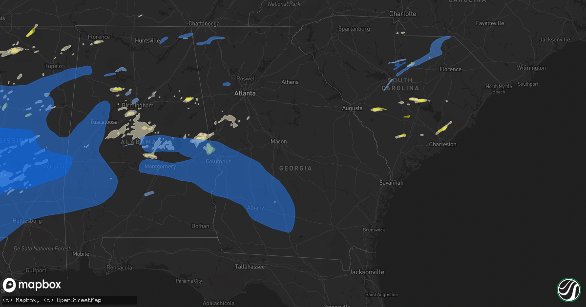
Hail Map in Georgia on May 4, 2021
Get this storm
May 4 map
$229
one time, instant access
Download today. No call, no setup
Keep the $229
Bought the map and want the full workflow? Apply the entire $229 to a subscription within 7 days. None of it is wasted.
Every map, not just this one
This buys you this map. Subscription and you get every map we run, in the markets you choose from a few cities to whole states to nationwide. Plus real-time alerts the moment a storm fires.
Contact data
Name, contact info, occupancy, even credit band for addresses in the footprint. You go from where it hit to who to call.
Become the source they trust
Unlimited branding weather history reports on demand. You already have the documented answer ready for the property owner, and you are the one who showed up with it.
Property data and RoofTrace estimates
Pull up any address you have got, its value and the exact code rules for that jurisdiction, straight from One Click Code. Then RoofTrace estimates the squares, pitch, and roof value, priced the way you price.
Storm reports in Georgia
Georgia
| Date | Description |
|---|---|
| 05/04/20214:43 PM CDT | *** 1 inj *** corrects previous tstm wnd dmg report from 2 n amboy. A 40x40 barn was destroyed along reid road with one injury reported to the person inside the barn. |
| 05/04/20214:37 PM CDT | Tree down on hopewell road. |
| 05/04/20214:18 PM CDT | One tree reported down in near the 2500 block of roosevelt hwy... Blocking one lane. |
| 05/04/20214:14 PM CDT | One tree reported down on the road at the 9500 block of roosevelt hwy. |
| 05/04/20214:00 PM CDT | Public report of trees down on baston road in martinez. Time estimated by radar. |
| 05/04/20213:12 PM CDT | The pierce county fire chief reported observing multiple trees down and some power line wires downed between jessica lane and ralston road south of patterson...ga after |
| 05/04/20212:18 PM CDT | Mcrae public safety reported a tree down north of workmore on hwy 441 blocking the entire roadway. |
| 05/04/20211:49 PM CDT | Several trees down along jersey walnut grove rd. |
| 05/04/20211:47 PM CDT | Tree down along ashland farm rd |
| 05/04/20211:47 PM CDT | Tree down along new hope church rd. |
| 05/04/202112:53 PM CDT | Part of a roof was pulled off a double wide home with several trees snapped off garland white road. |
| 05/04/202112:53 PM CDT | Wooden light pole snapped and landed on a house with several trees snapped near the intersection of old cornelia hwy and mud creek road along the hall/banks county line |
| 05/04/202112:45 PM CDT | Tree and additional limbs reported down near the intersection of windy hill rd se and south park place nw. |
| 05/04/202112:28 PM CDT | Emergency managment reporting a couple of trees downed on davis mill rd near renfroe rd and mustang dr. Other powerlines and road hazards also reported around the dalla |
| 05/04/202112:25 PM CDT | Trained spotter reported severe wind gusts with a couple downed trees and tree limbs near merchants dr and e. Memorial drive in dallas. |
| 05/04/202112:23 PM CDT | A tree was downed on finch court. |
| 05/04/202112:23 PM CDT | Tree blocking the roadway at new harmony church road and hiram sudie road. |
| 05/04/202112:21 PM CDT | An nws survey found an ef-0 tornado with peak winds of 85 mph touched down along long branch road near robinson road and tracked 4.8 miles before lifting near claude pa |
| 05/04/202112:21 PM CDT | Tree blocking the roadway at east paulding drive and tober mcgarity road. |
| 05/04/202112:18 PM CDT | A tree was downed on ash street. |
| 05/04/202112:18 PM CDT | Tree down along warhill park road and matheson drive. A tree down at henry pirkle drive and nix bridge road. |
| 05/04/202112:18 PM CDT | One tree was downed on shipp street and another was downed nearby on trenton street. |
| 05/04/202112:13 PM CDT | A tree was downed on canvas back drive. Another tree was downed nearby on myrtle road. |
| 05/04/202112:12 PM CDT | Tree down at cedar creek road and highway 136e. |
| 05/04/202112:08 PM CDT | Tree down at bailey waters road and highway 136w. A tree down along keith evans road. |
| 05/04/202112:08 PM CDT | Tree on a powerline along main street. |
| 05/04/202112:03 PM CDT | Tree down on a powerline at martin rd sw and bailey hill rd sw. |
| 05/04/202112:00 PM CDT | Tree down at highway 136w and goshen church road. |
| 05/04/202112:00 PM CDT | A tree was downed on gilmer ferry road at roberts lake road. |
| 05/04/202111:47 AM CDT | Tree down on a powerline at cassville white road and hickory lane |
| 05/04/202111:47 AM CDT | Tree on a powerline at stamp creek rd ne and highway 411. |
| 05/04/202111:47 AM CDT | A tree fell on arrow wood drive. |
| 05/04/202111:11 AM CDT | Tree down at aska road and crabapple drive. |
| 05/04/202111:04 AM CDT | Tree down along stanley creek road. |
| 05/04/202111:04 AM CDT | Tree down along old mobile road. |
| 05/04/202110:25 AM CDT | Powerline down. |
| 05/04/20217:59 AM CDT | At 1259 PM EDT, a severe thunderstorm was located over Taylorsville, or 12 miles southwest of Cartersville, moving east at 55 mph. HAZARD...60 mph wind gusts. SOURCE...Radar indicated. IMPACT...Expect damage to roofs, siding, and trees. Locations impacted include... Cartersville, Kennesaw, Woodstock, Acworth, Rockmart, Euharlee, Emerson, Aragon, White, Taylorsville, Lake Arrowhead, Burnt Hickory Ridge, Kellogg Creek, Red Top Mountain State Park, Oak Grove, Kennesaw State University, Little River Landing, George Washington Carver St Pk, Stilesboro and Sutallee. |
| 05/04/20217:35 AM CDT | At 1235 PM EDT, a severe thunderstorm was located over Sonoraville, or 8 miles east of Calhoun, moving east at 45 mph. HAZARD...60 mph wind gusts. SOURCE...Radar indicated. IMPACT...Expect damage to roofs, siding, and trees. Locations impacted include... Calhoun, Jasper, Adairsville, Ball Ground, Nelson, Waleska, Resaca, Talking Rock, Fairmount, Ranger, Sequoyah Lake, Redbud, Folsom, Fausett Lake, Talmadge, Oakman, Tate, Funkhouser, Hinton and Sonoraville. |
| 05/04/20216:38 AM CDT | At 1138 PM EDT, severe thunderstorms were located along a line extending from near Willacoochee to near Douglas to near Lumber City, moving east around 35 mph. HAZARD...60 mph wind gusts. SOURCE...Radar indicated. IMPACT...Expect damage to roofs, siding, and trees. Locations impacted include... Douglas, Baxley, Hazlehurst, Alma, Pearson, Willacoochee, Broxton, Graham, Plant Hatch and Nicholls. |
| 05/04/20216:13 AM CDT | At 1113 PM EDT, severe thunderstorms were located along a line extending from 6 miles southwest of Ambrose to near Ochlocknee, moving east at 40 mph. HAZARD...60 mph wind gusts. SOURCE...Radar indicated. IMPACT...Expect damage to roofs, siding, and trees. Locations impacted include... Lake Park, Lakeland, Quitman, Valdosta, Hahira, Pavo, I-75 At Exit 16, Moody Air Force Base, Remerton, Meigs, Dasher, Morven, Barwick, Grooverville, Barretts, Hansell, Nankin, Empress, Clyattville and Brooks Co A/p. |
| 05/04/20216:05 AM CDT | At 1105 AM EDT, a severe thunderstorm was located near Center Post, or 9 miles southwest of Lafayette, moving east at 55 mph. HAZARD...60 mph wind gusts and penny size hail. SOURCE...Radar indicated. IMPACT...Expect damage to roofs, siding, and trees. Locations impacted include... Lafayette, Summerville, Trion, Menlo, Naomi, Center Post, Subligna, Suttles Mill, Lake Marvin, Linwood, Villanow, Cloudland and Everett Springs. |
| 05/04/20215:54 AM CDT | At 1053 PM EDT, severe thunderstorms were located along a line extending from 8 miles west of Jacksonville to near Unionville, moving east at 50 mph. HAZARD...60 mph wind gusts. SOURCE...Radar indicated. IMPACT...Expect damage to roofs, siding, and trees. Locations impacted include... Douglas, Pearson, Willacoochee, Broxton, Ambrose, Nicholls, Pridgen, West Green, Snipesville and Denton. |
| 05/04/20215:30 AM CDT | At 1030 PM EDT, severe thunderstorms were located along a line extending from near Arabi to near Camilla, moving east at 65 mph. HAZARD...60 mph wind gusts. SOURCE...Radar indicated. IMPACT...Expect damage to roofs, siding, and trees. Locations impacted include... Nashville, Moultrie, Adel, Sparks, Omega, Ray City, Norman Park, Lenox, Doerun, Riverside, Schley, Berlin, Funston, Cecil, Ellenton, Reed Bingham State Park, New Lois, Massee, Greggs and Flat Ford. |
| 05/04/20215:27 AM CDT | At 1027 PM EDT/927 PM CDT/, severe thunderstorms were located along a line extending from 10 miles west of Vernon to 7 miles southeast of Cottonwood, moving east at 45 mph. HAZARD...60 mph wind gusts. SOURCE...Radar indicated. IMPACT...Expect damage to roofs, siding, and trees. Locations impacted include... Vernon, Chipley, Graceville, Bonifay, Marianna, Chattahoochee, Bradford, Malone, Sneads, Cottondale, Grand Ridge, Greenwood, Ponce De Leon, Altha, Alford, Caryville, Wausau, Esto, Westville and Campbellton. |
| 05/04/20215:07 AM CDT | At 1007 PM EDT, severe thunderstorms were located along a line extending from 8 miles east of Desoto to 10 miles east of Leary, moving east at 65 mph. HAZARD...60 mph wind gusts. SOURCE...Radar indicated. IMPACT...Expect damage to roofs, siding, and trees. Locations impacted include... Tifton, Ashburn, Ocilla, Fitzgerald, Sylvester, Enigma, Omega, Poulan, Ty Ty, Alapaha, Phillipsburg, Mystic, Unionville, Worth, Terrell, Sycamore, Sumner, Warwick, Rebecca and Minton. |
| 05/04/20214:51 AM CDT | At 950 AM CDT, severe thunderstorms were located along a line extending from near Ider to 7 miles north of Little River Falls to Fort Payne, moving east at 40 mph. HAZARD...60 mph wind gusts. SOURCE...Radar indicated. IMPACT...Expect damage to roofs, siding, and trees. Locations impacted include... Fort Payne, Henagar, Ider, Valley Head, Hammondville, Mentone, Lebanon, Collbran, Sulpher Springs and Adamsburg. |
| 05/04/20214:50 AM CDT | At 949 PM EDT, severe thunderstorms were located along a line extending from Meansville to near Salem to Montezuma to Maddox, moving east at 45 mph. HAZARD...60 mph wind gusts and nickel size hail. SOURCE...Radar indicated. IMPACT...Expect damage to roofs, siding, and trees. Locations impacted include... Macon, Americus, Perry, Cordele, Fort Valley, Thomaston, Barnesville, Hawkinsville, Vienna, Forsyth, Oglethorpe, Zebulon, Roberta, Warner Robins, Centerville, Byron, Unadilla, Montezuma, Marshallville and Milner. |
| 05/04/20214:45 AM CDT | At 944 PM EDT, a severe thunderstorm was located near Jacksonville, or 11 miles north of Ambrose, moving east at 30 mph. HAZARD...60 mph wind gusts. SOURCE...Radar indicated. IMPACT...Expect damage to roofs, siding, and trees. This severe thunderstorm will remain over mainly rural areas of north central Coffee County. |
| 05/04/20214:44 AM CDT | At 944 PM EDT, a severe thunderstorm was located over Dawson, moving east at 45 mph. HAZARD...60 mph wind gusts. SOURCE...Radar indicated. IMPACT...Expect damage to roofs, siding, and trees. Locations impacted include... Dawson, Leesburg, Albany, Smithville, Sasser, Bronwood, Parrott, Chokee, Stocks, Forrester, Palmyra, Clarks Mill, Dawson Municipal A/P, Chambliss, Olivers Mill, Neyami, Chickasawhatchee, Bridges Crossroad, Century and Herod. |
| 05/04/20214:15 AM CDT | At 914 PM EDT, severe thunderstorms were located along a line extending from near Manchester to near Junction City to Buena Vista to near Lumpkin, moving east at 60 mph. HAZARD...60 mph wind gusts and quarter size hail. SOURCE...Radar indicated. IMPACT...Hail damage to vehicles is expected. Expect wind damage to roofs, siding, and trees. Locations impacted include... Americus, Fort Valley, Thomaston, Barnesville, Forsyth, Lumpkin, Buena Vista, Butler, Ellaville, Oglethorpe, Roberta, Talbotton, Preston, Byron, Manchester, Montezuma, Richland, Marshallville, Reynolds and Plains. |
| 05/04/20214:05 AM CDT | At 905 PM EDT, a severe thunderstorm was located over Fitzgerald, moving northeast at 25 mph. HAZARD...60 mph wind gusts. SOURCE...Radar indicated. IMPACT...Expect damage to roofs, siding, and trees. Locations impacted include... Fitzgerald, Lulaville, Fitzgerald Municipal A/P, Bowens Mill, Red Bluff, Ashton and Queensland. |
| 05/04/20213:58 AM CDT | At 857 PM EDT, a severe thunderstorm was located over Alvaton, or 12 miles northeast of Greenville, moving northeast at 45 mph. HAZARD...60 mph wind gusts and quarter size hail. SOURCE...Radar indicated. IMPACT...Hail damage to vehicles is expected. Expect wind damage to roofs, siding, and trees. Locations impacted include... Griffin, Senoia, Brooks, Williamson, Haralson, Woolsey, Gay, Highland Mills, Rocky Mount, Starrs Mill, Birdie, Vaughn, Hollonville, Inman, Alvaton, Rover, Digbey, Lake Horton, Zetella and Wooster. |
| 05/04/20213:55 AM CDT | At 854 PM EDT, a severe thunderstorm was located near Sand Hill, or near Cusseta, moving east at 50 mph. HAZARD...70 mph wind gusts and quarter size hail. SOURCE...Radar indicated. IMPACT...Hail damage to vehicles is expected. Expect considerable tree damage. Wind damage is also likely to mobile homes, roofs, and outbuildings. Locations impacted include... Buena Vista, Putnam, Brantley, Tazewell, Marion Estates, Doyle, Church Hill, Oakland, Draneville and Zellobee. |
| 05/04/20213:46 AM CDT | At 845 PM EDT, a severe thunderstorm was located near Seale, or 16 miles east of Hurtsboro, moving east at 50 mph. HAZARD...70 mph wind gusts and quarter size hail. SOURCE...Radar indicated. IMPACT...Hail damage to vehicles is expected. Expect considerable tree damage. Wind damage is also likely to mobile homes, roofs, and outbuildings. Locations impacted include... Lumpkin, Preston, Richland, Weston, Seminole, Charles, Kimbrough, Westville, Brooklyn, Leveretts, Omaha, Church Hill, Centerpoint, Dumas, Louvale and Providence Canyon State Park. |
| 05/04/20213:40 AM CDT | At 840 PM CDT, severe thunderstorms were located along a line extending from near Headland to 6 miles southwest of Hartford, moving east at 45 mph. HAZARD...60 mph wind gusts. SOURCE...Radar indicated. IMPACT...Expect damage to roofs, siding, and trees. Locations impacted include... Daleville, Cottonwood, Headland, Dothan, Fort Rucker, Ozark, Enterprise, Hartford, Taylor, Midland City, Kinsey, Ashford, Level Plains, Slocomb, Cowarts, Newton, Webb, Columbia, Pinckard and Malvern. |
| 05/04/20213:21 AM CDT | At 821 PM EDT/721 PM CDT/, severe thunderstorms were located along a line extending from near Society Hill to near Dozier, moving east at 45 mph. HAZARD...60 mph wind gusts. SOURCE...Radar indicated. IMPACT...Expect damage to roofs, siding, and trees. Locations impacted include... Elba, Abbeville, Fort Gaines, Georgetown, Cuthbert, Fort Rucker, Ozark, New Brockton, Shellman, Ariton, Lee, Newville, Bellville, Haleburg, Bluffton, Shorterville, Carl Folsom A/p, Hooper Stage Field, Hayes and Camp Humming Hills. |
| 05/04/20212:21 AM CDT | At 720 PM CDT, severe thunderstorms were located along a line extending from near Guerryton to Goshen, moving southeast at 50 mph. HAZARD...60 mph wind gusts. High winds and wind damage have been reported with this line of storms. SOURCE...Radar indicated. IMPACT...Expect damage to roofs, siding, and trees. Locations impacted include... Eufaula, Clio, Clayton, Louisville, Tyler Crossroads, Doster, Hawkinsville, Spring Hill, Gaino, Comer, Barbour County Public Lake Dam, Blue Springs State Park, Osco, Texasville, Richards Crossroads, White Oak, Lakepoint Resort State Park, Boot Hill, Millers Ford and Batesville. |
| 05/04/20212:06 AM CDT | At 706 PM CDT, severe thunderstorms were located along a line extending from near Tuskegee National Forest to 6 miles north of Union Springs, moving east at 55 mph. HAZARD...60 mph wind gusts. SOURCE...Radar indicated. IMPACT...Expect damage to roofs, siding, and trees. Locations impacted include... Phenix City, Hurtsboro, Russell County Sports Complex, Uchee, Seale, Ladonia, Rutherford, Hatchechubbe, Uchee Creek, Fort Mitchell, Ladonia Sports Complex, Fort Mitchell Activity Center, Carter Acres, Phenix Drag Strip and Parkmanville. |
| 05/04/20211:41 AM CDT | At 640 PM CDT, severe thunderstorms were located along a line extending from 6 miles west of Goldville to Still Waters Resort to near Tysonville, moving east at 60 mph. HAZARD...60 mph wind gusts. A wind gust to 58 mph was recently recorded at the Montgomery airport. Wind damage has also been reported with this line of storms. SOURCE...Radar indicated. IMPACT...Expect damage to roofs, siding, and trees. Locations impacted include... Auburn, Opelika, Valley, Lanett, Notasulga, Smiths, Stroud, Lafayette, Smiths Station, La Fayette, Waverly, Lakeview, Cusseta, Beulah, Beauregard, Sturkie, Trammel Crossroads, Buffalo, Huguley and Fairfax. |
| 05/04/20211:24 AM CDT | At 624 PM EDT, a severe thunderstorm was located over Wallace, or near Hawkinsville, moving northeast at 35 mph. HAZARD...60 mph wind gusts and quarter size hail. SOURCE...Radar indicated. IMPACT...Hail damage to vehicles is expected. Expect wind damage to roofs, siding, and trees. Locations impacted include... Cochran, Hawkinsville, Dubois, Coley Station, Gresston, Empire, Mobley Crossing, Mock Springs, Baileys Park, Magnolia, Ocmulgee Banks, Finleyson, Royal, Wallace, Ocmulgee Public Fishing Area, Paulk, Hartford, Pulaski State Prison and Porter. |
| 05/04/20211:03 AM CDT | At 603 PM EDT, severe thunderstorms were located along a line extending from near Poinsett State Park to 6 miles east of Savannah River Site, moving east at 30 mph. HAZARD...60 mph wind gusts. SOURCE...Radar indicated. IMPACT...Expect damage to roofs, siding, and trees. Locations impacted include... Orangeburg, Barnwell, Bamberg, Denmark, Brookdale, Blackville, St. Matthews, Holly Hill, Branchville, Bowman, Elloree, Santee State Park, Claflin College, South Carolina State University, Orangeburg County Airport, Barnwell State Park, Rivers Bridge State Park, Edisto Gardens, Santee and Ehrhardt.This includes the following highways... Interstate 26 between mile markers 136 and 169. Interstate 95 between mile markers 85 and 101. |
| 05/04/202112:32 AM CDT | At 532 PM EDT, a severe thunderstorm was located over Ashburn, moving northeast at 25 mph. HAZARD...60 mph wind gusts. SOURCE...Radar indicated. IMPACT...Expect damage to roofs, siding, and trees. Locations impacted include... Ashburn, Worth, Sycamore, Rebecca, Amboy, Turner Co Airport, Dakota and Sibley. |
| 05/03/202111:14 PM CDT | Updates previous tstm wnd dmg report from douglas. Widespread downed trees and powerlines across the greater douglas area between midnight and 1230 am... Mainly north s |
| 05/03/202111:05 PM CDT | Several trees down in lanier county. |
| 05/03/202111:00 PM CDT | Trees down on tower rd & lakeland hwy. |
| 05/03/202111:00 PM CDT | Corrects previous tstm wnd dmg report from 1 nne valdosta. Trees and powelines down. |
| 05/03/202110:44 PM CDT | At 344 PM EDT, a severe thunderstorm was located 7 miles west of Abbeville, or 6 miles northeast of Calhoun Falls, moving east at 40 mph. HAZARD...60 mph wind gusts and nickel size hail. SOURCE...Radar indicated. IMPACT...Expect damage to trees and power lines. Locations impacted include... Greenwood, Abbeville, Calhoun Falls, Ninety Six, Cokesbury, Hodges, Lake Greenwood, Ninety Six Historic Site, Promised Land and Bradley. |
| 05/03/202110:37 PM CDT | Tree down on hwy 76 in eastern half of cook county. |
| 05/03/202110:30 PM CDT | Tree down. |
| 05/03/202110:30 PM CDT | Trees down throughout the county. |
| 05/03/202110:25 PM CDT | Damage to a residence off of green avenue with awning and gutter torn off. Trees twisted and snapped. Time of damage estimated from radar. |
| 05/03/202110:25 PM CDT | Tin roof blown off a mobile home along john keigens memorial road. |
| 05/03/202110:25 PM CDT | Corrects previous tstm wnd dmg report from adel. Powerline down. |
| 05/03/202110:20 PM CDT | Trees down in thomas county. |
| 05/03/202110:20 PM CDT | 1 or 2 trees down within grady county. |
| 05/03/202110:10 PM CDT | Tree down on lonnie brookard rd in norman park. |
| 05/03/202110:00 PM CDT | Several trees down throughout the county. |
| 05/03/20219:57 PM CDT | At 256 PM EDT, severe thunderstorms were located along a line extending from near Aragon to Abilene, moving east at 35 mph. HAZARD...60 mph wind gusts. SOURCE...Radar indicated. IMPACT...Expect damage to roofs, siding, and trees. Locations impacted include... Marietta, Douglasville, Carrollton, Canton, Cartersville, Dallas, Buchanan, Smyrna, Kennesaw, Woodstock, Acworth, Union City, Villa Rica, Powder Springs, Austell, Bremen, Temple, Rockmart, Euharlee and Hiram. |
| 05/03/20219:55 PM CDT | Multiple county roads and state routes closed due to downed trees and power lines. Local road dept and gdot working now to clear. 1 mobile home major damage... 1 house |
| 05/03/20219:51 PM CDT | Tree down across hwy 111 near the colquitt/mitchell county line. |
| 05/03/20219:40 PM CDT | Multiple lines and trees down on andrews in camilla... Ga. |
| 05/03/20219:35 PM CDT | Tree down along highway 112 near flint road. |
| 05/03/20219:35 PM CDT | Tree down along highway 112 near greenough road. |
| 05/03/20219:32 PM CDT | Reported trees down. |
| 05/03/20219:30 PM CDT | Powerlines down. |
| 05/03/20219:30 PM CDT | Trees and powerlines down. |
| 05/03/20219:30 PM CDT | Trees and powerlines down. |
| 05/03/20219:30 PM CDT | Trees and powerlines down. |
| 05/03/20219:25 PM CDT | Picture of a tree down in putney via social media. |
| 05/03/20219:20 PM CDT | Water blocking the roadway at mud green road and mcgarity road. |
| 05/03/20219:18 PM CDT | Tree down on the 2700 block of tarva road. |
| 05/03/20219:17 PM CDT | Power line down at gillionville road and n slappey blvd. |
| 05/03/20219:17 PM CDT | Tree down at pine ave and north harding st. |
| 05/03/20219:17 PM CDT | Tree down at leary road and eight mile road. |
| 05/03/20219:17 PM CDT | Asos station kaby albany reported a gust to 62 mph. |
| 05/03/20219:16 PM CDT | At 216 PM EDT, severe thunderstorms were located along a line extending from near Coloma to near Heflin, moving east at 50 mph. HAZARD...60 mph wind gusts. SOURCE...Radar indicated. IMPACT...Expect damage to roofs, siding, and trees. Locations impacted include... Carrollton, Cartersville, Dallas, Cedartown, Buchanan, Villa Rica, Bremen, Temple, Rockmart, Euharlee, Tallapoosa, Bowdon, Mount Zion, Aragon, Cave Spring, Waco, Braswell, Taylorsville, Cassville and Yorkville. |
| 05/03/20219:16 PM CDT | Tree down at 2000 w oglethorpe blvd. |
| 05/03/20219:15 PM CDT | Tree down near 400 forest glen drive. |
| 05/03/20218:58 PM CDT | Numerous trees and power outages throughout county. |
| 05/03/20218:55 PM CDT | Tree down on house. |
| 05/03/20218:55 PM CDT | Trees down. |
| 05/03/20218:54 PM CDT | A tree fell on pryor road at standard elevator road. |
| 05/03/20218:52 PM CDT | At 151 PM EDT, a severe thunderstorm was located over Roswell, or 10 miles northeast of Marietta, moving east at 45 mph. HAZARD...60 mph wind gusts. SOURCE...Radar indicated. IMPACT...Expect damage to roofs, siding, and trees. Locations impacted include... Lawrenceville, Cumming, Sandy Springs, Roswell, Johns Creek, Alpharetta, Milton, Duluth, Sugar Hill, Suwanee, Buford, Norcross, Flowery Branch, Dacula, Berkeley Lake, Rest Haven, Mountain Park, Mount Bethel, Sweat Mountain and Buford Dam-Lake Lanier Parks. |
| 05/03/20218:50 PM CDT | Numerous trees and power outages throughout county. |
| 05/03/20218:45 PM CDT | Two trees were downed on highway 195. One fell near the intersection of chambliss road and the other at clements road. |
| 05/03/20218:44 PM CDT | A tree was downed on highway 280 east at tommy smith road. |
| 05/03/20218:41 PM CDT | A tree was downed onto south lee street at mclittle bridge road. |
| 05/03/20218:40 PM CDT | Trees and power lines were downed on arch helms road. |
| 05/03/20218:39 PM CDT | A tree was downed onto bear branch road at sam rodgers road. |
| 05/03/20218:28 PM CDT | At 128 PM EDT, severe thunderstorms were located along a line extending from New Hope to Temple, moving east at 50 mph. HAZARD...60 mph wind gusts. SOURCE...Trained weather spotters. IMPACT...Expect damage to roofs, siding, and trees. Locations impacted include... Marietta, Douglasville, Dallas, Smyrna, Kennesaw, Villa Rica, Powder Springs, Austell, Bremen, Temple, Hiram, Waco, Lithia Springs, Fair Oaks, Mount Bethel, Lost Mountain Park, Vinings, Brownsville, Cross Roads and Draketown. |
| 05/03/20218:25 PM CDT | Multiple trees were blown down on spanns mill road between macedonia church road and rural hill church road. |
| 05/03/20218:24 PM CDT | Trees blocked the roadway on highway 30 west of friendship. |
| 05/03/20218:23 PM CDT | A tree was downed onto a vehicle on foreman road. A tree was also downed nearby onto power lines on ben williams road near the intersection of mill pond road. |
| 05/03/20218:22 PM CDT | Trees were downed on poplar springs road west of macedonia church road. |
| 05/03/20218:21 PM CDT | Multiple trees were downed on kennedy pond road in the vicinity millard kennedy road. |
| 05/03/20218:20 PM CDT | Tree down along melissa circle. |
| 05/03/20218:20 PM CDT | Hwy 82 at quitman/randolph county line blocked by trees. 2 semi trucks are stuck in between. |
| 05/03/20218:20 PM CDT | A tree down along north mcdonough road and a tree down along locust grove road. |
| 05/03/20218:19 PM CDT | Trees were downed on highway 41 just north of preston. |
| 05/03/20218:18 PM CDT | Tree down on home along henry birch drive. |
| 05/03/20218:18 PM CDT | Power lines and pole were downed at intersection of west centerpoint road and millard kennedy road. |
| 05/03/20218:13 PM CDT | Trees were downed on 1800 block of sears road. |
| 05/03/20218:13 PM CDT | Uga weather network at sunny view farms measured a 70 mph gust. |
| 05/03/20218:13 PM CDT | Trees were downed on wilson pond road. |
| 05/03/20218:12 PM CDT | The roof was blown off a pole barn on highway 280 near mile marker 1. |
| 05/03/20218:10 PM CDT | A few trees and powerlines down in quitman county. |
| 05/03/20218:09 PM CDT | Trees were downed on seminole road at mile markers 6 and 8. |
| 05/03/20218:08 PM CDT | Several reports of trees and powerlines blown down east of i-185 between lagrange and stovall. Damage likley occured within multiple waves of storms between 830-930 pm |
| 05/03/20218:07 PM CDT | A few trees down near ga109 and harman rd |
| 05/03/20217:57 PM CDT | 2 trees down 1.5 miles north of whitfield rd and hwy 54 between hoganville and lagrange |
| 05/03/20217:57 PM CDT | Tens of trees and powerlines blown down in the area ssw for lagrange between i-85 and i-185... In the wood valley area... Caused by multiple waves of storms between 8-9 |
| 05/03/20217:45 PM CDT | A few trees and powerlines blown down east of west point lake and west of the lagrange callaway airport. Damage was likely caused by multiple wave of storms between 8-9 |
| 05/03/20217:15 PM CDT | Tens of tens and powerlines were blown down in and around lagrange... Caused by multiple waves of svere storms between 8-9 pm. |
| 05/03/20217:07 PM CDT | Large tree down across hwy 109 near mile marker 3 blocking portions of the road. |
All States Impacted by Hail Map on May 4, 2021
Cities Impacted by Hail Map on May 4, 2021
- Saulsbury, TN
- Walnut, MS
- Ashland, MS
- Michigan City, MS
- Morton, MS
- Pelahatchie, MS
- Sulphur, LA
- French Settlement, LA
- Maurepas, LA
- Saint Amant, LA
- Clanton, AL
- Verbena, AL
- Billingsley, AL
- Martindale, TX
- Milam, WV
- Bergton, VA
- Moorefield, WV
- Waterford, MS
- Como, MS
- Holly Springs, MS
- Abbeville, MS
- Ruleville, MS
- Doddsville, MS
- Cleveland, MS
- Valley, AL
- Opelika, AL
- Hamilton, GA
- Cusseta, AL
- West Point, GA
- Salem, AL
- Smithville, TX
- Palacios, TX
- Florence, MS
- Frierson, LA
- Stonewall, LA
- Quicksburg, VA
- New Market, VA
- Timberville, VA
- Mount Jackson, VA
- Weogufka, AL
- Equality, AL
- Eclectic, AL
- Rockford, AL
- Alexander City, AL
- Elmore, AL
- Titus, AL
- Prattville, AL
- Deatsville, AL
- Wetumpka, AL
- Millbrook, AL
- Marbury, AL
- Ashburn, GA
- Pheba, MS
- Maben, MS
- Lamar, MS
- Bastrop, TX
- Red Rock, TX
- Cedar Creek, TX
- Florien, LA
- Steeles Tavern, VA
- Greenville, VA
- Raphine, VA
- Heflin, AL
- Anniston, AL
- Sardis, MS
- Crenshaw, MS
- Wilsonville, AL
- Columbiana, AL
- Gary, TX
- Tenaha, TX
- Timpson, TX
- Cameron, SC
- Effie, LA
- Jonesville, LA
- Marksville, LA
- Pennington, TX
- Groveton, TX
- Apple Springs, TX
- Kennard, TX
- Nacogdoches, TX
- Lafayette, AL
- Camp Hill, AL
- Five Points, AL
- Lanett, AL
- Moorhead, MS
- Indianola, MS
- Bienville, LA
- Crosby, MS
- Brent, AL
- Williston, SC
- Bedford, VA
- Big Island, VA
- Rolling Fork, MS
- Glen Allan, MS
- Hollandale, MS
- Mayersville, MS
- Anguilla, MS
- Lumberton, TX
- Kountze, TX
- Lockhart, TX
- Caldwell, TX
- Jasper, AL
- Vesuvius, VA
- Tyro, VA
- Montebello, VA
- Draper, VA
- Hamburg, AR
- Ragley, LA
- Starks, LA
- Lake Charles, LA
- Longville, LA
- Mittie, LA
- Dequincy, LA
- Oakdale, LA
- Kinder, LA
- Singer, LA
- Oberlin, LA
- Dry Creek, LA
- Iowa, LA
- Reeves, LA
- Warrior, AL
- Dora, AL
- Empire, AL
- Brenham, TX
- Ruffin, SC
- Islandton, SC
- Lovelady, TX
- Trinity, TX
- Amite, LA
- Holden, LA
- Walker, LA
- Dale, TX
- Dermott, AR
- Goode, VA
- Fulks Run, VA
- Broadway, VA
- Mathias, WV
- Criders, VA
- Middlebrook, VA
- Kyle, TX
- Philadelphia, MS
- Carthage, MS
- Jemison, AL
- Luray, VA
- Gloster, MS
- Centreville, MS
- Baytown, TX
- Brandywine, WV
- Franklin, WV
- Greenville, MS
- Windsor, SC
- Blackville, SC
- Parrish, AL
- Cordova, AL
- Montrose, AR
- Crossett, AR
- Woodville, MS
- Batchelor, LA
- Bessemer, AL
- Birmingham, AL
- McCalla, AL
- Huntington, TX
- Dayton, TX
- Amissville, VA
- Sperryville, VA
- Flint Hill, VA
- Washington, VA
- Woodville, VA
- Castleton, VA
- Saltillo, MS
- Jackson, MS
- Crystal Springs, MS
- Giddings, TX
- La Grange, TX
- Summerton, SC
- Pinewood, SC
- Gibsland, LA
- Lufkin, TX
- Greensburg, LA
- Orangeburg, SC
- Pleasant Shade, TN
- Haughton, LA
- Elm Grove, LA
- Lake, MS
- Browns Summit, NC
- Greensboro, NC
- Summerfield, NC
- Canton, MS
- Brandon, MS
- Hiwassee, VA
- Roxie, MS
- Meadville, MS
- Pulaski, MS
- Forest, MS
- Raleigh, MS
- Fairfield, VA
- Buena Vista, VA
- Lexington, VA
- Ledbetter, TX
- Huffman, TX
- Lexington, TX
- Rockdale, TX
- Lagrange, GA
- Camden, SC
- Jamestown, LA
- Castor, LA
- Cary, MS
- Burton, TX
- Calera, AL
- Shelby, AL
- Potts Camp, MS
- Oxford, MS
- Shreveport, LA
- McDade, TX
- Elgin, TX
- Carmine, TX
- Satartia, MS
- Sylacauga, AL
- Vidalia, LA
- Ackerman, MS
- Eupora, MS
- Mathiston, MS
- Crosby, TX
- Hickory Flat, MS
- Myrtle, MS
- Madison, MS
- Ridgeland, MS
- Clinton, MS
- Camden, MS
- Woodbury, TN
- Summit, MS
- Smithdale, MS
- Simmesport, LA
- Lettsworth, LA
- Jacksonville, AL
- Eagle Rock, VA
- Clifton Forge, VA
- Booneville, MS
- Georgetown, MS
- Harrisville, MS
- Huger, SC
- Cordesville, SC
- Moncks Corner, SC
- Taylorsville, MS
- Eros, LA
- West Monroe, LA
- Hornbeck, LA
- Woodbridge, VA
- Keithville, LA
- Marietta, MS
- Bastrop, LA
- Saint Matthews, SC
- Jamaica, VA
- Lancaster, VA
- Little Plymouth, VA
- Church View, VA
- Urbanna, VA
- Water View, VA
- Bentonia, MS
- Vaughan, MS
- McCarley, MS
- Winona, MS
- Coila, MS
- Elloree, SC
- Collinston, LA
- Mer Rouge, LA
- Tallulah, LA
- Watson, AR
- Vidor, TX
- Hazlehurst, MS
- Kingsbury, TX
- San Marcos, TX
- Noxapater, MS
- New Albany, MS
- South Mills, NC
- Mendenhall, MS
- Magee, MS
- Cheneyville, LA
- Denham Springs, LA
- Murfreesboro, TN
- Mount Olive, MS
- Mize, MS
- Bryan, TX
- Cherokee, AL
- Benton, MS
- Waverly, AL
- Dunnsville, VA
- Baldwyn, MS
- Saint Martinville, LA
- Round Top, TX
- Brooks, GA
- Senoia, GA
- Rayville, LA
- Gay, GA
- Luthersville, GA
- Greenville, GA
- Catherine, AL
- Camden, AL
- Edinburg, VA
- Orkney Springs, VA
- Amherst, VA
- Poplar Branch, NC
- Grandy, NC
- Collinsville, MS
- Rockbridge Baths, VA
- Tuscumbia, AL
- Liberty, TN
- Dowelltown, TN
- Smithville, TN
- Union, MS
- Decatur, MS
- Sunbury, NC
- Corapeake, NC
- Little Rock, MS
- Chunky, MS
- Hickory, MS
- Meridian, MS
- Newton, MS
- New Braunfels, TX
- Centreville, AL
- Banner, MS
- Water Valley, MS
- Somerville, TX
- Columbia, NC
- Navasota, TX
- Marion, LA
- Braxton, MS
- Pearl, MS
- Terry, MS
- Byram, MS
- Richland, MS
- Louin, MS
- Starkville, MS
- Suffolk, VA
- Farmerville, LA
- Hogansville, GA
- Franklin, GA
- Coffeeville, MS
- Itta Bena, MS
- Greenwood, MS
- Schlater, MS
- Bay Springs, MS
- De Kalb, MS
- Eutaw, AL
- Maxwell, TX
- Seguin, TX
- Bruce, MS
- Sunflower, MS
- Manning, SC
- Sharpsburg, GA
- Grantville, GA
- Moreland, GA
- Newnan, GA
- Warrenton, VA
- Catlett, VA
- Epps, LA
- Dadeville, AL
- Bunkie, LA
- Paige, TX
- Delta, AL
- Leesville, LA
- Bryans Road, MD
- Inverness, MS
- Tappahannock, VA
- Champlain, VA
- Ralph, AL
- Gore Springs, MS
- Grenada, MS
- Saint Landry, LA
- Deridder, LA
- Fort Polk, LA
- Pitkin, LA
- Maplesville, AL
- Thorsby, AL
- Brierfield, AL
- Pelham, AL
- Childersburg, AL
- Alabaster, AL
- Montevallo, AL
- Helena, AL
- Randolph, AL
- Bude, MS
- Liberty, MS
- Cedarbluff, MS
- West Point, MS
- Golden, MS
- Oakman, AL
- Adger, AL
- Trussville, AL
- Odenville, AL
- Monroe, LA
- Lake Village, AR
- Flora, MS
- Lugoff, SC
- Pontotoc, MS
- Accokeek, MD
- Indian Head, MD
- Muscle Shoals, AL
- Leighton, AL
- Catawba, SC
- Rock Hill, SC
- Lorton, VA
- Ragland, AL
- Pell City, AL
- Pinola, MS
- Livingston, LA
- Buchanan, VA
- Nokesville, VA
- Waldorf, MD
- Manassas, VA
- Dumfries, VA
- Warsaw, VA
- Granville, TN
- Gainesboro, TN
- Salters, SC
- Ethel, LA
- Clinton, LA
- Slaughter, LA
- McGehee, AR
- Arkansas City, AR
- Lancaster, SC
- Ruth, MS
- Jeanerette, LA
- Boligee, AL
- Lake Providence, LA
- Boyle, MS
- Cottageville, SC
- Ridgeville, SC
- Natchez, MS
- Manor, TX
- Corolla, NC
- Shiloh, NC
- Downsville, LA
- Moreauville, LA
- Stuarts Draft, VA
- Lyndhurst, VA
- Fayetteville, TN
- Frankewing, TN
- Leland, MS
- West Blocton, AL
- Townley, AL
- Charleston, SC
- Goose Creek, SC
- Ladson, SC
- North Charleston, SC
- Minter City, MS
- Philipp, MS
- Charleston, MS
- Pierre Part, LA
- Oak Ridge, LA
- Sterlington, LA
- Marshall, TX
- Evergreen, LA
- Morrow, LA
- Washington, LA
- Griffin, GA
- Weir, MS
- Newhebron, MS
- Chatham, LA
- Austin, TX
- Waskom, TX
- Oak Grove, LA
- Beulah, MS
- Benoit, MS
- Lawrence, MS
- Conehatta, MS
- Greenfield, TN
- Sharon, TN
- Martin, TN
- McBee, SC
- Monticello, AR
- Springville, AL
- Holcomb, MS
- Bedias, TX
- Adamsville, AL
- Petersburg, WV
- Hearne, TX
- Marshall, VA
- Duck Hill, MS
- Mississippi State, MS
- Duncanville, AL
- Moundville, AL
- Lena, MS
- Ringgold, LA
- Livingston, TX
- Cookeville, TN
- Monterey, TN
- Bossier City, LA
- Chestnut Mound, TN
- Elmwood, TN
- Del Valle, TX
- Shaw, MS
- Ranburne, AL
- Tishomingo, MS
- New Site, MS
- Bernice, LA
- Glasgow, VA
- Natural Bridge, VA
- Oxford, AL
- Yazoo City, MS
- Grand Cane, LA
- Mansfield, LA
- Calhoun, LA
- Jonesboro, LA
- Natchitoches, LA
- Campti, LA
- Goldonna, LA
- Winnfield, LA
- Mangham, LA
- Hollytree, AL
- Woodville, AL
- Paint Rock, AL
- Trenton, AL
- Scottsboro, AL
- Lynn, AL
- Double Springs, AL
- Haleyville, AL
- Houston, AL
- Nauvoo, AL
- Vinemont, AL
- Cullman, AL
- Addison, AL
- Arley, AL
- Logan, AL
- Bryant, AL
- Hollywood, AL
- Higdon, AL
- Stevenson, AL
- Flat Rock, AL
- Trenton, GA
- Rising Fawn, GA
- Pisgah, AL
- Gardendale, AL
- Fultondale, AL
- Mount Olive, AL
- Sumiton, AL
- Fort Deposit, AL
- Honoraville, AL
- Greenville, AL
- Pitts, GA
- Smiths Station, AL
- Preston, GA
- Cataula, GA
- Leslie, GA
- Rochelle, GA
- Ellenton, GA
- Adel, GA
- Reynolds, GA
- Pike Road, AL
- Oglethorpe, GA
- Omaha, GA
- De Soto, GA
- Camilla, GA
- Alapaha, GA
- Fitzgerald, GA
- Baconton, GA
- Ocilla, GA
- Warwick, GA
- Tallassee, AL
- Plains, GA
- Albany, GA
- Poulan, GA
- Andersonville, GA
- Columbus, GA
- Ideal, GA
- Rebecca, GA
- Box Springs, GA
- Ellaville, GA
- Talbotton, GA
- Shiloh, GA
- Oakfield, GA
- Unadilla, GA
- Pinehurst, GA
- Seale, AL
- Booth, AL
- Fitzpatrick, AL
- Hayneville, AL
- Lowndesboro, AL
- Buena Vista, GA
- Weston, GA
- Phenix City, AL
- Smithville, GA
- Auburn University, AL
- Georgetown, GA
- Tuskegee, AL
- Notasulga, AL
- Sparks, GA
- Ramer, AL
- Newton, GA
- Americus, GA
- Sale City, GA
- Bronwood, GA
- Cobb, GA
- Richland, GA
- Hardaway, AL
- Ty Ty, GA
- Ellerslie, GA
- Tifton, GA
- Sycamore, GA
- Enigma, GA
- Arabi, GA
- Fort Benning, GA
- Hurtsboro, AL
- Pittsview, AL
- Vienna, GA
- Cusseta, GA
- Fort Mitchell, AL
- Mauk, GA
- Tuskegee Institute, AL
- Byromville, GA
- Tyler, AL
- Fort Davis, AL
- Kellyton, AL
- Shellman, GA
- Autaugaville, AL
- Norman Park, GA
- Mathews, AL
- Rupert, GA
- Nashville, GA
- Sumner, GA
- Montgomery, AL
- Chula, GA
- Parrott, GA
- Junction City, GA
- Leesburg, GA
- Fortson, GA
- Marshallville, GA
- Shorter, AL
- Lumpkin, GA
- Upatoi, GA
- Eufaula, AL
- Clayton, AL
- Lenox, GA
- Butler, GA
- Midway, AL
- Moultrie, GA
- Jacksons Gap, AL
- Montezuma, GA
- Cuthbert, GA
- Midland, GA
- Auburn, AL
- Waverly Hall, GA
- Omega, GA
- Hatchechubbee, AL
- Doerun, GA
- Cordele, GA
- Morris, GA
- Sylvester, GA
- Cecil, AL
- Dawson, GA
- Hartsfield, GA
- Hope Hull, AL
- Pine Mountain, GA
- Union Springs, AL
- Dalton, GA
- Ringgold, GA
- Chatsworth, GA
- Rocky Face, GA
- La Fayette, GA
- Tunnel Hill, GA
- Rock Spring, GA
- Chickamauga, GA
- Powder Springs, GA
- Dallas, GA
- Hiram, GA
- Culpeper, VA
- Madison, VA
- Leon, VA
- Brightwood, VA
- Reva, VA
- Rochelle, VA
- Pratts, VA
- Arrington, VA
- Pelion, SC
- Columbia, SC
- Lexington, SC
- West Columbia, SC
- Cassatt, SC
- Patrick, SC
- Jefferson, SC
- Bethune, SC
- Cheraw, SC
- Wallace, SC
- Bishopville, SC
- Rockingham, NC
- Hartsville, SC
- Society Hill, SC
- Chesterfield, SC
- Bennettsville, SC
- Elgin, SC
- Hamlet, NC
- Blythewood, SC
- Ridgeway, SC
- Winnsboro, SC
- Norway, SC
- Branchville, SC
- Rowesville, SC
- Bowman, SC
- Clinton, MD
- Temple Hills, MD
- Andrews Air Force Base, MD
- Suitland, MD
- Fort Washington, MD
- Oxon Hill, MD
- Upper Marlboro, MD
- Brandywine, MD
- Coupland, TX
- Weedville, PA
- Pulaski, VA
- Roanoke, VA
- Bent Mountain, VA
- Christiansburg, VA
- Shawsville, VA
- Callaway, VA
- Check, VA
- Pilot, VA
- Radford, VA
- Riner, VA
- Copper Hill, VA
- Monroe, VA
- Troutville, VA
- Natural Bridge Station, VA
- Fincastle, VA
- Cloverdale, VA
- Thaxton, VA
- Coleman Falls, VA
- Montvale, VA
- Blue Ridge, VA
- Daleville, VA
- Salem, VA
- Fort Valley, VA
- Rileyville, VA
- Basye, VA
- Front Royal, VA
- Linden, VA
- Vienna, VA
- Dunn Loring, VA
- Falls Church, VA
- Fairfax, VA
- Spotsylvania, VA
- Secretary, MD
- Vienna, MD
- Great Mills, MD
- Bowling Green, VA
- Colonial Beach, VA
- Ruther Glen, VA
- Valley Lee, MD
- Madison, MD
- California, MD
- Columbia, VA
- Seaford, DE
- Avenue, MD
- Montross, VA
- Lexington Park, MD
- Chaptico, MD
- Crapo, MD
- Lusby, MD
- Fredericksburg, VA
- Hollywood, MD
- Louisa, VA
- Bushwood, MD
- Palmyra, VA
- Mineral, VA
- Church Creek, MD
- Kents Store, VA
- Bumpass, VA
- Trappe, MD
- Ellendale, DE
- Leonardtown, MD
- Newburg, MD
- Troy, VA
- Greenwood, DE
- Port Royal, VA
- Bridgeville, DE
- Issue, MD
- Woolford, MD
- Taylors Island, MD
- Fishing Creek, MD
- Georgetown, DE
- Callaway, MD
- Woodford, VA
- Partlow, VA
- Federalsburg, MD
- Rappahannock Academy, VA
- Abell, MD
- Solomons, MD
- Scottsville, VA
- Hurlock, MD
- Preston, MD
- Linkwood, MD
- Patuxent River, MD
- Park Hall, MD
- Drayden, MD
- Clements, MD
- Mechanicsville, MD
- Loveville, MD
- King George, VA
- Rhodesdale, MD
- Tall Timbers, MD
- Montpelier, VA
- Dowell, MD
- Beaverdam, VA
- East New Market, MD
- Coltons Point, MD
- Cobb Island, MD
- Milford, VA
- Cambridge, MD
- Milton, DE
- Stony Creek, VA
- Jarratt, VA
- Waverly, VA
- Emporia, VA
- Yale, VA
- Carson, VA
- Dinwiddie, VA
- Disputanta, VA
- Fort Monroe, VA
- Zuni, VA
- Smithfield, VA
- Hampton, VA
- Windsor, VA
- Carrollton, VA
- Newport News, VA
- Alexandria, TN
- Watertown, TN
- Oak Ridge, TN
- Harriman, TN
- Rockwood, TN
- Clinton, TN
- Pleasant Hill, TN
- Crab Orchard, TN
- Oliver Springs, TN
- Crossville, TN
- Sparta, TN
- Walling, TN
- Wartburg, TN
- Oakdale, TN
- Rock Island, TN
- Mcminnville, TN
- Bradyville, TN
- Louisville, TN
- Walland, TN
- Farragut, TN
- Maryville, TN
- Seymour, TN
- Rockford, TN
- Knoxville, TN
- Alcoa, TN
- Lenoir City, TN
- Carrollton, MS
- Emelle, AL
- Franklinton, LA
- Lisman, AL
- Mantee, MS
- Louise, MS
- Redwood, MS
- Hamilton, AL
- Akron, AL
- North Carrollton, MS
- Kosciusko, MS
- Dickinson, AL
- Bellamy, AL
- Goodman, MS
- Vina, AL
- Bogue Chitto, MS
- Louisville, MS
- Petal, MS
- Shubuta, MS
- Bailey, MS
- Daleville, MS
- Roseland, LA
- Epes, AL
- Shuqualak, MS
- Sidon, MS
- Raymond, MS
- Brookhaven, MS
- Gainesville, AL
- Newbern, AL
- Lumberton, MS
- Mccomb, MS
- Forkland, AL
- Marion, MS
- Flowood, MS
- Fayette, MS
- Buckatunna, MS
- Gallion, AL
- Ovett, MS
- Lexington, MS
- York, AL
- Edwards, MS
- Orrville, AL
- Quitman, MS
- Fluker, LA
- Loranger, LA
- Bassfield, MS
- Big Creek, MS
- Ward, AL
- Lauderdale, MS
- Kentwood, LA
- Cascilla, MS
- Laurel, MS
- Sumrall, MS
- Hermanville, MS
- Pine Grove, LA
- Sawyerville, AL
- Walthall, MS
- Glendora, MS
- Cottondale, AL
- Houlka, MS
- Tremont, MS
- Silver Creek, MS
- West, MS
- Toomsuba, MS
- Pine Hill, AL
- Smithville, MS
- Greenwood Springs, MS
- Holly Bluff, MS
- Sandy Hook, MS
- Coffeeville, AL
- Durant, MS
- Bellefontaine, MS
- Paulding, MS
- Frankville, AL
- McCall Creek, MS
- Calhoun City, MS
- Jayess, MS
- Foxworth, MS
- Wesson, MS
- Walnut Grove, MS
- Ferriday, LA
- Greensboro, AL
- Whatley, AL
- Safford, AL
- Vossburg, MS
- Rose Hill, MS
- Norwood, LA
- Oak Vale, MS
- Scooba, MS
- Tylertown, MS
- Pennington, AL
- Saint Francisville, LA
- Gordo, AL
- Tuscaloosa, AL
- Bolton, MS
- Fulton, MS
- Port Gibson, MS
- Echola, AL
- Vaiden, MS
- Jackson, LA
- Uniontown, AL
- Gilbertown, AL
- Shannon, MS
- Magnolia, AL
- Coker, AL
- Vardaman, MS
- Macon, MS
- Elrod, AL
- Coy, AL
- Seminary, MS
- Amory, MS
- Buhl, AL
- Kilmichael, MS
- Monticello, MS
- Prairie, MS
- Kokomo, MS
- Saint Stephens, AL
- State Line, MS
- Preston, MS
- Butler, AL
- Hattiesburg, MS
- Pickens, MS
- Newellton, LA
- Needham, AL
- Purvis, MS
- Tinsley, MS
- Ellisville, MS
- Wilson, LA
- Cruger, MS
- Scobey, MS
- Sallis, MS
- Aberdeen, MS
- Moselle, MS
- Thomasville, AL
- Osyka, MS
- Plantersville, MS
- Dixons Mills, AL
- Soso, MS
- Jachin, AL
- Grove Hill, AL
- Silver City, MS
- Hackleburg, AL
- Ethel, MS
- Sondheimer, LA
- Woodland, MS
- Melvin, AL
- Stringer, MS
- Carrollton, AL
- Angie, LA
- Berry, AL
- Husser, LA
- Derma, MS
- Union Church, MS
- Guin, AL
- Detroit, AL
- Sebastopol, MS
- Independence, LA
- Chatom, AL
- Minter, AL
- Vredenburgh, AL
- Lorman, MS
- Utica, MS
- Vicksburg, MS
- Knoxville, AL
- Linden, AL
- Sturgis, MS
- Stewart, MS
- Waterproof, LA
- Heidelberg, MS
- McCool, MS
- Livingston, AL
- Jackson, AL
- Saint Joseph, LA
- Faunsdale, AL
- Lower Peach Tree, AL
- Collins, MS
- Magnolia, MS
- Merigold, MS
- Arlington, AL
- Fosters, AL
- Thomaston, AL
- Mount Hermon, LA
- Tougaloo, MS
- Houston, MS
- Aliceville, AL
- Porterville, MS
- Isola, MS
- Silas, AL
- Drew, MS
- Fayette, AL
- Sontag, MS
- Waynesboro, MS
- Belzoni, MS
- Columbia, MS
- Transylvania, LA
- Cuba, AL
- Demopolis, AL
- Pachuta, MS
- Sweet Water, AL
- Greenwell Springs, LA
- Stonewall, MS
- Nettleton, MS
- Millry, AL
- Okolona, MS
- Valley Park, MS
- Prentiss, MS
- Chatham, MS
- Carson, MS
- Richton, MS
- French Camp, MS
- Campbell, AL
- Pattison, MS
- Alberta, AL
- Tchula, MS
- Enterprise, MS
- Northport, AL
- Toxey, AL
- Clayton, LA


