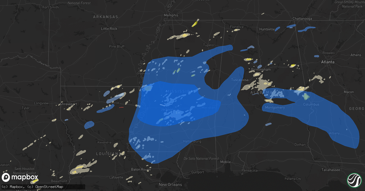
Hail Map in Mississippi on May 4, 2021
Get this storm
May 4 map
$229
one time, instant access
Download today. No call, no setup
Keep the $229
Bought the map and want the full workflow? Apply the entire $229 to a subscription within 7 days. None of it is wasted.
Every map, not just this one
This buys you this map. Subscription and you get every map we run, in the markets you choose from a few cities to whole states to nationwide. Plus real-time alerts the moment a storm fires.
Contact data
Name, contact info, occupancy, even credit band for addresses in the footprint. You go from where it hit to who to call.
Become the source they trust
Unlimited branding weather history reports on demand. You already have the documented answer ready for the property owner, and you are the one who showed up with it.
Property data and RoofTrace estimates
Pull up any address you have got, its value and the exact code rules for that jurisdiction, straight from One Click Code. Then RoofTrace estimates the squares, pitch, and roof value, priced the way you price.
Storm reports in Mississippi
Mississippi
| Date | Description |
|---|---|
| 05/04/20216:10 PM CDT | Trees down in both directions of the road - impassable. |
| 05/04/20214:55 PM CDT | Social media report of trees down in the ovett area. |
| 05/04/20214:34 PM CDT | Tree reported down on queensburg ave in laurel. |
| 05/04/20214:08 PM CDT | Two cars were damaged at the chick-fil-a drive thru when an anchored tent with metal poles was collapsed by the wind. |
| 05/04/20214:08 PM CDT | This tornado began along i-20/59 just west of the toomsuba exit... Downing large tree branches and uprooting or snapping a few trees as it crossed the interstate and th |
| 05/04/20214:07 PM CDT | Peak gust at asos site knmm. Measured out of the west-northwest. Peak sustained wind was 54 mph at the same time. |
| 05/04/20214:04 PM CDT | Numerous trees and lines down in the russel area. |
| 05/04/20214:03 PM CDT | Video and pictures show the collapse of brick walls at the old burlington mill in stonewall. |
| 05/04/20214:03 PM CDT | Trees downed in the westbound lanes of i-20/59 near mile marker 159. |
| 05/04/20214:00 PM CDT | A few trees down including a tree on the roof of a house...reported by kemper county em. |
| 05/04/20214:00 PM CDT | A corridor of straight line wind gusts up to 80 mph occurred in the vicinity of lindley rd and newell rd... Resulting in concentrated damage to large trees in a portion |
| 05/04/20214:00 PM CDT | A large tree fell and took down a power line and two other power poles associated with main feeder lines went down resulting in power outages to most of monticello...re |
| 05/04/20214:00 PM CDT | Large limb fell and went through the roof of a house...reported by lawrence county em. |
| 05/04/20214:00 PM CDT | Trees downed on houses at center st and pine st in enterprise. Multiple trees downed in the enterprise and stonewall area. |
| 05/04/20213:59 PM CDT | Corrects previous tstm wnd gst report from 2 se lost gap. Peak gust measured out of the west. Lasted 4 minutes until 4:03 pm. |
| 05/04/20213:59 PM CDT | Social media picture of a tree across power lines blocking dogwood lake rd. |
| 05/04/20213:58 PM CDT | Report from mping: wind damage similar to trees uprooted or snapped or a roof blown off. Time corrected to radar. |
| 05/04/20213:58 PM CDT | Several trees down along sam hurt road. |
| 05/04/20213:58 PM CDT | Part of a roof blown off an apt complex. Widespread downed trees and power lines in the county. Roughly 50 homes damaged by trees on them in the county. |
| 05/04/20213:58 PM CDT | Social media picture of trees and power lines downed on the northeast side of macon. |
| 05/04/20213:57 PM CDT | Trees and power lines downed across the county. Several homes with trees on them. |
| 05/04/20213:56 PM CDT | Trees downed on cr 16. |
| 05/04/20213:50 PM CDT | Tree downed on bay ave. |
| 05/04/20213:50 PM CDT | Numerous trees down with damage to houses... Vehicles and power lines. |
| 05/04/20213:50 PM CDT | Usace member reports numerous pine trees snapped. Photos relayed to nws via email. |
| 05/04/20213:50 PM CDT | Tree downed on e 2nd ave. |
| 05/04/20213:48 PM CDT | A house was damaged on cr 1529. |
| 05/04/20213:45 PM CDT | A few trees down in fulton. Some trees on vehicles and houses. |
| 05/04/20213:45 PM CDT | Trees were down along chunky-duffee road. |
| 05/04/20213:45 PM CDT | A few trees down in mantachie. |
| 05/04/20213:45 PM CDT | Large limbs and some trees down along cr363 near community of ozark |
| 05/04/20213:43 PM CDT | This tornado began along hopewell road then tracked northeastward along e l johnson road and across chunky duffee road just south of the duffee community. It crossed in |
| 05/04/20213:42 PM CDT | Social media picture of trees and power lines downed in hickory. |
| 05/04/20213:40 PM CDT | Large tree down between wren and aberdeen. |
| 05/04/20213:40 PM CDT | 75 mph wind measured at neshoba county eoc. |
| 05/04/20213:40 PM CDT | Trees downed on water well rd. |
| 05/04/20213:40 PM CDT | Large tree down on house in moorville community near itawamba county line. |
| 05/04/20213:38 PM CDT | Several trees down in this area... One on power lines on cardinal lane... Another across new light road. |
| 05/04/20213:37 PM CDT | Corrects previous tstm wnd dmg report from 2 ne newton. Numerous trees were down. Glass was blown out of a building. Power was out in newton and surrounding areas. Time |
| 05/04/20213:35 PM CDT | Multiple trees down along highway 15. Power was out in decatur and surrounding areas. |
| 05/04/20213:35 PM CDT | Tree down across watts lane reported by lincoln county em. |
| 05/04/20213:35 PM CDT | Trees and power line down in residential area of houston. |
| 05/04/20213:34 PM CDT | Social media picture of a shed destroyed in union. |
| 05/04/20213:31 PM CDT | Trees down on power lines in noxapater. |
| 05/04/20213:30 PM CDT | Numerous trees down along highway 492. Power was out across northern newton county. Power was out in union and surrounding areas. |
| 05/04/20213:29 PM CDT | Tin off of buildings around ms highway 35 and ms highway 902. |
| 05/04/20213:23 PM CDT | Report from mping of wind damage similar to trees uprooted or snapped or a roof blown off. Time corrected to radar. |
| 05/04/20213:21 PM CDT | Trees and power lines down along johns mayton rd. |
| 05/04/20213:21 PM CDT | Tree blocking hwy 15 near highpoint rd. |
| 05/04/20213:20 PM CDT | Tree downed on sturgis maben rd. |
| 05/04/20213:16 PM CDT | Trees downed at ms highway 13 and cr 143. |
| 05/04/20213:14 PM CDT | Trees downed with possible damage in walnut grove. |
| 05/04/20213:12 PM CDT | Tree downed on ms highway 35 north of carthage. |
| 05/04/20213:12 PM CDT | Trees downed on ms highway 14 blocking the roadway between kosciusko and louisville. |
| 05/04/20213:12 PM CDT | Social media report of a tree down in downtown carthage. |
| 05/04/20213:11 PM CDT | Tree down across bradshaw rd. |
| 05/04/20213:11 PM CDT | Tree across hwy 43 near wadsworth rd. |
| 05/04/20213:11 PM CDT | Several trees reported down in morton. |
| 05/04/20213:10 PM CDT | Limbs down. Report from mping:. |
| 05/04/20213:10 PM CDT | Large tree down blocking road at cr 4101 and cr 4130. |
| 05/04/20213:09 PM CDT | Tree downed on ms highway 16 just east of ms highway 493. |
| 05/04/20213:09 PM CDT | Tree reported down in hopewell. |
| 05/04/20213:09 PM CDT | A couple trees downed along hwy 429. |
| 05/04/20213:09 PM CDT | Several trees down. |
| 05/04/20213:06 PM CDT | 1-inch tree limbs broken; shingles blown off report from mping:. |
| 05/04/20213:06 PM CDT | This tornado began in a wooded area to the west of highway 13 on the northwest side of lena. A few large tree branches were snapped and a pine tree was uprooted as the |
| 05/04/20213:05 PM CDT | Numerous trees down. One fell on a camper and mobile home. Power lines were also down near the home. |
| 05/04/20213:05 PM CDT | Tree down across haynes chapel rd. |
| 05/04/20213:05 PM CDT | Tree across hwy 469 near henry byrd rd. |
| 05/04/20213:03 PM CDT | Social media picture of trees down in the thomasville area. |
| 05/04/20213:03 PM CDT | A couple trees down on hwy 429. |
| 05/04/20213:01 PM CDT | Tree down across garth farm rd. |
| 05/04/20213:00 PM CDT | Tree fell on outdoor gazebo in ripley. |
| 05/04/20213:00 PM CDT | Several trees reported down in gallman. |
| 05/04/20213:00 PM CDT | Power line blown down on old hwy 43 near the intersection of red oak rd. |
| 05/04/20213:00 PM CDT | A large oak or similar tree on the southeast side of first united methodist church of brandon was snapped near the base of the trunk. Other large limbs and a few small |
| 05/04/20213:00 PM CDT | Multiple trees and power lines down on the e side of brandon at the legacy subdivision. |
| 05/04/20212:59 PM CDT | Tree down across louis wilson south of towne street... Several trees and large limbs along louis wilson from deborah drive to hwy 18. |
| 05/04/20212:59 PM CDT | Tree down across e petros rd. |
| 05/04/20212:59 PM CDT | Tree down across briarhill rd. |
| 05/04/20212:59 PM CDT | 3 downed trees. |
| 05/04/20212:59 PM CDT | Tree downed on a fence in the greenfield station subdivision. |
| 05/04/20212:55 PM CDT | Trees uprooted or snapped; roof blown off report from mping: also reported via social media. |
| 05/04/20212:55 PM CDT | Corrects previous tstm wnd gst report from jan airport. Peak wind gust measured out of the north-northwest. |
| 05/04/20212:55 PM CDT | A few trees down...reported by webster county em. |
| 05/04/20212:54 PM CDT | Tree downed on a house on laurel dr at williams cir. |
| 05/04/20212:54 PM CDT | Tree down on florence-byram rd near the intersection of long dr. |
| 05/04/20212:52 PM CDT | A chimney was blown off a home in the laurelwood subdivision in flowood. Possible tornado damage. Report with picture relayed via facebook. |
| 05/04/20212:52 PM CDT | Trees down across north hwy 471 near the intersection of church road. |
| 05/04/20212:52 PM CDT | Tree down across barksdale rd. |
| 05/04/20212:52 PM CDT | Large tree branch brought down a power line along harbor lane. |
| 05/04/20212:52 PM CDT | Multiple trees down... Some roof damage to homes. |
| 05/04/20212:50 PM CDT | Report from mping of wind damage similar to 1-inch tree limbs broken or shingles blown off. Time corrected to radar. |
| 05/04/20212:50 PM CDT | Several reports of trees and limbs down around downtown jackson. |
| 05/04/20212:48 PM CDT | Report from mping: wind damage similar to 3-inch tree limbs broken or power poles broken. Time corrected to radar. |
| 05/04/20212:47 PM CDT | Trees and powerlines down. Tree on house. - picture via social media post. |
| 05/04/20212:47 PM CDT | Large tree down and through roof of house. |
| 05/04/20212:46 PM CDT | Corrects previous tstm wnd gst report from hawkins field. Peak wind gust measured out of the west-northwest. |
| 05/04/20212:46 PM CDT | Trees downed on brame rd and w jackson st near i-55. |
| 05/04/20212:46 PM CDT | A tall oak tree was uprooted and fell onto a home on north central avenue. It caused major damage to the home and the roof caved in. Report with pictures relayed via fa |
| 05/04/20212:45 PM CDT | Trees down near the intersection of beasley and hanging moss blocking the road. |
| 05/04/20212:45 PM CDT | Tree down across hwy 14. |
| 05/04/20212:45 PM CDT | Corrects previous tornado report from 4 ese tougaloo. Corrects previous tornado report from 4 ese tougaloo. Video taken from the fondren area looking east showed a torn |
| 05/04/20212:45 PM CDT | Trees were blown down on the southeast side of canton. |
| 05/04/20212:45 PM CDT | Tree down over pine lane drive. |
| 05/04/20212:45 PM CDT | Multiple homes damaged on ridgewood road by fallen trees. |
| 05/04/20212:45 PM CDT | Doors blown off of bankplus building in fondren - social media post. |
| 05/04/20212:45 PM CDT | Multiple homes damaged on ridgewood road by fallen trees. |
| 05/04/20212:45 PM CDT | A small amount of quarter inch fell in ashland. |
| 05/04/20212:43 PM CDT | Tree down near intersection of gluckstadt and bozeman. |
| 05/04/20212:43 PM CDT | Tree downed on a car in summertree. |
| 05/04/20212:40 PM CDT | Uprooted trees and snapped limbs were seen in northwest jackson. Large downed trees were blocking west county line road. |
| 05/04/20212:40 PM CDT | Uprooted trees and snapped limbs were seen in northwest jackson. Large downed trees were blocking west county line road. |
| 05/04/20212:39 PM CDT | Trees reported down in raymond. |
| 05/04/20212:39 PM CDT | Large tree across road. |
| 05/04/20212:39 PM CDT | Multiple trees down across the city. |
| 05/04/20212:38 PM CDT | Several trees down and lines... Some roads blocked by trees. |
| 05/04/20212:38 PM CDT | Trees down. |
| 05/04/20212:37 PM CDT | Picture of a carwash awning destroyed. |
| 05/04/20212:37 PM CDT | Intense tree damage occurred along the south frontage road just west of the natchez trace in clinton. Pictures relayed via twitter show a concentration of trees bent an |
| 05/04/20212:32 PM CDT | Tree and power line down. |
| 05/04/20212:30 PM CDT | Scattered trees and lines down. |
| 05/04/20212:30 PM CDT | Trees were blocking the road... Delaying traffic in both directions. |
| 05/04/20212:27 PM CDT | Numerous trees down and some power lines. |
| 05/04/20212:26 PM CDT | Widespread downed trees and lines... Most of the county is out of power. Several roads blocked by trees. |
| 05/04/20212:25 PM CDT | Myrleville rd area had numerous trees down and lines down. Possible tornado. |
| 05/04/20212:25 PM CDT | A few trees down. |
| 05/04/20212:25 PM CDT | Multiple trees and lines down around the area. |
| 05/04/20212:24 PM CDT | This mesovortex tornado began just past the farr road line to the northwest of brownsville. The tornado surged southeast along north john warren road... Alexander road. |
| 05/04/20212:23 PM CDT | Several trees and lines down in the sibley area. |
| 05/04/20212:23 PM CDT | Multiple trees down on old dover and paradise roads... Possible tornado. |
| 05/04/20212:23 PM CDT | Multiple trees down and some lines... Some roads blocked by trees. |
| 05/04/20212:22 PM CDT | Multiple trees down. |
| 05/04/20212:22 PM CDT | The tornado began off hwy 49 along fletchers chapel road near the dover community. The storm tracked east across old dover and paradise roads snapping large limbs and u |
| 05/04/20212:21 PM CDT | Trees and power lines downed in grenada and across the western portion of grenada county. |
| 05/04/20212:21 PM CDT | Trees down scattered in and around yazoo city. 6 homes in the county had trees on them. |
| 05/04/20212:18 PM CDT | Couple trees down along hwy 49. |
| 05/04/20212:15 PM CDT | Numerous trees and lines down across vicksburg and eastward on both sides of i-20. Sig swath of tree damage noted by em. 7 homes had trees down on them. |
| 05/04/20212:15 PM CDT | Numerous trees down on seely road in hamilton. |
| 05/04/20212:12 PM CDT | Trees and lines down in the n part of the county. |
| 05/04/20212:10 PM CDT | Sweethome rd blocked by downed trees. |
| 05/04/20212:10 PM CDT | Swath of wind damage from a microburst occurred in the sweethome community. Multiple trees were damaged... Esp along sweethome road... Power lines were down and a metal |
| 05/04/20211:56 PM CDT | Several large limbs down across town... Including several that fell on and damaged homes. |
| 05/04/20211:53 PM CDT | Trees down across cooper rd. |
| 05/04/20211:50 PM CDT | Tree down on elms court dr. |
| 05/04/20211:48 PM CDT | A local report indicates 58 MPH wind near 2 WSW VALLEY HILL |
| 05/04/20211:46 PM CDT | A local report indicates 1.00 inch wind near CARROLLTON |
| 05/04/20211:45 PM CDT | Extensive swath of wind damage occurred across the schlater area. Numerous trees were downed... 10 light poles snapped... Homes damaged by falling trees... And several |
| 05/04/20211:40 PM CDT | Golf ball sized hail reported in rolling fork by law enforcement. |
| 05/04/20211:33 PM CDT | Power poles down along mccorkle rd. |
| 05/04/20211:32 PM CDT | Several trees reported down in the blaine area. |
| 05/04/20211:30 PM CDT | Tree down along with several large limbs. |
| 05/04/20211:22 PM CDT | Tree down on highway 436. |
| 05/04/20211:22 PM CDT | An awning was blown off of a gas station. Reported via social media. |
| 05/04/20211:20 PM CDT | Corrects previous tstm wnd dmg report from cleveland. 1.5 inch diameter tree limbs were down. Winds were estimated at 50 mph gusting to between 60 and 65 mph. Heavy rai |
| 05/04/20211:20 PM CDT | 1.5 inch diameter tree limbs down...estimated 60 mph winds observed with heavy rain blowing sideways. |
| 05/04/20211:17 PM CDT | Roof of a mobile home was blown off... Picture relayed via social media. |
| 05/04/20211:17 PM CDT | Social media picture of a tree down across power lines in elizabeth. |
| 05/04/20211:15 PM CDT | Front half of roof blown off apartment building. |
| 05/04/20211:15 PM CDT | Social media report of a tree down in shaw. |
| 05/04/20211:15 PM CDT | A flag pole rated to around 70 mph was blown down in the cleveland area. Report relayed via facebook. |
| 05/04/20211:14 PM CDT | A large tree was snapped and fell across north bayou road across from the country club. Report with picture relayed via facebook. |
| 05/04/20211:14 PM CDT | Several trees and powerlines down along highway 448. |
| 05/04/20211:08 PM CDT | A tree and a few power lines were blown down in the elizabeth community near leland. Report with picture relayed to broadcast media facebook page. |
| 05/04/20211:03 PM CDT | Dime to quarter sized hail reported in crystal springs. |
| 05/04/202112:27 PM CDT | Social media report of a tree down in canton. |
| 05/04/202110:05 AM CDT | Quarter hail in the fentress community. |
| 05/04/20219:12 AM CDT | Tornado reported by person driving down hwy 49 near the rankin/simpson county line. |
| 05/04/20219:11 AM CDT | Tornado crossing hwy 49 and moving n and ne of the piney woods campus. |
| 05/04/20219:08 AM CDT | Large tree uprooted and several branches were snapped near a home on myers road. Reported via social media. |
| 05/04/20219:05 AM CDT | Trees down near the intersection of myers road and north star-braxton road. Possible tornado. |
| 05/04/20219:01 AM CDT | This supercell tornado developed in southern rankin county along the rankin and simpson county line. The tornado touched down along myers road as a low end ef1 with win |
| 05/04/20218:05 AM CDT | Half dollar sized hail reported near crystal springs. |
| 05/04/20217:57 AM CDT | At 1256 PM CDT, severe thunderstorms were located along a line extending from near Beekman to near Start to 11 miles northwest of Columbia, moving east at 45 mph. HAZARD...70 mph wind gusts and nickel size hail. SOURCE...Radar indicated. IMPACT...Expect considerable tree damage. Damage is likely to mobile homes, roofs, and outbuildings. Severe thunderstorms will be near... Start around 100 PM CDT. Rayville around 105 PM CDT. Buckner and Holly Ridge around 120 PM CDT. Alto around 125 PM CDT. Mangham, Archibald and Warden around 130 PM CDT. Darnell around 135 PM CDT. Monticello around 140 PM CDT. Crowville around 145 PM CDT.Other locations impacted by these severe thunderstorms include Baskinand Epps. |
| 05/04/20217:47 AM CDT | At 1247 PM CDT, a severe thunderstorm was located near Dentville, or 8 miles west of Hazlehurst, moving northeast at 25 mph. HAZARD...60 mph wind gusts and half dollar size hail. SOURCE...Radar indicated. IMPACT...Hail damage to vehicles is expected. Expect wind damage to roofs, siding, and trees. This severe thunderstorm will be near... Hazlehurst around 1255 PM CDT. Gallman around 105 PM CDT. Crystal Springs around 110 PM CDT. |
| 05/04/20217:46 AM CDT | At 1246 PM CDT, a severe thunderstorm was located near Myrleville, or 10 miles west of Canton, moving northeast at 30 mph. HAZARD...60 mph wind gusts. SOURCE...Radar indicated. IMPACT...Expect damage to roofs, siding, and trees. This severe thunderstorm will be near... Way around 110 PM CDT. Vaughan around 115 PM CDT. |
| 05/04/20217:40 AM CDT | At 1240 PM CDT, a severe thunderstorm was located over Sharon, or near Canton, moving northeast at 30 mph. HAZARD...60 mph wind gusts and quarter size hail. SOURCE...Radar indicated. IMPACT...Hail damage to vehicles is expected. Expect wind damage to roofs, siding, and trees. This severe thunderstorm will be near... Farmhaven around 1255 PM CDT. |
| 05/04/20217:07 AM CDT | At 1207 PM CDT, a severe thunderstorm was located over Gluckstadt, or near Madison, moving northeast at 30 mph. HAZARD...60 mph wind gusts and quarter size hail. SOURCE...Radar indicated. IMPACT...Hail damage to vehicles is expected. Expect wind damage to roofs, siding, and trees. This severe thunderstorm will be near... Gluckstadt around 1215 PM CDT. Canton around 1220 PM CDT. Sharon around 1240 PM CDT. |
| 05/04/20216:43 AM CDT | At 1142 AM CDT, a severe thunderstorm was located near Snyder, or 9 miles northeast of Hamburg, moving northeast at 40 mph. HAZARD...60 mph wind gusts and quarter size hail. SOURCE...Radar indicated. IMPACT...Hail damage to vehicles is expected. Expect wind damage to roofs, siding, and trees. Locations impacted include... Dermott... Rohwer... Arkansas City... Lucca Landing... McGehee... Ladelle... Prairie Grove... Jerome... Baxter... Halley... Masonville... Collins... McArthur... Lacey... |
| 05/04/20215:02 AM CDT | At 1002 AM CDT, a severe thunderstorm was located over Chester, or 19 miles northwest of Louisville, moving northeast at 30 mph. HAZARD...60 mph wind gusts and half dollar size hail. SOURCE...Radar indicated. IMPACT...Hail damage to vehicles is expected. Expect wind damage to roofs, siding, and trees. This severe thunderstorm will be near... Reform around 1015 AM CDT. Longview around 1040 AM CDT.Other locations impacted by this severe thunderstorm include Sturgis. |
| 05/04/20212:58 AM CDT | At 757 AM CDT, a severe thunderstorm was located over Crystal Springs, moving northeast at 25 mph. HAZARD...60 mph wind gusts and quarter size hail. SOURCE...Radar indicated. IMPACT...Hail damage to vehicles is expected. Expect wind damage to roofs, siding, and trees. This severe thunderstorm will be near... Terry around 815 AM CDT. Whites around 825 AM CDT. Florence around 835 AM CDT. Star around 840 AM CDT. Monterey around 845 AM CDT. |
| 05/04/202112:44 AM CDT | At 543 PM CDT, severe thunderstorms were located along a line extending from 6 miles west of Saint Stephens to near Beaumont, moving east at 45 mph. HAZARD...60 mph wind gusts. SOURCE...Radar indicated. IMPACT...Expect damage to roofs, siding, and trees. Locations impacted include... Monroeville, Jackson, Citronelle, Lucedale, Frisco City, Chatom, Leakesville, Chunchula, Stockton, Wagarville, Saint Stephens, Leroy, Gulfcrest, Deer Park, Axis, Uriah, Tibbie, Beaumont, Mount Vernon and Calvert. |
| 05/03/202111:44 PM CDT | At 444 PM CDT, severe thunderstorms were located along a line extending from 7 miles north of Waynesboro to 9 miles southeast of Mill Creek to 3 miles west of Ovett to West Hattiesburg, moving east at 75 mph. HAZARD...60 mph wind gusts. SOURCE...Radar indicated. IMPACT...Expect damage to roofs, siding, and trees. Locations impacted include... Citronelle, Lucedale, Frisco City, Chatom, Richton, Leakesville, Chunchula, Wagarville, Gulfcrest, Deer Park, Uriah, Tibbie, Beaumont, Calvert, Mount Vernon, New Augusta, McLain, Excel, State Line and Fruitdale. |
| 05/03/202110:58 PM CDT | At 358 PM CDT, a severe thunderstorm was located over De Kalb, or 13 miles southeast of Preston, moving east at 70 mph. HAZARD...70 mph wind gusts. SOURCE...Radar indicated. IMPACT...Expect considerable tree damage. Damage is likely to mobile homes, roofs, and outbuildings. This severe thunderstorm will be near... Electric Mills and Porterville around 405 PM CDT.Other locations impacted by this severe thunderstorm include Scooba. |
| 05/03/202110:38 PM CDT | At 338 PM CDT, severe thunderstorms were located along a line extending from near Raleigh to East Lincoln, moving southeast at 40 mph. HAZARD...70 mph wind gusts and nickel size hail. SOURCE...Radar indicated. IMPACT...Expect considerable tree damage. Damage is likely to mobile homes, roofs, and outbuildings. Severe thunderstorms will be near... Robinwood around 355 PM CDT. Tilton and Oak Vale around 405 PM CDT. Holly Springs around 410 PM CDT. Morgantown, Goss, Moss and Society Hill around 415 PM CDT. Bunker Hill around 420 PM CDT. Columbia around 425 PM CDT. Sandersville and Improve around 430 PM CDT.Other locations impacted by these severe thunderstorms includeSeminary, Silver Creek, Bassfield and Soso. |
| 05/03/202110:33 PM CDT | At 333 PM CDT, severe thunderstorms were located along a line extending from near Bogue Chitto to near Zachary, moving east at 50 mph. HAZARD...60 mph wind gusts and quarter size hail. SOURCE...Radar indicated. IMPACT...Hail damage to vehicles is expected. Expect wind damage to roofs, siding, and trees. Locations impacted include... Zachary, Mccomb, Jackson, Clinton, Liberty, Greensburg, Amite, Amite City, Magnolia, Kentwood, Summit, Centreville, Tylertown, Roseland, Slaughter, Wilson, Osyka, Norwood, Montpelier and Smithdale.This includes the following Interstates... Interstate 55 in Louisiana between mile markers 45 and 66. Interstate 55 in Mississippi between mile markers 1 and 24. |
| 05/03/202110:18 PM CDT | At 317 PM CDT, severe thunderstorms were located along a line extending from 8 miles east of Gholson to near Damascus, moving east at 35 mph. HAZARD...60 mph wind gusts and quarter size hail. SOURCE...Radar indicated. IMPACT...Hail damage to vehicles is expected. Expect wind damage to roofs, siding, and trees. Severe thunderstorms will be near... Paulette and Blackwater around 335 PM CDT. De Kalb and Cooksville around 340 PM CDT. Porterville and Tamola around 355 PM CDT. Electric Mills around 400 PM CDT.Other locations impacted by these severe thunderstorms includeScooba. |
| 05/03/202110:09 PM CDT | At 309 PM CDT, severe thunderstorms were located along a line extending from near Ludlow to 6 miles southwest of Pelahatchie to Harrisville, moving east at 60 mph. HAZARD...70 mph wind gusts and nickel size hail. SOURCE...Radar indicated. IMPACT...Expect considerable tree damage. Damage is likely to mobile homes, roofs, and outbuildings. Severe thunderstorms will be near... Harperville and Hillsboro around 320 PM CDT. Steele and Pulaski around 325 PM CDT. Homewood and Burns around 330 PM CDT. Prospect, Conehatta and Pineville around 335 PM CDT. Lawrence, Decatur, Raleigh, Roberts and Stratton around 345 PM CDT. Little Rock and Center Ridge around 350 PM CDT. Duffee and Garlandville around 355 PM CDT. Stringer, Bay Springs and Rose Hill around 400 PM CDT.Other locations impacted by these severe thunderstorms includeSylvarena, Mize, Sebastopol, Louin, Chunky, Lake, Montrose andHickory. |
| 05/03/202110:08 PM CDT | At 307 PM CDT, a severe thunderstorm was located near Carthage, moving east at 70 mph. HAZARD...70 mph wind gusts and nickel size hail. SOURCE...Radar indicated. IMPACT...Expect considerable tree damage. Damage is likely to mobile homes, roofs, and outbuildings. This severe thunderstorm will be near... Edinburg, Madden and Dowdville around 320 PM CDT. Pearl River and Dixon around 325 PM CDT. Philadelphia and Neshoba around 330 PM CDT. Bethsaida around 335 PM CDT. Forestdale around 340 PM CDT.Other locations impacted by this severe thunderstorm include Tucker,Standing Pine and Walnut Grove. |
| 05/03/202110:03 PM CDT | At 303 PM CDT, severe thunderstorms were located along a line extending from 9 miles southwest of Chester to near Smyrna, moving east at 70 mph. HAZARD...70 mph wind gusts. SOURCE...Radar indicated. IMPACT...Expect considerable tree damage. Damage is likely to mobile homes, roofs, and outbuildings. Severe thunderstorms will be near... Chester around 310 PM CDT. Ackerman around 315 PM CDT. Louisville, Craig Springs and Mcmillan around 325 PM CDT. Starkville and Longview around 330 PM CDT. Oktoc and Millcreek around 335 PM CDT. Sessums around 340 PM CDT.Other locations impacted by these severe thunderstorms includeNoxapater, Sturgis and Weir. |
| 05/03/202110:02 PM CDT | At 302 PM CDT, a severe thunderstorm was located near Mashulaville, or 16 miles northeast of Preston, moving northeast at 50 mph. HAZARD...60 mph wind gusts and penny size hail. SOURCE...Radar indicated. IMPACT...Expect damage to roofs, siding, and trees. This severe thunderstorm will be near... Macon around 310 PM CDT. Deerbrook around 320 PM CDT. Prairie Point around 325 PM CDT. Bigbee Valley around 330 PM CDT.Other locations impacted by this severe thunderstorm includeShuqualak. |
| 05/03/202110:02 PM CDT | At 301 PM CDT, a severe thunderstorm was located over Saltillo, or 7 miles south of Baldwyn, moving east at 65 mph. HAZARD...60 mph wind gusts. SOURCE...Radar indicated. IMPACT...Expect damage to roofs, siding, and trees. Locations impacted include... Baldwyn, Saltillo, Guntown, Mantachie, Fairview, Pratts Friendship, Sandy Springs, Blair, Marietta, Thrasher, Jericho, Branyan, Kirkville, Jug Fork, Hobo Station, Chapelville, Moores Mill, Alpine, Birmingham and Corrona. |
| 05/03/20219:58 PM CDT | At 258 PM CDT, a severe thunderstorm was located near Slate Springs, or 20 miles west of Montpelier, moving east at 40 mph. HAZARD...70 mph wind gusts. SOURCE...Radar indicated. IMPACT...Expect considerable tree damage. Damage is likely to mobile homes, roofs, and outbuildings. Locations impacted include... Houston, Calhoun City, Vardaman, Derma, Slate Springs, Pyland, Trebloc, Big Creek, Woodland, Sparta, Thorn, Van Vleet, Parkersburg, Thelma, Tabbville, McCondy, Anchor, Atlanta, Buena Vista and Slate Spring. |
| 05/03/20219:58 PM CDT | At 257 PM CDT, severe thunderstorms were located along a line extending from near Garden City to near St. Francisville, moving east at 45 mph. HAZARD...60 mph wind gusts and quarter size hail. SOURCE...Radar indicated. IMPACT...Hail damage to vehicles is expected. Expect wind damage to roofs, siding, and trees. Locations impacted include... Jackson, Clinton, Liberty, Centreville, Woodville, Slaughter, Gloster, Wilson, Norwood, Wakefield, Smithdale, Spillman, Felps and Crosby. |
| 05/03/20219:44 PM CDT | At 244 PM CDT, a severe thunderstorm was located near Pulaski, or 10 miles south of Morton, moving northeast at 45 mph. HAZARD...60 mph wind gusts and quarter size hail. SOURCE...Radar indicated. IMPACT...Hail damage to vehicles is expected. Expect wind damage to roofs, siding, and trees. This severe thunderstorm will be near... Homewood around 250 PM CDT. Forest around 300 PM CDT. Lawrence around 315 PM CDT. Newton around 325 PM CDT. Decatur and Stratton around 330 PM CDT.Other locations impacted by this severe thunderstorm include Lake andSebastopol. |
| 05/03/20219:40 PM CDT | At 240 PM CDT, severe thunderstorms were located along a line extending from near Carpenter to 8 miles northeast of Woodville, moving east at 60 mph. HAZARD...70 mph wind gusts and nickel size hail. SOURCE...Radar indicated. IMPACT...Expect considerable tree damage. Damage is likely to mobile homes, roofs, and outbuildings. Severe thunderstorms will be near... Dentville around 250 PM CDT. Hazlehurst around 255 PM CDT. Crystal Springs and Gallman around 300 PM CDT. Hopewell around 310 PM CDT. Union around 315 PM CDT. Sanatorium around 335 PM CDT.Other locations impacted by these severe thunderstorms include NewHebron, Silver Creek, Beauregard and Georgetown. |
| 05/03/20219:37 PM CDT | At 236 PM CDT, a severe thunderstorm was located over New Harmony, or near New Albany, moving east at 35 mph. HAZARD...60 mph wind gusts. SOURCE...Radar indicated. IMPACT...Expect damage to roofs, siding, and trees. Locations impacted include... New Albany, Baldwyn, Saltillo, Guntown, Mantachie, Fairview, New Harmony, Pratts Friendship, Sandy Springs, Blair, Sherman, Marietta, Blue Springs, Thrasher, Jericho, Cherry Creek, Branyan, Ellistown, Kirkville and Jug Fork. |
| 05/03/20219:33 PM CDT | At 233 PM CDT, a severe thunderstorm was located near Stallo, or 9 miles northwest of Nanih Waiya, moving northeast at 35 mph. HAZARD...60 mph wind gusts and quarter size hail. SOURCE...Radar indicated. IMPACT...Hail damage to vehicles is expected. Expect wind damage to roofs, siding, and trees. This severe thunderstorm will be near... Millcreek around 255 PM CDT.Other locations impacted by this severe thunderstorm includeNoxapater. |
| 05/03/20219:30 PM CDT | At 229 PM CDT, a severe thunderstorm was located near Duck Hill, or 11 miles north of Winona, moving east at 55 mph. HAZARD...60 mph wind gusts and nickel size hail. SOURCE...Radar indicated. IMPACT...Expect damage to roofs, siding, and trees. This severe thunderstorm will be near... Embry and Bellefontaine around 250 PM CDT. Clarkson around 300 PM CDT. Cumberland around 305 PM CDT.Other locations impacted by this severe thunderstorm include Manteeand Walthall. |
| 05/03/20219:30 PM CDT | At 230 PM CDT, a severe thunderstorm was located over Snow Lake Shores, or 12 miles east of Holly Springs, moving east at 40 mph. HAZARD...60 mph wind gusts and quarter size hail. SOURCE...Radar indicated. IMPACT...Hail damage to vehicles is expected. Expect wind damage to roofs, siding, and trees. Locations impacted include... Ripley, Snow Lake Shores, Canaan, Gravestown, Walnut, Ashland, Falkner, Chalybeate, Murry, Brody, Brownfield, Whitten Town, Hamilton, Peoples and Tiplersville. |
| 05/03/20219:29 PM CDT | At 229 PM CDT, a severe thunderstorm was located near Duck Hill, or 11 miles north of Winona, moving east at 55 mph. HAZARD...60 mph wind gusts and nickel size hail. SOURCE...Radar indicated. IMPACT...Expect damage to roofs, siding, and trees. This severe thunderstorm will be near... Embry and Bellefontaine around 250 PM CDT. Clarkson around 300 PM CDT. Cumberland around 305 PM CDT.Other locations impacted by this severe thunderstorm include Manteeand Walthall. |
| 05/03/20219:26 PM CDT | At 226 PM CDT, severe thunderstorms were located along a line extending from Sibley to near Bayou Current, moving northeast at 35 mph. HAZARD...60 mph wind gusts and quarter size hail. SOURCE...Radar indicated. IMPACT...Hail damage to vehicles is expected. Expect wind damage to roofs, siding, and trees. Locations impacted include... Woodville, Morganza, Lettsworth, Batchelor, Fort Adams, Dolorosa and Crosby. |
| 05/03/20219:12 PM CDT | At 212 PM CDT, severe thunderstorms were located along a line extending from near Seven Pines to Thornton, moving east at 65 mph. HAZARD...70 mph wind gusts and nickel size hail. SOURCE...Radar indicated. IMPACT...Expect considerable tree damage. Damage is likely to mobile homes, roofs, and outbuildings. Severe thunderstorms will be near... Black Hawk around 220 PM CDT. Franklin and Vaiden around 230 PM CDT. Bowling Green around 235 PM CDT. Durant, Kilmichael and Poplar Creek around 240 PM CDT. Possumneck around 245 PM CDT. Hesterville around 250 PM CDT.Other locations impacted by these severe thunderstorms includeMccool, Ethel, French Camp, West and Weir. |
| 05/03/20219:09 PM CDT | At 209 PM CDT, severe thunderstorms were located along a line extending from near Yazoo City to near Phoenix, moving east at 70 mph. These are very dangerous storms. HAZARD...80 mph wind gusts and penny size hail. SOURCE...Radar indicated. IMPACT...Flying debris will be dangerous to those caught without shelter. Mobile homes will be heavily damaged. Expect considerable damage to roofs, windows, and vehicles. Extensive tree damage and power outages are likely. Severe thunderstorms will be near... Benton around 220 PM CDT. Flora and Coxburg around 225 PM CDT. Ebenezer and Annandale around 230 PM CDT. Franklin, Pickens and Gluckstadt around 235 PM CDT. Canton, Goodman and Cameron around 240 PM CDT. Newport and Sharon around 245 PM CDT. Farmhaven, Mcadams and Thomastown around 250 PM CDT. Kosciusko, Ludlow and Singleton around 255 PM CDT.Other locations impacted by these severe thunderstorms include Lena,Sallis, Redwater and Bentonia. |
| 05/03/20219:00 PM CDT | At 159 PM CDT, a severe thunderstorm was located near Edinburg, moving east at 30 mph. HAZARD...60 mph wind gusts and quarter size hail. SOURCE...Radar indicated. IMPACT...Hail damage to vehicles is expected. Expect wind damage to roofs, siding, and trees. This severe thunderstorm will be near... Pearl River around 210 PM CDT. Stallo and Burnside around 230 PM CDT.Other locations impacted by this severe thunderstorm include StandingPine. |
| 05/03/20218:57 PM CDT | At 157 PM CDT, severe thunderstorms were located along a line extending from near Somerset to 6 miles northwest of Black Hawk, moving east at 45 mph. HAZARD...70 mph wind gusts and nickel size hail. SOURCE...Radar indicated. IMPACT...Expect considerable tree damage. Damage is likely to mobile homes, roofs, and outbuildings. Severe thunderstorms will be near... Newellton and Somerset around 205 PM CDT. Yokena around 225 PM CDT. Rocky Springs around 235 PM CDT. Reganton around 240 PM CDT. Utica around 250 PM CDT.Other locations impacted by these severe thunderstorms include Roxieand Meadville. |
| 05/03/20218:44 PM CDT | At 144 PM CDT, a severe thunderstorm was located near Winona, moving north at 30 mph. HAZARD...60 mph wind gusts and quarter size hail. SOURCE...Radar indicated. IMPACT...Hail damage to vehicles is expected. Expect wind damage to roofs, siding, and trees. This severe thunderstorm will be near... Jefferson and Duck Hill around 155 PM CDT. Elliott around 200 PM CDT. Grenada and Bew Springs around 215 PM CDT.Other locations impacted by this severe thunderstorm includeCarrollton. |
| 05/03/20218:31 PM CDT | At 130 PM CDT, a severe thunderstorm was located near Whites, or 9 miles east of Crystal Springs, moving east at 30 mph. HAZARD...60 mph wind gusts. SOURCE...Radar indicated. IMPACT...Expect damage to roofs, siding, and trees. This severe thunderstorm will be near... Star around 150 PM CDT. Piney Woods around 155 PM CDT. Cato around 210 PM CDT. Johns around 215 PM CDT.Other locations impacted by this severe thunderstorm include Braxton. |
| 05/03/20218:27 PM CDT | At 127 PM CDT, a severe thunderstorm was located over Laws Hill, or 7 miles southwest of Wall Doxey State Park, moving east at 30 mph. HAZARD...60 mph wind gusts and quarter size hail. SOURCE...Radar indicated. IMPACT...Hail damage to vehicles is expected. Expect wind damage to roofs, siding, and trees. Locations impacted include... Wall Doxey State Park, John W Kyle State Park, Barr, Harmontown, Bethlehem, Laws Hill, Hickory Flat, Potts Camp, Myrtle, Abbeville, Malone, Waterford, Spring Hill, Aiken, Crossroad, Tyro, Gilton, Chulahoma, Lake Center and Glenville. |
| 05/03/20218:19 PM CDT | At 119 PM CDT, a severe thunderstorm was located near Indianola, moving east at 40 mph. HAZARD...60 mph wind gusts and quarter size hail. SOURCE...Radar indicated. IMPACT...Hail damage to vehicles is expected. Expect wind damage to roofs, siding, and trees. This severe thunderstorm will be near... Moorhead and Sunflower around 130 PM CDT. Blaine around 135 PM CDT. Itta Bena around 145 PM CDT. Quito around 150 PM CDT. Money around 200 PM CDT. Greenwood around 205 PM CDT.Other locations impacted by this severe thunderstorm includeSchlater, Doddsville and Morgan City. |
| 05/03/20218:15 PM CDT | At 115 PM CDT, severe thunderstorms were located along a line extending from near Buckner to near Aimwell to near Effie, moving east at 40 mph. HAZARD...70 mph wind gusts and nickel size hail. SOURCE...Radar indicated. IMPACT...Expect considerable tree damage. Damage is likely to mobile homes, roofs, and outbuildings. Severe thunderstorms will be near... Aimwell and Manifest around 120 PM CDT. Sherwood and Rosefield around 125 PM CDT. Enterprise around 130 PM CDT. Larto around 135 PM CDT. Acme and Mayna around 140 PM CDT. New Era around 145 PM CDT. Monterey, Wisner and Slocum around 155 PM CDT. Cooter Point and Deer Park around 205 PM CDT.Other locations impacted by these severe thunderstorms includeHarrisonburg, Gilbert, Sicily Island and Ridgecrest. |
| 05/03/20218:10 PM CDT | At 110 PM CDT, a severe thunderstorm was located 7 miles east of Farmhaven, or 10 miles southwest of Carthage, moving northeast at 35 mph. HAZARD...60 mph wind gusts and quarter size hail. SOURCE...Radar indicated. IMPACT...Hail damage to vehicles is expected. Expect wind damage to roofs, siding, and trees. This severe thunderstorm will be near... Carthage around 125 PM CDT. Renfroe around 140 PM CDT. Edinburg around 150 PM CDT.Other locations impacted by this severe thunderstorm includeRedwater. |
| 05/03/20218:06 PM CDT | At 105 PM CDT, a severe thunderstorm was located near Como, or 7 miles south of Senatobia, moving northeast at 30 mph. HAZARD...Quarter size hail. SOURCE...Radar indicated. IMPACT...Damage to vehicles is expected. Locations impacted include... Senatobia, Wall Doxey State Park, Sardis, Como, Barr, Pleasant Grove, Harmontown, Independence, Red Banks, Laws Hill, Marianna, Malone, Wakefield, Waterford, Aiken, Crossroad, Tyro, Watson, Chulahoma and Glenville. |
All States Impacted by Hail Map on May 4, 2021
Cities Impacted by Hail Map on May 4, 2021
- Saulsbury, TN
- Walnut, MS
- Ashland, MS
- Michigan City, MS
- Morton, MS
- Pelahatchie, MS
- Sulphur, LA
- French Settlement, LA
- Maurepas, LA
- Saint Amant, LA
- Clanton, AL
- Verbena, AL
- Billingsley, AL
- Martindale, TX
- Milam, WV
- Bergton, VA
- Moorefield, WV
- Waterford, MS
- Como, MS
- Holly Springs, MS
- Abbeville, MS
- Ruleville, MS
- Doddsville, MS
- Cleveland, MS
- Valley, AL
- Opelika, AL
- Hamilton, GA
- Cusseta, AL
- West Point, GA
- Salem, AL
- Smithville, TX
- Palacios, TX
- Florence, MS
- Frierson, LA
- Stonewall, LA
- Quicksburg, VA
- New Market, VA
- Timberville, VA
- Mount Jackson, VA
- Weogufka, AL
- Equality, AL
- Eclectic, AL
- Rockford, AL
- Alexander City, AL
- Elmore, AL
- Titus, AL
- Prattville, AL
- Deatsville, AL
- Wetumpka, AL
- Millbrook, AL
- Marbury, AL
- Ashburn, GA
- Pheba, MS
- Maben, MS
- Lamar, MS
- Bastrop, TX
- Red Rock, TX
- Cedar Creek, TX
- Florien, LA
- Steeles Tavern, VA
- Greenville, VA
- Raphine, VA
- Heflin, AL
- Anniston, AL
- Sardis, MS
- Crenshaw, MS
- Wilsonville, AL
- Columbiana, AL
- Gary, TX
- Tenaha, TX
- Timpson, TX
- Cameron, SC
- Effie, LA
- Jonesville, LA
- Marksville, LA
- Pennington, TX
- Groveton, TX
- Apple Springs, TX
- Kennard, TX
- Nacogdoches, TX
- Lafayette, AL
- Camp Hill, AL
- Five Points, AL
- Lanett, AL
- Moorhead, MS
- Indianola, MS
- Bienville, LA
- Crosby, MS
- Brent, AL
- Williston, SC
- Bedford, VA
- Big Island, VA
- Rolling Fork, MS
- Glen Allan, MS
- Hollandale, MS
- Mayersville, MS
- Anguilla, MS
- Lumberton, TX
- Kountze, TX
- Lockhart, TX
- Caldwell, TX
- Jasper, AL
- Vesuvius, VA
- Tyro, VA
- Montebello, VA
- Draper, VA
- Hamburg, AR
- Ragley, LA
- Starks, LA
- Lake Charles, LA
- Longville, LA
- Mittie, LA
- Dequincy, LA
- Oakdale, LA
- Kinder, LA
- Singer, LA
- Oberlin, LA
- Dry Creek, LA
- Iowa, LA
- Reeves, LA
- Warrior, AL
- Dora, AL
- Empire, AL
- Brenham, TX
- Ruffin, SC
- Islandton, SC
- Lovelady, TX
- Trinity, TX
- Amite, LA
- Holden, LA
- Walker, LA
- Dale, TX
- Dermott, AR
- Goode, VA
- Fulks Run, VA
- Broadway, VA
- Mathias, WV
- Criders, VA
- Middlebrook, VA
- Kyle, TX
- Philadelphia, MS
- Carthage, MS
- Jemison, AL
- Luray, VA
- Gloster, MS
- Centreville, MS
- Baytown, TX
- Brandywine, WV
- Franklin, WV
- Greenville, MS
- Windsor, SC
- Blackville, SC
- Parrish, AL
- Cordova, AL
- Montrose, AR
- Crossett, AR
- Woodville, MS
- Batchelor, LA
- Bessemer, AL
- Birmingham, AL
- McCalla, AL
- Huntington, TX
- Dayton, TX
- Amissville, VA
- Sperryville, VA
- Flint Hill, VA
- Washington, VA
- Woodville, VA
- Castleton, VA
- Saltillo, MS
- Jackson, MS
- Crystal Springs, MS
- Giddings, TX
- La Grange, TX
- Summerton, SC
- Pinewood, SC
- Gibsland, LA
- Lufkin, TX
- Greensburg, LA
- Orangeburg, SC
- Pleasant Shade, TN
- Haughton, LA
- Elm Grove, LA
- Lake, MS
- Browns Summit, NC
- Greensboro, NC
- Summerfield, NC
- Canton, MS
- Brandon, MS
- Hiwassee, VA
- Roxie, MS
- Meadville, MS
- Pulaski, MS
- Forest, MS
- Raleigh, MS
- Fairfield, VA
- Buena Vista, VA
- Lexington, VA
- Ledbetter, TX
- Huffman, TX
- Lexington, TX
- Rockdale, TX
- Lagrange, GA
- Camden, SC
- Jamestown, LA
- Castor, LA
- Cary, MS
- Burton, TX
- Calera, AL
- Shelby, AL
- Potts Camp, MS
- Oxford, MS
- Shreveport, LA
- McDade, TX
- Elgin, TX
- Carmine, TX
- Satartia, MS
- Sylacauga, AL
- Vidalia, LA
- Ackerman, MS
- Eupora, MS
- Mathiston, MS
- Crosby, TX
- Hickory Flat, MS
- Myrtle, MS
- Madison, MS
- Ridgeland, MS
- Clinton, MS
- Camden, MS
- Woodbury, TN
- Summit, MS
- Smithdale, MS
- Simmesport, LA
- Lettsworth, LA
- Jacksonville, AL
- Eagle Rock, VA
- Clifton Forge, VA
- Booneville, MS
- Georgetown, MS
- Harrisville, MS
- Huger, SC
- Cordesville, SC
- Moncks Corner, SC
- Taylorsville, MS
- Eros, LA
- West Monroe, LA
- Hornbeck, LA
- Woodbridge, VA
- Keithville, LA
- Marietta, MS
- Bastrop, LA
- Saint Matthews, SC
- Jamaica, VA
- Lancaster, VA
- Little Plymouth, VA
- Church View, VA
- Urbanna, VA
- Water View, VA
- Bentonia, MS
- Vaughan, MS
- McCarley, MS
- Winona, MS
- Coila, MS
- Elloree, SC
- Collinston, LA
- Mer Rouge, LA
- Tallulah, LA
- Watson, AR
- Vidor, TX
- Hazlehurst, MS
- Kingsbury, TX
- San Marcos, TX
- Noxapater, MS
- New Albany, MS
- South Mills, NC
- Mendenhall, MS
- Magee, MS
- Cheneyville, LA
- Denham Springs, LA
- Murfreesboro, TN
- Mount Olive, MS
- Mize, MS
- Bryan, TX
- Cherokee, AL
- Benton, MS
- Waverly, AL
- Dunnsville, VA
- Baldwyn, MS
- Saint Martinville, LA
- Round Top, TX
- Brooks, GA
- Senoia, GA
- Rayville, LA
- Gay, GA
- Luthersville, GA
- Greenville, GA
- Catherine, AL
- Camden, AL
- Edinburg, VA
- Orkney Springs, VA
- Amherst, VA
- Poplar Branch, NC
- Grandy, NC
- Collinsville, MS
- Rockbridge Baths, VA
- Tuscumbia, AL
- Liberty, TN
- Dowelltown, TN
- Smithville, TN
- Union, MS
- Decatur, MS
- Sunbury, NC
- Corapeake, NC
- Little Rock, MS
- Chunky, MS
- Hickory, MS
- Meridian, MS
- Newton, MS
- New Braunfels, TX
- Centreville, AL
- Banner, MS
- Water Valley, MS
- Somerville, TX
- Columbia, NC
- Navasota, TX
- Marion, LA
- Braxton, MS
- Pearl, MS
- Terry, MS
- Byram, MS
- Richland, MS
- Louin, MS
- Starkville, MS
- Suffolk, VA
- Farmerville, LA
- Hogansville, GA
- Franklin, GA
- Coffeeville, MS
- Itta Bena, MS
- Greenwood, MS
- Schlater, MS
- Bay Springs, MS
- De Kalb, MS
- Eutaw, AL
- Maxwell, TX
- Seguin, TX
- Bruce, MS
- Sunflower, MS
- Manning, SC
- Sharpsburg, GA
- Grantville, GA
- Moreland, GA
- Newnan, GA
- Warrenton, VA
- Catlett, VA
- Epps, LA
- Dadeville, AL
- Bunkie, LA
- Paige, TX
- Delta, AL
- Leesville, LA
- Bryans Road, MD
- Inverness, MS
- Tappahannock, VA
- Champlain, VA
- Ralph, AL
- Gore Springs, MS
- Grenada, MS
- Saint Landry, LA
- Deridder, LA
- Fort Polk, LA
- Pitkin, LA
- Maplesville, AL
- Thorsby, AL
- Brierfield, AL
- Pelham, AL
- Childersburg, AL
- Alabaster, AL
- Montevallo, AL
- Helena, AL
- Randolph, AL
- Bude, MS
- Liberty, MS
- Cedarbluff, MS
- West Point, MS
- Golden, MS
- Oakman, AL
- Adger, AL
- Trussville, AL
- Odenville, AL
- Monroe, LA
- Lake Village, AR
- Flora, MS
- Lugoff, SC
- Pontotoc, MS
- Accokeek, MD
- Indian Head, MD
- Muscle Shoals, AL
- Leighton, AL
- Catawba, SC
- Rock Hill, SC
- Lorton, VA
- Ragland, AL
- Pell City, AL
- Pinola, MS
- Livingston, LA
- Buchanan, VA
- Nokesville, VA
- Waldorf, MD
- Manassas, VA
- Dumfries, VA
- Warsaw, VA
- Granville, TN
- Gainesboro, TN
- Salters, SC
- Ethel, LA
- Clinton, LA
- Slaughter, LA
- McGehee, AR
- Arkansas City, AR
- Lancaster, SC
- Ruth, MS
- Jeanerette, LA
- Boligee, AL
- Lake Providence, LA
- Boyle, MS
- Cottageville, SC
- Ridgeville, SC
- Natchez, MS
- Manor, TX
- Corolla, NC
- Shiloh, NC
- Downsville, LA
- Moreauville, LA
- Stuarts Draft, VA
- Lyndhurst, VA
- Fayetteville, TN
- Frankewing, TN
- Leland, MS
- West Blocton, AL
- Townley, AL
- Charleston, SC
- Goose Creek, SC
- Ladson, SC
- North Charleston, SC
- Minter City, MS
- Philipp, MS
- Charleston, MS
- Pierre Part, LA
- Oak Ridge, LA
- Sterlington, LA
- Marshall, TX
- Evergreen, LA
- Morrow, LA
- Washington, LA
- Griffin, GA
- Weir, MS
- Newhebron, MS
- Chatham, LA
- Austin, TX
- Waskom, TX
- Oak Grove, LA
- Beulah, MS
- Benoit, MS
- Lawrence, MS
- Conehatta, MS
- Greenfield, TN
- Sharon, TN
- Martin, TN
- McBee, SC
- Monticello, AR
- Springville, AL
- Holcomb, MS
- Bedias, TX
- Adamsville, AL
- Petersburg, WV
- Hearne, TX
- Marshall, VA
- Duck Hill, MS
- Mississippi State, MS
- Duncanville, AL
- Moundville, AL
- Lena, MS
- Ringgold, LA
- Livingston, TX
- Cookeville, TN
- Monterey, TN
- Bossier City, LA
- Chestnut Mound, TN
- Elmwood, TN
- Del Valle, TX
- Shaw, MS
- Ranburne, AL
- Tishomingo, MS
- New Site, MS
- Bernice, LA
- Glasgow, VA
- Natural Bridge, VA
- Oxford, AL
- Yazoo City, MS
- Grand Cane, LA
- Mansfield, LA
- Calhoun, LA
- Jonesboro, LA
- Natchitoches, LA
- Campti, LA
- Goldonna, LA
- Winnfield, LA
- Mangham, LA
- Hollytree, AL
- Woodville, AL
- Paint Rock, AL
- Trenton, AL
- Scottsboro, AL
- Lynn, AL
- Double Springs, AL
- Haleyville, AL
- Houston, AL
- Nauvoo, AL
- Vinemont, AL
- Cullman, AL
- Addison, AL
- Arley, AL
- Logan, AL
- Bryant, AL
- Hollywood, AL
- Higdon, AL
- Stevenson, AL
- Flat Rock, AL
- Trenton, GA
- Rising Fawn, GA
- Pisgah, AL
- Gardendale, AL
- Fultondale, AL
- Mount Olive, AL
- Sumiton, AL
- Fort Deposit, AL
- Honoraville, AL
- Greenville, AL
- Pitts, GA
- Smiths Station, AL
- Preston, GA
- Cataula, GA
- Leslie, GA
- Rochelle, GA
- Ellenton, GA
- Adel, GA
- Reynolds, GA
- Pike Road, AL
- Oglethorpe, GA
- Omaha, GA
- De Soto, GA
- Camilla, GA
- Alapaha, GA
- Fitzgerald, GA
- Baconton, GA
- Ocilla, GA
- Warwick, GA
- Tallassee, AL
- Plains, GA
- Albany, GA
- Poulan, GA
- Andersonville, GA
- Columbus, GA
- Ideal, GA
- Rebecca, GA
- Box Springs, GA
- Ellaville, GA
- Talbotton, GA
- Shiloh, GA
- Oakfield, GA
- Unadilla, GA
- Pinehurst, GA
- Seale, AL
- Booth, AL
- Fitzpatrick, AL
- Hayneville, AL
- Lowndesboro, AL
- Buena Vista, GA
- Weston, GA
- Phenix City, AL
- Smithville, GA
- Auburn University, AL
- Georgetown, GA
- Tuskegee, AL
- Notasulga, AL
- Sparks, GA
- Ramer, AL
- Newton, GA
- Americus, GA
- Sale City, GA
- Bronwood, GA
- Cobb, GA
- Richland, GA
- Hardaway, AL
- Ty Ty, GA
- Ellerslie, GA
- Tifton, GA
- Sycamore, GA
- Enigma, GA
- Arabi, GA
- Fort Benning, GA
- Hurtsboro, AL
- Pittsview, AL
- Vienna, GA
- Cusseta, GA
- Fort Mitchell, AL
- Mauk, GA
- Tuskegee Institute, AL
- Byromville, GA
- Tyler, AL
- Fort Davis, AL
- Kellyton, AL
- Shellman, GA
- Autaugaville, AL
- Norman Park, GA
- Mathews, AL
- Rupert, GA
- Nashville, GA
- Sumner, GA
- Montgomery, AL
- Chula, GA
- Parrott, GA
- Junction City, GA
- Leesburg, GA
- Fortson, GA
- Marshallville, GA
- Shorter, AL
- Lumpkin, GA
- Upatoi, GA
- Eufaula, AL
- Clayton, AL
- Lenox, GA
- Butler, GA
- Midway, AL
- Moultrie, GA
- Jacksons Gap, AL
- Montezuma, GA
- Cuthbert, GA
- Midland, GA
- Auburn, AL
- Waverly Hall, GA
- Omega, GA
- Hatchechubbee, AL
- Doerun, GA
- Cordele, GA
- Morris, GA
- Sylvester, GA
- Cecil, AL
- Dawson, GA
- Hartsfield, GA
- Hope Hull, AL
- Pine Mountain, GA
- Union Springs, AL
- Dalton, GA
- Ringgold, GA
- Chatsworth, GA
- Rocky Face, GA
- La Fayette, GA
- Tunnel Hill, GA
- Rock Spring, GA
- Chickamauga, GA
- Powder Springs, GA
- Dallas, GA
- Hiram, GA
- Culpeper, VA
- Madison, VA
- Leon, VA
- Brightwood, VA
- Reva, VA
- Rochelle, VA
- Pratts, VA
- Arrington, VA
- Pelion, SC
- Columbia, SC
- Lexington, SC
- West Columbia, SC
- Cassatt, SC
- Patrick, SC
- Jefferson, SC
- Bethune, SC
- Cheraw, SC
- Wallace, SC
- Bishopville, SC
- Rockingham, NC
- Hartsville, SC
- Society Hill, SC
- Chesterfield, SC
- Bennettsville, SC
- Elgin, SC
- Hamlet, NC
- Blythewood, SC
- Ridgeway, SC
- Winnsboro, SC
- Norway, SC
- Branchville, SC
- Rowesville, SC
- Bowman, SC
- Clinton, MD
- Temple Hills, MD
- Andrews Air Force Base, MD
- Suitland, MD
- Fort Washington, MD
- Oxon Hill, MD
- Upper Marlboro, MD
- Brandywine, MD
- Coupland, TX
- Weedville, PA
- Pulaski, VA
- Roanoke, VA
- Bent Mountain, VA
- Christiansburg, VA
- Shawsville, VA
- Callaway, VA
- Check, VA
- Pilot, VA
- Radford, VA
- Riner, VA
- Copper Hill, VA
- Monroe, VA
- Troutville, VA
- Natural Bridge Station, VA
- Fincastle, VA
- Cloverdale, VA
- Thaxton, VA
- Coleman Falls, VA
- Montvale, VA
- Blue Ridge, VA
- Daleville, VA
- Salem, VA
- Fort Valley, VA
- Rileyville, VA
- Basye, VA
- Front Royal, VA
- Linden, VA
- Vienna, VA
- Dunn Loring, VA
- Falls Church, VA
- Fairfax, VA
- Spotsylvania, VA
- Secretary, MD
- Vienna, MD
- Great Mills, MD
- Bowling Green, VA
- Colonial Beach, VA
- Ruther Glen, VA
- Valley Lee, MD
- Madison, MD
- California, MD
- Columbia, VA
- Seaford, DE
- Avenue, MD
- Montross, VA
- Lexington Park, MD
- Chaptico, MD
- Crapo, MD
- Lusby, MD
- Fredericksburg, VA
- Hollywood, MD
- Louisa, VA
- Bushwood, MD
- Palmyra, VA
- Mineral, VA
- Church Creek, MD
- Kents Store, VA
- Bumpass, VA
- Trappe, MD
- Ellendale, DE
- Leonardtown, MD
- Newburg, MD
- Troy, VA
- Greenwood, DE
- Port Royal, VA
- Bridgeville, DE
- Issue, MD
- Woolford, MD
- Taylors Island, MD
- Fishing Creek, MD
- Georgetown, DE
- Callaway, MD
- Woodford, VA
- Partlow, VA
- Federalsburg, MD
- Rappahannock Academy, VA
- Abell, MD
- Solomons, MD
- Scottsville, VA
- Hurlock, MD
- Preston, MD
- Linkwood, MD
- Patuxent River, MD
- Park Hall, MD
- Drayden, MD
- Clements, MD
- Mechanicsville, MD
- Loveville, MD
- King George, VA
- Rhodesdale, MD
- Tall Timbers, MD
- Montpelier, VA
- Dowell, MD
- Beaverdam, VA
- East New Market, MD
- Coltons Point, MD
- Cobb Island, MD
- Milford, VA
- Cambridge, MD
- Milton, DE
- Stony Creek, VA
- Jarratt, VA
- Waverly, VA
- Emporia, VA
- Yale, VA
- Carson, VA
- Dinwiddie, VA
- Disputanta, VA
- Fort Monroe, VA
- Zuni, VA
- Smithfield, VA
- Hampton, VA
- Windsor, VA
- Carrollton, VA
- Newport News, VA
- Alexandria, TN
- Watertown, TN
- Oak Ridge, TN
- Harriman, TN
- Rockwood, TN
- Clinton, TN
- Pleasant Hill, TN
- Crab Orchard, TN
- Oliver Springs, TN
- Crossville, TN
- Sparta, TN
- Walling, TN
- Wartburg, TN
- Oakdale, TN
- Rock Island, TN
- Mcminnville, TN
- Bradyville, TN
- Louisville, TN
- Walland, TN
- Farragut, TN
- Maryville, TN
- Seymour, TN
- Rockford, TN
- Knoxville, TN
- Alcoa, TN
- Lenoir City, TN
- Carrollton, MS
- Emelle, AL
- Franklinton, LA
- Lisman, AL
- Mantee, MS
- Louise, MS
- Redwood, MS
- Hamilton, AL
- Akron, AL
- North Carrollton, MS
- Kosciusko, MS
- Dickinson, AL
- Bellamy, AL
- Goodman, MS
- Vina, AL
- Bogue Chitto, MS
- Louisville, MS
- Petal, MS
- Shubuta, MS
- Bailey, MS
- Daleville, MS
- Roseland, LA
- Epes, AL
- Shuqualak, MS
- Sidon, MS
- Raymond, MS
- Brookhaven, MS
- Gainesville, AL
- Newbern, AL
- Lumberton, MS
- Mccomb, MS
- Forkland, AL
- Marion, MS
- Flowood, MS
- Fayette, MS
- Buckatunna, MS
- Gallion, AL
- Ovett, MS
- Lexington, MS
- York, AL
- Edwards, MS
- Orrville, AL
- Quitman, MS
- Fluker, LA
- Loranger, LA
- Bassfield, MS
- Big Creek, MS
- Ward, AL
- Lauderdale, MS
- Kentwood, LA
- Cascilla, MS
- Laurel, MS
- Sumrall, MS
- Hermanville, MS
- Pine Grove, LA
- Sawyerville, AL
- Walthall, MS
- Glendora, MS
- Cottondale, AL
- Houlka, MS
- Tremont, MS
- Silver Creek, MS
- West, MS
- Toomsuba, MS
- Pine Hill, AL
- Smithville, MS
- Greenwood Springs, MS
- Holly Bluff, MS
- Sandy Hook, MS
- Coffeeville, AL
- Durant, MS
- Bellefontaine, MS
- Paulding, MS
- Frankville, AL
- McCall Creek, MS
- Calhoun City, MS
- Jayess, MS
- Foxworth, MS
- Wesson, MS
- Walnut Grove, MS
- Ferriday, LA
- Greensboro, AL
- Whatley, AL
- Safford, AL
- Vossburg, MS
- Rose Hill, MS
- Norwood, LA
- Oak Vale, MS
- Scooba, MS
- Tylertown, MS
- Pennington, AL
- Saint Francisville, LA
- Gordo, AL
- Tuscaloosa, AL
- Bolton, MS
- Fulton, MS
- Port Gibson, MS
- Echola, AL
- Vaiden, MS
- Jackson, LA
- Uniontown, AL
- Gilbertown, AL
- Shannon, MS
- Magnolia, AL
- Coker, AL
- Vardaman, MS
- Macon, MS
- Elrod, AL
- Coy, AL
- Seminary, MS
- Amory, MS
- Buhl, AL
- Kilmichael, MS
- Monticello, MS
- Prairie, MS
- Kokomo, MS
- Saint Stephens, AL
- State Line, MS
- Preston, MS
- Butler, AL
- Hattiesburg, MS
- Pickens, MS
- Newellton, LA
- Needham, AL
- Purvis, MS
- Tinsley, MS
- Ellisville, MS
- Wilson, LA
- Cruger, MS
- Scobey, MS
- Sallis, MS
- Aberdeen, MS
- Moselle, MS
- Thomasville, AL
- Osyka, MS
- Plantersville, MS
- Dixons Mills, AL
- Soso, MS
- Jachin, AL
- Grove Hill, AL
- Silver City, MS
- Hackleburg, AL
- Ethel, MS
- Sondheimer, LA
- Woodland, MS
- Melvin, AL
- Stringer, MS
- Carrollton, AL
- Angie, LA
- Berry, AL
- Husser, LA
- Derma, MS
- Union Church, MS
- Guin, AL
- Detroit, AL
- Sebastopol, MS
- Independence, LA
- Chatom, AL
- Minter, AL
- Vredenburgh, AL
- Lorman, MS
- Utica, MS
- Vicksburg, MS
- Knoxville, AL
- Linden, AL
- Sturgis, MS
- Stewart, MS
- Waterproof, LA
- Heidelberg, MS
- McCool, MS
- Livingston, AL
- Jackson, AL
- Saint Joseph, LA
- Faunsdale, AL
- Lower Peach Tree, AL
- Collins, MS
- Magnolia, MS
- Merigold, MS
- Arlington, AL
- Fosters, AL
- Thomaston, AL
- Mount Hermon, LA
- Tougaloo, MS
- Houston, MS
- Aliceville, AL
- Porterville, MS
- Isola, MS
- Silas, AL
- Drew, MS
- Fayette, AL
- Sontag, MS
- Waynesboro, MS
- Belzoni, MS
- Columbia, MS
- Transylvania, LA
- Cuba, AL
- Demopolis, AL
- Pachuta, MS
- Sweet Water, AL
- Greenwell Springs, LA
- Stonewall, MS
- Nettleton, MS
- Millry, AL
- Okolona, MS
- Valley Park, MS
- Prentiss, MS
- Chatham, MS
- Carson, MS
- Richton, MS
- French Camp, MS
- Campbell, AL
- Pattison, MS
- Alberta, AL
- Tchula, MS
- Enterprise, MS
- Northport, AL
- Toxey, AL
- Clayton, LA


