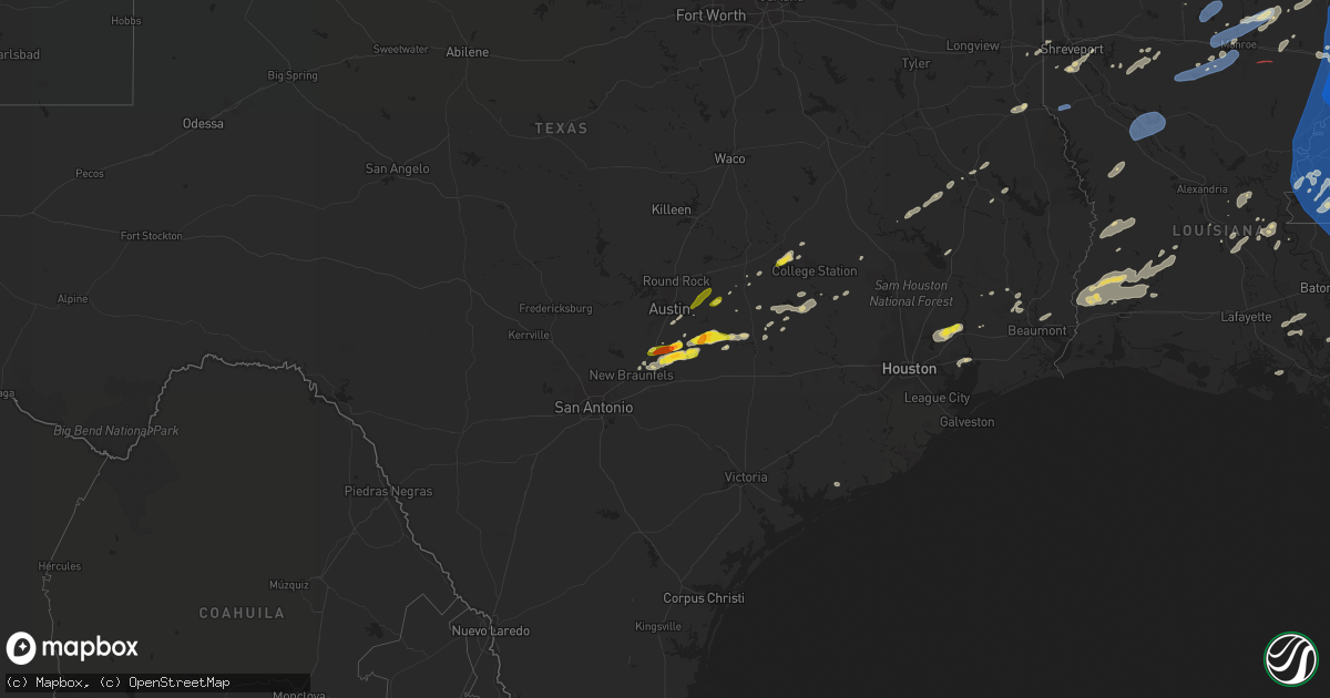
Hail Map on May 4, 2021
Get this storm
May 4 map
$229
one time, instant access
Download today. No call, no setup
Keep the $229
Bought the map and want the full workflow? Apply the entire $229 to a subscription within 7 days. None of it is wasted.
Every map, not just this one
This buys you this map. Subscription and you get every map we run, in the markets you choose from a few cities to whole states to nationwide. Plus real-time alerts the moment a storm fires.
Contact data
Name, contact info, occupancy, even credit band for addresses in the footprint. You go from where it hit to who to call.
Become the source they trust
Unlimited branding weather history reports on demand. You already have the documented answer ready for the property owner, and you are the one who showed up with it.
Property data and RoofTrace estimates
Pull up any address you have got, its value and the exact code rules for that jurisdiction, straight from One Click Code. Then RoofTrace estimates the squares, pitch, and roof value, priced the way you price.
States Impacted by Hail Map on May 4, 2021
Storm reports
North Carolina
| Date | Description |
|---|---|
| 05/04/20216:50 PM CDT | *** 1 inj *** wind caused tent collapse in columbia... 1 injured and taken to hospital. |
| 05/04/20216:45 PM CDT | Trees down. |
| 05/04/20215:48 PM CDT | Several reports of power lines down across the region. Time estimated by radar. |
| 05/04/20215:42 PM CDT | Tree fell down on a camper. No injuries reported. Time estimated by radar. |
| 05/04/20215:20 PM CDT | Numerous trees and power lines down throughout hoke county. |
| 05/04/20215:17 PM CDT | Lines down on alt 64 west of williamston close to robersonâs heating and air. Also lines down within williamston and on mccaskey road at corey drive. |
| 05/04/20215:15 PM CDT | Numerous reports of trees down across the county. |
| 05/04/20215:05 PM CDT | Social media report of several large tree branches down in/around laurinburg. Time estimated based on radar. |
| 05/04/20215:04 PM CDT | *** 1 inj *** tree fell across truck while traveling along nc 903. One minor injury. |
| 05/04/20214:57 PM CDT | Corrects previous tstm wnd dmg report from simpson. A few trees snapped and damage to a couple of fences. One larger tree uprooted. Additional pictures found on witn s |
| 05/04/20214:36 PM CDT | Trees down. Report via witn news story. |
| 05/04/20213:10 PM CDT | Tree down on the 7000 block of nc highway 86 n. |
| 05/04/20212:59 PM CDT | Large tree branch down on vehicle. |
| 05/04/20212:56 PM CDT | Two trees down in chapel hill... One at mlk jr blvd and bolinwood dr... The other at glandon dr and gimghoul rd. |
| 05/04/20212:55 PM CDT | Tree down near linden road. Time estimated by radar. |
| 05/04/20212:53 PM CDT | Tree down on bpw club rd in carrboro. |
| 05/04/20212:26 PM CDT | Period of hail... Some as big as quarters... Around and near the crooked tree golf course. |
| 05/04/20212:25 PM CDT | Tree down at highland farm rd and kenion rd. |
| 05/04/20215:45 AM CDT | At 1045 AM EDT, severe thunderstorms were located along a line extending from 7 miles south of Maryville to 8 miles east of Etowah, moving east at 40 mph. HAZARD...60 mph wind gusts and penny size hail. SOURCE...Radar indicated. IMPACT...Expect damage to roofs, siding, and trees. Locations impacted include... Smoky Mountains-Twentymile Creek, Smoky Mountains-Fontana Area, Tellico Plains, Citico Beach, Tariffville, Citico, Talassee, Happy Valley and Deals Gap. |
| 05/04/20215:41 AM CDT | At 1041 AM EDT, severe thunderstorms were located along a line extending from 8 miles northeast of Knoxville to 7 miles east of Rockford to near Eagleton Village to 7 miles south of Maryville, moving east at 40 mph. HAZARD...60 mph wind gusts. SOURCE...Radar indicated. IMPACT...Expect damage to roofs, siding, and trees. Locations impacted include... Knoxville, Sevierville, Gatlinburg, Dandridge, Pigeon Forge, Smoky Mountains-Fontana Area, Townsend, Walland, Kimberlin Heights and Wildwood.This includes Interstate 40 in Tennessee between mile markers 392 and417. |
| 05/04/20213:13 AM CDT | At 812 PM EDT, a severe thunderstorm was located 9 miles northwest of Newfoundland, or 9 miles south of Weeksville, moving northeast at 40 mph. HAZARD...60 mph wind gusts and quarter size hail. SOURCE...Radar indicated. IMPACT...Minor damage to vehicles is possible. Expect wind damage to trees and powerlines. This severe thunderstorm will be near, Old Trap around 835 PM EDT. Grandy around 845 PM EDT.Other locations impacted by this severe thunderstorm includeJarvisburg, Powells Point, Poplar Branch, Spot, Texas, Bertha, GooseCreek, Harbinger and Mamie. |
| 05/04/20212:35 AM CDT | At 735 PM EDT, a severe thunderstorm was located near Woodley, or 23 miles east of Plymouth, moving east at 40 mph. HAZARD...60 mph wind gusts and quarter size hail. SOURCE...Radar indicated. IMPACT...Hail damage to vehicles is expected. Expect wind damage to roofs, siding, and trees. Locations impacted include... Alligator, Mashoes, Manteo, Columbia, East Lake, Woodley, Newfoundland, Frying Pan Landing and Creswell. |
| 05/04/20211:14 AM CDT | At 614 PM EDT, a severe thunderstorm was located near Hoffman, or 12 miles north of Laurinburg, moving northeast at 55 mph. HAZARD...60 mph wind gusts. SOURCE...Radar indicated. IMPACT...Expect damage to roofs, siding, and trees. Locations impacted include... Fayetteville, Southern Pines, Raeford, Fort Bragg, Dunn, Aberdeen, Benson, Godwin, Pope AFB and Antioch. |
| 05/04/202112:47 AM CDT | At 547 PM EDT, a severe thunderstorm was located near Barley, or 10 miles northwest of Roanoke Rapids, moving east at 30 mph. HAZARD...60 mph wind gusts and nickel size hail. SOURCE...Radar indicated. IMPACT...Expect damage to trees and powerlines. This severe thunderstorm will be near, Emporia, Claresville and Green Plain around 615 PM EDT.Other locations impacted by this severe thunderstorm includeVicksville, Adams Grove, Grizzard, Handsom, Bryants Corner, Worrell,Sunbeam, Mason, Sebrell and Branchville. |
| 05/03/202111:22 PM CDT | At 421 PM EDT, a severe thunderstorm was located near Fishing Creek Reservoir, or near Lancaster, moving east at 30 mph. HAZARD...60 mph wind gusts and quarter size hail. SOURCE...Radar indicated. IMPACT...Hail damage to vehicles is expected. Expect wind damage to roofs, siding, and trees. Locations impacted include... Lancaster, Pageland, Kershaw, Elgin, Heath Springs, Westville, USC Lancaster, Irwin, Cassatt, Mt Pisgah, Buford, Jefferson, North Central High School, Bell Town Fire Station, Arrowood Estates, Faith Christian School, Midway Elementary School, Bear Creek Park, McDonald Green Elementary School and High Point Fire Station. |
| 05/03/202110:46 PM CDT | At 346 PM EDT, a severe thunderstorm was located near Hillsborough, moving northeast at 35 mph. HAZARD...60 mph wind gusts and penny size hail. SOURCE...Radar indicated. IMPACT...Expect damage to roofs, siding, and trees. Locations impacted include... Durham, Oxford, Hillsborough, Creedmoor, Butner, Rougemont, Stem, Lake Michie, Eno River State Park and Bahama. |
| 05/03/202110:19 PM CDT | At 318 PM EDT, a severe thunderstorm was located near Monroeton, or 8 miles north of Greensboro, moving east at 30 mph. HAZARD...60 mph wind gusts and penny size hail. SOURCE...Radar indicated. IMPACT...Expect damage to roofs, siding, and trees. Locations impacted include... Greensboro, Burlington, Mebane, McLeansville, Gibsonville, Haw River, Haw River State Park, Lake Jeanette Marina, Lake Burlington and Monticello. |
| 05/03/20217:20 PM CDT | Reports of power lines down across the southern portion of currituck county. |
Louisiana
| Date | Description |
|---|---|
| 05/04/20212:20 PM CDT | Tree down on hwy 131. |
| 05/04/20212:07 PM CDT | Couple trees down. |
| 05/04/20211:59 PM CDT | This tornado developed southeast of tallulah and south of i-20 over open fields and quickly reached ef-1 intensity as it overturned an irrigation pivot south of la high |
| 05/04/20211:55 PM CDT | Scattered trees down across town. |
| 05/04/20211:47 PM CDT | A tree was down on hwy 65. |
| 05/04/20211:47 PM CDT | Tree across hwy 126. |
| 05/04/20211:40 PM CDT | Scattered trees down sw and near wisner. |
| 05/04/20211:38 PM CDT | Scattered trees down around winnsboro. One tree on a home along hwy 425 just s of town. |
| 05/04/20211:25 PM CDT | Trees uprooted. |
| 05/04/20211:25 PM CDT | Scattered trees down around the pioneer area and this part of the parish. |
| 05/04/20211:25 PM CDT | Scattered trees down. |
| 05/04/20211:23 PM CDT | A few trees and limbs down... Trampoline thrown and wrapped in a tree. |
| 05/04/20211:22 PM CDT | Large tree on a home. |
| 05/04/20211:22 PM CDT | Social media report of trees and power lines down in rayville. |
| 05/04/20211:22 PM CDT | Scattered trees down. |
| 05/04/20211:13 PM CDT | Max winds: 85 mph width: 700 yds this brief tornado began west of la highway 133 and tracked east through the alto community then ending just north of archibald along u |
| 05/04/20211:12 PM CDT | A few trees down. |
| 05/04/20211:11 PM CDT | A few trees down. |
| 05/04/20211:10 PM CDT | Multiple trees down parish wide. |
| 05/04/20211:10 PM CDT | A few trees down. |
| 05/04/20211:05 PM CDT | A couple trees and power line down. |
| 05/04/20211:04 PM CDT | Scattered trees down in the n part of the parish. |
| 05/04/20211:01 PM CDT | Multiple trees reported down in the bastrop and log cabin areas. |
| 05/04/202112:55 PM CDT | Scattered trees down around the oak grove area. |
| 05/04/202112:50 PM CDT | Tree down on hwy 471 near the grant parish line. |
| 05/04/202112:50 PM CDT | Several trees reported down on hwy 146. |
| 05/04/202112:49 PM CDT | Tree reported down on hwy 505. |
| 05/04/202112:47 PM CDT | Picture of a power pole snapped north of oak grove. |
| 05/04/202112:44 PM CDT | Trees down near goldonna. |
| 05/04/202112:42 PM CDT | Trees and power lines reported down all over the parish. |
| 05/04/202112:42 PM CDT | Trees down in western part of ouachita parish in the cheniere. |
| 05/04/202112:40 PM CDT | Shingles blown off a roof in farmerville. |
| 05/04/202112:40 PM CDT | Tree reported down in calhoun across 144. |
| 05/04/202112:30 PM CDT | Trees down near flora and provencal along hwy 120. |
| 05/04/202112:20 PM CDT | Widespread trees and power lines down across the parish. |
| 05/04/202112:13 PM CDT | Trees and power lines reported down across the parish and mainly in pelican area. |
| 05/04/202112:13 PM CDT | Trees and power lines reported down across the parish. |
| 05/04/202111:48 AM CDT | Tree down on hwy 2 in shongaloo. |
| 05/04/202111:45 AM CDT | Large tree blocking highway 84 in both directions 5 wsw of south mansfield. |
| 05/04/202111:45 AM CDT | Fallen tree has taken down high voltage power lines. |
| 05/04/202111:42 AM CDT | Corrects previous tstm wnd dmg report from 4 ne dubberly. Tree down on hwy 80 east. |
| 05/04/202111:42 AM CDT | Corrects previous tstm wnd dmg report from 4 ne dubberly. Tree down on hwy 80 east. |
| 05/04/202111:30 AM CDT | Several trees reported down in the southern part of bossier parish. |
| 05/04/202111:30 AM CDT | Trees down on hwy 80 between arcadia and gibsland. |
| 05/04/20217:53 AM CDT | At 1252 PM CDT, severe thunderstorms were located along a line extending from 17 miles northwest of Clarks to 12 miles southwest of Olla, moving east at 40 mph. HAZARD...60 mph wind gusts. SOURCE...Radar indicated. IMPACT...Expect damage to roofs, siding, and trees. Locations impacted include... Olla, Clarks, Grayson, Urania, Tullos, Spaulding, Burlington, Standard and Kelly. |
| 05/04/20217:48 AM CDT | At 1247 PM CDT, a severe thunderstorm was located over Colfax, or 7 miles northeast of Lena, moving east at 40 mph. HAZARD...60 mph wind gusts. SOURCE...Radar indicated. IMPACT...Expect damage to roofs, siding, and trees. Locations impacted include... Jena, Colfax, Montgomery, Midway, Pollock, Dry Prong, Tullos, Georgetown, Atlanta, Nebo, Rogers, Catahoula Lake, Bentley, Rochelle, Zenoria, Lake Iatt, Fishville, Williana, St. Maurice and Aloha. |
| 05/04/20217:41 AM CDT | At 1240 PM CDT, a severe thunderstorm was located 10 miles northeast of Campti, or 17 miles northeast of Natchitoches, moving east at 50 mph. HAZARD...60 mph wind gusts and quarter size hail. SOURCE...Radar indicated. IMPACT...Hail damage to vehicles is expected. Expect wind damage to roofs, siding, and trees. Locations impacted include... Winnfield, Goldonna, Dodson, Saline, Calvin, Atlanta, Sikes, Joyce and Hudson. |
| 05/04/20217:28 AM CDT | At 1228 PM CDT, severe thunderstorms were located along a line extending from 6 miles southwest of Lapile to near Claiborne to 15 miles northwest of Clarks, moving east at 35 mph. HAZARD...60 mph wind gusts and quarter size hail. SOURCE...Radar indicated. IMPACT...Hail damage to vehicles is expected. Expect wind damage to roofs, siding, and trees. Locations impacted include... Monroe, Claiborne, West Monroe, Huttig, Columbia, Swartz, Brownsville-Bawcom, Brownsville-Bawcomville, Richwood, Sterlington, Strong, Lapile, Marion, Felsenthal, Drew, Fondale, Vixen, Bosco, Riverton and New London. |
| 05/04/20217:25 AM CDT | At 1224 PM CDT, severe thunderstorms were located along a line extending from near Arcadia to 7 miles northwest of Jonesboro, moving east at 20 mph. HAZARD...60 mph wind gusts and quarter size hail. SOURCE...Radar indicated. IMPACT...Hail damage to vehicles is expected. Expect wind damage to roofs, siding, and trees. Locations impacted include... Ruston, Grambling, Jonesboro, Choudrant, Simsboro, Chatham, Hodge, North Hodge, Vienna, East Hodge, Quitman, Eros, Downsville, Calhoun, Mineral Springs, Caderville, Friendship and Liberty Hill. |
| 05/04/20217:17 AM CDT | At 1217 PM CDT, severe thunderstorms were located along a line extending from near Many to near Hornbeck, moving northeast at 35 mph. HAZARD...60 mph wind gusts. SOURCE...Radar indicated. IMPACT...Expect damage to roofs, siding, and trees. Locations impacted include... Natchitoches, Many, Montgomery, Florien, Provencal, Natchez, Fisher, Robeline, Kisatchie, Cloutierville, Melrose, Mount Carmel, Bellwood, Chopin, Flora, Bermuda, Aloha, Gorum, Marthaville and Hagewood. |
| 05/04/20217:05 AM CDT | At 1204 PM CDT, severe thunderstorms were located along a line extending from 9 miles north of Mansfield to near Converse, moving east at 65 mph. HAZARD...60 mph wind gusts and quarter size hail. SOURCE...Public. IMPACT...Hail damage to vehicles is expected. Expect wind damage to roofs, siding, and trees. Locations impacted include... Natchitoches, Coushatta, Campti, Allen, Oak Grove, Pleasant Hill, Martin, Clarence, Goldonna, Hall Summit, Saline, Ashland, Edgefield, Powhatan, Carmel, Lake End, Grand Bayou, Hanna, Loggy Bayou and Pelican. |
| 05/04/20216:57 AM CDT | At 1157 AM CDT, a severe thunderstorm was located over Bastrop, moving northeast at 35 mph. HAZARD...60 mph wind gusts and quarter size hail. SOURCE...Radar indicated. IMPACT...Hail damage to vehicles is expected. Expect wind damage to roofs, siding, and trees. This severe thunderstorm will be near... Galion around 1215 PM CDT. Jones around 1230 PM CDT. Wilmot around 1245 PM CDT. Parkdale around 1255 PM CDT.Other locations impacted by this severe thunderstorm include Bonita,Collinston, Mer Rouge and Oak Ridge. |
| 05/04/20216:24 AM CDT | At 1123 AM CDT, a severe thunderstorm was located 11 miles south of Gibsland, or 21 miles southeast of Minden, moving northeast at 25 mph. HAZARD...60 mph wind gusts and quarter size hail. SOURCE...Radar indicated. IMPACT...Hail damage to vehicles is expected. Expect wind damage to roofs, siding, and trees. Locations impacted include... Ruston, Grambling, Arcadia, Gibsland, Simsboro, Lucky, Bienville, Bryceland, Mount Lebanon, Sailes and Brice. |
| 05/04/20216:14 AM CDT | At 1114 AM CDT, a severe thunderstorm was located near Stonewall, or 12 miles south of Shreveport, moving northeast at 25 mph. HAZARD...60 mph wind gusts and quarter size hail. SOURCE...Trained weather spotters. IMPACT...Hail damage to vehicles is expected. Expect wind damage to roofs, siding, and trees. Locations impacted include... Shreveport, Stonewall, Robson and Frierson. |
| 05/04/20216:10 AM CDT | At 1109 AM CDT, a severe thunderstorm was located 8 miles south of Bossier City, moving northeast at 30 mph. HAZARD...60 mph wind gusts and quarter size hail. SOURCE...Trained weather spotters. IMPACT...Hail damage to vehicles is expected. Expect wind damage to roofs, siding, and trees. Locations impacted include... Shreveport, Bossier City, Minden, Haughton, Ringgold, Sibley, Doyline, Dubberly, Dixie Inn, Heflin, Eastwood, Jamestown, Curtis, Fillmore, Bodcau, Plum Orchard Landing, Koran, Gilark, Noles Landing and Lake Bistineau North. |
| 05/04/20216:07 AM CDT | At 1106 AM CDT, a severe thunderstorm was located near Tenaha, or 13 miles southeast of Carthage, moving east at 35 mph. HAZARD...60 mph wind gusts and quarter size hail. SOURCE...Radar indicated. IMPACT...Hail damage to vehicles is expected. Expect wind damage to roofs, siding, and trees. Locations impacted include... Logansport, Tenaha, Joaquin, Keachi, Grand Cane, Longstreet, Stanley, Keat Chie, Kickapoo, Woods and Paxton. |
| 05/04/20215:28 AM CDT | At 1027 PM CDT, a severe thunderstorm was located 11 miles south of Ponchatoula, or 14 miles north of Laplace, moving east at 25 mph. HAZARD...60 mph wind gusts and penny size hail. SOURCE...Radar indicated. IMPACT...Expect damage to roofs, siding, and trees. This severe thunderstorm will remain over mainly rural areas of northeastern St. John The Baptist and southern Tangipahoa Parishes.This includes Interstate 55 in Louisiana between mile markers 12 and16. |
| 05/04/20215:03 AM CDT | At 1003 PM CDT, a severe thunderstorm was located near Whitehall, or 13 miles north of Reserve, moving east at 25 mph. HAZARD...60 mph wind gusts and quarter size hail. SOURCE...Radar indicated. IMPACT...Hail damage to vehicles is expected. Expect wind damage to roofs, siding, and trees. Locations impacted include... Killian.This includes Interstate 55 in Louisiana between mile markers 12 and23. |
| 05/03/202111:26 PM CDT | At 425 PM CDT, severe thunderstorms were located along a line extending from near Sandersville to Salem, moving southeast at 40 mph. HAZARD...70 mph wind gusts and nickel size hail. SOURCE...Radar indicated. IMPACT...Expect considerable tree damage. Damage is likely to mobile homes, roofs, and outbuildings. Severe thunderstorms will be near... Mill Creek around 430 PM CDT. Sandy Hook around 500 PM CDT. Pinebur around 505 PM CDT. Baxterville around 515 PM CDT. Lumberton around 530 PM CDT.Other locations impacted by these severe thunderstorms includeCorinth. |
| 05/03/202111:10 PM CDT | At 409 PM CDT, severe thunderstorms were located along a line extending from near Jayess to near Amite City, moving east at 25 mph. HAZARD...60 mph wind gusts and quarter size hail. SOURCE...Radar indicated. IMPACT...Hail damage to vehicles is expected. Expect wind damage to roofs, siding, and trees. Locations impacted include... Mccomb, Franklinton, Greensburg, Amite, Amite City, Magnolia, Kentwood, Summit, Independence, Tylertown, Roseland, Folsom, Osyka, Montpelier, Enon, Darlington, Mount Herman, Wilmer, Pride and Salem.This includes the following Interstates... Interstate 55 in Louisiana between mile markers 42 and 66. Interstate 55 in Mississippi between mile markers 1 and 22. |
| 05/03/20219:16 PM CDT | At 216 PM CDT, severe thunderstorms were located along a line extending from Acme to near Turkey Creek, moving northeast at 35 mph. HAZARD...60 mph wind gusts and nickel size hail. SOURCE...Radar indicated. IMPACT...Expect damage to roofs, siding, and trees. Locations impacted include... Ville Platte, Marksville, Bunkie, Simmesport, Moreauville, Cheneyville, Turkey Creek, Bordelonville, Bayou Current, Morrow, Effie, Cottonport, Pine Prairie, Mansura, Hessmer, Evergreen, Plaucheville, Bayou Chicot, Goudeau and Lake Ophelia National Wildlife Refuge.This includes Interstate 49 between mile markers 30 and 65. |
| 05/03/20218:37 PM CDT | At 137 PM CDT, severe thunderstorms were located along a line extending from near Lake Providence to near Tendal to near Crowville, moving east at 55 mph. HAZARD...70 mph wind gusts and nickel size hail. SOURCE...Radar indicated. IMPACT...Expect considerable tree damage. Damage is likely to mobile homes, roofs, and outbuildings. Severe thunderstorms will be near... Tallulah and Mansford around 145 PM CDT. Eagle Bend around 155 PM CDT. Afton around 200 PM CDT. Redwood around 205 PM CDT. Vicksburg, Le Tourneau, Oak Ridge and Flowers around 215 PM CDT. Youngton, Tinsley and Phoenix around 220 PM CDT. Little Yazoo around 225 PM CDT. Newman around 230 PM CDT.Other locations impacted by these severe thunderstorms include Mound,Satartia, Delta and Richmond. |
| 05/03/20218:22 PM CDT | At 122 PM CDT, a severe thunderstorm was located 7 miles west of Rolling Fork, moving east at 45 mph. HAZARD...70 mph wind gusts and quarter size hail. SOURCE...Radar indicated. IMPACT...Hail damage to vehicles is expected. Expect considerable tree damage. Wind damage is also likely to mobile homes, roofs, and outbuildings. This severe thunderstorm will be near... Rolling Fork around 130 PM CDT. Anguilla and Nitta Yuma around 140 PM CDT. Delta City around 145 PM CDT. Midnight around 200 PM CDT. Thornton around 220 PM CDT. Tchula around 230 PM CDT.Other locations impacted by this severe thunderstorm include Eden,Silver City, Arcola, Cary, Louise and Cruger. |
South Carolina
| Date | Description |
|---|---|
| 05/04/20216:55 PM CDT | Sc patrol reports tree down on road at indiantown swamp rd and sc-261. Time estimated via radar. |
| 05/04/20216:28 PM CDT | Tree in roadway at rehoboth road and muckenfus road. Time estimated from radar. |
| 05/04/20216:25 PM CDT | Tree in roadway at round o road and fennel drive. Time estimated from radar. |
| 05/04/20216:19 PM CDT | Tree in roadway at welch creek and coolers dairy road. Vehicle collided with the downed tree. Time estimated from radar. |
| 05/04/20216:16 PM CDT | Tree in roadway at us15 and robertson blvd. Time estimated from radar. |
| 05/04/20216:15 PM CDT | Tree down at pleasant grove rd and maple ridge rd. Time estimated from time of report and radar. |
| 05/04/20216:14 PM CDT | Tree down at jefferies hwy and lakeshore dr. Time estimated from report time and radar. |
| 05/04/20216:13 PM CDT | Tree in roadway at cougar nation dr and jefferies highway. |
| 05/04/20216:03 PM CDT | Tree in roadway at peirce road and rhode drive. Time estimated from radar. |
| 05/04/20216:03 PM CDT | Tree in roadway at peirce road and whites ave. Time estimated from radar. |
| 05/04/20216:00 PM CDT | Tree in roadway at tabor road and bells highway. Time estimated from radar. |
| 05/04/20215:57 PM CDT | Road blocked due to a tree down at bad ham lane and low country highway. Time estimated from radar. |
| 05/04/20215:56 PM CDT | Trees down along i-26. |
| 05/04/20215:18 PM CDT | Tree in roadway at wee hope loop and bonnie doon road. Time estimated from radar. |
| 05/04/20215:12 PM CDT | Broadcast reporter shared pictures of a fallen tree on a car. Time estimated via radar. |
| 05/04/20215:10 PM CDT | Sc patrol reports tree down on roadway at sc-381 and chelsea lane. Time estimated via radar. |
| 05/04/20215:00 PM CDT | Sc patrol reports tree down on roadway at zion rd and marlboro way. Time estimated via radar. |
| 05/04/20215:00 PM CDT | Sc patrol reports tree down on roadway at sandy grove rd and hebron dunbar rd. Time estimated via radar. |
| 05/04/20214:55 PM CDT | Sc highway patrol reports tree blocking roadway at ivy rd and us1. Time estimated by radar. |
| 05/04/20214:50 PM CDT | Sc patrol reports tree down on roadway at hickory grove rd and sc-9. Time estimated via radar. |
| 05/04/20214:50 PM CDT | Sc patrol reports tree down on roadway at aaron temple church rd and old wire rd w. Time estimated via radar. |
| 05/04/20214:41 PM CDT | Richland co emergency planner reports power lines arcing – tree on fire from power line. |
| 05/04/20214:35 PM CDT | *** 1 inj *** large tree on a camper on easterling landing rd. |
| 05/04/20214:34 PM CDT | Sc patrol reports multiple trees down in roadways north and northeast of the hartsville area. Sc 102 & patrick hwy. Lakeview blvd & jessamine dr. Sun valley dr & ousley |
| 05/04/20214:33 PM CDT | Sc highway patrol reports tree down along trolly line rd near proud pacer. Time estimated by radar. |
| 05/04/20214:30 PM CDT | Sc highway patrol reports tree in roadway at cedar creek rd and underground branch rd. Time estimated by radar. |
| 05/04/20214:30 PM CDT | Beech island fire department reports tree blocking roadway and power line down on sheraton drive. Time estimated by radar. |
| 05/04/20213:45 PM CDT | Public report of tree falling on house with exterior damage only. Time estimated by radar. |
| 05/04/20213:38 PM CDT | Multiple trees down along i77 north of blythewood rd. Video of damage posted by member of the public via twitter. Time estimated by radar. |
| 05/04/20213:37 PM CDT | Multiple power lines down across lockhart rd near north central middle school. Photo sent via social media. |
| 05/04/20213:35 PM CDT | Spotter reported 72 mph wind gust with home weather station on longtown rd... Ridgeway sc. |
| 05/04/20213:35 PM CDT | Sc highway patrol reports tree blocking roadway on i77 at exit 32nb. Time estimated by radar. |
| 05/04/20213:33 PM CDT | Social media report of quarter to half dollar size hail. Report relayed by local news station. Time estimated from radar. |
| 05/04/20213:33 PM CDT | Cpd power lines downed by tree – 4 lanes blocked. |
| 05/04/20213:30 PM CDT | Sc highway patrol reports trees and powerlines down at us 321 and roddy road. Time estimated by radar. |
| 05/04/20213:23 PM CDT | A national weather service storm survey team confirmed an ef1 tornado... With peak winds of 105 mph... And a maximum width of 300 yards near rion in fairfield county... |
| 05/04/20213:21 PM CDT | Highway patrol reports tree blocking roadway near i20 and monticello rd. |
| 05/04/20213:20 PM CDT | Richland co emergency planner reports power lines arcing – tree on power line and caught tree on fire. |
| 05/04/20213:18 PM CDT | Sc highway patrol reports trees blocking roadway along muller rd near pine grove rd. Time estimated by radar. |
| 05/04/20213:15 PM CDT | Retired nws employee reports partial roofing and siding ripped from houses near chapin elementary school as well as several trees down. Time estimated by radar. |
| 05/04/20213:14 PM CDT | Numerous trees snapped and uprooted in portrait hill neighborhood. |
| 05/04/20213:12 PM CDT | Airport asos measured 65 mph peak gust. |
| 05/04/20213:05 PM CDT | Sc highway patrol reports trees blocking roadway at old lexington highway and sid brickley rd. Time estimated by radar. |
| 05/04/20213:05 PM CDT | Sc highway patrol reports trees in roadway at i20 exit 55. Time estimated by radar. |
| 05/04/20212:42 AM CDT | At 742 PM EDT, a severe thunderstorm was located near Kingstree, moving east at 35 mph. HAZARD...60 mph wind gusts and quarter size hail. SOURCE...Radar indicated. IMPACT...Minor hail damage to vehicles is possible. Expect wind damage to trees and power lines. Locations impacted include... Lake City, Johnsonville, Hemingway, Rhems, Warsaw, Hannah, Poston, Oatland, Nesmith, Indiantown, Outland, Gresham, Morrisville, Henry, Kingsburg, Scranton, Stuckey and Lake City Community Hospital. |
| 05/04/20212:04 AM CDT | At 704 PM EDT, a severe thunderstorm was located 8 miles east of Manning, moving east at 30 mph. HAZARD...60 mph wind gusts and quarter size hail. SOURCE...Radar indicated. IMPACT...Minor hail damage to vehicles is possible. Expect wind damage to trees and power lines. Locations impacted include... Lake City, Kingstree, Salters, Hebron, Cades, Scranton, Coward, Lane, Greeleyville, Central Crossroads, Lake City Community Hospital and Williamsburg Regional Hospital. |
| 05/04/20211:59 AM CDT | At 659 PM EDT, severe thunderstorms were located along a line extending from near Lodge to near Walterboro, moving northeast at 35 mph. HAZARD...60 mph wind gusts and quarter size hail. SOURCE...Radar indicated. IMPACT...Minor hail damage to vehicles is possible. Expect wind damage to trees and powerlines. Locations impacted include... Walterboro, Saint George, Givhans Ferry State Park, Dorchester, Colleton, Ridgeville, Cottageville, Harleyville, Reevesville, Smoaks, Lodge, Williams, Givhans, Ruffin and Jedburg.This warning includes... I-26 between mile markers 171 and 189. I-95 in South Carolina between mile markers 53 and 85. |
| 05/04/20211:57 AM CDT | At 657 PM EDT, a severe thunderstorm was located over Manning, moving east at 35 mph. HAZARD...60 mph wind gusts and quarter size hail. SOURCE...Radar indicated. IMPACT...Hail damage to vehicles is expected. Expect wind damage to roofs, siding, and trees. Locations impacted include... Manning, Summerton, Santee Cooper Regional Airport, Alcolu, Turbeville, Paxville, Gable, Davis Station and Foreston.This includes Interstate 95 between mile markers 106 and 133. |
| 05/04/20211:30 AM CDT | At 630 PM EDT, severe thunderstorms were located along a line extending from near Aberdeen to near South Of The Border, moving northeast at 40 mph. HAZARD...60 mph wind gusts. SOURCE...Radar indicated. IMPACT...Expect wind damage to trees and power lines. Locations impacted include... Red Springs, Pembroke, Maxton, Rex, Raemon, Shannon, Buie, Wakulla, Purvis, Prospect, Minturn, Elrod, Parkton, Rennert and Lumber Bridge. |
| 05/04/20211:17 AM CDT | At 617 PM EDT, severe thunderstorms were located along a line extending from Ritter to near Ashepoo to near Bennetts Point, moving northeast at 40 mph. HAZARD...60 mph wind gusts and quarter size hail. SOURCE...Radar indicated. IMPACT...Minor hail damage to vehicles is possible. Expect wind damage to trees and powerlines. Locations impacted include... North Charleston, Mount Pleasant, Summerville, Goose Creek, Hanahan, Walterboro, Edisto Beach, Fort Sumter, Downtown Charleston, West Ashley, Daniel Island, Givhans Ferry State Park, Naval Weapons Station Charleston, Johns Island and Ladson.This warning includes... I-26 between mile markers 190 and 221. I-526 between mile markers 11 and 31. I-95 in South Carolina between mile markers 47 and 50. |
| 05/04/20211:07 AM CDT | At 607 PM EDT, severe thunderstorms were located along a line extending from near Clyde to near St. Matthews, moving southeast at 45 mph. HAZARD...60 mph wind gusts and quarter size hail. SOURCE...Radar indicated. IMPACT...Hail damage to vehicles is expected. Expect wind damage to roofs, siding, and trees. Locations impacted include... Sumter, Manning, Bishopville, South Sumter, Shaw Air Base, McEntire Air Base, Summerton, Eastover, Oakland, Mulberry, Congaree National Park, Alcolu, Woods Bay State Park, Santee Cooper Regional Airport, Elliott, Lee State Park, Sumter County Airport, Gadsden, Millwood and Poinsett State Park.This includes the following highways... Interstate 20 in South Carolina between mile markers 106 and 125. Interstate 95 between mile markers 102 and 146. |
| 05/04/202112:57 AM CDT | At 557 PM EDT, a severe thunderstorm was located near Bennettsville, moving east at 55 mph. HAZARD...70 mph wind gusts and penny size hail. SOURCE...Radar indicated. IMPACT...Expect considerable tree damage. Damage is likely to mobile homes, roofs, and outbuildings. Locations impacted include... Bennettsville, Pembroke, Maxton, Mccoll, Rowland, Clio, Raemon, Mont Clare, Wallace, Wakulla, Chavistown, Purvis, Prospect, Dunbar, Minturn, Elrod, Society Hill, Gibson, Blenheim and Mcdonald. |
| 05/04/202112:37 AM CDT | At 537 PM EDT, a severe thunderstorm was located near Cheraw Municipal Airport, or 7 miles west of Cheraw, moving northeast at 40 mph. HAZARD...60 mph wind gusts and penny size hail. SOURCE...Radar indicated. IMPACT...Expect damage to roofs, siding, and trees. Locations impacted include... Laurinburg, Rockingham, Hamlet, Maxton, Hoffman, Dobbins Heights, Wagram, Gibson, Morven and East Laurinburg. |
| 05/04/202112:30 AM CDT | At 529 PM EDT, severe thunderstorms were located along a line extending from 8 miles southwest of Red Bank to near Hephzibah, moving southeast at 25 mph. Additional isolated severe thunderstorms were also located ahead of this line. HAZARD...60 mph wind gusts. SOURCE...Radar indicated. IMPACT...Expect damage to roofs, siding, and trees. Locations impacted include... Aiken, North Augusta, Waynesboro, Fort Gordon, Augusta, Clearwater, Savannah River Site, Aiken Mall, Plant Vogtle, Belvedere, Red Bank, Hephzibah, Williston, Blackville, New Ellenton, Jackson, Glendale, South Augusta, Summerville and Augusta Mall.This includes the following highways... Interstate 20 in South Carolina between mile markers 3 and 50. Interstate 520 in Georgia between mile markers 2 and 15. Interstate 520 in South Carolina between mile markers 16 and 23. |
| 05/04/202112:08 AM CDT | At 508 PM EDT, a severe thunderstorm was located near Cassatt, or 16 miles northeast of Camden, moving east at 60 mph. HAZARD...60 mph wind gusts and penny size hail. SOURCE...Radar indicated. IMPACT...Expect wind damage to trees and power lines. Locations impacted include... Bennettsville, Hartsville, Clio, North Hartsville, Dovesville, Mont Clare, Auburn, Wallace, Clyde, Chavistown, Floyd, Dunbar, Kellytown, Society Hill, Blenheim, Tatum and Carolina Pines Regional Medical Center. |
| 05/04/202112:03 AM CDT | At 502 PM EDT, severe thunderstorms were located along a line extending from 6 miles northwest of Pageland to Goodale State Park, moving northeast at 60 mph. HAZARD...60 mph wind gusts. SOURCE...Radar indicated. IMPACT...Expect damage to roofs, siding, and trees. Locations impacted include... Cheraw, Pageland, Chesterfield, Cheraw State Park, Northeastern Technical College, Cassatt, Cheraw Municipal Airport, Carolina Sandhills Wildlife Refuge, Mt Pisgah, Goodale State Park, Mcbee, Jefferson, Ruby, Patrick, Bethune, Mount Croghan, Lucknow, Chesterfield Ruby Middle School, North Central High School and Cheraw Fish Hatchery. |
| 05/03/202111:46 PM CDT | At 446 PM EDT, severe thunderstorms were located along a line extending from near Jenkinsville to 7 miles south of Prosperity, moving east at 45 mph. HAZARD...60 mph wind gusts. SOURCE...Radar indicated. IMPACT...Expect damage to roofs, siding, and trees. Locations impacted include... Columbia, Lexington, West Columbia, Cayce, Irmo, Forest Acres, Springdale, St. Andrews, Dentsville, Oak Grove, Highway 6 at Lake Murray Dam, Red Bank, South Congaree, Pine Ridge, Gaston, Arcadia Lakes, Columbia International University, Jenkinsville, Harbison State Forest and Sesquicentennial State Park.This includes the following highways... Interstate 126 between mile markers 0 and 3. Interstate 20 in South Carolina between mile markers 51 and 82. Interstate 26 between mile markers 84 and 120. Interstate 77 between mile markers 0 and 26. |
| 05/03/202111:38 PM CDT | At 437 PM EDT, severe thunderstorms were located along a line extending from near Saluda County Airport to near Wrightsboro, moving east at 20 mph. HAZARD...60 mph wind gusts and penny size hail. SOURCE...Radar indicated. IMPACT...Expect damage to roofs, siding, and trees. Locations impacted include... North Augusta, Grovetown, Evans, Thomson, Batesburg-Leesville, Martinez, Edgefield, Saluda, McCormick, Harlem, Johnston, Lincolnton, Ridge Spring, Clarks Hill Recreation Area, Edgefield County Airport, Elijah Clark State Park, Mistletoe State Park, Wrightsboro, Village Plaza Shopping Center and J. Strom Thurmond Dam.This includes Interstate 20 in Georgia between mile markers 167 and198. |
| 05/03/202111:30 PM CDT | At 430 PM EDT, severe thunderstorms were located along a line extending from 6 miles north of Crowfield Plantation to near Huger, moving northeast at 30 mph. HAZARD...60 mph wind gusts and nickel size hail. SOURCE...Radar indicated. IMPACT...Expect damage to trees and powerlines. Locations impacted include... Moncks Corner, Jamestown, Old Santee Canal State Park and Huger. |
| 05/03/202111:16 PM CDT | At 415 PM EDT, severe thunderstorms were located along a line extending from VC Summer Nuclear Station to SC State Fair Grounds, moving northeast at 60 mph. An addition line of severe thunderstorms were also approaching from the northwest. HAZARD...70 mph wind gusts and quarter size hail. SOURCE...Radar indicated. IMPACT...Hail damage to vehicles is expected. Expect considerable tree damage. Wind damage is also likely to mobile homes, roofs, and outbuildings. Locations impacted include... Columbia, Forest Acres, Camden, Winnsboro, Lake Wateree Dam, Dentsville, Arcadia Lakes, Lugoff, Fairfield County Airport, Villages at Sandhill, Jenkinsville, Liberty Hill, Elgin, Killian, Woodfield, Sesquicentennial State Park, Lake Carolina, Longtown, Fort Jackson and Goodale State Park.This includes the following highways... Interstate 20 in South Carolina between mile markers 70 and 102. Interstate 77 between mile markers 13 and 46. |
| 05/03/202111:15 PM CDT | At 415 PM EDT, severe thunderstorms were located along a line extending from near Sangaree to near Naval Weapons Station Charleston, moving northeast at 30 mph. HAZARD...60 mph wind gusts and quarter size hail. SOURCE...Radar indicated. IMPACT...Minor hail damage to vehicles is possible. Expect wind damage to trees and powerlines. Locations impacted include... Summerville, Goose Creek, Moncks Corner, Naval Weapons Station Charleston, Ladson, Sangaree, Crowfield Plantation and College Park.This warning includes I-26 between mile markers 198 and 200. |
| 05/03/202111:00 PM CDT | At 359 PM EDT, severe thunderstorms were located along a line extending from 6 miles north of Blair to near Lake Greenwood State Park, moving northeast at 30 mph. HAZARD...60 mph wind gusts and quarter size hail. SOURCE...Radar indicated. IMPACT...Hail damage to vehicles is expected. Expect wind damage to roofs, siding, and trees. Locations impacted include... Newberry, VC Summer Nuclear Station, Saluda, Whitmire, Prosperity, Newberry College, Monticello, Newberry County Airport, Blair, Pomaria, Silverstreet, Lebanon Fire Station, US-176 and SC- 34 Crossroads, Good Hope, Henderson Island, Belfast Wildlife Management Area, Mitford, Hollywood Elementary School, Chappells Fire Station and White Oak.This includes the following highways... Interstate 26 between mile markers 62 and 84. Interstate 77 between mile markers 47 and 50. |
| 05/03/202110:54 PM CDT | At 354 PM EDT, a severe thunderstorm was located over Van Wyck, or 7 miles south of Indian Land, moving northeast at 35 mph. HAZARD...60 mph wind gusts and quarter size hail. SOURCE...Radar indicated. IMPACT...Hail damage to vehicles is expected. Expect wind damage to roofs, siding, and trees. Locations impacted include... Indian Land, Andrew Jackson State Park, Van Wyck, Carolina Commons Shopping Center, Community of Almond Glen and Unity Fire Station. |
| 05/03/202110:53 PM CDT | At 353 PM EDT, a severe thunderstorm was located 6 miles southeast of Rock Hill, or near Lesslie, moving east at 40 mph. HAZARD...70 mph wind gusts and penny size hail. SOURCE...Radar indicated. IMPACT...Expect considerable tree damage. Damage is likely to mobile homes, roofs, and outbuildings. Locations impacted include... Rock Hill, Monroe, Indian Trail, Weddington, Stallings, Unionville, Wesley Chapel, Wingate, Waxhaw and Lake Park. |
| 05/03/202110:52 PM CDT | At 352 PM EDT, a severe thunderstorm was located 7 miles west of Gaston, or 8 miles south of Red Bank, moving northeast at 35 mph. HAZARD...60 mph wind gusts and quarter size hail. SOURCE...Radar indicated. IMPACT...Hail damage to vehicles is expected. Expect wind damage to roofs, siding, and trees. Locations impacted include... Columbia, Lexington, West Columbia, Cayce, Irmo, Forest Acres, Batesburg-Leesville, Springdale, St. Andrews, Highway 6 at Lake Murray Dam, Red Bank, Oak Grove, South Congaree, Pine Ridge, Gaston, Hopkins, Columbia International University, Harbison State Forest, Riverbanks Zoo and SC State Farmer's Market.This includes the following highways... Interstate 126 between mile markers 0 and 3. Interstate 20 in South Carolina between mile markers 42 and 70. Interstate 26 between mile markers 102 and 125. Interstate 77 between mile markers 0 and 12. |
| 05/03/202110:45 PM CDT | At 345 PM EDT, a severe thunderstorm was located near Saluda, or 9 miles northwest of Batesburg-Leesville, moving northeast at 35 mph. HAZARD...60 mph wind gusts and quarter size hail. SOURCE...Radar indicated. IMPACT...Hail damage to vehicles is expected. Expect wind damage to roofs, siding, and trees. Locations impacted include... Irmo, Batesburg-Leesville, Saluda, Prosperity, Dreher Island State Park, Ballentine, Chapin, Little Mountain, Pomaria, Peak, Cedar Grove Fire Station, South Shore Marina, Oswald Park, Saluda Co Sheriff's Office, Bundrick Island, Putnam's Landing, White Rock, Rocky Point Recreation Area, Hollywood Elementary School and Emory.This includes Interstate 26 between mile markers 80 and 100. |
District of Columbia
| Date | Description |
|---|---|
| 05/04/20214:22 PM CDT | Tree down at 5037 call place se |
| 05/04/20214:17 PM CDT | Tree down at 500 21st st ne |
| 05/04/20214:09 PM CDT | Tree down on klingle rd and adams mill rd |
| 05/04/20214:00 PM CDT | Tree down on klingle rd and adams mill rd |
| 05/03/202111:55 PM CDT | At 455 PM EDT, severe thunderstorms were located along a line extending from near American University to Franconia to near Woodbridge, moving east at 35 mph. HAZARD...60 mph wind gusts. SOURCE...Radar indicated. IMPACT...Damaging winds will cause some trees and large branches to fall. This could injure those outdoors, as well as damage homes and vehicles. Roadways may become blocked by downed trees. Localized power outages are possible. Unsecured light objects may become projectiles. Locations impacted include... Arlington, Alexandria, Waldorf, Bethesda, Bowie, Clinton, Fort Washington, Forestville, Largo, Coral Hills, Bladensburg, Fort Belvoir, National Harbor, Upper Marlboro, Nationals Park, Fedex Field, Howard University, Gallaudet University, Fort Totten and Rosslyn. |
| 05/03/202111:26 PM CDT | At 426 PM EDT, severe thunderstorms were located along a line extending from Chantilly to near Bull Run to 10 miles west of Montclair, moving east at 35 mph. HAZARD...60 mph wind gusts. SOURCE...Radar indicated. IMPACT...Damaging winds will cause some trees and large branches to fall. This could injure those outdoors, as well as damage homes and vehicles. Roadways may become blocked by downed trees. Localized power outages are possible. Unsecured light objects may become projectiles. Locations impacted include... Arlington, Alexandria, Centreville, Dale City, Annandale, Springfield, South Riding, Fort Washington, Fairfax, Fort Hunt, Vienna, Groveton, Falls Church, Huntington, Mantua, Fort Belvoir, Pimmit Hills, Woodbridge, National Harbor and Reagan National Airport. |
West Virginia
| Date | Description |
|---|---|
| 05/04/202110:50 AM CDT | Tree limbs / power line down east of fairmont |
| 05/04/20217:12 AM CDT | At 1211 PM EDT, a severe thunderstorm was located near Rowlesburg, moving east at 45 mph. HAZARD...60 mph wind gusts and quarter size hail. SOURCE...Radar indicated. IMPACT...Damaging winds will cause some trees and large branches to fall. This could injure those outdoors, as well as damage homes and vehicles. Roadways may become blocked by downed trees. Localized power outages are possible. Unsecured light objects may become projectiles. Locations impacted include... Mountain Lake Park, Oakland, Bayard, Loch Lynn Heights, Deer Park, Elk Garden, Kitzmiller, Redhouse, Gorman, Crellin, Hutton, Sulphur City, Emoryville, Hartmansville, Warnocks, Gormania, Mount Pisgah and Mount Storm. |
| 05/04/20216:47 AM CDT | At 1147 AM EDT, a severe thunderstorm was located over Winfield, or near Fairmont, moving east at 30 mph. HAZARD...Wind gusts to 60 mph and quarter-size hail. SOURCE...Radar. IMPACT...Minor hail damage to vehicles is possible. Expect wind damage to trees and power lines, resulting in some power outages. Locations impacted include... Morgantown... Fairmont... Kingwood... Pleasant Valley... Winfield... Barrackville... Newburg... Brookhaven... Rivesville... Grant Town... Reedsville... Masontown...This includes the following highways... Interstate 68 in West Virginia between mile markers 1 and 5. Interstate 79 in West Virginia between mile markers 135 and 151. |
| 05/03/20218:52 PM CDT | At 152 PM EDT, a severe thunderstorm was located near Brandywine, or 9 miles northeast of Franklin, moving east at 35 mph. HAZARD...60 mph wind gusts and quarter size hail. SOURCE...Radar indicated. IMPACT...Damaging winds will cause some trees and large branches to fall. This could injure those outdoors, as well as damage homes and vehicles. Roadways may become blocked by downed trees. Localized power outages are possible. Unsecured light objects may become projectiles. Locations impacted include... Brandywine, Basye-Bryce Mountain, New Market, Basye, Tunis, Orkney Springs, Yankeetown, Fulks Run, Deer Run, Quicksburg, Bergton, Oak Flat, Forestville, Mount Clifton and Criders. |
Tennessee
| Date | Description |
|---|---|
| 05/04/202110:00 AM CDT | Several trees down in the sevierville area. |
| 05/04/20219:55 AM CDT | Trees down along the foothills parkway. |
| 05/04/20219:10 AM CDT | Couple trees down. |
| 05/04/20218:55 AM CDT | Numerous trees down and trailer blown over in the pikeville area. |
| 05/04/20218:50 AM CDT | Multiple homes damaged. |
| 05/04/20218:45 AM CDT | Corrects previous tstm wnd dmg report from 3 w deerlodge. Several trees down on hwy 62 in the chestnut ridge community. |
| 05/04/20218:45 AM CDT | Several trees down along hwy 62 in the chestnut ridge community. |
| 05/04/20218:38 AM CDT | Trees down on summerfield road and near south cumberland visitors center |
| 05/04/20218:30 AM CDT | Dozens of trees were blown down around the heatherhurst golf course with some trees falling onto homes and across roads. |
| 05/04/20218:15 AM CDT | Multiple trees down in pleasant hill |
| 05/04/20218:07 AM CDT | This small ef-0 tornado touched down on the north side of sparta near franklin avenue and spring street. Moving southeast... The tornado heavily damaged a barn on rober |
| 05/04/20218:05 AM CDT | Trees and power lines were blown down on hickerson road |
| 05/04/20218:04 AM CDT | Numerous trees were blown down along jones valley road |
| 05/04/20218:03 AM CDT | Severe straight-line winds caused significant damage on the west side of sparta along old smithville highway and highway 70. Numerous trees were blown down... Outbuildi |
| 05/04/20217:58 AM CDT | At 1258 AM CDT, a severe thunderstorm was located near Red Boiling Springs, or 11 miles northwest of Gainesboro, moving east at 25 mph. HAZARD...Quarter size hail. SOURCE...Radar indicated. IMPACT...Damage to vehicles is expected. Locations impacted include... Celina, Red Boiling Springs, Boles, Whitleyville and Moss. |
| 05/04/20217:47 AM CDT | Trees downs and some roof damage in smithville |
| 05/04/20217:47 AM CDT | Tree down along windle community rd near puncheon creek |
| 05/04/20217:45 AM CDT | Tree down across road near short mountain in ne cannon co |
| 05/04/20217:45 AM CDT | Trees down and some structural damage of homes in smithville and also toward flago bridge in the holliday haven community |
| 05/04/20217:43 AM CDT | This ef-0 tornado touched down along coconut ridge road north of smithville... Blowing down several trees. Moving southeast... The tornado crossed highway 56 and moved |
| 05/04/20217:26 AM CDT | At 1226 AM CDT, a severe thunderstorm was located 8 miles northwest of Red Boiling Springs, moving northeast at 45 mph. HAZARD...60 mph wind gusts and quarter size hail. SOURCE...Radar indicated. IMPACT...Hail damage to vehicles is expected. Expect wind damage to roofs, siding, and trees. Locations impacted include... Tompkinsville, Gamaliel, Meshack, Persimmon, Bugtussle, Forkton, Gum Tree, Blythe, Harlan Crossroads and Freetown. |
| 05/04/20217:25 AM CDT | At 1224 AM CDT, a severe thunderstorm was located near Lafayette, moving east at 30 mph. HAZARD...Quarter size hail. SOURCE...Radar indicated. IMPACT...Damage to vehicles is expected. Locations impacted include... Lafayette, Red Boiling Springs, Boles, Whitleyville and Bugtussle. |
| 05/04/20217:24 AM CDT | A large barn was destroyed and another barn had its roof partially blown off at gilmore livestock on highway 231 |
| 05/04/20217:22 AM CDT | Porch and part of metal roof blown of home on big springs road. Numerous trees also blown down with one falling on a car. Several nearby homes also suffered minor damag |
| 05/04/20217:20 AM CDT | This small... Brief tornado touched down on the south side of alexandria. Security video cameras at a home on old liberty road captured the tornado as the roof and back |
| 05/04/20217:19 AM CDT | Large metal barn destroyed and grain bin pushed off foundation on mankin road |
| 05/04/20217:10 AM CDT | Power poles snapped in half along with 12 to 18 inch trees snapped along 41 between 31w split and willamson. Lines down and trees down. |
| 05/04/20217:04 AM CDT | Several trees were blown down around 3 homes at 5765 nashville highway |
| 05/04/20216:25 AM CDT | At 1124 AM EDT, a severe thunderstorm was located over Mill Creek, or near Dalton, moving east at 55 mph. HAZARD...60 mph wind gusts. SOURCE...Radar indicated. IMPACT...Expect damage to roofs, siding, and trees. Locations impacted include... Dalton, Chatsworth, Varnell, Eton, Tunnel Hill, Crandall, Sumac, Wood Station, Rocky Face, Gregory, Mill Creek, Conasauga Lake, Tennga, Beaumont, Beaverdale, Dawnville, Villanow, Cisco and Fort Mountain State Park. |
| 05/04/20216:10 AM CDT | At 1110 AM EDT, severe thunderstorms were located along a line extending from near Dandridge to near Pigeon Forge to near Gatlinburg to near Smoky Mountains-Fontana Area, moving east at 40 mph. HAZARD...60 mph wind gusts. SOURCE...Radar indicated. IMPACT...Expect damage to roofs, siding, and trees. Locations impacted include... Sevierville, Newport, Gatlinburg, Dandridge, Pigeon Forge, Parrottsville, Smoky Mountains-Newfound Gap, Smoky Mountains-Fontana Area, Smoky Mountains-Balsam Mountain and Pittman Center.This includes Interstate 40 in Tennessee between mile markers 429 and451. |
| 05/04/20215:57 AM CDT | At 1056 AM EDT, severe thunderstorms were located along a line extending from 10 miles west of Jefferson City to 12 miles west of Gatlinburg to 13 miles northwest of Robbinsville to 10 miles south of Madisonville, moving east at 40 mph. HAZARD...60 mph wind gusts and quarter size hail. SOURCE...Radar indicated. IMPACT...Minor hail damage to vehicles is expected. Expect wind damage to trees and power lines. Locations impacted include... Bryson City, Robbinsville, Cherokee, Town Of Santeetlah, Smoky Mountains-Newfound Gap, Smoky Mountains-Fontana Area, Lake Santeetlah, Smoky Mountains-Balsam Mountain, Fontana Lake and Smoky Mountains-Big Creek. |
| 05/04/20215:42 AM CDT | At 1042 AM EDT, a severe thunderstorm was located over Higdon, or 7 miles southeast of Bridgeport, moving east at 50 mph. HAZARD...60 mph wind gusts and penny size hail. SOURCE...Radar indicated. IMPACT...Expect damage to roofs, siding, and trees. Locations impacted include... Ringgold, Trenton, Fort Oglethorpe, Rossville, Chickamauga, Lookout Mountain, Blue Spring, Fairview, Chattanooga Valley, Hooker, Cloudland Canyon State Park, Cooper Heights, Rock Spring, Rising Fawn, Noble, Lakeview, Wood Station, Indian Springs, Graysville and Cole City. |
| 05/04/20215:03 AM CDT | At 1002 AM EDT, severe thunderstorms were located along a line extending from Oliver Springs to near Kingston to near Fairview, moving east at 55 mph. HAZARD...60 mph wind gusts and penny size hail. SOURCE...Radar indicated. IMPACT...Expect damage to roofs, siding, and trees. Locations impacted include... Knoxville, Oak Ridge, Maryville, Lenoir City, Alcoa, Kingston, Loudon, Farragut, Fairview and Oliver Springs.This includes the following highways... Interstate 40 in Tennessee between mile markers 354 and 388. Interstate 75 in Tennessee between mile markers 67 and 84. |
| 05/04/20214:48 AM CDT | At 947 AM EDT/847 AM CDT/, a severe thunderstorm was located over Pikeville, moving east at 40 mph. HAZARD...60 mph wind gusts and nickel size hail. SOURCE...Radar indicated. IMPACT...Expect damage to roofs, siding, and trees. Locations impacted include... Dayton, Pikeville, Graysville, Evensville, Palio, Stinging Fork Falls State Park, Old Washington and Brayton. |
| 05/04/20214:37 AM CDT | At 937 AM EDT/837 AM CDT/, severe thunderstorms were located along a line extending from 11 miles west of Wartburg to near Fairfield Glade to 13 miles northeast of Spencer, moving east at 35 mph. HAZARD...60 mph wind gusts and penny size hail. SOURCE...Radar indicated. IMPACT...Expect damage to roofs, siding, and trees. Locations impacted include... Oak Ridge, Kingston, Rockwood, Wartburg, Fairview, Oliver Springs, Spring City, Midtown, Harriman and Oakdale.This includes Interstate 40 in Tennessee between mile markers 341 and358. |
| 05/04/20214:04 AM CDT | At 904 AM CDT, a severe thunderstorm was located near Skyline, or 11 miles northwest of Scottsboro, moving northeast at 65 mph. HAZARD...60 mph wind gusts and quarter size hail. SOURCE...Radar indicated. IMPACT...Hail damage to vehicles is expected. Expect wind damage to roofs, siding, and trees. Locations impacted include... Scottsboro, Bridgeport, Stevenson, Hollywood, Skyline, Woodville, Pleasant Groves, Hytop, Bass and Lim Rock. |
| 05/04/20213:05 AM CDT | At 805 AM CDT, a severe thunderstorm was located 7 miles south of Jamestown, moving northeast at 35 mph. HAZARD...60 mph wind gusts and penny size hail. SOURCE...Radar indicated. IMPACT...Expect damage to roofs, siding, and trees. Locations impacted include... Crossville, Jamestown, Fairfield Glade, Monterey, Crab Orchard, Allardt, Pleasant Hill, Grimsley, Slate Springs, Pall Mall, Clarkrange, Crawford and Pickett State Park.This includes Interstate 40 between mile markers 302 and 328. |
| 05/04/20212:53 AM CDT | At 753 AM CDT, severe thunderstorms were located along a line extending from 6 miles southeast of Smithville to near Tullahoma, moving east at 50 mph. HAZARD...60 mph wind gusts. SOURCE...Radar indicated. IMPACT...Expect damage to roofs, siding, and trees. Locations impacted include... McMinnville, Crossville, Manchester, Sparta, Spencer, Tullahoma, Gruetli-Laager, Altamont, Coalmont, Morrison, Palmer, Pleasant Hill, Doyle, Beersheba Springs, Centertown, Viola, Virgin Falls State Natural Area, Rock Island State Park, Summitville and Fall Creek Falls State Park.This includes Interstate 24 between mile markers 109 and 123. |
| 05/04/20212:38 AM CDT | At 738 AM CDT, a severe thunderstorm was located near Fayetteville, moving east at 50 mph. HAZARD...60 mph wind gusts and quarter size hail. SOURCE...Radar indicated. IMPACT...Hail damage to vehicles is expected. Expect wind damage to roofs, siding, and trees. Locations impacted include... Fayetteville, Lynchburg, Petersburg, Tims Ford Lake, Mulberry, Chestnut Ridge, Howell, Belleville, Dellrose and Hurdlow. |
| 05/04/20212:35 AM CDT | At 735 AM CDT, severe thunderstorms were located along a line extending from 6 miles west of Woodbury to 6 miles south of Shelbyville, moving east at 60 mph. HAZARD...60 mph wind gusts. SOURCE...Radar indicated. IMPACT...Expect damage to roofs, siding, and trees. Locations impacted include... Shelbyville, Manchester, Woodbury, Tullahoma, Morrison, Wartrace, Bell Buckle, Centertown, Normandy, Beechgrove, Raus, Summitville, Bradyville and Readyville.This includes Interstate 24 between mile markers 89 and 118. |
| 05/04/20212:09 AM CDT | At 708 PM CDT, a severe thunderstorm was located near Jericho, or near Meeman Shelby Forest State Park, moving east at 40 mph. HAZARD...60 mph wind gusts and quarter size hail. SOURCE...Radar indicated. IMPACT...Hail damage to vehicles is expected. Expect wind damage to roofs, siding, and trees. Locations impacted include... Bartlett, Collierville, Germantown, West Memphis, Marion, Millington, Meeman Shelby Forest State Park, Cordova, Memphis, Lakeland, Arlington, Sunset, Ellendale, Frayser, Midtown Memphis, Downtown Memphis, Eads, Oakland, Piperton and Gallaway. |
| 05/04/20211:29 AM CDT | At 629 PM CDT, a severe thunderstorm was located 8 miles north of Earle, moving east at 40 mph. HAZARD...60 mph wind gusts and quarter size hail. SOURCE...Radar indicated. IMPACT...Hail damage to vehicles is expected. Expect wind damage to roofs, siding, and trees. Locations impacted include... West Memphis, Marion, Earle, Parkin, Tyronza, Meeman Shelby Forest State Park, Memphis, Joiner, Crawfordsville, Sunset, Gilmore, Jericho, Dixonville, Turrell, Clarkedale, Birdsong, Three Forks, Dimple, Booker and Deckerville. |
| 05/04/20211:16 AM CDT | At 615 AM CDT, severe thunderstorms were located along a line extending from near Portland to Forest Hills, moving east at 45 mph. HAZARD...60 mph wind gusts and penny size hail. SOURCE...Radar indicated. IMPACT...Expect damage to roofs, siding, and trees. Locations impacted include... Gallatin, Lebanon, Lafayette, Hartsville, Hendersonville, La Vergne, Mount Juliet, Westmoreland, Watertown, Hermitage, Rural Hill, Belinda City, Antioch, Green Hill, Tuckers Crossroads, Bethpage, Dixon Springs, Oak Grove, Bledsoe Creek State Park and Dickerson Chapel Recreation Area.This includes the following highways... Interstate 40 between mile markers 218 and 249. Interstate 840 between mile markers 67 and 76. |
| 05/04/20211:10 AM CDT | At 610 AM CDT, severe thunderstorms were located along a line extending from 10 miles southwest of Memphis Junction to 7 miles north of Cross Plains, moving east at 15 mph. HAZARD...60 mph wind gusts and penny size hail. SOURCE...Radar indicated. IMPACT...Expect damage to roofs, siding, and trees. Locations impacted include... Hillsdale, Black Jack, Neosheo, Clare, Geddes, Mcelroy Ford, Pope, Butlersville, Trammel and Salmons. |
| 05/04/20211:05 AM CDT | At 605 AM EDT, a severe thunderstorm was located 9 miles southeast of Maryville, moving east at 25 mph. HAZARD...60 mph wind gusts and quarter size hail. SOURCE...Radar indicated. IMPACT...Hail damage to vehicles is expected. Expect wind damage to roofs, siding, and trees. Locations impacted include... Gatlinburg, Pigeon Forge, Townsend, Wears Valley, Walland, Cades Cove, Elkmont, Roundtop Mountain State Park, Happy Valley and Great Smoky Mountains National Park. |
| 05/04/202112:39 AM CDT | At 539 AM CDT, severe thunderstorms were located along a line extending from 9 miles east of Guthrie to near White Bluff, moving east at 45 mph. HAZARD...60 mph wind gusts and penny size hail. SOURCE...Radar indicated. IMPACT...Expect damage to roofs, siding, and trees. Locations impacted include... Springfield, Ashland City, Nashville, Madison, Hendersonville, Goodlettsville, White House, Millersville, Greenbrier, Forest Hills, Oak Hill, Coopertown, White Bluff, Belle Meade, Kingston Springs, Lakewood, Pegram, Ridgetop, Cross Plains and Burns.This includes the following highways... Interstate 40 between mile markers 185 and 218. Interstate 65 between mile markers 77 and 121. Interstate 24 between mile markers 19 and 57. |
| 05/04/202112:06 AM CDT | At 505 AM CDT, severe thunderstorms were located along a line extending from 6 miles northwest of Crofton to near Fort Campbell, moving east at 50 mph. HAZARD...60 mph wind gusts and penny size hail. SOURCE...Radar indicated. IMPACT...Expect damage to roofs, siding, and trees. Locations impacted include... Hopkinsville, Oak Grove, Elkton, Fort Campbell.This includes the following highways... Interstate 24 in Kentucky between Mile Markers 71 and 92. Interstate 69 in Kentucky between Mile Markers 97 and 106. Western Kentucky Parkway between Mile Markers 39 and 41. Pennyrile Parkway between Mile Markers 1 and 34. |
| 05/04/202112:02 AM CDT | At 501 AM CDT, severe thunderstorms were located along a line extending from McEwen to Parsons, moving east at 50 mph. HAZARD...60 mph wind gusts and quarter size hail. SOURCE...Radar indicated. IMPACT...Hail damage to vehicles is expected. Expect wind damage to roofs, siding, and trees. Locations impacted include... Dickson, Ashland City, Waverly, Centerville, Camden, White Bluff, Kingston Springs, New Johnsonville, McEwen, Burns, Hurricane Mills, Charlotte, Lobelville, Vanleer, Bon Aqua, Lyles, Bucksnort, Pinewood, Nunnelly and I-40 Near The Tennessee River.This includes the following highways... Interstate 40 between mile markers 136 and 180. Interstate 840 between mile markers 1 and 3. |
| 05/03/202111:43 PM CDT | At 442 AM CDT, severe thunderstorms were located along a line extending from near Springville to near Blue Goose, moving northeast at 35 mph. HAZARD...60 mph wind gusts and quarter size hail. SOURCE...Radar indicated. IMPACT...Hail damage to vehicles is expected. Expect wind damage to roofs, siding, and trees. Locations impacted include... Lexington, Huntingdon, Camden, Natchez Trace State Park, Natchez Trace State Forest, New Johnsonville, Bruceton, Blue Goose, Vale, Bargerton, Wildersville, Springville, Parkers Crossroads, Hollow Rock, Big Sandy, Henry, Clarksburg, Hickory Flat, Dollar and Old Springville. |
| 05/03/202111:40 PM CDT | At 440 AM EDT, a severe thunderstorm was located over Oak Ridge, moving east at 30 mph. HAZARD...60 mph wind gusts and quarter size hail. SOURCE...Radar indicated. IMPACT...Hail damage to vehicles is expected. Expect wind damage to roofs, siding, and trees. Locations impacted include... Knoxville, Oak Ridge, Clinton, Oliver Springs, Norris, Bearden, Powell, Karns and Andersonville.This includes the following highways... Interstate 40 in Tennessee between mile markers 376 and 385. Interstate 75 in Tennessee between mile markers 110 and 123. |
| 05/03/202111:08 PM CDT | At 408 AM CDT, severe thunderstorms were located along a line extending from near Reidland to 6 miles southeast of Lynnville, moving east at 50 mph. HAZARD...60 mph wind gusts and nickel size hail. SOURCE...Radar indicated. IMPACT...Expect damage to roofs, siding, and trees. Locations impacted include... Murray, Benton, Cadiz, Land Between The Lakes Area, Canton, Rockcastle, Hardin, Hazel, New Concord, Linton, Kirksey, Brewers, Aurora, Harris Grove and Crossland.This includes the following highways... Interstate 24 in Kentucky between Mile Markers 54 and 55, andbetween Mile Markers 58 and 70. Interstate 69 in Kentucky between Mile Markers 35 and 47. |
| 05/03/202110:53 PM CDT | At 353 AM EDT, a severe thunderstorm was located near Midtown, or 7 miles north of Kingston, moving east at 25 mph. HAZARD...60 mph wind gusts and quarter size hail. SOURCE...Radar indicated. IMPACT...Hail damage to vehicles is expected. Expect wind damage to roofs, siding, and trees. Locations impacted include... Oak Ridge, Oliver Springs, Harriman, Oakdale, Coalfield and Dearmond. |
| 05/03/202110:35 PM CDT | At 332 AM CDT, an area of severe thunderstorms was located from near Bardwell south through Clinton and Cayce, moving east at 45 mph. HAZARD...60 mph wind gusts and quarter size hail. SOURCE...Radar indicated. IMPACT...Hail damage to vehicles is expected. Expect wind damage to roofs, siding, and trees. Locations impacted include... Mayfield, Fulton, Clinton, Bardwell, Cayce, Lynnville, Fulgham, Sedalia, Wingo, Arlington, Water Valley, Columbus, Lowes, Fancy Farm and Symsonia.This includes Interstate 69 in Kentucky between Mile Markers 1 and33. |
| 05/03/202110:28 PM CDT | At 327 AM CDT, severe thunderstorms were located along a line extending from near Hickman to near Troy to 6 miles northeast of Chestnut Bluff, moving east at 65 mph. HAZARD...60 mph wind gusts. SOURCE...Radar indicated. IMPACT...Expect damage to roofs, siding, and trees. Locations impacted include... Martin, Union City, Milan, Trenton, Fulton, Newbern, Dresden, South Fulton, Dyer, Greenfield, Troy, Kenton, Rutherford, Obion, Bradford, Sharon, Atwood, Latham, Clayton and Eaton. |
| 05/03/202110:22 PM CDT | At 322 AM CDT, a severe thunderstorm was located near Celina, Tennessee, moving northeast at 25 mph. HAZARD...Quarter size hail. SOURCE...Radar indicated. IMPACT...Damage to vehicles is expected. Locations impacted include... Albany, Burkesville, Littrell, Modoc, Green Grove, Bow, Hobart, Peytonsburg, Hegira, and Kettle. |
| 05/03/202110:10 PM CDT | At 309 AM EDT, a severe thunderstorm was located near Fairfield Glade, or 8 miles northwest of Rockwood, moving east at 20 mph. HAZARD...Quarter size hail. SOURCE...Radar indicated. IMPACT...Damage to vehicles is expected. Locations impacted include... Oak Ridge, Kingston, Rockwood, Midtown, Harriman, Oakdale, Coalfield, Pine Orchard, Petros and Dearmond.This includes Interstate 40 in Tennessee between mile markers 341 and358. |
| 05/03/202110:00 PM CDT | At 300 PM CDT, a severe thunderstorm was located over Canaan, or 18 miles northwest of Ripley, moving northeast at 20 mph. HAZARD...Quarter size hail. SOURCE...Radar indicated. IMPACT...Damage to vehicles is expected. Locations impacted include... Canaan, Walnut, Middleton, Grand Junction, Saulsbury, Rogers Springs, Chalybeate, Brody, Lisbon, New Canaan, Brownfield, Hamilton and Tiplersville. |
| 05/03/20219:34 PM CDT | At 234 AM CDT, severe thunderstorms were located along a line extending from near Caraway to near Parkin, moving east at 65 mph. HAZARD...60 mph wind gusts. SOURCE...Radar indicated. IMPACT...Expect damage to roofs, siding, and trees. Locations impacted include... Osceola, Marked Tree, Lepanto, Wilson, Tyronza, Keiser, Joiner, Dyess, Gilmore, Bassett, Marie, Turrell, Etowah, Birdsong, Three Forks, Dimple, Deckerville, Evadale, Menesha and Grider. |
| 05/03/20219:25 PM CDT | At 224 AM CDT, severe thunderstorms were located along a line extending from near Holcomb to near Cardwell, moving east at 45 mph. HAZARD...60 mph wind gusts and quarter size hail. SOURCE...Radar indicated. IMPACT...Hail damage to vehicles is expected. Expect wind damage to roofs, siding, and trees. Locations impacted include... Blytheville, Kennett, Osceola, Caruthersville, Malden, Piggott, Gosnell, Manila, Portageville, Hayti, Steele, Leachville, Campbell, Senath, Caraway, Luxora, Cardwell, Hornersville, Holcomb and Hayti Heights. |
| 05/03/20219:07 PM CDT | At 207 AM CDT, a severe thunderstorm was located near Fairfield Glade, or 10 miles northwest of Rockwood, moving east at 20 mph. HAZARD...Quarter size hail. SOURCE...Radar indicated. IMPACT...Damage to vehicles is expected. Locations impacted include... Fairfield Glade and Crab Orchard. This includes Interstate 40 between mile markers 329 and 331, andbetween mile markers 335 and 340. |
| 05/03/20219:02 PM CDT | At 201 AM CDT, severe thunderstorms were located along a line extending from near Sedalia to Lilbourn, moving northeast at 60 mph. HAZARD...60 mph wind gusts and quarter size hail. SOURCE...Radar indicated. IMPACT...Hail damage to vehicles is expected. Expect wind damage to roofs, siding, and trees. Locations impacted include... Mayfield, East Prairie, New Madrid, Fulton, Hickman, Clinton, Bardwell, Towosahgy State Historic Site, Big Oak Tree State Park, Hunter-Dawson State Historic Site, Marston, Howardville, Wyatt, Anniston, Cayce, Dorena, Fulgham, Sedalia, Farrenburg and Wingo.This includes the following highways... Interstate 69 in Kentucky between Mile Markers 1 and 33. Interstate 55 between Mile Markers 39 and 50. |
| 05/03/20218:34 PM CDT | At 134 AM CDT, a severe thunderstorm was located over Celina, moving east at 30 mph. HAZARD...Quarter size hail. SOURCE...Radar indicated. IMPACT...Damage to vehicles is expected. Locations impacted include... Livingston, Celina, Dale Hollow Lake and Standing Stone State Park. |
Mississippi
| Date | Description |
|---|---|
| 05/04/20216:10 PM CDT | Trees down in both directions of the road - impassable. |
| 05/04/20214:55 PM CDT | Social media report of trees down in the ovett area. |
| 05/04/20214:34 PM CDT | Tree reported down on queensburg ave in laurel. |
| 05/04/20214:08 PM CDT | Two cars were damaged at the chick-fil-a drive thru when an anchored tent with metal poles was collapsed by the wind. |
| 05/04/20214:08 PM CDT | This tornado began along i-20/59 just west of the toomsuba exit... Downing large tree branches and uprooting or snapping a few trees as it crossed the interstate and th |
| 05/04/20214:07 PM CDT | Peak gust at asos site knmm. Measured out of the west-northwest. Peak sustained wind was 54 mph at the same time. |
| 05/04/20214:04 PM CDT | Numerous trees and lines down in the russel area. |
| 05/04/20214:03 PM CDT | Video and pictures show the collapse of brick walls at the old burlington mill in stonewall. |
| 05/04/20214:03 PM CDT | Trees downed in the westbound lanes of i-20/59 near mile marker 159. |
| 05/04/20214:00 PM CDT | A few trees down including a tree on the roof of a house...reported by kemper county em. |
| 05/04/20214:00 PM CDT | A corridor of straight line wind gusts up to 80 mph occurred in the vicinity of lindley rd and newell rd... Resulting in concentrated damage to large trees in a portion |
| 05/04/20214:00 PM CDT | Large limb fell and went through the roof of a house...reported by lawrence county em. |
| 05/04/20214:00 PM CDT | A large tree fell and took down a power line and two other power poles associated with main feeder lines went down resulting in power outages to most of monticello...re |
| 05/04/20214:00 PM CDT | Trees downed on houses at center st and pine st in enterprise. Multiple trees downed in the enterprise and stonewall area. |
| 05/04/20213:59 PM CDT | Social media picture of a tree across power lines blocking dogwood lake rd. |
| 05/04/20213:59 PM CDT | Corrects previous tstm wnd gst report from 2 se lost gap. Peak gust measured out of the west. Lasted 4 minutes until 4:03 pm. |
| 05/04/20213:58 PM CDT | Part of a roof blown off an apt complex. Widespread downed trees and power lines in the county. Roughly 50 homes damaged by trees on them in the county. |
| 05/04/20213:58 PM CDT | Report from mping: wind damage similar to trees uprooted or snapped or a roof blown off. Time corrected to radar. |
| 05/04/20213:58 PM CDT | Several trees down along sam hurt road. |
| 05/04/20213:58 PM CDT | Social media picture of trees and power lines downed on the northeast side of macon. |
| 05/04/20213:57 PM CDT | Trees and power lines downed across the county. Several homes with trees on them. |
| 05/04/20213:56 PM CDT | Trees downed on cr 16. |
| 05/04/20213:50 PM CDT | Tree downed on bay ave. |
| 05/04/20213:50 PM CDT | Tree downed on e 2nd ave. |
| 05/04/20213:50 PM CDT | Numerous trees down with damage to houses... Vehicles and power lines. |
| 05/04/20213:50 PM CDT | Usace member reports numerous pine trees snapped. Photos relayed to nws via email. |
| 05/04/20213:48 PM CDT | A house was damaged on cr 1529. |
| 05/04/20213:45 PM CDT | Trees were down along chunky-duffee road. |
| 05/04/20213:45 PM CDT | A few trees down in mantachie. |
| 05/04/20213:45 PM CDT | Large limbs and some trees down along cr363 near community of ozark |
| 05/04/20213:45 PM CDT | A few trees down in fulton. Some trees on vehicles and houses. |
| 05/04/20213:43 PM CDT | This tornado began along hopewell road then tracked northeastward along e l johnson road and across chunky duffee road just south of the duffee community. It crossed in |
| 05/04/20213:42 PM CDT | Social media picture of trees and power lines downed in hickory. |
| 05/04/20213:40 PM CDT | Trees downed on water well rd. |
| 05/04/20213:40 PM CDT | Large tree down on house in moorville community near itawamba county line. |
| 05/04/20213:40 PM CDT | 75 mph wind measured at neshoba county eoc. |
| 05/04/20213:40 PM CDT | Large tree down between wren and aberdeen. |
| 05/04/20213:38 PM CDT | Several trees down in this area... One on power lines on cardinal lane... Another across new light road. |
| 05/04/20213:37 PM CDT | Corrects previous tstm wnd dmg report from 2 ne newton. Numerous trees were down. Glass was blown out of a building. Power was out in newton and surrounding areas. Time |
| 05/04/20213:35 PM CDT | Multiple trees down along highway 15. Power was out in decatur and surrounding areas. |
| 05/04/20213:35 PM CDT | Tree down across watts lane reported by lincoln county em. |
| 05/04/20213:35 PM CDT | Trees and power line down in residential area of houston. |
| 05/04/20213:34 PM CDT | Social media picture of a shed destroyed in union. |
| 05/04/20213:31 PM CDT | Trees down on power lines in noxapater. |
| 05/04/20213:30 PM CDT | Numerous trees down along highway 492. Power was out across northern newton county. Power was out in union and surrounding areas. |
| 05/04/20213:29 PM CDT | Tin off of buildings around ms highway 35 and ms highway 902. |
| 05/04/20213:23 PM CDT | Report from mping of wind damage similar to trees uprooted or snapped or a roof blown off. Time corrected to radar. |
| 05/04/20213:21 PM CDT | Trees and power lines down along johns mayton rd. |
| 05/04/20213:21 PM CDT | Tree blocking hwy 15 near highpoint rd. |
| 05/04/20213:20 PM CDT | Tree downed on sturgis maben rd. |
| 05/04/20213:16 PM CDT | Trees downed at ms highway 13 and cr 143. |
| 05/04/20213:14 PM CDT | Trees downed with possible damage in walnut grove. |
| 05/04/20213:12 PM CDT | Tree downed on ms highway 35 north of carthage. |
| 05/04/20213:12 PM CDT | Social media report of a tree down in downtown carthage. |
| 05/04/20213:12 PM CDT | Trees downed on ms highway 14 blocking the roadway between kosciusko and louisville. |
| 05/04/20213:11 PM CDT | Several trees reported down in morton. |
| 05/04/20213:11 PM CDT | Tree down across bradshaw rd. |
| 05/04/20213:11 PM CDT | Tree across hwy 43 near wadsworth rd. |
| 05/04/20213:10 PM CDT | Limbs down. Report from mping:. |
| 05/04/20213:10 PM CDT | Large tree down blocking road at cr 4101 and cr 4130. |
| 05/04/20213:09 PM CDT | Several trees down. |
| 05/04/20213:09 PM CDT | Tree downed on ms highway 16 just east of ms highway 493. |
| 05/04/20213:09 PM CDT | Tree reported down in hopewell. |
| 05/04/20213:09 PM CDT | A couple trees downed along hwy 429. |
| 05/04/20213:06 PM CDT | 1-inch tree limbs broken; shingles blown off report from mping:. |
| 05/04/20213:06 PM CDT | This tornado began in a wooded area to the west of highway 13 on the northwest side of lena. A few large tree branches were snapped and a pine tree was uprooted as the |
| 05/04/20213:05 PM CDT | Numerous trees down. One fell on a camper and mobile home. Power lines were also down near the home. |
| 05/04/20213:05 PM CDT | Tree across hwy 469 near henry byrd rd. |
| 05/04/20213:05 PM CDT | Tree down across haynes chapel rd. |
| 05/04/20213:03 PM CDT | A couple trees down on hwy 429. |
| 05/04/20213:03 PM CDT | Social media picture of trees down in the thomasville area. |
| 05/04/20213:01 PM CDT | Tree down across garth farm rd. |
| 05/04/20213:00 PM CDT | Several trees reported down in gallman. |
| 05/04/20213:00 PM CDT | Power line blown down on old hwy 43 near the intersection of red oak rd. |
| 05/04/20213:00 PM CDT | Tree fell on outdoor gazebo in ripley. |
| 05/04/20213:00 PM CDT | A large oak or similar tree on the southeast side of first united methodist church of brandon was snapped near the base of the trunk. Other large limbs and a few small |
| 05/04/20213:00 PM CDT | Multiple trees and power lines down on the e side of brandon at the legacy subdivision. |
| 05/04/20212:59 PM CDT | Tree down across e petros rd. |
| 05/04/20212:59 PM CDT | Tree down across louis wilson south of towne street... Several trees and large limbs along louis wilson from deborah drive to hwy 18. |
| 05/04/20212:59 PM CDT | Tree down across briarhill rd. |
| 05/04/20212:59 PM CDT | 3 downed trees. |
| 05/04/20212:59 PM CDT | Tree downed on a fence in the greenfield station subdivision. |
| 05/04/20212:55 PM CDT | Trees uprooted or snapped; roof blown off report from mping: also reported via social media. |
| 05/04/20212:55 PM CDT | A few trees down...reported by webster county em. |
| 05/04/20212:55 PM CDT | Corrects previous tstm wnd gst report from jan airport. Peak wind gust measured out of the north-northwest. |
| 05/04/20212:54 PM CDT | Tree down on florence-byram rd near the intersection of long dr. |
| 05/04/20212:54 PM CDT | Tree downed on a house on laurel dr at williams cir. |
| 05/04/20212:52 PM CDT | Large tree branch brought down a power line along harbor lane. |
| 05/04/20212:52 PM CDT | Multiple trees down... Some roof damage to homes. |
| 05/04/20212:52 PM CDT | Tree down across barksdale rd. |
| 05/04/20212:52 PM CDT | Trees down across north hwy 471 near the intersection of church road. |
| 05/04/20212:52 PM CDT | A chimney was blown off a home in the laurelwood subdivision in flowood. Possible tornado damage. Report with picture relayed via facebook. |
| 05/04/20212:50 PM CDT | Report from mping of wind damage similar to 1-inch tree limbs broken or shingles blown off. Time corrected to radar. |
| 05/04/20212:50 PM CDT | Several reports of trees and limbs down around downtown jackson. |
| 05/04/20212:48 PM CDT | Report from mping: wind damage similar to 3-inch tree limbs broken or power poles broken. Time corrected to radar. |
| 05/04/20212:47 PM CDT | Trees and powerlines down. Tree on house. - picture via social media post. |
| 05/04/20212:47 PM CDT | Large tree down and through roof of house. |
| 05/04/20212:46 PM CDT | Trees downed on brame rd and w jackson st near i-55. |
| 05/04/20212:46 PM CDT | Corrects previous tstm wnd gst report from hawkins field. Peak wind gust measured out of the west-northwest. |
| 05/04/20212:46 PM CDT | A tall oak tree was uprooted and fell onto a home on north central avenue. It caused major damage to the home and the roof caved in. Report with pictures relayed via fa |
| 05/04/20212:45 PM CDT | Trees were blown down on the southeast side of canton. |
| 05/04/20212:45 PM CDT | Corrects previous tornado report from 4 ese tougaloo. Corrects previous tornado report from 4 ese tougaloo. Video taken from the fondren area looking east showed a torn |
| 05/04/20212:45 PM CDT | A small amount of quarter inch fell in ashland. |
| 05/04/20212:45 PM CDT | Trees down near the intersection of beasley and hanging moss blocking the road. |
| 05/04/20212:45 PM CDT | Tree down across hwy 14. |
| 05/04/20212:45 PM CDT | Doors blown off of bankplus building in fondren - social media post. |
| 05/04/20212:45 PM CDT | Multiple homes damaged on ridgewood road by fallen trees. |
| 05/04/20212:45 PM CDT | Tree down over pine lane drive. |
| 05/04/20212:45 PM CDT | Multiple homes damaged on ridgewood road by fallen trees. |
| 05/04/20212:43 PM CDT | Tree downed on a car in summertree. |
| 05/04/20212:43 PM CDT | Tree down near intersection of gluckstadt and bozeman. |
| 05/04/20212:40 PM CDT | Uprooted trees and snapped limbs were seen in northwest jackson. Large downed trees were blocking west county line road. |
| 05/04/20212:40 PM CDT | Uprooted trees and snapped limbs were seen in northwest jackson. Large downed trees were blocking west county line road. |
| 05/04/20212:39 PM CDT | Trees reported down in raymond. |
| 05/04/20212:39 PM CDT | Large tree across road. |
| 05/04/20212:39 PM CDT | Multiple trees down across the city. |
| 05/04/20212:38 PM CDT | Several trees down and lines... Some roads blocked by trees. |
| 05/04/20212:38 PM CDT | Trees down. |
| 05/04/20212:37 PM CDT | Picture of a carwash awning destroyed. |
| 05/04/20212:37 PM CDT | Intense tree damage occurred along the south frontage road just west of the natchez trace in clinton. Pictures relayed via twitter show a concentration of trees bent an |
| 05/04/20212:32 PM CDT | Tree and power line down. |
| 05/04/20212:30 PM CDT | Trees were blocking the road... Delaying traffic in both directions. |
| 05/04/20212:30 PM CDT | Scattered trees and lines down. |
| 05/04/20212:27 PM CDT | Numerous trees down and some power lines. |
| 05/04/20212:26 PM CDT | Widespread downed trees and lines... Most of the county is out of power. Several roads blocked by trees. |
| 05/04/20212:25 PM CDT | Myrleville rd area had numerous trees down and lines down. Possible tornado. |
| 05/04/20212:25 PM CDT | Multiple trees and lines down around the area. |
| 05/04/20212:25 PM CDT | A few trees down. |
| 05/04/20212:24 PM CDT | This mesovortex tornado began just past the farr road line to the northwest of brownsville. The tornado surged southeast along north john warren road... Alexander road. |
| 05/04/20212:23 PM CDT | Multiple trees down on old dover and paradise roads... Possible tornado. |
| 05/04/20212:23 PM CDT | Several trees and lines down in the sibley area. |
| 05/04/20212:23 PM CDT | Multiple trees down and some lines... Some roads blocked by trees. |
| 05/04/20212:22 PM CDT | Multiple trees down. |
| 05/04/20212:22 PM CDT | The tornado began off hwy 49 along fletchers chapel road near the dover community. The storm tracked east across old dover and paradise roads snapping large limbs and u |
| 05/04/20212:21 PM CDT | Trees and power lines downed in grenada and across the western portion of grenada county. |
| 05/04/20212:21 PM CDT | Trees down scattered in and around yazoo city. 6 homes in the county had trees on them. |
| 05/04/20212:18 PM CDT | Couple trees down along hwy 49. |
| 05/04/20212:15 PM CDT | Numerous trees down on seely road in hamilton. |
| 05/04/20212:15 PM CDT | Numerous trees and lines down across vicksburg and eastward on both sides of i-20. Sig swath of tree damage noted by em. 7 homes had trees down on them. |
| 05/04/20212:12 PM CDT | Trees and lines down in the n part of the county. |
| 05/04/20212:10 PM CDT | Sweethome rd blocked by downed trees. |
| 05/04/20212:10 PM CDT | Swath of wind damage from a microburst occurred in the sweethome community. Multiple trees were damaged... Esp along sweethome road... Power lines were down and a metal |
| 05/04/20211:56 PM CDT | Several large limbs down across town... Including several that fell on and damaged homes. |
| 05/04/20211:53 PM CDT | Trees down across cooper rd. |
| 05/04/20211:50 PM CDT | Tree down on elms court dr. |
| 05/04/20211:48 PM CDT | A local report indicates 58 MPH wind near 2 WSW VALLEY HILL |
| 05/04/20211:46 PM CDT | A local report indicates 1.00 inch wind near CARROLLTON |
| 05/04/20211:45 PM CDT | Extensive swath of wind damage occurred across the schlater area. Numerous trees were downed... 10 light poles snapped... Homes damaged by falling trees... And several |
| 05/04/20211:40 PM CDT | Golf ball sized hail reported in rolling fork by law enforcement. |
| 05/04/20211:33 PM CDT | Power poles down along mccorkle rd. |
| 05/04/20211:32 PM CDT | Several trees reported down in the blaine area. |
| 05/04/20211:30 PM CDT | Tree down along with several large limbs. |
| 05/04/20211:22 PM CDT | Tree down on highway 436. |
| 05/04/20211:22 PM CDT | An awning was blown off of a gas station. Reported via social media. |
| 05/04/20211:20 PM CDT | 1.5 inch diameter tree limbs down...estimated 60 mph winds observed with heavy rain blowing sideways. |
| 05/04/20211:20 PM CDT | Corrects previous tstm wnd dmg report from cleveland. 1.5 inch diameter tree limbs were down. Winds were estimated at 50 mph gusting to between 60 and 65 mph. Heavy rai |
| 05/04/20211:17 PM CDT | Social media picture of a tree down across power lines in elizabeth. |
| 05/04/20211:17 PM CDT | Roof of a mobile home was blown off... Picture relayed via social media. |
| 05/04/20211:15 PM CDT | A flag pole rated to around 70 mph was blown down in the cleveland area. Report relayed via facebook. |
| 05/04/20211:15 PM CDT | Social media report of a tree down in shaw. |
| 05/04/20211:15 PM CDT | Front half of roof blown off apartment building. |
| 05/04/20211:14 PM CDT | Several trees and powerlines down along highway 448. |
| 05/04/20211:14 PM CDT | A large tree was snapped and fell across north bayou road across from the country club. Report with picture relayed via facebook. |
| 05/04/20211:08 PM CDT | A tree and a few power lines were blown down in the elizabeth community near leland. Report with picture relayed to broadcast media facebook page. |
| 05/04/20211:03 PM CDT | Dime to quarter sized hail reported in crystal springs. |
| 05/04/202112:27 PM CDT | Social media report of a tree down in canton. |
| 05/04/202110:05 AM CDT | Quarter hail in the fentress community. |
| 05/04/20219:12 AM CDT | Tornado reported by person driving down hwy 49 near the rankin/simpson county line. |
| 05/04/20219:11 AM CDT | Tornado crossing hwy 49 and moving n and ne of the piney woods campus. |
| 05/04/20219:08 AM CDT | Large tree uprooted and several branches were snapped near a home on myers road. Reported via social media. |
| 05/04/20219:05 AM CDT | Trees down near the intersection of myers road and north star-braxton road. Possible tornado. |
| 05/04/20219:01 AM CDT | This supercell tornado developed in southern rankin county along the rankin and simpson county line. The tornado touched down along myers road as a low end ef1 with win |
| 05/04/20218:05 AM CDT | Half dollar sized hail reported near crystal springs. |
| 05/04/20217:57 AM CDT | At 1256 PM CDT, severe thunderstorms were located along a line extending from near Beekman to near Start to 11 miles northwest of Columbia, moving east at 45 mph. HAZARD...70 mph wind gusts and nickel size hail. SOURCE...Radar indicated. IMPACT...Expect considerable tree damage. Damage is likely to mobile homes, roofs, and outbuildings. Severe thunderstorms will be near... Start around 100 PM CDT. Rayville around 105 PM CDT. Buckner and Holly Ridge around 120 PM CDT. Alto around 125 PM CDT. Mangham, Archibald and Warden around 130 PM CDT. Darnell around 135 PM CDT. Monticello around 140 PM CDT. Crowville around 145 PM CDT.Other locations impacted by these severe thunderstorms include Baskinand Epps. |
| 05/04/20217:47 AM CDT | At 1247 PM CDT, a severe thunderstorm was located near Dentville, or 8 miles west of Hazlehurst, moving northeast at 25 mph. HAZARD...60 mph wind gusts and half dollar size hail. SOURCE...Radar indicated. IMPACT...Hail damage to vehicles is expected. Expect wind damage to roofs, siding, and trees. This severe thunderstorm will be near... Hazlehurst around 1255 PM CDT. Gallman around 105 PM CDT. Crystal Springs around 110 PM CDT. |
| 05/04/20217:46 AM CDT | At 1246 PM CDT, a severe thunderstorm was located near Myrleville, or 10 miles west of Canton, moving northeast at 30 mph. HAZARD...60 mph wind gusts. SOURCE...Radar indicated. IMPACT...Expect damage to roofs, siding, and trees. This severe thunderstorm will be near... Way around 110 PM CDT. Vaughan around 115 PM CDT. |
| 05/04/20217:40 AM CDT | At 1240 PM CDT, a severe thunderstorm was located over Sharon, or near Canton, moving northeast at 30 mph. HAZARD...60 mph wind gusts and quarter size hail. SOURCE...Radar indicated. IMPACT...Hail damage to vehicles is expected. Expect wind damage to roofs, siding, and trees. This severe thunderstorm will be near... Farmhaven around 1255 PM CDT. |
| 05/04/20217:07 AM CDT | At 1207 PM CDT, a severe thunderstorm was located over Gluckstadt, or near Madison, moving northeast at 30 mph. HAZARD...60 mph wind gusts and quarter size hail. SOURCE...Radar indicated. IMPACT...Hail damage to vehicles is expected. Expect wind damage to roofs, siding, and trees. This severe thunderstorm will be near... Gluckstadt around 1215 PM CDT. Canton around 1220 PM CDT. Sharon around 1240 PM CDT. |
| 05/04/20216:43 AM CDT | At 1142 AM CDT, a severe thunderstorm was located near Snyder, or 9 miles northeast of Hamburg, moving northeast at 40 mph. HAZARD...60 mph wind gusts and quarter size hail. SOURCE...Radar indicated. IMPACT...Hail damage to vehicles is expected. Expect wind damage to roofs, siding, and trees. Locations impacted include... Dermott... Rohwer... Arkansas City... Lucca Landing... McGehee... Ladelle... Prairie Grove... Jerome... Baxter... Halley... Masonville... Collins... McArthur... Lacey... |
| 05/04/20215:02 AM CDT | At 1002 AM CDT, a severe thunderstorm was located over Chester, or 19 miles northwest of Louisville, moving northeast at 30 mph. HAZARD...60 mph wind gusts and half dollar size hail. SOURCE...Radar indicated. IMPACT...Hail damage to vehicles is expected. Expect wind damage to roofs, siding, and trees. This severe thunderstorm will be near... Reform around 1015 AM CDT. Longview around 1040 AM CDT.Other locations impacted by this severe thunderstorm include Sturgis. |
| 05/04/20212:58 AM CDT | At 757 AM CDT, a severe thunderstorm was located over Crystal Springs, moving northeast at 25 mph. HAZARD...60 mph wind gusts and quarter size hail. SOURCE...Radar indicated. IMPACT...Hail damage to vehicles is expected. Expect wind damage to roofs, siding, and trees. This severe thunderstorm will be near... Terry around 815 AM CDT. Whites around 825 AM CDT. Florence around 835 AM CDT. Star around 840 AM CDT. Monterey around 845 AM CDT. |
| 05/04/202112:44 AM CDT | At 543 PM CDT, severe thunderstorms were located along a line extending from 6 miles west of Saint Stephens to near Beaumont, moving east at 45 mph. HAZARD...60 mph wind gusts. SOURCE...Radar indicated. IMPACT...Expect damage to roofs, siding, and trees. Locations impacted include... Monroeville, Jackson, Citronelle, Lucedale, Frisco City, Chatom, Leakesville, Chunchula, Stockton, Wagarville, Saint Stephens, Leroy, Gulfcrest, Deer Park, Axis, Uriah, Tibbie, Beaumont, Mount Vernon and Calvert. |
| 05/03/202111:44 PM CDT | At 444 PM CDT, severe thunderstorms were located along a line extending from 7 miles north of Waynesboro to 9 miles southeast of Mill Creek to 3 miles west of Ovett to West Hattiesburg, moving east at 75 mph. HAZARD...60 mph wind gusts. SOURCE...Radar indicated. IMPACT...Expect damage to roofs, siding, and trees. Locations impacted include... Citronelle, Lucedale, Frisco City, Chatom, Richton, Leakesville, Chunchula, Wagarville, Gulfcrest, Deer Park, Uriah, Tibbie, Beaumont, Calvert, Mount Vernon, New Augusta, McLain, Excel, State Line and Fruitdale. |
| 05/03/202110:58 PM CDT | At 358 PM CDT, a severe thunderstorm was located over De Kalb, or 13 miles southeast of Preston, moving east at 70 mph. HAZARD...70 mph wind gusts. SOURCE...Radar indicated. IMPACT...Expect considerable tree damage. Damage is likely to mobile homes, roofs, and outbuildings. This severe thunderstorm will be near... Electric Mills and Porterville around 405 PM CDT.Other locations impacted by this severe thunderstorm include Scooba. |
| 05/03/202110:38 PM CDT | At 338 PM CDT, severe thunderstorms were located along a line extending from near Raleigh to East Lincoln, moving southeast at 40 mph. HAZARD...70 mph wind gusts and nickel size hail. SOURCE...Radar indicated. IMPACT...Expect considerable tree damage. Damage is likely to mobile homes, roofs, and outbuildings. Severe thunderstorms will be near... Robinwood around 355 PM CDT. Tilton and Oak Vale around 405 PM CDT. Holly Springs around 410 PM CDT. Morgantown, Goss, Moss and Society Hill around 415 PM CDT. Bunker Hill around 420 PM CDT. Columbia around 425 PM CDT. Sandersville and Improve around 430 PM CDT.Other locations impacted by these severe thunderstorms includeSeminary, Silver Creek, Bassfield and Soso. |
| 05/03/202110:33 PM CDT | At 333 PM CDT, severe thunderstorms were located along a line extending from near Bogue Chitto to near Zachary, moving east at 50 mph. HAZARD...60 mph wind gusts and quarter size hail. SOURCE...Radar indicated. IMPACT...Hail damage to vehicles is expected. Expect wind damage to roofs, siding, and trees. Locations impacted include... Zachary, Mccomb, Jackson, Clinton, Liberty, Greensburg, Amite, Amite City, Magnolia, Kentwood, Summit, Centreville, Tylertown, Roseland, Slaughter, Wilson, Osyka, Norwood, Montpelier and Smithdale.This includes the following Interstates... Interstate 55 in Louisiana between mile markers 45 and 66. Interstate 55 in Mississippi between mile markers 1 and 24. |
| 05/03/202110:18 PM CDT | At 317 PM CDT, severe thunderstorms were located along a line extending from 8 miles east of Gholson to near Damascus, moving east at 35 mph. HAZARD...60 mph wind gusts and quarter size hail. SOURCE...Radar indicated. IMPACT...Hail damage to vehicles is expected. Expect wind damage to roofs, siding, and trees. Severe thunderstorms will be near... Paulette and Blackwater around 335 PM CDT. De Kalb and Cooksville around 340 PM CDT. Porterville and Tamola around 355 PM CDT. Electric Mills around 400 PM CDT.Other locations impacted by these severe thunderstorms includeScooba. |
| 05/03/202110:09 PM CDT | At 309 PM CDT, severe thunderstorms were located along a line extending from near Ludlow to 6 miles southwest of Pelahatchie to Harrisville, moving east at 60 mph. HAZARD...70 mph wind gusts and nickel size hail. SOURCE...Radar indicated. IMPACT...Expect considerable tree damage. Damage is likely to mobile homes, roofs, and outbuildings. Severe thunderstorms will be near... Harperville and Hillsboro around 320 PM CDT. Steele and Pulaski around 325 PM CDT. Homewood and Burns around 330 PM CDT. Prospect, Conehatta and Pineville around 335 PM CDT. Lawrence, Decatur, Raleigh, Roberts and Stratton around 345 PM CDT. Little Rock and Center Ridge around 350 PM CDT. Duffee and Garlandville around 355 PM CDT. Stringer, Bay Springs and Rose Hill around 400 PM CDT.Other locations impacted by these severe thunderstorms includeSylvarena, Mize, Sebastopol, Louin, Chunky, Lake, Montrose andHickory. |
| 05/03/202110:08 PM CDT | At 307 PM CDT, a severe thunderstorm was located near Carthage, moving east at 70 mph. HAZARD...70 mph wind gusts and nickel size hail. SOURCE...Radar indicated. IMPACT...Expect considerable tree damage. Damage is likely to mobile homes, roofs, and outbuildings. This severe thunderstorm will be near... Edinburg, Madden and Dowdville around 320 PM CDT. Pearl River and Dixon around 325 PM CDT. Philadelphia and Neshoba around 330 PM CDT. Bethsaida around 335 PM CDT. Forestdale around 340 PM CDT.Other locations impacted by this severe thunderstorm include Tucker,Standing Pine and Walnut Grove. |
| 05/03/202110:03 PM CDT | At 303 PM CDT, severe thunderstorms were located along a line extending from 9 miles southwest of Chester to near Smyrna, moving east at 70 mph. HAZARD...70 mph wind gusts. SOURCE...Radar indicated. IMPACT...Expect considerable tree damage. Damage is likely to mobile homes, roofs, and outbuildings. Severe thunderstorms will be near... Chester around 310 PM CDT. Ackerman around 315 PM CDT. Louisville, Craig Springs and Mcmillan around 325 PM CDT. Starkville and Longview around 330 PM CDT. Oktoc and Millcreek around 335 PM CDT. Sessums around 340 PM CDT.Other locations impacted by these severe thunderstorms includeNoxapater, Sturgis and Weir. |
| 05/03/202110:02 PM CDT | At 302 PM CDT, a severe thunderstorm was located near Mashulaville, or 16 miles northeast of Preston, moving northeast at 50 mph. HAZARD...60 mph wind gusts and penny size hail. SOURCE...Radar indicated. IMPACT...Expect damage to roofs, siding, and trees. This severe thunderstorm will be near... Macon around 310 PM CDT. Deerbrook around 320 PM CDT. Prairie Point around 325 PM CDT. Bigbee Valley around 330 PM CDT.Other locations impacted by this severe thunderstorm includeShuqualak. |
| 05/03/202110:02 PM CDT | At 301 PM CDT, a severe thunderstorm was located over Saltillo, or 7 miles south of Baldwyn, moving east at 65 mph. HAZARD...60 mph wind gusts. SOURCE...Radar indicated. IMPACT...Expect damage to roofs, siding, and trees. Locations impacted include... Baldwyn, Saltillo, Guntown, Mantachie, Fairview, Pratts Friendship, Sandy Springs, Blair, Marietta, Thrasher, Jericho, Branyan, Kirkville, Jug Fork, Hobo Station, Chapelville, Moores Mill, Alpine, Birmingham and Corrona. |
| 05/03/20219:58 PM CDT | At 257 PM CDT, severe thunderstorms were located along a line extending from near Garden City to near St. Francisville, moving east at 45 mph. HAZARD...60 mph wind gusts and quarter size hail. SOURCE...Radar indicated. IMPACT...Hail damage to vehicles is expected. Expect wind damage to roofs, siding, and trees. Locations impacted include... Jackson, Clinton, Liberty, Centreville, Woodville, Slaughter, Gloster, Wilson, Norwood, Wakefield, Smithdale, Spillman, Felps and Crosby. |
| 05/03/20219:58 PM CDT | At 258 PM CDT, a severe thunderstorm was located near Slate Springs, or 20 miles west of Montpelier, moving east at 40 mph. HAZARD...70 mph wind gusts. SOURCE...Radar indicated. IMPACT...Expect considerable tree damage. Damage is likely to mobile homes, roofs, and outbuildings. Locations impacted include... Houston, Calhoun City, Vardaman, Derma, Slate Springs, Pyland, Trebloc, Big Creek, Woodland, Sparta, Thorn, Van Vleet, Parkersburg, Thelma, Tabbville, McCondy, Anchor, Atlanta, Buena Vista and Slate Spring. |
| 05/03/20219:44 PM CDT | At 244 PM CDT, a severe thunderstorm was located near Pulaski, or 10 miles south of Morton, moving northeast at 45 mph. HAZARD...60 mph wind gusts and quarter size hail. SOURCE...Radar indicated. IMPACT...Hail damage to vehicles is expected. Expect wind damage to roofs, siding, and trees. This severe thunderstorm will be near... Homewood around 250 PM CDT. Forest around 300 PM CDT. Lawrence around 315 PM CDT. Newton around 325 PM CDT. Decatur and Stratton around 330 PM CDT.Other locations impacted by this severe thunderstorm include Lake andSebastopol. |
| 05/03/20219:40 PM CDT | At 240 PM CDT, severe thunderstorms were located along a line extending from near Carpenter to 8 miles northeast of Woodville, moving east at 60 mph. HAZARD...70 mph wind gusts and nickel size hail. SOURCE...Radar indicated. IMPACT...Expect considerable tree damage. Damage is likely to mobile homes, roofs, and outbuildings. Severe thunderstorms will be near... Dentville around 250 PM CDT. Hazlehurst around 255 PM CDT. Crystal Springs and Gallman around 300 PM CDT. Hopewell around 310 PM CDT. Union around 315 PM CDT. Sanatorium around 335 PM CDT.Other locations impacted by these severe thunderstorms include NewHebron, Silver Creek, Beauregard and Georgetown. |
| 05/03/20219:37 PM CDT | At 236 PM CDT, a severe thunderstorm was located over New Harmony, or near New Albany, moving east at 35 mph. HAZARD...60 mph wind gusts. SOURCE...Radar indicated. IMPACT...Expect damage to roofs, siding, and trees. Locations impacted include... New Albany, Baldwyn, Saltillo, Guntown, Mantachie, Fairview, New Harmony, Pratts Friendship, Sandy Springs, Blair, Sherman, Marietta, Blue Springs, Thrasher, Jericho, Cherry Creek, Branyan, Ellistown, Kirkville and Jug Fork. |
| 05/03/20219:33 PM CDT | At 233 PM CDT, a severe thunderstorm was located near Stallo, or 9 miles northwest of Nanih Waiya, moving northeast at 35 mph. HAZARD...60 mph wind gusts and quarter size hail. SOURCE...Radar indicated. IMPACT...Hail damage to vehicles is expected. Expect wind damage to roofs, siding, and trees. This severe thunderstorm will be near... Millcreek around 255 PM CDT.Other locations impacted by this severe thunderstorm includeNoxapater. |
| 05/03/20219:30 PM CDT | At 229 PM CDT, a severe thunderstorm was located near Duck Hill, or 11 miles north of Winona, moving east at 55 mph. HAZARD...60 mph wind gusts and nickel size hail. SOURCE...Radar indicated. IMPACT...Expect damage to roofs, siding, and trees. This severe thunderstorm will be near... Embry and Bellefontaine around 250 PM CDT. Clarkson around 300 PM CDT. Cumberland around 305 PM CDT.Other locations impacted by this severe thunderstorm include Manteeand Walthall. |
| 05/03/20219:30 PM CDT | At 230 PM CDT, a severe thunderstorm was located over Snow Lake Shores, or 12 miles east of Holly Springs, moving east at 40 mph. HAZARD...60 mph wind gusts and quarter size hail. SOURCE...Radar indicated. IMPACT...Hail damage to vehicles is expected. Expect wind damage to roofs, siding, and trees. Locations impacted include... Ripley, Snow Lake Shores, Canaan, Gravestown, Walnut, Ashland, Falkner, Chalybeate, Murry, Brody, Brownfield, Whitten Town, Hamilton, Peoples and Tiplersville. |
| 05/03/20219:29 PM CDT | At 229 PM CDT, a severe thunderstorm was located near Duck Hill, or 11 miles north of Winona, moving east at 55 mph. HAZARD...60 mph wind gusts and nickel size hail. SOURCE...Radar indicated. IMPACT...Expect damage to roofs, siding, and trees. This severe thunderstorm will be near... Embry and Bellefontaine around 250 PM CDT. Clarkson around 300 PM CDT. Cumberland around 305 PM CDT.Other locations impacted by this severe thunderstorm include Manteeand Walthall. |
| 05/03/20219:26 PM CDT | At 226 PM CDT, severe thunderstorms were located along a line extending from Sibley to near Bayou Current, moving northeast at 35 mph. HAZARD...60 mph wind gusts and quarter size hail. SOURCE...Radar indicated. IMPACT...Hail damage to vehicles is expected. Expect wind damage to roofs, siding, and trees. Locations impacted include... Woodville, Morganza, Lettsworth, Batchelor, Fort Adams, Dolorosa and Crosby. |
| 05/03/20219:12 PM CDT | At 212 PM CDT, severe thunderstorms were located along a line extending from near Seven Pines to Thornton, moving east at 65 mph. HAZARD...70 mph wind gusts and nickel size hail. SOURCE...Radar indicated. IMPACT...Expect considerable tree damage. Damage is likely to mobile homes, roofs, and outbuildings. Severe thunderstorms will be near... Black Hawk around 220 PM CDT. Franklin and Vaiden around 230 PM CDT. Bowling Green around 235 PM CDT. Durant, Kilmichael and Poplar Creek around 240 PM CDT. Possumneck around 245 PM CDT. Hesterville around 250 PM CDT.Other locations impacted by these severe thunderstorms includeMccool, Ethel, French Camp, West and Weir. |
| 05/03/20219:09 PM CDT | At 209 PM CDT, severe thunderstorms were located along a line extending from near Yazoo City to near Phoenix, moving east at 70 mph. These are very dangerous storms. HAZARD...80 mph wind gusts and penny size hail. SOURCE...Radar indicated. IMPACT...Flying debris will be dangerous to those caught without shelter. Mobile homes will be heavily damaged. Expect considerable damage to roofs, windows, and vehicles. Extensive tree damage and power outages are likely. Severe thunderstorms will be near... Benton around 220 PM CDT. Flora and Coxburg around 225 PM CDT. Ebenezer and Annandale around 230 PM CDT. Franklin, Pickens and Gluckstadt around 235 PM CDT. Canton, Goodman and Cameron around 240 PM CDT. Newport and Sharon around 245 PM CDT. Farmhaven, Mcadams and Thomastown around 250 PM CDT. Kosciusko, Ludlow and Singleton around 255 PM CDT.Other locations impacted by these severe thunderstorms include Lena,Sallis, Redwater and Bentonia. |
| 05/03/20219:00 PM CDT | At 159 PM CDT, a severe thunderstorm was located near Edinburg, moving east at 30 mph. HAZARD...60 mph wind gusts and quarter size hail. SOURCE...Radar indicated. IMPACT...Hail damage to vehicles is expected. Expect wind damage to roofs, siding, and trees. This severe thunderstorm will be near... Pearl River around 210 PM CDT. Stallo and Burnside around 230 PM CDT.Other locations impacted by this severe thunderstorm include StandingPine. |
| 05/03/20218:57 PM CDT | At 157 PM CDT, severe thunderstorms were located along a line extending from near Somerset to 6 miles northwest of Black Hawk, moving east at 45 mph. HAZARD...70 mph wind gusts and nickel size hail. SOURCE...Radar indicated. IMPACT...Expect considerable tree damage. Damage is likely to mobile homes, roofs, and outbuildings. Severe thunderstorms will be near... Newellton and Somerset around 205 PM CDT. Yokena around 225 PM CDT. Rocky Springs around 235 PM CDT. Reganton around 240 PM CDT. Utica around 250 PM CDT.Other locations impacted by these severe thunderstorms include Roxieand Meadville. |
| 05/03/20218:44 PM CDT | At 144 PM CDT, a severe thunderstorm was located near Winona, moving north at 30 mph. HAZARD...60 mph wind gusts and quarter size hail. SOURCE...Radar indicated. IMPACT...Hail damage to vehicles is expected. Expect wind damage to roofs, siding, and trees. This severe thunderstorm will be near... Jefferson and Duck Hill around 155 PM CDT. Elliott around 200 PM CDT. Grenada and Bew Springs around 215 PM CDT.Other locations impacted by this severe thunderstorm includeCarrollton. |
| 05/03/20218:31 PM CDT | At 130 PM CDT, a severe thunderstorm was located near Whites, or 9 miles east of Crystal Springs, moving east at 30 mph. HAZARD...60 mph wind gusts. SOURCE...Radar indicated. IMPACT...Expect damage to roofs, siding, and trees. This severe thunderstorm will be near... Star around 150 PM CDT. Piney Woods around 155 PM CDT. Cato around 210 PM CDT. Johns around 215 PM CDT.Other locations impacted by this severe thunderstorm include Braxton. |
| 05/03/20218:27 PM CDT | At 127 PM CDT, a severe thunderstorm was located over Laws Hill, or 7 miles southwest of Wall Doxey State Park, moving east at 30 mph. HAZARD...60 mph wind gusts and quarter size hail. SOURCE...Radar indicated. IMPACT...Hail damage to vehicles is expected. Expect wind damage to roofs, siding, and trees. Locations impacted include... Wall Doxey State Park, John W Kyle State Park, Barr, Harmontown, Bethlehem, Laws Hill, Hickory Flat, Potts Camp, Myrtle, Abbeville, Malone, Waterford, Spring Hill, Aiken, Crossroad, Tyro, Gilton, Chulahoma, Lake Center and Glenville. |
| 05/03/20218:19 PM CDT | At 119 PM CDT, a severe thunderstorm was located near Indianola, moving east at 40 mph. HAZARD...60 mph wind gusts and quarter size hail. SOURCE...Radar indicated. IMPACT...Hail damage to vehicles is expected. Expect wind damage to roofs, siding, and trees. This severe thunderstorm will be near... Moorhead and Sunflower around 130 PM CDT. Blaine around 135 PM CDT. Itta Bena around 145 PM CDT. Quito around 150 PM CDT. Money around 200 PM CDT. Greenwood around 205 PM CDT.Other locations impacted by this severe thunderstorm includeSchlater, Doddsville and Morgan City. |
| 05/03/20218:15 PM CDT | At 115 PM CDT, severe thunderstorms were located along a line extending from near Buckner to near Aimwell to near Effie, moving east at 40 mph. HAZARD...70 mph wind gusts and nickel size hail. SOURCE...Radar indicated. IMPACT...Expect considerable tree damage. Damage is likely to mobile homes, roofs, and outbuildings. Severe thunderstorms will be near... Aimwell and Manifest around 120 PM CDT. Sherwood and Rosefield around 125 PM CDT. Enterprise around 130 PM CDT. Larto around 135 PM CDT. Acme and Mayna around 140 PM CDT. New Era around 145 PM CDT. Monterey, Wisner and Slocum around 155 PM CDT. Cooter Point and Deer Park around 205 PM CDT.Other locations impacted by these severe thunderstorms includeHarrisonburg, Gilbert, Sicily Island and Ridgecrest. |
| 05/03/20218:10 PM CDT | At 110 PM CDT, a severe thunderstorm was located 7 miles east of Farmhaven, or 10 miles southwest of Carthage, moving northeast at 35 mph. HAZARD...60 mph wind gusts and quarter size hail. SOURCE...Radar indicated. IMPACT...Hail damage to vehicles is expected. Expect wind damage to roofs, siding, and trees. This severe thunderstorm will be near... Carthage around 125 PM CDT. Renfroe around 140 PM CDT. Edinburg around 150 PM CDT.Other locations impacted by this severe thunderstorm includeRedwater. |
| 05/03/20218:06 PM CDT | At 105 PM CDT, a severe thunderstorm was located near Como, or 7 miles south of Senatobia, moving northeast at 30 mph. HAZARD...Quarter size hail. SOURCE...Radar indicated. IMPACT...Damage to vehicles is expected. Locations impacted include... Senatobia, Wall Doxey State Park, Sardis, Como, Barr, Pleasant Grove, Harmontown, Independence, Red Banks, Laws Hill, Marianna, Malone, Wakefield, Waterford, Aiken, Crossroad, Tyro, Watson, Chulahoma and Glenville. |
Georgia
| Date | Description |
|---|---|
| 05/04/20214:43 PM CDT | *** 1 inj *** corrects previous tstm wnd dmg report from 2 n amboy. A 40x40 barn was destroyed along reid road with one injury reported to the person inside the barn. |
| 05/04/20214:37 PM CDT | Tree down on hopewell road. |
| 05/04/20214:18 PM CDT | One tree reported down in near the 2500 block of roosevelt hwy... Blocking one lane. |
| 05/04/20214:14 PM CDT | One tree reported down on the road at the 9500 block of roosevelt hwy. |
| 05/04/20214:00 PM CDT | Public report of trees down on baston road in martinez. Time estimated by radar. |
| 05/04/20213:12 PM CDT | The pierce county fire chief reported observing multiple trees down and some power line wires downed between jessica lane and ralston road south of patterson...ga after |
| 05/04/20212:18 PM CDT | Mcrae public safety reported a tree down north of workmore on hwy 441 blocking the entire roadway. |
| 05/04/20211:49 PM CDT | Several trees down along jersey walnut grove rd. |
| 05/04/20211:47 PM CDT | Tree down along ashland farm rd |
| 05/04/20211:47 PM CDT | Tree down along new hope church rd. |
| 05/04/202112:53 PM CDT | Wooden light pole snapped and landed on a house with several trees snapped near the intersection of old cornelia hwy and mud creek road along the hall/banks county line |
| 05/04/202112:53 PM CDT | Part of a roof was pulled off a double wide home with several trees snapped off garland white road. |
| 05/04/202112:45 PM CDT | Tree and additional limbs reported down near the intersection of windy hill rd se and south park place nw. |
| 05/04/202112:28 PM CDT | Emergency managment reporting a couple of trees downed on davis mill rd near renfroe rd and mustang dr. Other powerlines and road hazards also reported around the dalla |
| 05/04/202112:25 PM CDT | Trained spotter reported severe wind gusts with a couple downed trees and tree limbs near merchants dr and e. Memorial drive in dallas. |
| 05/04/202112:23 PM CDT | A tree was downed on finch court. |
| 05/04/202112:23 PM CDT | Tree blocking the roadway at new harmony church road and hiram sudie road. |
| 05/04/202112:21 PM CDT | Tree blocking the roadway at east paulding drive and tober mcgarity road. |
| 05/04/202112:21 PM CDT | An nws survey found an ef-0 tornado with peak winds of 85 mph touched down along long branch road near robinson road and tracked 4.8 miles before lifting near claude pa |
| 05/04/202112:18 PM CDT | Tree down along warhill park road and matheson drive. A tree down at henry pirkle drive and nix bridge road. |
| 05/04/202112:18 PM CDT | A tree was downed on ash street. |
| 05/04/202112:18 PM CDT | One tree was downed on shipp street and another was downed nearby on trenton street. |
| 05/04/202112:13 PM CDT | A tree was downed on canvas back drive. Another tree was downed nearby on myrtle road. |
| 05/04/202112:12 PM CDT | Tree down at cedar creek road and highway 136e. |
| 05/04/202112:08 PM CDT | Tree down at bailey waters road and highway 136w. A tree down along keith evans road. |
| 05/04/202112:08 PM CDT | Tree on a powerline along main street. |
| 05/04/202112:03 PM CDT | Tree down on a powerline at martin rd sw and bailey hill rd sw. |
| 05/04/202112:00 PM CDT | A tree was downed on gilmer ferry road at roberts lake road. |
| 05/04/202112:00 PM CDT | Tree down at highway 136w and goshen church road. |
| 05/04/202111:47 AM CDT | A tree fell on arrow wood drive. |
| 05/04/202111:47 AM CDT | Tree down on a powerline at cassville white road and hickory lane |
| 05/04/202111:47 AM CDT | Tree on a powerline at stamp creek rd ne and highway 411. |
| 05/04/202111:11 AM CDT | Tree down at aska road and crabapple drive. |
| 05/04/202111:04 AM CDT | Tree down along stanley creek road. |
| 05/04/202111:04 AM CDT | Tree down along old mobile road. |
| 05/04/202110:25 AM CDT | Powerline down. |
| 05/04/20217:59 AM CDT | At 1259 PM EDT, a severe thunderstorm was located over Taylorsville, or 12 miles southwest of Cartersville, moving east at 55 mph. HAZARD...60 mph wind gusts. SOURCE...Radar indicated. IMPACT...Expect damage to roofs, siding, and trees. Locations impacted include... Cartersville, Kennesaw, Woodstock, Acworth, Rockmart, Euharlee, Emerson, Aragon, White, Taylorsville, Lake Arrowhead, Burnt Hickory Ridge, Kellogg Creek, Red Top Mountain State Park, Oak Grove, Kennesaw State University, Little River Landing, George Washington Carver St Pk, Stilesboro and Sutallee. |
| 05/04/20217:35 AM CDT | At 1235 PM EDT, a severe thunderstorm was located over Sonoraville, or 8 miles east of Calhoun, moving east at 45 mph. HAZARD...60 mph wind gusts. SOURCE...Radar indicated. IMPACT...Expect damage to roofs, siding, and trees. Locations impacted include... Calhoun, Jasper, Adairsville, Ball Ground, Nelson, Waleska, Resaca, Talking Rock, Fairmount, Ranger, Sequoyah Lake, Redbud, Folsom, Fausett Lake, Talmadge, Oakman, Tate, Funkhouser, Hinton and Sonoraville. |
| 05/04/20216:38 AM CDT | At 1138 PM EDT, severe thunderstorms were located along a line extending from near Willacoochee to near Douglas to near Lumber City, moving east around 35 mph. HAZARD...60 mph wind gusts. SOURCE...Radar indicated. IMPACT...Expect damage to roofs, siding, and trees. Locations impacted include... Douglas, Baxley, Hazlehurst, Alma, Pearson, Willacoochee, Broxton, Graham, Plant Hatch and Nicholls. |
| 05/04/20216:13 AM CDT | At 1113 PM EDT, severe thunderstorms were located along a line extending from 6 miles southwest of Ambrose to near Ochlocknee, moving east at 40 mph. HAZARD...60 mph wind gusts. SOURCE...Radar indicated. IMPACT...Expect damage to roofs, siding, and trees. Locations impacted include... Lake Park, Lakeland, Quitman, Valdosta, Hahira, Pavo, I-75 At Exit 16, Moody Air Force Base, Remerton, Meigs, Dasher, Morven, Barwick, Grooverville, Barretts, Hansell, Nankin, Empress, Clyattville and Brooks Co A/p. |
| 05/04/20216:05 AM CDT | At 1105 AM EDT, a severe thunderstorm was located near Center Post, or 9 miles southwest of Lafayette, moving east at 55 mph. HAZARD...60 mph wind gusts and penny size hail. SOURCE...Radar indicated. IMPACT...Expect damage to roofs, siding, and trees. Locations impacted include... Lafayette, Summerville, Trion, Menlo, Naomi, Center Post, Subligna, Suttles Mill, Lake Marvin, Linwood, Villanow, Cloudland and Everett Springs. |
| 05/04/20215:54 AM CDT | At 1053 PM EDT, severe thunderstorms were located along a line extending from 8 miles west of Jacksonville to near Unionville, moving east at 50 mph. HAZARD...60 mph wind gusts. SOURCE...Radar indicated. IMPACT...Expect damage to roofs, siding, and trees. Locations impacted include... Douglas, Pearson, Willacoochee, Broxton, Ambrose, Nicholls, Pridgen, West Green, Snipesville and Denton. |
| 05/04/20215:30 AM CDT | At 1030 PM EDT, severe thunderstorms were located along a line extending from near Arabi to near Camilla, moving east at 65 mph. HAZARD...60 mph wind gusts. SOURCE...Radar indicated. IMPACT...Expect damage to roofs, siding, and trees. Locations impacted include... Nashville, Moultrie, Adel, Sparks, Omega, Ray City, Norman Park, Lenox, Doerun, Riverside, Schley, Berlin, Funston, Cecil, Ellenton, Reed Bingham State Park, New Lois, Massee, Greggs and Flat Ford. |
| 05/04/20215:27 AM CDT | At 1027 PM EDT/927 PM CDT/, severe thunderstorms were located along a line extending from 10 miles west of Vernon to 7 miles southeast of Cottonwood, moving east at 45 mph. HAZARD...60 mph wind gusts. SOURCE...Radar indicated. IMPACT...Expect damage to roofs, siding, and trees. Locations impacted include... Vernon, Chipley, Graceville, Bonifay, Marianna, Chattahoochee, Bradford, Malone, Sneads, Cottondale, Grand Ridge, Greenwood, Ponce De Leon, Altha, Alford, Caryville, Wausau, Esto, Westville and Campbellton. |
| 05/04/20215:07 AM CDT | At 1007 PM EDT, severe thunderstorms were located along a line extending from 8 miles east of Desoto to 10 miles east of Leary, moving east at 65 mph. HAZARD...60 mph wind gusts. SOURCE...Radar indicated. IMPACT...Expect damage to roofs, siding, and trees. Locations impacted include... Tifton, Ashburn, Ocilla, Fitzgerald, Sylvester, Enigma, Omega, Poulan, Ty Ty, Alapaha, Phillipsburg, Mystic, Unionville, Worth, Terrell, Sycamore, Sumner, Warwick, Rebecca and Minton. |
| 05/04/20214:51 AM CDT | At 950 AM CDT, severe thunderstorms were located along a line extending from near Ider to 7 miles north of Little River Falls to Fort Payne, moving east at 40 mph. HAZARD...60 mph wind gusts. SOURCE...Radar indicated. IMPACT...Expect damage to roofs, siding, and trees. Locations impacted include... Fort Payne, Henagar, Ider, Valley Head, Hammondville, Mentone, Lebanon, Collbran, Sulpher Springs and Adamsburg. |
| 05/04/20214:50 AM CDT | At 949 PM EDT, severe thunderstorms were located along a line extending from Meansville to near Salem to Montezuma to Maddox, moving east at 45 mph. HAZARD...60 mph wind gusts and nickel size hail. SOURCE...Radar indicated. IMPACT...Expect damage to roofs, siding, and trees. Locations impacted include... Macon, Americus, Perry, Cordele, Fort Valley, Thomaston, Barnesville, Hawkinsville, Vienna, Forsyth, Oglethorpe, Zebulon, Roberta, Warner Robins, Centerville, Byron, Unadilla, Montezuma, Marshallville and Milner. |
| 05/04/20214:45 AM CDT | At 944 PM EDT, a severe thunderstorm was located near Jacksonville, or 11 miles north of Ambrose, moving east at 30 mph. HAZARD...60 mph wind gusts. SOURCE...Radar indicated. IMPACT...Expect damage to roofs, siding, and trees. This severe thunderstorm will remain over mainly rural areas of north central Coffee County. |
| 05/04/20214:44 AM CDT | At 944 PM EDT, a severe thunderstorm was located over Dawson, moving east at 45 mph. HAZARD...60 mph wind gusts. SOURCE...Radar indicated. IMPACT...Expect damage to roofs, siding, and trees. Locations impacted include... Dawson, Leesburg, Albany, Smithville, Sasser, Bronwood, Parrott, Chokee, Stocks, Forrester, Palmyra, Clarks Mill, Dawson Municipal A/P, Chambliss, Olivers Mill, Neyami, Chickasawhatchee, Bridges Crossroad, Century and Herod. |
| 05/04/20214:15 AM CDT | At 914 PM EDT, severe thunderstorms were located along a line extending from near Manchester to near Junction City to Buena Vista to near Lumpkin, moving east at 60 mph. HAZARD...60 mph wind gusts and quarter size hail. SOURCE...Radar indicated. IMPACT...Hail damage to vehicles is expected. Expect wind damage to roofs, siding, and trees. Locations impacted include... Americus, Fort Valley, Thomaston, Barnesville, Forsyth, Lumpkin, Buena Vista, Butler, Ellaville, Oglethorpe, Roberta, Talbotton, Preston, Byron, Manchester, Montezuma, Richland, Marshallville, Reynolds and Plains. |
| 05/04/20214:05 AM CDT | At 905 PM EDT, a severe thunderstorm was located over Fitzgerald, moving northeast at 25 mph. HAZARD...60 mph wind gusts. SOURCE...Radar indicated. IMPACT...Expect damage to roofs, siding, and trees. Locations impacted include... Fitzgerald, Lulaville, Fitzgerald Municipal A/P, Bowens Mill, Red Bluff, Ashton and Queensland. |
| 05/04/20213:58 AM CDT | At 857 PM EDT, a severe thunderstorm was located over Alvaton, or 12 miles northeast of Greenville, moving northeast at 45 mph. HAZARD...60 mph wind gusts and quarter size hail. SOURCE...Radar indicated. IMPACT...Hail damage to vehicles is expected. Expect wind damage to roofs, siding, and trees. Locations impacted include... Griffin, Senoia, Brooks, Williamson, Haralson, Woolsey, Gay, Highland Mills, Rocky Mount, Starrs Mill, Birdie, Vaughn, Hollonville, Inman, Alvaton, Rover, Digbey, Lake Horton, Zetella and Wooster. |
| 05/04/20213:55 AM CDT | At 854 PM EDT, a severe thunderstorm was located near Sand Hill, or near Cusseta, moving east at 50 mph. HAZARD...70 mph wind gusts and quarter size hail. SOURCE...Radar indicated. IMPACT...Hail damage to vehicles is expected. Expect considerable tree damage. Wind damage is also likely to mobile homes, roofs, and outbuildings. Locations impacted include... Buena Vista, Putnam, Brantley, Tazewell, Marion Estates, Doyle, Church Hill, Oakland, Draneville and Zellobee. |
| 05/04/20213:46 AM CDT | At 845 PM EDT, a severe thunderstorm was located near Seale, or 16 miles east of Hurtsboro, moving east at 50 mph. HAZARD...70 mph wind gusts and quarter size hail. SOURCE...Radar indicated. IMPACT...Hail damage to vehicles is expected. Expect considerable tree damage. Wind damage is also likely to mobile homes, roofs, and outbuildings. Locations impacted include... Lumpkin, Preston, Richland, Weston, Seminole, Charles, Kimbrough, Westville, Brooklyn, Leveretts, Omaha, Church Hill, Centerpoint, Dumas, Louvale and Providence Canyon State Park. |
| 05/04/20213:40 AM CDT | At 840 PM CDT, severe thunderstorms were located along a line extending from near Headland to 6 miles southwest of Hartford, moving east at 45 mph. HAZARD...60 mph wind gusts. SOURCE...Radar indicated. IMPACT...Expect damage to roofs, siding, and trees. Locations impacted include... Daleville, Cottonwood, Headland, Dothan, Fort Rucker, Ozark, Enterprise, Hartford, Taylor, Midland City, Kinsey, Ashford, Level Plains, Slocomb, Cowarts, Newton, Webb, Columbia, Pinckard and Malvern. |
| 05/04/20213:21 AM CDT | At 821 PM EDT/721 PM CDT/, severe thunderstorms were located along a line extending from near Society Hill to near Dozier, moving east at 45 mph. HAZARD...60 mph wind gusts. SOURCE...Radar indicated. IMPACT...Expect damage to roofs, siding, and trees. Locations impacted include... Elba, Abbeville, Fort Gaines, Georgetown, Cuthbert, Fort Rucker, Ozark, New Brockton, Shellman, Ariton, Lee, Newville, Bellville, Haleburg, Bluffton, Shorterville, Carl Folsom A/p, Hooper Stage Field, Hayes and Camp Humming Hills. |
| 05/04/20212:21 AM CDT | At 720 PM CDT, severe thunderstorms were located along a line extending from near Guerryton to Goshen, moving southeast at 50 mph. HAZARD...60 mph wind gusts. High winds and wind damage have been reported with this line of storms. SOURCE...Radar indicated. IMPACT...Expect damage to roofs, siding, and trees. Locations impacted include... Eufaula, Clio, Clayton, Louisville, Tyler Crossroads, Doster, Hawkinsville, Spring Hill, Gaino, Comer, Barbour County Public Lake Dam, Blue Springs State Park, Osco, Texasville, Richards Crossroads, White Oak, Lakepoint Resort State Park, Boot Hill, Millers Ford and Batesville. |
| 05/04/20212:06 AM CDT | At 706 PM CDT, severe thunderstorms were located along a line extending from near Tuskegee National Forest to 6 miles north of Union Springs, moving east at 55 mph. HAZARD...60 mph wind gusts. SOURCE...Radar indicated. IMPACT...Expect damage to roofs, siding, and trees. Locations impacted include... Phenix City, Hurtsboro, Russell County Sports Complex, Uchee, Seale, Ladonia, Rutherford, Hatchechubbe, Uchee Creek, Fort Mitchell, Ladonia Sports Complex, Fort Mitchell Activity Center, Carter Acres, Phenix Drag Strip and Parkmanville. |
| 05/04/20211:41 AM CDT | At 640 PM CDT, severe thunderstorms were located along a line extending from 6 miles west of Goldville to Still Waters Resort to near Tysonville, moving east at 60 mph. HAZARD...60 mph wind gusts. A wind gust to 58 mph was recently recorded at the Montgomery airport. Wind damage has also been reported with this line of storms. SOURCE...Radar indicated. IMPACT...Expect damage to roofs, siding, and trees. Locations impacted include... Auburn, Opelika, Valley, Lanett, Notasulga, Smiths, Stroud, Lafayette, Smiths Station, La Fayette, Waverly, Lakeview, Cusseta, Beulah, Beauregard, Sturkie, Trammel Crossroads, Buffalo, Huguley and Fairfax. |
| 05/04/20211:24 AM CDT | At 624 PM EDT, a severe thunderstorm was located over Wallace, or near Hawkinsville, moving northeast at 35 mph. HAZARD...60 mph wind gusts and quarter size hail. SOURCE...Radar indicated. IMPACT...Hail damage to vehicles is expected. Expect wind damage to roofs, siding, and trees. Locations impacted include... Cochran, Hawkinsville, Dubois, Coley Station, Gresston, Empire, Mobley Crossing, Mock Springs, Baileys Park, Magnolia, Ocmulgee Banks, Finleyson, Royal, Wallace, Ocmulgee Public Fishing Area, Paulk, Hartford, Pulaski State Prison and Porter. |
| 05/04/20211:03 AM CDT | At 603 PM EDT, severe thunderstorms were located along a line extending from near Poinsett State Park to 6 miles east of Savannah River Site, moving east at 30 mph. HAZARD...60 mph wind gusts. SOURCE...Radar indicated. IMPACT...Expect damage to roofs, siding, and trees. Locations impacted include... Orangeburg, Barnwell, Bamberg, Denmark, Brookdale, Blackville, St. Matthews, Holly Hill, Branchville, Bowman, Elloree, Santee State Park, Claflin College, South Carolina State University, Orangeburg County Airport, Barnwell State Park, Rivers Bridge State Park, Edisto Gardens, Santee and Ehrhardt.This includes the following highways... Interstate 26 between mile markers 136 and 169. Interstate 95 between mile markers 85 and 101. |
| 05/04/202112:32 AM CDT | At 532 PM EDT, a severe thunderstorm was located over Ashburn, moving northeast at 25 mph. HAZARD...60 mph wind gusts. SOURCE...Radar indicated. IMPACT...Expect damage to roofs, siding, and trees. Locations impacted include... Ashburn, Worth, Sycamore, Rebecca, Amboy, Turner Co Airport, Dakota and Sibley. |
| 05/03/202111:14 PM CDT | Updates previous tstm wnd dmg report from douglas. Widespread downed trees and powerlines across the greater douglas area between midnight and 1230 am... Mainly north s |
| 05/03/202111:05 PM CDT | Several trees down in lanier county. |
| 05/03/202111:00 PM CDT | Corrects previous tstm wnd dmg report from 1 nne valdosta. Trees and powelines down. |
| 05/03/202111:00 PM CDT | Trees down on tower rd & lakeland hwy. |
| 05/03/202110:44 PM CDT | At 344 PM EDT, a severe thunderstorm was located 7 miles west of Abbeville, or 6 miles northeast of Calhoun Falls, moving east at 40 mph. HAZARD...60 mph wind gusts and nickel size hail. SOURCE...Radar indicated. IMPACT...Expect damage to trees and power lines. Locations impacted include... Greenwood, Abbeville, Calhoun Falls, Ninety Six, Cokesbury, Hodges, Lake Greenwood, Ninety Six Historic Site, Promised Land and Bradley. |
| 05/03/202110:37 PM CDT | Tree down on hwy 76 in eastern half of cook county. |
| 05/03/202110:30 PM CDT | Tree down. |
| 05/03/202110:30 PM CDT | Trees down throughout the county. |
| 05/03/202110:25 PM CDT | Corrects previous tstm wnd dmg report from adel. Powerline down. |
| 05/03/202110:25 PM CDT | Tin roof blown off a mobile home along john keigens memorial road. |
| 05/03/202110:25 PM CDT | Damage to a residence off of green avenue with awning and gutter torn off. Trees twisted and snapped. Time of damage estimated from radar. |
| 05/03/202110:20 PM CDT | Trees down in thomas county. |
| 05/03/202110:20 PM CDT | 1 or 2 trees down within grady county. |
| 05/03/202110:10 PM CDT | Tree down on lonnie brookard rd in norman park. |
| 05/03/202110:00 PM CDT | Several trees down throughout the county. |
| 05/03/20219:57 PM CDT | At 256 PM EDT, severe thunderstorms were located along a line extending from near Aragon to Abilene, moving east at 35 mph. HAZARD...60 mph wind gusts. SOURCE...Radar indicated. IMPACT...Expect damage to roofs, siding, and trees. Locations impacted include... Marietta, Douglasville, Carrollton, Canton, Cartersville, Dallas, Buchanan, Smyrna, Kennesaw, Woodstock, Acworth, Union City, Villa Rica, Powder Springs, Austell, Bremen, Temple, Rockmart, Euharlee and Hiram. |
| 05/03/20219:55 PM CDT | Multiple county roads and state routes closed due to downed trees and power lines. Local road dept and gdot working now to clear. 1 mobile home major damage... 1 house |
| 05/03/20219:51 PM CDT | Tree down across hwy 111 near the colquitt/mitchell county line. |
| 05/03/20219:40 PM CDT | Multiple lines and trees down on andrews in camilla... Ga. |
| 05/03/20219:35 PM CDT | Tree down along highway 112 near greenough road. |
| 05/03/20219:35 PM CDT | Tree down along highway 112 near flint road. |
| 05/03/20219:32 PM CDT | Reported trees down. |
| 05/03/20219:30 PM CDT | Trees and powerlines down. |
| 05/03/20219:30 PM CDT | Trees and powerlines down. |
| 05/03/20219:30 PM CDT | Trees and powerlines down. |
| 05/03/20219:30 PM CDT | Powerlines down. |
| 05/03/20219:25 PM CDT | Picture of a tree down in putney via social media. |
| 05/03/20219:20 PM CDT | Water blocking the roadway at mud green road and mcgarity road. |
| 05/03/20219:18 PM CDT | Tree down on the 2700 block of tarva road. |
| 05/03/20219:17 PM CDT | Tree down at pine ave and north harding st. |
| 05/03/20219:17 PM CDT | Power line down at gillionville road and n slappey blvd. |
| 05/03/20219:17 PM CDT | Tree down at leary road and eight mile road. |
| 05/03/20219:17 PM CDT | Asos station kaby albany reported a gust to 62 mph. |
| 05/03/20219:16 PM CDT | Tree down at 2000 w oglethorpe blvd. |
| 05/03/20219:16 PM CDT | At 216 PM EDT, severe thunderstorms were located along a line extending from near Coloma to near Heflin, moving east at 50 mph. HAZARD...60 mph wind gusts. SOURCE...Radar indicated. IMPACT...Expect damage to roofs, siding, and trees. Locations impacted include... Carrollton, Cartersville, Dallas, Cedartown, Buchanan, Villa Rica, Bremen, Temple, Rockmart, Euharlee, Tallapoosa, Bowdon, Mount Zion, Aragon, Cave Spring, Waco, Braswell, Taylorsville, Cassville and Yorkville. |
| 05/03/20219:15 PM CDT | Tree down near 400 forest glen drive. |
| 05/03/20218:58 PM CDT | Numerous trees and power outages throughout county. |
| 05/03/20218:55 PM CDT | Trees down. |
| 05/03/20218:55 PM CDT | Tree down on house. |
| 05/03/20218:54 PM CDT | A tree fell on pryor road at standard elevator road. |
| 05/03/20218:52 PM CDT | At 151 PM EDT, a severe thunderstorm was located over Roswell, or 10 miles northeast of Marietta, moving east at 45 mph. HAZARD...60 mph wind gusts. SOURCE...Radar indicated. IMPACT...Expect damage to roofs, siding, and trees. Locations impacted include... Lawrenceville, Cumming, Sandy Springs, Roswell, Johns Creek, Alpharetta, Milton, Duluth, Sugar Hill, Suwanee, Buford, Norcross, Flowery Branch, Dacula, Berkeley Lake, Rest Haven, Mountain Park, Mount Bethel, Sweat Mountain and Buford Dam-Lake Lanier Parks. |
| 05/03/20218:50 PM CDT | Numerous trees and power outages throughout county. |
| 05/03/20218:45 PM CDT | Two trees were downed on highway 195. One fell near the intersection of chambliss road and the other at clements road. |
| 05/03/20218:44 PM CDT | A tree was downed on highway 280 east at tommy smith road. |
| 05/03/20218:41 PM CDT | A tree was downed onto south lee street at mclittle bridge road. |
| 05/03/20218:40 PM CDT | Trees and power lines were downed on arch helms road. |
| 05/03/20218:39 PM CDT | A tree was downed onto bear branch road at sam rodgers road. |
| 05/03/20218:28 PM CDT | At 128 PM EDT, severe thunderstorms were located along a line extending from New Hope to Temple, moving east at 50 mph. HAZARD...60 mph wind gusts. SOURCE...Trained weather spotters. IMPACT...Expect damage to roofs, siding, and trees. Locations impacted include... Marietta, Douglasville, Dallas, Smyrna, Kennesaw, Villa Rica, Powder Springs, Austell, Bremen, Temple, Hiram, Waco, Lithia Springs, Fair Oaks, Mount Bethel, Lost Mountain Park, Vinings, Brownsville, Cross Roads and Draketown. |
| 05/03/20218:25 PM CDT | Multiple trees were blown down on spanns mill road between macedonia church road and rural hill church road. |
| 05/03/20218:24 PM CDT | Trees blocked the roadway on highway 30 west of friendship. |
| 05/03/20218:23 PM CDT | A tree was downed onto a vehicle on foreman road. A tree was also downed nearby onto power lines on ben williams road near the intersection of mill pond road. |
| 05/03/20218:22 PM CDT | Trees were downed on poplar springs road west of macedonia church road. |
| 05/03/20218:21 PM CDT | Multiple trees were downed on kennedy pond road in the vicinity millard kennedy road. |
| 05/03/20218:20 PM CDT | Tree down along melissa circle. |
| 05/03/20218:20 PM CDT | Hwy 82 at quitman/randolph county line blocked by trees. 2 semi trucks are stuck in between. |
| 05/03/20218:20 PM CDT | A tree down along north mcdonough road and a tree down along locust grove road. |
| 05/03/20218:19 PM CDT | Trees were downed on highway 41 just north of preston. |
| 05/03/20218:18 PM CDT | Tree down on home along henry birch drive. |
| 05/03/20218:18 PM CDT | Power lines and pole were downed at intersection of west centerpoint road and millard kennedy road. |
| 05/03/20218:13 PM CDT | Trees were downed on 1800 block of sears road. |
| 05/03/20218:13 PM CDT | Uga weather network at sunny view farms measured a 70 mph gust. |
| 05/03/20218:13 PM CDT | Trees were downed on wilson pond road. |
| 05/03/20218:12 PM CDT | The roof was blown off a pole barn on highway 280 near mile marker 1. |
| 05/03/20218:10 PM CDT | A few trees and powerlines down in quitman county. |
| 05/03/20218:09 PM CDT | Trees were downed on seminole road at mile markers 6 and 8. |
| 05/03/20218:08 PM CDT | Several reports of trees and powerlines blown down east of i-185 between lagrange and stovall. Damage likley occured within multiple waves of storms between 830-930 pm |
| 05/03/20218:07 PM CDT | A few trees down near ga109 and harman rd |
| 05/03/20217:57 PM CDT | Tens of trees and powerlines blown down in the area ssw for lagrange between i-85 and i-185... In the wood valley area... Caused by multiple waves of storms between 8-9 |
| 05/03/20217:57 PM CDT | 2 trees down 1.5 miles north of whitfield rd and hwy 54 between hoganville and lagrange |
| 05/03/20217:45 PM CDT | A few trees and powerlines blown down east of west point lake and west of the lagrange callaway airport. Damage was likely caused by multiple wave of storms between 8-9 |
| 05/03/20217:15 PM CDT | Tens of tens and powerlines were blown down in and around lagrange... Caused by multiple waves of svere storms between 8-9 pm. |
| 05/03/20217:07 PM CDT | Large tree down across hwy 109 near mile marker 3 blocking portions of the road. |
Virginia
| Date | Description |
|---|---|
| 05/04/20216:32 PM CDT | Trees down along highway 17 south. Some small hail. |
| 05/04/20216:26 PM CDT | Numerous large tree branches down near the intersection of poplar neck road and teal lane |
| 05/04/20216:24 PM CDT | State route 3 closed at james b jones memorial hwy north of kilmarnock. |
| 05/04/20216:19 PM CDT | Wind damage along black stump road. |
| 05/04/20216:18 PM CDT | Trees down on houses along quarters cove drive. |
| 05/04/20216:15 PM CDT | Large tree branch in roadway on 12000 block of jersey road |
| 05/04/20216:15 PM CDT | Trees and power lines down across lancaster. |
| 05/04/20216:13 PM CDT | Wind damage at the end of merry point road. |
| 05/04/20216:12 PM CDT | Tree and a power line down. |
| 05/04/20215:56 PM CDT | Trees down. |
| 05/04/20215:55 PM CDT | Tree down at rainbow lane and water view rd in water view va. |
| 05/04/20215:40 PM CDT | Tree down on the 16000 block of james madison parkway |
| 05/04/20215:38 PM CDT | Tree and powerline down on the 6000 block of berry plains landing |
| 05/04/20215:35 PM CDT | Tree down blocking road near the intersection of washington mill road and windsor drive |
| 05/04/20215:33 PM CDT | 2 power poles broken along broad street rd. |
| 05/04/20215:28 PM CDT | Large branches down. Shingles off roofs. |
| 05/04/20215:20 PM CDT | Large tree branch down across road near the intersection of millbank road and st. Anthony's road |
| 05/04/20215:12 PM CDT | Tree and a power pole down near courtland. |
| 05/04/20215:05 PM CDT | Several trees down across eastern sussex county. |
| 05/04/20214:59 PM CDT | Tree down near the intersection of kings hwy and big timber road |
| 05/04/20214:58 PM CDT | Tree and powerline down on the 12400 block of beaver drive |
| 05/04/20214:57 PM CDT | Tree down on the 14300 block of millbank road |
| 05/04/20214:55 PM CDT | Trees and power lines are down at intersection of kings highway and leedstown rd. |
| 05/04/20214:53 PM CDT | Tree down. |
| 05/04/20214:52 PM CDT | Tree down on the 10000 block of indiantown road |
| 05/04/20214:52 PM CDT | Trees and power lines down blocking va route 3 near oak grove rd. |
| 05/04/20214:50 PM CDT | Trees are down and power lines are in the roadway on rt 634 claymont road. |
| 05/04/20214:47 PM CDT | Tree down on the 16000 block of nanzatico lane |
| 05/04/20214:43 PM CDT | Large tree downed. |
| 05/04/20214:42 PM CDT | Tree down blocking the westbound lane near the intersection of kings hwy and canterbury loop |
| 05/04/20214:40 PM CDT | Trees down along flatfoot rd. |
| 05/04/20214:38 PM CDT | Fencing was damaged at a plantation along ambassador ln. |
| 05/04/20214:38 PM CDT | Fencing was damaged at a plantation along ambassador ln. |
| 05/04/20214:35 PM CDT | Trees down along tidewater trail blocking several section of the highway. |
| 05/04/20214:35 PM CDT | Siding damaged on home. |
| 05/04/20214:28 PM CDT | Business 301 closed due to fallen trees. |
| 05/04/20214:25 PM CDT | Trees down widespread across caroline county. Fredericksburg highway blocked along with several other roads. |
| 05/04/20214:23 PM CDT | Trees down near i64. Winds estimated 60 mph. |
| 05/04/20214:22 PM CDT | Trees and power lines down. |
| 05/04/20214:22 PM CDT | Trees and power lines down. |
| 05/04/20214:22 PM CDT | Trees down along huguenot trail. |
| 05/04/20214:20 PM CDT | Chicken coop blown approximately 50 feet. Dog kennels were blown several feet. |
| 05/04/20214:18 PM CDT | Trees down. |
| 05/04/20214:04 PM CDT | *** 2 inj *** the goochland farmers market was hit with an estimated 65 mph thunderstorm wind gust. Two individuals were injured as a result of flying debris. Additiona |
| 05/04/20214:03 PM CDT | Tree reported down on the 8600 block of fort hunt road. |
| 05/04/20214:03 PM CDT | Multiple downed trees blocking roadways in southern spotsylvania county |
| 05/04/20214:02 PM CDT | *** 2 inj *** severe winds resulted in damage to the goochland farmers market. The market was open at the time and there where 2 injuries. Once person suffered a concus |
| 05/04/20214:01 PM CDT | Tree reported down on the 8600 block of stockton parkway. |
| 05/04/20214:01 PM CDT | Multiple trees down near lake anna in the holladay and kirk o'cliff neighborhoods. |
| 05/04/20214:00 PM CDT | Pergola blown into an in-ground pool. |
| 05/04/20214:00 PM CDT | Tree reported down on the 3200 block of woodland lane. |
| 05/04/20213:58 PM CDT | Two large trees reported down on spotters property. |
| 05/04/20213:56 PM CDT | Trees snapped along lake anna. |
| 05/04/20213:56 PM CDT | Oak trees uprooted off kentucky springs road near lake anna. |
| 05/04/20213:55 PM CDT | Corrects previous non-tstm wnd gst report from mineral. Mesonet station fw1208 mineral. |
| 05/04/20213:54 PM CDT | Corrects previous tornado report from 1 wnw fredericks hall. Car flipped over. Silo and a barn damaged. Roofs are damaged. |
| 05/04/20213:54 PM CDT | Large tree fell and crushed house. |
| 05/04/20213:50 PM CDT | Numerous trees down blocking roads. |
| 05/04/20213:48 PM CDT | Corrects previous tstm wnd gst report from 1 ese louisa airport. Airport manager reported peak wind of 77 kt. |
| 05/04/20213:47 PM CDT | Dozens of trees down blocking i64 east bound in western louisa. Numerous trees down blocking roads countrywide. |
| 05/04/20213:45 PM CDT | Tree on a home. |
| 05/04/20213:44 PM CDT | Downed tree blocking eastbound lanes of little river tpk |
| 05/04/20213:40 PM CDT | 2 power poles broken along broad street rd. Time corrected and estimated from radar. |
| 05/04/20213:39 PM CDT | Large tree uprooted at residence... Causing roof/wall/siding damage to corner of house |
| 05/04/20213:30 PM CDT | Downed tree blocking fox mill rd |
| 05/04/20213:30 PM CDT | 2 large trees downed. Many branches downed and blocking road. |
| 05/04/20213:28 PM CDT | Over 50 trees down across fluvanna. Widespread tree damage with many roads blocked across the county. |
| 05/04/20213:27 PM CDT | Numerous reports of trees down across roads... On houses... And on vehicles... And multiple power lines down around lake monticello. |
| 05/04/20213:26 PM CDT | A large tree fell and damaged a home in lake monticello. |
| 05/04/20213:24 PM CDT | Tree down along holiday lake road. |
| 05/04/20213:24 PM CDT | Tree down along dixie hill road. |
| 05/04/20213:20 PM CDT | Roof off of a barn... Porch roof lifted... Siding damage and numerous trees down. |
| 05/04/20213:20 PM CDT | Tree blew down on farmview road near intersection of route 28. |
| 05/04/20213:17 PM CDT | Tree blew down on 5000 block of catlett road. |
| 05/04/20213:15 PM CDT | Tree down in 7100 block of blenheim rd |
| 05/04/20213:15 PM CDT | Corrects previous tstm wnd dmg report from 5 nne centenary. Trees and power lines down near route 20. |
| 05/04/20213:14 PM CDT | Outbuilding damaged...roof removed. Updated to add several trees also downed in the area north of scottsville. |
| 05/04/20213:12 PM CDT | Tree down along liberty chapel road. |
| 05/04/20213:12 PM CDT | Pole and wires blew down on 4000 block of ringwood road. |
| 05/04/20213:11 PM CDT | Tree down along oakville road. |
| 05/04/20213:09 PM CDT | Measurement at fan mountain observatory |
| 05/04/20213:06 PM CDT | Large branches downed |
| 05/04/20213:00 PM CDT | Tree downed on green creek rd |
| 05/04/20212:59 PM CDT | Tree blew down onto turnbull road near intersection of springs road. |
| 05/04/20212:58 PM CDT | Tree down on i-64 near mm 108 |
| 05/04/20212:53 PM CDT | Downed trees blocking roadway near routes 620 and 831 |
| 05/04/20212:49 PM CDT | Trees down in the fairview heights area. |
| 05/04/20212:49 PM CDT | Multiple trees down on route 29 in lovingston. |
| 05/04/20212:49 PM CDT | Several trees down near the intersection of old allen creek ln. And richmond hwy. In gladstone... Va. |
| 05/04/20212:46 PM CDT | Two trees blew down on wilson hill road. |
| 05/04/20212:38 PM CDT | Two large trees downed. Some limbs downed as well. |
| 05/04/20212:38 PM CDT | Trees down along wiggington road. |
| 05/04/20212:31 PM CDT | *** 1 fatal *** tree down on car near b street causing 1 fatality. Time estimated from radar. |
| 05/04/20212:30 PM CDT | Numerous very large trees down especially irvington springs rd at irvington park neighborhood. Time estimated by radar. |
| 05/04/20212:30 PM CDT | Several 4 inch diameter tree branches down. Power lines blown down. |
| 05/04/20212:27 PM CDT | Multiple branches down on hopewell lane. |
| 05/04/20212:24 PM CDT | Multiple trees blew down on crabtree falls highway. |
| 05/04/20212:20 PM CDT | Tree reported down on the morgan ford road low river bridge. |
| 05/04/20212:19 PM CDT | Tree down along glasgow highway and bennetts run road. |
| 05/04/20212:17 PM CDT | Tree down along inch run ln. |
| 05/04/20212:17 PM CDT | Tree down along inch run ln. |
| 05/04/20212:15 PM CDT | Trees and power lines down near route 20. |
| 05/04/20212:14 PM CDT | Tree down near intersection of river road and glasgow highway. |
| 05/04/20212:14 PM CDT | Several trees down. |
| 05/04/20212:12 PM CDT | Mping report for quarter size hail. Radar time estimated |
| 05/04/20212:10 PM CDT | Tree reported down on cave hill road near general drive. |
| 05/04/20212:10 PM CDT | Tree blew down on us-211 west near intersection of us-340. |
| 05/04/20212:09 PM CDT | Tree reported down on the 3000 block of guard hill road. |
| 05/04/20212:07 PM CDT | Tree down on wines lane near kendrick ford road. |
| 05/04/20212:01 PM CDT | Tree blew down on 1600 block of egypt bend road. |
| 05/04/20212:00 PM CDT | Extensive damage to trees and structures at a farm along penicks mill road in the thaxton area. Several skylights blown out of a barn. A large shed moved 6 feet from it |
| 05/04/20212:00 PM CDT | At least two mobile homes blown off their foundation in the robincrest mobile home park between montvale and thaxton along the lynchburg-salem turnpike or u.s. 460. Sev |
| 05/04/20212:00 PM CDT | Spotter reports several large trees down blocking wildwood road near the food lion shopping center in the western part of salem city. |
| 05/04/20211:57 PM CDT | Tree down along lithia road. |
| 05/04/20211:57 PM CDT | Large tree reported down on us 211 |
| 05/04/20211:50 PM CDT | Tree down on a trailer along prease road. |
| 05/04/20211:50 PM CDT | The public reports a tree down on the northbound lane of the blue ridge parkway. |
| 05/04/20211:49 PM CDT | Tree reportdd down on edinburg gap road. |
| 05/04/20211:49 PM CDT | Tree down on the 100 block of lake rd. |
| 05/04/20211:49 PM CDT | Numerous trees reported down in the new market area. |
| 05/04/20211:49 PM CDT | A local report indicates 1.00 inch wind near 3 SSW MOUNT JACKSON |
| 05/04/20211:49 PM CDT | Tree blew down on river road near manor mill lane. |
| 05/04/20211:48 PM CDT | Updated hail size based on pictures received |
| 05/04/20211:47 PM CDT | Trees down along field ave in blue ridge. |
| 05/04/20211:47 PM CDT | Several trees down. |
| 05/04/20211:47 PM CDT | Also 3 large trees down and power out. |
| 05/04/20211:46 PM CDT | Tree reported down on jiggadly road near neese road. |
| 05/04/20211:45 PM CDT | A couple of trees and several limbs down along u.s. 11/460 in elliston. |
| 05/04/20211:43 PM CDT | Multiple trees reported down in the broadway area. |
| 05/04/20211:42 PM CDT | Trees down along archway road in blue ridge... Va. |
| 05/04/20211:40 PM CDT | Trees uprooted or snapped. Roof blown off. |
| 05/04/20211:39 PM CDT | Tree down atop mill mountain. |
| 05/04/20211:38 PM CDT | Tree down on the 800 block of spotswood rd. |
| 05/04/20211:37 PM CDT | One tree down along lakeview circle nw. |
| 05/04/20211:34 PM CDT | A tree was blown down at the intersection of brandon ave and canterbury road sw. |
| 05/04/20211:33 PM CDT | 3-inch tree limbs broken. Power poles broken. |
| 05/04/20211:33 PM CDT | A tree was blown down at the intersection of 13th street sw and patterson ave. |
| 05/04/20211:33 PM CDT | Winds blew large limbs down in the 1900 block of greenwood road. |
| 05/04/20211:32 PM CDT | A tree was blown down at the intersection of angus road and guernsey lane. |
| 05/04/20211:31 PM CDT | Tree down at the intersection of westside blvd nw and salem turnpike. |
| 05/04/20211:28 PM CDT | 30-50 foot tree snapped and felled. |
| 05/04/20211:27 PM CDT | Multiple limbs and two trees were blown down along apperson drive near the american legion. |
| 05/04/20211:25 PM CDT | Winds blew multiple limbs down along west riverside drive. |
| 05/04/20211:23 PM CDT | 2 large trees down along us-460 in the dixie caverns area. |
| 05/04/20211:20 PM CDT | Tree down on the 200 block of sugarloaf rd. |
| 05/04/20211:20 PM CDT | Large tree down in median of us 460 near big spring baptist church. |
| 05/04/20211:12 PM CDT | One tree down. |
| 05/04/20211:12 PM CDT | Two trees down. |
| 05/04/20211:12 PM CDT | Tree down. |
| 05/04/20211:08 PM CDT | Tree down in the 400 block of mount hermon rd. |
| 05/04/20211:06 PM CDT | Tree blew down on 400 block of mt hermon road. Road closed. |
| 05/04/20211:05 PM CDT | Large tree downed on residence along hemlock street. |
| 05/04/20211:00 PM CDT | Tree blown down on a house in the 5000 block of long shop road. |
| 05/04/202112:58 PM CDT | Tree blown down across mccoy road between tipple road and centennial road. |
| 05/04/202112:58 PM CDT | Lean-to display constructed with sheet metal and lumber at the intersection of centennial road and mccoy road destroyed. |
| 05/04/202112:57 PM CDT | Tree blown down across big falls road. |
| 05/04/20212:39 AM CDT | At 739 PM EDT, severe thunderstorms were located along a line extending from near Chesapeake to Elizabeth City, moving east at 45 mph. HAZARD...60 mph wind gusts and quarter size hail. SOURCE...Radar indicated. IMPACT...Minor damage to vehicles is possible. Expect wind damage to trees and powerlines. Severe thunderstorms will be near, Northwest around 745 PM EDT. Indiantown and Fentress around 750 PM EDT. Currituck around 755 PM EDT. Back Bay and Princess Anne around 800 PM EDT. Corolla around 805 PM EDT.Other locations impacted by these severe thunderstorms include PoplarBranch, Pierceville, Sigma, Tar Corner, Gregory, Sharon, Pungo,Barco, Spences Corner and Dam Neck. |
| 05/04/20212:15 AM CDT | At 715 PM EDT, a severe thunderstorm was located near Corapeake, or 9 miles northeast of Sunbury, moving east at 30 mph. HAZARD...60 mph wind gusts and quarter size hail. SOURCE...Radar indicated. IMPACT...Minor damage to vehicles is possible. Expect wind damage to trees and powerlines. This severe thunderstorm will be near, Northwest around 745 PM EDT.Other locations impacted by this severe thunderstorm includeHorseshoe, Pierceville, Tar Corner, Sharon, Lilly, Hickory andChesapeake Airport. |
| 05/04/20212:11 AM CDT | At 711 PM EDT, severe thunderstorms were located along a line extending from near Hayes to near Seaford to near Crittenden, moving east at 45 mph. HAZARD...60 mph wind gusts. SOURCE...Radar indicated. IMPACT...Expect damage to trees and powerlines. Severe thunderstorms will be near, Old Dominion University around 720 PM EDT. Hampton University, Fort Monroe and Norfolk NAS around 725 PM EDT. Ocean View, Norfolk, Buckroe Beach and Grand View around 730 PM EDT.Other locations impacted by these severe thunderstorms includeCarrollton, Lackey, Benns Church, Oriana, Huntersville, HiltonVillage, Chuckatuck, Newport News Golf Course, Wards Corner andOyster Point. |
| 05/04/20211:39 AM CDT | At 639 PM EDT, severe thunderstorms were located along a line extending from Claremont to near Elberon to near Ivor, moving east at 45 mph. HAZARD...60 mph wind gusts. SOURCE...Radar indicated. IMPACT...Expect damage to trees and powerlines. Severe thunderstorms will be near, Scotland around 650 PM EDT. Isle Of Wight, Fort Eustis, Kings Point and Jamestown around 655 PM EDT. Williamsburg, Smithfield, Christopher Newport University, Denbigh, York Terrace, Carver Gardens, Busch Gardens and Lee Hall around 700 PM EDT. Newport News, Patrick Henry Field, Tabb, Beaconsdale and Grove around 705 PM EDT. Hampton, Seaford, Langley AFB, Suffolk, Crittenden and Rescue around 710 PM EDT. Gloucester Point, Hampton University, Northampton and Grand View around 715 PM EDT.Other locations impacted by these severe thunderstorms includeRushmere, Pons, Carrollton, Chippokes State Park, Lackey, Longview,Benns Church, Oriana, Huntersville and Bethel Church. |
| 05/04/20211:12 AM CDT | At 612 PM EDT, severe thunderstorms were located along a line extending from near Disputanta to 8 miles southeast of Sussex, moving northeast at 40 mph. HAZARD...60 mph wind gusts and penny size hail. SOURCE...Radar indicated. IMPACT...Expect damage to trees and powerlines. Severe thunderstorms will be near, Waverly around 615 PM EDT. Wakefield and Ivor around 635 PM EDT. Surry around 640 PM EDT. Dendron, Scotland and Elberon around 645 PM EDT.Other locations impacted by these severe thunderstorms include BoothFork, Carsley, Pons, Chippokes State Park, Spring Grove, BethelChurch, Lumberton, Ellis Fork, Dory and Poolesville. |
| 05/04/202112:43 AM CDT | At 543 PM EDT, a severe thunderstorm was located near McKenney, moving east at 30 mph. HAZARD...60 mph wind gusts and penny size hail. SOURCE...Radar indicated. IMPACT...Expect damage to trees and powerlines. This severe thunderstorm will be near, Carson around 625 PM EDT.Other locations impacted by this severe thunderstorm includeTempleton, Reams and Prince George Golf. |
| 05/04/202112:35 AM CDT | At 535 PM EDT, a severe thunderstorm was located near Purdy, moving east at 30 mph. HAZARD...60 mph wind gusts and nickel size hail. SOURCE...Radar indicated. IMPACT...Expect damage to trees and powerlines. This severe thunderstorm will be near, Jarratt around 540 PM EDT. Stony Creek around 555 PM EDT. Sussex around 605 PM EDT. Homeville around 615 PM EDT.Other locations impacted by this severe thunderstorm include Gray,Newville, Booker, Yale, Fields Crossroads, Lumberton, Manry, Huske,Cowie Corner and Littleton. |
| 05/03/202111:59 PM CDT | At 459 PM EDT, severe thunderstorms were located along a line extending from near Sunnyside to near Rice, moving east at 45 mph. HAZARD...60 mph wind gusts. SOURCE...Radar indicated. IMPACT...Expect damage to trees and powerlines. Severe thunderstorms will be near, Ballsville, Tobaccoville and Sunnyside around 505 PM EDT. Macon around 515 PM EDT. Powhatan and Jetersville around 520 PM EDT. Morven around 525 PM EDT. Amelia Courthouse, Chula and Scotts Fork around 530 PM EDT.Other locations impacted by these severe thunderstorms includeAngola, Pilkinton, Winterham, Kingsville, Maplewood, Fine CreekMills, Grays Siding, Fergusonville, Deatonville and Holly Hills. |
| 05/03/202111:57 PM CDT | At 456 PM EDT, severe thunderstorms were located along a line extending from 12 miles east of Orange to near Mineral, moving east at 40 mph. HAZARD...60 mph wind gusts. SOURCE...Law enforcement. These storms have a history of producing tree damage. IMPACT...Damaging winds will cause some trees and large branches to fall. This could injure those outdoors, as well as damage homes and vehicles. Roadways may become blocked by downed trees. Localized power outages are possible. Unsecured light objects may become projectiles. Locations impacted include... Fredericksburg, Massaponax, Spotsylvania, Falmouth, Passapatanzy, Stones Corner, Leeland, Brokenburg, Snell, Spring Valley, Alsop, Gatewood, Chancellorsville, Partlow, Post Oak, Thornburg, White Oak, Brookfield and Cookstown. |
| 05/03/202111:52 PM CDT | At 451 PM EDT, severe thunderstorms were located along a line extending from 6 miles northeast of Louisa to near Bumpass to Trenholm, moving east at 60 mph. HAZARD...60 mph wind gusts and penny size hail. SOURCE...Radar indicated. IMPACT...Expect damage to trees and powerlines. Severe thunderstorms will be near, Bumpass around 500 PM EDT. Gum Spring around 505 PM EDT. Ladysmith, Oilville and Sabot around 510 PM EDT. Tuckahoe, Wyndham and Montpelier around 515 PM EDT. Bowling Green and Milford around 520 PM EDT. Ashland, Randolph Macon College, Fort A.p. Hill, Glen Allen and Laurel around 525 PM EDT. Hanover, Port Royal, Kings Dominion and Dawn around 530 PM EDT.Other locations impacted by these severe thunderstorms includeChilesburg, Orchid, Maidens, Gum Tree, Three Square, Fine CreekMills, Michaux, Atlee, West View and Ashcake. |
| 05/03/202111:41 PM CDT | At 440 PM EDT, a severe thunderstorm was located near Orange, moving east at 25 mph. HAZARD...60 mph wind gusts. SOURCE...Radar indicated. IMPACT...Damaging winds will cause some trees and large branches to fall. This could injure those outdoors, as well as damage homes and vehicles. Roadways may become blocked by downed trees. Localized power outages are possible. Unsecured light objects may become projectiles. Locations impacted include... Orange, Gordonsville, Mine Run, Rhoadesville, Parker, Everona, Verdiersville, Burr Hill, Madison Run, Locust Grove, Gold Dale, Thornhill, Nasons, Logan, Lahore, Glenora, Lake Of The Woods and Unionville. |
| 05/03/202111:12 PM CDT | At 412 PM EDT, severe thunderstorms were located along a line extending from 6 miles west of Lake Monticello to near Toga, moving east at 45 mph. HAZARD...60 mph wind gusts and penny size hail. SOURCE...Radar indicated. IMPACT...Expect damage to trees and powerlines. Severe thunderstorms will be near, Lake Monticello around 420 PM EDT. Palmyra and Troy around 425 PM EDT. Ferncliff, Boswells Tavern and Guinea Mills around 435 PM EDT. Cumberland around 440 PM EDT. Louisa and Sunnyside around 445 PM EDT. Tobaccoville and Lakeside Village around 450 PM EDT. Mineral, Cartersville, Trenholm and Ballsville around 455 PM EDT.Other locations impacted by these severe thunderstorms includeOrchid, Three Square, Central Plains, Bremo Bluff, Whiteville, WestView, Grays Siding, Wares Crossroads, Wilmington and Pemberton. |
| 05/03/202111:08 PM CDT | At 407 PM EDT, severe thunderstorms were located along a line extending from near Crozet to near Wingina, moving northeast at 55 mph. HAZARD...60 mph wind gusts. SOURCE...Law enforcement. Numerous trees have been downed in Nelson County. IMPACT...Damaging winds will cause some trees and large branches to fall. This could injure those outdoors, as well as damage homes and vehicles. Roadways may become blocked by downed trees. Localized power outages are possible. Unsecured light objects may become projectiles. Locations impacted include... Charlottesville, Campbell, Westmoreland, Hollymead, Ivy, Scottsville, Esmont, North Garden, Covesville, Stony Point, Flordon, Scott Stadium, Cobham, Cismont, Damon, Newcomb Hall, Batesville, Boyd Tavern, Monticello and Woodridge. |
| 05/03/202110:57 PM CDT | At 356 PM EDT, severe thunderstorms were located along a line extending from near The Plains to near Warrenton to 9 miles north of Culpeper, moving east at 35 mph. HAZARD...60 mph wind gusts. SOURCE...Radar indicated. IMPACT...Damaging winds will cause some trees and large branches to fall. This could injure those outdoors, as well as damage homes and vehicles. Roadways may become blocked by downed trees. Localized power outages are possible. Unsecured light objects may become projectiles. Locations impacted include... Warrenton, Linton Hall, Bull Run, Bealeton, Haymarket, Manassas, Sudley, Manassas Park, Gainesville, New Baltimore, Nokesville, Opal, Catlett, Calverton, Midland, Catharpin, Broken Hill, Amissville, Casanova and Jeffersonton. |
| 05/03/202110:50 PM CDT | At 349 PM EDT, a severe thunderstorm was located near Rustburg, moving east at 40 mph. HAZARD...60 mph wind gusts. SOURCE...Radar indicated. IMPACT...Expect damage to roofs, siding, and trees. Locations impacted include... Appomattox... Red House... Concord... Rustburg... Pamplin City... Madisonville... and Appomattox National Historic Park. |
| 05/03/202110:36 PM CDT | At 336 PM EDT, severe thunderstorms were located along a line extending from near Montebello to near Amherst, moving northeast at 45 mph. HAZARD...60 mph wind gusts. SOURCE...Radar indicated. IMPACT...Damaging winds will cause some trees and large branches to fall. This could injure those outdoors, as well as damage homes and vehicles. Roadways may become blocked by downed trees. Localized power outages are possible. Unsecured light objects may become projectiles. Locations impacted include... Crozet, Shipman, Schuyler, Wintergreen, Montebello, Afton, Nellysford, Arrington, Scottsville, Esmont, Lovingston, Allens Creek, North Garden, Covesville, Yancey Mills, Tyro, Buffalo Springs, Norwood, Jonesboro and Gladstone. |
| 05/03/202110:35 PM CDT | At 334 PM EDT, a severe thunderstorm was located near Amherst, moving east at 35 mph. HAZARD...60 mph wind gusts. SOURCE...Radar indicated. IMPACT...Expect damage to roofs, siding, and trees. Locations impacted include... Amherst... Forks Of Buffalo... Bent Creek... Concord... Clifford... Stonewall... and Tower Hill. |
| 05/03/202110:31 PM CDT | At 331 PM EDT, a severe thunderstorm was located over Madison, moving northeast at 30 mph. HAZARD...60 mph wind gusts and quarter size hail. SOURCE...Radar indicated. IMPACT...Damaging winds will cause some trees and large branches to fall. This could injure those outdoors, as well as damage homes and vehicles. Roadways may become blocked by downed trees. Localized power outages are possible. Unsecured light objects may become projectiles. Locations impacted include... Culpeper, Madison, Brightwood, Catalpa, Brandy Station, Oakpark, Pratts, Aroda, Cardova, Reva, Fordsville, Leon and Alanthus. |
| 05/03/202110:08 PM CDT | At 308 PM EDT, a severe thunderstorm was located 10 miles southwest of Front Royal, moving east at 30 mph. HAZARD...60 mph wind gusts. SOURCE...Radar indicated. IMPACT...Damaging winds will cause some trees and large branches to fall. This could injure those outdoors, as well as damage homes and vehicles. Roadways may become blocked by downed trees. Localized power outages are possible. Unsecured light objects may become projectiles. Locations impacted include... Front Royal, Hume, Linden, Chester Gap, Flint Hill, Washington, Huntly, Arco, Compton, Seven Fountains, Dilbeck, Hackleys Crossroads, Fourway, Cresthill, Orlean, Karo, Glen Echo, Bentonville, Markham and Browntown. |
| 05/03/202110:05 PM CDT | At 304 PM EDT, a severe thunderstorm was located over Collierstown, moving east at 65 mph. HAZARD...60 mph wind gusts. SOURCE...Radar indicated. IMPACT...Expect damage to roofs, siding, and trees. Locations impacted include... Lexington... Collierstown... Rockbridge Baths... Cornwall... Lowesville... Alto... and Fairfield.This includes The following Location VMI. |
| 05/03/20219:57 PM CDT | At 256 PM EDT, a severe thunderstorm was located over Vesuvius, or 10 miles east of Rockbridge Baths, moving east at 35 mph. HAZARD...60 mph wind gusts and quarter size hail. SOURCE...Radar indicated. IMPACT...Damaging winds will cause some trees and large branches to fall. This could injure those outdoors, as well as damage homes and vehicles. Roadways may become blocked by downed trees. Localized power outages are possible. Unsecured light objects may become projectiles. Locations impacted include... Stuarts Draft, Sherando, Wintergreen, Montebello, Afton, Lyndhurst, Nellysford, Greenfield, Spottswood and Afton Mountain. |
| 05/03/20219:53 PM CDT | At 253 PM EDT, a severe thunderstorm was located over Montvale, moving northeast at 30 mph. HAZARD...60 mph wind gusts. SOURCE...Radar indicated. IMPACT...Expect damage to roofs, siding, and trees. Locations impacted include... Lynchburg... Buena Vista... Bedford... Buchanan... Glasgow... Big Island... and Montvale.This includes The following Locations Liberty University, TheNational D-Day Memorial, and Lynchburg Airport. |
| 05/03/20219:32 PM CDT | At 231 PM EDT, a severe thunderstorm was located near Vesuvius, or 11 miles east of Rockbridge Baths, moving northeast at 25 mph. HAZARD...60 mph wind gusts and quarter size hail. SOURCE...Radar indicated. IMPACT...Damaging winds will cause some trees and large branches to fall. This could injure those outdoors, as well as damage homes and vehicles. Roadways may become blocked by downed trees. Localized power outages are possible. Unsecured light objects may become projectiles. Locations impacted include... Waynesboro, Stuarts Draft, Sherando, Fishersville, Lyndhurst, Greenville, Hermitage, Spottswood and Afton Mountain. |
| 05/03/20219:27 PM CDT | At 226 PM EDT, a severe thunderstorm was located near Basye-Bryce Mountain, or 18 miles southwest of Woodstock, moving east at 30 mph. HAZARD...60 mph wind gusts and quarter size hail. SOURCE...Radar indicated. IMPACT...Damaging winds will cause some trees and large branches to fall. This could injure those outdoors, as well as damage homes and vehicles. Roadways may become blocked by downed trees. Localized power outages are possible. Unsecured light objects may become projectiles. Locations impacted include... Woodstock, Luray, Timberville, Mount Jackson, Basye-Bryce Mountain, New Market, Basye, Edinburg, Orkney Springs, Kings Crossing, Shenandoah Caverns, Harmony, Hamburg, Quicksburg, Fairview, Saint Davids Church, Hawkinstown, Forestville and Mount Clifton. |
| 05/03/20219:22 PM CDT | At 222 PM EDT, a severe thunderstorm was located over Shawsville, moving northeast at 30 mph. HAZARD...60 mph wind gusts and quarter size hail. SOURCE...Radar indicated. IMPACT...Hail damage to vehicles is expected. Expect wind damage to roofs, siding, and trees. Locations impacted include... Roanoke... Blacksburg... Salem... Christiansburg... Vinton... Troutville... and Boones Mill.This includes The following Locations The Salem Fairgrounds andRoanoke Regional Airport. |
| 05/03/20219:15 PM CDT | At 215 PM EDT, a severe thunderstorm was located over Longdale Furnace, or near Clifton Forge, moving northeast at 30 mph. HAZARD...60 mph wind gusts and quarter size hail. SOURCE...Radar indicated. IMPACT...Hail damage to vehicles is expected. Expect wind damage to roofs, siding, and trees. Locations impacted include... Lexington... Clifton Forge... Goshen... Collierstown... Rockbridge Baths... Millboro... and Iron Gate.This includes The following Location VMI. |
| 05/03/20219:15 PM CDT | At 215 PM EDT, a severe thunderstorm was located 10 miles north of Brownsburg, or 12 miles southwest of Staunton, moving northeast at 35 mph. HAZARD...60 mph wind gusts and quarter size hail. SOURCE...Radar indicated. IMPACT...Damaging winds will cause some trees and large branches to fall. This could injure those outdoors, as well as damage homes and vehicles. Roadways may become blocked by downed trees. Localized power outages are possible. Unsecured light objects may become projectiles. Locations impacted include... Staunton, Verona, Weyers Cave, New Hope, Mount Sidney, Middlebrook, Churchville, Moscow, Summerdean, Trimbles Mill, Christian, Fort Defiance, Swoope, Staunton Airport and Mint Spring. |
| 05/03/20218:48 PM CDT | At 148 PM EDT, a severe thunderstorm was located over Rough Run, moving east at 35 mph. HAZARD...60 mph wind gusts and quarter size hail. SOURCE...Radar indicated. IMPACT...Damaging winds will cause some trees and large branches to fall. This could injure those outdoors, as well as damage homes and vehicles. Roadways may become blocked by downed trees. Localized power outages are possible. Unsecured light objects may become projectiles. Locations impacted include... Rough Run, Basye-Bryce Mountain, Mathias, Basye, Masonville, Orkney Springs, Milam, Lost City, Lost River, Landes, Dorcas and Brake. |
| 05/03/20218:41 PM CDT | At 141 PM EDT, a severe thunderstorm was located near Claytor Lake State Park, or near Allisonia, moving northeast at 25 mph. HAZARD...60 mph wind gusts. SOURCE...Radar indicated. IMPACT...Expect damage to roofs, siding, and trees. Locations impacted include... Blacksburg... Christiansburg... Radford... Pulaski... Dublin... Pilot... and Shawsville.This includes The following Location Virginia Tech. |
| 05/03/20218:05 PM CDT | Powerlines down across the intersection of beaver drive and thunder road |
Pennsylvania
| Date | Description |
|---|---|
| 05/04/20211:53 PM CDT | Trees on wires. Power company reported an outage with the cause being tree damage. |
| 05/04/20211:51 PM CDT | Photos show several tress snapped or uprooted along old byrnedale rd and route 255 from a tornado that briefly touched down with wind est 90 mph. |
Texas
| Date | Description |
|---|---|
| 05/04/20212:09 PM CDT | Tree blown down near the intersection of hwy 69 and fm420. |
| 05/04/202111:29 AM CDT | Report from mping: 1-inch tree limbs broken; shingles blown off. |
| 05/04/202110:13 AM CDT | A local report indicates 1.00 inch wind near 1 SE LOCKHART |
| 05/04/20217:55 AM CDT | Near smithville middle school. |
| 05/04/20217:34 AM CDT | At 1233 AM CDT, severe thunderstorms were located along a line extending from near Horatio to near Richmond to Redwater, moving northeast at 60 mph. HAZARD...60 mph wind gusts. SOURCE...Radar indicated. Trees have been downed across Franklin, Titus, and Bowie Counties with these storms. IMPACT...Expect damage to roofs, siding, and trees. Locations impacted include... Texarkana, Hope, De Queen, Wake Village, Ashdown, Nashville, Mineral Springs, Dierks, Horatio, Foreman, Nash, Hooks, Redwater, Red Lick, Lockesburg, Wilton, Blevins, Perrytown, Tollette and Fulton. |
| 05/04/20217:30 AM CDT | Public report of quarter to ping pong ball sized hail. Only lasted about 5 minutes. |
| 05/04/20217:28 AM CDT | At 1228 AM CDT, a severe thunderstorm was located near Petrolia, moving east at 45 mph. HAZARD...70 mph wind gusts and quarter size hail. SOURCE...Trained weather spotters. IMPACT...Hail damage to vehicles is expected. Expect considerable tree damage. Wind damage is also likely to mobile homes, roofs, and outbuildings. Locations impacted include... Waurika, Ryan, Petrolia, Byers, Terral, Sugden, Oscar and Charlie. |
| 05/04/20217:25 AM CDT | A local report indicates 1.75 inch wind near 4 SE UHLAND |
| 05/04/20217:18 AM CDT | At 1217 AM CDT, a cluster of severe thunderstorms was located from near Kemp to Kerens, moving east at 50 mph. HAZARD...60 mph wind gusts and penny size hail. SOURCE...Radar indicated. IMPACT...Expect damage to roofs, siding, and trees. Locations impacted include... Athens, Gun Barrel City, Canton, Mabank, Chandler, Van, Malakoff, Tool, Kerens, Seven Points, Kemp, Brownsboro, Eustace, Trinidad, Edom, Grays Prairie, Enchanted Oaks, Caney City, Purtis Creek State Park and Payne Springs.This includes Interstate 20 between mile markers 525 and 542. |
| 05/04/20215:04 AM CDT | At 1004 AM CDT, a severe thunderstorm was located near Lockhart, moving east at 40 mph. HAZARD...Quarter size hail. SOURCE...Radar indicated. IMPACT...Damage to vehicles is expected. Locations impacted include... Lockhart, Smithville, Rosanky, Fentress, Upton, Brownsboro, Delhi, Hills Prairie, Joliet, Rockne, Watterson, Maxwell, Red Rock, Buescher State Park, Lytton Springs, Taylorsville, Togo, Tilmon, String Prairie and Alum Creek. |
| 05/04/20213:57 AM CDT | At 856 AM CDT, a cluster severe thunderstorms was located 8 miles west of Washington, or 12 miles northeast of Brenham, moving east at 35 mph. HAZARD...Quarter size hail. SOURCE...Radar indicated. IMPACT...Damage to vehicles is expected. Locations impacted include... Southeastern College Station, Navasota, Washington, Millican, Anderson, Todd Mission, Plantersville, Roans Prairie and Independence. |
| 05/04/20213:31 AM CDT | At 831 AM CDT, a severe thunderstorm was located 10 miles south of Hearne, moving northeast at 15 mph. HAZARD...60 mph wind gusts and quarter size hail. SOURCE...Radar indicated. IMPACT...Hail damage to vehicles is expected. Expect wind damage to roofs, siding, and trees. Locations impacted include... Hearne. |
| 05/04/20213:17 AM CDT | At 816 AM CDT, a severe thunderstorm was located 12 miles west of Bryan, moving east at 30 mph. HAZARD...60 mph wind gusts and quarter size hail. SOURCE...Radar indicated. IMPACT...Hail damage to vehicles is expected. Expect wind damage to roofs, siding, and trees. Locations impacted include... Northwestern College Station and Bryan. |
| 05/04/20213:05 AM CDT | At 805 AM CDT, a severe thunderstorm was located near Elgin, moving northeast at 30 mph. HAZARD...60 mph wind gusts and quarter size hail. SOURCE...Radar indicated. IMPACT...Hail damage to vehicles is expected. Expect wind damage to roofs, siding, and trees. Locations impacted include... Elgin, Thrall, Coupland, Knobb Springs, Blue, Noack, Beyarsville, Butler and Cedar Hills. |
| 05/04/20212:37 AM CDT | At 736 AM CDT, a severe thunderstorm was located near Rosanky, or near Bastrop, moving east at 30 mph. HAZARD...Half dollar size hail. SOURCE...Radar indicated. IMPACT...Damage to vehicles is expected. Locations impacted include... Bastrop, Giddings, La Grange, Smithville, Round Top, Fedor, Paige, Camp Swift, Circle D-KC Estates, Cedar Creek, Rosanky, Wyldwood, Upton, Carmine, Phelan, Bastrop State Park, Hills Prairie, Northrup, Rutersville and Rockne. |
| 05/04/20212:25 AM CDT | At 725 AM CDT, a severe thunderstorm was located over Austin Bergstrom Int Airport, moving northeast at 35 mph. HAZARD...Quarter size hail. SOURCE...Radar indicated. IMPACT...Damage to vehicles is expected. Locations impacted include... Austin, Elgin, Austin Bergstrom Int Airport, Manor, Wyldwood, Hornsby Bend, Webberville, Garfield, McDade, Del Valle, Pilot Knob, Cedar Hills, McKinney Falls State Park and Butler. |
| 05/04/20211:41 AM CDT | At 641 AM CDT, a severe thunderstorm was located near San Marcos, moving northeast at 35 mph. HAZARD...Quarter size hail. SOURCE...Radar indicated. IMPACT...Damage to vehicles is expected. Locations impacted include... San Marcos, Kyle, Buda, Lockhart, Bastrop, Martindale, Uhland, Mustang Ridge, Niederwald, Cedar Creek, Wyldwood, Camp Swift, Webberville, Creedmoor, Phelan, Hills Prairie, Garfield, Rockne, Watterson and Maha. |
| 05/03/20219:09 PM CDT | At 209 PM CDT, a severe thunderstorm was located over Lumberton, moving east at 50 mph. HAZARD...60 mph wind gusts and quarter size hail. SOURCE...Radar indicated. IMPACT...Hail damage to vehicles is expected. Expect wind damage to roofs, siding, and trees. Locations impacted include... Lumberton, Silsbee, Buna, Evadale, Bevil Oaks, Weiss Bluff and Gist. |
| 05/03/20218:14 PM CDT | At 114 PM CDT, a severe thunderstorm was located near Dayton, moving east at 30 mph. HAZARD...Quarter size hail. SOURCE...Radar indicated. IMPACT...Damage to vehicles is expected. Locations impacted include... Liberty, Dayton, Ames, Hardin, Kenefick, Dayton Lakes and Moss Hill. |
| 05/03/20218:10 PM CDT | At 110 AM CDT, a severe thunderstorm was located near Edom, or 15 miles south of Mineola, moving northeast at 60 mph. Another severe thunderstorm was indicated just northwest of Van, almost moving northeast near 60 mph. HAZARD...60 mph wind gusts and quarter size hail. SOURCE...Radar indicated. IMPACT...Hail damage to vehicles is expected. Expect wind damage to roofs, siding, and trees. Locations impacted include... Tyler, Longview, Kilgore, White Oak, Gladewater, Gilmer, Mineola, Lindale, Quitman, Big Sandy, Hawkins, Clarksville City, East Mountain, Hainesville, Golden, Rosewood, Hoard, Liberty City, West Mountain and Winona. |
Arkansas
| Date | Description |
|---|---|
| 05/04/20211:10 PM CDT | Two trees down. |
| 05/04/202112:55 PM CDT | Social media picture of a tree down on state line road between coyler rd and dawson rd. |
| 05/04/202112:52 PM CDT | Tree down along hwy 82 e. |
| 05/04/202112:37 PM CDT | Wind gust was estimated. |
| 05/04/202112:17 PM CDT | Report from mping: 1-inch tree limbs broken; shingles blown off. |
| 05/04/20217:59 AM CDT | At 1258 AM CDT, a severe thunderstorm was located over Walnut Ridge, moving northeast at 30 mph. This storm has had a history of penny sized hail. HAZARD...60 mph wind gusts and quarter size hail. SOURCE...Radar indicated. IMPACT...Hail damage to vehicles is expected. Expect wind damage to roofs, siding, and trees. Locations impacted include... Pocahontas... Walnut Ridge... Hoxie... Reyno... College City... Biggers... O'Kean... Whiskerville... Giles Spur... Shannon... Dicus... Fender... Elnora... Manson... Lesterville... This includes US Highway 67 between mile markers 116 and 121. |
| 05/04/20217:45 AM CDT | At 1245 AM CDT, severe thunderstorms were located along a line extending from Athens to near Lockesburg, moving northeast at 40 mph. HAZARD...60 mph wind gusts and quarter size hail. SOURCE...Radar indicated. IMPACT...Hail damage to vehicles is expected. Expect wind damage to roofs, siding, and trees. Locations impacted include... Daisy... Narrows Dam... Daisy State Park... Nathan... Fancyhill... Hopper... Highland in Pike County... Lodi... New Hope in Pike County... Langley... |
| 05/04/20217:40 AM CDT | At 1240 AM CDT, a severe thunderstorm was located near Little Missouri Falls Recreation Area, or 15 miles west of Mount Ida, moving northeast at 50 mph. HAZARD...60 mph wind gusts and quarter size hail. SOURCE...Radar indicated. IMPACT...Hail damage to vehicles is expected. Expect wind damage to roofs, siding, and trees. Locations impacted include... Mount Ida... Norman... Oden... Mimosa... Little Missouri Falls Recreatio... Mauldin... Albert Pike Recreation Area... Black Springs... Pencil Bluff... Pine Ridge... Cherry Hill in Polk County... Sims... Caddo Gap... Hurricane Grove... |
| 05/04/20217:38 AM CDT | At 1237 AM CDT, a severe thunderstorm was located over Evening Star, or 10 miles north of Crowleys Ridge State Park, moving northeast at 25 mph. HAZARD...60 mph wind gusts and half dollar size hail. SOURCE...Radar indicated. IMPACT...Hail damage to vehicles is expected. Expect wind damage to roofs, siding, and trees. Locations impacted include... Lafe, Reyno, Knobel, O'Kean, Peach Orchard, Delaplaine, Evening Star, Beech Grove, Heelstring, Stonewall, Case, Brookings, Knob and Faulknerville. |
| 05/04/20217:30 AM CDT | At 1230 PM CDT, a severe thunderstorm was located near Goodwill, or 16 miles south of Wilmot, moving northeast at 35 mph. HAZARD...70 mph wind gusts and quarter size hail. SOURCE...Radar indicated. IMPACT...Hail damage to vehicles is expected. Expect considerable tree damage. Wind damage is also likely to mobile homes, roofs, and outbuildings. This severe thunderstorm will be near... Oak Grove around 1250 PM CDT. Shelburn around 110 PM CDT. Gassoway and Millikin around 115 PM CDT. Glen Allan around 135 PM CDT.Other locations impacted by this severe thunderstorm includeMayersville, Kilbourne, Forest and Pioneer. |
| 05/04/20217:18 AM CDT | At 1218 PM CDT, a severe thunderstorm was located 7 miles east of Dermott, moving northeast at 35 mph. HAZARD...60 mph wind gusts and quarter size hail. SOURCE...Radar indicated. IMPACT...Hail damage to vehicles is expected. Expect wind damage to roofs, siding, and trees. This severe thunderstorm will be near... Lamont and Winterville around 1240 PM CDT. Scott around 1245 PM CDT. Benoit around 1255 PM CDT. Cleveland and Boyle around 120 PM CDT. Renova around 125 PM CDT.Other locations impacted by this severe thunderstorm includeWinstonville, Beulah, Pace and Merigold. |
| 05/04/20217:15 AM CDT | At 1215 AM CDT, a severe thunderstorm was located over Wickes, or 15 miles west of Umpire, moving northeast at 45 mph. HAZARD...60 mph wind gusts and quarter size hail. SOURCE...Radar indicated. IMPACT...Hail damage to vehicles is expected. Expect wind damage to roofs, siding, and trees. Locations impacted include... Wickes... Grannis... Vandervoort... Shady... Hartley... Opal... Cossatot River State Park... Bard Springs Recreation Area... Caney Creek Wilderness... Mccauley... Mena Intermountain Airport... Big Fork... Board Camp... Nunley... Ink... Shady Lake Recreation Area... Hatton... Roaring Branch Natural Area... Bogg Springs... |
| 05/04/20217:05 AM CDT | At 1205 AM CDT, a severe thunderstorm was located near Oden, or 14 miles northwest of Mount Ida, moving northeast at 50 mph. HAZARD...60 mph wind gusts and half dollar size hail. SOURCE...Radar indicated. IMPACT...Hail damage to vehicles is expected. Expect wind damage to roofs, siding, and trees. Locations impacted include... Oden... Gravelly... Fourche Valley... Muddy Creek WMA... Union Hill... Wing... Chula... Olio... Cedar Creek... Gibbs... Pencil Bluff... Bluffton... Rover... Nola... Harvey... Sims... Fourche Mountain Recreation Are... Briggsville... Blue Ball... |
| 05/03/202110:07 PM CDT | At 307 AM CDT, a severe thunderstorm was located near Parkers Corner, or 9 miles southeast of Lonoke, moving northeast at 35 mph. HAZARD...60 mph wind gusts and quarter size hail. SOURCE...Radar indicated. IMPACT...Hail damage to vehicles is expected. Expect wind damage to roofs, siding, and trees. Locations impacted include... Carlisle... McCreanor... Prairie Center... Parkers Corner... Stuttgart Municipal Airport... Screeton... Slovak... Culler... Seaton... Blakemore... Pettus... This includes Interstate 40 between mile markers 180 and 183. |
| 05/03/20219:58 PM CDT | At 258 AM CDT, a severe thunderstorm was located over Prairie Center, or near Hazen, moving northeast at 35 mph. HAZARD...60 mph wind gusts and quarter size hail. SOURCE...Radar indicated. IMPACT...Hail damage to vehicles is expected. Expect wind damage to roofs, siding, and trees. Locations impacted include... Des Arc... Hazen... Carlisle... Barrettsville... Prairie Center... Hallsville... Screeton... Center Point... Childers... This includes Interstate 40 between mile markers 181 and 201. |
| 05/03/20219:37 PM CDT | At 237 AM CDT, severe thunderstorms were located along a line extending from Cabot to near Toltec Mounds State Park, moving northeast at 40 mph. HAZARD...60 mph wind gusts and quarter size hail. SOURCE...Radar indicated. IMPACT...Hail damage to vehicles is expected. Expect wind damage to roofs, siding, and trees. Locations impacted include... Cabot... Searcy... Lonoke... Beebe... Ward... Carlisle... Austin in Lonoke County... Kensett... Higginson... Old Austin... Prairie Center... Meto... Sylvania... Thurman... McCreanor... McRae... Sisemore... Parnell... Garner... Antioch in White County...This includes the following highways... Interstate 40 between mile markers 168 and 185. US Highway 67 between mile markers 24 and 43. |
| 05/03/20219:18 PM CDT | At 218 AM CDT, severe thunderstorms were located along a line extending from near Perry to near Williams Junction to near Rockport, moving northeast at 60 mph. HAZARD...60 mph wind gusts and quarter size hail. SOURCE...Radar indicated. IMPACT...Hail damage to vehicles is expected. Expect wind damage to roofs, siding, and trees. Locations impacted include... Little Rock... North Little Rock... Conway... Sherwood... Jacksonville... Cabot... West Little Rock... Maumelle... Downtown Little Rock... North Little Rock Airport... Little Rock AFB... Southwest Little Rock... Greenbrier... Ward... Vilonia... Shannon Hills... Wrightsville... Austin in Lonoke County... Argenta... Wooster...This includes the following highways... Interstate 30 between mile markers 128 and 142. Interstate 40 between mile markers 143 and 169. Interstate 430 between mile markers 1 and 12. Interstate 530 between mile markers 1 and 10. Interstate 630 between mile markers 1 and 7. Interstate 440 between mile markers 1 and 14. US Highway 67 between mile markers 1 and 26. |
| 05/03/20219:03 PM CDT | At 202 AM CDT, severe thunderstorms were located along a line extending from near Perryville to 8 miles south of Williams Junction to near Rockport, moving northeast at 55 mph. HAZARD...70 mph wind gusts and quarter size hail. An automated station in Hot Springs recently recorded a 71 mph wind gust. SOURCE...Radar indicated. IMPACT...Hail damage to vehicles is expected. Expect considerable tree damage. Wind damage is also likely to mobile homes, roofs, and outbuildings. Locations impacted include... Little Rock... North Little Rock... Conway... Benton... West Little Rock... Maumelle... Bryant... Hot Springs Village... Morrilton... Perryville... Southwest Little Rock... Haskell... Shannon Hills... Mayflower... Wooster... Oppelo... Menifee... Perry... Adona... Houston...This includes the following highways... Interstate 30 between mile markers 107 and 134. Interstate 40 between mile markers 99 and 151. Interstate 430 between mile markers 1 and 12. Interstate 630 between mile markers 3 and 7. |
| 05/03/20218:41 PM CDT | At 141 AM CDT, a severe thunderstorm was located over Lofton, or 12 miles southwest of Hot Springs, moving northeast at 45 mph. HAZARD...60 mph wind gusts and quarter size hail. SOURCE...Radar indicated. IMPACT...Hail damage to vehicles is expected. Expect wind damage to roofs, siding, and trees. Locations impacted include... Hot Springs... Hot Springs Village... Malvern... Mountain Pine... Rockport... Perla... Hot Springs Memorial Field... Rockwell... Hot Springs National Park... Lofton... Bismarck... Magnet Cove... Red Oak... Oaklawn Racetrack... Sunshine... Mountain Valley... Royal... Lake Catherine State Park... Gulpha Gorge... Pettyview...This includes Interstate 30 between mile markers 92 and 102. |
| 05/03/20218:32 PM CDT | At 132 AM CDT, severe thunderstorms were located along a line extending from 10 miles northwest of Dalton to near Ravenden to Lynn, moving east at 45 mph. HAZARD...60 mph wind gusts and quarter size hail. SOURCE...Radar indicated. IMPACT...Hail damage to vehicles is expected. Expect wind damage to roofs, siding, and trees. Locations impacted include... Pocahontas... Walnut Ridge... Hoxie... Black Rock... Lake Charles State Park... Imboden... Ravenden... Reyno... College City... Portia... Maynard... Biggers... Lynn... O'Kean... Ravenden Springs... Annieville... Dalton... Attica... Smithville... Williford...This includes US Highway 67 between mile markers 120 and 121. |
| 05/03/20218:31 PM CDT | At 131 AM CDT, a severe thunderstorm was located near Lake Ouachita State Park, or 16 miles northwest of Hot Springs, moving northeast at 45 mph. HAZARD...60 mph wind gusts and quarter size hail. SOURCE...Radar indicated. IMPACT...Hail damage to vehicles is expected. Expect wind damage to roofs, siding, and trees. Locations impacted include... Hot Springs Village... Jessieville... Lake Ouachita State Park... Avant... Lena Landing Rec Area... Hamilton... Mt Tabor... Hollis... Mountain Valley... |
| 05/03/20218:23 PM CDT | At 122 AM CDT, a severe thunderstorm was located 11 miles southeast of Fourche Valley, or 18 miles northeast of Mount Ida, moving northeast at 55 mph. HAZARD...60 mph wind gusts and quarter size hail. SOURCE...Radar indicated. IMPACT...Hail damage to vehicles is expected. Expect wind damage to roofs, siding, and trees. Locations impacted include... Ola... Plainview in Yell County... Petit Jean River WMA... Muddy Creek WMA... Birta... Carter Cove Park... Wing... Chula... Mt George... Mt Tabor... Kingston... Fannie... Centerville... Rover... Fourche Junction... Hollis... Onyx... Fourche Mountain Recreation Are... Story... Sunlight Bay Park... |
| 05/03/20218:08 PM CDT | At 108 AM CDT, severe thunderstorms were located along a line extending from near Albert Pike Recreation Area to near Narrows Dam to near Nashville, moving northeast at 50 mph. HAZARD...60 mph wind gusts and quarter size hail. SOURCE...Radar indicated. IMPACT...Hail damage to vehicles is expected. Expect wind damage to roofs, siding, and trees. Locations impacted include... Murfreesboro... Glenwood... Amity... Okolona... Halfway... Crater Of Diamonds State Park... Meyers... Lofton... Narrows Dam... Delight... Antoine... Billstown... Alpine... Bonnerdale... Sunshine... Point Cedar... Pisgah... Kirby... Burtsell... Bear Creek Public Use Area...This includes Interstate 30 between mile markers 57 and 58. |
| 05/03/20218:06 PM CDT | At 106 AM CDT, severe thunderstorms were located along a line extending from 7 miles east of Cushman to near Pangburn, moving east at 50 mph. HAZARD...60 mph wind gusts and quarter size hail. SOURCE...Radar indicated. IMPACT...Hail damage to vehicles is expected. Expect wind damage to roofs, siding, and trees. Locations impacted include... Batesville... Newport... Hoxie... Cave City... Tuckerman... Diaz... Newark... Swifton... Cushman... Grubbs... Pleasant Plains... Strawberry... Lynn... Oil Trough... Concord... Jacksonport... Magness... Moorefield... Alicia... Minturn...This includes US Highway 67 between mile markers 71 and 101, andbetween mile markers 109 and 120. |
Kentucky
| Date | Description |
|---|---|
| 05/04/20217:12 AM CDT | At 1211 AM CDT, a severe thunderstorm was located over Bowling Green, moving northeast at 30 mph. HAZARD...60 mph wind gusts and quarter size hail. SOURCE...Radar indicated. IMPACT...Hail damage to vehicles is expected. Expect wind damage to roofs, siding, and trees. Locations impacted include... Bowling Green, Plum Springs, Crestmoor, Memphis Junction, Mount Victor, Smiths Grove, Oakland, Barren River, Bristow and Girkin. |
| 05/04/20214:18 AM CDT | At 918 PM EDT, a severe thunderstorm was located 13 miles east of Hodgenville, moving northeast at 25 mph. HAZARD...70 mph wind gusts. SOURCE...Radar indicated. IMPACT...Expect considerable tree damage. Damage is likely to mobile homes, roofs, and outbuildings. Locations impacted include... Lebanon, Loretto, Raywick, Saint Francis, Burkes Spring, Saint Joseph, Attilla, Belltown, Saint Mary and Gleanings. |
| 05/04/20213:36 AM CDT | At 836 PM EDT, a severe thunderstorm was located over Springfield, moving east at 30 mph. HAZARD...60 mph wind gusts. SOURCE...Radar indicated. IMPACT...Expect damage to roofs, siding, and trees. Locations impacted include... Springfield, Mackville, Rineltown, Thompsonville, Texas, Pottsville, Briartown and Jenkinsville. |
| 05/04/20212:29 AM CDT | At 729 AM CDT, severe thunderstorms were located along a line extending from 8 miles south of Tompkinsville to near Smithville, moving east at 75 mph. HAZARD...60 mph wind gusts. SOURCE...Radar indicated. IMPACT...Expect damage to roofs, siding, and trees. Locations impacted include... Cookeville, Sparta, Smithville, Livingston, Celina, Gainesboro, Byrdstown, Algood, Monterey, Baxter, Hamptons Crossroads, Bakers Crossroads, Whitleyville, Moss, Burgess Falls State Park, Rickman, Center Hill Lake, Wolf River Dock, Granville and Dale Hollow Lake.This includes Interstate 40 between mile markers 267 and 301. |
| 05/04/20211:52 AM CDT | At 651 AM CDT, severe thunderstorms were located along a line extending from near Lafayette to 6 miles west of Watertown, moving east at 45 mph. HAZARD...60 mph wind gusts and penny size hail. SOURCE...Radar indicated. IMPACT...Expect damage to roofs, siding, and trees. Locations impacted include... Lebanon, Smithville, Lafayette, Carthage, Celina, Gainesboro, Hartsville, Watertown, Baxter, Gordonsville, Red Boiling Springs, Hickman, South Carthage, Alexandria, Dowelltown, Liberty, Moss, Pleasant Shade, Dickerson Chapel Recreation Area and Cedars Of Lebanon State Park.This includes Interstate 40 between mile markers 237 and 280. |
| 05/03/202111:50 PM CDT | At 450 AM CDT, severe thunderstorms were located along a line extending from 9 miles southeast of Cadiz to Tennessee Ridge, moving east at 55 mph. HAZARD...60 mph wind gusts and penny size hail. SOURCE...Radar indicated. IMPACT...Expect damage to roofs, siding, and trees. Locations impacted include... Springfield, Oak Grove, Ashland City, Erin, Fort Campbell, Clarksville, Coopertown, Guthrie, Tennessee Ridge, Big Rock, Pleasant View, Adams, Vanleer, Cedar Hill, Cumberland City, Slayden, Cheatham Dam, Palmyra, Woodlawn and Indian Mound.This includes Interstate 24 between mile markers 1 and 29. |
| 05/03/202111:30 PM CDT | At 430 AM CDT, severe thunderstorms were located along a line extending from near Salem to 7 miles south of Eddyville, moving east at 50 mph. HAZARD...60 mph wind gusts and nickel size hail. SOURCE...Radar indicated. IMPACT...Expect damage to roofs, siding, and trees. Locations impacted include... Princeton, Providence, Marion, Dawson Springs, Eddyville, Clay, Dixon, Salem, Olney, Burna, Cobb, Creswell, Farmersville, Kuttawa, Fredonia, Grand Rivers, St. Charles, Nebo, Wheatcroft and Hawkins.This includes the following highways... Interstate 24 in Kentucky between Mile Markers 32 and 52, andbetween Mile Markers 56 and 57. Interstate 69 in Kentucky between Mile Markers 68 and 101. |
| 05/03/202111:18 PM CDT | At 418 AM CDT, severe thunderstorms were located along a line extending from 7 miles south of Murray to near Huntingdon, moving east at 55 mph. HAZARD...60 mph wind gusts. SOURCE...Radar indicated. IMPACT...Expect damage to roofs, siding, and trees. Locations impacted include... Paris, McKenzie, Huntingdon, Camden, Paris Landing State Park, Bruceton, Gleason, Atwood, Cottage Grove, Routon, Vale, Springville, Trezevant, Hollow Rock, Puryear, Big Sandy, Henry, McLemoresville, Mansfield and Jones Mill. |
| 05/03/202111:12 PM CDT | At 412 AM CDT, severe thunderstorms were located along a line extending from 8 miles northwest of Murray to Paris, moving east at 55 mph. HAZARD...60 mph wind gusts and penny size hail. SOURCE...Radar indicated. IMPACT...Expect damage to roofs, siding, and trees. Locations impacted include... Dover, Erin, Tennessee Ridge, Big Rock, Cumberland City, Land Between The Lakes, Houston County Airport and Indian Mound. |
| 05/03/202110:42 PM CDT | At 342 AM CDT, a severe thunderstorm was located 8 miles east of Tompkinsville, moving northeast at 20 mph. HAZARD...Quarter size hail. SOURCE...Radar indicated. IMPACT...Damage to vehicles is expected. Locations impacted include... Burkesville, Leslie, Waterview, Meshack, Modoc, Blythe, Green Grove, Ellington, Bow and Grider. |
| 05/03/202110:13 PM CDT | At 313 AM CDT, a severe thunderstorm was located 9 miles northwest of Glasgow, moving northeast at 25 mph. HAZARD...Quarter size hail. SOURCE...Radar indicated. IMPACT...Damage to vehicles is expected. Locations impacted include... Horse Cave, Cave City, Park City, Oil City, Mammoth Cave, Stovall, Highland Springs, Bear Wallow, Carden, and Cedar Spring. |
| 05/03/202110:07 PM CDT | At 307 AM CDT, a severe thunderstorm was located near Celina, moving northeast at 30 mph. HAZARD...Quarter size hail. SOURCE...Radar indicated. IMPACT...Damage to vehicles is expected. Locations impacted include... Celina, Byrdstown, Wolf River Dock, Dale Hollow Lake, Static, Standing Stone State Park and Huntersville. |
| 05/03/20219:59 PM CDT | At 258 AM CDT, severe thunderstorms were located along a line extending from near Bolton to near Caruthersville to near Marie, moving east at 65 mph. HAZARD...60 mph wind gusts and quarter size hail. SOURCE...Radar indicated. IMPACT...Hail damage to vehicles is expected. Expect wind damage to roofs, siding, and trees. Locations impacted include... Dyersburg, Blytheville, Ripley, Osceola, Caruthersville, Portageville, Hayti, Luxora, Reelfoot Lake State Park, Fort Pillow State Park, Tiptonville, Newbern, Halls, Ridgely, Troy, Obion, Burdette, Marie, Clayton and Bradleytown. |
| 05/03/20218:10 PM CDT | At 109 AM CDT, a severe thunderstorm was located near Masonville, or 8 miles south of Owensboro, moving east at 20 mph. HAZARD...60 mph wind gusts and quarter size hail. SOURCE...Radar indicated. IMPACT...Hail damage to vehicles is expected. Expect wind damage to roofs, siding, and trees. Locations impacted include... Owensboro, Whitesville, Knottsville and Masonville. This includes Interstate 165 between Mile Markers 60 and 69. |
| 05/03/20217:24 PM CDT | Report of lots of trees down near makers mark distillery. Time based on radar. |
| 05/03/20217:18 PM CDT | First responders responded to trees down on nerinx road at the county line. Roads have been cleared. Time based on radar. |
Oklahoma
| Date | Description |
|---|---|
| 05/04/20217:49 AM CDT | At 1249 AM CDT, a severe thunderstorm was located 4 miles east of Coyle, moving northeast at 25 mph. HAZARD...60 mph wind gusts and quarter size hail. SOURCE...Radar indicated. IMPACT...Hail damage to vehicles is expected. Expect wind damage to roofs, siding, and trees. Locations impacted include... Stillwater, Perkins, Ripley and Ingalls. |
| 05/04/20217:43 AM CDT | At 1243 AM CDT, a severe thunderstorm was located 4 miles southeast of Ringling, moving east at 40 mph. HAZARD...60 mph wind gusts and quarter size hail. SOURCE...Radar indicated. IMPACT...Hail damage to vehicles is expected. Expect wind damage to roofs, siding, and trees. Locations impacted include... Ardmore, Lone Grove, Healdton, Wilson, Ringling, Springer, Overbrook, northwestern Lake Murray and Cornish. |
| 05/04/20217:40 AM CDT | At 1239 AM CDT, a severe thunderstorm was located near Pooleville, moving east at 45 mph. HAZARD...Tennis ball size hail and 70 mph wind gusts. SOURCE...Radar indicated. IMPACT...People and animals outdoors will be injured. Expect hail damage to roofs, siding, windows, and vehicles. Expect considerable tree damage. Wind damage is also likely to mobile homes, roofs, and outbuildings. Locations impacted include... Sulphur, Davis, Springer, Dougherty, Tatums, Hennepin, Graham, Pooleville, Milo, Lake Of The Arbuckles, Turner Falls and Fox. |
| 05/04/20217:25 AM CDT | At 1224 AM CDT, a severe thunderstorm was located 5 miles northwest of Horatio, moving north at 35 mph. HAZARD...60 mph wind gusts and half dollar size hail. SOURCE...Radar indicated. IMPACT...Hail damage to vehicles is expected. Expect wind damage to roofs, siding, and trees. Locations impacted include... De Queen, Horatio, Gillham, Athens, Cerrogordo, West Line and West Otis. |
| 05/04/20217:12 AM CDT | At 1212 AM CDT, severe thunderstorms were located along a line extending from near Bray to 6 miles southwest of Velma, moving east at 20 mph. HAZARD...60 mph wind gusts and quarter size hail. SOURCE...Radar indicated. IMPACT...Hail damage to vehicles is expected. Expect wind damage to roofs, siding, and trees. Locations impacted include... Bray, Velma, Foster, Tatums, Loco, Ratliff City, Graham, Pooleville, Pernell and Fox. |
| 05/03/20218:55 PM CDT | At 155 AM CDT, a severe thunderstorm was located near Pontotoc, moving east at 50 mph. HAZARD...Ping pong ball size hail and 60 mph wind gusts. SOURCE...Radar indicated. IMPACT...People and animals outdoors will be injured. Expect hail damage to roofs, siding, windows, and vehicles. Expect wind damage to roofs, siding, and trees. Locations impacted include... Coalgate, Stonewall, Lehigh, Tupelo, Bromide, Centrahoma, Fittstown, Clarita, Olney, Phillips and Jesse. |
| 05/03/20218:23 PM CDT | At 122 AM CDT, a severe thunderstorm was located near Lake Of The Arbuckles, moving east at 35 mph. HAZARD...Golf ball size hail and 70 mph wind gusts. SOURCE...Radar indicated. IMPACT...People and animals outdoors will be injured. Expect hail damage to roofs, siding, windows, and vehicles. Expect considerable tree damage. Wind damage is also likely to mobile homes, roofs, and outbuildings. Locations impacted include... Sulphur, Mill Creek, Dougherty, Hickory, Connerville, Scullin, Pontotoc, Fittstown and Lake Of The Arbuckles. |
Missouri
| Date | Description |
|---|---|
| 05/04/20217:10 AM CDT | At 1210 AM CDT, severe thunderstorms were located along a line extending from near Rush to 9 miles southwest of Culp to 7 miles southwest of Blanchard Springs Campground to 8 miles east of Elba, moving northeast at 45 mph. HAZARD...60 mph wind gusts and quarter size hail. SOURCE...Radar indicated. IMPACT...Hail damage to vehicles is expected. Expect wind damage to roofs, siding, and trees. Locations impacted include... Mountain Home... Mountain View... Bull Shoals... Melbourne... Yellville... Gassville... Calico Rock... Flippin... Lakeview in Baxter County... Oxford... Norfork... Salesville... Pineville... Briarcliff... Arkawana... Bull Shoals State Park... Lone Star... Wideman... Herron... Colfax... |
| 05/03/20219:22 PM CDT | At 221 AM CDT, severe thunderstorms were located along a line extending from 6 miles north of Glennonville to Lilbourn, moving northeast at 15 mph. HAZARD...60 mph wind gusts and quarter size hail. SOURCE...Radar indicated. IMPACT...Hail damage to vehicles is expected. Expect wind damage to roofs, siding, and trees. Locations impacted include... Sikeston, Dexter, Bernie, Bloomfield, Lilbourn, Miner, Morehouse, Parma, Matthews, Essex, Canalou, Dudley, Farrenburg, Baker, Catron, Penermon and North Lilbourn.This includes the following highways... Interstate 57 in Missouri between Mile Markers 1 and 3. Interstate 55 between Mile Markers 50 and 68. |
| 05/03/20219:08 PM CDT | At 208 AM CDT, a severe thunderstorm was located 7 miles southwest of McDougal, or 8 miles southeast of Corning, moving northeast at 30 mph. HAZARD...60 mph wind gusts and quarter size hail. SOURCE...Radar indicated. IMPACT...Hail damage to vehicles is expected. Expect wind damage to roofs, siding, and trees. Locations impacted include... Paragould, Malden, Piggott, Corning, Campbell, Rector, Marmaduke, Chalk Bluff Natural Area, Oak Grove Heights, Cardwell, Holcomb, Arbyrd, Lafe, Reyno, Knobel, St. Francis, Pollard, Greenway, O'Kean and McDougal. |
| 05/03/20218:57 PM CDT | At 156 AM CDT, severe thunderstorms were located along a line extending from near Fontaine to near Waldenburg, moving east at 55 mph. HAZARD...60 mph wind gusts and quarter size hail. SOURCE...Radar indicated. IMPACT...Hail damage to vehicles is expected. Expect wind damage to roofs, siding, and trees. Locations impacted include... Jonesboro, Paragould, Trumann, Marked Tree, Harrisburg, Bono, Lake City, Lepanto, Bay, Brookland, Monette, Caraway, Tyronza, Crowleys Ridge State Park, Lake Frierson State Park, Oak Grove Heights, Weiner, Cash, Egypt and Waldenburg. |
| 05/03/20218:43 PM CDT | At 142 AM CDT, severe thunderstorms were located along a line extending from 10 miles north of Alton to near Dalton to near Delaplaine, moving northeast at 45 mph. HAZARD...60 mph wind gusts and quarter size hail. SOURCE...Radar indicated. IMPACT...Hail damage to vehicles is expected. Expect wind damage to roofs, siding, and trees. Locations impacted include... Poplar Bluff, Doniphan, Piedmont, Van Buren, Lake Wappapello State Park, Naylor, Neelyville, Qulin, Ellsinore, Williamsville, Fisk, Brush Arbor, Milltown, Fremont, Hendrickson, Hunter, Handy, Harviell, Budapest and Gatewood. |
| 05/03/20218:36 PM CDT | At 136 AM CDT, a severe thunderstorm was located near Deering, or 7 miles east of Kennett, moving northeast at 15 mph. HAZARD...60 mph wind gusts and quarter size hail. SOURCE...Radar indicated. IMPACT...Hail damage to vehicles is expected. Expect wind damage to roofs, siding, and trees. Locations impacted include... Portageville, Gideon, Marston, Risco and Tallapoosa. This includes Interstate 55 between Mile Markers 32 and 40. |
| 05/03/20218:34 PM CDT | At 134 AM CDT, a severe thunderstorm was located near Kennett, moving northeast at 25 mph. HAZARD...60 mph wind gusts and quarter size hail. SOURCE...Radar indicated. IMPACT...Hail damage to vehicles is expected. Expect wind damage to roofs, siding, and trees. Locations impacted include... Kennett, Portageville, Hayti, Clarkton, Holcomb, Hayti Heights, Wardell, Bolton, Bragg City, Pascola, Lorine, West Kennett, North Wardell, White Oak, Homestown, Ipley, Bakerville, Baird, Stanley and Frisbee. |
| 05/03/20218:30 PM CDT | At 130 AM CDT, a severe thunderstorm was located over Peach Orchard, or 9 miles south of Corning, moving northeast at 45 mph. HAZARD...60 mph wind gusts and quarter size hail. SOURCE...Radar indicated. IMPACT...Hail damage to vehicles is expected. Expect wind damage to roofs, siding, and trees. Locations impacted include... Corning, Reyno, Knobel, O'Kean, McDougal, Success, Peach Orchard, Delaplaine, Datto, Evening Star, Beech Grove, Heelstring, Stonewall, Tipperary, Hickoria, Case, Brookings, Twin Oaks and Palatka. |
| 05/03/20218:19 PM CDT | At 119 AM CDT, a severe thunderstorm was located 9 miles southeast of West Plains, moving northeast at 45 mph. HAZARD...60 mph wind gusts and penny size hail. SOURCE...Radar indicated. IMPACT...Expect damage to roofs, siding, and trees. Locations impacted include... West Plains... Grand Gulf State Park... Thayer... Winona... Alton... South Fork... Koshkonong... Brandsville... Thomasville... Peace Valley... Lanton... Myrtle... Wilderness... Couch... Rover... White Church... Greer... |
Florida
| Date | Description |
|---|---|
| 05/04/20215:43 AM CDT | At 1043 PM EDT, severe thunderstorms were located along a line extending from 6 miles northwest of Donalsonville to 7 miles northeast of Pelham, moving southeast at 55 mph. HAZARD...60 mph wind gusts. SOURCE...Radar indicated. IMPACT...Expect damage to roofs, siding, and trees. Locations impacted include... Bainbridge, Thomasville, Cairo, Boston, Ochlocknee, Pavo, Coolidge, Whigham, West Bainbridge, Attapulgus, Barwick, Climax, Brinson, Capel, Dillon, Everett, Rocky Hill, Recovery, Merrillville and Harrells Still. |
| 05/04/20214:52 AM CDT | At 952 PM EDT, severe thunderstorms were located along a line extending from near Morgan to near Columbia, moving southeast at 55 mph. HAZARD...60 mph wind gusts. SOURCE...Radar indicated. IMPACT...Expect damage to roofs, siding, and trees. Locations impacted include... Colquitt, Newton, Morgan, Albany, Blakely, Pelham, Putney, Donalsonville, Camilla, Edison, Arlington, Baconton, Columbia, Leary, East Albany, Marine Corps Logistics Base, Turner City, Walker, Douglasville and Centerville. |
| 05/04/20213:46 AM CDT | At 846 PM CDT, a severe thunderstorm was located 7 miles northwest of De Funiak Springs, moving east at 45 mph. HAZARD...60 mph wind gusts. SOURCE...Radar indicated. IMPACT...Expect damage to roofs, siding, and trees. Locations impacted include... Vernon, De Funiak Springs, Bonifay, Eglin Air Force Base, Union, Liberty, Live Oak, Ponce De Leon, Caryville, Westville, Oakwood Hills, Cluster Springs, Whitehead Crossroads, Cerrogordo, Gritney, Rock Hill, Glendale, Millers Ferry, Pleasant Ridge and Knox Hill. |
| 05/04/20212:41 AM CDT | At 741 PM CDT, severe thunderstorms were located along a line extending from 7 miles southeast of Dozier to 11 miles east of East Brewton, moving southeast at 25 mph. HAZARD...60 mph wind gusts. SOURCE...Radar indicated. IMPACT...Expect damage to roofs, siding, and trees. Locations impacted include... Elba, Geneva, Enterprise, Fort Rucker, Samson, New Brockton, Kinston, Coffee Springs, Chancellor, Perry Store, Curtis, Lytle, Lucile, Marl, Ino, Turner Crossroads, Central City, Logan Field Municipal A/P, Geneva Municipal A/P and Clintonville. |
| 05/03/202110:15 PM CDT | Tree blocking the roadway on ne blueberry drive in the ocheesee community. |
| 05/03/20219:40 PM CDT | Trees down throughout jackson county hwy 90... Hwy 2... Hwy162. |
| 05/03/20219:10 PM CDT | Large pine tree down on bob sikes rd near defuniak springs in walton co. |
Maryland
| Date | Description |
|---|---|
| 05/04/20216:35 PM CDT | Powerline knocked down along mt herman road. |
| 05/04/20215:59 PM CDT | Numerous power outages reported by choptank electric cooperative. |
| 05/04/20215:48 PM CDT | Numerous power outages reported by choptank electric cooperative. |
| 05/04/20215:07 PM CDT | Two trees reported down on the 2200 block of bushwood road. |
| 05/04/20215:06 PM CDT | A few trees snapped and uprooted on notley hall road. |
| 05/04/20215:05 PM CDT | Multipe trees reported down on notley hall road. |
| 05/04/20215:05 PM CDT | Tree reported down on the 36000 block of bay drive. |
| 05/04/20215:01 PM CDT | A local report indicates 62 MPH wind near 2 SE COBB ISLAND |
| 05/04/20214:59 PM CDT | Home weather station on woodland point |
| 05/04/20214:58 PM CDT | A local report indicates 70 MPH wind near 5 S SWAN POINT |
| 05/04/20211:54 AM CDT | At 654 PM EDT, severe thunderstorms were located along a line extending from near Saint Inigoes Creek to near Shacklefords, moving east at 40 mph. HAZARD...60 mph wind gusts. SOURCE...Radar indicated. IMPACT...Expect damage to trees and powerlines. Severe thunderstorms will be near, Kilmarnock, Lancaster and White Stone around 720 PM EDT. Fair Port around 735 PM EDT.Other locations impacted by these severe thunderstorms includeByrdton, Regina, Mollusk, Senora, Avalon, Brook Vale, Nuttsville,Harmony Village, Bertrand and Reedville. |
| 05/04/20211:32 AM CDT | At 631 PM EDT, severe thunderstorms were located along a line extending from near Chesapeake Beach to Flag Harbor to Patuxent River Naval Air Station, moving east at 45 mph. HAZARD...60 mph wind gusts. SOURCE...Radar indicated. IMPACT...Expect damage to trees and powerlines. Severe thunderstorms will be near, Taylors Island around 645 PM EDT. University Of Maryland Center For Environmental Studies around 655 PM EDT. Cambridge around 700 PM EDT. Hurlock, Secretary and Vienna around 715 PM EDT.Other locations impacted by these severe thunderstorms includeMadison, Taylors Island, Woolford, Andrews, Hudson, East New Market,Church Creek, Bucktown, Wingate and Linkwood. |
| 05/04/20211:11 AM CDT | At 609 PM EDT, severe thunderstorms were located along a line extending from near Saint Clements Bay to Bottoms Bridge, moving east at 50 mph. HAZARD...60 mph wind gusts. SOURCE...Radar indicated. IMPACT...Expect damage to trees and powerlines. Severe thunderstorms will be near, New Kent and King William around 625 PM EDT. West Point, King And Queen Court House and Little Plymouth around 635 PM EDT. Shacklefords around 640 PM EDT. Church View and Jamaica around 645 PM EDT. Urbanna and Saluda around 650 PM EDT. Lancaster around 700 PM EDT.Other locations impacted by these severe thunderstorms includeEltham, Currioman Landing, Lottsburg, Threeway, Avalon, Cohoke, BelleIsle State Park, Sandston, Rose Garden and Mattaponi. |
| 05/04/202112:54 AM CDT | At 554 PM EDT, severe thunderstorms were located along a line extending from Shady Side to Breezy Point, moving east at 30 mph. HAZARD...60 mph wind gusts and penny size hail. SOURCE...Radar indicated. IMPACT...Damage to roofs, siding, trees, and power lines is possible. Locations impacted include... Easton, Talbot, Trappe, St. Michaels, Oxford, Tilghman Island, Hambleton, Skipton, Copperville and Cordova. |
| 05/04/202112:49 AM CDT | At 548 PM EDT, severe thunderstorms were located along a line extending from 6 miles southeast of Quantico to near Leedstown, moving east at 50 mph. HAZARD...60 mph wind gusts. SOURCE...Radar indicated. IMPACT...Damaging winds will cause some trees and large branches to fall. This could injure those outdoors, as well as damage homes and vehicles. Roadways may become blocked by downed trees. Localized power outages are possible. Unsecured light objects may become projectiles. Locations impacted include... Lexington Park, Chesapeake Ranch Estates, La Plata, Leonardtown, Prince Frederick, Piney Point, Tall Timbers, Saint Inigoes Creek, Nanjemoy Creek, Saint Marys City, Popes Creek, Greenwell State Park, Hallowing Point, Saint Leonard Creek, Town Creek, Saint Marys River, White Point Beach, Cuckold Creek, Saint George Island and Sheridan Point. |
| 05/04/202112:27 AM CDT | At 527 PM EDT, severe thunderstorms were located along a line extending from Marlton to 6 miles southwest of Dunkirk, moving east at 35 mph. HAZARD...60 mph wind gusts. SOURCE...Radar indicated. IMPACT...Damaging winds will cause some trees and large branches to fall. This could injure those outdoors, as well as damage homes and vehicles. Roadways may become blocked by downed trees. Localized power outages are possible. Unsecured light objects may become projectiles. Locations impacted include... Shady Side, Chesapeake Beach, Deale, Prince Frederick, Upper Marlboro, Breezy Point, Rhode River, Rosaryville, Marlton, Dunkirk, Huntingtown, Hughesville, Owings, Baden, Aquasco, Galesville, Friendship, Eagle Harbor, Lower Marlboro and Lothian. |
| 05/04/202112:27 AM CDT | At 526 PM EDT, severe thunderstorms were located along a line extending from near Fredericksburg to near Bowling Green to near Manakin, moving east at 50 mph. HAZARD...60 mph wind gusts and penny size hail. SOURCE...Radar indicated. IMPACT...Expect damage to trees and powerlines. Severe thunderstorms will be near, Bowling Green and Milford around 530 PM EDT. Fort A.p. Hill around 535 PM EDT. Virginia Union University, Virginia Commonwealth University, Downtown Richmond, Port Royal and Glen Allen around 540 PM EDT. Mechanicsville, Highland Springs and East Highland Park around 545 PM EDT. Studley, Leedstown and Loretto around 550 PM EDT. Colonial Beach, Manquin and Tunstall around 600 PM EDT. Montross and Aylett around 605 PM EDT. King William and Saint Stephens Church around 610 PM EDT.Other locations impacted by these severe thunderstorms includeBeazley, Currioman Landing, Gum Tree, Etna Mills, Montrose, Sandston,Biscoe, Chamberlayne, Atlee and Ashcake. |
| 05/04/202112:24 AM CDT | At 523 PM EDT, severe thunderstorms were located along a line extending from Fredericksburg to near Bowling Green, moving east at 50 mph. HAZARD...60 mph wind gusts. SOURCE...Radar indicated. IMPACT...Damaging winds will cause some trees and large branches to fall. This could injure those outdoors, as well as damage homes and vehicles. Roadways may become blocked by downed trees. Localized power outages are possible. Unsecured light objects may become projectiles. Locations impacted include... King George, Dahlgren, Fairview Beach, Potomac Creek, Nanjemoy Creek, Passapatanzy, Potomac Beach, Weedonville, Ninde, Lambs Creek, Sealston, Jersey, Berthaville, Shiloh and Dogue. |
| 05/03/202111:01 PM CDT | At 400 PM EDT, a severe thunderstorm was located near Middleburg, or 8 miles west of Brambleton, moving east at 30 mph. HAZARD...60 mph wind gusts. SOURCE...Radar indicated. IMPACT...Damaging winds will cause some trees and large branches to fall. This could injure those outdoors, as well as damage homes and vehicles. Roadways may become blocked by downed trees. Localized power outages are possible. Unsecured light objects may become projectiles. Locations impacted include... Reston, South Riding, Herndon, Vienna, Broadlands, Lowes Island, Brambleton, Dulles International Airport, Ashburn, Oakton, Sterling, Chantilly, Wolf Trap, Great Falls, Countryside, Middleburg, Arcola, Belmont, Aldie and Sterling Park. |
| 05/03/20217:30 PM CDT | Power line downed on hall dr. |
Illinois
| Date | Description |
|---|---|
| 05/03/20219:50 PM CDT | At 249 AM CDT, severe thunderstorms were located along a line extending from 6 miles west of Bloomfield to near Gideon to near Deering, moving east at 45 mph. HAZARD...60 mph wind gusts and quarter size hail. SOURCE...Radar indicated. IMPACT...Hail damage to vehicles is expected. Expect wind damage to roofs, siding, and trees. Locations impacted include... Sikeston, Dexter, Charleston, Portageville, East Prairie, New Madrid, Hickman, Bernie, Bloomfield, Lilbourn, Miner, Towosahgy State Historic Site, Big Oak Tree State Park, Hunter-Dawson State Historic Site, Gideon, Morehouse, Bertrand, Parma, Matthews and Marston.This includes the following highways... Interstate 57 in Missouri between Mile Markers 1 and 21. Interstate 55 between Mile Markers 33 and 74. |
Delaware
| Date | Description |
|---|---|
| 05/04/20216:25 PM CDT | Corrects time of previous tstm wnd dmg report from 2 nw seaford. Delayed report. Tree limbs down on wires caused a power outage near atlanta rd. Time estimated from rad |
| 05/04/20212:38 AM CDT | At 737 PM EDT, severe thunderstorms were located along a line extending from near Andrewsville to near Sycamore, moving northeast at 30 mph. HAZARD...60 mph wind gusts and penny size hail. SOURCE...Radar indicated. IMPACT...Damage to roofs, siding, trees, and power lines is possible. Locations impacted include... Georgetown, Milford, Lewes, Milton, Ellendale, Cape Henlopen State Park and Greenwood. |
| 05/04/20212:38 AM CDT | At 738 PM EDT, severe thunderstorms were located along a line extending from Delmar to University Of Maryland Eastern Shore to near Lawsonia, moving east at 40 mph. HAZARD...60 mph wind gusts. SOURCE...Radar indicated. IMPACT...Expect damage to trees and powerlines. Severe thunderstorms will be near, Parsonsburg around 745 PM EDT. Westover around 800 PM EDT. Snow Hill around 805 PM EDT. Pocomoke City, West Pocomoke and Newark around 810 PM EDT. Berlin and Ocean Pines around 825 PM EDT. Cape Isle Of Wight around 830 PM EDT. Ocean City around 835 PM EDT.Other locations impacted by these severe thunderstorms includeBishop, Ocean City Municipality, Cokesbury, Goodwill, Kingston,Longridge, Cedartown, Chesapeake Heights, Pittsville and Powellville. |
| 05/04/20212:07 AM CDT | At 706 PM EDT, severe thunderstorms were located along a line extending from near Choptank to Vienna to near Deal Island, moving east at 40 mph. HAZARD...60 mph wind gusts. SOURCE...Radar indicated. IMPACT...Expect damage to trees and powerlines. Severe thunderstorms will be near, Secretary and Vienna around 710 PM EDT. Hurlock around 715 PM EDT. Princess Anne and University Of Maryland Eastern Shore around 740 PM EDT. Fruitland and Salisbury University around 745 PM EDT.Other locations impacted by these severe thunderstorms include GreenHill, Catchpenny, Wetipquin, Brookview, Oriole, Trinity, Eldorado,Royal Oak, Eden and Dames Quarter. |
| 05/04/20212:04 AM CDT | At 703 PM EDT, a severe thunderstorm was located over Windyhill, or near Easton, moving northeast at 50 mph. HAZARD...60 mph wind gusts. SOURCE...Radar indicated. IMPACT...Damage to roofs, siding, trees, and power lines is possible. Locations impacted include... Easton, Seaford, Denton, Laurel, Harrington, Federalsburg, Bridgeville, Trappe, Preston, Tanyard, Harmony, Smithville, Agner, Matthews, Choptank, Hambleton, Windyhill, Andrewsville, Griffin and Blades. |
| 05/03/20217:40 PM CDT | Delayed report. Tree limbs down on wires caused a power outage near atlanta rd. Time estimated from radar. |
Alabama
| Date | Description |
|---|---|
| 05/04/20216:57 PM CDT | Corrects previous tstm wnd dmg report from tuskegee for time. Trees blown down at various locations across macon county. |
| 05/04/20216:50 PM CDT | Tree on a home on hwy 49 s. 1 minor injury. |
| 05/04/20216:50 PM CDT | Power out... Trees down and fencing blown over in rolling hills area in pike road. |
| 05/04/20216:48 PM CDT | Trees down blocking alabama hwy 168. |
| 05/04/20216:46 PM CDT | Timber damage was surveyed near chubahatchee creek along crosskeys road in macon county and determined to be consistent with a brief ef-0 tornado. Most of the path was |
| 05/04/20216:45 PM CDT | Trees and power lines down in greenville on highway 10 near stabler hospital. |
| 05/04/20216:45 PM CDT | Multiple roads with trees down across the city of greenville. West commerce st near the hospital is closed due to downed trees and partially closed on hwy 31s near high |
| 05/04/20216:45 PM CDT | Trees blown down at various locations across the county. Some structures were heavily damaged by fallen trees... With at least 30 instances of roads blocked by fallen t |
| 05/04/20216:42 PM CDT | Numerous trees and powerlines down in alexander city. |
| 05/04/20216:42 PM CDT | Tree down on hwy 79. |
| 05/04/20216:35 PM CDT | 58 mph measured gust. |
| 05/04/20216:34 PM CDT | Trees down at various locations across the county. Some trees fell onto structures. |
| 05/04/20216:30 PM CDT | Trees uprooted on a home with two people trapped. |
| 05/04/20216:26 PM CDT | Mesonet station in grove hill gusted to 67 mph. |
| 05/04/20216:23 PM CDT | Trees down county-wide... Including in coosada and redland. |
| 05/04/20216:21 PM CDT | Trees blown down at various locations across lowndes county. |
| 05/04/20216:18 PM CDT | Numerous trees uprooted on rocky mount road. |
| 05/04/20216:17 PM CDT | Wind damage was prevalent along a line of storms that moved through autauga and elmore counties... Making it hard to distinguish between straight-line wind damage and t |
| 05/04/20216:15 PM CDT | Trees down. |
| 05/04/20216:15 PM CDT | Trees down. |
| 05/04/20216:15 PM CDT | Trees down. |
| 05/04/20216:12 PM CDT | Tree down near intersection of rockville rd and suel rd. |
| 05/04/20216:11 PM CDT | Trees blown down at various locations across coosa county. |
| 05/04/20216:10 PM CDT | Trees down in beatrice. |
| 05/04/20216:05 PM CDT | Large tree down near intersection of gainestown rd & rockville rd. |
| 05/04/20216:05 PM CDT | Multiple trees down on i-65 southbound at mile marker 197. |
| 05/04/20216:00 PM CDT | Approximately 20 trees snapped in town. Minor damage to a mobile home. Time estimated from radar. |
| 05/04/20216:00 PM CDT | Tree fell on a home off of beech grove rd. |
| 05/04/20215:58 PM CDT | Law enforcement reports tree down in leroy on cr 34. |
| 05/04/20215:57 PM CDT | Trees blown down at various locations across macon county. |
| 05/04/20215:55 PM CDT | Large tree fell on the union united methodist church and damaging the building... And lifted it off of its foundation. |
| 05/04/20215:50 PM CDT | Trees blown down at various locations across chilton county. |
| 05/04/20215:50 PM CDT | Corrected time. Mesonet station in grove hill gusted to 67 mph. |
| 05/04/20215:50 PM CDT | Multiple trees down along ellis island rd. Reports and pictures via social media. |
| 05/04/20215:50 PM CDT | Large tree down. Part of a roof blown off a shed. Report via social media. |
| 05/04/20215:45 PM CDT | Trees blown down at various locations across dallas county. A business in selma had its roof peeled off. |
| 05/04/20215:40 PM CDT | Trees and power lines down near wilson hall middle school. |
| 05/04/20215:38 PM CDT | Multiple trees and power lines downed. Associated with tds on radar. Likely tornado. |
| 05/04/20215:38 PM CDT | Tree down along west cobb rd blocking roadway. |
| 05/04/20215:38 PM CDT | Report from mping: 1-inch tree limbs broken; shingles blown off. |
| 05/04/20215:35 PM CDT | Trees blown down at various locations in southwest chilton county. |
| 05/04/20215:32 PM CDT | Chatom police reported large tree down in yarbo community on france city rd. |
| 05/04/20215:31 PM CDT | Report from mping: 1-inch tree limbs broken; shingles blown off. |
| 05/04/20215:25 PM CDT | A tree was down at banks-caddell elementary school. Time estimated by radar. |
| 05/04/20215:25 PM CDT | Tree down near the corner of 7th ave. Se and 5th st. Se. |
| 05/04/20215:25 PM CDT | Trees down in the thomasville area. |
| 05/04/20215:25 PM CDT | Corrects previous tstm wnd dmg report from 3 nnw decatur. Social media photo of a 60 year old oak tree uprooted in decatur. Time estimated by radar. Time estimated by r |
| 05/04/20215:20 PM CDT | Trees and power lines down along bashi rd. |
| 05/04/20215:19 PM CDT | An ef-0 tornado track was confirmed by nws bmx survey team from northeast perry county to southwest chilton county. The tornado began along j mitchell road and moved ea |
| 05/04/20215:18 PM CDT | Trees down blocking the road near coffeeville. |
| 05/04/20215:17 PM CDT | Trees blown down at various locations across perry county. Some roof damage in areas as well. |
| 05/04/20215:10 PM CDT | Trees down along highway 69 near campbells landing rd |
| 05/04/20215:03 PM CDT | Helena road flooded with water flowing over the road near the quarry. |
| 05/04/20215:02 PM CDT | Trees down on cr 208. |
| 05/04/20215:02 PM CDT | Trees down on cr 43. |
| 05/04/20215:01 PM CDT | Widespread trees downed and power lines downed along highway 14 in hale county. |
| 05/04/20215:01 PM CDT | Damage to a home on hwy 69... South of greensboro. Many trees snapped at same location. |
| 05/04/20215:00 PM CDT | Trees down along cr14. |
| 05/04/20214:57 PM CDT | Large trees snapped. |
| 05/04/20214:56 PM CDT | Trees down on home on south strawberry st. Via social media. |
| 05/04/20214:50 PM CDT | Multiple trees and power lines down across choctaw county. |
| 05/04/20214:46 PM CDT | Trees down. Reported on social media. |
| 05/04/20214:33 PM CDT | Tree down on queen city ave near 15th street. |
| 05/04/20214:30 PM CDT | Trees blown down at various locations in sumter county. Power lines downed as well. |
| 05/04/20214:26 PM CDT | Several trees uprooted along hoggle ridge road. |
| 05/04/20214:25 PM CDT | Tree down on hagler road. |
| 05/04/20214:20 PM CDT | Trees down along i-20 between york and cuba. |
| 05/04/20214:20 PM CDT | Tree down on county road 11. |
| 05/04/20214:20 PM CDT | Tree down on us highway 43. |
| 05/04/20214:16 PM CDT | Multiple trees down. Reported by fire official. |
| 05/04/20214:15 PM CDT | Report from mping: quarter |
| 05/04/20211:31 PM CDT | Hail dollar or slightly larger hail reported on social media. |
| 05/04/20211:09 PM CDT | Flooding on cobb street. |
| 05/04/202112:28 PM CDT | Trees down. Reported by spotter. |
| 05/04/202112:28 PM CDT | Trees down along sunrise and south hillcrest roads. |
| 05/04/202112:15 PM CDT | Trees and power lines down. |
| 05/04/202112:05 PM CDT | Tree down across county road 30. |
| 05/04/202112:03 PM CDT | Trees uprooted. Reported by trained spotter. |
| 05/04/202112:00 PM CDT | Trees down on toadvine road and camp oliver road. |
| 05/04/202111:26 AM CDT | Tree down along state highway 160 in hayden. |
| 05/04/202111:11 AM CDT | A local report indicates 1.00 inch wind near JASPER |
| 05/04/202110:58 AM CDT | Power lines down along duck springs road. |
| 05/04/202110:50 AM CDT | Trees down along buster willet road and sand valley road. |
| 05/04/202110:46 AM CDT | Trees down and blocking the roadway at hwy 179 and barnes road. |
| 05/04/202110:18 AM CDT | Tree down across 4th street. |
| 05/04/202110:14 AM CDT | Trees and powerlines down blocking roadway. |
| 05/04/202110:12 AM CDT | Tree down across bridge at philadelphia road and center springs road in trafford. |
| 05/04/20219:44 AM CDT | Social media report of a tree knocked down in flat rock. |
| 05/04/20219:43 AM CDT | A tree was uprooted damaging a fence and shed. Social media report through broadcast media. Time estimated by radar. |
| 05/04/20219:41 AM CDT | A tree was knocked down on cr 318. Time estimated by radar. |
| 05/04/20219:40 AM CDT | Correction: trees down across hwy 79 at cr21 south of skyline. Trees also down at intersection of cr107 and cr241 near hytop. |
| 05/04/20219:33 AM CDT | Tree down near county road 5 and hayes road. |
| 05/04/20219:10 AM CDT | Trees and power lines were knocked down at cr 107 at cr 241. Time estimated by radar. |
| 05/04/20219:08 AM CDT | Corrects previous tstm wnd dmg report from 3 s skyline. Correction: trees down across hwy 79 at cr21 south of skyline. |
| 05/04/20219:07 AM CDT | A tree was knocked down. Time estimated by radar. |
| 05/04/20218:57 AM CDT | Social media photo of a 60 year old oak tree uprooted in decatur. Time estimated by radar. |
| 05/04/20218:56 AM CDT | Tree down on sparkman road near first baptist church in hartselle. |
| 05/04/20218:50 AM CDT | Emergency manager reported 7 to 8 trees down from sw marshall to ne marshall county. |
| 05/04/20218:50 AM CDT | Measured at the huntsville international airport. |
| 05/04/20218:10 AM CDT | Up to 5 power poles were broken and trees knocked down at 2045 cr 222. |
| 05/04/20218:00 AM CDT | A tree was knocked down at the intersection of cr 291 and cr 292. |
| 05/04/20217:58 AM CDT | A tree was knocked down at cr 222. |
| 05/04/20217:56 AM CDT | At 1255 PM CDT, severe thunderstorms were located along a line extending from 6 miles southwest of Ball Flat to Pell City, moving east at 45 mph. HAZARD...60 mph wind gusts and quarter size hail. SOURCE...Radar indicated. IMPACT...Hail damage to vehicles is expected. Expect wind damage to roofs, siding, and trees. Locations impacted include... Anniston, Oxford, Jacksonville, Piedmont, Heflin, West End-Cobb Town, Cobb Town, Fort McClellan, Saks, Lincoln, Weaver, Munford, Hobson City, Ranburne, Fruithurst, Edwardsville, Talladega Superspeedway, Pleasant Gap, Alexandria and Talladega Municipal Airport. |
| 05/04/20217:17 AM CDT | At 1217 PM CDT, severe thunderstorms were located along a line extending from Odenville to Mountain Brook, moving east at 10 mph. HAZARD...60 mph wind gusts. SOURCE...Radar indicated. IMPACT...Expect damage to roofs, siding, and trees. Locations impacted include... Vestavia Hills, Trussville, Irondale, Leeds, Moody, Springville, Odenville, Margaret, Argo, Vincent, Harpersville, Shops of Grand River, Bald Rock, Vandiver, Barber Motorsports Park, Branchville, Lake Purdy, Grants Mill Road Bridge, St. Clair Springs and Sterrett. |
| 05/04/20217:14 AM CDT | At 1214 PM CDT, severe thunderstorms were located along a line extending from near Altoona to Leeds, moving east at 45 mph. HAZARD...60 mph wind gusts. SOURCE...Radar indicated. IMPACT...Expect damage to roofs, siding, and trees. Locations impacted include... Anniston, Oxford, Pell City, Rainbow City, Cobb Town, West End-Cobb Town, Saks, Lincoln, Glencoe, Weaver, Ashville, Riverside, Ragland, Munford, Ohatchee, Steele, Hobson City, Talladega Superspeedway, Anniston Regional Airport and Blue Mountain. |
| 05/04/20217:10 AM CDT | 4/5 broken power poles and trees down at this location. |
| 05/04/20217:04 AM CDT | Tree down at the intersection of cr 291 and 292. |
| 05/04/20216:49 AM CDT | At 1148 AM CDT, severe thunderstorms were located along a line extending from Locust Fork to near Forestdale, moving east at 60 mph. HAZARD...60 mph wind gusts and quarter size hail. SOURCE...Radar indicated. IMPACT...Hail damage to vehicles is expected. Expect wind damage to roofs, siding, and trees. Locations impacted include... Northern Birmingham, Trussville, Gardendale, Irondale, Leeds, Moody, Fultondale, Oneonta, Springville, Odenville, Cleveland, Dallas, Center Point, Clay, Pinson, Tarrant, Margaret, Argo, Warrior and Kimberly. |
| 05/04/20216:25 AM CDT | At 1124 AM CDT, severe thunderstorms were located along a line extending from near Smith Dam to near Gorgas, moving east at 20 mph. HAZARD...60 mph wind gusts and quarter size hail. SOURCE...Radar indicated. IMPACT...Hail damage to vehicles is expected. Expect wind damage to roofs, siding, and trees. Locations impacted include... Jasper, Sumiton, Cordova, Dora, Adamsville, Graysville, Brookside, Parrish, Sipsey, Maytown, West Jefferson, Cardiff, Curry, Gorgas Steam Plant, Smith Dam, Gorgas, Rocky Hollow, Burnwell, Beloit and Quinton. |
| 05/04/20216:18 AM CDT | At 1118 AM CDT, a severe thunderstorm was located over Sipsey, or near Sumiton, moving east at 45 mph. HAZARD...60 mph wind gusts and quarter size hail. SOURCE...Radar indicated. IMPACT...Hail damage to vehicles is expected. Expect wind damage to roofs, siding, and trees. Locations impacted include... Garden City, Colony, Arkadelphia and Black Bottom. |
| 05/04/20215:26 AM CDT | At 1026 AM CDT, a severe thunderstorm was located near Nectar, or 7 miles west of Cleveland, moving east at 55 mph. HAZARD...60 mph wind gusts. SOURCE...Radar indicated. IMPACT...Expect damage to roofs, siding, and trees. Locations impacted include... Oneonta, Blountsville, Cleveland, Altoona, Snead, Susan Moore, Walnut Grove, Allgood, Fairview, Nectar, Rosa, McLarty, Bangor, Brooksville, Easley, Chamblees Mill, Fowler Spring and Hendrix. |
| 05/04/20214:39 AM CDT | At 939 AM CDT, severe thunderstorms were located along a line extending from near Bridgeport to 7 miles southeast of Stevenson to near Henagar, moving northeast at 35 mph. HAZARD...60 mph wind gusts and penny size hail. SOURCE...Radar indicated. IMPACT...Expect damage to roofs, siding, and trees. Locations impacted include... Bridgeport, Henagar, Ider, Rosalie, Long Island, Russell Cave National Monument and Higdon. |
| 05/04/20214:31 AM CDT | At 930 AM CDT, a severe thunderstorm was located over Addison, or 9 miles north of Arley, moving east at 45 mph. HAZARD...60 mph wind gusts and penny size hail. SOURCE...Radar indicated. IMPACT...Expect damage to roofs, siding, and trees. Locations impacted include... Cullman, Hartselle, Good Hope, Falkville, Holly Pond, Morgan City, Baldwin, Vinemont, Baileyton and West Point. |
| 05/04/20214:07 AM CDT | At 906 AM CDT, a severe thunderstorm was located near Ashbank, or near Lynn, moving northeast at 55 mph. HAZARD...60 mph wind gusts. SOURCE...Radar indicated. IMPACT...Expect damage to roofs, siding, and trees. Locations impacted include... Lynn, Arley, Double Springs, Addison, Nauvoo, Houston Recreational Area, Camp McDowell, Nesmith, Ashbank, Brushy Lake, Poplar Springs, Ashridge, Falls City, Moreland, Smith Lake, Helicon, Inmanfield, Sardis, Corinth Rec Area and Winston Free State Barn. |
| 05/04/20213:25 AM CDT | At 825 PM EDT, severe thunderstorms were located along a line extending from near Denson to near Beans Mill to Marvyn to near Warriorstand, moving east at 65 mph. HAZARD...70 mph wind gusts and quarter size hail. SOURCE...Radar indicated. IMPACT...Hail damage to vehicles is expected. Expect considerable tree damage. Wind damage is also likely to mobile homes, roofs, and outbuildings. Locations impacted include... LaGrange, Hamilton, Talbotton, Greenville, Cusseta, Manchester, West Point, Pine Mountain, Woodbury, Waverly Hall, Warm Springs, Woodland, Geneva, Gay, Fort Benning/lawson Army Air Fld, North Fort Benning, Bibb City, Upatoi, F.d. Roosevelt State Park and Green Island Hills. |
| 05/04/20212:51 AM CDT | At 751 PM EDT, a severe thunderstorm was located over State Line Park, or 8 miles east of Stroud, moving northeast at 55 mph. HAZARD...60 mph wind gusts and quarter size hail. SOURCE...Radar indicated. IMPACT...Hail damage to vehicles is expected. Expect wind damage to roofs, siding, and trees. Locations impacted include... Columbus, LaGrange, Hamilton, Greenville, Manchester, West Point, Hogansville, Pine Mountain, Waverly Hall, Warm Springs, Lone Oak, North Fort Benning, Bibb City, Upatoi, F.d. Roosevelt State Park, Green Island Hills, Cataula, Columbus Metropolitan Airport, Louise and Stovall. |
| 05/04/20212:44 AM CDT | At 743 PM CDT, severe thunderstorms were located along a line extending from 3 miles southeast of Goshen to 5 miles north of Opp to 12 miles northwest of Laurel Hill, moving east at 35 mph. HAZARD...60 mph wind gusts. SOURCE...Radar indicated. IMPACT...Expect damage to roofs, siding, and trees. Locations impacted include... Andalusia, Opp, River Falls and Heath. |
| 05/04/20211:37 AM CDT | At 636 PM CDT, severe thunderstorms were located along a line extending from near Southern Lake Martin to Greenville, moving east at 40 mph. HAZARD...60 mph wind gusts. A wind gust to 58 mph was recently recorded at the Montgomery airport. Wind damage has also been reported with this line of storms. SOURCE...Radar indicated. IMPACT...Expect damage to roofs, siding, and trees. Locations impacted include... Troy, Tuskegee, Union Springs, Brundidge, Notasulga, Midway, Goshen, Milstead, Shorter, Banks, Franklin, Pickett, Lake Tuskegee, Beans Crossroads, Guerryton, Shopton, Tuskegee National Forest, Liverpool, Liberty City and Hardaway. |
| 05/04/20211:28 AM CDT | At 628 PM CDT, severe thunderstorms were located along a line extending from 4 miles southwest of Gordonville to 4 miles east of Pine Apple to 6 miles east of Beatrice to Peterman, moving east at 45 mph. HAZARD...60 mph wind gusts. SOURCE...Radar indicated. IMPACT...Expect damage to roofs, siding, and trees. Locations impacted include... Greenville, Monroeville, Luverne, Peterman, Georgiana, Brantley, McKenzie, Red Level, Rutledge, Beatrice, Dozier, Gantt, Glenwood, Pine Apple, Petrey and Highland Home. |
| 05/04/20211:19 AM CDT | At 618 PM CDT, severe thunderstorms were located along a line extending from near Parkdale to near Maxwell Air Force Base, moving east at 50 mph. HAZARD...60 mph wind gusts. This line of storms has a history of producing wind damage. SOURCE...Radar indicated. IMPACT...Expect damage to roofs, siding, and trees. Locations impacted include... Alexander City, Tallassee, Dadeville, Camp Hill, Jacksons' Gap, New Site, Goldville, Martin Dam, Reeves Airport, Southern Lake Martin, Hillabee Creek, Eastern Lake Martin, Liberty City, Tallapoosa City, Northern Lake Martin, Wind Creek State Park, Still Waters Resort, Western Lake Martin, Daviston and Hackneyville. |
| 05/04/20211:07 AM CDT | At 607 PM CDT, severe thunderstorms were located along a line extending from Booth to 11 miles northeast of Pine Apple, moving east at 50 mph. HAZARD...60 mph wind gusts. SOURCE...Radar indicated. IMPACT...Expect damage to roofs, siding, and trees. Locations impacted include... Montgomery, Meadville, Pike Road, Coosada, Pine Level, Montgomery Zoo, Boylston, Hyundai Motors Of Alabama, Auburn University In Montgomery, Dublin, Bob Woodruff Lake, Woodcrest, Maxwell Air Force Base, Snowdoun, Grady, Sellers, Davenport, Ramer, Waugh and Lagoon Park. |
| 05/04/202112:59 AM CDT | At 559 PM CDT, severe thunderstorms were located along a line extending from near Marbury to near Autaugaville, moving east at 50 mph. HAZARD...60 mph wind gusts. SOURCE...Radar indicated. IMPACT...Expect damage to roofs, siding, and trees. Locations impacted include... Prattville, Millbrook, Wetumpka, Tallassee, Elmore, Coosada, Deatsville, Eclectic, Santuck, Titus, Emerald Mountain, Ten Cedar Estates, Dexter, Weoka Mills, Jordan Lake, Blue Ridge, Kowaliga Bridge, Welona, Martin Dam and Western Lake Martin. |
| 05/04/202112:54 AM CDT | At 554 PM CDT, severe thunderstorms were located along a line extending from near Lay Lake to near Pooles Crossroads, moving east at 55 mph. HAZARD...60 mph wind gusts. SOURCE...Radar indicated. IMPACT...Expect damage to roofs, siding, and trees. Locations impacted include... Goodwater, Rockford, Kellyton, Weogufka, Equality, Stewartville, Hanover, Lyle, Pentonville, Dollar, Bradford, Cottage Grove, Strickland Crossroads, Bentleyville, Marble Valley, Moriah, Hatchet, Nixburg, Speed and Highway 9 and Highway 22. |
| 05/04/202112:33 AM CDT | At 532 PM CDT, severe thunderstorms were located along a line extending from 3 miles southeast of Consul to 3 miles southeast of Thomasville to 8 miles northwest of Grove Hill to 4 miles southwest of Coffeeville, moving east at 55 mph. HAZARD...60 mph wind gusts. SOURCE...Radar indicated. IMPACT...Expect damage to roofs, siding, and trees. Locations impacted include... Greenville, Thomasville, Camden, Grove Hill, Peterman, Georgiana, Whatley, Pine Hill, Beatrice, Vredenburgh, Fulton, Yellow Bluff and Pine Apple. |
| 05/04/202112:29 AM CDT | At 528 PM CDT, severe thunderstorms were located along a line extending from Brierfield Ironworks Park to 6 miles west of Dannelly Reservoir, moving east at 60 mph. HAZARD...60 mph wind gusts. This line of storms has a history of producing wind damage. SOURCE...Radar indicated. IMPACT...Expect damage to roofs, siding, and trees. Locations impacted include... Prattville, Millbrook, Calera, Clanton, Jemison, Fort Deposit, Mosses, Hayneville, Thorsby, Deatsville, Autaugaville, White Hall, Maplesville, Gordonville, Billingsley, Lowndesboro, Benton, Gap Of The Mountain, Autauga County Airport and Verbena. |
| 05/04/202112:00 AM CDT | At 500 PM CDT, severe thunderstorms were located along a line extending from near Low Gap to near Dixons Mill, moving east at 55 mph. HAZARD...60 mph wind gusts. Wind damage has been reported with this line of storms. SOURCE...Radar indicated. IMPACT...Expect damage to roofs, siding, and trees. Locations impacted include... Selma, Brent, Valley Grande, Marion, Centreville, Uniontown, Selmont-West Selmont, Maplesville, Orrville, Newbern, Bogue Chitto, Vaiden, Parnell, Tyler, Dannelly Reservoir, Paul M Grist State Park, Low Gap, Mertz, Dallas Lake and Talladega National Forest. |
| 05/03/202111:59 PM CDT | At 458 PM CDT, severe thunderstorms were located along a line extending from 4 miles south of Pennington to near Toxey to 5 miles northeast of Waynesboro to 8 miles southeast of Mill Creek, moving east at 40 mph. HAZARD...60 mph wind gusts. SOURCE...Radar indicated. IMPACT...Expect damage to roofs, siding, and trees. Locations impacted include... Jackson, Waynesboro, Thomasville, Butler, Grove Hill, Saint Stephens, Leroy, Clara, Pine Hill, Millry, Buckatunna, Silas, Coffeeville, Pennington, Fulton, Gilbertown, Yellow Bluff and Toxey. |
| 05/03/202111:30 PM CDT | At 429 PM CDT, severe thunderstorms were located along a line extending from near West Greene to near Butler, moving east at 50 mph. HAZARD...60 mph wind gusts. Wind damage has been reported with this line of storms. SOURCE...Radar indicated. IMPACT...Expect damage to roofs, siding, and trees. Locations impacted include... Demopolis, Greensboro, Linden, Jefferson, Moundville, Thomaston, Akron, Sweet Water, Newbern, Myrtlewood, Faunsdale, Dayton, Nanafalia, Consul, Magnolia, Sawyerville, Wayne, Miller, Vineland and Arcola. |
| 05/03/202111:20 PM CDT | At 420 PM CDT, a severe thunderstorm was located near Emelle, or 12 miles north of Livingston, moving east at 50 mph. HAZARD...60 mph wind gusts. SOURCE...Radar indicated. IMPACT...Expect damage to roofs, siding, and trees. Locations impacted include... Eutaw, Forkland, Boligee, Union, Gainesville, Epes, New West Greene, Mantua, Allison, Walden Quarters, West Greene, Knoxville, Thornhill, Tishabee, Snoddy, New Mount Hebron, Eutaw Municipal Airport, Clinton, Five Points Intersection and I 20 Rest Area Near Eutaw. |
| 05/03/202111:13 PM CDT | At 413 PM CDT, severe thunderstorms were located along a line extending from near Gordo to near Knoxville, moving east at 40 mph. HAZARD...60 mph wind gusts. SOURCE...Radar indicated. IMPACT...Expect damage to roofs, siding, and trees. Locations impacted include... Tuscaloosa, Northport, Holt, Brookwood, Coaling, Vance, Coker, Samantha, McFarland Mall, Lake Lurleen State Park, Tuscaloosa Amphitheater, Tuscaloosa Regional Airport, Lake Wildwood, Mercedes Benz Of Alabama, Binion Creek Landing, Abernant, Shelton State Community College, Bryant Denny Stadium, University Mall and Deerlick Creek Campgrounds. |
| 05/03/202110:55 PM CDT | At 354 PM CDT, severe thunderstorms were located along a line extending from 4 miles east of Suqualena to 3 miles northwest of Paulding to 5 miles south of Turnerville to near Mount Olive, moving east at 70 mph. HAZARD...70 mph wind gusts. SOURCE...Radar indicated. IMPACT...Expect considerable tree damage. Damage is likely to mobile homes, roofs, and outbuildings. Locations impacted include... Waynesboro, Butler, Chatom, Clara, Lisman, Millry, State Line, Buckatunna, Silas, Coffeeville, Pennington, Gilbertown and Toxey. |
| 05/03/202110:50 PM CDT | At 350 PM CDT, severe thunderstorms were located along a line extending from Meehan to near Taylorsville, moving east at 75 mph. HAZARD...70 mph wind gusts and nickel size hail. SOURCE...Radar indicated. IMPACT...Expect considerable tree damage. Damage is likely to mobile homes, roofs, and outbuildings. Severe thunderstorms will be near... Sable around 400 PM CDT. Snell around 410 PM CDT. Goodwater around 415 PM CDT.Other locations impacted by these severe thunderstorms includePachuta and Shubuta. |
| 05/03/202110:50 PM CDT | At 349 PM CDT, severe thunderstorms were located along a line extending from near Bluff Springs to near Nellieburg, moving east at 60 mph. HAZARD...70 mph wind gusts. SOURCE...Radar indicated. IMPACT...Expect considerable tree damage. Damage is likely to mobile homes, roofs, and outbuildings. Locations impacted include... Livingston, York, Cuba, Gainesville, Epes, Emelle, Panola, The University Of West Alabama, Dug Hill, Boyd, Bluffport, Coatopa, Kinterbish, Geiger, Old Mallard Airport, Belmont, Demopolis Lock And Dam, Sumterville, McDowell and Bellamy. |
| 05/03/202110:49 PM CDT | At 349 PM CDT, severe thunderstorms were located along a line extending from Sessums to Mashulaville, moving east at 55 mph. HAZARD...60 mph wind gusts. SOURCE...Radar indicated. IMPACT...Expect damage to roofs, siding, and trees. Severe thunderstorms will be near... Macon and Bent Oak around 400 PM CDT. Deerbrook around 405 PM CDT. Columbus and Prairie Point around 410 PM CDT. Steens and Bigbee Valley around 415 PM CDT.Other locations impacted by these severe thunderstorms includeShuqualak and Artesia. |
| 05/03/202110:36 PM CDT | At 336 PM CDT, a severe thunderstorm was located near Decatur, or 10 miles northeast of Newton, moving east at 70 mph. HAZARD...60 mph wind gusts and quarter size hail. SOURCE...Radar indicated. IMPACT...Hail damage to vehicles is expected. Expect wind damage to roofs, siding, and trees. This severe thunderstorm will be near... Suqualena and Meehan around 345 PM CDT. Meridian and Nellieburg around 350 PM CDT. Marion and Zero around 355 PM CDT. Toomsuba around 400 PM CDT. Kewanee and Alamucha around 405 PM CDT. |
| 05/03/202110:33 PM CDT | At 332 PM CDT, a severe thunderstorm was located over Okolona, moving east at 40 mph. HAZARD...60 mph wind gusts. SOURCE...Radar indicated. IMPACT...Expect damage to roofs, siding, and trees. Locations impacted include... Amory, Aberdeen, Okolona, Shannon, Smithville, Prairie, New Salem, New Wren, Trebloc, Nettleton, Hatley, Gattman, Quincy, Turon, Egypt, Wise Gap, Wren, McCondy, Leotis and Buena Vista. |
| 05/03/202110:17 PM CDT | At 317 PM CDT, a severe thunderstorm was located near Mantachie, or near Fulton, moving east at 45 mph. HAZARD...60 mph wind gusts. SOURCE...Radar indicated. IMPACT...Expect damage to roofs, siding, and trees. Locations impacted include... Fulton, Mantachie, Tremont, Fairview, New Salem, Evergreen, Clay, Abney, Eastman, Cardsville, Tilden, Mooreville, Eggville, Ballardsville, Bounds Crossroads, Dorsey, Jacinto, Cadamy and Richmond. |
| 05/03/20218:55 PM CDT | Trees down. |
| 05/03/20218:55 PM CDT | Trees down. |
| 05/03/20218:52 PM CDT | Tree down on cr 1 in abbeville. |
| 05/03/20218:45 PM CDT | Tree down. |
| 05/03/20218:40 PM CDT | Corrects previous tstm wnd dmg report from abbeville. Tree down on cr 1 in abbeville. |
| 05/03/20218:30 PM CDT | Powerline down on stuart tarter rd in dale county. |
| 05/03/20218:30 PM CDT | Powerlines down. |
| 05/03/20218:20 PM CDT | Trees down. |
| 05/03/20218:15 PM CDT | At 115 PM CDT, a severe thunderstorm was located near Hoover Metropolitan Stadium, or near Bessemer, moving east at 30 mph. HAZARD...60 mph wind gusts and quarter size hail. SOURCE...Radar indicated. IMPACT...Hail damage to vehicles is expected. Expect wind damage to roofs, siding, and trees. Locations impacted include... Southwestern Birmingham, Hoover, Vestavia Hills, Bessemer, Homewood, Pelham, Mountain Brook, Helena, Chelsea, Brighton, Indian Springs Village, Lipscomb, Oak Mountain State Park, Bluff Park, Oak Mountain Amphitheater, Samford University, Cahaba Heights, Riverchase, Patton Creek and Hoover Metropolitan Stadium. |
| 05/03/20218:02 PM CDT | Powerlines down on s eufaula ave and dale rd in eufaula. |
| 05/03/20217:51 PM CDT | Large tree fallen on road on elba hwy at powell rd. |
| 05/03/20217:51 PM CDT | Large tree down on hwy 165 between corcoran rd and the eufaula wildlife preserve. |
| 05/03/20217:50 PM CDT | Fallen tree at mile marker 32 on hwy 189. |
| 05/03/20217:47 PM CDT | Trees and powerlines down in roadway. Cr 304 and cr 308 in coffee county... Al. |
| 05/03/20217:32 PM CDT | Trees blown down at various locations across russell county. |
| 05/03/20217:30 PM CDT | Trees blown down at various locations across chambers county... But especially in the lanett and valley areas. |
| 05/03/20217:30 PM CDT | Fallen tree near intersection of glenwood rd and new hope church rd. |
| 05/03/20217:30 PM CDT | Several trees and power lines down in the rose hill community. |
| 05/03/20217:25 PM CDT | Fallen power lines on roy beall dr in luverne. |
| 05/03/20217:25 PM CDT | An additional report of at least 75 trees snapped across gantt community via social media. |
| 05/03/20217:22 PM CDT | Trees down on cr 2201 and cr 2219... Near goshen. |
| 05/03/20217:20 PM CDT | At least 15-20 trees down and structural damage to a barn and a mobile home in the gantt community. Reports and photos via social media. |
| 05/03/20217:17 PM CDT | Trees down near rawls school rd at boston rd. |
| 05/03/20217:16 PM CDT | Tree down on asbury rd. |
| 05/03/20217:14 PM CDT | Trees blown down at various locations in the opelika area. Power lines also downed. |
| 05/03/20217:13 PM CDT | Trees blown down at various locations in the beauregard area. |
| 05/03/20217:10 PM CDT | Trees blown down at various locations across bullock county... Blocking some roadways. |
| 05/03/20217:06 PM CDT | Trees blown down at various locations across the auburn area. |
| 05/03/20217:03 PM CDT | Tree down on a home at conway acres on wire rd. |
Cities Impacted by Hail Map on May 4, 2021
- Saulsbury, TN
- Walnut, MS
- Ashland, MS
- Michigan City, MS
- Morton, MS
- Pelahatchie, MS
- Sulphur, LA
- French Settlement, LA
- Maurepas, LA
- Saint Amant, LA
- Clanton, AL
- Verbena, AL
- Billingsley, AL
- Martindale, TX
- Milam, WV
- Bergton, VA
- Moorefield, WV
- Waterford, MS
- Como, MS
- Holly Springs, MS
- Abbeville, MS
- Ruleville, MS
- Doddsville, MS
- Cleveland, MS
- Valley, AL
- Opelika, AL
- Hamilton, GA
- Cusseta, AL
- West Point, GA
- Salem, AL
- Smithville, TX
- Palacios, TX
- Florence, MS
- Frierson, LA
- Stonewall, LA
- Quicksburg, VA
- New Market, VA
- Timberville, VA
- Mount Jackson, VA
- Weogufka, AL
- Equality, AL
- Eclectic, AL
- Rockford, AL
- Alexander City, AL
- Elmore, AL
- Titus, AL
- Prattville, AL
- Deatsville, AL
- Wetumpka, AL
- Millbrook, AL
- Marbury, AL
- Ashburn, GA
- Pheba, MS
- Maben, MS
- Lamar, MS
- Bastrop, TX
- Red Rock, TX
- Cedar Creek, TX
- Florien, LA
- Steeles Tavern, VA
- Greenville, VA
- Raphine, VA
- Heflin, AL
- Anniston, AL
- Sardis, MS
- Crenshaw, MS
- Wilsonville, AL
- Columbiana, AL
- Gary, TX
- Tenaha, TX
- Timpson, TX
- Cameron, SC
- Effie, LA
- Jonesville, LA
- Marksville, LA
- Pennington, TX
- Groveton, TX
- Apple Springs, TX
- Kennard, TX
- Nacogdoches, TX
- Lafayette, AL
- Camp Hill, AL
- Five Points, AL
- Lanett, AL
- Moorhead, MS
- Indianola, MS
- Bienville, LA
- Crosby, MS
- Brent, AL
- Williston, SC
- Bedford, VA
- Big Island, VA
- Rolling Fork, MS
- Glen Allan, MS
- Hollandale, MS
- Mayersville, MS
- Anguilla, MS
- Lumberton, TX
- Kountze, TX
- Lockhart, TX
- Caldwell, TX
- Jasper, AL
- Vesuvius, VA
- Tyro, VA
- Montebello, VA
- Draper, VA
- Hamburg, AR
- Ragley, LA
- Starks, LA
- Lake Charles, LA
- Longville, LA
- Mittie, LA
- Dequincy, LA
- Oakdale, LA
- Kinder, LA
- Singer, LA
- Oberlin, LA
- Dry Creek, LA
- Iowa, LA
- Reeves, LA
- Warrior, AL
- Dora, AL
- Empire, AL
- Brenham, TX
- Ruffin, SC
- Islandton, SC
- Lovelady, TX
- Trinity, TX
- Amite, LA
- Holden, LA
- Walker, LA
- Dale, TX
- Dermott, AR
- Goode, VA
- Fulks Run, VA
- Broadway, VA
- Mathias, WV
- Criders, VA
- Middlebrook, VA
- Kyle, TX
- Philadelphia, MS
- Carthage, MS
- Jemison, AL
- Luray, VA
- Gloster, MS
- Centreville, MS
- Baytown, TX
- Brandywine, WV
- Franklin, WV
- Greenville, MS
- Windsor, SC
- Blackville, SC
- Parrish, AL
- Cordova, AL
- Montrose, AR
- Crossett, AR
- Woodville, MS
- Batchelor, LA
- Bessemer, AL
- Birmingham, AL
- McCalla, AL
- Huntington, TX
- Dayton, TX
- Amissville, VA
- Sperryville, VA
- Flint Hill, VA
- Washington, VA
- Woodville, VA
- Castleton, VA
- Saltillo, MS
- Jackson, MS
- Crystal Springs, MS
- Giddings, TX
- La Grange, TX
- Summerton, SC
- Pinewood, SC
- Gibsland, LA
- Lufkin, TX
- Greensburg, LA
- Orangeburg, SC
- Pleasant Shade, TN
- Haughton, LA
- Elm Grove, LA
- Lake, MS
- Browns Summit, NC
- Greensboro, NC
- Summerfield, NC
- Canton, MS
- Brandon, MS
- Hiwassee, VA
- Roxie, MS
- Meadville, MS
- Pulaski, MS
- Forest, MS
- Raleigh, MS
- Fairfield, VA
- Buena Vista, VA
- Lexington, VA
- Ledbetter, TX
- Huffman, TX
- Lexington, TX
- Rockdale, TX
- Lagrange, GA
- Camden, SC
- Jamestown, LA
- Castor, LA
- Cary, MS
- Burton, TX
- Calera, AL
- Shelby, AL
- Potts Camp, MS
- Oxford, MS
- Shreveport, LA
- McDade, TX
- Elgin, TX
- Carmine, TX
- Satartia, MS
- Sylacauga, AL
- Vidalia, LA
- Ackerman, MS
- Eupora, MS
- Mathiston, MS
- Crosby, TX
- Hickory Flat, MS
- Myrtle, MS
- Madison, MS
- Ridgeland, MS
- Clinton, MS
- Camden, MS
- Woodbury, TN
- Summit, MS
- Smithdale, MS
- Simmesport, LA
- Lettsworth, LA
- Jacksonville, AL
- Eagle Rock, VA
- Clifton Forge, VA
- Booneville, MS
- Georgetown, MS
- Harrisville, MS
- Huger, SC
- Cordesville, SC
- Moncks Corner, SC
- Taylorsville, MS
- Eros, LA
- West Monroe, LA
- Hornbeck, LA
- Woodbridge, VA
- Keithville, LA
- Marietta, MS
- Bastrop, LA
- Saint Matthews, SC
- Jamaica, VA
- Lancaster, VA
- Little Plymouth, VA
- Church View, VA
- Urbanna, VA
- Water View, VA
- Bentonia, MS
- Vaughan, MS
- McCarley, MS
- Winona, MS
- Coila, MS
- Elloree, SC
- Collinston, LA
- Mer Rouge, LA
- Tallulah, LA
- Watson, AR
- Vidor, TX
- Hazlehurst, MS
- Kingsbury, TX
- San Marcos, TX
- Noxapater, MS
- New Albany, MS
- South Mills, NC
- Mendenhall, MS
- Magee, MS
- Cheneyville, LA
- Denham Springs, LA
- Murfreesboro, TN
- Mount Olive, MS
- Mize, MS
- Bryan, TX
- Cherokee, AL
- Benton, MS
- Waverly, AL
- Dunnsville, VA
- Baldwyn, MS
- Saint Martinville, LA
- Round Top, TX
- Brooks, GA
- Senoia, GA
- Rayville, LA
- Gay, GA
- Luthersville, GA
- Greenville, GA
- Catherine, AL
- Camden, AL
- Edinburg, VA
- Orkney Springs, VA
- Amherst, VA
- Poplar Branch, NC
- Grandy, NC
- Collinsville, MS
- Rockbridge Baths, VA
- Tuscumbia, AL
- Liberty, TN
- Dowelltown, TN
- Smithville, TN
- Union, MS
- Decatur, MS
- Sunbury, NC
- Corapeake, NC
- Little Rock, MS
- Chunky, MS
- Hickory, MS
- Meridian, MS
- Newton, MS
- New Braunfels, TX
- Centreville, AL
- Banner, MS
- Water Valley, MS
- Somerville, TX
- Columbia, NC
- Navasota, TX
- Marion, LA
- Braxton, MS
- Pearl, MS
- Terry, MS
- Byram, MS
- Richland, MS
- Louin, MS
- Starkville, MS
- Suffolk, VA
- Farmerville, LA
- Hogansville, GA
- Franklin, GA
- Coffeeville, MS
- Itta Bena, MS
- Greenwood, MS
- Schlater, MS
- Bay Springs, MS
- De Kalb, MS
- Eutaw, AL
- Maxwell, TX
- Seguin, TX
- Bruce, MS
- Sunflower, MS
- Manning, SC
- Sharpsburg, GA
- Grantville, GA
- Moreland, GA
- Newnan, GA
- Warrenton, VA
- Catlett, VA
- Epps, LA
- Dadeville, AL
- Bunkie, LA
- Paige, TX
- Delta, AL
- Leesville, LA
- Bryans Road, MD
- Inverness, MS
- Tappahannock, VA
- Champlain, VA
- Ralph, AL
- Gore Springs, MS
- Grenada, MS
- Saint Landry, LA
- Deridder, LA
- Fort Polk, LA
- Pitkin, LA
- Maplesville, AL
- Thorsby, AL
- Brierfield, AL
- Pelham, AL
- Childersburg, AL
- Alabaster, AL
- Montevallo, AL
- Helena, AL
- Randolph, AL
- Bude, MS
- Liberty, MS
- Cedarbluff, MS
- West Point, MS
- Golden, MS
- Oakman, AL
- Adger, AL
- Trussville, AL
- Odenville, AL
- Monroe, LA
- Lake Village, AR
- Flora, MS
- Lugoff, SC
- Pontotoc, MS
- Accokeek, MD
- Indian Head, MD
- Muscle Shoals, AL
- Leighton, AL
- Catawba, SC
- Rock Hill, SC
- Lorton, VA
- Ragland, AL
- Pell City, AL
- Pinola, MS
- Livingston, LA
- Buchanan, VA
- Nokesville, VA
- Waldorf, MD
- Manassas, VA
- Dumfries, VA
- Warsaw, VA
- Granville, TN
- Gainesboro, TN
- Salters, SC
- Ethel, LA
- Clinton, LA
- Slaughter, LA
- McGehee, AR
- Arkansas City, AR
- Lancaster, SC
- Ruth, MS
- Jeanerette, LA
- Boligee, AL
- Lake Providence, LA
- Boyle, MS
- Cottageville, SC
- Ridgeville, SC
- Natchez, MS
- Manor, TX
- Corolla, NC
- Shiloh, NC
- Downsville, LA
- Moreauville, LA
- Stuarts Draft, VA
- Lyndhurst, VA
- Fayetteville, TN
- Frankewing, TN
- Leland, MS
- West Blocton, AL
- Townley, AL
- Charleston, SC
- Goose Creek, SC
- Ladson, SC
- North Charleston, SC
- Minter City, MS
- Philipp, MS
- Charleston, MS
- Pierre Part, LA
- Oak Ridge, LA
- Sterlington, LA
- Marshall, TX
- Evergreen, LA
- Morrow, LA
- Washington, LA
- Griffin, GA
- Weir, MS
- Newhebron, MS
- Chatham, LA
- Austin, TX
- Waskom, TX
- Oak Grove, LA
- Beulah, MS
- Benoit, MS
- Lawrence, MS
- Conehatta, MS
- Greenfield, TN
- Sharon, TN
- Martin, TN
- McBee, SC
- Monticello, AR
- Springville, AL
- Holcomb, MS
- Bedias, TX
- Adamsville, AL
- Petersburg, WV
- Hearne, TX
- Marshall, VA
- Duck Hill, MS
- Mississippi State, MS
- Duncanville, AL
- Moundville, AL
- Lena, MS
- Ringgold, LA
- Livingston, TX
- Cookeville, TN
- Monterey, TN
- Bossier City, LA
- Chestnut Mound, TN
- Elmwood, TN
- Del Valle, TX
- Shaw, MS
- Ranburne, AL
- Tishomingo, MS
- New Site, MS
- Bernice, LA
- Glasgow, VA
- Natural Bridge, VA
- Oxford, AL
- Yazoo City, MS
- Grand Cane, LA
- Mansfield, LA
- Calhoun, LA
- Jonesboro, LA
- Natchitoches, LA
- Campti, LA
- Goldonna, LA
- Winnfield, LA
- Mangham, LA
- Hollytree, AL
- Woodville, AL
- Paint Rock, AL
- Trenton, AL
- Scottsboro, AL
- Lynn, AL
- Double Springs, AL
- Haleyville, AL
- Houston, AL
- Nauvoo, AL
- Vinemont, AL
- Cullman, AL
- Addison, AL
- Arley, AL
- Logan, AL
- Bryant, AL
- Hollywood, AL
- Higdon, AL
- Stevenson, AL
- Flat Rock, AL
- Trenton, GA
- Rising Fawn, GA
- Pisgah, AL
- Gardendale, AL
- Fultondale, AL
- Mount Olive, AL
- Sumiton, AL
- Fort Deposit, AL
- Honoraville, AL
- Greenville, AL
- Pitts, GA
- Smiths Station, AL
- Preston, GA
- Cataula, GA
- Leslie, GA
- Rochelle, GA
- Ellenton, GA
- Adel, GA
- Reynolds, GA
- Pike Road, AL
- Oglethorpe, GA
- Omaha, GA
- De Soto, GA
- Camilla, GA
- Alapaha, GA
- Fitzgerald, GA
- Baconton, GA
- Ocilla, GA
- Warwick, GA
- Tallassee, AL
- Plains, GA
- Albany, GA
- Poulan, GA
- Andersonville, GA
- Columbus, GA
- Ideal, GA
- Rebecca, GA
- Box Springs, GA
- Ellaville, GA
- Talbotton, GA
- Shiloh, GA
- Oakfield, GA
- Unadilla, GA
- Pinehurst, GA
- Seale, AL
- Booth, AL
- Fitzpatrick, AL
- Hayneville, AL
- Lowndesboro, AL
- Buena Vista, GA
- Weston, GA
- Phenix City, AL
- Smithville, GA
- Auburn University, AL
- Georgetown, GA
- Tuskegee, AL
- Notasulga, AL
- Sparks, GA
- Ramer, AL
- Newton, GA
- Americus, GA
- Sale City, GA
- Bronwood, GA
- Cobb, GA
- Richland, GA
- Hardaway, AL
- Ty Ty, GA
- Ellerslie, GA
- Tifton, GA
- Sycamore, GA
- Enigma, GA
- Arabi, GA
- Fort Benning, GA
- Hurtsboro, AL
- Pittsview, AL
- Vienna, GA
- Cusseta, GA
- Fort Mitchell, AL
- Mauk, GA
- Tuskegee Institute, AL
- Byromville, GA
- Tyler, AL
- Fort Davis, AL
- Kellyton, AL
- Shellman, GA
- Autaugaville, AL
- Norman Park, GA
- Mathews, AL
- Rupert, GA
- Nashville, GA
- Sumner, GA
- Montgomery, AL
- Chula, GA
- Parrott, GA
- Junction City, GA
- Leesburg, GA
- Fortson, GA
- Marshallville, GA
- Shorter, AL
- Lumpkin, GA
- Upatoi, GA
- Eufaula, AL
- Clayton, AL
- Lenox, GA
- Butler, GA
- Midway, AL
- Moultrie, GA
- Jacksons Gap, AL
- Montezuma, GA
- Cuthbert, GA
- Midland, GA
- Auburn, AL
- Waverly Hall, GA
- Omega, GA
- Hatchechubbee, AL
- Doerun, GA
- Cordele, GA
- Morris, GA
- Sylvester, GA
- Cecil, AL
- Dawson, GA
- Hartsfield, GA
- Hope Hull, AL
- Pine Mountain, GA
- Union Springs, AL
- Dalton, GA
- Ringgold, GA
- Chatsworth, GA
- Rocky Face, GA
- La Fayette, GA
- Tunnel Hill, GA
- Rock Spring, GA
- Chickamauga, GA
- Powder Springs, GA
- Dallas, GA
- Hiram, GA
- Culpeper, VA
- Madison, VA
- Leon, VA
- Brightwood, VA
- Reva, VA
- Rochelle, VA
- Pratts, VA
- Arrington, VA
- Pelion, SC
- Columbia, SC
- Lexington, SC
- West Columbia, SC
- Cassatt, SC
- Patrick, SC
- Jefferson, SC
- Bethune, SC
- Cheraw, SC
- Wallace, SC
- Bishopville, SC
- Rockingham, NC
- Hartsville, SC
- Society Hill, SC
- Chesterfield, SC
- Bennettsville, SC
- Elgin, SC
- Hamlet, NC
- Blythewood, SC
- Ridgeway, SC
- Winnsboro, SC
- Norway, SC
- Branchville, SC
- Rowesville, SC
- Bowman, SC
- Clinton, MD
- Temple Hills, MD
- Andrews Air Force Base, MD
- Suitland, MD
- Fort Washington, MD
- Oxon Hill, MD
- Upper Marlboro, MD
- Brandywine, MD
- Coupland, TX
- Weedville, PA
- Pulaski, VA
- Roanoke, VA
- Bent Mountain, VA
- Christiansburg, VA
- Shawsville, VA
- Callaway, VA
- Check, VA
- Pilot, VA
- Radford, VA
- Riner, VA
- Copper Hill, VA
- Monroe, VA
- Troutville, VA
- Natural Bridge Station, VA
- Fincastle, VA
- Cloverdale, VA
- Thaxton, VA
- Coleman Falls, VA
- Montvale, VA
- Blue Ridge, VA
- Daleville, VA
- Salem, VA
- Fort Valley, VA
- Rileyville, VA
- Basye, VA
- Front Royal, VA
- Linden, VA
- Vienna, VA
- Dunn Loring, VA
- Falls Church, VA
- Fairfax, VA
- Spotsylvania, VA
- Secretary, MD
- Vienna, MD
- Great Mills, MD
- Bowling Green, VA
- Colonial Beach, VA
- Ruther Glen, VA
- Valley Lee, MD
- Madison, MD
- California, MD
- Columbia, VA
- Seaford, DE
- Avenue, MD
- Montross, VA
- Lexington Park, MD
- Chaptico, MD
- Crapo, MD
- Lusby, MD
- Fredericksburg, VA
- Hollywood, MD
- Louisa, VA
- Bushwood, MD
- Palmyra, VA
- Mineral, VA
- Church Creek, MD
- Kents Store, VA
- Bumpass, VA
- Trappe, MD
- Ellendale, DE
- Leonardtown, MD
- Newburg, MD
- Troy, VA
- Greenwood, DE
- Port Royal, VA
- Bridgeville, DE
- Issue, MD
- Woolford, MD
- Taylors Island, MD
- Fishing Creek, MD
- Georgetown, DE
- Callaway, MD
- Woodford, VA
- Partlow, VA
- Federalsburg, MD
- Rappahannock Academy, VA
- Abell, MD
- Solomons, MD
- Scottsville, VA
- Hurlock, MD
- Preston, MD
- Linkwood, MD
- Patuxent River, MD
- Park Hall, MD
- Drayden, MD
- Clements, MD
- Mechanicsville, MD
- Loveville, MD
- King George, VA
- Rhodesdale, MD
- Tall Timbers, MD
- Montpelier, VA
- Dowell, MD
- Beaverdam, VA
- East New Market, MD
- Coltons Point, MD
- Cobb Island, MD
- Milford, VA
- Cambridge, MD
- Milton, DE
- Stony Creek, VA
- Jarratt, VA
- Waverly, VA
- Emporia, VA
- Yale, VA
- Carson, VA
- Dinwiddie, VA
- Disputanta, VA
- Fort Monroe, VA
- Zuni, VA
- Smithfield, VA
- Hampton, VA
- Windsor, VA
- Carrollton, VA
- Newport News, VA
- Alexandria, TN
- Watertown, TN
- Oak Ridge, TN
- Harriman, TN
- Rockwood, TN
- Clinton, TN
- Pleasant Hill, TN
- Crab Orchard, TN
- Oliver Springs, TN
- Crossville, TN
- Sparta, TN
- Walling, TN
- Wartburg, TN
- Oakdale, TN
- Rock Island, TN
- Mcminnville, TN
- Bradyville, TN
- Louisville, TN
- Walland, TN
- Farragut, TN
- Maryville, TN
- Seymour, TN
- Rockford, TN
- Knoxville, TN
- Alcoa, TN
- Lenoir City, TN
- Carrollton, MS
- Emelle, AL
- Franklinton, LA
- Lisman, AL
- Mantee, MS
- Louise, MS
- Redwood, MS
- Hamilton, AL
- Akron, AL
- North Carrollton, MS
- Kosciusko, MS
- Dickinson, AL
- Bellamy, AL
- Goodman, MS
- Vina, AL
- Bogue Chitto, MS
- Louisville, MS
- Petal, MS
- Shubuta, MS
- Bailey, MS
- Daleville, MS
- Roseland, LA
- Epes, AL
- Shuqualak, MS
- Sidon, MS
- Raymond, MS
- Brookhaven, MS
- Gainesville, AL
- Newbern, AL
- Lumberton, MS
- Mccomb, MS
- Forkland, AL
- Marion, MS
- Flowood, MS
- Fayette, MS
- Buckatunna, MS
- Gallion, AL
- Ovett, MS
- Lexington, MS
- York, AL
- Edwards, MS
- Orrville, AL
- Quitman, MS
- Fluker, LA
- Loranger, LA
- Bassfield, MS
- Big Creek, MS
- Ward, AL
- Lauderdale, MS
- Kentwood, LA
- Cascilla, MS
- Laurel, MS
- Sumrall, MS
- Hermanville, MS
- Pine Grove, LA
- Sawyerville, AL
- Walthall, MS
- Glendora, MS
- Cottondale, AL
- Houlka, MS
- Tremont, MS
- Silver Creek, MS
- West, MS
- Toomsuba, MS
- Pine Hill, AL
- Smithville, MS
- Greenwood Springs, MS
- Holly Bluff, MS
- Sandy Hook, MS
- Coffeeville, AL
- Durant, MS
- Bellefontaine, MS
- Paulding, MS
- Frankville, AL
- McCall Creek, MS
- Calhoun City, MS
- Jayess, MS
- Foxworth, MS
- Wesson, MS
- Walnut Grove, MS
- Ferriday, LA
- Greensboro, AL
- Whatley, AL
- Safford, AL
- Vossburg, MS
- Rose Hill, MS
- Norwood, LA
- Oak Vale, MS
- Scooba, MS
- Tylertown, MS
- Pennington, AL
- Saint Francisville, LA
- Gordo, AL
- Tuscaloosa, AL
- Bolton, MS
- Fulton, MS
- Port Gibson, MS
- Echola, AL
- Vaiden, MS
- Jackson, LA
- Uniontown, AL
- Gilbertown, AL
- Shannon, MS
- Magnolia, AL
- Coker, AL
- Vardaman, MS
- Macon, MS
- Elrod, AL
- Coy, AL
- Seminary, MS
- Amory, MS
- Buhl, AL
- Kilmichael, MS
- Monticello, MS
- Prairie, MS
- Kokomo, MS
- Saint Stephens, AL
- State Line, MS
- Preston, MS
- Butler, AL
- Hattiesburg, MS
- Pickens, MS
- Newellton, LA
- Needham, AL
- Purvis, MS
- Tinsley, MS
- Ellisville, MS
- Wilson, LA
- Cruger, MS
- Scobey, MS
- Sallis, MS
- Aberdeen, MS
- Moselle, MS
- Thomasville, AL
- Osyka, MS
- Plantersville, MS
- Dixons Mills, AL
- Soso, MS
- Jachin, AL
- Grove Hill, AL
- Silver City, MS
- Hackleburg, AL
- Ethel, MS
- Sondheimer, LA
- Woodland, MS
- Melvin, AL
- Stringer, MS
- Carrollton, AL
- Angie, LA
- Berry, AL
- Husser, LA
- Derma, MS
- Union Church, MS
- Guin, AL
- Detroit, AL
- Sebastopol, MS
- Independence, LA
- Chatom, AL
- Minter, AL
- Vredenburgh, AL
- Lorman, MS
- Utica, MS
- Vicksburg, MS
- Knoxville, AL
- Linden, AL
- Sturgis, MS
- Stewart, MS
- Waterproof, LA
- Heidelberg, MS
- McCool, MS
- Livingston, AL
- Jackson, AL
- Saint Joseph, LA
- Faunsdale, AL
- Lower Peach Tree, AL
- Collins, MS
- Magnolia, MS
- Merigold, MS
- Arlington, AL
- Fosters, AL
- Thomaston, AL
- Mount Hermon, LA
- Tougaloo, MS
- Houston, MS
- Aliceville, AL
- Porterville, MS
- Isola, MS
- Silas, AL
- Drew, MS
- Fayette, AL
- Sontag, MS
- Waynesboro, MS
- Belzoni, MS
- Columbia, MS
- Transylvania, LA
- Cuba, AL
- Demopolis, AL
- Pachuta, MS
- Sweet Water, AL
- Greenwell Springs, LA
- Stonewall, MS
- Nettleton, MS
- Millry, AL
- Okolona, MS
- Valley Park, MS
- Prentiss, MS
- Chatham, MS
- Carson, MS
- Richton, MS
- French Camp, MS
- Campbell, AL
- Pattison, MS
- Alberta, AL
- Tchula, MS
- Enterprise, MS
- Northport, AL
- Toxey, AL
- Clayton, LA