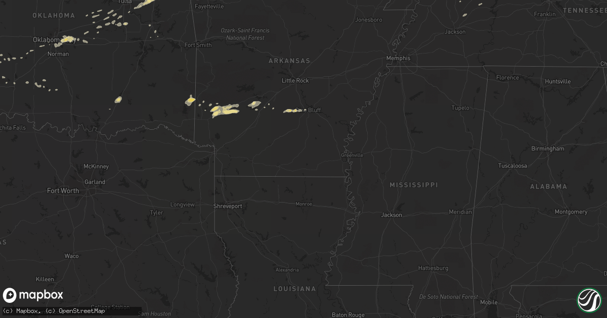
Hail Map in Kansas on April 30, 2012
Get this storm
April 30 map
$229
one time, instant access
Download today. No call, no setup
Keep the $229
Bought the map and want the full workflow? Apply the entire $229 to a subscription within 7 days. None of it is wasted.
Every map, not just this one
This buys you this map. Subscription and you get every map we run, in the markets you choose from a few cities to whole states to nationwide. Plus real-time alerts the moment a storm fires.
Contact data
Name, contact info, occupancy, even credit band for addresses in the footprint. You go from where it hit to who to call.
Become the source they trust
Unlimited branding weather history reports on demand. You already have the documented answer ready for the property owner, and you are the one who showed up with it.
Property data and RoofTrace estimates
Pull up any address you have got, its value and the exact code rules for that jurisdiction, straight from One Click Code. Then RoofTrace estimates the squares, pitch, and roof value, priced the way you price.
Storm reports in Kansas
Kansas
| Date | Description |
|---|---|
| 04/30/20126:59 PM CDT | A local report indicates 1.75 inch wind near 3 E GREENSBURG |
| 04/30/20126:57 PM CDT | A local report indicates 3.00 inch wind near 13 SE ASHLAND |
| 04/30/20126:55 PM CDT | A local report indicates 1.75 inch wind near W GREENSBURG |
| 04/30/20126:47 PM CDT | This tornado only touched down briefly. |
| 04/30/20126:45 PM CDT | A local report indicates 1.00 inch wind near 17 ESE JETMORE |
| 04/30/20126:43 PM CDT | A local report indicates 2.50 inch wind near GREENSBURG |
| 04/30/20126:36 PM CDT | A local report indicates 1.25 inch wind near MULLINVILLE |
| 04/30/20126:32 PM CDT | This was only a brief touchdown. |
| 04/30/20126:32 PM CDT | A local report indicates 1.25 inch wind near 10 W GREENSBURG |
| 04/30/20126:25 PM CDT | This is a duplicate report |
| 04/30/20126:23 PM CDT | A local report indicates 1.00 inch wind near MULLINVILLE |
| 04/30/20126:18 PM CDT | A local report indicates 1.00 inch wind near 8 S ASHLAND |
| 04/30/20126:08 PM CDT | A local report indicates 1.00 inch wind near 8 E COLDWATER |
| 04/30/20126:05 PM CDT | A local report indicates 1.75 inch wind near 9 S SITKA |
| 04/30/20126:04 PM CDT | Report received via 800w radio. |
| 04/30/20126:00 PM CDT | A local report indicates 1.75 inch wind near 23 ESE DODGE CITY |
| 04/30/20125:59 PM CDT | A local report indicates 1.50 inch wind near 10 NNW WRIGHT |
| 04/30/20125:57 PM CDT | This was a brief touchdown of the tornado. |
| 04/30/20125:53 PM CDT | A local report indicates 1.00 inch wind near 2 NW ACRES |
| 04/30/20125:42 PM CDT | A local report indicates 1.00 inch wind near ASHLAND |
| 04/30/20125:14 PM CDT | A local report indicates 1.00 inch wind near 2 NNE CIMARRON |
| 04/30/20124:51 PM CDT | A local report indicates 1.00 inch wind near INGALLS |
| 04/30/20124:50 PM CDT | A local report indicates 2.00 inch wind near NE INGALLS |
| 04/30/20121:37 AM CDT | Roof blown off mobile home. |
| 04/30/201212:33 AM CDT | A local report indicates 1.00 inch wind near 3 W COLUMBUS |
| 04/30/201212:20 AM CDT | A local report indicates 1.00 inch wind near MELROSE |
| 04/29/201210:43 PM CDT | Power poles reported down west of udall on k-55. Power outages reported. |
| 04/29/201210:00 PM CDT | A local report indicates 1.00 inch wind near 3 N MEDICINE LODGE |
| 04/29/20129:58 PM CDT | A local report indicates 1.75 inch wind near 3 NNE SUN CITY |
| 04/29/20129:55 PM CDT | A local report indicates 1.00 inch wind near 3 N MEDICINE LODGE |
| 04/29/20129:39 PM CDT | A local report indicates 1.00 inch wind near 4 NNW LAKE CITY |
| 04/29/20129:23 PM CDT | A local report indicates 1.75 inch wind near 3 S PARSONS |
| 04/29/20129:16 PM CDT | A local report indicates 1.25 inch wind near 4 SE HAVILAND |
| 04/29/20129:13 PM CDT | Dime to nickle sized hail with some quarter sized hail was reported. |
| 04/29/20129:12 PM CDT | 1 power pole downed with reports of tree damage |
| 04/29/20129:11 PM CDT | A local report indicates 70 MPH wind near ALTAMONT |
| 04/29/20129:11 PM CDT | A local report indicates 1.00 inch wind near ALTAMONT |
| 04/29/20129:07 PM CDT | A local report indicates 1.00 inch wind near SW CANEY |
| 04/29/20129:06 PM CDT | Dime to nickle sized hail with some quarter sized hail was reported. |
| 04/29/20129:05 PM CDT | Numerous quarter sized hail stones were observed. |
| 04/29/20128:48 PM CDT | A local report indicates 1.00 inch wind near 5 S HAZELTON |
| 04/29/20128:46 PM CDT | A local report indicates 1.75 inch wind near KIOWA |
| 04/29/20128:28 PM CDT | A local report indicates 2.50 inch wind near 1 S HARDTNER |
| 04/29/20128:10 PM CDT | A local report indicates 1.00 inch wind near 6 W HARDTNER |
| 04/29/20128:10 PM CDT | A local report indicates 1.75 inch wind near 8 WNW HARDTNER |
| 04/29/20128:08 PM CDT | A local report indicates 1.25 inch wind near SW KINSLEY |
| 04/29/20128:01 PM CDT | A local report indicates 1.00 inch wind near 12 W ANTHONY |
| 04/29/20127:45 PM CDT | A local report indicates 60 MPH wind near 6 SE OFFERLE |
| 04/29/20127:45 PM CDT | Lots of tree and power pole damage was reported. Farm equipment was rolled into a ball. There was minor roof and window damage to the farm home. |
| 04/29/20127:45 PM CDT | A local report indicates 1.00 inch wind near 6 SE OFFERLE |
| 04/29/20127:45 PM CDT | A local report indicates 1.75 inch wind near E KIOWA |
| 04/29/20127:44 PM CDT | A local report indicates 1.25 inch wind near 3 W HARDTNER |
| 04/29/20127:35 PM CDT | A local report indicates 1.75 inch wind near KIOWA |
| 04/29/20127:30 PM CDT | A local report indicates 1.00 inch wind near 8 S KINSLEY |
| 04/29/20127:14 PM CDT | A local report indicates 1.75 inch wind near 3 NW HAVILAND |
| 04/29/20127:00 PM CDT | Tornado was reported near coldwater lake. |
| 04/29/20127:00 PM CDT | A local report indicates 3.00 inch wind near ESE ASHLAND |
All States Impacted by Hail Map on April 30, 2012
Cities Impacted by Hail Map on April 30, 2012
- Center, KY
- Edmonton, KY
- Whitetop, VA
- Mouth Of Wilson, VA
- Troutdale, VA
- Lansing, NC
- Eldorado, OK
- Nashville, AR
- Kirby, AR
- Murfreesboro, AR
- Afton, OK
- Vinita, OK
- Eucha, OK
- Marathon, TX
- Talala, OK
- Ramona, OK
- Elkton, KY
- Trenton, KY
- Amarillo, TX
- Meeker, OK
- Sparks, OK
- Chandler, OK
- Taylorsville, KY
- Shelbyville, KY
- Finchville, KY
- Fisherville, KY
- Wilmore, KS
- Savonburg, KS
- Erie, KS
- Humboldt, KS
- Thayer, KS
- Chanute, KS
- Galesburg, KS
- Jefferson, NC
- Ashland, KS
- Viola, KS
- Conway Springs, KS
- Clearwater, KS
- Herndon, KY
- Cedar Vale, KS
- Moline, KS
- Lenapah, OK
- Wann, OK
- Cimarron, KS
- Ingalls, KS
- Medford, OK
- Thurmond, NC
- State Road, NC
- Helena, OK
- Goltry, OK
- Rosston, OK
- Dodge City, KS
- Spearville, KS
- Jetmore, KS
- Wright, KS
- Kinsley, KS
- Hanston, KS
- Belle Plaine, KS
- Wellington, KS
- Peck, KS
- Fluvanna, TX
- Sedan, KS
- Burlington, KS
- Lebo, KS
- Hartford, KS
- Nash, OK
- Ralls, TX
- Crosbyton, TX
- Noel, MO
- Lanagan, MO
- Pineville, MO
- Claude, TX
- Clarendon, TX
- Lelia Lake, TX
- Broken Arrow, OK
- Stanton, TX
- Post, TX
- Pocasset, OK
- Minco, OK
- Grapevine, AR
- Pine Bluff, AR
- Sheridan, AR
- White Hall, AR
- Roosevelt, OK
- Delaware, OK
- Harrisburg, IL
- Eddyville, IL
- Bowling Green, KY
- Brownsville, KY
- Park City, KY
- Oakland, KY
- Rocky Hill, KY
- Smiths Grove, KY
- Henderson, KY
- Spottsville, KY
- Carthage, MO
- Jasper, MO
- Waverly, KS
- Harrah, OK
- Newalla, OK
- Oklahoma City, OK
- Spencer, OK
- Mcloud, OK
- Choctaw, OK
- Protection, KS
- Fort Stockton, TX
- Mayfield, KS
- Garber, OK
- Red Rock, OK
- Ralston, OK
- Hunter, OK
- Nardin, OK
- Fairfax, OK
- Ponca City, OK
- Braman, OK
- Billings, OK
- Marland, OK
- Deer Creek, OK
- Lamont, OK
- Tonkawa, OK
- Pond Creek, OK
- Blackwell, OK
- Pawnee, OK
- Wellington, TX
- Sunray, TX
- Dumas, TX
- Stinnett, TX
- Grenola, KS
- Cambridge, KS
- Strang, OK
- Adair, OK
- Canyon, TX
- Dewey, OK
- S Coffeyville, OK
- Fairdale, KY
- Brooks, KY
- Elizabeth, IN
- Louisville, KY
- Laconia, IN
- Quail, TX
- Butler, TN
- Coats, KS
- Sun City, KS
- Vinson, OK
- Hollis, OK
- Bucklin, KS
- Hereford, TX
- Vega, TX
- Pittsburg, KS
- Ackerly, TX
- Lamesa, TX
- Willow, OK
- Cherokee, OK
- Bixby, OK
- Snyder, TX
- Gail, TX
- Scammon, KS
- Columbus, KS
- Weir, KS
- Collettsville, NC
- Green Mountain, NC
- Bakersville, NC
- Linville, NC
- Blowing Rock, NC
- Roan Mountain, TN
- Newland, NC
- Lenoir, NC
- Dryden, TX
- Alva, OK
- Kiowa, KS
- Hardtner, KS
- Prague, OK
- Adairville, KY
- Olmstead, KY
- Etoile, KY
- Austin, KY
- Glasgow, KY
- Summer Shade, KY
- Gotebo, OK
- Sentinel, OK
- Hobart, OK
- Lone Wolf, OK
- Rocky, OK
- Dill City, OK
- Atoka, OK
- Beggs, OK
- Chouteau, OK
- Inola, OK
- Carmen, OK
- Bartlesville, OK
- Nowata, OK
- Freedom, OK
- Meno, OK
- Parsons, KS
- Altamont, KS
- Aspermont, TX
- Georgetown, KY
- Stamping Ground, KY
- Sadieville, KY
- Owenton, KY
- Coldwater, KS
- Gate, OK
- Tarzan, TX
- Matador, TX
- Hedley, TX
- Paducah, TX
- Spur, TX
- Justiceburg, TX
- Afton, TX
- Dickens, TX
- Santa Claus, IN
- Bristow, IN
- Saint Meinrad, IN
- Ferdinand, IN
- Arkansas City, KS
- Minneola, KS
- Dodson, TX
- Pryor, OK
- Ozona, TX
- Iberia, MO
- Todd, NC
- Boone, NC
- Imperial, TX
- Cadiz, KY
- Gracey, KY
- Amorita, OK
- Waldron, KS
- Burlington, OK
- Lake City, KS
- Jet, OK
- Hazelton, KS
- Anthony, KS
- Alpine, TX
- Crofton, KY
- Princeton, KY
- Eddyville, KY
- Cerulean, KY
- Cave City, KY
- Greenville, KY
- Lewisburg, KY
- Belton, KY
- Wakita, OK
- Saint Paul, KS
- Oswego, KS
- Coffeyville, KS
- Edna, KS
- Bristow, OK
- Gould, OK
- Mangum, OK
- Childress, TX
- Pampa, TX
- Memphis, TX
- Copan, OK
- Quanah, TX
- Lenorah, TX
- McCune, KS
- Mound Valley, KS
- Marion, KS
- Lost Springs, KS
- Lincolnville, KS
- Guthrie, KY
- Adams, TN
- Cedar Hill, TN
- Elk City, KS
- Waddy, KY
- Okmulgee, OK
- Marlow, OK
- Roaring River, NC
- Elkin, NC
- Greensburg, KS
- Mullinville, KS
- Haviland, KS
- Ronda, NC
- Traphill, NC
- Newhope, AR
- Dierks, AR
- Stark City, MO
- Purdy, MO
- Bartlett, KS
- Welch, OK
- Chetopa, KS
- Vandervoort, AR
- Dobson, NC
- Mount Airy, NC
- Hardin, KY
- Muskogee, OK
- Englewood, KS
- Lewis, KS
- Offerle, KS
- Medicine Lodge, KS
- Garfield, KS
- Sawyer, KS
- Pratt, KS
- Buffalo, OK
- Ford, KS
- Belpre, KS
- Odell, TX
- Vernon, TX
- Mustang, OK
- Fort Davis, TX
- Mcadoo, TX
- Roaring Springs, TX
- Waynoka, OK
- Grove, OK
- South West City, MO
- Springville, TN
- Paris, TN
- Greensburg, KY
- Laurel Springs, NC
- Brackettville, TX
- Knott, TX
- Cottonwood Falls, KS
- Arkadelphia, AR
- Old Glory, TX
- Kremlin, OK
- Asheville, NC
- Leicester, NC
- Alexander, NC
- Weaverville, NC
- Zionville, NC
- Mountain City, TN
- Trade, TN
- Agra, OK
- Cushing, OK
- Carnegie, OK
- Elmdale, KS
- Bluejacket, OK
- Fletcher, OK
- Ararat, NC
- Pilot Mountain, NC
- Fulton, MO
- Independence, KS
- Miami, OK
- Cedar Point, KS
- Walnut, KS
- Chelsea, OK
- Claremore, OK
- Russellville, KY
- Springfield, TN
- Allensville, KY
- Franklin, KY
- Granite, OK
- Carter, OK
- Mountain View, OK
- Blair, OK
- Cordell, OK
- Manchester, OK
- Burbank, OK
- Sapulpa, OK
- Kellyville, OK
- Auburn, KY
- Foster, OK
- Banner Elk, NC
- Duke, OK
- Chillicothe, TX
- Salina, OK
- Stroud, OK
- Bismarck, AR
- Hooker, OK
- Golconda, IL
- Olustee, OK
- Erick, OK
- Jefferson City, MO
- Elmore City, OK
- Boonville, IN
- Gentryville, IN
- Tennyson, IN
- Gracemont, OK
- Fort Cobb, OK
- Smithville, OK
- Watson, OK
- Cove, AR
- Shawnee, OK
- Fort Sill, OK
- Salyersville, KY
- Udall, KS
- Havana, KS
- Attica, KS
- Golden City, MO
- Lockwood, MO
- Rocky Comfort, MO
- Powell, MO
- Pembroke, KY
- Hopkinsville, KY
- Oak Grove, KY
- North Wilkesboro, NC
- Mounds, OK
- Winfield, KS
- Rock, KS
- Eureka, KS
- Langley, AR
- De Queen, AR
- Umpire, AR
- Glenwood, AR
- Amity, AR
- Delight, AR
- Mount Vernon, MO
- Verona, MO
- Malvern, AR
- Dexter, KY
- Drumright, OK
- Rush Springs, OK
- Lindsay, OK
- Norwich, KS
- Milton, KS
- Horse Cave, KY
- Canmer, KY
- Hardyville, KY
- Tyro, KS
- Caney, KS
- Pawhuska, OK
- Niotaze, KS
- Burnsville, NC
- Laredo, TX
- Jay, OK
- McLeansboro, IL
- Dixon, MO
- Hamilton, KS
- Madison, KS
- Carrier, OK
- Enid, OK
- Ringwood, OK
- Perry, OK
- Cleo Springs, OK
- Morrison, OK
- Aline, OK
- Sharon, KS
- Elk Creek, VA
- Lavinia, TN
- Huntingdon, TN
- Cedar Grove, TN
- Lanesville, IN
- Spruce Pine, NC
- Midland, TX
- Peru, KS
- Comstock, TX
- Depew, OK
- Scottsville, KY
- Paden, OK
- Anadarko, OK
- Elmer, OK
- Liberty, KS
- Tampa, KS
- Waukomis, OK
- Checotah, OK
- Vilas, NC
- Cynthiana, KY
- Greenfield, MO
- Arcola, MO
- Cannelton, IN
- Hawesville, KY
- Erwin, TN
- Burden, KS
- Atlanta, KS
- West Jefferson, NC
- Cub Run, KY
- Mammoth Cave, KY
- Donaldson, AR
- Simpson, IL
- Rockfield, KY
- Hays, NC
- Norwood, MO
- Rule, TX
- Gillham, AR
- Caddo, OK
- Rocksprings, TX
- Elgin, OK
- Isabel, KS
- Spavinaw, OK
- Locust Grove, OK
- Cunningham, KS
- Nashville, KS
- Rome, IN
- Jayton, TX
- Girard, TX
- Altus, OK
- Newkirk, OK
- Hominy, OK
- Tell City, IN
- Elk Falls, KS
- Dadeville, MO
- Westphalia, KS
- Maple City, KS
- Morgantown, KY
- Unicoi, TN
- Hampton, TN
- Sugar Grove, NC
- Wickes, AR
- Sparta, NC
- Sulphur Springs, AR
- Gravette, AR
- Anderson, MO
- Hankinson, ND
- Bee Spring, KY
- Girard, KS
- Clarksville, TN
- Lawton, OK
- Dale, IN
- Lincoln City, IN
- Tennessee Ridge, TN
- Waverly, TN
- Erin, TN
- Roundhill, KY
- Sweeden, KY
- Warner, OK
- Ochelata, OK
- Frankfort, KY
- Corinth, KY
- Barnsdall, OK
- Dexter, KS
- Simpsonville, KY
- Big Cabin, OK
- Lyons, KS
- Enfield, IL
- Carl Junction, MO
- Asbury, MO
- Webb City, MO
- Oronogo, MO
- El Dorado, KS
- Uvalde, TX
- Hollow Rock, TN
- Bruceton, TN
- Greenfield, TN


