Hail Map in Texas on April 30, 2012
Get this storm
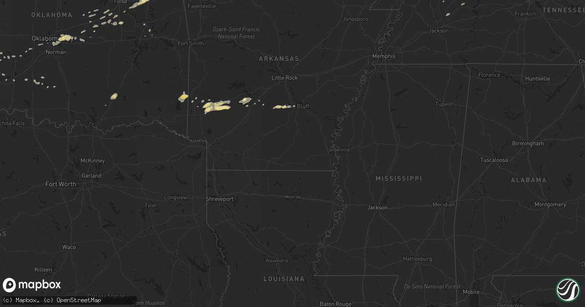
April 30 map
$229
one time, instant access
Download today. No call, no setup
Keep the $229
Bought the map and want the full workflow? Apply the entire $229 to a subscription within 7 days. None of it is wasted.
Every map, not just this one
This buys you this map. Subscription and you get every map we run, in the markets you choose from a few cities to whole states to nationwide. Plus real-time alerts the moment a storm fires.
Contact data
Name, contact info, occupancy, even credit band for addresses in the footprint. You go from where it hit to who to call.
Become the source they trust
Unlimited branding weather history reports on demand. You already have the documented answer ready for the property owner, and you are the one who showed up with it.
Property data and RoofTrace estimates
Pull up any address you have got, its value and the exact code rules for that jurisdiction, straight from One Click Code. Then RoofTrace estimates the squares, pitch, and roof value, priced the way you price.
Storm reports in Texas
Texas
| Date | Description |
|---|---|
| 04/30/20126:58 PM CDT | With 0.21 inches of rain |
| 04/30/20126:58 PM CDT | A local report indicates 1.75 inch wind near CLARENDON |
| 04/30/20126:55 PM CDT | A local report indicates 1.50 inch wind near 4 S CLARENDON |
| 04/30/20126:55 PM CDT | A local report indicates 1.75 inch wind near 5 S CLARENDON |
| 04/30/20126:54 PM CDT | A local report indicates 1.00 inch wind near 3 SE CLAUDE |
| 04/30/20126:54 PM CDT | Along u 82 |
| 04/30/20126:53 PM CDT | Multiple large hailstones still on ground |
| 04/30/20126:52 PM CDT | A local report indicates 1.75 inch wind near 2 S DICKENS |
| 04/30/20126:50 PM CDT | A local report indicates 2.50 inch wind near FLUVANNA |
| 04/30/20126:49 PM CDT | A local report indicates 1.75 inch wind near CLARENDON |
| 04/30/20126:48 PM CDT | Quarter to half dollar size hail reported. |
| 04/30/20126:46 PM CDT | A local report indicates 1.00 inch wind near 2 N HOWARDWICK |
| 04/30/20126:41 PM CDT | A local report indicates 2.75 inch wind near 6 S FLUVANNA |
| 04/30/20126:41 PM CDT | A local report indicates 1.50 inch wind near CLAUDE |
| 04/30/20126:38 PM CDT | A local report indicates 1.75 inch wind near CLAUDE |
| 04/30/20126:36 PM CDT | A local report indicates 1.75 inch wind near 2 W CLAUDE |
| 04/30/20126:35 PM CDT | A local report indicates 1.25 inch wind near 3 SE CLAUDE |
| 04/30/20126:34 PM CDT | A local report indicates 1.50 inch wind near CLAUDE |
| 04/30/20126:32 PM CDT | On us 70 |
| 04/30/20126:28 PM CDT | Relayed by kcbd...along highway 70 in matador. |
| 04/30/20126:23 PM CDT | Reported by matador fire department. |
| 04/30/20126:20 PM CDT | A local report indicates 1.00 inch wind near LAKE MCCLELLAN |
| 04/30/20126:13 PM CDT | Reported by roaring springs fire department. |
| 04/30/20126:05 PM CDT | A local report indicates 1.00 inch wind near FLUVANNA |
| 04/30/20125:55 PM CDT | A local report indicates 1.75 inch wind near 5 SSW AMARILLO |
| 04/30/20125:45 PM CDT | A local report indicates 1.50 inch wind near 5 S AMARILLO |
| 04/30/20125:45 PM CDT | A local report indicates 1.00 inch wind near MCADOO |
| 04/30/20125:45 PM CDT | Reported 10 miles north of polar community. |
| 04/30/20125:35 PM CDT | A local report indicates 1.25 inch wind near 10 SW AMARILLO |
| 04/30/20125:35 PM CDT | A local report indicates 1.00 inch wind near 6 WSW AMARILLO |
| 04/30/20125:33 PM CDT | A local report indicates 1.00 inch wind near 6 SW AMARILLO |
| 04/30/20125:29 PM CDT | A local report indicates 1.00 inch wind near 10 SW AMARILLO |
| 04/30/20125:27 PM CDT | Relayed by kcbd...along crosby garza county line. |
| 04/30/20125:26 PM CDT | A local report indicates 1.50 inch wind near 7 SW AMARILLO |
| 04/30/20125:25 PM CDT | A local report indicates 1.00 inch wind near AMARILLO |
| 04/30/20125:24 PM CDT | A local report indicates 1.00 inch wind near 6 SW AMARILLO |
| 04/30/20125:21 PM CDT | A local report indicates 1.00 inch wind near 6 SW AMARILLO |
| 04/30/20125:11 PM CDT | Half mile wide swath of hail at highway 380 and 208. Largest hail measured at 2 inches. |
| 04/30/20124:45 PM CDT | Windshield broken out by hail on 207 north of post. |
| 04/29/201211:05 PM CDT | A local report indicates 70 MPH wind near 3 NW SEYMOUR |
| 04/29/201210:00 PM CDT | Roof damage at knox city hospital. Trampolines hanging from power lines. Numerous power outages. Reported by knox county 911. |
| 04/29/201210:00 PM CDT | Mostly nickel to quarter size |
| 04/29/20129:31 PM CDT | A local report indicates 1.00 inch wind near MEMPHIS |
| 04/29/20129:00 PM CDT | A local report indicates 1.75 inch wind near LELIA LAKE |
| 04/29/20128:50 PM CDT | A local report indicates 60 MPH wind near WELLINGTON |
| 04/29/20128:50 PM CDT | Some street flooding reported as well |
| 04/29/20128:49 PM CDT | A local report indicates 1.75 inch wind near WELLINGTON |
| 04/29/20128:34 PM CDT | A local report indicates 1.75 inch wind near WELLINGTON |
| 04/29/20128:32 PM CDT | Estimated 60 to 65 mph winds |
| 04/29/20128:30 PM CDT | A local report indicates 1.25 inch wind near 6 N HOWARDWICK |
| 04/29/20128:30 PM CDT | Preliminary information. Tornado began 7.25 miles south of wellington and traveled 1.25 miles. Path width was 150 yards. Tornado began at 0830 pm and ended at 0833 pm. |
| 04/29/20128:20 PM CDT | A local report indicates 1.75 inch wind near 5 NE CLARENDON |
| 04/29/20128:12 PM CDT | A local report indicates 1.75 inch wind near HOWARDWICK |
| 04/29/20128:06 PM CDT | A local report indicates 1.50 inch wind near CLARENDON |
| 04/29/20127:58 PM CDT | A local report indicates 1.00 inch wind near PADUCAH |
| 04/29/20127:57 PM CDT | A local report indicates 2.50 inch wind near 1 NW CLARENDON |
| 04/29/20127:57 PM CDT | A local report indicates 1.75 inch wind near CLARENDON |
| 04/29/20127:56 PM CDT | A local report indicates 2.50 inch wind near 4 W CLARENDON |
| 04/29/20127:55 PM CDT | This hail fell in ashtola. |
| 04/29/20127:49 PM CDT | Baseball size hail fell for five minutes. Multiple vehicle windshields and windows smashed according to this report. |
| 04/29/20127:45 PM CDT | A local report indicates 59 MPH wind near 1 ENE MCLEAN |
| 04/29/20127:40 PM CDT | A local report indicates 1.00 inch wind near 6 E GOODNIGHT |
| 04/29/20127:40 PM CDT | A local report indicates 77 MPH wind near 3 WNW FLUVANNA |
| 04/29/20127:30 PM CDT | A local report indicates 1.25 inch wind near 7 N HOWARDWICK |
| 04/29/20127:30 PM CDT | A local report indicates 2.50 inch wind near LELIA LAKE |
| 04/29/20127:26 PM CDT | A local report indicates 1.75 inch wind near 1 W GOODNIGHT |
| 04/29/20127:20 PM CDT | A local report indicates 1.00 inch wind near 5 E CLAUDE |
| 04/29/20127:14 PM CDT | A local report indicates 2.00 inch wind near SE LELIA LAKE |
| 04/29/20127:12 PM CDT | A local report indicates 1.50 inch wind near 6 S FLUVANNA |
| 04/29/20127:09 PM CDT | A local report indicates 2.50 inch wind near 3 E CLARENDON |
| 04/29/20127:00 PM CDT | Largest hail stone measured 2.5 inches by 3.5 inches. |
All States Impacted by Hail Map on April 30, 2012
Cities Impacted by Hail Map on April 30, 2012
- Center, KY
- Edmonton, KY
- Whitetop, VA
- Mouth Of Wilson, VA
- Troutdale, VA
- Lansing, NC
- Eldorado, OK
- Nashville, AR
- Kirby, AR
- Murfreesboro, AR
- Afton, OK
- Vinita, OK
- Eucha, OK
- Marathon, TX
- Talala, OK
- Ramona, OK
- Elkton, KY
- Trenton, KY
- Amarillo, TX
- Meeker, OK
- Sparks, OK
- Chandler, OK
- Taylorsville, KY
- Shelbyville, KY
- Finchville, KY
- Fisherville, KY
- Wilmore, KS
- Savonburg, KS
- Erie, KS
- Humboldt, KS
- Thayer, KS
- Chanute, KS
- Galesburg, KS
- Jefferson, NC
- Ashland, KS
- Viola, KS
- Conway Springs, KS
- Clearwater, KS
- Herndon, KY
- Cedar Vale, KS
- Moline, KS
- Lenapah, OK
- Wann, OK
- Cimarron, KS
- Ingalls, KS
- Medford, OK
- Thurmond, NC
- State Road, NC
- Helena, OK
- Goltry, OK
- Rosston, OK
- Dodge City, KS
- Spearville, KS
- Jetmore, KS
- Wright, KS
- Kinsley, KS
- Hanston, KS
- Belle Plaine, KS
- Wellington, KS
- Peck, KS
- Fluvanna, TX
- Sedan, KS
- Burlington, KS
- Lebo, KS
- Hartford, KS
- Nash, OK
- Ralls, TX
- Crosbyton, TX
- Noel, MO
- Lanagan, MO
- Pineville, MO
- Claude, TX
- Clarendon, TX
- Lelia Lake, TX
- Broken Arrow, OK
- Stanton, TX
- Post, TX
- Pocasset, OK
- Minco, OK
- Grapevine, AR
- Pine Bluff, AR
- Sheridan, AR
- White Hall, AR
- Roosevelt, OK
- Delaware, OK
- Harrisburg, IL
- Eddyville, IL
- Bowling Green, KY
- Brownsville, KY
- Park City, KY
- Oakland, KY
- Rocky Hill, KY
- Smiths Grove, KY
- Henderson, KY
- Spottsville, KY
- Carthage, MO
- Jasper, MO
- Waverly, KS
- Harrah, OK
- Newalla, OK
- Oklahoma City, OK
- Spencer, OK
- Mcloud, OK
- Choctaw, OK
- Protection, KS
- Fort Stockton, TX
- Mayfield, KS
- Garber, OK
- Red Rock, OK
- Ralston, OK
- Hunter, OK
- Nardin, OK
- Fairfax, OK
- Ponca City, OK
- Braman, OK
- Billings, OK
- Marland, OK
- Deer Creek, OK
- Lamont, OK
- Tonkawa, OK
- Pond Creek, OK
- Blackwell, OK
- Pawnee, OK
- Wellington, TX
- Sunray, TX
- Dumas, TX
- Stinnett, TX
- Grenola, KS
- Cambridge, KS
- Strang, OK
- Adair, OK
- Canyon, TX
- Dewey, OK
- S Coffeyville, OK
- Fairdale, KY
- Brooks, KY
- Elizabeth, IN
- Louisville, KY
- Laconia, IN
- Quail, TX
- Butler, TN
- Coats, KS
- Sun City, KS
- Vinson, OK
- Hollis, OK
- Bucklin, KS
- Hereford, TX
- Vega, TX
- Pittsburg, KS
- Ackerly, TX
- Lamesa, TX
- Willow, OK
- Cherokee, OK
- Bixby, OK
- Snyder, TX
- Gail, TX
- Scammon, KS
- Columbus, KS
- Weir, KS
- Collettsville, NC
- Green Mountain, NC
- Bakersville, NC
- Linville, NC
- Blowing Rock, NC
- Roan Mountain, TN
- Newland, NC
- Lenoir, NC
- Dryden, TX
- Alva, OK
- Kiowa, KS
- Hardtner, KS
- Prague, OK
- Adairville, KY
- Olmstead, KY
- Etoile, KY
- Austin, KY
- Glasgow, KY
- Summer Shade, KY
- Gotebo, OK
- Sentinel, OK
- Hobart, OK
- Lone Wolf, OK
- Rocky, OK
- Dill City, OK
- Atoka, OK
- Beggs, OK
- Chouteau, OK
- Inola, OK
- Carmen, OK
- Bartlesville, OK
- Nowata, OK
- Freedom, OK
- Meno, OK
- Parsons, KS
- Altamont, KS
- Aspermont, TX
- Georgetown, KY
- Stamping Ground, KY
- Sadieville, KY
- Owenton, KY
- Coldwater, KS
- Gate, OK
- Tarzan, TX
- Matador, TX
- Hedley, TX
- Paducah, TX
- Spur, TX
- Justiceburg, TX
- Afton, TX
- Dickens, TX
- Santa Claus, IN
- Bristow, IN
- Saint Meinrad, IN
- Ferdinand, IN
- Arkansas City, KS
- Minneola, KS
- Dodson, TX
- Pryor, OK
- Ozona, TX
- Iberia, MO
- Todd, NC
- Boone, NC
- Imperial, TX
- Cadiz, KY
- Gracey, KY
- Amorita, OK
- Waldron, KS
- Burlington, OK
- Lake City, KS
- Jet, OK
- Hazelton, KS
- Anthony, KS
- Alpine, TX
- Crofton, KY
- Princeton, KY
- Eddyville, KY
- Cerulean, KY
- Cave City, KY
- Greenville, KY
- Lewisburg, KY
- Belton, KY
- Wakita, OK
- Saint Paul, KS
- Oswego, KS
- Coffeyville, KS
- Edna, KS
- Bristow, OK
- Gould, OK
- Mangum, OK
- Childress, TX
- Pampa, TX
- Memphis, TX
- Copan, OK
- Quanah, TX
- Lenorah, TX
- McCune, KS
- Mound Valley, KS
- Marion, KS
- Lost Springs, KS
- Lincolnville, KS
- Guthrie, KY
- Adams, TN
- Cedar Hill, TN
- Elk City, KS
- Waddy, KY
- Okmulgee, OK
- Marlow, OK
- Roaring River, NC
- Elkin, NC
- Greensburg, KS
- Mullinville, KS
- Haviland, KS
- Ronda, NC
- Traphill, NC
- Newhope, AR
- Dierks, AR
- Stark City, MO
- Purdy, MO
- Bartlett, KS
- Welch, OK
- Chetopa, KS
- Vandervoort, AR
- Dobson, NC
- Mount Airy, NC
- Hardin, KY
- Muskogee, OK
- Englewood, KS
- Lewis, KS
- Offerle, KS
- Medicine Lodge, KS
- Garfield, KS
- Sawyer, KS
- Pratt, KS
- Buffalo, OK
- Ford, KS
- Belpre, KS
- Odell, TX
- Vernon, TX
- Mustang, OK
- Fort Davis, TX
- Mcadoo, TX
- Roaring Springs, TX
- Waynoka, OK
- Grove, OK
- South West City, MO
- Springville, TN
- Paris, TN
- Greensburg, KY
- Laurel Springs, NC
- Brackettville, TX
- Knott, TX
- Cottonwood Falls, KS
- Arkadelphia, AR
- Old Glory, TX
- Kremlin, OK
- Asheville, NC
- Leicester, NC
- Alexander, NC
- Weaverville, NC
- Zionville, NC
- Mountain City, TN
- Trade, TN
- Agra, OK
- Cushing, OK
- Carnegie, OK
- Elmdale, KS
- Bluejacket, OK
- Fletcher, OK
- Ararat, NC
- Pilot Mountain, NC
- Fulton, MO
- Independence, KS
- Miami, OK
- Cedar Point, KS
- Walnut, KS
- Chelsea, OK
- Claremore, OK
- Russellville, KY
- Springfield, TN
- Allensville, KY
- Franklin, KY
- Granite, OK
- Carter, OK
- Mountain View, OK
- Blair, OK
- Cordell, OK
- Manchester, OK
- Burbank, OK
- Sapulpa, OK
- Kellyville, OK
- Auburn, KY
- Foster, OK
- Banner Elk, NC
- Duke, OK
- Chillicothe, TX
- Salina, OK
- Stroud, OK
- Bismarck, AR
- Hooker, OK
- Golconda, IL
- Olustee, OK
- Erick, OK
- Jefferson City, MO
- Elmore City, OK
- Boonville, IN
- Gentryville, IN
- Tennyson, IN
- Gracemont, OK
- Fort Cobb, OK
- Smithville, OK
- Watson, OK
- Cove, AR
- Shawnee, OK
- Fort Sill, OK
- Salyersville, KY
- Udall, KS
- Havana, KS
- Attica, KS
- Golden City, MO
- Lockwood, MO
- Rocky Comfort, MO
- Powell, MO
- Pembroke, KY
- Hopkinsville, KY
- Oak Grove, KY
- North Wilkesboro, NC
- Mounds, OK
- Winfield, KS
- Rock, KS
- Eureka, KS
- Langley, AR
- De Queen, AR
- Umpire, AR
- Glenwood, AR
- Amity, AR
- Delight, AR
- Mount Vernon, MO
- Verona, MO
- Malvern, AR
- Dexter, KY
- Drumright, OK
- Rush Springs, OK
- Lindsay, OK
- Norwich, KS
- Milton, KS
- Horse Cave, KY
- Canmer, KY
- Hardyville, KY
- Tyro, KS
- Caney, KS
- Pawhuska, OK
- Niotaze, KS
- Burnsville, NC
- Laredo, TX
- Jay, OK
- McLeansboro, IL
- Dixon, MO
- Hamilton, KS
- Madison, KS
- Carrier, OK
- Enid, OK
- Ringwood, OK
- Perry, OK
- Cleo Springs, OK
- Morrison, OK
- Aline, OK
- Sharon, KS
- Elk Creek, VA
- Lavinia, TN
- Huntingdon, TN
- Cedar Grove, TN
- Lanesville, IN
- Spruce Pine, NC
- Midland, TX
- Peru, KS
- Comstock, TX
- Depew, OK
- Scottsville, KY
- Paden, OK
- Anadarko, OK
- Elmer, OK
- Liberty, KS
- Tampa, KS
- Waukomis, OK
- Checotah, OK
- Vilas, NC
- Cynthiana, KY
- Greenfield, MO
- Arcola, MO
- Cannelton, IN
- Hawesville, KY
- Erwin, TN
- Burden, KS
- Atlanta, KS
- West Jefferson, NC
- Cub Run, KY
- Mammoth Cave, KY
- Donaldson, AR
- Simpson, IL
- Rockfield, KY
- Hays, NC
- Norwood, MO
- Rule, TX
- Gillham, AR
- Caddo, OK
- Rocksprings, TX
- Elgin, OK
- Isabel, KS
- Spavinaw, OK
- Locust Grove, OK
- Cunningham, KS
- Nashville, KS
- Rome, IN
- Jayton, TX
- Girard, TX
- Altus, OK
- Newkirk, OK
- Hominy, OK
- Tell City, IN
- Elk Falls, KS
- Dadeville, MO
- Westphalia, KS
- Maple City, KS
- Morgantown, KY
- Unicoi, TN
- Hampton, TN
- Sugar Grove, NC
- Wickes, AR
- Sparta, NC
- Sulphur Springs, AR
- Gravette, AR
- Anderson, MO
- Hankinson, ND
- Bee Spring, KY
- Girard, KS
- Clarksville, TN
- Lawton, OK
- Dale, IN
- Lincoln City, IN
- Tennessee Ridge, TN
- Waverly, TN
- Erin, TN
- Roundhill, KY
- Sweeden, KY
- Warner, OK
- Ochelata, OK
- Frankfort, KY
- Corinth, KY
- Barnsdall, OK
- Dexter, KS
- Simpsonville, KY
- Big Cabin, OK
- Lyons, KS
- Enfield, IL
- Carl Junction, MO
- Asbury, MO
- Webb City, MO
- Oronogo, MO
- El Dorado, KS
- Uvalde, TX
- Hollow Rock, TN
- Bruceton, TN
- Greenfield, TN


