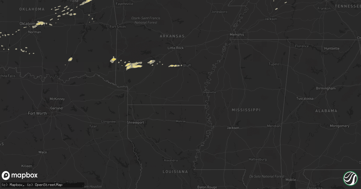
Hail Map in Oklahoma on April 30, 2012
Get this storm
April 30 map
$229
one time, instant access
Download today. No call, no setup
Keep the $229
Bought the map and want the full workflow? Apply the entire $229 to a subscription within 7 days. None of it is wasted.
Every map, not just this one
This buys you this map. Subscription and you get every map we run, in the markets you choose from a few cities to whole states to nationwide. Plus real-time alerts the moment a storm fires.
Contact data
Name, contact info, occupancy, even credit band for addresses in the footprint. You go from where it hit to who to call.
Become the source they trust
Unlimited branding weather history reports on demand. You already have the documented answer ready for the property owner, and you are the one who showed up with it.
Property data and RoofTrace estimates
Pull up any address you have got, its value and the exact code rules for that jurisdiction, straight from One Click Code. Then RoofTrace estimates the squares, pitch, and roof value, priced the way you price.
Storm reports in Oklahoma
Oklahoma
| Date | Description |
|---|---|
| 04/30/20123:35 AM CDT | 2 to 3 inch diameter tree limbs down on highway 59 |
| 04/30/20121:53 AM CDT | Large tree limbs down. Shingles damaged on numerous homes. |
| 04/30/20121:45 AM CDT | A local report indicates 58 MPH wind near 3 SSE INOLA |
| 04/30/20121:35 AM CDT | Large tree limbs blown down and brought down power lines. |
| 04/30/20121:34 AM CDT | Power lines and trees over a foot in diameter down south of dawes. |
| 04/30/20121:30 AM CDT | Ef1 damage was confirmed on the north side of welch. Two homes were damaged...one with the roof completely off the home. Surveyors noted mud and debris caked on the eas |
| 04/30/20121:30 AM CDT | Vinita mesonet. |
| 04/30/20121:30 AM CDT | Several homes lost shingles. Large tree limbs broken and downed. |
| 04/30/20121:30 AM CDT | Centralia mesonet. |
| 04/30/20121:21 AM CDT | A local report indicates 65 MPH wind near 2 ENE BROKEN ARROW |
| 04/30/20121:11 AM CDT | Large tree down blocking road near centralia. Time estimated by radar. |
| 04/30/201212:58 AM CDT | Out building damaged...moved 10-15 feet off foundation. 6 to 8 inch diameter tree blown over. Report relayed via emergency mgt. |
| 04/30/201212:55 AM CDT | Tree on top of house on cherokee street in delaware. Time estimated by radar. |
| 04/30/201212:42 AM CDT | Damage survey found 6.5 mile long tornado path of numerous snapped and uprooted hardwood trees and several damaged barns. Tornado was rated ef1 with maximum wind of 105 |
| 04/30/201212:33 AM CDT | Power lines down near the interstate 40 and 240 interchange. Reported by okc fire dispatch. |
| 04/30/201212:25 AM CDT | Large tree limbs down |
| 04/30/201212:10 AM CDT | Oklahoma mesonet. |
| 04/30/201212:06 AM CDT | Several large tree limbs down. Time estimated by radar. |
| 04/30/201212:00 AM CDT | A local report indicates 1.00 inch wind near HARRAH |
| 04/30/201212:00 AM CDT | 3ft diamter tree blown over |
| 04/29/201211:52 PM CDT | A local report indicates 1.00 inch wind near CHOCTAW |
| 04/29/201211:40 PM CDT | Reports of large tree limbs broken around town. |
| 04/29/201211:33 PM CDT | A local report indicates 62 MPH wind near WILL ROGERS AIRPORT |
| 04/29/201211:30 PM CDT | A local report indicates 65 MPH wind near 2 SSW MINCO |
| 04/29/201211:25 PM CDT | A local report indicates 78 MPH wind near 2 SSW MINCO |
| 04/29/201211:19 PM CDT | Several large tree limbs down |
| 04/29/201210:45 PM CDT | Roof and outbuilding damage 4se of hwy11/i35. Time estimated. |
| 04/29/201210:35 PM CDT | A local report indicates 60 MPH wind near 5 WNW EL RENO |
| 04/29/201210:30 PM CDT | Several power poles blown down |
| 04/29/201210:30 PM CDT | A local report indicates 60 MPH wind near 4 NNW FORT COBB |
| 04/29/201210:30 PM CDT | A local report indicates 1.00 inch wind near HOLLIS |
| 04/29/201210:25 PM CDT | A local report indicates 64 MPH wind near 4 NNW FORT COBB |
| 04/29/201210:10 PM CDT | A local report indicates 76 MPH wind near 3 W GOULD |
| 04/29/201210:10 PM CDT | A local report indicates 1.50 inch wind near 3 E HOLLIS |
| 04/29/201210:05 PM CDT | Large trees uprooted |
| 04/29/201210:00 PM CDT | A local report indicates 65 MPH wind near 1 SW MEDFORD |
| 04/29/20129:58 PM CDT | A local report indicates 1.00 inch wind near HOLLIS |
| 04/29/20129:55 PM CDT | A local report indicates 67 MPH wind near 1 SW MEDFORD |
| 04/29/20129:50 PM CDT | A local report indicates 68 MPH wind near 1 SW MEDFORD |
| 04/29/20129:45 PM CDT | A local report indicates 1.75 inch wind near 5 SSW VINSON |
| 04/29/20129:35 PM CDT | A local report indicates 1.75 inch wind near 5 SSW VINSON |
| 04/29/20129:30 PM CDT | A local report indicates 65 MPH wind near 1 SW MEDFORD |
| 04/29/20129:15 PM CDT | A local report indicates 58 MPH wind near 1 SW MEDFORD |
| 04/29/20129:10 PM CDT | The wind gust occurred as a likely tornado moved south of the site. |
| 04/29/20129:06 PM CDT | A local report indicates a tornado near 2 SW MEDFORD |
| 04/29/20129:01 PM CDT | This tornado developed southwest of medford and moved northeast. The mesonet site 1 mile southwest of medford reported a wind gust of 84 mph at 2110 cdt. The tornado li |
| 04/29/20128:59 PM CDT | Damage survey found 1.5 mile long tornado damage path of a few snapped hardwood tree trunks...numerous snapped branches...and a damaged pole barn. Tornado was rated ef1 |
| 04/29/20128:35 PM CDT | A local report indicates 1.75 inch wind near 7 NW CAPRON |
| 04/29/20128:25 PM CDT | Spotter reported a small tornado touchdown...with a few power flashes |
| 04/29/20128:15 PM CDT | W410 rd and n24 rd. Several brief touchdowns. |
| 04/29/20128:10 PM CDT | Spotter reported a brief tornado touchdown. |
| 04/29/20128:10 PM CDT | Local broadcast media and a storm chaser observed a tornado that began about 4 miles north-northwest of nash. It is somewhat uncertain at this time whether this was a s |
| 04/29/20127:55 PM CDT | Home damage near the intersection of 4060 rd and 2400 rd sw of nowata. Possible tornado damage. Time estimated by radar. |
| 04/29/20127:55 PM CDT | A local report indicates 1.75 inch wind near GREAT SALT PLAINS LAKE |
| 04/29/20127:48 PM CDT | 8 inch tree limb down. |
| 04/29/20127:48 PM CDT | Between quarter and golf ball size hail. |
| 04/29/20127:40 PM CDT | Kfor-tv and alfalfa county emergency manager reported a tornado that formed on the south side of the great salt plains lake. The tornado damaged an outbuilding on the s |
| 04/29/20127:30 PM CDT | Kfor-tv storm chaser reported a brief tornado 2 miles west of nash. No damage was reported with the tornado. |
| 04/29/20127:00 PM CDT | A local report indicates 1.75 inch wind near 12 W ALVA |
All States Impacted by Hail Map on April 30, 2012
Cities Impacted by Hail Map on April 30, 2012
- Center, KY
- Edmonton, KY
- Whitetop, VA
- Mouth Of Wilson, VA
- Troutdale, VA
- Lansing, NC
- Eldorado, OK
- Nashville, AR
- Kirby, AR
- Murfreesboro, AR
- Afton, OK
- Vinita, OK
- Eucha, OK
- Marathon, TX
- Talala, OK
- Ramona, OK
- Elkton, KY
- Trenton, KY
- Amarillo, TX
- Meeker, OK
- Sparks, OK
- Chandler, OK
- Taylorsville, KY
- Shelbyville, KY
- Finchville, KY
- Fisherville, KY
- Wilmore, KS
- Savonburg, KS
- Erie, KS
- Humboldt, KS
- Thayer, KS
- Chanute, KS
- Galesburg, KS
- Jefferson, NC
- Ashland, KS
- Viola, KS
- Conway Springs, KS
- Clearwater, KS
- Herndon, KY
- Cedar Vale, KS
- Moline, KS
- Lenapah, OK
- Wann, OK
- Cimarron, KS
- Ingalls, KS
- Medford, OK
- Thurmond, NC
- State Road, NC
- Helena, OK
- Goltry, OK
- Rosston, OK
- Dodge City, KS
- Spearville, KS
- Jetmore, KS
- Wright, KS
- Kinsley, KS
- Hanston, KS
- Belle Plaine, KS
- Wellington, KS
- Peck, KS
- Fluvanna, TX
- Sedan, KS
- Burlington, KS
- Lebo, KS
- Hartford, KS
- Nash, OK
- Ralls, TX
- Crosbyton, TX
- Noel, MO
- Lanagan, MO
- Pineville, MO
- Claude, TX
- Clarendon, TX
- Lelia Lake, TX
- Broken Arrow, OK
- Stanton, TX
- Post, TX
- Pocasset, OK
- Minco, OK
- Grapevine, AR
- Pine Bluff, AR
- Sheridan, AR
- White Hall, AR
- Roosevelt, OK
- Delaware, OK
- Harrisburg, IL
- Eddyville, IL
- Bowling Green, KY
- Brownsville, KY
- Park City, KY
- Oakland, KY
- Rocky Hill, KY
- Smiths Grove, KY
- Henderson, KY
- Spottsville, KY
- Carthage, MO
- Jasper, MO
- Waverly, KS
- Harrah, OK
- Newalla, OK
- Oklahoma City, OK
- Spencer, OK
- Mcloud, OK
- Choctaw, OK
- Protection, KS
- Fort Stockton, TX
- Mayfield, KS
- Garber, OK
- Red Rock, OK
- Ralston, OK
- Hunter, OK
- Nardin, OK
- Fairfax, OK
- Ponca City, OK
- Braman, OK
- Billings, OK
- Marland, OK
- Deer Creek, OK
- Lamont, OK
- Tonkawa, OK
- Pond Creek, OK
- Blackwell, OK
- Pawnee, OK
- Wellington, TX
- Sunray, TX
- Dumas, TX
- Stinnett, TX
- Grenola, KS
- Cambridge, KS
- Strang, OK
- Adair, OK
- Canyon, TX
- Dewey, OK
- S Coffeyville, OK
- Fairdale, KY
- Brooks, KY
- Elizabeth, IN
- Louisville, KY
- Laconia, IN
- Quail, TX
- Butler, TN
- Coats, KS
- Sun City, KS
- Vinson, OK
- Hollis, OK
- Bucklin, KS
- Hereford, TX
- Vega, TX
- Pittsburg, KS
- Ackerly, TX
- Lamesa, TX
- Willow, OK
- Cherokee, OK
- Bixby, OK
- Snyder, TX
- Gail, TX
- Scammon, KS
- Columbus, KS
- Weir, KS
- Collettsville, NC
- Green Mountain, NC
- Bakersville, NC
- Linville, NC
- Blowing Rock, NC
- Roan Mountain, TN
- Newland, NC
- Lenoir, NC
- Dryden, TX
- Alva, OK
- Kiowa, KS
- Hardtner, KS
- Prague, OK
- Adairville, KY
- Olmstead, KY
- Etoile, KY
- Austin, KY
- Glasgow, KY
- Summer Shade, KY
- Gotebo, OK
- Sentinel, OK
- Hobart, OK
- Lone Wolf, OK
- Rocky, OK
- Dill City, OK
- Atoka, OK
- Beggs, OK
- Chouteau, OK
- Inola, OK
- Carmen, OK
- Bartlesville, OK
- Nowata, OK
- Freedom, OK
- Meno, OK
- Parsons, KS
- Altamont, KS
- Aspermont, TX
- Georgetown, KY
- Stamping Ground, KY
- Sadieville, KY
- Owenton, KY
- Coldwater, KS
- Gate, OK
- Tarzan, TX
- Matador, TX
- Hedley, TX
- Paducah, TX
- Spur, TX
- Justiceburg, TX
- Afton, TX
- Dickens, TX
- Santa Claus, IN
- Bristow, IN
- Saint Meinrad, IN
- Ferdinand, IN
- Arkansas City, KS
- Minneola, KS
- Dodson, TX
- Pryor, OK
- Ozona, TX
- Iberia, MO
- Todd, NC
- Boone, NC
- Imperial, TX
- Cadiz, KY
- Gracey, KY
- Amorita, OK
- Waldron, KS
- Burlington, OK
- Lake City, KS
- Jet, OK
- Hazelton, KS
- Anthony, KS
- Alpine, TX
- Crofton, KY
- Princeton, KY
- Eddyville, KY
- Cerulean, KY
- Cave City, KY
- Greenville, KY
- Lewisburg, KY
- Belton, KY
- Wakita, OK
- Saint Paul, KS
- Oswego, KS
- Coffeyville, KS
- Edna, KS
- Bristow, OK
- Gould, OK
- Mangum, OK
- Childress, TX
- Pampa, TX
- Memphis, TX
- Copan, OK
- Quanah, TX
- Lenorah, TX
- McCune, KS
- Mound Valley, KS
- Marion, KS
- Lost Springs, KS
- Lincolnville, KS
- Guthrie, KY
- Adams, TN
- Cedar Hill, TN
- Elk City, KS
- Waddy, KY
- Okmulgee, OK
- Marlow, OK
- Roaring River, NC
- Elkin, NC
- Greensburg, KS
- Mullinville, KS
- Haviland, KS
- Ronda, NC
- Traphill, NC
- Newhope, AR
- Dierks, AR
- Stark City, MO
- Purdy, MO
- Bartlett, KS
- Welch, OK
- Chetopa, KS
- Vandervoort, AR
- Dobson, NC
- Mount Airy, NC
- Hardin, KY
- Muskogee, OK
- Englewood, KS
- Lewis, KS
- Offerle, KS
- Medicine Lodge, KS
- Garfield, KS
- Sawyer, KS
- Pratt, KS
- Buffalo, OK
- Ford, KS
- Belpre, KS
- Odell, TX
- Vernon, TX
- Mustang, OK
- Fort Davis, TX
- Mcadoo, TX
- Roaring Springs, TX
- Waynoka, OK
- Grove, OK
- South West City, MO
- Springville, TN
- Paris, TN
- Greensburg, KY
- Laurel Springs, NC
- Brackettville, TX
- Knott, TX
- Cottonwood Falls, KS
- Arkadelphia, AR
- Old Glory, TX
- Kremlin, OK
- Asheville, NC
- Leicester, NC
- Alexander, NC
- Weaverville, NC
- Zionville, NC
- Mountain City, TN
- Trade, TN
- Agra, OK
- Cushing, OK
- Carnegie, OK
- Elmdale, KS
- Bluejacket, OK
- Fletcher, OK
- Ararat, NC
- Pilot Mountain, NC
- Fulton, MO
- Independence, KS
- Miami, OK
- Cedar Point, KS
- Walnut, KS
- Chelsea, OK
- Claremore, OK
- Russellville, KY
- Springfield, TN
- Allensville, KY
- Franklin, KY
- Granite, OK
- Carter, OK
- Mountain View, OK
- Blair, OK
- Cordell, OK
- Manchester, OK
- Burbank, OK
- Sapulpa, OK
- Kellyville, OK
- Auburn, KY
- Foster, OK
- Banner Elk, NC
- Duke, OK
- Chillicothe, TX
- Salina, OK
- Stroud, OK
- Bismarck, AR
- Hooker, OK
- Golconda, IL
- Olustee, OK
- Erick, OK
- Jefferson City, MO
- Elmore City, OK
- Boonville, IN
- Gentryville, IN
- Tennyson, IN
- Gracemont, OK
- Fort Cobb, OK
- Smithville, OK
- Watson, OK
- Cove, AR
- Shawnee, OK
- Fort Sill, OK
- Salyersville, KY
- Udall, KS
- Havana, KS
- Attica, KS
- Golden City, MO
- Lockwood, MO
- Rocky Comfort, MO
- Powell, MO
- Pembroke, KY
- Hopkinsville, KY
- Oak Grove, KY
- North Wilkesboro, NC
- Mounds, OK
- Winfield, KS
- Rock, KS
- Eureka, KS
- Langley, AR
- De Queen, AR
- Umpire, AR
- Glenwood, AR
- Amity, AR
- Delight, AR
- Mount Vernon, MO
- Verona, MO
- Malvern, AR
- Dexter, KY
- Drumright, OK
- Rush Springs, OK
- Lindsay, OK
- Norwich, KS
- Milton, KS
- Horse Cave, KY
- Canmer, KY
- Hardyville, KY
- Tyro, KS
- Caney, KS
- Pawhuska, OK
- Niotaze, KS
- Burnsville, NC
- Laredo, TX
- Jay, OK
- McLeansboro, IL
- Dixon, MO
- Hamilton, KS
- Madison, KS
- Carrier, OK
- Enid, OK
- Ringwood, OK
- Perry, OK
- Cleo Springs, OK
- Morrison, OK
- Aline, OK
- Sharon, KS
- Elk Creek, VA
- Lavinia, TN
- Huntingdon, TN
- Cedar Grove, TN
- Lanesville, IN
- Spruce Pine, NC
- Midland, TX
- Peru, KS
- Comstock, TX
- Depew, OK
- Scottsville, KY
- Paden, OK
- Anadarko, OK
- Elmer, OK
- Liberty, KS
- Tampa, KS
- Waukomis, OK
- Checotah, OK
- Vilas, NC
- Cynthiana, KY
- Greenfield, MO
- Arcola, MO
- Cannelton, IN
- Hawesville, KY
- Erwin, TN
- Burden, KS
- Atlanta, KS
- West Jefferson, NC
- Cub Run, KY
- Mammoth Cave, KY
- Donaldson, AR
- Simpson, IL
- Rockfield, KY
- Hays, NC
- Norwood, MO
- Rule, TX
- Gillham, AR
- Caddo, OK
- Rocksprings, TX
- Elgin, OK
- Isabel, KS
- Spavinaw, OK
- Locust Grove, OK
- Cunningham, KS
- Nashville, KS
- Rome, IN
- Jayton, TX
- Girard, TX
- Altus, OK
- Newkirk, OK
- Hominy, OK
- Tell City, IN
- Elk Falls, KS
- Dadeville, MO
- Westphalia, KS
- Maple City, KS
- Morgantown, KY
- Unicoi, TN
- Hampton, TN
- Sugar Grove, NC
- Wickes, AR
- Sparta, NC
- Sulphur Springs, AR
- Gravette, AR
- Anderson, MO
- Hankinson, ND
- Bee Spring, KY
- Girard, KS
- Clarksville, TN
- Lawton, OK
- Dale, IN
- Lincoln City, IN
- Tennessee Ridge, TN
- Waverly, TN
- Erin, TN
- Roundhill, KY
- Sweeden, KY
- Warner, OK
- Ochelata, OK
- Frankfort, KY
- Corinth, KY
- Barnsdall, OK
- Dexter, KS
- Simpsonville, KY
- Big Cabin, OK
- Lyons, KS
- Enfield, IL
- Carl Junction, MO
- Asbury, MO
- Webb City, MO
- Oronogo, MO
- El Dorado, KS
- Uvalde, TX
- Hollow Rock, TN
- Bruceton, TN
- Greenfield, TN


