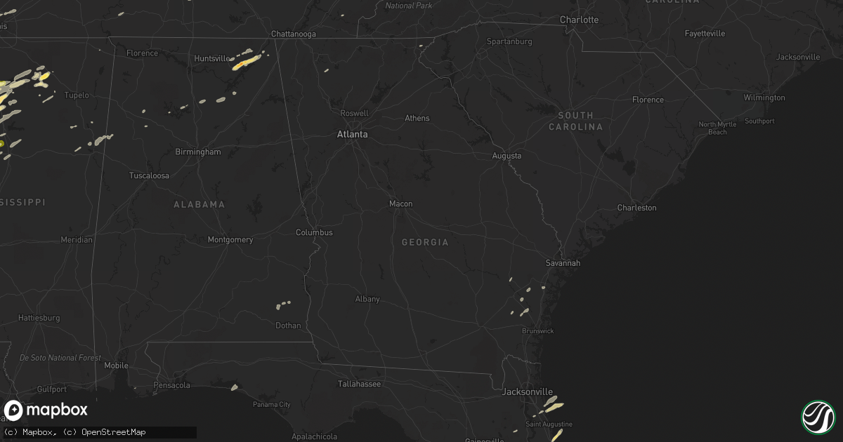
Hail Map in Georgia on April 19, 2015
Get this storm
April 19 map
$229
one time, instant access
Download today. No call, no setup
Keep the $229
Bought the map and want the full workflow? Apply the entire $229 to a subscription within 7 days. None of it is wasted.
Every map, not just this one
This buys you this map. Subscription and you get every map we run, in the markets you choose from a few cities to whole states to nationwide. Plus real-time alerts the moment a storm fires.
Contact data
Name, contact info, occupancy, even credit band for addresses in the footprint. You go from where it hit to who to call.
Become the source they trust
Unlimited branding weather history reports on demand. You already have the documented answer ready for the property owner, and you are the one who showed up with it.
Property data and RoofTrace estimates
Pull up any address you have got, its value and the exact code rules for that jurisdiction, straight from One Click Code. Then RoofTrace estimates the squares, pitch, and roof value, priced the way you price.
Storm reports in Georgia
Georgia
| Date | Description |
|---|---|
| 04/19/20156:10 PM CDT | The walker county emergency manager reported a few trees down in the rossville area. One tree fell on a house and another fell on a car. |
| 04/19/20155:42 PM CDT | Sheriff deputy report. Tree pulled up. Downed power lines. Dunroven rd and bennock mill rd. |
| 04/19/20154:37 PM CDT | Emergency manager reported tree down on vehicle at 50 block of sagittarius lane. Time estimated based on radar. |
| 04/19/20154:33 PM CDT | 20 foot motorhome overturned and trees damaged. 1/2 mi s of us56 on ga hwy 23. |
| 04/19/20154:29 PM CDT | Spotter reported a large oak tree downed on a home off of dover road. |
| 04/19/20154:00 PM CDT | Straight line wind snapped several pine trees. |
| 04/19/20153:58 PM CDT | Spotter reported a tree downed on a powerline as well as numerous large limbs down in the roadway near spanish creek road. |
| 04/19/20153:58 PM CDT | Spotter reported a tree downed on a powerline as well as numerous large limbs down in the roadway near spanish creek road. |
| 04/19/20153:30 PM CDT | Strong winds split a large tree in two. |
| 04/19/20153:22 PM CDT | Emergency manager reported power lines down and on fire at the 8500 block of kent drive. |
| 04/19/20153:21 PM CDT | Emergency manager reported power lines down at the 400 block of beaulieu avenue. |
| 04/19/20153:17 PM CDT | Trees down on plantation drive |
| 04/19/20153:11 PM CDT | Broadcast media reports tree down on king george boulevard in georgetown. |
| 04/19/20153:11 PM CDT | Tree down reported at 1500 block of grove point road. |
| 04/19/20153:09 PM CDT | Emergency manager reported power lines down at the intersection of chevis road and wild heron road. |
| 04/19/20152:50 PM CDT | Several trees and large limbs down in statesboro... West of statesboro... And south of statesboro. |
| 04/19/20152:49 PM CDT | Warning point reported 3 trees down in the northern portions of the county. |
| 04/19/20152:48 PM CDT | Sheriff deputy report. Tree pulled up. Downed power lines. Dunroven rd and bennock mill rd. |
| 04/19/20152:42 PM CDT | Nws storm survey team determined that an ef-2 tornado touched down near the town of mcbean near the border of richmond and burke counties. There were several homes dama |
| 04/19/20152:40 PM CDT | Trees were blown down in the little creek area. |
| 04/19/20152:38 PM CDT | Sheriff deputy report. Tree pulled up. Downed power lines. Dunroven rd and bennock mill rd. |
| 04/19/20152:38 PM CDT | Trees were blown down in the longford area. |
| 04/19/20152:37 PM CDT | Emergency manager reported tree down on vehicle at 50 block of sagittarius lane. Time estimated based on radar. |
| 04/19/20152:33 PM CDT | Numerous trees down across route 84. |
| 04/19/20152:23 PM CDT | Long county warning point reported a tree down across the road off us 301 at jones creek loop. Time estimated based on radar. |
| 04/19/20152:18 PM CDT | Tattnall county warning point reported power lines down at 6008 hwy 292. Time estimated based on radar. |
| 04/19/20152:18 PM CDT | Tattnall county warning point reported power lines down at hwy 292 and old collins manassas rd. Time estimated based on radar. |
| 04/19/20152:17 PM CDT | Trees down on plantation drive |
| 04/19/20152:05 PM CDT | Trees were blown down in screven. |
| 04/19/20151:55 PM CDT | Several trees and power lines down within the city of valdosta |
| 04/19/20151:48 PM CDT | Tree down in remerton |
| 04/19/20151:44 PM CDT | Trees down in the western part of lowndes county |
| 04/19/20151:12 PM CDT | Em reported damage to agricultural structures off of sinkhole road. |
| 04/19/20151:12 PM CDT | Em reported multiple trees downed near the intersection of hwy 32 w and chaney road. Timing estimated by radar. |
| 04/19/20151:12 PM CDT | Em reported multiple trees downed in the city of broxton. Time estimated by radar. |
| 04/19/20151:03 PM CDT | Nws jacksonville conducted a storm survey in coffee county georgia on the outskirts of douglas. The tornado was determined to be an ef0 with winds of 75 to 85 mph. The |
| 04/19/201512:30 PM CDT | At least 20 trees were reported down near mile marker 44 on interstate 16. Additional trees were down near route 257. |
| 04/19/201512:23 PM CDT | 3 large pecan limbs down on mcdaniels rd near dodge county line. |
| 04/19/201512:23 PM CDT | Nws survey determined ef1 tornado with max winds of 95 mph touched down near west alcorn farm rd traveling northeast 11.6 miles. 200-300 trees downed along the path. Me |
| 04/19/201512:20 PM CDT | 3 large pecan limbs down on mcdaniels rd near dodge county line. |
| 04/19/201512:05 PM CDT | A tree was reported down near route 257. |
| 04/19/201511:55 AM CDT | Several large trees toppled in sylvester. One large tree fell into a house causing damage. Time is estimated from radar. Relayed by walb-tv. |
| 04/19/201511:00 AM CDT | 911 center reported several trees down near hwy 271 and 19s. |
| 04/19/201511:00 AM CDT | Several trees and powerlines down. |
| 04/19/201511:00 AM CDT | Several trees down at hwy 27 and mile marker 3. |
| 04/19/201510:50 AM CDT | Trees blown down into a road near patmos. Via walb-tv. |
| 04/19/201510:50 AM CDT | One tree down near hwy 108 and hwy 20. |
| 04/19/201510:50 AM CDT | 911 center reported a tree down near hwy195 n and middle road. |
| 04/19/201510:48 AM CDT | Emergency manager reported tree down at hwy 382 and hwy 136. |
| 04/19/201510:45 AM CDT | 911 center reported several trees down. |
| 04/19/201510:45 AM CDT | 911 center reported powerlines down on hwy 30w |
| 04/19/201510:45 AM CDT | Barn blown into the roadway and several grain silos were knocked down. |
| 04/19/201510:38 AM CDT | Trees down around blakely |
| 04/19/201510:38 AM CDT | Brief ef1 tornado with maximum winds of 105 mph destroyed 4 large silos throwing debris 1 4 mile. A metal building had 2 doors blown off. A total of 30-40 trees were up |
| 04/19/201510:38 AM CDT | Large pecan tree near the intersection of ga 39 and rockbluff rd. |
| 04/19/201510:35 AM CDT | Large tree was reported down across manchester highway. |
| 04/19/201510:35 AM CDT | Tree at down youngs mill road and hwy 45n |
| 04/19/201510:30 AM CDT | 911 center reported a tree down on wires. |
| 04/19/201510:30 AM CDT | Large tree down near the intersection oj big pine rd and cr 26. Rotation evident from wind shift. |
| 04/19/201510:20 AM CDT | 911 center reported three trees down in the weston area. |
| 04/19/201510:15 AM CDT | Multiple trees reported down in the parrott area on the walb-tv facebook page. |
| 04/19/201510:15 AM CDT | Couple of power lines down around highway 520. |
| 04/19/201510:15 AM CDT | One tree down at logan store road and boo crosby road. |
| 04/19/201510:00 AM CDT | Large tree blown down into a home near shellman. Time is estimated from radar. Via walb-tv. |
| 04/19/20159:55 AM CDT | Media reported trees down near armurchee. |
| 04/19/20159:50 AM CDT | Floyd county emergency manager reported power lines down on williamson road and hwy 53 near broadus road. |
| 04/19/20159:35 AM CDT | Tree at down youngs mill road and hwy 45n |
| 04/19/20159:30 AM CDT | Fort benning plans and operations division reported a tornado. Multiple trees were down. |
| 04/19/20156:05 AM CDT | Two trees down in cleveland. |
| 04/19/20154:50 AM CDT | The gilmer county emergency manager reported trees and power lines down in cherry log. |
| 04/19/20154:50 AM CDT | The gilmer county emergency manager reported multiple trees down and 1100 customers without power. Trees were blocking roy road and big creek road. |
| 04/19/20154:35 AM CDT | The gilmer county emergency manager reported trees and power lines down on ridgeway church road. |
| 04/19/20153:25 AM CDT | A trained spotter reported a 60 mph gust as the leading edge of the thunderstorm reached rising fawn. |
| 04/18/20157:00 PM CDT | Straight line wind snapped several pine trees at a home about 1 mile west of folkston. |
All States Impacted by Hail Map on April 19, 2015
Cities Impacted by Hail Map on April 19, 2015
- Burnsville, MS
- Hot Springs National Park, AR
- Pearcy, AR
- Malvern, AR
- Rayville, LA
- Pioneer, LA
- Oak Grove, LA
- Oak Ridge, LA
- Mer Rouge, LA
- Collinston, LA
- Converse, LA
- Piggott, AR
- Saint Francis, AR
- Campbell, MO
- Chappell Hill, TX
- Brenham, TX
- Washington, TX
- Heth, AR
- Cave City, AR
- Foley, AL
- Marianna, AR
- Oakland, MS
- Batesville, MS
- Enid, MS
- Courtland, MS
- Pope, MS
- Bastrop, TX
- Knobel, AR
- Pollard, AR
- Clarkton, MO
- Malden, MO
- Parma, MO
- Corning, AR
- Rector, AR
- Gideon, MO
- Weimar, TX
- Columbus, TX
- Murfreesboro, AR
- Amity, AR
- Houston, TX
- Sugar Land, TX
- Dayton, TX
- Nacogdoches, TX
- Alvin, TX
- Liverpool, TX
- Schulenburg, TX
- Brookshire, TX
- Wallis, TX
- Cat Spring, TX
- Sealy, TX
- Fulshear, TX
- Shreveport, LA
- De Berry, TX
- Marshall, TX
- Bethany, LA
- Waskom, TX
- Keithville, LA
- Ozark, AL
- La Grange, TX
- Alleyton, TX
- Garwood, TX
- Glidden, TX
- Palestine, AR
- Colt, AR
- Lexington, TX
- Crockett, TX
- Spring, TX
- Conroe, TX
- Hallettsville, TX
- Sublime, TX
- Little Rock, AR
- Wallisville, TX
- Anahuac, TX
- Wilson, AR
- Marked Tree, AR
- Dyess, AR
- Osceola, AR
- Keiser, AR
- Henning, TN
- Lepanto, AR
- Pittsburg, OK
- Kiowa, OK
- Benton, LA
- North Zulch, TX
- Iola, TX
- Timpson, TX
- Garrison, TX
- Shelbyville, TX
- Belmont, LA
- Pleasant Hill, LA
- Marthaville, LA
- Cushing, TX
- Center, TX
- Zwolle, LA
- Tenaha, TX
- Robeline, LA
- Neelyville, MO
- White Hall, AR
- Pine Bluff, AR
- Colfax, LA
- Lena, LA
- Havana, AR
- Blue Mountain, AR
- New Blaine, AR
- Magazine, AR
- Booneville, AR
- Delaware, AR
- Dardanelle, AR
- Paris, AR
- Lake Providence, LA
- Thaxton, MS
- Mabelvale, AR
- Vidalia, LA
- Woodville, MS
- Center Point, LA
- Deville, LA
- Jonesville, LA
- Effie, LA
- Marksville, LA
- Monterey, LA
- Crosby, MS
- Acme, LA
- Clayton, GA
- Dry Prong, LA
- Boyce, LA
- Pineville, LA
- Ball, LA
- Pollock, LA
- Grayson, LA
- Doddridge, AR
- Glen Allan, MS
- Mayersville, MS
- Chatham, MS
- Greenville, MS
- Anguilla, MS
- Hollandale, MS
- Rolling Fork, MS
- Pond Creek, OK
- Hackett, AR
- Wister, OK
- Mansfield, AR
- Huntington, AR
- Greenwood, AR
- Poteau, OK
- Cameron, OK
- Midland, AR
- Hartford, AR
- Lafe, AR
- Kirbyville, TX
- Conway, AR
- Wooster, AR
- Greenbrier, AR
- Mangham, LA
- Heber Springs, AR
- Lambert, MS
- Cloutierville, LA
- Provencal, LA
- Ponte Vedra Beach, FL
- Plainview, AR
- Carthage, AR
- Gary, TX
- Katy, TX
- Smithville, TX
- Charleston, MS
- Moulton, TX
- Shiner, TX
- Greenwood, MS
- Carrollton, MS
- San Augustine, TX
- Benton, AR
- Glenwood, AR
- Oxford, MS
- Mount Enterprise, TX
- Long Branch, TX
- Paragould, AR
- Marmaduke, AR
- Clarksville, AR
- Sheridan, AR
- Leola, AR
- Grapevine, AR
- Cecil, AR
- Charleston, AR
- Ozark, AR
- Earle, AR
- Widener, AR
- Mount Ida, AR
- Etta, MS
- Monroe, LA
- Columbia, LA
- Sledge, MS
- Sardis, MS
- Crenshaw, MS
- Tomball, TX
- Pinehurst, TX
- Magnolia, TX
- Cypress, TX
- Jessieville, AR
- Waller, TX
- Navasota, TX
- Hempstead, TX
- Crosby, TX
- Hattieville, AR
- Danville, AR
- Pottsville, AR
- Atkins, AR
- Abbeville, MS
- Okolona, MS
- Aberdeen, MS
- Huntsville, TX
- Bedias, TX
- Laneville, TX
- Henderson, TX
- West Point, MS
- Columbus, MS
- Burton, TX
- Ledbetter, TX
- Wardville, OK
- Atlanta, TX
- Somerville, TX
- Caldwell, TX
- Bokoshe, OK
- Shady Point, OK
- Winona, MS
- Pocahontas, AR
- Black Rock, AR
- Weiner, AR
- Harrisburg, AR
- Fisher, AR
- Dundee, MS
- Helena, AR
- Marks, MS
- Friars Point, MS
- Coahoma, MS
- Clarksdale, MS
- Waldron, AR
- Myrtle, MS
- Hankamer, TX
- Pearland, TX
- Manvel, TX
- Fresno, TX
- Rosharon, TX
- Itta Bena, MS
- Moorhead, MS
- Sunflower, MS
- Indianola, MS
- Baytown, TX
- Prescott, AR
- Wabbaseka, AR
- Scottsboro, AL
- Woodville, AL
- Pangburn, AR
- Cleveland, AR
- Clinton, AR
- Tumbling Shoals, AR
- Mount Vernon, AR
- Center Ridge, AR
- Judsonia, AR
- Rose Bud, AR
- Romance, AR
- Searcy, AR
- Enola, AR
- Springfield, AR
- Pleasant Plains, AR
- Wilburn, AR
- Belleville, AR
- Floral, AR
- Guy, AR
- Solgohachia, AR
- Damascus, AR
- Quitman, AR
- Drasco, AR
- Bee Branch, AR
- Star City, AR
- Devers, TX
- Porter, TX
- Huffman, TX
- New Caney, TX
- Winnie, TX
- Liberty, TX
- Kingwood, TX
- Humble, TX
- Millington, TN
- Drummonds, TN
- Bryan, TX
- Highlands, TX
- Bivins, TX
- Bonnerdale, AR
- Caddo Gap, AR
- Potts Camp, MS
- Hickory Flat, MS
- Pontotoc, MS
- Gould, AR
- Yorktown, AR
- Ponca, AR
- Subiaco, AR
- Scranton, AR
- Langley, AR
- Channelview, TX
- Pasadena, TX
- Galena Park, TX
- Jennings, OK
- Maramec, OK
- Madisonville, TX
- New Llano, LA
- Anacoco, LA
- Fort Polk, LA
- Leesville, LA
- Hornbeck, LA
- Plumerville, AR
- Coalgate, OK
- Stevenson, AL
- Flat Rock, AL
- Hollywood, AL
- Grant, AL
- Pisgah, AL
- Greenway, AR
- Gibson, MO
- Peach Orchard, AR
- Catron, MO
- Lilbourn, MO
- Delaplaine, AR
- Houston, AR
- Perry, AR
- Morrilton, AR
- Perryville, AR
- Mayflower, AR
- Roland, AR
- Gurdon, AR
- Okolona, AR
- Stilwell, OK
- Bunch, OK
- Forrest City, AR
- Madison, AR
- Many, LA
- Lyons, TX
- Grady, AR
- Rison, AR
- Arkadelphia, AR
- Altheimer, AR
- Stuart, OK
- Yates Center, KS
- North Little Rock, AR
- Rusk, TX
- Philipp, MS
- Minter City, MS
- Wheatley, AR
- Brinkley, AR
- Moro, AR
- Belcher, LA
- Hockley, TX
- Montgomery, TX
- Waynesboro, TN
- Olivehill, TN
- Kelly, LA
- Olla, LA
- Minden, LA
- Cotton Valley, LA
- Haughton, LA
- Mooringsport, LA
- Deer, AR
- Pettigrew, AR
- Kingston, AR
- Bradford, AR
- London, AR
- Dover, AR
- Russellville, AR
- Knoxville, AR
- Lamar, AR
- Ola, AR
- Casa, AR
- McCarley, MS
- Bismarck, AR
- Schlater, MS
- Ruleville, MS
- Holcomb, MS
- Grenada, MS
- Rosanky, TX
- Red Rock, TX
- Cedar Creek, TX
- Montgomery, LA
- Memphis, TN
- Houston, MS
- Elaine, AR
- Washington, AR
- Arlington, TN
- Gonzales, TX
- Longton, KS
- Elk Falls, KS
- Tatum, TX
- Palm Coast, FL
- Saint Augustine, FL
- Crane Hill, AL
- Vian, OK
- Stigler, OK
- Holcomb, MO
- Maumelle, AR
- Spivey, KS
- Kingman, KS
- Midway, TX
- Carbon Hill, AL
- Eldridge, AL
- Jesup, GA
- Vilonia, AR
- Natchez, LA
- Melrose, LA
- Natchitoches, LA
- Dime Box, TX
- Paron, AR
- Blevins, AR
- Richmond, TX
- Hamshire, TX
- Cullman, AL
- Santa Rosa Beach, FL
- Amory, MS
- Stuttgart, AR
- De Witt, AR
- Brunswick, GA
- Hortense, GA
- Arley, AL
- Parthenon, AR
- Winnfield, LA
- Tullos, LA
- Spurger, TX
- Imboden, AR
- Walnut Ridge, AR
- Gilliam, LA
- Scott, AR
- Sparkman, AR
- New Ulm, TX
- Atlanta, LA
- Flatwoods, LA
- Mora, LA
- Florien, LA
- Fisher, LA
- Trenton, AL
- Water Valley, MS
- Crumrod, AR
- Culleoka, TN
- Kingsland, AR
- Hensley, AR
- Trumann, AR
- Gillett, AR
- Almyra, AR
- Harper, KS
- Vivian, LA
- Winnsboro, LA
- Baskin, LA
- Joaquin, TX
- East Bernard, TX
- Logan, AL
- Letona, AR
- Augusta, AR
- Alligator, MS
- Snow Lake, AR
- Mellwood, AR
- Carmine, TX
- Giddings, TX
- West Helena, AR
- Traskwood, AR
- Poyen, AR
- Bauxite, AR
- England, AR
- Frenchmans Bayou, AR
- Bassett, AR
- Joiner, AR
- Abbeville, AL
- Epps, LA
- Delhi, LA
- Lovelady, TX
- Beckville, TX
- Summers, AR
- Westville, OK
- Lonsdale, AR
- Birmingham, AL
- Ratcliff, AR
- Lamont, OK
- Deer Creek, OK
- Resaca, GA
- Ranger, GA
- Palatka, FL
- Florahome, FL
- Snow, OK
- Rattan, OK
- Scobey, MS
- Cascilla, MS
- Tillatoba, MS
- Coffeeville, MS
- Belzoni, MS
- Bastrop, LA
- West Point, TX
- Lexa, AR
- Winfield, KS
- Caledonia, MS
- Sulligent, AL
- Steens, MS
- Vernon, AL
- Bryant, AR
- Albertville, AL
- Duck Hill, MS
- Starkville, MS
- Roe, AR
- Ponte Vedra, FL
- Riceboro, GA
- Royal, AR
- Mountain Pine, AR
- Tonkawa, OK
- Alexander, AR
- Etowah, TN
- Burkeville, TX
- Paint Rock, AL
- Stringtown, OK
- Watson, AR
- Saint Charles, AR
- Ethel, AR
- Covington, TN
- Skipperville, AL
- Newville, AL
- Oil Trough, AR
- Waterford, MS
- Marvell, AR
- Poplar Grove, AR
- Silver Springs, FL
- Randolph, MS
- Cushing, OK
- Stroud, OK
- Tryon, OK
- Hagarville, AR
- Wiergate, TX
- Yale, OK
- Kennard, TX
- Apple Springs, TX
- Fackler, AL
- Sidon, MS
- Leland, MS
- Isola, MS
- Inverness, MS
- Powhatan, AR
- Smithville, AR
- Bigelow, AR
- Hot Springs Village, AR
- Trinity, TX
- Dodson, LA
- Groveton, TX
- Camden, AR
- Ludowici, GA
- Rosston, AR
- Satellite Beach, FL
- Indialantic, FL
- Merritt Island, FL
- Ecru, MS
- Bald Knob, AR
- Jerusalem, AR
- Taylor, AR
- Kyle, TX
- Dale, TX
- Lockhart, TX
- Blountsville, AL
- Horton, AL
- Guntersville, AL
- Beedeville, AR
- McCrory, AR
- Kirby, AR
- Lavaca, AR
- Aubrey, AR
- Ripley, OK
- Alexandria, LA
- Cotton Plant, AR
- Goodwin, AR
- Wynne, AR
- Glennville, GA
- Checotah, OK
- Stafford, TX
- Missouri City, TX
- Jasper, TX
- Adona, AR
- Fayetteville, TX
- Lynn, AL
- Fort Smith, AR
- New Madrid, MO
- Sikes, LA
- West Monroe, LA
- Beaumont, TX
- Douglass, TX
- Como, MS
- Lyon, MS
- Tutwiler, MS
- Concord, AR
- Flatonia, TX
- Muldoon, TX
- Jena, LA
- Sherwood, AR
- Jacksonville, AR
- Little Rock Air Force Base, AR


