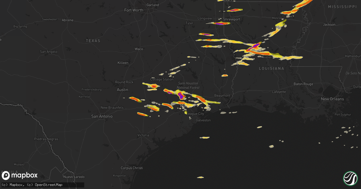
Hail Map on April 19, 2015
Get this storm
April 19 map
$229
one time, instant access
Download today. No call, no setup
Keep the $229
Bought the map and want the full workflow? Apply the entire $229 to a subscription within 7 days. None of it is wasted.
Every map, not just this one
This buys you this map. Subscription and you get every map we run, in the markets you choose from a few cities to whole states to nationwide. Plus real-time alerts the moment a storm fires.
Contact data
Name, contact info, occupancy, even credit band for addresses in the footprint. You go from where it hit to who to call.
Become the source they trust
Unlimited branding weather history reports on demand. You already have the documented answer ready for the property owner, and you are the one who showed up with it.
Property data and RoofTrace estimates
Pull up any address you have got, its value and the exact code rules for that jurisdiction, straight from One Click Code. Then RoofTrace estimates the squares, pitch, and roof value, priced the way you price.
States Impacted by Hail Map on April 19, 2015
Storm reports
Florida
| Date | Description |
|---|---|
| 04/19/20154:25 PM CDT | Numerous reports of fallen trees and minor structural damage in apopka. Pictures provided over social media via local media wftv indicate several large fallen tree bran |
| 04/19/20153:55 PM CDT | Trained spotter reported tree damage near williston. |
| 04/19/20153:45 PM CDT | Trees down at the intersection of sweet magnolia street and white oaks trace. |
| 04/19/20153:41 PM CDT | Weather spotter reported 60 mph winds. |
| 04/19/20153:35 PM CDT | Media received report with photo of a tree downed off of old kings road. |
| 04/19/20153:20 PM CDT | Power lines were blown down on fleming island. |
| 04/19/20153:10 PM CDT | A couple of trees were blown down across lake city. |
| 04/19/20153:00 PM CDT | Trees were blown down across the southern end of the county.the time of damage was based on radar. |
| 04/19/20152:25 PM CDT | A power line was blown down by thunderstorm winds. |
| 04/19/20152:23 PM CDT | Multiple trees downed around the mayo area including along county roads 351 and 354. Initially reported by 911 center...also reported by the public and relayed by wctv- |
| 04/19/20152:22 PM CDT | Large tree limb blown down at price road and state road 21. |
| 04/19/20152:20 PM CDT | Resident reported a possible tornado. Large live oak down and numerous power lines down on 209th road near county road 252. |
| 04/19/20152:20 PM CDT | Wind damage impacted a home and damaged the outdoor canopy. Cost of damage was unknown. The canopy was the only damage in the area. No tree damage was reported. |
| 04/19/20152:00 PM CDT | Several trees down on highway 19 near bill howell road |
| 04/19/20151:40 PM CDT | Tree down on woods creek road |
| 04/19/201512:47 PM CDT | Tree down on simpson rd. |
| 04/19/201512:00 PM CDT | Tree down on vehicle at meridian and maclay |
| 04/19/201511:58 AM CDT | Trees down on lakeshore drive |
| 04/19/201511:58 AM CDT | Trees down at hermitage road and thomasville road |
| 04/19/201511:51 AM CDT | Survey confirms ef1 tornado with max winds estimated near 95 mph from 30.4981...-84.3136 at 1251 pm edt to 30.5443...-84.2574 at 1259 pm edt. Sporadic tree damage along a w ( |
| 04/19/20159:52 AM CDT | Nws survey determines ef1 tornado with damage path from 30.98 -85.41 at 952 am cdt to 31.33 -84.90 2mi se of blakely georgia at 1138 am edt. This tornado began about a |
| 04/19/20159:50 AM CDT | Large trees uprooted along highway 231 near campbellton and the alabama-florida state border. Report via wmbb-tv meteorologist. |
| 04/19/20159:50 AM CDT | Several pecan trees blown over. One tree destroyed a barn. |
| 04/19/20159:20 AM CDT | Trees and power lines down in the northern part of washington county |
| 04/19/20158:42 AM CDT | Social media picture of trees down on highway 81 just north of highway 20. |
| 04/19/20158:25 AM CDT | Possible tornado. 1/4 mi damage path with trees and power lines down near bruce along hwy 81 n. |
| 04/19/20158:25 AM CDT | Tree damage earlier reported by broadcast media determined to be associated with a tornado. Rated ef0. 1/4 mile damage path with trees and power lines downed along high |
| 04/19/20158:22 AM CDT | Short ef0 tornado path confirmed by nws dual pol radar debris signature in a rural area west of bruce. Damage likely confined to trees. Estimated duration 3 minutes. Pa |
| 04/19/20157:38 AM CDT | Large tree snapped near the hilton sandestin. Via wmbb-tv meteorologist. |
South Carolina
| Date | Description |
|---|---|
| 04/19/20156:11 PM CDT | Trees and power lines down |
| 04/19/20155:58 PM CDT | Tree in roadway |
| 04/19/20155:58 PM CDT | Storm survey reported an ef-0 occurred. |
| 04/19/20155:40 PM CDT | Multiple leland cypress trees blown over. Two bradford pair trees snapped. Estimated 60 mph wind gust. |
| 04/19/20155:38 PM CDT | Report of trees and powerlines down in lamar. Time estimated by radar. |
| 04/19/20155:38 PM CDT | Minor shingle damage to house and multiple small trees blown over. Estimated 60 mph wind gust. |
| 04/19/20155:38 PM CDT | Storm survey reported an ef-0 occurred. |
| 04/19/20155:36 PM CDT | Metal cornice bent and minor tree damage...including several small limbs down. Estimated 60 mph wind gust. |
| 04/19/20155:30 PM CDT | Several trees down in the park circle area. Time estimated based on radar. |
| 04/19/20155:24 PM CDT | Photograph of downed tree in park circle sent in by social media user. Time estimated based on radar. |
| 04/19/20155:24 PM CDT | Trees down near highway 6 and mount olivet road. Time estimated from radar. |
| 04/19/20155:20 PM CDT | Large tree blown into an attached garage and vehicle. No injuries. Time estimated based on radar. |
| 04/19/20155:17 PM CDT | A 50 to 60 feet tall oak tree fell... With part of it brushing and causing slight damage to a house. |
| 04/19/20155:16 PM CDT | Tree and power lines down at highway 78 and shipley street. |
| 04/19/20155:15 PM CDT | Tree down on a power line. |
| 04/19/20155:10 PM CDT | Sumter county dispatch reported trees down at the intersection of dogwood drive and bagnal drive. |
| 04/19/20155:02 PM CDT | Sc highway patrol reported trees down just north of mount bethel church on us 521. |
| 04/19/20154:48 PM CDT | Trees across coolers dairy road near chestnut road. Time estimated based on radar. |
| 04/19/20154:38 PM CDT | Richland county dispatch reported trees in the roadway at the intersection of wilmont ave and walker street. |
| 04/19/20154:38 PM CDT | Sc highway patrol reports a tree down and in the roadway on charleston highway near the intersection with smoak road. Time estimated from radar. |
| 04/19/20154:27 PM CDT | Pontoon boat flipped on its side and landed on the other side of dock and multiple trees reported down off shadowood drive in ballentine. |
| 04/19/20154:20 PM CDT | A tree down onto route 21 near mount caramel road. |
| 04/19/20154:20 PM CDT | Calhoun county emergency manager reported that a mobile home was wiped out along ott sisters rd near i-26 |
| 04/19/20154:20 PM CDT | *** 2 inj *** calhoun county emergency manager reported a mobile home was destroyed on ott sisters rd and two people were transported to the hospital with serious but n |
| 04/19/20154:19 PM CDT | Highway patrol reported tree down at the intersection of mount carmel road and lightsey way. |
| 04/19/20154:15 PM CDT | The national weather service conducted a storm survey in lexington county and found a tornado touched down on the south side of lake murray and then again on the north |
| 04/19/20154:14 PM CDT | Sc highway patrol reported trees down off of i26 at mile marker 149. Time estimated from radar. |
| 04/19/20154:12 PM CDT | Trees down on ramblin rd in south congaree... Including one that fell on a boat. Report courtesy wltx-tv. |
| 04/19/20154:10 PM CDT | Report relayed by john farley to our office from the public of estimated 40 large trees snapped on waters edge court in lexington. |
| 04/19/20154:05 PM CDT | Sc highway patrol reported trees down in lexington... Sc on calks ferry rd at us1 and spring hill rd. Time estimated from radar. |
| 04/19/20154:00 PM CDT | Sc highway patrol reports a tree down and in the roadway on clover circle near the intersection with bees creek road. Time estimated from radar. |
| 04/19/20153:57 PM CDT | Broken power poles. Downed power lines. Uprooted trees. Via social media. |
| 04/19/20153:57 PM CDT | Highway patrol reported tree down at the intersection of okatie highway and snake road. |
| 04/19/20153:51 PM CDT | Warning point reported tree down on highway 278 near jasper county. |
| 04/19/20153:51 PM CDT | Highway patrol reported tree down at the intersection of highway 278 and rock spring road. |
| 04/19/20153:49 PM CDT | Tree down and porch furniture blown across yard in the 20 block of st simons drive. |
| 04/19/20153:42 PM CDT | One tree snapped off and partially in the roadway on new riverside drive...near alston park...about 1 mile south of the may river road and hw-170 traffic circle. Time e |
| 04/19/20153:38 PM CDT | Tree down across route 170... Just east of route 17. |
| 04/19/20153:38 PM CDT | Tree down across route 170... Just east of route 17. |
| 04/19/20153:37 PM CDT | Warning point reported multiple trees down in brunson. |
| 04/19/20153:37 PM CDT | Sc highway patrol reports a tree down and in the roadway in the 300 block of tye branch spur near lee lawyer road. Time estimated from radar. |
| 04/19/20153:35 PM CDT | Sc highway patrol reports a tree down and in the roadway on okatie highway in the bellinger hill area. Time estimated from radar. |
| 04/19/20153:32 PM CDT | Sc highway patrol reports a tree down and in the roadway on hw-315 near hw-17. Time estimated from radar. |
| 04/19/20153:31 PM CDT | Warning point reported multiple trees down on highway 321 between estill and garnett. |
| 04/19/20153:30 PM CDT | Trees down on rayzor road near route 301. |
| 04/19/20153:30 PM CDT | Highway patrol reported tree down on wells branch road one mile off of highway 301. |
| 04/19/20153:30 PM CDT | Barnwell county sheriff reported trees down on highway 300 and annie laurie drive |
| 04/19/20153:24 PM CDT | Edgefield county dispatch reported trees down at various locations in the town of edgefield. Including trees down at the intersection of bouknight rd and woodyard rd. T |
| 04/19/20153:22 PM CDT | The national weather service conducted a storm survey in edgefield county and found a tornado touched down approximately 3.5 miles east of edgefield to 1.5 miles southw |
| 04/19/20153:20 PM CDT | *** 2 inj *** an ef1 tornado touched down near sunny plain road and traveled northeast across ott sisters road then weakened as it crossed i-26. Winds were determined t |
| 04/19/20153:16 PM CDT | Strong straight line winds produced some damage of a home just off of bull swamp road. The strong winds damaged the roof of the home and also blew out a wall on the ne |
| 04/19/20153:14 PM CDT | Sc highway patrol reported trees in the roadway at the intersection of silver bluff rd and dougherty rd. Time estimated from radar. |
| 04/19/20153:13 PM CDT | Public reported trees down on oriole st in aiken. Report and photos relayed via social media. Time estimated. |
| 04/19/20153:13 PM CDT | Survey found an ef-2 tornado damage in the woodside plantation subdivision and also aiken estates subdivision. Wind speeds were estimated to be at 115 mph. There was si |
| 04/19/20153:11 PM CDT | Tree down on a home on arcturus dr. Roof damage and carport damage to other homes on the street as well. |
| 04/19/20153:00 PM CDT | Sc highway patrol reported trees in the roadway at the intersection of us 278 and green pond rd. Time estimated from radar |
| 04/19/20152:55 PM CDT | Sc highway patrol reported trees in the roadway at the intersection of i20 and palmetto pkwy. Time estimated from radar |
| 04/19/20151:12 PM CDT | Storm survey reported an ef-0 occurred. |
| 04/19/20156:50 AM CDT | Trees down around the westminster area. Tree fell on a home. |
| 04/18/20157:09 PM CDT | Tree in roadway |
Missouri
| Date | Description |
|---|---|
| 04/19/20155:46 PM CDT | A local report indicates 1.00 inch wind near 3 S CARUTHERSVILLE |
| 04/18/20159:05 PM CDT | A local report indicates 1.00 inch wind near PARMA |
| 04/18/20158:35 PM CDT | Campbell em reported quarter to ping-pong ball sized hail confirmed through video sent to office |
Iowa
| Date | Description |
|---|---|
| 04/19/20154:47 PM CDT | Highway 30 covered in quarter sized hail and ditches along the highway full of water |
Kentucky
| Date | Description |
|---|---|
| 04/19/20153:00 AM CDT | Em reported approximately 20 trees downed on west side of albany... Damaging 5 structures. |
| 04/19/20152:26 AM CDT | Trees down on thomson ridge road. |
| 04/19/20152:26 AM CDT | Tree down on red hill road. |
| 04/19/20152:26 AM CDT | Tree down along c. Conklin road near boles. |
| 04/19/20151:46 AM CDT | Report of a couple of trees down in the northern part of the county. Time estimated based on radar. |
Ohio
| Date | Description |
|---|---|
| 04/18/20159:56 PM CDT | Nws survey confirms a brief tornado along glenmina drive with mostly tree damage |
Georgia
| Date | Description |
|---|---|
| 04/19/20156:10 PM CDT | The walker county emergency manager reported a few trees down in the rossville area. One tree fell on a house and another fell on a car. |
| 04/19/20155:42 PM CDT | Sheriff deputy report. Tree pulled up. Downed power lines. Dunroven rd and bennock mill rd. |
| 04/19/20154:37 PM CDT | Emergency manager reported tree down on vehicle at 50 block of sagittarius lane. Time estimated based on radar. |
| 04/19/20154:33 PM CDT | 20 foot motorhome overturned and trees damaged. 1/2 mi s of us56 on ga hwy 23. |
| 04/19/20154:29 PM CDT | Spotter reported a large oak tree downed on a home off of dover road. |
| 04/19/20154:00 PM CDT | Straight line wind snapped several pine trees. |
| 04/19/20153:58 PM CDT | Spotter reported a tree downed on a powerline as well as numerous large limbs down in the roadway near spanish creek road. |
| 04/19/20153:58 PM CDT | Spotter reported a tree downed on a powerline as well as numerous large limbs down in the roadway near spanish creek road. |
| 04/19/20153:30 PM CDT | Strong winds split a large tree in two. |
| 04/19/20153:22 PM CDT | Emergency manager reported power lines down and on fire at the 8500 block of kent drive. |
| 04/19/20153:21 PM CDT | Emergency manager reported power lines down at the 400 block of beaulieu avenue. |
| 04/19/20153:17 PM CDT | Trees down on plantation drive |
| 04/19/20153:11 PM CDT | Broadcast media reports tree down on king george boulevard in georgetown. |
| 04/19/20153:11 PM CDT | Tree down reported at 1500 block of grove point road. |
| 04/19/20153:09 PM CDT | Emergency manager reported power lines down at the intersection of chevis road and wild heron road. |
| 04/19/20152:50 PM CDT | Several trees and large limbs down in statesboro... West of statesboro... And south of statesboro. |
| 04/19/20152:49 PM CDT | Warning point reported 3 trees down in the northern portions of the county. |
| 04/19/20152:48 PM CDT | Sheriff deputy report. Tree pulled up. Downed power lines. Dunroven rd and bennock mill rd. |
| 04/19/20152:42 PM CDT | Nws storm survey team determined that an ef-2 tornado touched down near the town of mcbean near the border of richmond and burke counties. There were several homes dama |
| 04/19/20152:40 PM CDT | Trees were blown down in the little creek area. |
| 04/19/20152:38 PM CDT | Sheriff deputy report. Tree pulled up. Downed power lines. Dunroven rd and bennock mill rd. |
| 04/19/20152:38 PM CDT | Trees were blown down in the longford area. |
| 04/19/20152:37 PM CDT | Emergency manager reported tree down on vehicle at 50 block of sagittarius lane. Time estimated based on radar. |
| 04/19/20152:33 PM CDT | Numerous trees down across route 84. |
| 04/19/20152:23 PM CDT | Long county warning point reported a tree down across the road off us 301 at jones creek loop. Time estimated based on radar. |
| 04/19/20152:18 PM CDT | Tattnall county warning point reported power lines down at hwy 292 and old collins manassas rd. Time estimated based on radar. |
| 04/19/20152:18 PM CDT | Tattnall county warning point reported power lines down at 6008 hwy 292. Time estimated based on radar. |
| 04/19/20152:17 PM CDT | Trees down on plantation drive |
| 04/19/20152:05 PM CDT | Trees were blown down in screven. |
| 04/19/20151:55 PM CDT | Several trees and power lines down within the city of valdosta |
| 04/19/20151:48 PM CDT | Tree down in remerton |
| 04/19/20151:44 PM CDT | Trees down in the western part of lowndes county |
| 04/19/20151:12 PM CDT | Em reported multiple trees downed in the city of broxton. Time estimated by radar. |
| 04/19/20151:12 PM CDT | Em reported damage to agricultural structures off of sinkhole road. |
| 04/19/20151:12 PM CDT | Em reported multiple trees downed near the intersection of hwy 32 w and chaney road. Timing estimated by radar. |
| 04/19/20151:03 PM CDT | Nws jacksonville conducted a storm survey in coffee county georgia on the outskirts of douglas. The tornado was determined to be an ef0 with winds of 75 to 85 mph. The |
| 04/19/201512:30 PM CDT | At least 20 trees were reported down near mile marker 44 on interstate 16. Additional trees were down near route 257. |
| 04/19/201512:23 PM CDT | Nws survey determined ef1 tornado with max winds of 95 mph touched down near west alcorn farm rd traveling northeast 11.6 miles. 200-300 trees downed along the path. Me |
| 04/19/201512:23 PM CDT | 3 large pecan limbs down on mcdaniels rd near dodge county line. |
| 04/19/201512:20 PM CDT | 3 large pecan limbs down on mcdaniels rd near dodge county line. |
| 04/19/201512:05 PM CDT | A tree was reported down near route 257. |
| 04/19/201511:55 AM CDT | Several large trees toppled in sylvester. One large tree fell into a house causing damage. Time is estimated from radar. Relayed by walb-tv. |
| 04/19/201511:00 AM CDT | Several trees and powerlines down. |
| 04/19/201511:00 AM CDT | Several trees down at hwy 27 and mile marker 3. |
| 04/19/201511:00 AM CDT | 911 center reported several trees down near hwy 271 and 19s. |
| 04/19/201510:50 AM CDT | One tree down near hwy 108 and hwy 20. |
| 04/19/201510:50 AM CDT | 911 center reported a tree down near hwy195 n and middle road. |
| 04/19/201510:50 AM CDT | Trees blown down into a road near patmos. Via walb-tv. |
| 04/19/201510:48 AM CDT | Emergency manager reported tree down at hwy 382 and hwy 136. |
| 04/19/201510:45 AM CDT | 911 center reported powerlines down on hwy 30w |
| 04/19/201510:45 AM CDT | 911 center reported several trees down. |
| 04/19/201510:45 AM CDT | Barn blown into the roadway and several grain silos were knocked down. |
| 04/19/201510:38 AM CDT | Trees down around blakely |
| 04/19/201510:38 AM CDT | Brief ef1 tornado with maximum winds of 105 mph destroyed 4 large silos throwing debris 1 4 mile. A metal building had 2 doors blown off. A total of 30-40 trees were up |
| 04/19/201510:38 AM CDT | Large pecan tree near the intersection of ga 39 and rockbluff rd. |
| 04/19/201510:35 AM CDT | Tree at down youngs mill road and hwy 45n |
| 04/19/201510:35 AM CDT | Large tree was reported down across manchester highway. |
| 04/19/201510:30 AM CDT | Large tree down near the intersection oj big pine rd and cr 26. Rotation evident from wind shift. |
| 04/19/201510:30 AM CDT | 911 center reported a tree down on wires. |
| 04/19/201510:20 AM CDT | 911 center reported three trees down in the weston area. |
| 04/19/201510:15 AM CDT | Multiple trees reported down in the parrott area on the walb-tv facebook page. |
| 04/19/201510:15 AM CDT | Couple of power lines down around highway 520. |
| 04/19/201510:15 AM CDT | One tree down at logan store road and boo crosby road. |
| 04/19/201510:00 AM CDT | Large tree blown down into a home near shellman. Time is estimated from radar. Via walb-tv. |
| 04/19/20159:55 AM CDT | Media reported trees down near armurchee. |
| 04/19/20159:50 AM CDT | Floyd county emergency manager reported power lines down on williamson road and hwy 53 near broadus road. |
| 04/19/20159:35 AM CDT | Tree at down youngs mill road and hwy 45n |
| 04/19/20159:30 AM CDT | Fort benning plans and operations division reported a tornado. Multiple trees were down. |
| 04/19/20156:05 AM CDT | Two trees down in cleveland. |
| 04/19/20154:50 AM CDT | The gilmer county emergency manager reported trees and power lines down in cherry log. |
| 04/19/20154:50 AM CDT | The gilmer county emergency manager reported multiple trees down and 1100 customers without power. Trees were blocking roy road and big creek road. |
| 04/19/20154:35 AM CDT | The gilmer county emergency manager reported trees and power lines down on ridgeway church road. |
| 04/19/20153:25 AM CDT | A trained spotter reported a 60 mph gust as the leading edge of the thunderstorm reached rising fawn. |
| 04/18/20157:00 PM CDT | Straight line wind snapped several pine trees at a home about 1 mile west of folkston. |
Louisiana
| Date | Description |
|---|---|
| 04/19/20156:50 PM CDT | A local report indicates 2.50 inch wind near 8 NE BENTON |
| 04/19/20156:43 PM CDT | Hail covering the ground |
| 04/19/20156:40 PM CDT | Quarter size hail fell along barron road just south of the shreveport city limits. |
| 04/19/20156:40 PM CDT | A local report indicates 1.75 inch wind near 4 N BENTON |
| 04/19/20156:40 PM CDT | A local report indicates 1.00 inch wind near BENTON |
| 04/19/20156:25 PM CDT | A local report indicates 1.75 inch wind near MANY |
| 04/18/201510:19 PM CDT | A few tree tops were snapped. |
| 04/18/20159:55 PM CDT | Tree down on kiwi dr |
| 04/18/20159:42 PM CDT | A local report indicates 1.75 inch wind near 2 N OAK RIDGE |
| 04/18/20159:28 PM CDT | A local report indicates 1.75 inch wind near 4 E OAK GROVE |
| 04/18/20159:26 PM CDT | A local report indicates 1.00 inch wind near OAK GROVE |
| 04/18/20159:25 PM CDT | Golf ball size hail reported in both pioneer and darnell. |
| 04/18/20159:17 PM CDT | A local report indicates 1.00 inch wind near 3 W BASKIN |
| 04/18/20159:11 PM CDT | At the intersection hwys 165 and 845 |
| 04/18/20159:05 PM CDT | A local report indicates 1.00 inch wind near RAYVILLE |
| 04/18/20159:00 PM CDT | Multiple public reports of quarter sized hail in deville |
| 04/18/20158:55 PM CDT | On sr-15. Hail lasted about 7 min. |
| 04/18/20158:45 PM CDT | A local report indicates 1.00 inch wind near MANGHAM |
| 04/18/20158:31 PM CDT | Public reported golf ball sized hail north of pineville |
| 04/18/20158:25 PM CDT | Public reports quarter size hail in williana community. |
| 04/18/20158:20 PM CDT | Public reports half dollar size hail in tioga |
| 04/18/20158:20 PM CDT | Quarter size hail in the creola community. |
| 04/18/20158:19 PM CDT | Spotter reported quarter size hail in ball |
| 04/18/20158:17 PM CDT | Public reported golfball size hail on the west side of leesville. |
| 04/18/20157:30 PM CDT | A local report indicates 1.00 inch wind near COLFAX |
| 04/18/20157:19 PM CDT | Quarter size hail reported by public in the bellwood community. |
| 04/18/20157:15 PM CDT | A local report indicates 1.50 inch wind near CONVERSE |
| 04/18/20157:05 PM CDT | Sheriff deputy reported broken glass window in vehicle due to baseball size hail. |
Arkansas
| Date | Description |
|---|---|
| 04/19/20156:58 PM CDT | A local report indicates 1.75 inch wind near PINE BLUFF |
| 04/19/20156:55 PM CDT | A local report indicates 2.00 inch wind near SULPHUR SPRINGS |
| 04/19/20156:49 PM CDT | A local report indicates 1.00 inch wind near SULPHUR SPRINGS |
| 04/19/20156:45 PM CDT | A local report indicates 1.00 inch wind near LETONA |
| 04/19/20156:43 PM CDT | Trees down on highway 16. |
| 04/19/20156:43 PM CDT | A local report indicates 1.00 inch wind near EAST END |
| 04/19/20156:37 PM CDT | A local report indicates 1.00 inch wind near HEBER SPRINGS |
| 04/19/20156:33 PM CDT | Power lines down 1 block south of u.s. Highway 64 on logan street near the intersection of arkansas highway 179. |
| 04/19/20156:28 PM CDT | A local report indicates 1.75 inch wind near ROSE BUD |
| 04/19/20156:16 PM CDT | A local report indicates 1.00 inch wind near BENTON |
| 04/19/20156:15 PM CDT | Near exit 113 on interstate 30. |
| 04/19/20156:14 PM CDT | 12 inch diamter tree down in quitman. |
| 04/19/20156:08 PM CDT | A local report indicates 1.00 inch wind near GUY |
| 04/19/20156:02 PM CDT | A local report indicates 1.00 inch wind near GREENBRIER |
| 04/19/20155:55 PM CDT | A local report indicates 1.00 inch wind near MORRILTON |
| 04/19/20155:55 PM CDT | A local report indicates 1.50 inch wind near MALVERN |
| 04/19/20155:35 PM CDT | A local report indicates 2.75 inch wind near 1 SE HOT SPRINGS |
| 04/19/20155:35 PM CDT | Trees and power lines down...and some damage to buildings. |
| 04/19/20155:35 PM CDT | A local report indicates 1.00 inch wind near BLACKWELL |
| 04/19/20155:35 PM CDT | Pea to quarter sized hail fell and covered the ground. Leaves were stripped from trees...and gardens were damaged. |
| 04/19/20155:34 PM CDT | Damage mainly consisted of snapped or uprooted trees. There was also minor damage to outbuildings and chicken houses. |
| 04/19/20155:30 PM CDT | A local report indicates 1.75 inch wind near HOT SPRINGS |
| 04/19/20155:30 PM CDT | A local report indicates 1.50 inch wind near LAKE HAMILTON |
| 04/19/20155:26 PM CDT | A local report indicates 1.00 inch wind near HOT SPRINGS |
| 04/19/20155:15 PM CDT | Hail fell 5 miles southwest of hot springs memorial field. |
| 04/19/20155:13 PM CDT | A local report indicates 1.00 inch wind near PRESCOTT |
| 04/19/20155:05 PM CDT | A local report indicates 1.00 inch wind near 3 WNW GURDON |
| 04/19/20154:55 PM CDT | A local report indicates 1.00 inch wind near DARDANELLE |
| 04/19/20154:44 PM CDT | A local report indicates 2.75 inch wind near 3 N GLENWOOD |
| 04/19/20154:35 PM CDT | Golf ball sized hail covering ground on twin bridges road. Numerous reports of damage to roofs and vehicles. |
| 04/19/20154:35 PM CDT | A local report indicates 2.00 inch wind near CADDO GAP |
| 04/19/20154:32 PM CDT | Also reported a wall cloud visible to the northwest. |
| 04/19/20154:20 PM CDT | A local report indicates 1.75 inch wind near MT MAGAZINE |
| 04/19/20154:05 PM CDT | A local report indicates 1.00 inch wind near MAGAZINE |
| 04/19/20153:45 PM CDT | A local report indicates 1.75 inch wind near HUNTINGTON |
| 04/19/20153:42 PM CDT | A local report indicates 1.75 inch wind near WITCHERVILLE |
| 04/19/20153:38 PM CDT | From twitter...time estimated by radar. |
| 04/18/20158:59 PM CDT | Golfball sized hail and estimated 60 mph wind. |
| 04/18/20158:57 PM CDT | A local report indicates 1.00 inch wind near WILSON |
| 04/18/20158:40 PM CDT | Power lines down with power outages. |
| 04/18/20158:26 PM CDT | A local report indicates 60 MPH wind near TRUMANN |
| 04/18/20158:20 PM CDT | A local report indicates 1.00 inch wind near GALLOWAY |
| 04/18/20158:18 PM CDT | A local report indicates 1.00 inch wind near JACKSONVILLE |
| 04/18/20158:10 PM CDT | Numerous trees down and an awning knocked over. |
| 04/18/20158:10 PM CDT | Tree down on 611 road. |
| 04/18/20158:10 PM CDT | At the interstate 40/interstate 430 split. |
| 04/18/20158:05 PM CDT | At the intersection of highway 10/cantrell road and taylor loop. |
| 04/18/20158:00 PM CDT | Golf ball hail reported near corning via emergency manager. Time estimated using radar. |
| 04/18/20157:58 PM CDT | A local report indicates 1.50 inch wind near WEST LITTLE ROCK |
| 04/18/20157:55 PM CDT | A local report indicates 1.75 inch wind near 2 N CHENAL VALLEY |
| 04/18/20157:52 PM CDT | A local report indicates 1.00 inch wind near 5 N AVILLA |
| 04/18/20157:48 PM CDT | A local report indicates 1.75 inch wind near FERNDALE |
| 04/18/20157:45 PM CDT | A local report indicates 1.00 inch wind near STAR CITY |
| 04/18/20157:44 PM CDT | Estimated 70 mph wind gusts. Trees snapped or uprooted. |
| 04/18/20157:32 PM CDT | A local report indicates 1.00 inch wind near GLENDALE |
| 04/18/20157:31 PM CDT | Estimated 60 mph wind. |
| 04/18/20157:12 PM CDT | A local report indicates 1.00 inch wind near 4 NE CONWAY |
| 04/18/20157:10 PM CDT | A local report indicates 1.00 inch wind near SPRINGHILL |
| 04/18/20157:10 PM CDT | A local report indicates 1.00 inch wind near RISON |
| 04/18/20157:08 PM CDT | A local report indicates 1.00 inch wind near WOOSTER |
| 04/18/20157:05 PM CDT | A local report indicates 1.00 inch wind near 2 S PINE BLUFF |
| 04/18/20157:04 PM CDT | A local report indicates 1.25 inch wind near TOLTEC |
| 04/18/20157:02 PM CDT | Large tree limbs down. |
Mississippi
| Date | Description |
|---|---|
| 04/19/201512:30 AM CDT | Nickel to quarter size hail |
| 04/19/201512:08 AM CDT | Trees down at the intersection of highways 15 and 76 on the west side of pontotoc. |
| 04/18/201511:52 PM CDT | Power line down |
| 04/18/201511:24 PM CDT | A local report indicates 1.50 inch wind near 2 WNW ETTA |
| 04/18/201511:18 PM CDT | Report of half dollar size hail and 60 mph winds. |
| 04/18/201511:15 PM CDT | Tree and power line down on lodi rd. |
| 04/18/201511:15 PM CDT | Webster so reported tree down on cadaretta road |
| 04/18/201511:15 PM CDT | Tree and power line down on lodi rd. |
| 04/18/201511:00 PM CDT | Few trees snapped and uprooted |
| 04/18/201510:52 PM CDT | Mping report |
| 04/18/201510:51 PM CDT | Trees down. |
| 04/18/201510:45 PM CDT | A local report indicates 1.00 inch wind near TEOC |
| 04/18/201510:39 PM CDT | Quarter size hail fell at the highway 35 exit near batesville on interstate 55. |
| 04/18/201510:38 PM CDT | Near the county line |
| 04/18/201510:30 PM CDT | Reported by greenwood pd |
| 04/18/201510:20 PM CDT | Reported by law enforcement officer along state highway 436 |
| 04/18/201510:09 PM CDT | A local report indicates 1.75 inch wind near POPE |
| 04/18/20159:58 PM CDT | Light pole blown down at the so. |
| 04/18/20159:35 PM CDT | Three large trees snapped or uprooted |
| 04/18/20159:20 PM CDT | Structual damage to helena chemical plant... Quarter sized hail |
| 04/18/20159:15 PM CDT | A local report indicates 1.75 inch wind near 2 S LULA |
Texas
| Date | Description |
|---|---|
| 04/19/20156:50 PM CDT | 1.5 ping pong size hail north of sealy reported by wfo midland employee. |
| 04/19/20156:39 PM CDT | 1.75 inch hail hwy 249 and louetta rd |
| 04/19/20156:39 PM CDT | 1.75 inch hail hwy 249 and louetta rd |
| 04/19/20156:36 PM CDT | Twitter report of baseball size hail at hwy 249 and boudreaux road south of tomball. |
| 04/19/20156:35 PM CDT | Quarter size hail in the james community. |
| 04/19/20156:25 PM CDT | Quarter size hail in the martinsville community. |
| 04/19/20156:22 PM CDT | A local report indicates 1.25 inch wind near NACOGDOCHES |
| 04/19/20156:10 PM CDT | A local report indicates 2.00 inch wind near WALLER |
| 04/19/20156:04 PM CDT | A local report indicates 1.75 inch wind near HEMPSTEAD |
| 04/19/20156:03 PM CDT | A local report indicates 2.00 inch wind near TOMBALL |
| 04/19/20156:00 PM CDT | Hail ranged from golf ball to baseball sized in the town of de berry |
| 04/19/20155:58 PM CDT | A local report indicates 1.00 inch wind near HEMPSTEAD |
| 04/19/20155:57 PM CDT | A local report indicates 1.75 inch wind near 3 NE NACOGDOCHES |
| 04/19/20155:55 PM CDT | A local report indicates 1.00 inch wind near GARY CITY |
| 04/19/20155:50 PM CDT | Twitter report of quarter size hail. |
| 04/19/20155:50 PM CDT | Public reports ping pong size hail near dotson community. |
| 04/19/20155:45 PM CDT | A local report indicates 1.00 inch wind near 1 NNW NACOGDOCHES |
| 04/19/20155:45 PM CDT | A local report indicates 1.75 inch wind near GARRISON |
| 04/19/20155:40 PM CDT | Ping pong size hail in smyrna communtity |
| 04/19/20155:40 PM CDT | Public reports ping pong size hail in dotson community. |
| 04/19/20155:40 PM CDT | Quarter size hail in new hope community. |
| 04/19/20155:35 PM CDT | Sheriff reports hail at intersection of hwy 59 and fm road 1186. |
| 04/19/20155:31 PM CDT | A local report indicates 1.00 inch wind near 2 N LA GRANGE |
| 04/19/20155:30 PM CDT | Golf ball hail covering the ground |
| 04/19/20155:30 PM CDT | A local report indicates 1.00 inch wind near 7 S MOUNT ENTERPRISE |
| 04/19/20155:27 PM CDT | 1.00 hail on fm 1488 |
| 04/19/20155:20 PM CDT | Golfball size hail in minden community. |
| 04/19/20155:00 PM CDT | Baseball to softball size hail reported by college student driving on highway 6. |
| 04/19/20154:58 PM CDT | A local report indicates 1.50 inch wind near 10 SW HENDERSON |
| 04/19/20154:24 PM CDT | A local report indicates 1.75 inch wind near 4 SW SMITHVILLE |
| 04/19/20154:12 PM CDT | A local report indicates 1.00 inch wind near 1 NE TOGO |
| 04/19/20154:09 PM CDT | A local report indicates 1.75 inch wind near 3 SW UPTON |
| 04/19/20154:02 PM CDT | Reported near kurten |
| 04/19/20154:00 PM CDT | A local report indicates 1.75 inch wind near 2 ENE WATTERSON |
| 04/19/20153:58 PM CDT | Cr 431 |
| 04/19/20153:50 PM CDT | A local report indicates 1.75 inch wind near 2 NNE ROCKNE |
| 04/19/20153:50 PM CDT | Public report of 1 inch size hail near lake somerville. |
| 04/19/20153:48 PM CDT | Reported in lyons |
| 04/19/20153:24 PM CDT | Near deanville |
| 04/18/20158:48 PM CDT | 1 hail vcnty of hwy 518 hwy 288 and kirby |
| 04/18/20158:30 PM CDT | A local report indicates 1.75 inch wind near 1 N HALLETTSVILLE |
| 04/18/20158:25 PM CDT | Public reported estimated one inch hail |
| 04/18/20158:16 PM CDT | A local report indicates 1.00 inch wind near 5 ENE COVE |
| 04/18/20157:50 PM CDT | Quarter size hail in columbus. |
| 04/18/20157:50 PM CDT | Quarter size hail in weimer. |
| 04/18/20157:48 PM CDT | A local report indicates 1.00 inch wind near 5 ENE COVE |
| 04/18/20157:47 PM CDT | Quarter size hail houston heights |
| 04/18/20157:43 PM CDT | A local report indicates 1.75 inch wind near 8 S COLUMBUS |
| 04/18/20157:40 PM CDT | Public reported hail between quarter and golf ball size |
| 04/18/20157:38 PM CDT | Quarter size hail reported in city of weston lakes. |
| 04/18/20157:30 PM CDT | Public measured two inch hail and also observed golf ball sized hail. |
| 04/18/20157:30 PM CDT | Golf ball size hail 6 miles ne of mont belvieu. |
| 04/18/20157:29 PM CDT | Golf ball size hail at west little york and north eldridge. |
| 04/18/20157:25 PM CDT | A local report indicates 1.25 inch wind near 5 SSW HUXLEY |
| 04/18/20157:25 PM CDT | A local report indicates 1.25 inch wind near 2 S HUXLEY |
| 04/18/20157:11 PM CDT | A local report indicates 1.00 inch wind near 4 WNW JERSEY VILLAGE |
| 04/18/20157:05 PM CDT | Reported at cypresswood and hwy 249 |
Virginia
| Date | Description |
|---|---|
| 04/18/201510:35 PM CDT | Couple trees down. |
| 04/18/201510:35 PM CDT | Tree down. |
| 04/18/20159:45 PM CDT | Numerous trees down across the southern portions of the county. |
Tennessee
| Date | Description |
|---|---|
| 04/19/20154:25 PM CDT | 3 trees down on riley creek rd at normandy lake. Time estimated based on radar. |
| 04/19/20153:40 PM CDT | Delayed report from sunday afternoon. Outbuilding destroyed with sheet metal blown into trees in rayon city. |
| 04/19/20153:37 PM CDT | Tree blocking pennington bend road near grace church |
| 04/19/20153:37 PM CDT | Tree blocking pennington bend road near grace church |
| 04/19/20153:33 PM CDT | Electrical wires and a few trees down in east nashville. Time estimated based on radar. |
| 04/19/20153:30 AM CDT | Numerous trees and power lines down in red bank and nearby communities. |
| 04/19/20153:26 AM CDT | Tree across maysville road south of winchester. |
| 04/19/20153:00 AM CDT | Tree down on house in sparta |
| 04/19/20153:00 AM CDT | Public reported trees down on houses...power lines...and roads across grundy county |
| 04/19/20152:49 AM CDT | Pictures of multiple trees uprooted and snapped in monteagle on the grundy county side. Time estimated based on radar. |
| 04/19/20152:40 AM CDT | Facebook report of part of tree blown into road in mcminnville. Wsmv-tv reported a 50 mph wind gust at warren county high school. |
| 04/19/20152:36 AM CDT | Trees and power lines down on highway 52 west |
| 04/19/20152:34 AM CDT | Tree down blocking york highway |
| 04/19/20152:30 AM CDT | Several trees were downed by thunderstorm winds. |
| 04/19/20152:26 AM CDT | Tree across maysville road south of winchester. |
| 04/19/20152:25 AM CDT | Several trees were downed due to thunderstorm winds. |
| 04/19/20152:24 AM CDT | Trees were uprooted at a residence. |
| 04/19/20152:15 AM CDT | A few trees down on back roads in eastern macon county |
| 04/19/20152:12 AM CDT | Thunderstorm winds knocked down trees...on cars in some cases...power lines...and produced roof damage. This damage was along lincoln lake road. |
| 04/19/20152:09 AM CDT | Thunderstorm winds knocked down trees...on cars in some cases...power lines...and produced roof damage. This damage was along crystal springs road. |
| 04/19/20152:09 AM CDT | Thunderstorm winds knocked down trees...on cars in some cases...power lines...and produced roof damage. This damage was along oliver smith road. |
| 04/19/20152:08 AM CDT | Thunderstorm winds knocked down trees..on cars in some cases...power lines...and produced roof damage. This damage was along howell hill road. |
| 04/19/20151:47 AM CDT | Thunderstorm winds knocked down trees...on cars in some cases...power lines...and produced wind damage. This was along power station road. |
| 04/19/20151:46 AM CDT | Thunderstorm winds knocked down trees...power lines...produced roof damage...and knocked down trees on cars. Along highway 110 at old baptist road. |
| 04/19/20151:35 AM CDT | Tree down partially blocking the road at highway 52 and mount vernon road |
| 04/19/20151:35 AM CDT | Trained spotter at 2161 verona camey road reported power poles snapped...trees down blocking his driveway...and debris plastered on his barn. |
| 04/19/20151:22 AM CDT | A local report indicates 60 MPH wind near 4 NE GREEN HILL |
| 04/19/20151:20 AM CDT | Tree down blocking barnes road |
| 04/19/20151:10 AM CDT | Tree down blocking driveway of house on highway 96 east near i-65 |
| 04/19/20151:05 AM CDT | Tree fell on mobile home on cheyenne blvd. No injuries. |
| 04/19/20151:00 AM CDT | Tree down |
| 04/19/201512:55 AM CDT | Trees down |
| 04/19/201512:41 AM CDT | Trees down on sycamore valley road at fox hill road |
| 04/19/201512:41 AM CDT | Trees down on sams creek road at dry creek road |
| 04/19/201512:30 AM CDT | Trees down on highway 230 |
| 04/19/201512:25 AM CDT | Trees down on highway 100 west near beaverdam road |
| 04/18/201510:00 PM CDT | A couple of downed power lines and a large limb damaged a mobile home. |
| 04/18/20159:40 PM CDT | A local report indicates 60 MPH wind near DYERSBURG |
| 04/18/20159:28 PM CDT | Trees and power lines down across greene county. |
| 04/18/20159:11 PM CDT | A few trees and power lines down in rogersville. |
| 04/18/20158:35 PM CDT | Few trees down county-wide. |
| 04/18/20158:15 PM CDT | A few trees and power lines down across union county |
| 04/18/20158:06 PM CDT | Multiple trees and a few power lines down across knox county. |
| 04/18/20157:58 PM CDT | Several trees and a few power lines down across blount county. |
| 04/18/20157:31 PM CDT | Multiple trees down across monroe county...including the vonore and madisonville areas. |
| 04/18/20157:27 PM CDT | Damage to the roof of a gas station from strong thunderstorm winds in madisonville. |
| 04/18/20157:12 PM CDT | A few trees down and tin roof blown off of a shed along joyner hollow rd. |
Oklahoma
| Date | Description |
|---|---|
| 04/19/20155:52 PM CDT | Hail covered the ground. Time estimated via radar. |
| 04/19/20155:25 PM CDT | Quarter to half dollar size hail |
| 04/19/20155:19 PM CDT | A local report indicates 1.00 inch wind near STILWELL |
| 04/19/20155:08 PM CDT | Dime to quarter hail |
| 04/19/20154:55 PM CDT | A local report indicates 1.00 inch wind near 2 S KIOWA |
| 04/19/20154:22 PM CDT | Nickel to quarter size hail |
| 04/19/20154:06 PM CDT | A local report indicates 1.00 inch wind near CUSHING |
| 04/19/20153:17 PM CDT | Report came in from south side of town |
| 04/19/20153:14 PM CDT | A local report indicates 1.00 inch wind near POTEAU |
Alabama
| Date | Description |
|---|---|
| 04/19/20155:13 PM CDT | A local report indicates 1.25 inch wind near SCOTTSBORO |
| 04/19/20155:10 PM CDT | A local report indicates 1.00 inch wind near SCOTTSBORO |
| 04/19/20155:10 PM CDT | Golf ball hail in scottsboro on long hollow road. |
| 04/19/20154:39 PM CDT | Large limbs down on melbourne ave in huntsville |
| 04/19/20154:32 PM CDT | Trees down on papas hill road. |
| 04/19/20154:30 PM CDT | Large limb down at the intersection of bradford and explorer in huntsville |
| 04/19/20154:29 PM CDT | Large tree fell on a home at 4519 sparkman dr in huntsville |
| 04/19/20154:25 PM CDT | Trees down on oak ridge drive. |
| 04/19/20154:25 PM CDT | Tree and power lines down on bell factory road and st. Clair lane in moores mill. |
| 04/19/20154:25 PM CDT | Tree and power lines down on bell factory road in moores mill. |
| 04/19/20154:17 PM CDT | Tree down on powerlines at 2205 11th street in huntsville |
| 04/19/20153:57 PM CDT | Numerous trees down in mountain brook. |
| 04/19/201510:07 AM CDT | Trees blown down along bodiford road near pansey alabama. Nearby structure also possibly damaged. Photo posted to wdhn-tv facebook page. Time estimated from radar. |
| 04/19/201510:02 AM CDT | Trees down at south rocky creek road and womack road |
| 04/19/20159:58 AM CDT | Possible tornado. Damage from madrid to cottonwood to gordon areas in southern houston county. 5 homes significantly damaged...and 20 to 30 more with some roof damage. |
| 04/19/20159:54 AM CDT | Trees down near highway 231 south near the state line. |
| 04/19/20159:26 AM CDT | An ef-1 tornado moved across the alabama georgia state line and tracked across southern fort benning. Multiple trees were downed. The tornado lifted approximately 7 min |
| 04/19/20159:17 AM CDT | Structural damage reported near intersection of hwy 165 and oswichee rd. Extent of damage unknown at this time. Possible tornado. Time estimated from radar. |
| 04/19/20159:17 AM CDT | The tornado touched down south of county road 18 just west of highwsy 165. The tornado tracked northeast and crossed highway 165...and caused structural damage to sever |
| 04/19/20159:15 AM CDT | Trees and power lines blown down along county road 47 near shorterville. Public post to wtvy-tv facebook. |
| 04/19/20159:00 AM CDT | Tree down along deese road |
| 04/19/20159:00 AM CDT | Tree down along logan road |
| 04/19/20159:00 AM CDT | Tree down along pebble creek road |
| 04/19/20158:57 AM CDT | Several power lines down around abbeville. Possible tornado just south of abbeville based on dual pol data from eox |
| 04/19/20158:55 AM CDT | Tree down on myrtle road. |
| 04/19/20158:51 AM CDT | State trooper reported train cars overturned near highway 431...mile marker 38. |
| 04/19/20158:46 AM CDT | Preliminary data supports at least an ef1 tornado with damage path from 31.5135 -85.3112 at 846 am cdt to 31.5302 -85.2815 at 853 am cdt. Damage to trees with five rail |
| 04/19/20158:43 AM CDT | The tornado touched down in a very rural portion of southwest russell county...near the barbour county line along perrys well road. The tornado traveled northeast appro |
| 04/19/20158:42 AM CDT | Tree down on antler drive |
| 04/19/20158:40 AM CDT | Several large trees downed. Time estimated from radar. Report via a wtvy-tv web report. Corrected time. |
| 04/19/20158:38 AM CDT | The tornado touched down along keener dr just northwest of the city of leesburg. Multiple trees were snapped or uprooted...and unfortunately one tree fell onto a reside |
| 04/19/20158:35 AM CDT | Multiple trees down along pleasant valley rd. Also damage to agricultural buildings at pleasant valley high school. Updated report. |
| 04/19/20158:30 AM CDT | Numerous trees down in leesburg. Also damage to a barn and house. Corrected report. |
| 04/19/20158:30 AM CDT | Numerous trees down in leesburg |
| 04/19/20157:46 AM CDT | Preliminary data supports at least an ef1 tornado with damage path from 31.5135...-85.3112 at 846 am cdt to 31.5302...-85.2815 at 853 am cdt. Damage to trees with five rail ( |
| 04/19/20157:19 AM CDT | The tornado touched down in a pecan grove west of peachburg plantation...uprooting a mature healthy pecan tree. It travelled northeast paralleling peachburg road...snap |
| 04/19/20153:40 AM CDT | Tree fell on mobile home. |
| 04/19/20153:20 AM CDT | Power outage on highway 117 in ider. |
| 04/19/20153:02 AM CDT | Tree knocked down onto a mobile home in geraldine. |
| 04/19/20152:58 AM CDT | Large tree down on darlington road in huntsville. |
| 04/19/20152:52 AM CDT | Two trees were downed due to thunderstorm winds. |
| 04/19/20152:51 AM CDT | Tree down at pulaski and wall triana in nw huntsville. |
| 04/19/20152:44 AM CDT | Tree down on hwy 231 and steger road. |
| 04/19/20152:42 AM CDT | Tree down at 116 darlington in huntsville. |
| 04/19/20152:36 AM CDT | Quarter size hail 3 miles north of hwy 278 on highway 79. |
| 04/19/20152:20 AM CDT | A few trees were downed by thunderstorm winds. |
| 04/19/20152:11 AM CDT | A few trees were downed by thunderstorm winds. |
| 04/19/20152:11 AM CDT | Tree and power lines down on wooley springs road. |
| 04/19/20152:11 AM CDT | Power outage in hazel green. |
| 04/19/20152:11 AM CDT | Several trees were downed and a couple of buildings had some tin peeled back from roofs due to thunderstorm winds. |
| 04/19/20152:08 AM CDT | Large tree down on oneal road. |
| 04/19/20152:05 AM CDT | Trees down on highway 53 and dan crutcher road. |
| 04/19/20152:05 AM CDT | A tree was knocked down on steger road at highway 231. |
| 04/19/20152:03 AM CDT | Large tree down on darlington road in huntsville. |
| 04/19/20152:01 AM CDT | Trees down on monroe... Nunley... And bobo section roads. |
| 04/19/20151:49 AM CDT | Tree down at pulaski and wall triana in nw huntsville. |
| 04/19/20151:49 AM CDT | Tree on road on pulaski pike just east of wall triana highway. |
| 04/19/20151:47 AM CDT | A large tree was uprooted on 6th street 3 blocks east of highway 251. Time estimated by radar. |
| 04/19/20151:45 AM CDT | Ef0 with maximum wind speeds of 75 mph. Path length 0.76 miles. Path width up to 100 yards. Surveyed by ua-huntsville atmospheric science department / swirll. Tree dama |
| 04/19/20151:45 AM CDT | A 300 yard path of damage was reported at a residence on bridges road in northeast limestone county. It was reported that several pine trees snaped and uprooted. |
| 04/19/20151:42 AM CDT | Tree and power lines down on wooley springs road. |
| 04/19/20151:37 AM CDT | In the piney chapel community...minor roof damage and several trees down on loggins road. Major damage to home from two large trees being knocked down. One shed destroy |
| 04/19/20151:32 AM CDT | Large tree down on oneal road. |
| 04/19/20151:30 AM CDT | In the owens community....trees were blown down off easter ferry road. |
| 04/19/20151:30 AM CDT | A tree was knocked down on zehner road in the blackburn community. |
| 04/19/20151:30 AM CDT | In the owens community...trees were blown down off easter ferry road. |
| 04/19/20151:25 AM CDT | In the lentzville community...trees were knocked down in lakeside estates. |
| 04/19/20151:25 AM CDT | Thunderstorm winds knocked a tree onto a roof on blue springs drive. Trees and power lines were knocked down on davis road and beechwood road. |
| 04/19/20151:15 AM CDT | A few large limbs were downed due to thunderstorm winds. |
| 04/19/20151:00 AM CDT | Several trees were downed by thunderstorm winds. |
| 04/19/201512:53 AM CDT | One tree and a few branches down near the vicinity of cr 22...cr 20...and cr 63. Tin off of a garage in the area as well. |
| 04/19/201512:37 AM CDT | Several trees were blown down. |
| 04/18/20158:40 PM CDT | Several large trees downed. Time estimated from radar. Report via a wtvy-tv web report. |
California
| Date | Description |
|---|---|
| 04/18/20159:04 PM CDT | Convective activity produced a 61 mph wind gust from the east-southeast at the eastern sierra regional airport. |
Cities Impacted by Hail Map on April 19, 2015
- Burnsville, MS
- Hot Springs National Park, AR
- Pearcy, AR
- Malvern, AR
- Rayville, LA
- Pioneer, LA
- Oak Grove, LA
- Oak Ridge, LA
- Mer Rouge, LA
- Collinston, LA
- Converse, LA
- Piggott, AR
- Saint Francis, AR
- Campbell, MO
- Chappell Hill, TX
- Brenham, TX
- Washington, TX
- Heth, AR
- Cave City, AR
- Foley, AL
- Marianna, AR
- Oakland, MS
- Batesville, MS
- Enid, MS
- Courtland, MS
- Pope, MS
- Bastrop, TX
- Knobel, AR
- Pollard, AR
- Clarkton, MO
- Malden, MO
- Parma, MO
- Corning, AR
- Rector, AR
- Gideon, MO
- Weimar, TX
- Columbus, TX
- Murfreesboro, AR
- Amity, AR
- Houston, TX
- Sugar Land, TX
- Dayton, TX
- Nacogdoches, TX
- Alvin, TX
- Liverpool, TX
- Schulenburg, TX
- Brookshire, TX
- Wallis, TX
- Cat Spring, TX
- Sealy, TX
- Fulshear, TX
- Shreveport, LA
- De Berry, TX
- Marshall, TX
- Bethany, LA
- Waskom, TX
- Keithville, LA
- Ozark, AL
- La Grange, TX
- Alleyton, TX
- Garwood, TX
- Glidden, TX
- Palestine, AR
- Colt, AR
- Lexington, TX
- Crockett, TX
- Spring, TX
- Conroe, TX
- Hallettsville, TX
- Sublime, TX
- Little Rock, AR
- Wallisville, TX
- Anahuac, TX
- Wilson, AR
- Marked Tree, AR
- Dyess, AR
- Osceola, AR
- Keiser, AR
- Henning, TN
- Lepanto, AR
- Pittsburg, OK
- Kiowa, OK
- Benton, LA
- North Zulch, TX
- Iola, TX
- Timpson, TX
- Garrison, TX
- Shelbyville, TX
- Belmont, LA
- Pleasant Hill, LA
- Marthaville, LA
- Cushing, TX
- Center, TX
- Zwolle, LA
- Tenaha, TX
- Robeline, LA
- Neelyville, MO
- White Hall, AR
- Pine Bluff, AR
- Colfax, LA
- Lena, LA
- Havana, AR
- Blue Mountain, AR
- New Blaine, AR
- Magazine, AR
- Booneville, AR
- Delaware, AR
- Dardanelle, AR
- Paris, AR
- Lake Providence, LA
- Thaxton, MS
- Mabelvale, AR
- Vidalia, LA
- Woodville, MS
- Center Point, LA
- Deville, LA
- Jonesville, LA
- Effie, LA
- Marksville, LA
- Monterey, LA
- Crosby, MS
- Acme, LA
- Clayton, GA
- Dry Prong, LA
- Boyce, LA
- Pineville, LA
- Ball, LA
- Pollock, LA
- Grayson, LA
- Doddridge, AR
- Glen Allan, MS
- Mayersville, MS
- Chatham, MS
- Greenville, MS
- Anguilla, MS
- Hollandale, MS
- Rolling Fork, MS
- Pond Creek, OK
- Hackett, AR
- Wister, OK
- Mansfield, AR
- Huntington, AR
- Greenwood, AR
- Poteau, OK
- Cameron, OK
- Midland, AR
- Hartford, AR
- Lafe, AR
- Kirbyville, TX
- Conway, AR
- Wooster, AR
- Greenbrier, AR
- Mangham, LA
- Heber Springs, AR
- Lambert, MS
- Cloutierville, LA
- Provencal, LA
- Ponte Vedra Beach, FL
- Plainview, AR
- Carthage, AR
- Gary, TX
- Katy, TX
- Smithville, TX
- Charleston, MS
- Moulton, TX
- Shiner, TX
- Greenwood, MS
- Carrollton, MS
- San Augustine, TX
- Benton, AR
- Glenwood, AR
- Oxford, MS
- Mount Enterprise, TX
- Long Branch, TX
- Paragould, AR
- Marmaduke, AR
- Clarksville, AR
- Sheridan, AR
- Leola, AR
- Grapevine, AR
- Cecil, AR
- Charleston, AR
- Ozark, AR
- Earle, AR
- Widener, AR
- Mount Ida, AR
- Etta, MS
- Monroe, LA
- Columbia, LA
- Sledge, MS
- Sardis, MS
- Crenshaw, MS
- Tomball, TX
- Pinehurst, TX
- Magnolia, TX
- Cypress, TX
- Jessieville, AR
- Waller, TX
- Navasota, TX
- Hempstead, TX
- Crosby, TX
- Hattieville, AR
- Danville, AR
- Pottsville, AR
- Atkins, AR
- Abbeville, MS
- Okolona, MS
- Aberdeen, MS
- Huntsville, TX
- Bedias, TX
- Laneville, TX
- Henderson, TX
- West Point, MS
- Columbus, MS
- Burton, TX
- Ledbetter, TX
- Wardville, OK
- Atlanta, TX
- Somerville, TX
- Caldwell, TX
- Bokoshe, OK
- Shady Point, OK
- Winona, MS
- Pocahontas, AR
- Black Rock, AR
- Weiner, AR
- Harrisburg, AR
- Fisher, AR
- Dundee, MS
- Helena, AR
- Marks, MS
- Friars Point, MS
- Coahoma, MS
- Clarksdale, MS
- Waldron, AR
- Myrtle, MS
- Hankamer, TX
- Pearland, TX
- Manvel, TX
- Fresno, TX
- Rosharon, TX
- Itta Bena, MS
- Moorhead, MS
- Sunflower, MS
- Indianola, MS
- Baytown, TX
- Prescott, AR
- Wabbaseka, AR
- Scottsboro, AL
- Woodville, AL
- Pangburn, AR
- Cleveland, AR
- Clinton, AR
- Tumbling Shoals, AR
- Mount Vernon, AR
- Center Ridge, AR
- Judsonia, AR
- Rose Bud, AR
- Romance, AR
- Searcy, AR
- Enola, AR
- Springfield, AR
- Pleasant Plains, AR
- Wilburn, AR
- Belleville, AR
- Floral, AR
- Guy, AR
- Solgohachia, AR
- Damascus, AR
- Quitman, AR
- Drasco, AR
- Bee Branch, AR
- Star City, AR
- Devers, TX
- Porter, TX
- Huffman, TX
- New Caney, TX
- Winnie, TX
- Liberty, TX
- Kingwood, TX
- Humble, TX
- Millington, TN
- Drummonds, TN
- Bryan, TX
- Highlands, TX
- Bivins, TX
- Bonnerdale, AR
- Caddo Gap, AR
- Potts Camp, MS
- Hickory Flat, MS
- Pontotoc, MS
- Gould, AR
- Yorktown, AR
- Ponca, AR
- Subiaco, AR
- Scranton, AR
- Langley, AR
- Channelview, TX
- Pasadena, TX
- Galena Park, TX
- Jennings, OK
- Maramec, OK
- Madisonville, TX
- New Llano, LA
- Anacoco, LA
- Fort Polk, LA
- Leesville, LA
- Hornbeck, LA
- Plumerville, AR
- Coalgate, OK
- Stevenson, AL
- Flat Rock, AL
- Hollywood, AL
- Grant, AL
- Pisgah, AL
- Greenway, AR
- Gibson, MO
- Peach Orchard, AR
- Catron, MO
- Lilbourn, MO
- Delaplaine, AR
- Houston, AR
- Perry, AR
- Morrilton, AR
- Perryville, AR
- Mayflower, AR
- Roland, AR
- Gurdon, AR
- Okolona, AR
- Stilwell, OK
- Bunch, OK
- Forrest City, AR
- Madison, AR
- Many, LA
- Lyons, TX
- Grady, AR
- Rison, AR
- Arkadelphia, AR
- Altheimer, AR
- Stuart, OK
- Yates Center, KS
- North Little Rock, AR
- Rusk, TX
- Philipp, MS
- Minter City, MS
- Wheatley, AR
- Brinkley, AR
- Moro, AR
- Belcher, LA
- Hockley, TX
- Montgomery, TX
- Waynesboro, TN
- Olivehill, TN
- Kelly, LA
- Olla, LA
- Minden, LA
- Cotton Valley, LA
- Haughton, LA
- Mooringsport, LA
- Deer, AR
- Pettigrew, AR
- Kingston, AR
- Bradford, AR
- London, AR
- Dover, AR
- Russellville, AR
- Knoxville, AR
- Lamar, AR
- Ola, AR
- Casa, AR
- McCarley, MS
- Bismarck, AR
- Schlater, MS
- Ruleville, MS
- Holcomb, MS
- Grenada, MS
- Rosanky, TX
- Red Rock, TX
- Cedar Creek, TX
- Montgomery, LA
- Memphis, TN
- Houston, MS
- Elaine, AR
- Washington, AR
- Arlington, TN
- Gonzales, TX
- Longton, KS
- Elk Falls, KS
- Tatum, TX
- Palm Coast, FL
- Saint Augustine, FL
- Crane Hill, AL
- Vian, OK
- Stigler, OK
- Holcomb, MO
- Maumelle, AR
- Spivey, KS
- Kingman, KS
- Midway, TX
- Carbon Hill, AL
- Eldridge, AL
- Jesup, GA
- Vilonia, AR
- Natchez, LA
- Melrose, LA
- Natchitoches, LA
- Dime Box, TX
- Paron, AR
- Blevins, AR
- Richmond, TX
- Hamshire, TX
- Cullman, AL
- Santa Rosa Beach, FL
- Amory, MS
- Stuttgart, AR
- De Witt, AR
- Brunswick, GA
- Hortense, GA
- Arley, AL
- Parthenon, AR
- Winnfield, LA
- Tullos, LA
- Spurger, TX
- Imboden, AR
- Walnut Ridge, AR
- Gilliam, LA
- Scott, AR
- Sparkman, AR
- New Ulm, TX
- Atlanta, LA
- Flatwoods, LA
- Mora, LA
- Florien, LA
- Fisher, LA
- Trenton, AL
- Water Valley, MS
- Crumrod, AR
- Culleoka, TN
- Kingsland, AR
- Hensley, AR
- Trumann, AR
- Gillett, AR
- Almyra, AR
- Harper, KS
- Vivian, LA
- Winnsboro, LA
- Baskin, LA
- Joaquin, TX
- East Bernard, TX
- Logan, AL
- Letona, AR
- Augusta, AR
- Alligator, MS
- Snow Lake, AR
- Mellwood, AR
- Carmine, TX
- Giddings, TX
- West Helena, AR
- Traskwood, AR
- Poyen, AR
- Bauxite, AR
- England, AR
- Frenchmans Bayou, AR
- Bassett, AR
- Joiner, AR
- Abbeville, AL
- Epps, LA
- Delhi, LA
- Lovelady, TX
- Beckville, TX
- Summers, AR
- Westville, OK
- Lonsdale, AR
- Birmingham, AL
- Ratcliff, AR
- Lamont, OK
- Deer Creek, OK
- Resaca, GA
- Ranger, GA
- Palatka, FL
- Florahome, FL
- Snow, OK
- Rattan, OK
- Scobey, MS
- Cascilla, MS
- Tillatoba, MS
- Coffeeville, MS
- Belzoni, MS
- Bastrop, LA
- West Point, TX
- Lexa, AR
- Winfield, KS
- Caledonia, MS
- Sulligent, AL
- Steens, MS
- Vernon, AL
- Bryant, AR
- Albertville, AL
- Duck Hill, MS
- Starkville, MS
- Roe, AR
- Ponte Vedra, FL
- Riceboro, GA
- Royal, AR
- Mountain Pine, AR
- Tonkawa, OK
- Alexander, AR
- Etowah, TN
- Burkeville, TX
- Paint Rock, AL
- Stringtown, OK
- Watson, AR
- Saint Charles, AR
- Ethel, AR
- Covington, TN
- Skipperville, AL
- Newville, AL
- Oil Trough, AR
- Waterford, MS
- Marvell, AR
- Poplar Grove, AR
- Silver Springs, FL
- Randolph, MS
- Cushing, OK
- Stroud, OK
- Tryon, OK
- Hagarville, AR
- Wiergate, TX
- Yale, OK
- Kennard, TX
- Apple Springs, TX
- Fackler, AL
- Sidon, MS
- Leland, MS
- Isola, MS
- Inverness, MS
- Powhatan, AR
- Smithville, AR
- Bigelow, AR
- Hot Springs Village, AR
- Trinity, TX
- Dodson, LA
- Groveton, TX
- Camden, AR
- Ludowici, GA
- Rosston, AR
- Satellite Beach, FL
- Indialantic, FL
- Merritt Island, FL
- Ecru, MS
- Bald Knob, AR
- Jerusalem, AR
- Taylor, AR
- Kyle, TX
- Dale, TX
- Lockhart, TX
- Blountsville, AL
- Horton, AL
- Guntersville, AL
- Beedeville, AR
- McCrory, AR
- Kirby, AR
- Lavaca, AR
- Aubrey, AR
- Ripley, OK
- Alexandria, LA
- Cotton Plant, AR
- Goodwin, AR
- Wynne, AR
- Glennville, GA
- Checotah, OK
- Stafford, TX
- Missouri City, TX
- Jasper, TX
- Adona, AR
- Fayetteville, TX
- Lynn, AL
- Fort Smith, AR
- New Madrid, MO
- Sikes, LA
- West Monroe, LA
- Beaumont, TX
- Douglass, TX
- Como, MS
- Lyon, MS
- Tutwiler, MS
- Concord, AR
- Flatonia, TX
- Muldoon, TX
- Jena, LA
- Sherwood, AR
- Jacksonville, AR
- Little Rock Air Force Base, AR