Hail Map in New Jersey on March 15, 2019
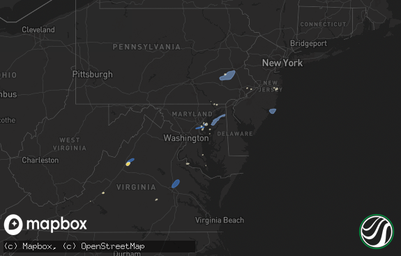
The weather event in New Jersey on March 15, 2019 includes Hail map. 4 states and 128 cities were impacted and suffered possible damage. The total estimated number of properties impacted is 82,145.

Hail
82,145
Estimated number of impacted properties by a 1.00" hail or larger0
Estimated number of impacted properties by a 1.75" hail or larger0
Estimated number of impacted properties by a 2.50" hail or largerStorm reports in New Jersey
New Jersey
| Date | Description |
|---|---|
| 03/15/20196:58 PM CDT | Tree reported down on home on park rd. Significant structural damage reported. Time estimated by radar. |
| 03/15/20196:56 PM CDT | Tree reported down. Time estimated from radar. |
| 03/15/20196:56 PM CDT | Tree reported down. Time estimated from radar. |
| 03/15/20196:56 PM CDT | Tree reported down. Time estimated from radar. |
| 03/15/20196:40 PM CDT | A local report indicates 1.00 inch wind near MENDHAM |
| 03/15/20193:08 AM CDT | At 807 PM EDT, a severe thunderstorm was located over Hawthorne, or over Paterson, moving northeast at 45 mph. HAZARD...60 mph wind gusts and penny size hail. SOURCE...Radar indicated. IMPACT...Expect damage to trees and power lines. This severe thunderstorm will be near... Ridgewood around 810 PM EDT. Paramus and Oradell around 815 PM EDT. Pearl River and Norwood around 820 PM EDT. Tappan and Orangeburg around 825 PM EDT. Tarrytown and Dobbs Ferry around 830 PM EDT. White Plains and Harrison around 835 PM EDT. Stamford and Mount Kisco around 845 PM EDT. |
| 03/15/20192:45 AM CDT | At 745 PM EDT, severe thunderstorms were located along a line extending from Long Valley to near Califon to near Clinton to Frenchtown, moving east at 45 mph. HAZARD...60 mph wind gusts and nickel size hail. SOURCE...Radar indicated. IMPACT...Damage to roofs, siding, trees, and power lines is possible. Locations impacted include... Morristown, Bridgewater, Madison, Florham Park, East Hanover, Chatham, Morris Plains, Mendham, High Bridge, Clinton, Peapack And Gladstone, Chester, Lebanon, Califon, Far Hills, Martinsville, Millington, Annandale, White House Station and Basking Ridge. |
| 03/15/20192:32 AM CDT | At 731 PM EDT, a severe thunderstorm was located over Pottstown, or 16 miles east of Reading, moving east at 45 mph. HAZARD...60 mph wind gusts and nickel size hail. SOURCE...Radar indicated. IMPACT...Damage to roofs, siding, trees, and power lines is possible. Locations impacted include... Pottstown, Lansdale, Perkasie, Doylestown, Hatboro, Souderton, Bedminster, Collegeville, Royersford, Chalfont, Trappe, Hatfield, Dublin, Langhorne, Schwenksville, Ivyland, Green Lane, Fricks, Spring Mount and Richboro. |
| 03/15/20192:20 AM CDT | At 720 PM EDT, a severe thunderstorm was located over Sloatsburg, moving northeast at 40 mph. HAZARD...60 mph wind gusts and quarter size hail. SOURCE...Radar indicated. IMPACT...Minor hail damage to vehicles is possible. Expect wind damage to trees and power lines. This severe thunderstorm will be near... Monsey around 725 PM EDT. New City and Pomona around 730 PM EDT. Haverstraw around 735 PM EDT. Mount Kisco and Yorktown Heights around 750 PM EDT. |
| 03/15/20192:11 AM CDT | At 711 PM EDT, a severe thunderstorm was located over Washington, or 14 miles east of Easton, moving east at 45 mph. HAZARD...60 mph wind gusts and nickel size hail. SOURCE...Radar indicated. IMPACT...Damage to roofs, siding, trees, and power lines is possible. Locations impacted include... Morristown, Dover, Madison, Hopatcong, Florham Park, East Hanover, Lincoln Park, Kinnelon, Hackettstown, Boonton, Butler, Wharton, Washington, Rockaway, Morris Plains, Mount Arlington, Mendham, Mountain Lakes, Stanhope and Riverdale. |
| 03/14/20197:26 PM CDT | Tree down on house on patricia place east of the intersection with lorrie lane. |
| 03/14/20197:17 PM CDT | Tree down on car on force hill road between east mount pleasant avenue and michele lane. |
| 03/14/20197:15 PM CDT | Quarter to half dollar size hail. |
All States Impacted by Hail Map on March 15, 2019
Cities Impacted by Hail Map on March 15, 2019
- Harleysville, PA
- Green Lane, PA
- Souderton, PA
- Telford, PA
- Schwenksville, PA
- Zieglerville, PA
- Perkiomenville, PA
- Gilbertsville, PA
- Pottstown, PA
- Denville, NJ
- Paramus, NJ
- Randolph, NJ
- Paterson, NJ
- Wayne, NJ
- Boonton, NJ
- Glen Rock, NJ
- Hawthorne, NJ
- Parsippany, NJ
- Lake Hiawatha, NJ
- Fair Lawn, NJ
- Towaco, NJ
- Elmwood Park, NJ
- Rockaway, NJ
- Haledon, NJ
- Fairfield, NJ
- Totowa, NJ
- Ridgewood, NJ
- Little Falls, NJ
- Morristown, NJ
- Mount Tabor, NJ
- Montville, NJ
- Dover, NJ
- Morris Plains, NJ
- Lincoln Park, NJ
- Pine Brook, NJ
- Mountain Lakes, NJ
- Florham Park, NJ
- Livingston, NJ
- East Hanover, NJ
- Chatham, NJ
- Madison, NJ
- Roseland, NJ
- Short Hills, NJ
- Sandy Hook, CT
- Newtown, CT
- Southbury, CT
- Redding, CT
- Danbury, CT
- Bethel, CT
- Oxford, CT
- Denver, PA
- Birdsboro, PA
- Elverson, PA
- Morgantown, PA
- Narvon, PA
- East Earl, PA
- Mohnton, PA
- Garnerville, NY
- Suffern, NY
- Monsey, NY
- Sloatsburg, NY
- Hillburn, NY
- New City, NY
- Spring Valley, NY
- Pomona, NY
- Thiells, NY
- Haverstraw, NY
- Mahwah, NJ
- Ringwood, NJ
- Clinton, NJ
- Peapack, NJ
- Far Hills, NJ
- Lebanon, NJ
- Hampton, NJ
- Califon, NJ
- Annandale, NJ
- Gladstone, NJ
- Bernardsville, NJ
- Glen Gardner, NJ
- Asbury, NJ
- High Bridge, NJ
- Milford, NJ
- Pittstown, NJ
- Mendham, NJ
- Chester, NJ
- Naugatuck, CT
- Ridgefield, CT
- Norwood, NJ
- Township Of Washington, NJ
- Hillsdale, NJ
- Westwood, NJ
- Palisades, NY
- Emerson, NJ
- Tappan, NY
- Northvale, NJ
- Harrington Park, NJ
- West Orange, NJ
- Green Village, NJ
- West Haverstraw, NY
- Franklin Lakes, NJ
- Oakland, NJ
- Port Murray, NJ
- Ho Ho Kus, NJ
- Oradell, NJ
- Sparkill, NY
- Long Valley, NJ
- Washington, NJ
- Bridgewater, CT
- Cheshire, CT
- North Salem, NY
- South Salem, NY
- Prospect, CT
- New Vernon, NJ
- Glen Ridge, NJ
- Whippany, NJ
- Basking Ridge, NJ
- Montclair, NJ
- Verona, NJ
- Essex Fells, NJ
- Reading, PA
- Oley, PA
- Haskell, NJ
- Bloomingdale, NJ
- Butler, NJ
- New Milford, CT
- Brookfield, CT
- Plantsville, CT
- Southington, CT


