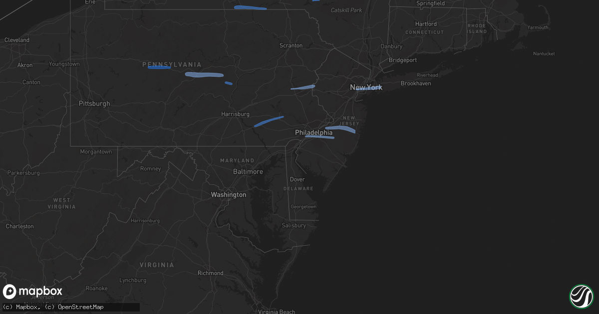
Hail Map in New Jersey on March 7, 2022
Get this storm
March 7 map
$229
one time, instant access
Download today. No call, no setup
Keep the $229
Bought the map and want the full workflow? Apply the entire $229 to a subscription within 7 days. None of it is wasted.
Every map, not just this one
This buys you this map. Subscription and you get every map we run, in the markets you choose from a few cities to whole states to nationwide. Plus real-time alerts the moment a storm fires.
Contact data
Name, contact info, occupancy, even credit band for addresses in the footprint. You go from where it hit to who to call.
Become the source they trust
Unlimited branding weather history reports on demand. You already have the documented answer ready for the property owner, and you are the one who showed up with it.
Property data and RoofTrace estimates
Pull up any address you have got, its value and the exact code rules for that jurisdiction, straight from One Click Code. Then RoofTrace estimates the squares, pitch, and roof value, priced the way you price.
Storm reports in New Jersey
New Jersey
| Date | Description |
|---|---|
| 03/07/20223:50 AM CST | At 950 PM EST, severe showers and embedded thunderstorms were located along a line extending from Navesink to Newfield, moving east at 60 mph. HAZARD...60 mph wind gusts. SOURCE...Radar indicated. IMPACT...Damage to roofs, siding, trees, and power lines is possible. Locations impacted include... Toms River, Long Branch, Asbury Park, Sandy Hook, Lakewood, Middletown, Jackson, Howell, Barnegat, Tinton Falls, Holmdel, Hammonton, Red Bank, Beachwood, Shamong, Manasquan, Highlands, Point Pleasant Beach, Buena and Egg Harbor City.This includes the following highways... Interstate 195 in New Jersey between mile markers 20 and 34. Garden State Parkway between mile markers 43 and 114. Atlantic City Expressway between mile markers 17 and 29. |
| 03/07/20222:54 AM CST | At 853 PM EST, severe showers and embedded thunderstorms were located along a line extending from near Kinnelon to near Bridgewater to near East Norriton, moving east at 60 mph. This line has a history of producing areas of wind damage. HAZARD...70 mph wind gusts. SOURCE...Radar indicated. IMPACT...Expect considerable tree damage. Damage is likely to mobile homes, roofs, and outbuildings. Locations impacted include... Trenton, New Brunswick, Perth Amboy, Long Branch, Morristown, Asbury Park, Somerville, Sandy Hook, Somerset, Edison, Middletown, Old Bridge, Howell, East Brunswick, Bridgewater, South Brunswick, Sayreville, North Brunswick, Marlboro and Manalapan.This includes the following highways... New Jersey Turnpike between exits 8 and 13. Northeast Extension between mile markers 26 and 28. Interstate 78 in New Jersey between mile markers 26 and 42. Interstate 80 in New Jersey between mile markers 35 and 47. Interstate 195 in New Jersey between mile markers 0 and 9. Interstate 295 in New Jersey between mile markers 61 and 76. Interstate 287 in New Jersey between mile markers 0 and 54. Garden State Parkway between mile markers 99 and 134. |
| 03/07/20221:29 AM CST | At 727 PM EST, severe showers and embedded thunderstorms were located along a line extending from near Hop Bottom to Shenandoah to Shiremanstown, moving east at 60 mph. This line has had a history of producing wind damage to the west. HAZARD...60 mph wind gusts. SOURCE...Radar indicated. IMPACT...Damage to roofs, siding, trees, and power lines is possible. Locations impacted include... Allentown, Reading, Easton, Lehighton, Mount Pocono, Bethlehem, Forks, Emmaus, Wyomissing, Northampton, East Stroudsburg, Tobyhanna, Wilson, Hellertown, Nazareth, Palmerton, Bangor, Kutztown, Jim Thorpe and Hamburg.This includes the following highways... Northeast Extension between mile markers 46 and 97. Interstate 78 in Pennsylvania near mile marker 8, and between milemarkers 10 and 75. Interstate 80 in Pennsylvania between mile markers 278 and 314. Interstate 380 in Pennsylvania between mile markers 0 and 13. |
| 03/06/20229:14 PM CST | Report via social media. |
| 03/06/20229:00 PM CST | Large tree blown over onto two vehicles on cross street. Time estimated from radar. |
| 03/06/20228:57 PM CST | Monmouth executive airport. |
| 03/06/20228:46 PM CST | Mcguire afb. |
| 03/06/20228:30 PM CST | Several poles and wires down on rt 541 near irick road and western drive. Traffic lights out at irick road and rt 541 and power outage at nearby hotels. |
| 03/06/20228:30 PM CST | Downed tree on us 130 northbound south of cr 670 / jacksonville road. |
| 03/06/20228:29 PM CST | 52 knot gust at kewr. |
| 03/06/20228:20 PM CST | Downed tree on i-295 northbound south of exit 76 - nj 29 |
| 03/06/20228:20 PM CST | Fallen tree on home. |
| 03/06/20228:16 PM CST | Fallen tree on home. |
| 03/06/20228:14 PM CST | Tree and wires reported down on southern dr near 30th st in fair lawn. Time estimated by radar. |
| 03/06/20228:13 PM CST | Basketball hoop blown over |
| 03/06/20228:11 PM CST | Downed tree on us 202 both directions north of cr 512 / sunnybranch road. |
| 03/06/20228:06 PM CST | Downed tree on i-287 northbound north of exit 22 - us 202 |
| 03/06/20228:05 PM CST | Snapped trees and branches in area. One neighbor had a tree uprooted and another had a limb fall on their home. Time estimated from radar. |
| 03/06/20228:00 PM CST | A local report indicates 62 MPH wind near CHATHAM |
| 03/06/20228:00 PM CST | Downed tree on nj 29 northbound south of weeden st |
| 03/06/20228:00 PM CST | Multiple tree limbs down on roadways. Via social media. |
| 03/06/20228:00 PM CST | Downed tree on i-287 southbound north of exit 30 - north maple ave |
| 03/06/20227:58 PM CST | Tree blown down and knocked out transformer. |
| 03/06/20227:57 PM CST | Downed tree and downed wires on nj 57 both directions of cr 637 / liberty road. |
| 03/06/20227:51 PM CST | Social media photo of a backyard tool shed crushed by a fallen tree. Time estimated from radar. |
| 03/06/20227:44 PM CST | Down tree on power lines on 6th street. Time estimated from radar. |
| 03/06/20227:44 PM CST | Trees down on two cars. Time estimated from radar. |
| 03/06/20227:44 PM CST | Downed tree on power lines. Time estimated from radar. |
All States Impacted by Hail Map on March 7, 2022
Cities Impacted by Hail Map on March 7, 2022
- Laurelton, PA
- Centre Hall, PA
- Milesburg, PA
- Julian, PA
- Fleming, PA
- Spring Mills, PA
- Philipsburg, PA
- Madisonburg, PA
- Bellefonte, PA
- Aaronsburg, PA
- Coburn, PA
- Rebersburg, PA
- Millmont, PA
- Howard, PA
- Millheim, PA
- Woodward, PA
- Woodland, PA
- Troutville, PA
- Du Bois, PA
- Grampian, PA
- Luthersburg, PA
- Clearfield, PA
- Rockton, PA
- Curwensville, PA
- Middleburg, PA
- Freeburg, PA
- Schnecksville, PA
- Allentown, PA
- Stewartsville, NJ
- Northampton, PA
- Whitehall, PA
- Easton, PA
- Phillipsburg, NJ
- Bath, PA
- Bethlehem, PA
- Nazareth, PA
- Coplay, PA
- Columbia, PA
- Lititz, PA
- Terre Hill, PA
- Narvon, PA
- Morgantown, PA
- Mohnton, PA
- Ephrata, PA
- Stevens, PA
- Birdsboro, PA
- Lancaster, PA
- Landisville, PA
- East Petersburg, PA
- East Earl, PA
- New Holland, PA
- Elverson, PA
- Leola, PA
- Brownstown, PA
- Akron, PA
- Manheim, PA
- Bird In Hand, PA
- Mountville, PA
- Denver, PA
- Crum Lynne, PA
- Haddonfield, NJ
- Philadelphia, PA
- Folcroft, PA
- Audubon, NJ
- Sharon Hill, PA
- Vincentown, NJ
- Folsom, PA
- Magnolia, NJ
- Glenolden, PA
- Swarthmore, PA
- Ridley Park, PA
- Medford, NJ
- Marlton, NJ
- Norwood, PA
- Gloucester City, NJ
- Thorofare, NJ
- Prospect Park, PA
- Voorhees, NJ
- Lawnside, NJ
- Westville, NJ
- Essington, PA
- Haddon Heights, NJ
- National Park, NJ
- Bellmawr, NJ
- Holmes, PA
- Mount Ephraim, NJ
- Cherry Hill, NJ
- Barrington, NJ
- Rancocas, NJ
- Lakehurst, NJ
- Manchester Township, NJ
- Burlington, NJ
- Willingboro, NJ
- Jobstown, NJ
- Toms River, NJ
- Mount Holly, NJ
- Wrightstown, NJ
- Bordentown, NJ
- Pemberton, NJ
- Cookstown, NJ
- Joint Base Mdl, NJ
- New Egypt, NJ
- Columbus, NJ
- Rome, PA
- Pine City, NY
- Barton, NY
- Apalachin, NY
- Little Meadows, PA
- Owego, NY
- Elmira, NY
- Waverly, NY
- Wellsburg, NY
- Chemung, NY
- Sayre, PA
- Nichols, NY
- Lowman, NY
- Johnson City, NY
- Binghamton, NY
- Port Crane, NY
- Castle Creek, NY
- Sidney, NY
- Unadilla, NY
- Greene, NY
- Bainbridge, NY
- Walton, NY
- Downsville, NY
- East Berne, NY
- Schoharie, NY
- Voorheesville, NY
- Howes Cave, NY
- Central Bridge, NY
- Altamont, NY
- Cobleskill, NY
- Delanson, NY
- Sloansville, NY
- Berne, NY
- Middleburgh, NY
- Clarksville, NY
- Selkirk, NY
- Ravena, NY
- Coeymans Hollow, NY
- Feura Bush, NY
- Westerlo, NY
- Jefferson, NY
- East Meredith, NY
- Davenport Center, NY
- West Davenport, NY
- Oneonta, NY
- Davenport, NY
- Bennington, VT
- North Bennington, VT
- Eagle Bridge, NY
- Buskirk, NY
- Hoosick Falls, NY
- New Lebanon, NY
- East Nassau, NY
- Dalton, MA
- Pittsfield, MA
- Canaan, NY
- Brainard, NY
- Hinsdale, MA
- East Chatham, NY
- Becket, MA
- Stephentown, NY
- Lenox, MA
- Nassau, NY
- Hollis, NY
- South Richmond Hill, NY
- Woodhaven, NY
- Cambria Heights, NY
- Garden City, NY
- Saint Albans, NY
- Hillside, NJ
- Newark, NJ
- Springfield Gardens, NY
- Elizabeth, NJ
- New York, NY
- Elizabethport, NJ
- New Hyde Park, NY
- Valley Stream, NY
- Ozone Park, NY
- West Hempstead, NY
- Jamaica, NY
- South Ozone Park, NY
- Elmont, NY
- Rosedale, NY
- Richmond Hill, NY
- Brooklyn, NY
- Middle Village, NY
- Hempstead, NY
- Bellerose, NY
- Bayonne, NJ
- Franklin Square, NY
- Howard Beach, NY
- Ridgewood, NY
- Forest Hills, NY
- Kew Gardens, NY
- Queens Village, NY
- Jersey City, NJ
- Floral Park, NY
- Warren, MA
- Holyoke, MA
- Easthampton, MA
- Belchertown, MA
- Palmer, MA
- Brookfield, MA
- Granby, MA
- Ware, MA
- South Hadley, MA
- West Warren, MA
- Southampton, MA
- Ludlow, MA
- Bondsville, MA
- West Brookfield, MA
- Stem, NC
- Oxford, NC
- Castalia, NC
- Louisburg, NC
- Butner, NC
- Creedmoor, NC
- Kittrell, NC
- Franklinton, NC


