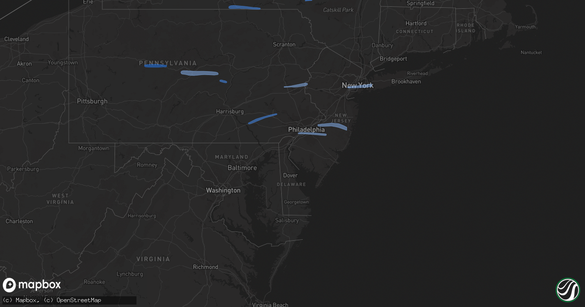
Hail Map on March 7, 2022
Get this storm
March 7 map
$229
one time, instant access
Download today. No call, no setup
Keep the $229
Bought the map and want the full workflow? Apply the entire $229 to a subscription within 7 days. None of it is wasted.
Every map, not just this one
This buys you this map. Subscription and you get every map we run, in the markets you choose from a few cities to whole states to nationwide. Plus real-time alerts the moment a storm fires.
Contact data
Name, contact info, occupancy, even credit band for addresses in the footprint. You go from where it hit to who to call.
Become the source they trust
Unlimited branding weather history reports on demand. You already have the documented answer ready for the property owner, and you are the one who showed up with it.
Property data and RoofTrace estimates
Pull up any address you have got, its value and the exact code rules for that jurisdiction, straight from One Click Code. Then RoofTrace estimates the squares, pitch, and roof value, priced the way you price.
States Impacted by Hail Map on March 7, 2022
Storm reports
North Carolina
| Date | Description |
|---|---|
| 03/07/20223:15 AM CST | At 914 PM EST, a severe thunderstorm was located 10 miles east of Louisburg, moving east at 40 mph. HAZARD...60 mph wind gusts. SOURCE...Radar indicated. IMPACT...Expect damage to roofs, siding, and trees. Locations impacted include... Rocky Mount, Halifax, Scotland Neck, Dortches, Red Oak, Enfield, Whitakers, Hobgood, Castalia and Centerville. |
| 03/07/20222:36 AM CST | At 836 PM EST, a severe thunderstorm was located near Creedmoor, moving east at 50 mph. HAZARD...60 mph wind gusts. SOURCE...Radar indicated. IMPACT...Expect damage to roofs, siding, and trees. Locations impacted include... Henderson, Oxford, Creedmoor, Louisburg, Butner, Franklinton, Kittrell, Stem, Centerville and Ingleside. |
| 03/06/20229:18 PM CST | Large oak tree down along nc-581. Location estimated by radar. |
| 03/06/20228:18 PM CST | Corrects previous tstm wnd dmg report from 6 nnw spring hope. Large oak tree down along nc-581. Location estimated by radar. |
| 03/06/20227:55 PM CST | Tree down on cedar creek rd... Blocking road. |
| 03/06/20227:45 PM CST | Powerlines and power poles down on hayes road in creedmoor. |
| 03/06/20227:41 PM CST | Tree down near butner... Nc. |
Maryland
| Date | Description |
|---|---|
| 03/07/20224:40 PM CST | Tree down on new germany road at chestnut ridge rd |
| 03/07/20224:40 PM CST | Tree down on maryland highway at kitzmiller road |
| 03/07/20224:35 PM CST | Tree down on cranesville road near herrington manor road |
| 03/07/20224:15 PM CST | Numerous trees and powerlines down throughout the city of cumberland |
| 03/07/20222:21 AM CST | At 820 PM EST, severe showers and embedded thunderstorms were located along a line extending from near Lyons to near Delta, moving east at 60 mph. This line has had a history of producing areas of wind damage. HAZARD...60 mph wind gusts. SOURCE...Radar indicated. IMPACT...Damage to roofs, siding, trees, and power lines is possible. Locations impacted include... Philadelphia, Camden, Wilmington, West Chester, Bensalem, Norristown, Chester, Phoenixville, West Norriton, East Norriton, Coatesville, Yeadon, Westtown, Carneys Point, Downingtown, Conshohocken, Palmyra, Hatboro, Folcroft and Ambler.This includes the following highways... Pennsylvania Turnpike between mile markers 301 and 352. Northeast Extension between mile markers 21 and 25. Interstate 95 in Pennsylvania between mile markers 0 and 16, andbetween mile markers 19 and 35. Interstate 95 in Delaware between mile markers 12 and 23. Interstate 76 in Pennsylvania between mile markers 327 and 350. Interstate 676 in Pennsylvania between mile markers 0 and 1. Interstate 476 in Pennsylvania between mile markers 0 and 19. |
| 03/07/20221:33 AM CST | At 733 PM EST, severe thunderstorms were located along a line extending from Steelton to Bonneauville, moving east at 55 mph. HAZARD...60 mph wind gusts. SOURCE...Radar indicated. IMPACT...Expect damage to roofs, siding, and trees. Locations impacted include... Lancaster, York, Lower Allen, Hanover, Ephrata, Weigelstown, Elizabethtown, Columbia, Lititz, Middletown, Millersville, Gettysburg, Mount Joy, New Cumberland, Parkville, Red Lion, New Holland, Manheim, Akron and Hampton.This includes the following Interstates... The Pennsylvania Turnpike from mile markers 242 to 295. Interstate 83 from mile markers 0 to 39. Interstate 283 from mile markers 0 to 1. |
| 03/07/202212:26 AM CST | At 625 PM EST, severe thunderstorms were located along a line extending from near Rockhill Furnace to Warfordsburg, moving east at 55 mph. HAZARD...60 mph wind gusts. SOURCE...Radar indicated. IMPACT...Expect damage to roofs, siding, and trees. Locations impacted include... Chambersburg, Carlisle, Waynesboro, Shippensburg, Greencastle, McConnellsburg, Guilford, Plainfield, St. Thomas, Schlusser, Fayetteville, Warfordsburg, Wayne Heights, Mount Holly Springs, Mont Alto, Mercersburg, Scotland, Newville, Harrisonville and Rouzerville.This includes the following Interstates... Interstate 70 from mile markers 151 to 170. The Pennsylvania Turnpike from mile markers 168 to 228. Interstate 81 from mile markers 0 to 53. |
| 03/06/202211:27 PM CST | At 527 PM EST, severe thunderstorms were located along a line extending from Prince Gallitzin State Park to Ogletown to Meyersdale, moving east at 60 mph. HAZARD...60 mph wind gusts. SOURCE...Trained weather spotters. IMPACT...Expect damage to roofs, siding, and trees. Locations impacted include... Altoona, Huntingdon, Hollidaysburg, Tyrone, Bedford, Portage, Meyersdale, Breezewood, Roaring Spring, Mount Union, Berlin, Clearville, Bald Eagle, New Enterprise, Martinsburg, Lakemont, Everett, Bellwood, Warriors Mark and Cresson.This includes the following Interstates... Interstate 70 from mile markers 147 to 150. The Pennsylvania Turnpike from mile markers 114 to 165. Interstate 99 from mile markers 0 to 55. |
| 03/06/202210:52 PM CST | At 451 PM EST, severe thunderstorms were located along a line extending from near Indiana to Ligonier to near Uniontown, moving east at 50 mph. HAZARD...60 mph wind gusts. SOURCE...Radar indicated. IMPACT...Expect damage to roofs, siding, and trees. Locations impacted include... Johnstown, Somerset, Windber, Ebensburg, Nanty-Glo, Portage, Meyersdale, Westmont, Northern Cambria, Belmont, Geistown, Southmont, Berlin, Patton, Cresson, Gallitzin, Friedens, Vinco, Loretto and Hastings.This includes The Pennsylvania Turnpike from mile markers 101 to 130. |
| 03/06/20227:35 PM CST | Tree down on bauer avenue |
| 03/06/20227:30 PM CST | Tree down on fork road |
| 03/06/20227:28 PM CST | A local report indicates 60 MPH wind near PATUXENT RIVER NAS |
| 03/06/20227:25 PM CST | Tree down on deer lodge court |
| 03/06/20227:25 PM CST | A local report indicates 69 MPH wind near THOMAS JOHNSON BRIDGE |
| 03/06/20227:23 PM CST | A local report indicates 59 MPH wind near BAY BRIDGE S-9 E B |
| 03/06/20227:21 PM CST | Tree down on rosewood lane |
| 03/06/20227:13 PM CST | Tree down on ridgelawn road |
| 03/06/20226:50 PM CST | Tree down on jasontown road near smith road |
| 03/06/20226:48 PM CST | Tree down in libertytown |
| 03/06/20226:30 PM CST | Tree down in myersville |
| 03/06/20226:25 PM CST | Tree down in emmitsburg |
| 03/06/20226:12 PM CST | Tree down in smithsburg |
Alabama
| Date | Description |
|---|---|
| 03/07/20229:35 AM CST | Four power poles down across the road at mccrary road and wall triana highway. Estimated winds of 40-50 mph. |
New Hampshire
| Date | Description |
|---|---|
| 03/07/20224:16 AM CST | At 1015 PM EST, severe thunderstorms were located along a line extending from near Haverhill to near Southbridge, moving east at 70 mph. HAZARD...60 mph wind gusts. SOURCE...Radar indicated. IMPACT...Expect damage to trees and power lines. Locations impacted include... Boston, Worcester, Lowell, Cambridge, Quincy, Lynn, Newton, Lawrence, Somerville, Framingham, Haverhill, Waltham, Malden, Brookline, Medford, Revere, Peabody, Methuen, Arlington and Everett. |
| 03/07/20223:00 AM CST | At 859 PM EST, severe thunderstorms were located along a line extending from 10 miles west of Walpole to 10 miles west of Hinsdale to 40 miles southwest of Winchester, moving east at 60 mph. HAZARD...60 mph wind gusts. SOURCE...Radar indicated. IMPACT...Expect damage to roofs, siding, and trees. Locations impacted include... Manchester, Nashua, Keene, Jaffrey, Henniker, Merrimack, Bedford, Milford, Hooksett, Amherst, Litchfield, Hollis, Peterborough, New Boston, Winchester, Antrim, Mont Vernon, Greenfield, Lyndeborough and Dublin. |
| 03/07/20222:43 AM CST | At 843 PM EST, a severe thunderstorm was located over West Wardsboro, or over Stratton, moving east at 55 mph. HAZARD...60 mph wind gusts. SOURCE...Radar indicated. IMPACT...Expect damage to roofs, siding, and trees. Locations impacted include... Brattleboro, Bellows Falls, Townshend, Manchester, Stratton, Putney, Vernon, Wilmington, Readsboro, Saxtons River, Westminster, Newfane, Guilford Center, West Wardsboro, Manchester Center, Windham, Rockingham, Guilford, Whitingham and Dover. |
| 03/06/20229:20 PM CST | Several power flashes observed in seabrook as squall line moved through. A few trees and wires down. |
| 03/06/20229:19 PM CST | Power lines down across ashworth road. |
| 03/06/20229:13 PM CST | Trees and wires down. |
| 03/06/20229:05 PM CST | Trees down. |
| 03/06/20229:05 PM CST | Trees down. |
| 03/06/20229:05 PM CST | A local report indicates 60 MPH wind near NOTTINGHAM |
| 03/06/20228:50 PM CST | Numerous outages due to downed trees and wires. |
| 03/06/20228:50 PM CST | Trees and wires down. |
| 03/06/20228:47 PM CST | Trees and wires down. |
| 03/06/20228:44 PM CST | Trees down on wires. Radar estimated time. |
| 03/06/20228:43 PM CST | Trees down on wires. Radar estimated time. |
| 03/06/20228:42 PM CST | Trees and wires down. Radar estimated time. |
| 03/06/20228:39 PM CST | A local report indicates 58 MPH wind near 3 SE RINDGE |
| 03/06/20228:39 PM CST | Reliable wind gust measurement at 1300 ft. |
| 03/06/20228:37 PM CST | Trees and wires down. |
| 03/06/20228:36 PM CST | Multiple trees... Wires down. Radar estimated time. |
| 03/06/20228:36 PM CST | Trees on wires. Radar estimated time. |
| 03/06/20228:35 PM CST | Wires down. Radar estimated time. |
| 03/06/20228:35 PM CST | Trees and wires down. |
| 03/06/20228:33 PM CST | Tree down blocking cathedral road. Radar estimated time. |
| 03/06/20228:29 PM CST | Multiple trees... Wires down. Radar estimated time. |
| 03/06/20228:15 PM CST | A few trees down in keene... At least one on a house. |
| 03/06/20228:13 PM CST | Trees down. Radar estimated time. |
| 03/06/20228:13 PM CST | Tree on a house. Radar estimated time. |
| 03/06/20228:05 PM CST | Multiple trees down. Radar estimated time. |
Delaware
| Date | Description |
|---|---|
| 03/07/20223:02 AM CST | At 900 PM EST, severe showers and embedded thunderstorms were located along a line extending from near Chalfont to Stanton, moving east at 65 mph. This line has a history of producing areas of wind damage. HAZARD...70 mph wind gusts. SOURCE...Radar indicated. IMPACT...Expect considerable tree damage. Damage is likely to mobile homes, roofs, and outbuildings. Locations impacted include... Philadelphia, Toms River, Trenton, Camden, Wilmington, Gloucester City, Lakewood, Cherry Hill, Bensalem, Jackson, Howell, Evesham, Mount Laurel, Chester, Willingboro, Deptford, Voorhees, Medford, West Deptford and Barnegat.This includes the following highways... New Jersey Turnpike between exits 1 and 8. Pennsylvania Turnpike between mile markers 334 and 359. Interstate 95 in Pennsylvania between mile markers 0 and 40. Interstate 95 in Delaware between mile markers 3 and 23. Interstate 76 in Pennsylvania between mile markers 332 and 351. Interstate 76 in New Jersey between mile markers 0 and 3. Interstate 195 in New Jersey between mile markers 0 and 2, andbetween mile markers 7 and 34. Interstate 295 in New Jersey between mile markers 0 and 61. Interstate 676 in Pennsylvania between mile markers 0 and 1. Interstate 676 in New Jersey between mile markers 0 and 4. Interstate 476 in Pennsylvania between mile markers 0 and 13, andbetween mile markers 15 and 17, and near mile marker 19. Garden State Parkway between mile markers 46 and 99. Atlantic City Expressway between mile markers 21 and 44. |
New Jersey
| Date | Description |
|---|---|
| 03/07/20223:50 AM CST | At 950 PM EST, severe showers and embedded thunderstorms were located along a line extending from Navesink to Newfield, moving east at 60 mph. HAZARD...60 mph wind gusts. SOURCE...Radar indicated. IMPACT...Damage to roofs, siding, trees, and power lines is possible. Locations impacted include... Toms River, Long Branch, Asbury Park, Sandy Hook, Lakewood, Middletown, Jackson, Howell, Barnegat, Tinton Falls, Holmdel, Hammonton, Red Bank, Beachwood, Shamong, Manasquan, Highlands, Point Pleasant Beach, Buena and Egg Harbor City.This includes the following highways... Interstate 195 in New Jersey between mile markers 20 and 34. Garden State Parkway between mile markers 43 and 114. Atlantic City Expressway between mile markers 17 and 29. |
| 03/07/20222:54 AM CST | At 853 PM EST, severe showers and embedded thunderstorms were located along a line extending from near Kinnelon to near Bridgewater to near East Norriton, moving east at 60 mph. This line has a history of producing areas of wind damage. HAZARD...70 mph wind gusts. SOURCE...Radar indicated. IMPACT...Expect considerable tree damage. Damage is likely to mobile homes, roofs, and outbuildings. Locations impacted include... Trenton, New Brunswick, Perth Amboy, Long Branch, Morristown, Asbury Park, Somerville, Sandy Hook, Somerset, Edison, Middletown, Old Bridge, Howell, East Brunswick, Bridgewater, South Brunswick, Sayreville, North Brunswick, Marlboro and Manalapan.This includes the following highways... New Jersey Turnpike between exits 8 and 13. Northeast Extension between mile markers 26 and 28. Interstate 78 in New Jersey between mile markers 26 and 42. Interstate 80 in New Jersey between mile markers 35 and 47. Interstate 195 in New Jersey between mile markers 0 and 9. Interstate 295 in New Jersey between mile markers 61 and 76. Interstate 287 in New Jersey between mile markers 0 and 54. Garden State Parkway between mile markers 99 and 134. |
| 03/07/20221:29 AM CST | At 727 PM EST, severe showers and embedded thunderstorms were located along a line extending from near Hop Bottom to Shenandoah to Shiremanstown, moving east at 60 mph. This line has had a history of producing wind damage to the west. HAZARD...60 mph wind gusts. SOURCE...Radar indicated. IMPACT...Damage to roofs, siding, trees, and power lines is possible. Locations impacted include... Allentown, Reading, Easton, Lehighton, Mount Pocono, Bethlehem, Forks, Emmaus, Wyomissing, Northampton, East Stroudsburg, Tobyhanna, Wilson, Hellertown, Nazareth, Palmerton, Bangor, Kutztown, Jim Thorpe and Hamburg.This includes the following highways... Northeast Extension between mile markers 46 and 97. Interstate 78 in Pennsylvania near mile marker 8, and between milemarkers 10 and 75. Interstate 80 in Pennsylvania between mile markers 278 and 314. Interstate 380 in Pennsylvania between mile markers 0 and 13. |
| 03/06/20229:14 PM CST | Report via social media. |
| 03/06/20229:00 PM CST | Large tree blown over onto two vehicles on cross street. Time estimated from radar. |
| 03/06/20228:57 PM CST | Monmouth executive airport. |
| 03/06/20228:46 PM CST | Mcguire afb. |
| 03/06/20228:30 PM CST | Downed tree on us 130 northbound south of cr 670 / jacksonville road. |
| 03/06/20228:30 PM CST | Several poles and wires down on rt 541 near irick road and western drive. Traffic lights out at irick road and rt 541 and power outage at nearby hotels. |
| 03/06/20228:29 PM CST | 52 knot gust at kewr. |
| 03/06/20228:20 PM CST | Fallen tree on home. |
| 03/06/20228:20 PM CST | Downed tree on i-295 northbound south of exit 76 - nj 29 |
| 03/06/20228:16 PM CST | Fallen tree on home. |
| 03/06/20228:14 PM CST | Tree and wires reported down on southern dr near 30th st in fair lawn. Time estimated by radar. |
| 03/06/20228:13 PM CST | Basketball hoop blown over |
| 03/06/20228:11 PM CST | Downed tree on us 202 both directions north of cr 512 / sunnybranch road. |
| 03/06/20228:06 PM CST | Downed tree on i-287 northbound north of exit 22 - us 202 |
| 03/06/20228:05 PM CST | Snapped trees and branches in area. One neighbor had a tree uprooted and another had a limb fall on their home. Time estimated from radar. |
| 03/06/20228:00 PM CST | Downed tree on nj 29 northbound south of weeden st |
| 03/06/20228:00 PM CST | Multiple tree limbs down on roadways. Via social media. |
| 03/06/20228:00 PM CST | Downed tree on i-287 southbound north of exit 30 - north maple ave |
| 03/06/20228:00 PM CST | A local report indicates 62 MPH wind near CHATHAM |
| 03/06/20227:58 PM CST | Tree blown down and knocked out transformer. |
| 03/06/20227:57 PM CST | Downed tree and downed wires on nj 57 both directions of cr 637 / liberty road. |
| 03/06/20227:51 PM CST | Social media photo of a backyard tool shed crushed by a fallen tree. Time estimated from radar. |
| 03/06/20227:44 PM CST | Downed tree on power lines. Time estimated from radar. |
| 03/06/20227:44 PM CST | Trees down on two cars. Time estimated from radar. |
| 03/06/20227:44 PM CST | Down tree on power lines on 6th street. Time estimated from radar. |
Pennsylvania
| Date | Description |
|---|---|
| 03/07/20225:57 PM CST | Trees down blocking roadway. |
| 03/07/20225:52 PM CST | Multiple reports of trees and wires down in eastern lycoming county. |
| 03/07/20225:50 PM CST | Multiple trees down in the area. |
| 03/07/20225:40 PM CST | Numerous trees and wires down along middle road. |
| 03/07/20225:38 PM CST | Trees and wires down near intersection of blue bird road and milan road. |
| 03/07/20225:35 PM CST | Trees down oak hill road. |
| 03/07/20225:30 PM CST | Multiple reports of trees and wires down in central lycoming county. |
| 03/07/20225:30 PM CST | Trees down on wires on blue mountain road. |
| 03/07/20225:30 PM CST | Trees down on wires on route 414/east main street. Power out in the area. |
| 03/07/20225:29 PM CST | Multiple reports of trees down in orbisonia along croghan pike. |
| 03/07/20225:15 PM CST | Numerous reports of trees and wires down in western lycoming county. |
| 03/07/20225:10 PM CST | Trees and wires down along route 6. |
| 03/07/20225:05 PM CST | Trees and wires down along brush valley road. |
| 03/07/20225:05 PM CST | Trees down on wires along creek road. |
| 03/07/20225:05 PM CST | Wires down on a car. |
| 03/07/20225:00 PM CST | Multiple reports of wires down on raystown road and woodbury pike in hopewell township... Bedford county. Passed along by pema. |
| 03/07/20224:56 PM CST | Trees down on wires om east high street. |
| 03/07/20224:56 PM CST | Trees and wires down on a pick up truck on linn street. |
| 03/07/20224:55 PM CST | Trees down on wires along water street. |
| 03/07/20224:53 PM CST | Trees and wires down. |
| 03/07/20224:42 PM CST | Multiple trees down on charger highway near the greendown acres trailer park. |
| 03/07/20224:40 PM CST | Tress down on wires on wayne blvd. |
| 03/07/20224:40 PM CST | Tress down on wires on kettle street. |
| 03/07/20224:38 PM CST | Tree down at intersection of lower skelp rd and e pleasant valley blvd. |
| 03/07/20224:35 PM CST | Trees down on wires on phoenix road. |
| 03/07/20224:30 PM CST | Trees and power poles down along route 350. |
| 03/07/20224:30 PM CST | Trees down on wires on dungarvin road. |
| 03/07/20224:14 PM CST | Kfig airport asos 61 knot wind gust. |
| 03/07/20224:10 PM CST | Corrects previous tstm wnd dmg report from boswel for timel. Trees and wires down on center street. |
| 03/07/20224:05 PM CST | Trees down on wires on trolls lake road. |
| 03/07/20224:05 PM CST | Large tree across route 153 at moose grade road. |
| 03/07/20223:55 PM CST | Numerous trees down in the latrobe area. |
| 03/07/20223:55 PM CST | Numerous trees down in the greensburg area. |
| 03/07/20223:51 PM CST | Trees and wires down along evergreen road and shamokin trail. |
| 03/07/20223:50 PM CST | Trees and wires down on thunderbird road. |
| 03/07/20223:45 PM CST | Tree down on bethel church road |
| 03/07/20223:42 PM CST | Tree down on moween road |
| 03/07/20223:40 PM CST | Trees and wires down route 30 |
| 03/07/20223:40 PM CST | Damage to a home on division avenue. Time estimated on radar. |
| 03/07/20223:40 PM CST | Wind damage to trees and farm buildings along mahoning rd. |
| 03/07/20223:38 PM CST | Tree down on route 356 |
| 03/07/20223:35 PM CST | Tree down on tyrol boulevard |
| 03/07/20223:35 PM CST | Trees and wires down on menk road |
| 03/07/20223:15 PM CST | Trees and wires down on new texas rd / lindsey ln. |
| 03/07/20223:10 PM CST | Trees and wires down on center street. |
| 03/07/20223:07 PM CST | Partial church roof collapse. |
| 03/07/20223:05 PM CST | Partial building collapse on 800 block of penn ave. |
| 03/07/20223:05 PM CST | Numerous trees and powerlines down across the city. |
| 03/07/20223:00 PM CST | High voltage lines down at melwood/jewell and melwood/herron. |
| 03/07/20223:00 PM CST | Downed trees. |
| 03/07/20222:40 PM CST | Trees uprooted. Widespread wind damage. |
| 03/07/20222:13 AM CST | At 812 PM EST, severe thunderstorms were located along a line extending from near Willowemoc to near Skytop, moving northeast at 60 mph. HAZARD...60 mph wind gusts. SOURCE...Radar indicated. IMPACT...Expect damage to roofs, siding, and trees. Locations impacted include... Fallsburg, Bushkill, Monticello, Lackawaxen, Liberty, Bethel, Neversink, South Fallsburg, Shohola and Matamoras. |
| 03/07/20222:00 AM CST | At 759 PM EST, severe thunderstorms were located along a line extending from near Downsville to near Prompton to Beltzville State Park to near Bernville to near Manheim, moving east at 60 mph. HAZARD...60 mph wind gusts. SOURCE...Radar indicated. IMPACT...Expect damage to trees and power lines. Severe thunderstorms will be near... Cuddebackville around 835 PM EST. Otisville around 840 PM EST. Middletown and Howells around 845 PM EST. Walden and Montgomery around 855 PM EST. Pompton Lakes and Bloomingdale around 900 PM EST. |
| 03/07/20221:44 AM CST | At 744 PM EST, a severe thunderstorm was located over Forest City, or near Carbondale, moving east at 70 mph. HAZARD...70 mph wind gusts. SOURCE...Radar indicated. IMPACT...Expect considerable tree damage. Damage is likely to mobile homes, roofs, and outbuildings. Locations impacted include... Carbondale, Honesdale, Bethel, Damascus, Callicoon, Forest City, Tusten, Cochecton, Waymart and Vandling. |
| 03/07/20221:00 AM CST | At 700 PM EST, severe thunderstorms were located along a line extending from Meiserville to Plainfield, moving east at 55 mph. HAZARD...60 mph wind gusts. SOURCE...Radar indicated. IMPACT...Expect damage to roofs, siding, and trees. Locations impacted include... Harrisburg, Lebanon, Carlisle, Lower Allen, Pottsville, Hershey, Berwick, Mechanicsburg, Camp Hill, Shamokin, Palmyra, New Cumberland, Tamaqua, Linglestown, Enola, Schuylkill Haven, Shenandoah, Lemoyne, Myerstown and St. Clair.For those driving on Interstate 80, this includes areas between theMifflinville and Nescopek exits, specifically from mile markers 244to 247.This includes the following Interstates... The Pennsylvania Turnpike from mile markers 208 to 231. Interstate 78 from mile markers 0 to 8. Interstate 81 from mile markers 49 to 139. Interstate 83 from mile markers 41 to 50. Interstate 283 near mile marker 2. |
| 03/07/202212:44 AM CST | At 643 PM EST, severe thunderstorms were located along a line extending from Le Roy to Mooresburg to Perulack, moving east at 55 mph. HAZARD...60 mph wind gusts. SOURCE...Radar indicated. IMPACT...Expect damage to roofs, siding, and trees. Locations impacted include... Bloomsburg, Berwick, Sunbury, Shamokin, Milton, Lewisburg, Selinsgrove, Danville, Montoursville, Laporte, Mount Carmel, Northumberland, Winfield, Kulpmont, Muncy, Watsontown, Elysburg, Fairview-Ferndale, Hughesville and Riverside.For those driving on Interstate 80, this includes areas between theMile Run and Nescopek exits, specifically from mile markers 206 to247.This includes Interstate 180 from mile markers 1 to 21. |
| 03/07/202212:10 AM CST | At 609 PM EST, severe thunderstorms were located along a line extending from Whipple Dam State Park to Raystown Dam, moving east at 55 mph. HAZARD...60 mph wind gusts. SOURCE...Trained weather spotters. IMPACT...Expect damage to roofs, siding, and trees. Locations impacted include... Lewistown, Huntingdon, Selinsgrove, Newport, Mifflintown, Mount Union, Burnham, Belleville, Shamokin Dam, Duncannon, Milroy, Highland Park, Hummels Wharf, Middleburg, Honey Grove, New Bloomfield, Mcalisterville, McClure, Port Royal and Spruce Hill. |
| 03/06/202210:28 PM CST | At 428 PM EST, severe rated winds were located along a line extending from near Leechburg to Fredericktown-Millsboro, moving east at 55 mph. HAZARD...60 mph wind gusts. SOURCE...Radar indicated. IMPACT...Expect damage to trees and power lines, resulting in some power outages. Locations impacted include... Monroeville, Greensburg, McKeesport, Indiana, Uniontown, Jeannette, Latrobe, Connellsville, Vandergrift, Homer City, Apollo, and Plum. |
| 03/06/20228:25 PM CST | A local report indicates 67 MPH wind near PHILADELPHIA INTERNATIO |
| 03/06/20228:22 PM CST | Measured on a personal anemometer. |
| 03/06/20228:20 PM CST | Several trees and wires down across lower bucks county. Times estimated from radar. |
| 03/06/20228:20 PM CST | Part of roof siding torn off. |
| 03/06/20228:03 PM CST | Report of straight line wind damage to trees and shrubbery in the middletown... Edgemont... And thornbury areas. Trees blown over in the same direction and a few limbs |
| 03/06/20227:45 PM CST | Wires down on marienstein road. |
| 03/06/20227:43 PM CST | Tree reported down in limerick... Pa. |
| 03/06/20227:38 PM CST | Social media photo of an uprooted healthy tree in coatesville. Time estimated from radar. |
| 03/06/20227:35 PM CST | Numerous trees down in westfall township. |
| 03/06/20227:32 PM CST | Numerous trees down in milford area. |
| 03/06/20227:31 PM CST | Trees down on mill street in boyertown. Report via social media. |
| 03/06/20227:30 PM CST | Downed tree; tree knocked over full size metal basketball hoop stand. |
| 03/06/20227:30 PM CST | Trees and wires down. |
| 03/06/20227:26 PM CST | Power knocked out. |
| 03/06/20227:14 PM CST | Wires down near voganville rd & amishtown rd. |
| 03/06/20227:06 PM CST | 1 inch tree limbs broken; shingles blown off. |
| 03/06/20227:05 PM CST | Reported at klns. |
| 03/06/20227:02 PM CST | Numeroius trees down. |
| 03/06/20227:00 PM CST | Trees and wire down in middletown and areas to the east. |
| 03/06/20226:58 PM CST | Multiple reports of utility wires down in manheim township. |
| 03/06/20226:58 PM CST | Measured by the southern pennsylvania amateur radio club weather station. |
| 03/06/20226:43 PM CST | Multiple reports of trees and wires down in the eastern part of the county. |
| 03/06/20226:40 PM CST | Report of wires down at the intersection on hepplewhite drive and timberlane drive in manchester township. |
| 03/06/20226:36 PM CST | Numerous trees down in hazleton area. |
| 03/06/20226:34 PM CST | Multiple reports of trees and wires down throughout the central part of the county. |
| 03/06/20226:34 PM CST | Numerous trees down in mountain top area. |
| 03/06/20226:32 PM CST | Multiple reports of trees and wires down in lower paxton township. |
| 03/06/20226:26 PM CST | Numerous trees down in dallas area. |
| 03/06/20226:26 PM CST | Numerous trees down in back mountain area. |
| 03/06/20226:24 PM CST | Numerous trees down in hunlock creek area. |
| 03/06/20226:23 PM CST | Tree down on a house in nw new cumberland. |
| 03/06/20226:20 PM CST | Numerous reports of trees and wires down in the western part of the county. |
| 03/06/20226:19 PM CST | Report of a tree down on new valley rd in rye township. |
| 03/06/20226:17 PM CST | Numerous trees down in huntington mills area. |
| 03/06/20226:15 PM CST | Numerous trees down in sweet valley area. |
| 03/06/20226:13 PM CST | Numerous trees down in shickshinny area. |
| 03/06/20226:05 PM CST | Multiple reports of trees and wires down from catawissa to numidia. |
| 03/06/20226:00 PM CST | Multiple reports of trees down in bucks valley. |
Arkansas
| Date | Description |
|---|---|
| 03/07/20226:48 AM CST | At 1248 AM CST, a severe thunderstorm was located over Delaplaine, or 12 miles east of Pocahontas, moving east at 50 mph. HAZARD...60 mph wind gusts. SOURCE...Radar indicated. IMPACT...Expect damage to roofs, siding, and trees. Locations impacted include... Rector, Lafe, Knobel, O'Kean, Peach Orchard, Delaplaine, Evening Star, Crockett, Heelstring, Stonewall, Heubner, Tipperary, Hickoria, Case, Brookings and Knob. |
| 03/07/20226:23 AM CST | At 1222 AM CST, a severe thunderstorm was located near Maynard, or 12 miles south of Doniphan, moving east at 40 mph. HAZARD...60 mph wind gusts. SOURCE...Radar indicated. IMPACT...Expect damage to roofs, siding, and trees. Locations impacted include... Corning, Chalk Bluff Natural Area, Reyno, Pollard, McDougal, Success, Datto, Twin Oaks and Palatka. |
| 03/07/20226:19 AM CST | At 1219 AM CST, a severe thunderstorm was located over Highland Industrial Park, or 10 miles northeast of Camden, moving northeast at 50 mph. HAZARD...60 mph wind gusts and quarter size hail. SOURCE...Radar indicated. IMPACT...Hail damage to vehicles is expected. Expect wind damage to roofs, siding, and trees. Locations impacted include... Fordyce... Bearden... Thornton... Highland Industrial Park... Harlow... East Camden... Chambersville... Eagle Mills... Harmony Grove... Hopeville... Ivan... Millville... Ramsey... Warner... Holly Springs... |
| 03/06/20229:09 PM CST | At 309 AM CST, a severe thunderstorm was located over St Francis National Park, moving northeast at 50 mph. HAZARD...60 mph wind gusts. SOURCE...Radar indicated. IMPACT...Expect damage to roofs, siding, and trees. Locations impacted include... Helena-West Helena, St Francis National Park, Tunica, Phillipp, Strayhorn, Dubbs, North Tunica, Dundee, Little Texas, Lula, Savage, Preston Place, Quarles, Austin, Jeffries, Prichard, Helena Crossing, Huma, Dooley and Maud. |
| 03/06/20227:56 PM CST | At 156 AM CST, a severe thunderstorm was located over Arbyrd, or near Senath, moving east at 50 mph. HAZARD...60 mph wind gusts and quarter size hail. SOURCE...Radar indicated. IMPACT...Hail damage to vehicles is expected. Expect wind damage to roofs, siding, and trees. Locations impacted include... Kennett, Hayti, Steele, Senath, Cardwell, Hornersville, Hayti Heights, Arbyrd, Deering, Bragg City, Pascola, Heubner, Fritz, Mounds, West Kennett, Leonard, Noland, Brighton, Bertig and Rives. |
| 03/06/20227:12 PM CST | At 112 AM CST, a severe thunderstorm was located over Chalk Bluff Natural Area, moving east at 55 mph. HAZARD...60 mph wind gusts. SOURCE...Radar indicated. IMPACT...Expect damage to roofs, siding, and trees. Locations impacted include... Malden, Piggott, Campbell, Chalk Bluff Natural Area, Clarkton, Holcomb, St. Francis, Pollard, McDougal, Saint Francis, Glennonville, Crockett, Tipperary, Hickoria, Valley Ridge, Providence, Morris State Park, Wilhelmina, Brian and Chalk Bluff Battlefield Park. |
Ohio
| Date | Description |
|---|---|
| 03/06/202211:26 PM CST | At 526 AM EST, a severe thunderstorm was located over Blanchester, moving east at 65 mph. HAZARD...60 mph wind gusts. SOURCE...Radar indicated. IMPACT...Expect damage to trees and power lines. Locations impacted include... Blanchester, Lynchburg, New Vienna, Russell, Woodville, Martinsville, Midland, St. Martin, Westboro, Cuba, Morrisville, Edenton and Lake Lorelei. |
Virginia
| Date | Description |
|---|---|
| 03/07/20222:22 PM CST | Report from mping: 3-inch tree limbs broken; power poles broken. |
New York
| Date | Description |
|---|---|
| 03/07/20225:57 PM CST | Multiple trees down. |
| 03/07/20225:57 PM CST | Multiple trees and wires down on upper stella ireland road. |
| 03/07/20225:53 PM CST | Large pine tree down. |
| 03/07/20225:51 PM CST | Numerous trees down. |
| 03/07/20225:51 PM CST | Awning damage on a home. |
| 03/07/20225:48 PM CST | Tree down in road at higby rd and graffenburg rd |
| 03/07/20225:24 PM CST | Trees and wires down. |
| 03/07/20225:18 PM CST | Tree down blocking waterburg road. |
| 03/07/20225:14 PM CST | Trees down in alpine... Time estimated from radar. |
| 03/07/20225:10 PM CST | Power pole down on old ithaca rd... Time estimated from radar. |
| 03/07/20225:06 PM CST | Trees down in caton... Time estimated from radar. |
| 03/07/20225:00 PM CST | Tree down on moreland rd in beaver dams... Time estimated from radar. |
| 03/07/20225:00 PM CST | Multiple trees down in corning... Time estimated from radar. |
| 03/07/20224:57 PM CST | Trees blown down in hornby. Time estimated from radar. |
| 03/07/20224:54 PM CST | Trees down in hector... Time estimated from radar. |
| 03/07/20224:54 PM CST | Trees down in the town of hector... Time estimated from radar. |
| 03/07/20224:34 PM CST | Multiple trees down around the city of bath... Time estimated from radar. |
| 03/07/20224:17 PM CST | Multiple trees down across hornell... Time estimated from radar. |
| 03/07/20223:44 AM CST | At 944 PM EST, severe thunderstorms were located along a line extending from near Bayville to near Jamaica to near Sandy Hook, moving east at 55 mph. HAZARD...60 mph wind gusts. SOURCE...Radar indicated. IMPACT...Expect damage to trees and power lines. Severe thunderstorms will be near... Long Beach and Garden City around 950 PM EST. Levittown and Freeport around 955 PM EST. Massapequa and Farmingdale around 1000 PM EST. Brentwood and Commack around 1005 PM EST. Islip and Hauppauge around 1010 PM EST. Centereach and Ronkonkoma around 1015 PM EST. |
| 03/07/20223:01 AM CST | At 901 PM EST, a severe thunderstorm was located near Goshen, moving east at 55 mph. HAZARD...60 mph wind gusts. SOURCE...Radar indicated. IMPACT...Expect damage to trees and power lines. This severe thunderstorm will be near... Newburgh and West Point around 915 PM EST. Peekskill around 920 PM EST. Fahnestock State Park around 925 PM EST. Mahopac and Lake Carmel around 930 PM EST. Brewster around 935 PM EST. New Canaan and Ridgefield around 945 PM EST. Wilton and Weston around 950 PM EST. Monroe around 1000 PM EST. |
| 03/07/20222:59 AM CST | At 859 PM EST, severe thunderstorms were located along a line extending from Staatsburg to Plattekill, moving east at 60 mph. HAZARD...60 mph wind gusts. SOURCE...Radar indicated. IMPACT...Expect damage to roofs, siding, and trees. Locations impacted include... Wallkill, Plattekill, Highland, Modena, Marlboro, Lloyd, Oakes, Tuckers Corner, Lattintown, Highland Landing, Elting Corners, Saint Elmo, Stoneco, Clintondale, Ardonia, Sylva, Baileys Gap, Clintondale Station, Flint and Barnegat. |
| 03/07/20222:21 AM CST | At 821 PM EST, severe thunderstorms were located along a line extending from near Lanesville to near Grahamsville, moving east at 60 mph. HAZARD...60 mph wind gusts. SOURCE...Radar indicated. IMPACT...Expect damage to roofs, siding, and trees. Severe thunderstorms will be near... Phoenicia and Mount Tremper around 825 PM EST. Woodstock and West Shokan around 830 PM EST. Saugerties, Olivebridge, West Hurley, Kenneth L Wilson Campground, Saugerties South and Tillson around 835 PM EST. Kingston, Hurley, Lake Katrine and Port Ewen around 840 PM EST.Other locations impacted by these severe thunderstorms includeCherrytown, Tuckers Corner, Rolling Meadows, Maple Hill, Glenford,Atwood, Manorville, Katsbaan, Shultis Corners and Sweet Meadows. |
| 03/07/20222:07 AM CST | At 807 PM EST, severe thunderstorms were located along a line extending from near Altamont to near Livingstonville to near Margaretville, moving east at 65 mph. HAZARD...60 mph wind gusts. SOURCE...Radar indicated. IMPACT...Expect damage to roofs, siding, and trees. Severe thunderstorms will be near... Duanesburg, Altamont, Windham, Delanson and Livingstonville around 810 PM EST. Schenectady, Rotterdam, Guilderland, Voorheesville, Preston Hollow and Preston-Potter Hollow around 815 PM EST. Albany, Colonie, Delmar and Westerlo around 820 PM EST. Cohoes, Watervliet, Latham, Menands, Green Island, Loudonville and Lanesville around 825 PM EST. Hunter, Ravena and Coxsackie around 830 PM EST. New Baltimore, North-South Lake Campground and Selkirk around 835 PM EST. Catskill around 845 PM EST. Athens around 850 PM EST.Other locations impacted by these severe thunderstorms includeShakers, West Settlement, Bleecker Stadium, Clarksville, East Berne,Shoefelt Corners, North Lexington, West Berne, Huntersland andDormansville. |
| 03/07/20222:05 AM CST | At 803 PM EST, severe showers and embedded thunderstorms were located along a line extending from near Hawley to Kunkletown to Wernersville, moving east at 50 mph. This line has had a history of producing areas of wind damage. HAZARD...60 mph wind gusts. SOURCE...Radar indicated. IMPACT...Damage to roofs, siding, trees, and power lines is possible. Locations impacted include... Allentown, Reading, Easton, Morristown, Somerville, Newton, Montague, Bethlehem, Bridgewater, Pottstown, Dover, Lansdale, Madison, Hopatcong, Forks, Florham Park, Emmaus, East Hanover, Lincoln Park and Wyomissing.This includes the following highways... Pennsylvania Turnpike between mile markers 295 and 303. Northeast Extension between mile markers 26 and 57. Interstate 78 in Pennsylvania between mile markers 54 and 76. Interstate 78 in New Jersey between mile markers 0 and 37. Interstate 80 in Pennsylvania between mile markers 308 and 314. Interstate 80 in New Jersey between mile markers 0 and 47. Interstate 287 in New Jersey between mile markers 16 and 54. Interstate 176 in Pennsylvania between mile markers 1 and 11. |
| 03/07/20221:55 AM CST | At 755 PM EST, a severe thunderstorm was located near Andes, or 8 miles south of Delhi, moving east at 55 mph. HAZARD...70 mph wind gusts. SOURCE...Radar indicated. IMPACT...Expect considerable tree damage. Damage is likely to mobile homes, roofs, and outbuildings. Locations impacted include... Andes, Margaretville, Fleischmanns, Arkville, Dunraven, Wolf Hollow, Halcottsville, New Kingston and Halcott Center. |
| 03/07/20221:31 AM CST | At 731 PM EST, severe thunderstorms were located along a line extending from Franklin to Conyngham, moving east at 60 mph. HAZARD...60 mph wind gusts. SOURCE...Radar indicated. IMPACT...Expect damage to roofs, siding, and trees. Locations impacted include... Rockland, Scranton, Wilkes-Barre, Hazleton, Dunmore, Kingston, Fallsburg, Nanticoke, Plains and Carbondale. |
| 03/07/20221:23 AM CST | At 722 PM EST, a severe thunderstorm was located over Afton, or 11 miles northwest of Deposit, moving east at 60 mph. HAZARD...70 mph wind gusts. SOURCE...Radar indicated. IMPACT...Expect considerable tree damage. Damage is likely to mobile homes, roofs, and outbuildings. Locations impacted include... Sidney, Walton, Colchester, Bainbridge, Masonville, Unadilla, Afton, Franklin, Sidney Center and East Sidney. |
| 03/07/20221:22 AM CST | At 721 PM EST, severe thunderstorms were located along a line extending from near Caroga Lake to near Gilbertsville, moving east at 55 mph. HAZARD...60 mph wind gusts. SOURCE...Radar indicated. IMPACT...Expect damage to roofs, siding, and trees. Severe thunderstorms will be near... Jefferson around 755 PM EST. North Blenheim around 805 PM EST. Gilboa around 810 PM EST.Other locations impacted by these severe thunderstorms includeBeekman Corners, West Richmondville, Rockwell Corners, Huntersland,Engleville, Gardnersville, Quaker Street, Broome Center, West Fultonand Eminence. |
| 03/07/20221:12 AM CST | At 712 PM EST, severe thunderstorms were located along a line extending from near Richfield Springs to near Guilford, moving east at 60 mph. HAZARD...60 mph wind gusts. SOURCE...Radar indicated. IMPACT...Expect damage to roofs, siding, and trees. Locations impacted include... Oneonta, Davenport, Guilford, Worcester, Middlefield, Hartwick, Maryland, Cooperstown, Edmeston and Westville. |
| 03/07/202212:53 AM CST | At 652 PM EST, severe thunderstorms were located along a line extending from near Willet to New Albany, moving east at 70 mph. HAZARD...60 mph wind gusts. SOURCE...Radar indicated. IMPACT...Expect damage to roofs, siding, and trees. Locations impacted include... Scranton, Binghamton, Wilkes-Barre, Falls, Vestal, Muhlenberg, Johnson City, Endicott, Kingston and Berwick. |
| 03/07/202212:13 AM CST | At 612 PM EST, severe thunderstorms were located along a line extending from near Scott to Arnot, moving east at 50 mph. HAZARD...60 mph wind gusts. SOURCE...Radar indicated. IMPACT...Expect damage to roofs, siding, and trees. Locations impacted include... Chemung, Ithaca, Elmira, Vestal, Cortland, Endicott, Southport, Barton, Horseheads and Sayre. |
| 03/06/202211:59 PM CST | At 559 PM EST, severe thunderstorms were located along a line extending from South Corning to Blanchard to Williamsburg, moving east at 50 mph. HAZARD...60 mph wind gusts. SOURCE...Radar indicated. IMPACT...Expect damage to roofs, siding, and trees. Locations impacted include... State College, Williamsport, Lock Haven, Milton, Bellefonte, Lewisburg, Montoursville, Jersey Shore, Mansfield, Mifflinburg, Wellsboro, Park Forest Village, Carroll, Woodward, Boalsburg, Winfield, Morris, Pleasant Gap, Lamar and Muncy.For those driving on Interstate 80, this includes areas between theSnow Shoe and Danville exits, specifically from mile markers 155 to216.This includes the following Interstates... Interstate 99 from mile markers 71 to 85. Interstate 180 from mile markers 1 to 29. |
| 03/06/202211:32 PM CST | At 532 PM EST, severe thunderstorms were located along a line extending from Keuka Park to Troupsburg, moving east at 50 mph. HAZARD...60 mph wind gusts. SOURCE...Radar indicated. IMPACT...Expect damage to roofs, siding, and trees. Locations impacted include... Ithaca, Elmira, Cortland, Corning, Southport, Big Flats, Horseheads, Bath, Newfield and Penn Yan. |
| 03/06/202211:22 PM CST | At 522 PM EST, severe thunderstorms were located along a line extending from Canisteo to near Karthaus to near Boswell, moving northeast at 60 mph. HAZARD...60 mph wind gusts. SOURCE...Radar indicated. IMPACT...Expect damage to roofs, siding, and trees. Locations impacted include... State College, Lock Haven, Bellefonte, Mansfield, Wellsboro, Philipsburg, Renovo, Park Forest Village, Boalsburg, Wharton, Keating, Morris, Pleasant Gap, Woodland, Lamar, Stormstown, Lemont, Zion, Elkland and Houserville.For those driving on Interstate 80, this includes areas between theClearfield and Lock Haven exits, specifically from mile markers 122to 176.This includes Interstate 99 from mile markers 56 to 85. |
| 03/06/202210:49 PM CST | At 448 PM EST, severe thunderstorms were located along a line extending from near Cuba to South Connellsville, moving northeast at 75 mph. HAZARD...60 mph wind gusts. SOURCE...Radar indicated. IMPACT...Expect damage to roofs, siding, and trees. Locations impacted include... St. Marys, DuBois, Clearfield, Ridgway, Coudersport, Emporium, Sandy, Cameron, Wharton, Woodland, Curwensville, Johnsonburg, Port Allegany, Smethport, Penfield, Hyde, Roulette, Shinglehouse, Plymptonville and Rockton.For those driving on Interstate 80, this includes areas between theDubois and Kylertown exits, specifically from mile markers 97 to 131. |
| 03/06/20229:52 PM CST | Trees down on moreland rd... Time estimated from radar. |
| 03/06/20228:35 PM CST | 59 mph gust at brooklyn college. |
| 03/06/20228:30 PM CST | Nydot reports tree down on us 6 westbound between curry st and hill blvd... 2 lanes blocked. Time estimated by radar. |
| 03/06/20228:28 PM CST | Fallen tree onto home. Time estimated by radar. |
| 03/06/20228:23 PM CST | Large tree branches reported down. |
| 03/06/20228:23 PM CST | Law enforcement reported trees down |
| 03/06/20228:20 PM CST | Multiple trees and wires reported down on park ave in tarrytown. Time estimated from radar. |
| 03/06/20228:17 PM CST | Law enforcement reported trees down |
| 03/06/20228:13 PM CST | Law enforcement reported trees down |
| 03/06/20228:11 PM CST | Law enforcement reported trees down |
| 03/06/20228:11 PM CST | Law enforcement reported downed trees |
| 03/06/20228:06 PM CST | Law enforcement reported trees down |
| 03/06/20228:05 PM CST | Law enforcement reported downed trees |
| 03/06/20228:04 PM CST | Law enforcement reported trees down |
| 03/06/20228:01 PM CST | Law enforcement reported trees down |
| 03/06/20228:00 PM CST | Utility pole and power lines down on route 7n |
| 03/06/20228:00 PM CST | Numerous trees and wires down across ulster county. Reports from olive... Esopus... High falls... Lomontville... New paltz... And accord. |
| 03/06/20227:59 PM CST | Utility pole and power lines down on preusser road |
| 03/06/20227:55 PM CST | Utility pole and power lines down on n. Cross road |
| 03/06/20227:53 PM CST | Trees and wires down. |
| 03/06/20227:51 PM CST | Tree down on county route 5 |
| 03/06/20227:51 PM CST | Utility pole and power lines down on stony kill road |
| 03/06/20227:50 PM CST | Multiple large tree branches down along bull mill rd in chester. Time estimated from radar. |
| 03/06/20227:48 PM CST | Tree down on route 66 |
| 03/06/20227:48 PM CST | Utility pole and power lines down on percey hill road |
| 03/06/20227:46 PM CST | Utility pole and power lines down on east shore drive |
| 03/06/20227:44 PM CST | Tree and wires down on cindy lane |
| 03/06/20227:42 PM CST | Utility pole and power lines down |
| 03/06/20227:40 PM CST | Tree down on sharptown road |
| 03/06/20227:40 PM CST | Tree and wires down on hill street |
| 03/06/20227:40 PM CST | Trees and wires down. |
| 03/06/20227:30 PM CST | Tree damage throughout greene county. Reports of damage started coming in between 830 and 900 pm along a line of heavy showers. Strong winds continued through the night |
| 03/06/20227:30 PM CST | Trees and wires down. |
| 03/06/20227:25 PM CST | Wires down on old stage rd |
| 03/06/20227:24 PM CST | Trees and wires down on michigan road. |
| 03/06/20227:15 PM CST | Tree down at willsey rd and fleming rd |
| 03/06/20227:15 PM CST | Tree down at miller lane and route 143 |
| 03/06/20227:15 PM CST | Tree down on wires willsey rd and route 351 |
| 03/06/20227:12 PM CST | Trees down blocking roadway. |
| 03/06/20227:01 PM CST | Law enforcement reports tree down near the intersection of blenheim hill rd and north rd |
| 03/06/20227:01 PM CST | Law enforcement reports numerous large trees down on state route 30 and cotton hill rd |
| 03/06/20226:55 PM CST | Trees and wires down. |
| 03/06/20226:51 PM CST | Law enforcement reports large tree down near the intersection of route 10 and route 43 |
| 03/06/20226:45 PM CST | Trees and wires down. |
| 03/06/20226:40 PM CST | Tree down onto a residence. |
| 03/06/20226:34 PM CST | Window shattered from wind. |
| 03/06/20226:32 PM CST | Trees and wires down. |
| 03/06/20226:30 PM CST | Trees and power lines down |
| 03/06/20226:30 PM CST | Large tree and wires down in road. |
| 03/06/20226:26 PM CST | Tree down blocking roadway. |
| 03/06/20226:22 PM CST | 2 power poles and a tree down. |
| 03/06/20226:20 PM CST | Tree down blocking airport road. |
| 03/06/20226:13 PM CST | Trees and wires down. |
| 03/06/20226:05 PM CST | Trees down. |
| 03/06/20226:01 PM CST | Trees down on wayne avenue. |
| 03/06/20226:00 PM CST | Numerous trees down. |
| 03/06/20226:00 PM CST | Numerous trees down. Airport road is blocked. |
| 03/06/20226:00 PM CST | A local report indicates 65 MPH wind near 3 SSE SHERBURNE |
Massachusetts
| Date | Description |
|---|---|
| 03/07/20223:57 AM CST | At 957 PM EST, severe thunderstorms were located along a line extending from near Goffstown to Amherst to near Greenville, moving east at 60 mph. HAZARD...60 mph wind gusts. SOURCE...Radar indicated. IMPACT...Expect damage to roofs, siding, and trees. Locations impacted include... Manchester, Nashua, Derry, Portsmouth, Hampton, Durham, Exeter, Merrimack, Salem, Dover, Bedford, Hooksett, Amherst, Litchfield, Hollis, Epping, Brentwood, Greenland, Newington and Seabrook. |
| 03/07/20223:35 AM CST | At 934 PM EST, severe thunderstorms were located along a line extending from Hartland to near Brookfield, moving east at 60 mph. HAZARD...60 mph wind gusts. SOURCE...Radar indicated. IMPACT...Expect damage to trees and power lines. Locations impacted include... Hartford, New Britain, West Hartford, Bristol, Manchester, East Hartford, Enfield, Southington, Glastonbury, Newington, Vernon, Windsor, Agawam, Wethersfield, Mansfield, South Windsor, Farmington, Windham, Simsbury and Bloomfield. |
| 03/07/20223:31 AM CST | At 930 PM EST, severe thunderstorms were located along a line extending from near Tolland to Litchfield to New Fairfield, moving east at 65 mph. HAZARD...60 mph wind gusts. SOURCE...Radar indicated. IMPACT...Expect damage to roofs, siding, and trees. Severe thunderstorms will be near... Thomaston around 935 PM EST. Northwest Harwinton and Terryville around 940 PM EST. Wolcott and Woodbury Center around 945 PM EST. Oakville around 950 PM EST.Other locations impacted by these severe thunderstorms include WestTorrington, Haight Vineyard, Wrightville, Marble Dale, EastLitchfield, Plymouth Green, Delano Field, Dempsey Landing, LitchfieldGreen and Hatch Four Corners. |
| 03/07/20222:41 AM CST | At 841 PM EST, severe thunderstorms were located along a line extending from near Valatie to near Kerhonkson, moving east at 55 mph. HAZARD...60 mph wind gusts. SOURCE...Radar indicated. IMPACT...Expect damage to roofs, siding, and trees. Severe thunderstorms will be near... Chatham and Valatie around 845 PM EST. Austerlitz around 850 PM EST. Hyde Park, Highland and New Lebanon around 855 PM EST. Poughkeepsie, Lenox, Fairview and Red Oaks Mill around 900 PM EST. Pittsfield, Pleasant Valley and Lee around 905 PM EST. Becket and Millbrook around 910 PM EST. Dover Plains around 915 PM EST. Sherman, Kent, Middlefield, Gaylordsville and Wingdale around 920 PM EST.Other locations impacted by these severe thunderstorms include NorrieHeights, Lithgow, Hoxie Corner, South Amenia, Pleasant Ridge, JacksonCorners, Verbank, Bulls Bridge, Niverville and Dempsey Landing. |
| 03/07/20222:30 AM CST | At 829 PM EST, severe thunderstorms were located along a line extending from Wyantskill to Ravena, moving east at 70 mph. HAZARD...60 mph wind gusts. SOURCE...Radar indicated. IMPACT...Expect damage to roofs, siding, and trees. Severe thunderstorms will be near... West Sand Lake and Averill Park around 835 PM EST. Nassau and Grafton around 840 PM EST. Stephentown and Berlin around 845 PM EST. Williamstown, Pownal and Hancock around 850 PM EST. North Adams, Adams and New Ashford around 855 PM EST. Cheshire, Stamford and Florida around 900 PM EST. Monroe, Readsboro and Savoy around 905 PM EST.Other locations impacted by these severe thunderstorms includeBrookview, Van Hoesen Station, Albia, North Hancock, Readsboro Falls,Cheshire Harbor, Millers Corners, South Schodack, Zylonite and Best. |
| 03/07/20222:27 AM CST | At 826 PM EST, a severe thunderstorm was located over Hoosick Falls, moving east at 55 mph. HAZARD...60 mph wind gusts. SOURCE...Radar indicated. IMPACT...Expect damage to roofs, siding, and trees. Locations impacted include... Troy, Bennington, North Adams, Hoosick Falls, Arlington, Stratton, Williamstown, Shaftsbury, Pownal, Green Island, Grafton, Berlin, Cambridge, Stamford, New Ashford, Center Brunswick, Wyantskill, Wynantskill, West Wardsboro and Brunswick. |
| 03/06/20229:54 PM CST | Tree and wires down on lincoln street. |
| 03/06/20229:40 PM CST | Tree down on a car on endicott street. |
| 03/06/20229:37 PM CST | Trees down on high street and shawsheen square. |
| 03/06/20229:35 PM CST | Limbs and wires down on main street at the north beverly line. |
| 03/06/20229:30 PM CST | Large treen branch down on a house on knollwood road. |
| 03/06/20229:27 PM CST | Large tree down blocking road on b street. |
| 03/06/20229:26 PM CST | Tree down on house on warwick street. |
| 03/06/20229:18 PM CST | Trees down on shaker lane and foster street. |
| 03/06/20229:16 PM CST | Tree down on a house on mashapaug rd. |
| 03/06/20229:13 PM CST | Large tree and wires down on woodside road. |
| 03/06/20229:13 PM CST | A local report indicates 59 MPH wind near LEICESTER |
| 03/06/20229:11 PM CST | Tree down halfway across the road on beaver brook road. |
| 03/06/20229:03 PM CST | Large tree down on house on riverbank terrace. |
| 03/06/20228:50 PM CST | Tree down on millers falls road |
| 03/06/20228:47 PM CST | Wires down on beacon ave |
| 03/06/20228:47 PM CST | Tree down on car on main street |
| 03/06/20228:45 PM CST | Power lines down across rte 68 |
| 03/06/20228:40 PM CST | Tree down on a car on goodale street. Tree branch broke through the windshield of the car. |
| 03/06/20228:39 PM CST | Large down across rte 2 |
| 03/06/20228:30 PM CST | Tree down on rte 2 |
| 03/06/20228:30 PM CST | Tree down on brookside ave |
| 03/06/20228:20 PM CST | Downed tree reports began in salisbury connecticut starting around 920 pm with a line of heavy showers. |
| 03/06/20228:10 PM CST | Wires and pole down on jones corner road |
| 03/06/20228:10 PM CST | Large limb down on main street |
| 03/06/20228:05 PM CST | Trees down blocking rte 7 |
| 03/06/20228:04 PM CST | Tree on house on main street |
| 03/06/20228:01 PM CST | A local report indicates 65 MPH wind near PITTSFIELD MUNICIPAL AP |
| 03/06/20228:01 PM CST | Utility pole down on interlaken rd |
| 03/06/20228:00 PM CST | Tree down on richard dr |
| 03/06/20227:59 PM CST | Large branch down blocking old windsor rd |
| 03/06/20227:59 PM CST | Tree down on wires on stockbridge rd |
| 03/06/20227:59 PM CST | Public reports wind broke two trees in their yard as the line of thunderstorms moved through |
| 03/06/20227:54 PM CST | Wires down |
| 03/06/20227:50 PM CST | Two broken trees |
| 03/06/20227:47 PM CST | Tree down on wires on rte 43 |
Missouri
| Date | Description |
|---|---|
| 03/07/20226:28 AM CST | At 1227 AM CST, a severe thunderstorm was located near Success, or 9 miles south of Doniphan, moving east at 45 mph. HAZARD...60 mph wind gusts. SOURCE...Radar indicated. IMPACT...Expect damage to roofs, siding, and trees. This severe thunderstorm will be near... Oxly around 1235 AM CST. Naylor around 1240 AM CST.Other locations in the path of this severe thunderstorm includeNeelyville, Harviell and Qulin. |
| 03/06/20227:28 PM CST | At 128 AM CST, a severe thunderstorm was located over Paragould, moving east at 50 mph. HAZARD...60 mph wind gusts. SOURCE...Radar indicated. IMPACT...Expect damage to roofs, siding, and trees. Locations impacted include... Jonesboro, Paragould, Manila, Bono, Lake City, Leachville, Senath, Brookland, Monette, Marmaduke, Crowleys Ridge State Park, Lake Frierson State Park, Oak Grove Heights, Cardwell, Arbyrd, Beech Grove, Walcott, Black Oak, Jolliff Store and Delfore. |
Indiana
| Date | Description |
|---|---|
| 03/06/202210:47 PM CST | At 447 AM EST, a severe thunderstorm was located over Rising Sun, moving east at 65 mph. HAZARD...60 mph wind gusts. SOURCE...Radar indicated. IMPACT...Expect damage to trees and power lines. Locations impacted include... Cincinnati, Covington, Florence, Independence, Norwood, Erlanger, Fort Thomas, Newport, Madeira, Edgewood, Alexandria, Elsmere, Fort Mitchell, Villa Hills, Highland Heights, Milford, Taylor Mill, Bellevue, Fort Wright and Dayton.This includes the following Interstates... I-71 in Ohio between mile markers 0 and 7. I-75 in Kentucky between mile markers 176 and 191. I-75 in Ohio between mile markers 0 and 3. |
| 03/06/20229:41 PM CST | At 341 AM EST, a severe thunderstorm was located 7 miles south of Paoli, moving east at 60 mph. HAZARD...60 mph wind gusts. SOURCE...Radar indicated. IMPACT...Expect damage to roofs, siding, and trees. This severe thunderstorm will be near... Salem around 400 AM EST. |
| 03/06/20229:14 PM CST | At 314 AM EST, a severe thunderstorm was located 7 miles north of Dale, moving east at 65 mph. HAZARD...60 mph wind gusts. SOURCE...Radar indicated. IMPACT...Expect damage to roofs, siding, and trees. Locations impacted include... English. |
| 03/06/20228:29 PM CST | At 228 AM EST, a severe thunderstorm was located 9 miles northwest of Greensburg, or 11 miles southeast of Shelbyville, moving east at 50 mph. HAZARD...60 mph wind gusts. SOURCE...Radar indicated. IMPACT...Expect damage to roofs, siding, and trees. This severe thunderstorm will be near... Greensburg and Sandusky around 235 AM EST. Milroy around 240 AM EST. Clarksburg and New Salem around 245 AM EST.Other locations in the path of this severe thunderstorm include LakeSantee.This includes the following highways... Interstate 65 between mile markers 66 and 68. Interstate 74 between mile markers 118 and 144. |
West Virginia
| Date | Description |
|---|---|
| 03/07/20221:24 AM CST | At 724 PM EST, severe thunderstorms were located along a line extending from near Emmitsburg to Braddock Heights, moving east at 55 mph. HAZARD...60 mph wind gusts. SOURCE...Radar indicated. IMPACT...Damaging winds will cause some trees and large branches to fall. This could injure those outdoors, as well as damage homes and vehicles. Roadways may become blocked by downed trees. Localized power outages are possible. Unsecured light objects may become projectiles. Locations impacted include... Frederick, Pikesville, Cockeysville, Westminster, Thurmont, Emmitsburg, Harry Grove Stadium, Randallstown, Owings Mills, Eldersburg, Milford Mill, Reisterstown, Lochearn, Ballenger Creek, Mays Chapel, Mount Airy, Robinwood, Taneytown, Hampstead and Walkersville. |
| 03/06/202211:02 PM CST | At 501 PM EST, severe thunderstorms were located along a line extending from near Farmington to 10 miles east of Philippi, moving east at 50 mph. HAZARD...60 mph wind gusts. SOURCE...Radar indicated. IMPACT...Damaging winds will cause some trees and large branches to fall. This could injure those outdoors, as well as damage homes and vehicles. Roadways may become blocked by downed trees. Localized power outages are possible. Unsecured light objects may become projectiles. Locations impacted include... Frostburg, Keyser, Mountain Lake Park, Oakland, Westernport, Bayard, Bittinger, La Vale, Lonaconing, Piedmont, Grantsville, Loch Lynn Heights, Friendsville, Deer Park, Accident, Elk Garden, Kitzmiller, Cresaptown, Eckhart Mines and Mount Savage. |
Kentucky
| Date | Description |
|---|---|
| 03/06/20229:59 PM CST | At 359 AM EST, a severe thunderstorm was located 8 miles west of Osgood, moving northeast at 65 mph. HAZARD...60 mph wind gusts. SOURCE...Radar indicated. IMPACT...Expect damage to trees and power lines. Locations impacted include... Batesville, Lawrenceburg, Greendale, Aurora, Bright, Hidden Valley, Versailles, Milan, Osgood, Dillsboro, Oldenburg, Moores Hill, Guilford, Wilmington, Logan, Manchester, French, Sunman, Hartford and St. Leon.This includes the following Interstates... I-74 in Indiana between mile markers 145 and 171. I-74 in Ohio near mile marker 0. |
Tennessee
| Date | Description |
|---|---|
| 03/06/20229:55 PM CST | At 355 AM CST, a severe thunderstorm was located near Murray, moving east at 45 mph. HAZARD...60 mph wind gusts and penny size hail. SOURCE...Radar indicated. IMPACT...Expect damage to roofs, siding, and trees. This severe thunderstorm will remain over mainly rural areas of Calloway and southeastern Marshall Counties, including the following locations... Aurora, Hardin, Kirksey and Harris Grove. |
Connecticut
| Date | Description |
|---|---|
| 03/07/20223:23 AM CST | At 923 PM EST, severe thunderstorms were located along a line extending from Nelson to near Whately to near Norfolk, moving east at 75 mph. HAZARD...60 mph wind gusts. SOURCE...Radar indicated. IMPACT...Expect damage to trees and power lines. Locations impacted include... Worcester, Springfield, Chicopee, Westfield, Leominster, Fitchburg, Holyoke, Amherst, Shrewsbury, Northampton, Agawam, West Springfield, Greenfield, Orange, Deerfield, Westford, Ludlow, Gardner, South Hadley and Holden. |
| 03/07/20222:47 AM CST | At 847 PM EST, severe thunderstorms were located along a line extending from 6 miles northwest of Townshend to Williamstown to Catskill, moving east at 70 mph. HAZARD...60 mph wind gusts. SOURCE...Radar indicated. IMPACT...Expect damage to trees and power lines. Locations impacted include... Springfield, Chicopee, Westfield, Holyoke, Amherst, Northampton, Agawam, West Springfield, Greenfield, Orange, Deerfield, Ludlow, South Hadley, Easthampton, Longmeadow, East Longmeadow, Belchertown, Wilbraham, Monroe and Somers. |
| 03/06/20228:40 PM CST | Trees and powerlines down across much of litchfield county including from torrington to winsted. Damaging winds started with a line of heavy showers moving across the a |
Vermont
| Date | Description |
|---|---|
| 03/06/20227:32 PM CST | A local report indicates 64 MPH wind near BENNINGTON STATE AIR |
| 03/06/20227:32 PM CST | Reported at sw vermont medical center |
Cities Impacted by Hail Map on March 7, 2022
- Laurelton, PA
- Centre Hall, PA
- Milesburg, PA
- Julian, PA
- Fleming, PA
- Spring Mills, PA
- Philipsburg, PA
- Madisonburg, PA
- Bellefonte, PA
- Aaronsburg, PA
- Coburn, PA
- Rebersburg, PA
- Millmont, PA
- Howard, PA
- Millheim, PA
- Woodward, PA
- Woodland, PA
- Troutville, PA
- Du Bois, PA
- Grampian, PA
- Luthersburg, PA
- Clearfield, PA
- Rockton, PA
- Curwensville, PA
- Middleburg, PA
- Freeburg, PA
- Schnecksville, PA
- Allentown, PA
- Stewartsville, NJ
- Northampton, PA
- Whitehall, PA
- Easton, PA
- Phillipsburg, NJ
- Bath, PA
- Bethlehem, PA
- Nazareth, PA
- Coplay, PA
- Columbia, PA
- Lititz, PA
- Terre Hill, PA
- Narvon, PA
- Morgantown, PA
- Mohnton, PA
- Ephrata, PA
- Stevens, PA
- Birdsboro, PA
- Lancaster, PA
- Landisville, PA
- East Petersburg, PA
- East Earl, PA
- New Holland, PA
- Elverson, PA
- Leola, PA
- Brownstown, PA
- Akron, PA
- Manheim, PA
- Bird In Hand, PA
- Mountville, PA
- Denver, PA
- Crum Lynne, PA
- Haddonfield, NJ
- Philadelphia, PA
- Folcroft, PA
- Audubon, NJ
- Sharon Hill, PA
- Vincentown, NJ
- Folsom, PA
- Magnolia, NJ
- Glenolden, PA
- Swarthmore, PA
- Ridley Park, PA
- Medford, NJ
- Marlton, NJ
- Norwood, PA
- Gloucester City, NJ
- Thorofare, NJ
- Prospect Park, PA
- Voorhees, NJ
- Lawnside, NJ
- Westville, NJ
- Essington, PA
- Haddon Heights, NJ
- National Park, NJ
- Bellmawr, NJ
- Holmes, PA
- Mount Ephraim, NJ
- Cherry Hill, NJ
- Barrington, NJ
- Rancocas, NJ
- Lakehurst, NJ
- Manchester Township, NJ
- Burlington, NJ
- Willingboro, NJ
- Jobstown, NJ
- Toms River, NJ
- Mount Holly, NJ
- Wrightstown, NJ
- Bordentown, NJ
- Pemberton, NJ
- Cookstown, NJ
- Joint Base Mdl, NJ
- New Egypt, NJ
- Columbus, NJ
- Rome, PA
- Pine City, NY
- Barton, NY
- Apalachin, NY
- Little Meadows, PA
- Owego, NY
- Elmira, NY
- Waverly, NY
- Wellsburg, NY
- Chemung, NY
- Sayre, PA
- Nichols, NY
- Lowman, NY
- Johnson City, NY
- Binghamton, NY
- Port Crane, NY
- Castle Creek, NY
- Sidney, NY
- Unadilla, NY
- Greene, NY
- Bainbridge, NY
- Walton, NY
- Downsville, NY
- East Berne, NY
- Schoharie, NY
- Voorheesville, NY
- Howes Cave, NY
- Central Bridge, NY
- Altamont, NY
- Cobleskill, NY
- Delanson, NY
- Sloansville, NY
- Berne, NY
- Middleburgh, NY
- Clarksville, NY
- Selkirk, NY
- Ravena, NY
- Coeymans Hollow, NY
- Feura Bush, NY
- Westerlo, NY
- Jefferson, NY
- East Meredith, NY
- Davenport Center, NY
- West Davenport, NY
- Oneonta, NY
- Davenport, NY
- Bennington, VT
- North Bennington, VT
- Eagle Bridge, NY
- Buskirk, NY
- Hoosick Falls, NY
- New Lebanon, NY
- East Nassau, NY
- Dalton, MA
- Pittsfield, MA
- Canaan, NY
- Brainard, NY
- Hinsdale, MA
- East Chatham, NY
- Becket, MA
- Stephentown, NY
- Lenox, MA
- Nassau, NY
- Hollis, NY
- South Richmond Hill, NY
- Woodhaven, NY
- Cambria Heights, NY
- Garden City, NY
- Saint Albans, NY
- Hillside, NJ
- Newark, NJ
- Springfield Gardens, NY
- Elizabeth, NJ
- New York, NY
- Elizabethport, NJ
- New Hyde Park, NY
- Valley Stream, NY
- Ozone Park, NY
- West Hempstead, NY
- Jamaica, NY
- South Ozone Park, NY
- Elmont, NY
- Rosedale, NY
- Richmond Hill, NY
- Brooklyn, NY
- Middle Village, NY
- Hempstead, NY
- Bellerose, NY
- Bayonne, NJ
- Franklin Square, NY
- Howard Beach, NY
- Ridgewood, NY
- Forest Hills, NY
- Kew Gardens, NY
- Queens Village, NY
- Jersey City, NJ
- Floral Park, NY
- Warren, MA
- Holyoke, MA
- Easthampton, MA
- Belchertown, MA
- Palmer, MA
- Brookfield, MA
- Granby, MA
- Ware, MA
- South Hadley, MA
- West Warren, MA
- Southampton, MA
- Ludlow, MA
- Bondsville, MA
- West Brookfield, MA
- Stem, NC
- Oxford, NC
- Castalia, NC
- Louisburg, NC
- Butner, NC
- Creedmoor, NC
- Kittrell, NC
- Franklinton, NC