Hail Map in North Carolina on March 7, 2022
Get this storm
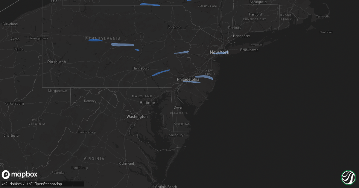
March 7 map
$229
one time, instant access
Download today. No call, no setup
Keep the $229
Bought the map and want the full workflow? Apply the entire $229 to a subscription within 7 days. None of it is wasted.
Every map, not just this one
This buys you this map. Subscription and you get every map we run, in the markets you choose from a few cities to whole states to nationwide. Plus real-time alerts the moment a storm fires.
Contact data
Name, contact info, occupancy, even credit band for addresses in the footprint. You go from where it hit to who to call.
Become the source they trust
Unlimited branding weather history reports on demand. You already have the documented answer ready for the property owner, and you are the one who showed up with it.
Property data and RoofTrace estimates
Pull up any address you have got, its value and the exact code rules for that jurisdiction, straight from One Click Code. Then RoofTrace estimates the squares, pitch, and roof value, priced the way you price.
Storm reports in North Carolina
North Carolina
| Date | Description |
|---|---|
| 03/07/20223:15 AM CST | At 914 PM EST, a severe thunderstorm was located 10 miles east of Louisburg, moving east at 40 mph. HAZARD...60 mph wind gusts. SOURCE...Radar indicated. IMPACT...Expect damage to roofs, siding, and trees. Locations impacted include... Rocky Mount, Halifax, Scotland Neck, Dortches, Red Oak, Enfield, Whitakers, Hobgood, Castalia and Centerville. |
| 03/07/20222:36 AM CST | At 836 PM EST, a severe thunderstorm was located near Creedmoor, moving east at 50 mph. HAZARD...60 mph wind gusts. SOURCE...Radar indicated. IMPACT...Expect damage to roofs, siding, and trees. Locations impacted include... Henderson, Oxford, Creedmoor, Louisburg, Butner, Franklinton, Kittrell, Stem, Centerville and Ingleside. |
| 03/06/20229:18 PM CST | Large oak tree down along nc-581. Location estimated by radar. |
| 03/06/20228:18 PM CST | Corrects previous tstm wnd dmg report from 6 nnw spring hope. Large oak tree down along nc-581. Location estimated by radar. |
| 03/06/20227:55 PM CST | Tree down on cedar creek rd... Blocking road. |
| 03/06/20227:45 PM CST | Powerlines and power poles down on hayes road in creedmoor. |
| 03/06/20227:41 PM CST | Tree down near butner... Nc. |
All States Impacted by Hail Map on March 7, 2022
Cities Impacted by Hail Map on March 7, 2022
- Laurelton, PA
- Centre Hall, PA
- Milesburg, PA
- Julian, PA
- Fleming, PA
- Spring Mills, PA
- Philipsburg, PA
- Madisonburg, PA
- Bellefonte, PA
- Aaronsburg, PA
- Coburn, PA
- Rebersburg, PA
- Millmont, PA
- Howard, PA
- Millheim, PA
- Woodward, PA
- Woodland, PA
- Troutville, PA
- Du Bois, PA
- Grampian, PA
- Luthersburg, PA
- Clearfield, PA
- Rockton, PA
- Curwensville, PA
- Middleburg, PA
- Freeburg, PA
- Schnecksville, PA
- Allentown, PA
- Stewartsville, NJ
- Northampton, PA
- Whitehall, PA
- Easton, PA
- Phillipsburg, NJ
- Bath, PA
- Bethlehem, PA
- Nazareth, PA
- Coplay, PA
- Columbia, PA
- Lititz, PA
- Terre Hill, PA
- Narvon, PA
- Morgantown, PA
- Mohnton, PA
- Ephrata, PA
- Stevens, PA
- Birdsboro, PA
- Lancaster, PA
- Landisville, PA
- East Petersburg, PA
- East Earl, PA
- New Holland, PA
- Elverson, PA
- Leola, PA
- Brownstown, PA
- Akron, PA
- Manheim, PA
- Bird In Hand, PA
- Mountville, PA
- Denver, PA
- Crum Lynne, PA
- Haddonfield, NJ
- Philadelphia, PA
- Folcroft, PA
- Audubon, NJ
- Sharon Hill, PA
- Vincentown, NJ
- Folsom, PA
- Magnolia, NJ
- Glenolden, PA
- Swarthmore, PA
- Ridley Park, PA
- Medford, NJ
- Marlton, NJ
- Norwood, PA
- Gloucester City, NJ
- Thorofare, NJ
- Prospect Park, PA
- Voorhees, NJ
- Lawnside, NJ
- Westville, NJ
- Essington, PA
- Haddon Heights, NJ
- National Park, NJ
- Bellmawr, NJ
- Holmes, PA
- Mount Ephraim, NJ
- Cherry Hill, NJ
- Barrington, NJ
- Rancocas, NJ
- Lakehurst, NJ
- Manchester Township, NJ
- Burlington, NJ
- Willingboro, NJ
- Jobstown, NJ
- Toms River, NJ
- Mount Holly, NJ
- Wrightstown, NJ
- Bordentown, NJ
- Pemberton, NJ
- Cookstown, NJ
- Joint Base Mdl, NJ
- New Egypt, NJ
- Columbus, NJ
- Rome, PA
- Pine City, NY
- Barton, NY
- Apalachin, NY
- Little Meadows, PA
- Owego, NY
- Elmira, NY
- Waverly, NY
- Wellsburg, NY
- Chemung, NY
- Sayre, PA
- Nichols, NY
- Lowman, NY
- Johnson City, NY
- Binghamton, NY
- Port Crane, NY
- Castle Creek, NY
- Sidney, NY
- Unadilla, NY
- Greene, NY
- Bainbridge, NY
- Walton, NY
- Downsville, NY
- East Berne, NY
- Schoharie, NY
- Voorheesville, NY
- Howes Cave, NY
- Central Bridge, NY
- Altamont, NY
- Cobleskill, NY
- Delanson, NY
- Sloansville, NY
- Berne, NY
- Middleburgh, NY
- Clarksville, NY
- Selkirk, NY
- Ravena, NY
- Coeymans Hollow, NY
- Feura Bush, NY
- Westerlo, NY
- Jefferson, NY
- East Meredith, NY
- Davenport Center, NY
- West Davenport, NY
- Oneonta, NY
- Davenport, NY
- Bennington, VT
- North Bennington, VT
- Eagle Bridge, NY
- Buskirk, NY
- Hoosick Falls, NY
- New Lebanon, NY
- East Nassau, NY
- Dalton, MA
- Pittsfield, MA
- Canaan, NY
- Brainard, NY
- Hinsdale, MA
- East Chatham, NY
- Becket, MA
- Stephentown, NY
- Lenox, MA
- Nassau, NY
- Hollis, NY
- South Richmond Hill, NY
- Woodhaven, NY
- Cambria Heights, NY
- Garden City, NY
- Saint Albans, NY
- Hillside, NJ
- Newark, NJ
- Springfield Gardens, NY
- Elizabeth, NJ
- New York, NY
- Elizabethport, NJ
- New Hyde Park, NY
- Valley Stream, NY
- Ozone Park, NY
- West Hempstead, NY
- Jamaica, NY
- South Ozone Park, NY
- Elmont, NY
- Rosedale, NY
- Richmond Hill, NY
- Brooklyn, NY
- Middle Village, NY
- Hempstead, NY
- Bellerose, NY
- Bayonne, NJ
- Franklin Square, NY
- Howard Beach, NY
- Ridgewood, NY
- Forest Hills, NY
- Kew Gardens, NY
- Queens Village, NY
- Jersey City, NJ
- Floral Park, NY
- Warren, MA
- Holyoke, MA
- Easthampton, MA
- Belchertown, MA
- Palmer, MA
- Brookfield, MA
- Granby, MA
- Ware, MA
- South Hadley, MA
- West Warren, MA
- Southampton, MA
- Ludlow, MA
- Bondsville, MA
- West Brookfield, MA
- Stem, NC
- Oxford, NC
- Castalia, NC
- Louisburg, NC
- Butner, NC
- Creedmoor, NC
- Kittrell, NC
- Franklinton, NC


