Hail Map in Massachusetts on March 7, 2022
Get this storm
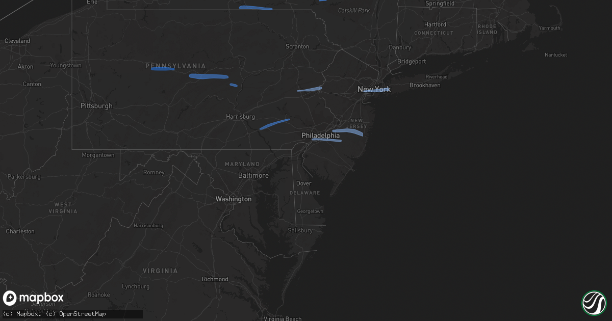
March 7 map
$229
one time, instant access
Download today. No call, no setup
Keep the $229
Bought the map and want the full workflow? Apply the entire $229 to a subscription within 7 days. None of it is wasted.
Every map, not just this one
This buys you this map. Subscription and you get every map we run, in the markets you choose from a few cities to whole states to nationwide. Plus real-time alerts the moment a storm fires.
Contact data
Name, contact info, occupancy, even credit band for addresses in the footprint. You go from where it hit to who to call.
Become the source they trust
Unlimited branding weather history reports on demand. You already have the documented answer ready for the property owner, and you are the one who showed up with it.
Property data and RoofTrace estimates
Pull up any address you have got, its value and the exact code rules for that jurisdiction, straight from One Click Code. Then RoofTrace estimates the squares, pitch, and roof value, priced the way you price.
Storm reports in Massachusetts
Massachusetts
| Date | Description |
|---|---|
| 03/07/20223:57 AM CST | At 957 PM EST, severe thunderstorms were located along a line extending from near Goffstown to Amherst to near Greenville, moving east at 60 mph. HAZARD...60 mph wind gusts. SOURCE...Radar indicated. IMPACT...Expect damage to roofs, siding, and trees. Locations impacted include... Manchester, Nashua, Derry, Portsmouth, Hampton, Durham, Exeter, Merrimack, Salem, Dover, Bedford, Hooksett, Amherst, Litchfield, Hollis, Epping, Brentwood, Greenland, Newington and Seabrook. |
| 03/07/20223:35 AM CST | At 934 PM EST, severe thunderstorms were located along a line extending from Hartland to near Brookfield, moving east at 60 mph. HAZARD...60 mph wind gusts. SOURCE...Radar indicated. IMPACT...Expect damage to trees and power lines. Locations impacted include... Hartford, New Britain, West Hartford, Bristol, Manchester, East Hartford, Enfield, Southington, Glastonbury, Newington, Vernon, Windsor, Agawam, Wethersfield, Mansfield, South Windsor, Farmington, Windham, Simsbury and Bloomfield. |
| 03/07/20223:31 AM CST | At 930 PM EST, severe thunderstorms were located along a line extending from near Tolland to Litchfield to New Fairfield, moving east at 65 mph. HAZARD...60 mph wind gusts. SOURCE...Radar indicated. IMPACT...Expect damage to roofs, siding, and trees. Severe thunderstorms will be near... Thomaston around 935 PM EST. Northwest Harwinton and Terryville around 940 PM EST. Wolcott and Woodbury Center around 945 PM EST. Oakville around 950 PM EST.Other locations impacted by these severe thunderstorms include WestTorrington, Haight Vineyard, Wrightville, Marble Dale, EastLitchfield, Plymouth Green, Delano Field, Dempsey Landing, LitchfieldGreen and Hatch Four Corners. |
| 03/07/20222:41 AM CST | At 841 PM EST, severe thunderstorms were located along a line extending from near Valatie to near Kerhonkson, moving east at 55 mph. HAZARD...60 mph wind gusts. SOURCE...Radar indicated. IMPACT...Expect damage to roofs, siding, and trees. Severe thunderstorms will be near... Chatham and Valatie around 845 PM EST. Austerlitz around 850 PM EST. Hyde Park, Highland and New Lebanon around 855 PM EST. Poughkeepsie, Lenox, Fairview and Red Oaks Mill around 900 PM EST. Pittsfield, Pleasant Valley and Lee around 905 PM EST. Becket and Millbrook around 910 PM EST. Dover Plains around 915 PM EST. Sherman, Kent, Middlefield, Gaylordsville and Wingdale around 920 PM EST.Other locations impacted by these severe thunderstorms include NorrieHeights, Lithgow, Hoxie Corner, South Amenia, Pleasant Ridge, JacksonCorners, Verbank, Bulls Bridge, Niverville and Dempsey Landing. |
| 03/07/20222:30 AM CST | At 829 PM EST, severe thunderstorms were located along a line extending from Wyantskill to Ravena, moving east at 70 mph. HAZARD...60 mph wind gusts. SOURCE...Radar indicated. IMPACT...Expect damage to roofs, siding, and trees. Severe thunderstorms will be near... West Sand Lake and Averill Park around 835 PM EST. Nassau and Grafton around 840 PM EST. Stephentown and Berlin around 845 PM EST. Williamstown, Pownal and Hancock around 850 PM EST. North Adams, Adams and New Ashford around 855 PM EST. Cheshire, Stamford and Florida around 900 PM EST. Monroe, Readsboro and Savoy around 905 PM EST.Other locations impacted by these severe thunderstorms includeBrookview, Van Hoesen Station, Albia, North Hancock, Readsboro Falls,Cheshire Harbor, Millers Corners, South Schodack, Zylonite and Best. |
| 03/07/20222:27 AM CST | At 826 PM EST, a severe thunderstorm was located over Hoosick Falls, moving east at 55 mph. HAZARD...60 mph wind gusts. SOURCE...Radar indicated. IMPACT...Expect damage to roofs, siding, and trees. Locations impacted include... Troy, Bennington, North Adams, Hoosick Falls, Arlington, Stratton, Williamstown, Shaftsbury, Pownal, Green Island, Grafton, Berlin, Cambridge, Stamford, New Ashford, Center Brunswick, Wyantskill, Wynantskill, West Wardsboro and Brunswick. |
| 03/06/20229:54 PM CST | Tree and wires down on lincoln street. |
| 03/06/20229:40 PM CST | Tree down on a car on endicott street. |
| 03/06/20229:37 PM CST | Trees down on high street and shawsheen square. |
| 03/06/20229:35 PM CST | Limbs and wires down on main street at the north beverly line. |
| 03/06/20229:30 PM CST | Large treen branch down on a house on knollwood road. |
| 03/06/20229:27 PM CST | Large tree down blocking road on b street. |
| 03/06/20229:26 PM CST | Tree down on house on warwick street. |
| 03/06/20229:18 PM CST | Trees down on shaker lane and foster street. |
| 03/06/20229:16 PM CST | Tree down on a house on mashapaug rd. |
| 03/06/20229:13 PM CST | A local report indicates 59 MPH wind near LEICESTER |
| 03/06/20229:13 PM CST | Large tree and wires down on woodside road. |
| 03/06/20229:11 PM CST | Tree down halfway across the road on beaver brook road. |
| 03/06/20229:03 PM CST | Large tree down on house on riverbank terrace. |
| 03/06/20228:50 PM CST | Tree down on millers falls road |
| 03/06/20228:47 PM CST | Tree down on car on main street |
| 03/06/20228:47 PM CST | Wires down on beacon ave |
| 03/06/20228:45 PM CST | Power lines down across rte 68 |
| 03/06/20228:40 PM CST | Tree down on a car on goodale street. Tree branch broke through the windshield of the car. |
| 03/06/20228:39 PM CST | Large down across rte 2 |
| 03/06/20228:30 PM CST | Tree down on rte 2 |
| 03/06/20228:30 PM CST | Tree down on brookside ave |
| 03/06/20228:20 PM CST | Downed tree reports began in salisbury connecticut starting around 920 pm with a line of heavy showers. |
| 03/06/20228:10 PM CST | Wires and pole down on jones corner road |
| 03/06/20228:10 PM CST | Large limb down on main street |
| 03/06/20228:05 PM CST | Trees down blocking rte 7 |
| 03/06/20228:04 PM CST | Tree on house on main street |
| 03/06/20228:01 PM CST | Utility pole down on interlaken rd |
| 03/06/20228:01 PM CST | A local report indicates 65 MPH wind near PITTSFIELD MUNICIPAL AP |
| 03/06/20228:00 PM CST | Tree down on richard dr |
| 03/06/20227:59 PM CST | Tree down on wires on stockbridge rd |
| 03/06/20227:59 PM CST | Public reports wind broke two trees in their yard as the line of thunderstorms moved through |
| 03/06/20227:59 PM CST | Large branch down blocking old windsor rd |
| 03/06/20227:54 PM CST | Wires down |
| 03/06/20227:50 PM CST | Two broken trees |
| 03/06/20227:47 PM CST | Tree down on wires on rte 43 |
All States Impacted by Hail Map on March 7, 2022
Cities Impacted by Hail Map on March 7, 2022
- Laurelton, PA
- Centre Hall, PA
- Milesburg, PA
- Julian, PA
- Fleming, PA
- Spring Mills, PA
- Philipsburg, PA
- Madisonburg, PA
- Bellefonte, PA
- Aaronsburg, PA
- Coburn, PA
- Rebersburg, PA
- Millmont, PA
- Howard, PA
- Millheim, PA
- Woodward, PA
- Woodland, PA
- Troutville, PA
- Du Bois, PA
- Grampian, PA
- Luthersburg, PA
- Clearfield, PA
- Rockton, PA
- Curwensville, PA
- Middleburg, PA
- Freeburg, PA
- Schnecksville, PA
- Allentown, PA
- Stewartsville, NJ
- Northampton, PA
- Whitehall, PA
- Easton, PA
- Phillipsburg, NJ
- Bath, PA
- Bethlehem, PA
- Nazareth, PA
- Coplay, PA
- Columbia, PA
- Lititz, PA
- Terre Hill, PA
- Narvon, PA
- Morgantown, PA
- Mohnton, PA
- Ephrata, PA
- Stevens, PA
- Birdsboro, PA
- Lancaster, PA
- Landisville, PA
- East Petersburg, PA
- East Earl, PA
- New Holland, PA
- Elverson, PA
- Leola, PA
- Brownstown, PA
- Akron, PA
- Manheim, PA
- Bird In Hand, PA
- Mountville, PA
- Denver, PA
- Crum Lynne, PA
- Haddonfield, NJ
- Philadelphia, PA
- Folcroft, PA
- Audubon, NJ
- Sharon Hill, PA
- Vincentown, NJ
- Folsom, PA
- Magnolia, NJ
- Glenolden, PA
- Swarthmore, PA
- Ridley Park, PA
- Medford, NJ
- Marlton, NJ
- Norwood, PA
- Gloucester City, NJ
- Thorofare, NJ
- Prospect Park, PA
- Voorhees, NJ
- Lawnside, NJ
- Westville, NJ
- Essington, PA
- Haddon Heights, NJ
- National Park, NJ
- Bellmawr, NJ
- Holmes, PA
- Mount Ephraim, NJ
- Cherry Hill, NJ
- Barrington, NJ
- Rancocas, NJ
- Lakehurst, NJ
- Manchester Township, NJ
- Burlington, NJ
- Willingboro, NJ
- Jobstown, NJ
- Toms River, NJ
- Mount Holly, NJ
- Wrightstown, NJ
- Bordentown, NJ
- Pemberton, NJ
- Cookstown, NJ
- Joint Base Mdl, NJ
- New Egypt, NJ
- Columbus, NJ
- Rome, PA
- Pine City, NY
- Barton, NY
- Apalachin, NY
- Little Meadows, PA
- Owego, NY
- Elmira, NY
- Waverly, NY
- Wellsburg, NY
- Chemung, NY
- Sayre, PA
- Nichols, NY
- Lowman, NY
- Johnson City, NY
- Binghamton, NY
- Port Crane, NY
- Castle Creek, NY
- Sidney, NY
- Unadilla, NY
- Greene, NY
- Bainbridge, NY
- Walton, NY
- Downsville, NY
- East Berne, NY
- Schoharie, NY
- Voorheesville, NY
- Howes Cave, NY
- Central Bridge, NY
- Altamont, NY
- Cobleskill, NY
- Delanson, NY
- Sloansville, NY
- Berne, NY
- Middleburgh, NY
- Clarksville, NY
- Selkirk, NY
- Ravena, NY
- Coeymans Hollow, NY
- Feura Bush, NY
- Westerlo, NY
- Jefferson, NY
- East Meredith, NY
- Davenport Center, NY
- West Davenport, NY
- Oneonta, NY
- Davenport, NY
- Bennington, VT
- North Bennington, VT
- Eagle Bridge, NY
- Buskirk, NY
- Hoosick Falls, NY
- New Lebanon, NY
- East Nassau, NY
- Dalton, MA
- Pittsfield, MA
- Canaan, NY
- Brainard, NY
- Hinsdale, MA
- East Chatham, NY
- Becket, MA
- Stephentown, NY
- Lenox, MA
- Nassau, NY
- Hollis, NY
- South Richmond Hill, NY
- Woodhaven, NY
- Cambria Heights, NY
- Garden City, NY
- Saint Albans, NY
- Hillside, NJ
- Newark, NJ
- Springfield Gardens, NY
- Elizabeth, NJ
- New York, NY
- Elizabethport, NJ
- New Hyde Park, NY
- Valley Stream, NY
- Ozone Park, NY
- West Hempstead, NY
- Jamaica, NY
- South Ozone Park, NY
- Elmont, NY
- Rosedale, NY
- Richmond Hill, NY
- Brooklyn, NY
- Middle Village, NY
- Hempstead, NY
- Bellerose, NY
- Bayonne, NJ
- Franklin Square, NY
- Howard Beach, NY
- Ridgewood, NY
- Forest Hills, NY
- Kew Gardens, NY
- Queens Village, NY
- Jersey City, NJ
- Floral Park, NY
- Warren, MA
- Holyoke, MA
- Easthampton, MA
- Belchertown, MA
- Palmer, MA
- Brookfield, MA
- Granby, MA
- Ware, MA
- South Hadley, MA
- West Warren, MA
- Southampton, MA
- Ludlow, MA
- Bondsville, MA
- West Brookfield, MA
- Stem, NC
- Oxford, NC
- Castalia, NC
- Louisburg, NC
- Butner, NC
- Creedmoor, NC
- Kittrell, NC
- Franklinton, NC


