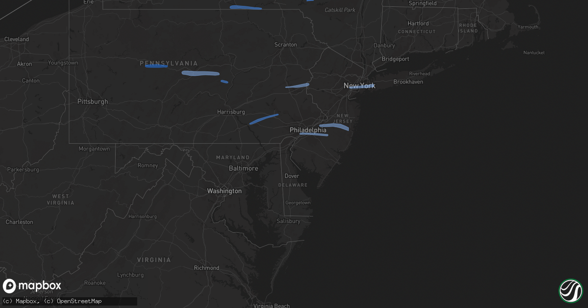
Hail Map in Pennsylvania on March 7, 2022
Get this storm
March 7 map
$229
one time, instant access
Download today. No call, no setup
Keep the $229
Bought the map and want the full workflow? Apply the entire $229 to a subscription within 7 days. None of it is wasted.
Every map, not just this one
This buys you this map. Subscription and you get every map we run, in the markets you choose from a few cities to whole states to nationwide. Plus real-time alerts the moment a storm fires.
Contact data
Name, contact info, occupancy, even credit band for addresses in the footprint. You go from where it hit to who to call.
Become the source they trust
Unlimited branding weather history reports on demand. You already have the documented answer ready for the property owner, and you are the one who showed up with it.
Property data and RoofTrace estimates
Pull up any address you have got, its value and the exact code rules for that jurisdiction, straight from One Click Code. Then RoofTrace estimates the squares, pitch, and roof value, priced the way you price.
Storm reports in Pennsylvania
Pennsylvania
| Date | Description |
|---|---|
| 03/07/20225:57 PM CST | Trees down blocking roadway. |
| 03/07/20225:52 PM CST | Multiple reports of trees and wires down in eastern lycoming county. |
| 03/07/20225:50 PM CST | Multiple trees down in the area. |
| 03/07/20225:40 PM CST | Numerous trees and wires down along middle road. |
| 03/07/20225:38 PM CST | Trees and wires down near intersection of blue bird road and milan road. |
| 03/07/20225:35 PM CST | Trees down oak hill road. |
| 03/07/20225:30 PM CST | Multiple reports of trees and wires down in central lycoming county. |
| 03/07/20225:30 PM CST | Trees down on wires on blue mountain road. |
| 03/07/20225:30 PM CST | Trees down on wires on route 414/east main street. Power out in the area. |
| 03/07/20225:29 PM CST | Multiple reports of trees down in orbisonia along croghan pike. |
| 03/07/20225:15 PM CST | Numerous reports of trees and wires down in western lycoming county. |
| 03/07/20225:10 PM CST | Trees and wires down along route 6. |
| 03/07/20225:05 PM CST | Wires down on a car. |
| 03/07/20225:05 PM CST | Trees down on wires along creek road. |
| 03/07/20225:05 PM CST | Trees and wires down along brush valley road. |
| 03/07/20225:00 PM CST | Multiple reports of wires down on raystown road and woodbury pike in hopewell township... Bedford county. Passed along by pema. |
| 03/07/20224:56 PM CST | Trees down on wires om east high street. |
| 03/07/20224:56 PM CST | Trees and wires down on a pick up truck on linn street. |
| 03/07/20224:55 PM CST | Trees down on wires along water street. |
| 03/07/20224:53 PM CST | Trees and wires down. |
| 03/07/20224:42 PM CST | Multiple trees down on charger highway near the greendown acres trailer park. |
| 03/07/20224:40 PM CST | Tress down on wires on kettle street. |
| 03/07/20224:40 PM CST | Tress down on wires on wayne blvd. |
| 03/07/20224:38 PM CST | Tree down at intersection of lower skelp rd and e pleasant valley blvd. |
| 03/07/20224:35 PM CST | Trees down on wires on phoenix road. |
| 03/07/20224:30 PM CST | Trees down on wires on dungarvin road. |
| 03/07/20224:30 PM CST | Trees and power poles down along route 350. |
| 03/07/20224:14 PM CST | Kfig airport asos 61 knot wind gust. |
| 03/07/20224:10 PM CST | Corrects previous tstm wnd dmg report from boswel for timel. Trees and wires down on center street. |
| 03/07/20224:05 PM CST | Large tree across route 153 at moose grade road. |
| 03/07/20224:05 PM CST | Trees down on wires on trolls lake road. |
| 03/07/20223:55 PM CST | Numerous trees down in the latrobe area. |
| 03/07/20223:55 PM CST | Numerous trees down in the greensburg area. |
| 03/07/20223:51 PM CST | Trees and wires down along evergreen road and shamokin trail. |
| 03/07/20223:50 PM CST | Trees and wires down on thunderbird road. |
| 03/07/20223:45 PM CST | Tree down on bethel church road |
| 03/07/20223:42 PM CST | Tree down on moween road |
| 03/07/20223:40 PM CST | Wind damage to trees and farm buildings along mahoning rd. |
| 03/07/20223:40 PM CST | Damage to a home on division avenue. Time estimated on radar. |
| 03/07/20223:40 PM CST | Trees and wires down route 30 |
| 03/07/20223:38 PM CST | Tree down on route 356 |
| 03/07/20223:35 PM CST | Trees and wires down on menk road |
| 03/07/20223:35 PM CST | Tree down on tyrol boulevard |
| 03/07/20223:15 PM CST | Trees and wires down on new texas rd / lindsey ln. |
| 03/07/20223:10 PM CST | Trees and wires down on center street. |
| 03/07/20223:07 PM CST | Partial church roof collapse. |
| 03/07/20223:05 PM CST | Numerous trees and powerlines down across the city. |
| 03/07/20223:05 PM CST | Partial building collapse on 800 block of penn ave. |
| 03/07/20223:00 PM CST | Downed trees. |
| 03/07/20223:00 PM CST | High voltage lines down at melwood/jewell and melwood/herron. |
| 03/07/20222:40 PM CST | Trees uprooted. Widespread wind damage. |
| 03/07/20222:13 AM CST | At 812 PM EST, severe thunderstorms were located along a line extending from near Willowemoc to near Skytop, moving northeast at 60 mph. HAZARD...60 mph wind gusts. SOURCE...Radar indicated. IMPACT...Expect damage to roofs, siding, and trees. Locations impacted include... Fallsburg, Bushkill, Monticello, Lackawaxen, Liberty, Bethel, Neversink, South Fallsburg, Shohola and Matamoras. |
| 03/07/20222:00 AM CST | At 759 PM EST, severe thunderstorms were located along a line extending from near Downsville to near Prompton to Beltzville State Park to near Bernville to near Manheim, moving east at 60 mph. HAZARD...60 mph wind gusts. SOURCE...Radar indicated. IMPACT...Expect damage to trees and power lines. Severe thunderstorms will be near... Cuddebackville around 835 PM EST. Otisville around 840 PM EST. Middletown and Howells around 845 PM EST. Walden and Montgomery around 855 PM EST. Pompton Lakes and Bloomingdale around 900 PM EST. |
| 03/07/20221:44 AM CST | At 744 PM EST, a severe thunderstorm was located over Forest City, or near Carbondale, moving east at 70 mph. HAZARD...70 mph wind gusts. SOURCE...Radar indicated. IMPACT...Expect considerable tree damage. Damage is likely to mobile homes, roofs, and outbuildings. Locations impacted include... Carbondale, Honesdale, Bethel, Damascus, Callicoon, Forest City, Tusten, Cochecton, Waymart and Vandling. |
| 03/07/20221:00 AM CST | At 700 PM EST, severe thunderstorms were located along a line extending from Meiserville to Plainfield, moving east at 55 mph. HAZARD...60 mph wind gusts. SOURCE...Radar indicated. IMPACT...Expect damage to roofs, siding, and trees. Locations impacted include... Harrisburg, Lebanon, Carlisle, Lower Allen, Pottsville, Hershey, Berwick, Mechanicsburg, Camp Hill, Shamokin, Palmyra, New Cumberland, Tamaqua, Linglestown, Enola, Schuylkill Haven, Shenandoah, Lemoyne, Myerstown and St. Clair.For those driving on Interstate 80, this includes areas between theMifflinville and Nescopek exits, specifically from mile markers 244to 247.This includes the following Interstates... The Pennsylvania Turnpike from mile markers 208 to 231. Interstate 78 from mile markers 0 to 8. Interstate 81 from mile markers 49 to 139. Interstate 83 from mile markers 41 to 50. Interstate 283 near mile marker 2. |
| 03/07/202212:44 AM CST | At 643 PM EST, severe thunderstorms were located along a line extending from Le Roy to Mooresburg to Perulack, moving east at 55 mph. HAZARD...60 mph wind gusts. SOURCE...Radar indicated. IMPACT...Expect damage to roofs, siding, and trees. Locations impacted include... Bloomsburg, Berwick, Sunbury, Shamokin, Milton, Lewisburg, Selinsgrove, Danville, Montoursville, Laporte, Mount Carmel, Northumberland, Winfield, Kulpmont, Muncy, Watsontown, Elysburg, Fairview-Ferndale, Hughesville and Riverside.For those driving on Interstate 80, this includes areas between theMile Run and Nescopek exits, specifically from mile markers 206 to247.This includes Interstate 180 from mile markers 1 to 21. |
| 03/07/202212:10 AM CST | At 609 PM EST, severe thunderstorms were located along a line extending from Whipple Dam State Park to Raystown Dam, moving east at 55 mph. HAZARD...60 mph wind gusts. SOURCE...Trained weather spotters. IMPACT...Expect damage to roofs, siding, and trees. Locations impacted include... Lewistown, Huntingdon, Selinsgrove, Newport, Mifflintown, Mount Union, Burnham, Belleville, Shamokin Dam, Duncannon, Milroy, Highland Park, Hummels Wharf, Middleburg, Honey Grove, New Bloomfield, Mcalisterville, McClure, Port Royal and Spruce Hill. |
| 03/06/202210:28 PM CST | At 428 PM EST, severe rated winds were located along a line extending from near Leechburg to Fredericktown-Millsboro, moving east at 55 mph. HAZARD...60 mph wind gusts. SOURCE...Radar indicated. IMPACT...Expect damage to trees and power lines, resulting in some power outages. Locations impacted include... Monroeville, Greensburg, McKeesport, Indiana, Uniontown, Jeannette, Latrobe, Connellsville, Vandergrift, Homer City, Apollo, and Plum. |
| 03/06/20228:25 PM CST | A local report indicates 67 MPH wind near PHILADELPHIA INTERNATIO |
| 03/06/20228:22 PM CST | Measured on a personal anemometer. |
| 03/06/20228:20 PM CST | Several trees and wires down across lower bucks county. Times estimated from radar. |
| 03/06/20228:20 PM CST | Part of roof siding torn off. |
| 03/06/20228:03 PM CST | Report of straight line wind damage to trees and shrubbery in the middletown... Edgemont... And thornbury areas. Trees blown over in the same direction and a few limbs |
| 03/06/20227:45 PM CST | Wires down on marienstein road. |
| 03/06/20227:43 PM CST | Tree reported down in limerick... Pa. |
| 03/06/20227:38 PM CST | Social media photo of an uprooted healthy tree in coatesville. Time estimated from radar. |
| 03/06/20227:35 PM CST | Numerous trees down in westfall township. |
| 03/06/20227:32 PM CST | Numerous trees down in milford area. |
| 03/06/20227:31 PM CST | Trees down on mill street in boyertown. Report via social media. |
| 03/06/20227:30 PM CST | Downed tree; tree knocked over full size metal basketball hoop stand. |
| 03/06/20227:30 PM CST | Trees and wires down. |
| 03/06/20227:26 PM CST | Power knocked out. |
| 03/06/20227:14 PM CST | Wires down near voganville rd & amishtown rd. |
| 03/06/20227:06 PM CST | 1 inch tree limbs broken; shingles blown off. |
| 03/06/20227:05 PM CST | Reported at klns. |
| 03/06/20227:02 PM CST | Numeroius trees down. |
| 03/06/20227:00 PM CST | Trees and wire down in middletown and areas to the east. |
| 03/06/20226:58 PM CST | Multiple reports of utility wires down in manheim township. |
| 03/06/20226:58 PM CST | Measured by the southern pennsylvania amateur radio club weather station. |
| 03/06/20226:43 PM CST | Multiple reports of trees and wires down in the eastern part of the county. |
| 03/06/20226:40 PM CST | Report of wires down at the intersection on hepplewhite drive and timberlane drive in manchester township. |
| 03/06/20226:36 PM CST | Numerous trees down in hazleton area. |
| 03/06/20226:34 PM CST | Multiple reports of trees and wires down throughout the central part of the county. |
| 03/06/20226:34 PM CST | Numerous trees down in mountain top area. |
| 03/06/20226:32 PM CST | Multiple reports of trees and wires down in lower paxton township. |
| 03/06/20226:26 PM CST | Numerous trees down in back mountain area. |
| 03/06/20226:26 PM CST | Numerous trees down in dallas area. |
| 03/06/20226:24 PM CST | Numerous trees down in hunlock creek area. |
| 03/06/20226:23 PM CST | Tree down on a house in nw new cumberland. |
| 03/06/20226:20 PM CST | Numerous reports of trees and wires down in the western part of the county. |
| 03/06/20226:19 PM CST | Report of a tree down on new valley rd in rye township. |
| 03/06/20226:17 PM CST | Numerous trees down in huntington mills area. |
| 03/06/20226:15 PM CST | Numerous trees down in sweet valley area. |
| 03/06/20226:13 PM CST | Numerous trees down in shickshinny area. |
| 03/06/20226:05 PM CST | Multiple reports of trees and wires down from catawissa to numidia. |
| 03/06/20226:00 PM CST | Multiple reports of trees down in bucks valley. |
All States Impacted by Hail Map on March 7, 2022
Cities Impacted by Hail Map on March 7, 2022
- Laurelton, PA
- Centre Hall, PA
- Milesburg, PA
- Julian, PA
- Fleming, PA
- Spring Mills, PA
- Philipsburg, PA
- Madisonburg, PA
- Bellefonte, PA
- Aaronsburg, PA
- Coburn, PA
- Rebersburg, PA
- Millmont, PA
- Howard, PA
- Millheim, PA
- Woodward, PA
- Woodland, PA
- Troutville, PA
- Du Bois, PA
- Grampian, PA
- Luthersburg, PA
- Clearfield, PA
- Rockton, PA
- Curwensville, PA
- Middleburg, PA
- Freeburg, PA
- Schnecksville, PA
- Allentown, PA
- Stewartsville, NJ
- Northampton, PA
- Whitehall, PA
- Easton, PA
- Phillipsburg, NJ
- Bath, PA
- Bethlehem, PA
- Nazareth, PA
- Coplay, PA
- Columbia, PA
- Lititz, PA
- Terre Hill, PA
- Narvon, PA
- Morgantown, PA
- Mohnton, PA
- Ephrata, PA
- Stevens, PA
- Birdsboro, PA
- Lancaster, PA
- Landisville, PA
- East Petersburg, PA
- East Earl, PA
- New Holland, PA
- Elverson, PA
- Leola, PA
- Brownstown, PA
- Akron, PA
- Manheim, PA
- Bird In Hand, PA
- Mountville, PA
- Denver, PA
- Crum Lynne, PA
- Haddonfield, NJ
- Philadelphia, PA
- Folcroft, PA
- Audubon, NJ
- Sharon Hill, PA
- Vincentown, NJ
- Folsom, PA
- Magnolia, NJ
- Glenolden, PA
- Swarthmore, PA
- Ridley Park, PA
- Medford, NJ
- Marlton, NJ
- Norwood, PA
- Gloucester City, NJ
- Thorofare, NJ
- Prospect Park, PA
- Voorhees, NJ
- Lawnside, NJ
- Westville, NJ
- Essington, PA
- Haddon Heights, NJ
- National Park, NJ
- Bellmawr, NJ
- Holmes, PA
- Mount Ephraim, NJ
- Cherry Hill, NJ
- Barrington, NJ
- Rancocas, NJ
- Lakehurst, NJ
- Manchester Township, NJ
- Burlington, NJ
- Willingboro, NJ
- Jobstown, NJ
- Toms River, NJ
- Mount Holly, NJ
- Wrightstown, NJ
- Bordentown, NJ
- Pemberton, NJ
- Cookstown, NJ
- Joint Base Mdl, NJ
- New Egypt, NJ
- Columbus, NJ
- Rome, PA
- Pine City, NY
- Barton, NY
- Apalachin, NY
- Little Meadows, PA
- Owego, NY
- Elmira, NY
- Waverly, NY
- Wellsburg, NY
- Chemung, NY
- Sayre, PA
- Nichols, NY
- Lowman, NY
- Johnson City, NY
- Binghamton, NY
- Port Crane, NY
- Castle Creek, NY
- Sidney, NY
- Unadilla, NY
- Greene, NY
- Bainbridge, NY
- Walton, NY
- Downsville, NY
- East Berne, NY
- Schoharie, NY
- Voorheesville, NY
- Howes Cave, NY
- Central Bridge, NY
- Altamont, NY
- Cobleskill, NY
- Delanson, NY
- Sloansville, NY
- Berne, NY
- Middleburgh, NY
- Clarksville, NY
- Selkirk, NY
- Ravena, NY
- Coeymans Hollow, NY
- Feura Bush, NY
- Westerlo, NY
- Jefferson, NY
- East Meredith, NY
- Davenport Center, NY
- West Davenport, NY
- Oneonta, NY
- Davenport, NY
- Bennington, VT
- North Bennington, VT
- Eagle Bridge, NY
- Buskirk, NY
- Hoosick Falls, NY
- New Lebanon, NY
- East Nassau, NY
- Dalton, MA
- Pittsfield, MA
- Canaan, NY
- Brainard, NY
- Hinsdale, MA
- East Chatham, NY
- Becket, MA
- Stephentown, NY
- Lenox, MA
- Nassau, NY
- Hollis, NY
- South Richmond Hill, NY
- Woodhaven, NY
- Cambria Heights, NY
- Garden City, NY
- Saint Albans, NY
- Hillside, NJ
- Newark, NJ
- Springfield Gardens, NY
- Elizabeth, NJ
- New York, NY
- Elizabethport, NJ
- New Hyde Park, NY
- Valley Stream, NY
- Ozone Park, NY
- West Hempstead, NY
- Jamaica, NY
- South Ozone Park, NY
- Elmont, NY
- Rosedale, NY
- Richmond Hill, NY
- Brooklyn, NY
- Middle Village, NY
- Hempstead, NY
- Bellerose, NY
- Bayonne, NJ
- Franklin Square, NY
- Howard Beach, NY
- Ridgewood, NY
- Forest Hills, NY
- Kew Gardens, NY
- Queens Village, NY
- Jersey City, NJ
- Floral Park, NY
- Warren, MA
- Holyoke, MA
- Easthampton, MA
- Belchertown, MA
- Palmer, MA
- Brookfield, MA
- Granby, MA
- Ware, MA
- South Hadley, MA
- West Warren, MA
- Southampton, MA
- Ludlow, MA
- Bondsville, MA
- West Brookfield, MA
- Stem, NC
- Oxford, NC
- Castalia, NC
- Louisburg, NC
- Butner, NC
- Creedmoor, NC
- Kittrell, NC
- Franklinton, NC


