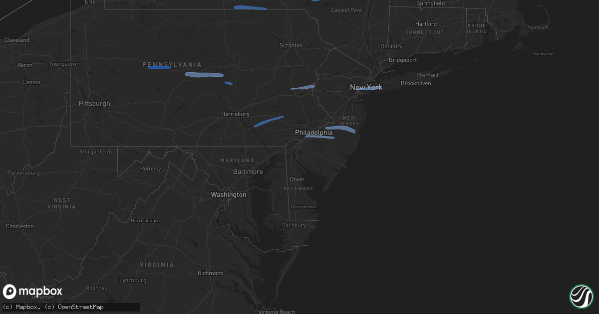
Hail Map in New York on March 7, 2022
Get this storm
March 7 map
$229
one time, instant access
Download today. No call, no setup
Keep the $229
Bought the map and want the full workflow? Apply the entire $229 to a subscription within 7 days. None of it is wasted.
Every map, not just this one
This buys you this map. Subscription and you get every map we run, in the markets you choose from a few cities to whole states to nationwide. Plus real-time alerts the moment a storm fires.
Contact data
Name, contact info, occupancy, even credit band for addresses in the footprint. You go from where it hit to who to call.
Become the source they trust
Unlimited branding weather history reports on demand. You already have the documented answer ready for the property owner, and you are the one who showed up with it.
Property data and RoofTrace estimates
Pull up any address you have got, its value and the exact code rules for that jurisdiction, straight from One Click Code. Then RoofTrace estimates the squares, pitch, and roof value, priced the way you price.
Storm reports in New York
New York
| Date | Description |
|---|---|
| 03/07/20225:57 PM CST | Multiple trees and wires down on upper stella ireland road. |
| 03/07/20225:57 PM CST | Multiple trees down. |
| 03/07/20225:53 PM CST | Large pine tree down. |
| 03/07/20225:51 PM CST | Numerous trees down. |
| 03/07/20225:51 PM CST | Awning damage on a home. |
| 03/07/20225:48 PM CST | Tree down in road at higby rd and graffenburg rd |
| 03/07/20225:24 PM CST | Trees and wires down. |
| 03/07/20225:18 PM CST | Tree down blocking waterburg road. |
| 03/07/20225:14 PM CST | Trees down in alpine... Time estimated from radar. |
| 03/07/20225:10 PM CST | Power pole down on old ithaca rd... Time estimated from radar. |
| 03/07/20225:06 PM CST | Trees down in caton... Time estimated from radar. |
| 03/07/20225:00 PM CST | Multiple trees down in corning... Time estimated from radar. |
| 03/07/20225:00 PM CST | Tree down on moreland rd in beaver dams... Time estimated from radar. |
| 03/07/20224:57 PM CST | Trees blown down in hornby. Time estimated from radar. |
| 03/07/20224:54 PM CST | Trees down in the town of hector... Time estimated from radar. |
| 03/07/20224:54 PM CST | Trees down in hector... Time estimated from radar. |
| 03/07/20224:34 PM CST | Multiple trees down around the city of bath... Time estimated from radar. |
| 03/07/20224:17 PM CST | Multiple trees down across hornell... Time estimated from radar. |
| 03/07/20223:44 AM CST | At 944 PM EST, severe thunderstorms were located along a line extending from near Bayville to near Jamaica to near Sandy Hook, moving east at 55 mph. HAZARD...60 mph wind gusts. SOURCE...Radar indicated. IMPACT...Expect damage to trees and power lines. Severe thunderstorms will be near... Long Beach and Garden City around 950 PM EST. Levittown and Freeport around 955 PM EST. Massapequa and Farmingdale around 1000 PM EST. Brentwood and Commack around 1005 PM EST. Islip and Hauppauge around 1010 PM EST. Centereach and Ronkonkoma around 1015 PM EST. |
| 03/07/20223:01 AM CST | At 901 PM EST, a severe thunderstorm was located near Goshen, moving east at 55 mph. HAZARD...60 mph wind gusts. SOURCE...Radar indicated. IMPACT...Expect damage to trees and power lines. This severe thunderstorm will be near... Newburgh and West Point around 915 PM EST. Peekskill around 920 PM EST. Fahnestock State Park around 925 PM EST. Mahopac and Lake Carmel around 930 PM EST. Brewster around 935 PM EST. New Canaan and Ridgefield around 945 PM EST. Wilton and Weston around 950 PM EST. Monroe around 1000 PM EST. |
| 03/07/20222:59 AM CST | At 859 PM EST, severe thunderstorms were located along a line extending from Staatsburg to Plattekill, moving east at 60 mph. HAZARD...60 mph wind gusts. SOURCE...Radar indicated. IMPACT...Expect damage to roofs, siding, and trees. Locations impacted include... Wallkill, Plattekill, Highland, Modena, Marlboro, Lloyd, Oakes, Tuckers Corner, Lattintown, Highland Landing, Elting Corners, Saint Elmo, Stoneco, Clintondale, Ardonia, Sylva, Baileys Gap, Clintondale Station, Flint and Barnegat. |
| 03/07/20222:21 AM CST | At 821 PM EST, severe thunderstorms were located along a line extending from near Lanesville to near Grahamsville, moving east at 60 mph. HAZARD...60 mph wind gusts. SOURCE...Radar indicated. IMPACT...Expect damage to roofs, siding, and trees. Severe thunderstorms will be near... Phoenicia and Mount Tremper around 825 PM EST. Woodstock and West Shokan around 830 PM EST. Saugerties, Olivebridge, West Hurley, Kenneth L Wilson Campground, Saugerties South and Tillson around 835 PM EST. Kingston, Hurley, Lake Katrine and Port Ewen around 840 PM EST.Other locations impacted by these severe thunderstorms includeCherrytown, Tuckers Corner, Rolling Meadows, Maple Hill, Glenford,Atwood, Manorville, Katsbaan, Shultis Corners and Sweet Meadows. |
| 03/07/20222:07 AM CST | At 807 PM EST, severe thunderstorms were located along a line extending from near Altamont to near Livingstonville to near Margaretville, moving east at 65 mph. HAZARD...60 mph wind gusts. SOURCE...Radar indicated. IMPACT...Expect damage to roofs, siding, and trees. Severe thunderstorms will be near... Duanesburg, Altamont, Windham, Delanson and Livingstonville around 810 PM EST. Schenectady, Rotterdam, Guilderland, Voorheesville, Preston Hollow and Preston-Potter Hollow around 815 PM EST. Albany, Colonie, Delmar and Westerlo around 820 PM EST. Cohoes, Watervliet, Latham, Menands, Green Island, Loudonville and Lanesville around 825 PM EST. Hunter, Ravena and Coxsackie around 830 PM EST. New Baltimore, North-South Lake Campground and Selkirk around 835 PM EST. Catskill around 845 PM EST. Athens around 850 PM EST.Other locations impacted by these severe thunderstorms includeShakers, West Settlement, Bleecker Stadium, Clarksville, East Berne,Shoefelt Corners, North Lexington, West Berne, Huntersland andDormansville. |
| 03/07/20222:05 AM CST | At 803 PM EST, severe showers and embedded thunderstorms were located along a line extending from near Hawley to Kunkletown to Wernersville, moving east at 50 mph. This line has had a history of producing areas of wind damage. HAZARD...60 mph wind gusts. SOURCE...Radar indicated. IMPACT...Damage to roofs, siding, trees, and power lines is possible. Locations impacted include... Allentown, Reading, Easton, Morristown, Somerville, Newton, Montague, Bethlehem, Bridgewater, Pottstown, Dover, Lansdale, Madison, Hopatcong, Forks, Florham Park, Emmaus, East Hanover, Lincoln Park and Wyomissing.This includes the following highways... Pennsylvania Turnpike between mile markers 295 and 303. Northeast Extension between mile markers 26 and 57. Interstate 78 in Pennsylvania between mile markers 54 and 76. Interstate 78 in New Jersey between mile markers 0 and 37. Interstate 80 in Pennsylvania between mile markers 308 and 314. Interstate 80 in New Jersey between mile markers 0 and 47. Interstate 287 in New Jersey between mile markers 16 and 54. Interstate 176 in Pennsylvania between mile markers 1 and 11. |
| 03/07/20221:55 AM CST | At 755 PM EST, a severe thunderstorm was located near Andes, or 8 miles south of Delhi, moving east at 55 mph. HAZARD...70 mph wind gusts. SOURCE...Radar indicated. IMPACT...Expect considerable tree damage. Damage is likely to mobile homes, roofs, and outbuildings. Locations impacted include... Andes, Margaretville, Fleischmanns, Arkville, Dunraven, Wolf Hollow, Halcottsville, New Kingston and Halcott Center. |
| 03/07/20221:31 AM CST | At 731 PM EST, severe thunderstorms were located along a line extending from Franklin to Conyngham, moving east at 60 mph. HAZARD...60 mph wind gusts. SOURCE...Radar indicated. IMPACT...Expect damage to roofs, siding, and trees. Locations impacted include... Rockland, Scranton, Wilkes-Barre, Hazleton, Dunmore, Kingston, Fallsburg, Nanticoke, Plains and Carbondale. |
| 03/07/20221:23 AM CST | At 722 PM EST, a severe thunderstorm was located over Afton, or 11 miles northwest of Deposit, moving east at 60 mph. HAZARD...70 mph wind gusts. SOURCE...Radar indicated. IMPACT...Expect considerable tree damage. Damage is likely to mobile homes, roofs, and outbuildings. Locations impacted include... Sidney, Walton, Colchester, Bainbridge, Masonville, Unadilla, Afton, Franklin, Sidney Center and East Sidney. |
| 03/07/20221:22 AM CST | At 721 PM EST, severe thunderstorms were located along a line extending from near Caroga Lake to near Gilbertsville, moving east at 55 mph. HAZARD...60 mph wind gusts. SOURCE...Radar indicated. IMPACT...Expect damage to roofs, siding, and trees. Severe thunderstorms will be near... Jefferson around 755 PM EST. North Blenheim around 805 PM EST. Gilboa around 810 PM EST.Other locations impacted by these severe thunderstorms includeBeekman Corners, West Richmondville, Rockwell Corners, Huntersland,Engleville, Gardnersville, Quaker Street, Broome Center, West Fultonand Eminence. |
| 03/07/20221:12 AM CST | At 712 PM EST, severe thunderstorms were located along a line extending from near Richfield Springs to near Guilford, moving east at 60 mph. HAZARD...60 mph wind gusts. SOURCE...Radar indicated. IMPACT...Expect damage to roofs, siding, and trees. Locations impacted include... Oneonta, Davenport, Guilford, Worcester, Middlefield, Hartwick, Maryland, Cooperstown, Edmeston and Westville. |
| 03/07/202212:53 AM CST | At 652 PM EST, severe thunderstorms were located along a line extending from near Willet to New Albany, moving east at 70 mph. HAZARD...60 mph wind gusts. SOURCE...Radar indicated. IMPACT...Expect damage to roofs, siding, and trees. Locations impacted include... Scranton, Binghamton, Wilkes-Barre, Falls, Vestal, Muhlenberg, Johnson City, Endicott, Kingston and Berwick. |
| 03/07/202212:13 AM CST | At 612 PM EST, severe thunderstorms were located along a line extending from near Scott to Arnot, moving east at 50 mph. HAZARD...60 mph wind gusts. SOURCE...Radar indicated. IMPACT...Expect damage to roofs, siding, and trees. Locations impacted include... Chemung, Ithaca, Elmira, Vestal, Cortland, Endicott, Southport, Barton, Horseheads and Sayre. |
| 03/06/202211:59 PM CST | At 559 PM EST, severe thunderstorms were located along a line extending from South Corning to Blanchard to Williamsburg, moving east at 50 mph. HAZARD...60 mph wind gusts. SOURCE...Radar indicated. IMPACT...Expect damage to roofs, siding, and trees. Locations impacted include... State College, Williamsport, Lock Haven, Milton, Bellefonte, Lewisburg, Montoursville, Jersey Shore, Mansfield, Mifflinburg, Wellsboro, Park Forest Village, Carroll, Woodward, Boalsburg, Winfield, Morris, Pleasant Gap, Lamar and Muncy.For those driving on Interstate 80, this includes areas between theSnow Shoe and Danville exits, specifically from mile markers 155 to216.This includes the following Interstates... Interstate 99 from mile markers 71 to 85. Interstate 180 from mile markers 1 to 29. |
| 03/06/202211:32 PM CST | At 532 PM EST, severe thunderstorms were located along a line extending from Keuka Park to Troupsburg, moving east at 50 mph. HAZARD...60 mph wind gusts. SOURCE...Radar indicated. IMPACT...Expect damage to roofs, siding, and trees. Locations impacted include... Ithaca, Elmira, Cortland, Corning, Southport, Big Flats, Horseheads, Bath, Newfield and Penn Yan. |
| 03/06/202211:22 PM CST | At 522 PM EST, severe thunderstorms were located along a line extending from Canisteo to near Karthaus to near Boswell, moving northeast at 60 mph. HAZARD...60 mph wind gusts. SOURCE...Radar indicated. IMPACT...Expect damage to roofs, siding, and trees. Locations impacted include... State College, Lock Haven, Bellefonte, Mansfield, Wellsboro, Philipsburg, Renovo, Park Forest Village, Boalsburg, Wharton, Keating, Morris, Pleasant Gap, Woodland, Lamar, Stormstown, Lemont, Zion, Elkland and Houserville.For those driving on Interstate 80, this includes areas between theClearfield and Lock Haven exits, specifically from mile markers 122to 176.This includes Interstate 99 from mile markers 56 to 85. |
| 03/06/202210:49 PM CST | At 448 PM EST, severe thunderstorms were located along a line extending from near Cuba to South Connellsville, moving northeast at 75 mph. HAZARD...60 mph wind gusts. SOURCE...Radar indicated. IMPACT...Expect damage to roofs, siding, and trees. Locations impacted include... St. Marys, DuBois, Clearfield, Ridgway, Coudersport, Emporium, Sandy, Cameron, Wharton, Woodland, Curwensville, Johnsonburg, Port Allegany, Smethport, Penfield, Hyde, Roulette, Shinglehouse, Plymptonville and Rockton.For those driving on Interstate 80, this includes areas between theDubois and Kylertown exits, specifically from mile markers 97 to 131. |
| 03/06/20229:52 PM CST | Trees down on moreland rd... Time estimated from radar. |
| 03/06/20228:35 PM CST | 59 mph gust at brooklyn college. |
| 03/06/20228:30 PM CST | Nydot reports tree down on us 6 westbound between curry st and hill blvd... 2 lanes blocked. Time estimated by radar. |
| 03/06/20228:28 PM CST | Fallen tree onto home. Time estimated by radar. |
| 03/06/20228:23 PM CST | Large tree branches reported down. |
| 03/06/20228:23 PM CST | Law enforcement reported trees down |
| 03/06/20228:20 PM CST | Multiple trees and wires reported down on park ave in tarrytown. Time estimated from radar. |
| 03/06/20228:17 PM CST | Law enforcement reported trees down |
| 03/06/20228:13 PM CST | Law enforcement reported trees down |
| 03/06/20228:11 PM CST | Law enforcement reported downed trees |
| 03/06/20228:11 PM CST | Law enforcement reported trees down |
| 03/06/20228:06 PM CST | Law enforcement reported trees down |
| 03/06/20228:05 PM CST | Law enforcement reported downed trees |
| 03/06/20228:04 PM CST | Law enforcement reported trees down |
| 03/06/20228:01 PM CST | Law enforcement reported trees down |
| 03/06/20228:00 PM CST | Numerous trees and wires down across ulster county. Reports from olive... Esopus... High falls... Lomontville... New paltz... And accord. |
| 03/06/20228:00 PM CST | Utility pole and power lines down on route 7n |
| 03/06/20227:59 PM CST | Utility pole and power lines down on preusser road |
| 03/06/20227:55 PM CST | Utility pole and power lines down on n. Cross road |
| 03/06/20227:53 PM CST | Trees and wires down. |
| 03/06/20227:51 PM CST | Utility pole and power lines down on stony kill road |
| 03/06/20227:51 PM CST | Tree down on county route 5 |
| 03/06/20227:50 PM CST | Multiple large tree branches down along bull mill rd in chester. Time estimated from radar. |
| 03/06/20227:48 PM CST | Tree down on route 66 |
| 03/06/20227:48 PM CST | Utility pole and power lines down on percey hill road |
| 03/06/20227:46 PM CST | Utility pole and power lines down on east shore drive |
| 03/06/20227:44 PM CST | Tree and wires down on cindy lane |
| 03/06/20227:42 PM CST | Utility pole and power lines down |
| 03/06/20227:40 PM CST | Tree down on sharptown road |
| 03/06/20227:40 PM CST | Tree and wires down on hill street |
| 03/06/20227:40 PM CST | Trees and wires down. |
| 03/06/20227:30 PM CST | Tree damage throughout greene county. Reports of damage started coming in between 830 and 900 pm along a line of heavy showers. Strong winds continued through the night |
| 03/06/20227:30 PM CST | Trees and wires down. |
| 03/06/20227:25 PM CST | Wires down on old stage rd |
| 03/06/20227:24 PM CST | Trees and wires down on michigan road. |
| 03/06/20227:15 PM CST | Tree down on wires willsey rd and route 351 |
| 03/06/20227:15 PM CST | Tree down at willsey rd and fleming rd |
| 03/06/20227:15 PM CST | Tree down at miller lane and route 143 |
| 03/06/20227:12 PM CST | Trees down blocking roadway. |
| 03/06/20227:01 PM CST | Law enforcement reports numerous large trees down on state route 30 and cotton hill rd |
| 03/06/20227:01 PM CST | Law enforcement reports tree down near the intersection of blenheim hill rd and north rd |
| 03/06/20226:55 PM CST | Trees and wires down. |
| 03/06/20226:51 PM CST | Law enforcement reports large tree down near the intersection of route 10 and route 43 |
| 03/06/20226:45 PM CST | Trees and wires down. |
| 03/06/20226:40 PM CST | Tree down onto a residence. |
| 03/06/20226:34 PM CST | Window shattered from wind. |
| 03/06/20226:32 PM CST | Trees and wires down. |
| 03/06/20226:30 PM CST | Trees and power lines down |
| 03/06/20226:30 PM CST | Large tree and wires down in road. |
| 03/06/20226:26 PM CST | Tree down blocking roadway. |
| 03/06/20226:22 PM CST | 2 power poles and a tree down. |
| 03/06/20226:20 PM CST | Tree down blocking airport road. |
| 03/06/20226:13 PM CST | Trees and wires down. |
| 03/06/20226:05 PM CST | Trees down. |
| 03/06/20226:01 PM CST | Trees down on wayne avenue. |
| 03/06/20226:00 PM CST | Numerous trees down. Airport road is blocked. |
| 03/06/20226:00 PM CST | Numerous trees down. |
| 03/06/20226:00 PM CST | A local report indicates 65 MPH wind near 3 SSE SHERBURNE |
All States Impacted by Hail Map on March 7, 2022
Cities Impacted by Hail Map on March 7, 2022
- Laurelton, PA
- Centre Hall, PA
- Milesburg, PA
- Julian, PA
- Fleming, PA
- Spring Mills, PA
- Philipsburg, PA
- Madisonburg, PA
- Bellefonte, PA
- Aaronsburg, PA
- Coburn, PA
- Rebersburg, PA
- Millmont, PA
- Howard, PA
- Millheim, PA
- Woodward, PA
- Woodland, PA
- Troutville, PA
- Du Bois, PA
- Grampian, PA
- Luthersburg, PA
- Clearfield, PA
- Rockton, PA
- Curwensville, PA
- Middleburg, PA
- Freeburg, PA
- Schnecksville, PA
- Allentown, PA
- Stewartsville, NJ
- Northampton, PA
- Whitehall, PA
- Easton, PA
- Phillipsburg, NJ
- Bath, PA
- Bethlehem, PA
- Nazareth, PA
- Coplay, PA
- Columbia, PA
- Lititz, PA
- Terre Hill, PA
- Narvon, PA
- Morgantown, PA
- Mohnton, PA
- Ephrata, PA
- Stevens, PA
- Birdsboro, PA
- Lancaster, PA
- Landisville, PA
- East Petersburg, PA
- East Earl, PA
- New Holland, PA
- Elverson, PA
- Leola, PA
- Brownstown, PA
- Akron, PA
- Manheim, PA
- Bird In Hand, PA
- Mountville, PA
- Denver, PA
- Crum Lynne, PA
- Haddonfield, NJ
- Philadelphia, PA
- Folcroft, PA
- Audubon, NJ
- Sharon Hill, PA
- Vincentown, NJ
- Folsom, PA
- Magnolia, NJ
- Glenolden, PA
- Swarthmore, PA
- Ridley Park, PA
- Medford, NJ
- Marlton, NJ
- Norwood, PA
- Gloucester City, NJ
- Thorofare, NJ
- Prospect Park, PA
- Voorhees, NJ
- Lawnside, NJ
- Westville, NJ
- Essington, PA
- Haddon Heights, NJ
- National Park, NJ
- Bellmawr, NJ
- Holmes, PA
- Mount Ephraim, NJ
- Cherry Hill, NJ
- Barrington, NJ
- Rancocas, NJ
- Lakehurst, NJ
- Manchester Township, NJ
- Burlington, NJ
- Willingboro, NJ
- Jobstown, NJ
- Toms River, NJ
- Mount Holly, NJ
- Wrightstown, NJ
- Bordentown, NJ
- Pemberton, NJ
- Cookstown, NJ
- Joint Base Mdl, NJ
- New Egypt, NJ
- Columbus, NJ
- Rome, PA
- Pine City, NY
- Barton, NY
- Apalachin, NY
- Little Meadows, PA
- Owego, NY
- Elmira, NY
- Waverly, NY
- Wellsburg, NY
- Chemung, NY
- Sayre, PA
- Nichols, NY
- Lowman, NY
- Johnson City, NY
- Binghamton, NY
- Port Crane, NY
- Castle Creek, NY
- Sidney, NY
- Unadilla, NY
- Greene, NY
- Bainbridge, NY
- Walton, NY
- Downsville, NY
- East Berne, NY
- Schoharie, NY
- Voorheesville, NY
- Howes Cave, NY
- Central Bridge, NY
- Altamont, NY
- Cobleskill, NY
- Delanson, NY
- Sloansville, NY
- Berne, NY
- Middleburgh, NY
- Clarksville, NY
- Selkirk, NY
- Ravena, NY
- Coeymans Hollow, NY
- Feura Bush, NY
- Westerlo, NY
- Jefferson, NY
- East Meredith, NY
- Davenport Center, NY
- West Davenport, NY
- Oneonta, NY
- Davenport, NY
- Bennington, VT
- North Bennington, VT
- Eagle Bridge, NY
- Buskirk, NY
- Hoosick Falls, NY
- New Lebanon, NY
- East Nassau, NY
- Dalton, MA
- Pittsfield, MA
- Canaan, NY
- Brainard, NY
- Hinsdale, MA
- East Chatham, NY
- Becket, MA
- Stephentown, NY
- Lenox, MA
- Nassau, NY
- Hollis, NY
- South Richmond Hill, NY
- Woodhaven, NY
- Cambria Heights, NY
- Garden City, NY
- Saint Albans, NY
- Hillside, NJ
- Newark, NJ
- Springfield Gardens, NY
- Elizabeth, NJ
- New York, NY
- Elizabethport, NJ
- New Hyde Park, NY
- Valley Stream, NY
- Ozone Park, NY
- West Hempstead, NY
- Jamaica, NY
- South Ozone Park, NY
- Elmont, NY
- Rosedale, NY
- Richmond Hill, NY
- Brooklyn, NY
- Middle Village, NY
- Hempstead, NY
- Bellerose, NY
- Bayonne, NJ
- Franklin Square, NY
- Howard Beach, NY
- Ridgewood, NY
- Forest Hills, NY
- Kew Gardens, NY
- Queens Village, NY
- Jersey City, NJ
- Floral Park, NY
- Warren, MA
- Holyoke, MA
- Easthampton, MA
- Belchertown, MA
- Palmer, MA
- Brookfield, MA
- Granby, MA
- Ware, MA
- South Hadley, MA
- West Warren, MA
- Southampton, MA
- Ludlow, MA
- Bondsville, MA
- West Brookfield, MA
- Stem, NC
- Oxford, NC
- Castalia, NC
- Louisburg, NC
- Butner, NC
- Creedmoor, NC
- Kittrell, NC
- Franklinton, NC


