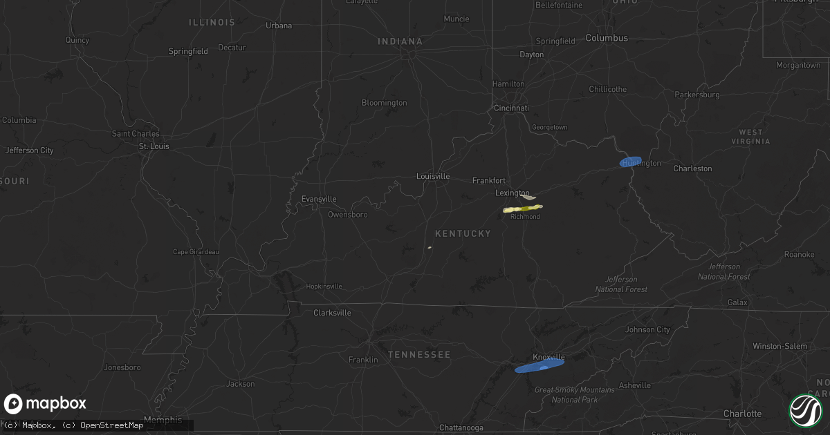
Hail Map in Kentucky on February 28, 2024
Get this storm
February 28 map
$229
one time, instant access
Download today. No call, no setup
Keep the $229
Bought the map and want the full workflow? Apply the entire $229 to a subscription within 7 days. None of it is wasted.
Every map, not just this one
This buys you this map. Subscription and you get every map we run, in the markets you choose from a few cities to whole states to nationwide. Plus real-time alerts the moment a storm fires.
Contact data
Name, contact info, occupancy, even credit band for addresses in the footprint. You go from where it hit to who to call.
Become the source they trust
Unlimited branding weather history reports on demand. You already have the documented answer ready for the property owner, and you are the one who showed up with it.
Property data and RoofTrace estimates
Pull up any address you have got, its value and the exact code rules for that jurisdiction, straight from One Click Code. Then RoofTrace estimates the squares, pitch, and roof value, priced the way you price.
Storm reports in Kentucky
Kentucky
| Date | Description |
|---|---|
| 02/28/20242:36 PM CST | Delayed report. Several large trees uprooted on old leitchfield road east of whitesville. Time estimated by radar. |
| 02/28/20248:31 AM CST | A thunderstorm wind gust of 67 mph was measured by the asos at the london-corbin airport this morning. |
| 02/28/20247:30 AM CST | Corrects previous tstm wnd dmg report from 2 se pitts. Tree down at 265 cobhill road. |
| 02/28/20247:30 AM CST | Tree down. |
| 02/28/20247:25 AM CST | Damage to greenhouse. Time is estimated from radar. |
| 02/28/20247:25 AM CST | Tree down on doe creek road. |
| 02/28/20247:23 AM CST | Carport blown down and a few trees down. One tree down on a vehicle. Nearby personal weather station had a 47 mph gust. Time estimated from radar. |
| 02/28/20247:05 AM CST | Delayed report. Tree down at wilgreen lake rd. |
| 02/28/20247:03 AM CST | Tree down on north us 127. |
| 02/28/20247:03 AM CST | Tree down on loop road. |
| 02/28/20246:42 AM CST | Tree blown down at the intersection of robin hood drive and knapp avenue. |
| 02/28/20246:25 AM CST | Tree down near us 150. |
| 02/28/20246:23 AM CST | A local report indicates 1.25 inch wind near Winchester |
| 02/28/20246:20 AM CST | Large tree limbs down near home. |
| 02/28/20246:18 AM CST | Barn down at route 11/van thompson road. |
| 02/28/20246:15 AM CST | A local report indicates 61 MPH wind near Ashland |
| 02/28/20246:06 AM CST | A local report indicates 1.00 inch wind near 4 NNE Keene |
All States Impacted by Hail Map on February 28, 2024
Cities Impacted by Hail Map on February 28, 2024
- Three Oaks, MI
- Sawyer, MI
- Buchanan, MI
- New Troy, MI
- Bridgman, MI
- Baroda, MI
- Dowagiac, MI
- Decatur, MI
- Hawesville, KY
- Philpot, KY
- Reynolds Station, KY
- Richmond, KY
- Lexington, KY
- Nicholasville, KY
- Ashland, KY
- Catlettsburg, KY
- Chesapeake, OH
- Ironton, OH
- South Point, OH
- Kenova, WV
- Huntington, WV
- Ceredo, WV
- Argillite, KY
- Winchester, KY
- Waco, KY
- Muscle Shoals, AL
- Tuscumbia, AL
- Leighton, AL
- Town Creek, AL
- Kingston, TN
- Loudon, TN
- Lenoir City, TN
- Farragut, TN
- Louisville, TN
- Friendsville, TN
- Knoxville, TN
- Rockford, TN
- Alcoa, TN
- Maryville, TN
- Seymour, TN
- Clay City, KY
- Lancaster, KY
- Magnolia, KY
- Sevierville, TN
- Atlanta, GA
- Norcross, GA
- Lilburn, GA
- Tucker, GA
- Stone Mountain, GA
- Union, SC
- Buffalo, SC


