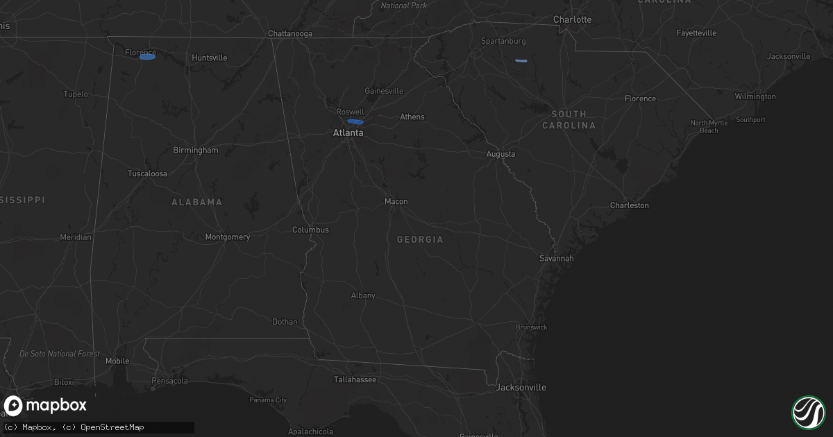
Hail Map in Georgia on February 28, 2024
Get this storm
February 28 map
$229
one time, instant access
Download today. No call, no setup
Keep the $229
Bought the map and want the full workflow? Apply the entire $229 to a subscription within 7 days. None of it is wasted.
Every map, not just this one
This buys you this map. Subscription and you get every map we run, in the markets you choose from a few cities to whole states to nationwide. Plus real-time alerts the moment a storm fires.
Contact data
Name, contact info, occupancy, even credit band for addresses in the footprint. You go from where it hit to who to call.
Become the source they trust
Unlimited branding weather history reports on demand. You already have the documented answer ready for the property owner, and you are the one who showed up with it.
Property data and RoofTrace estimates
Pull up any address you have got, its value and the exact code rules for that jurisdiction, straight from One Click Code. Then RoofTrace estimates the squares, pitch, and roof value, priced the way you price.
Storm reports in Georgia
Georgia
| Date | Description |
|---|---|
| 02/28/20245:00 PM CST | Columbia county dispatch reported trees on powerlines at crawford place and haire baxton road. Time estimated by radar. |
| 02/28/20245:00 PM CST | Columbia county dispatch reported trees on powerlines at clarks hill road and petersburg road. Time estimated by radar. |
| 02/28/20243:45 PM CST | Uga mesonet station uga49 covington. |
| 02/28/20243:40 PM CST | Tree down near the intersection of stevens grove church rd and palmer rd. |
| 02/28/20243:30 PM CST | Tree down near the intersection of wolfskin rd and athens rd. |
| 02/28/20243:22 PM CST | Tree down along nunnally shoals rd near old monroe madison hwy. |
| 02/28/20243:15 PM CST | Tree down across hwy 92 at peeples road. All lanes blocked. |
| 02/28/20243:15 PM CST | Tree down on norton rd between barnett shoals rd and williamsburg pl. |
| 02/28/20242:53 PM CST | Report of a tree downed along i85 near the sharpsburg-mccollum rd exit. |
| 02/28/20242:50 PM CST | Tree down... Blocking one lane of traffic on hwy 78 near the intersection of cown rd. |
| 02/28/20242:46 PM CST | Tree down at the intersection of center hill church rd and mccullers rd. |
| 02/28/20242:41 PM CST | Power lines damaged at the intersection of xavier ray ct sw and lenna dr sw. |
| 02/28/20242:40 PM CST | A few trees downed with one on power lines. No specific area but generally near hartwell. |
| 02/28/20242:35 PM CST | Powerlines down near the intersection of i285 and memorial dr. |
| 02/28/20242:33 PM CST | Tree reported down on a home on white cir sw. |
| 02/28/20242:31 PM CST | Tree down on powerlines... Which started a brush fire... On old fountain rd ne. |
| 02/28/20242:29 PM CST | Tree reported down near the intersection of braselton hwy and old fountain rd. |
| 02/28/20242:27 PM CST | Tree down near the intersection of fort daniels dr ne and auburn rd. |
| 02/28/20242:26 PM CST | A few trees down with at least 2 falling on power lines generally near carnesville. |
| 02/28/20242:26 PM CST | Measured gust from peachtree-dekalb |
| 02/28/20242:25 PM CST | Tree down on powerlines near the intersection of duluth hwy and sever rd. |
| 02/28/20242:23 PM CST | Tree reported down near the intersection of stoneview dr sw and bailey dr sw. |
| 02/28/20242:22 PM CST | Tree down near the intersection of buford dr and gravel springs rd. |
| 02/28/20242:20 PM CST | Tree reported down on a house on millerbrook dr. Nw. |
| 02/28/20242:20 PM CST | Tree and wires reported down in the road on rolling way nw. |
| 02/28/20242:19 PM CST | Tree down at the intersection of oneta dr and williams rd. |
| 02/28/20242:15 PM CST | Tree downed along gillsville hwy just east of suggs road. |
| 02/28/20242:15 PM CST | Weather station dw1905 atlanta. |
| 02/28/20242:13 PM CST | Tree down near the intersection of jones mill rd and bay cir. |
| 02/28/20242:13 PM CST | Tree reported down near the intersection of governors lake pkwy nw and jones mill rd nw. |
| 02/28/20242:10 PM CST | Tree downed along atlanta hwy at gaines ferry road. |
| 02/28/20242:08 PM CST | A few small trees downed near blackstock rd. |
| 02/28/20241:53 PM CST | Four trees down north of highway 92 and south of arnold mill rd... Between neese rd and wiley bridge rd. |
| 02/28/20241:50 PM CST | Tree down on osco parkway. |
| 02/28/20241:50 PM CST | Tree down and blocking the roadway near the intersection of stonechat ct. And mabry rd ne. |
| 02/28/20241:47 PM CST | Tree down in woodstock park near dupree rd. |
| 02/28/20241:45 PM CST | Tree down at brookwood dr and alabama rd. |
| 02/28/20241:43 PM CST | Damage to an outdoor structure...the roof of a baseball dugout was blown off. |
| 02/28/20241:40 PM CST | Tree down along ball ground road just south of george mcclure lane. |
| 02/28/20241:40 PM CST | Trees and powerlines down at the intersection of edwards mill road and newt green road. |
| 02/28/20241:35 PM CST | Trees down at the intersection of pearidge rd and pine grove road. |
| 02/28/20241:35 PM CST | Corrects previous tstm wnd dmg report from 1 ne dallas. Fallen tree near the intersection of croker rd and e memorial dr. |
| 02/28/20241:35 PM CST | Several reports of trees down around canton ga. Pearidge rd and pine grove rd... Marietta rd and bells ferry rd... York dr... N brooke dr and river estates pkwy... And |
| 02/28/20241:35 PM CST | Tree down along marble quarry rd and crestmont dr. |
| 02/28/20241:30 PM CST | Large tree limbs and branches down greater than 2 inches in diameter near intersection of sr-140 and waleska road. Estimated wind gusts to 50 mph. |
| 02/28/20241:30 PM CST | A few trees down near the intersection of croker rd and old acworth rd. |
| 02/28/20241:30 PM CST | Fallen tree near the intersection of croker rd and e memorial dr. |
| 02/28/20241:30 PM CST | Four reports of trees down near the town of lathemtown... Between cumming hwy... Along ball ground rd... And near new green rd and edwards mill rd intersection. |
| 02/28/20241:25 PM CST | Four reports of trees down along fincher rd between broad water bay rd and reinhardt college parkway. |
| 02/28/20241:05 PM CST | Trees reported down near the intersection of blanche rd and cherokee cir. |
| 02/28/20241:00 PM CST | Trees reported down near the intersection of n 6th street and seab green rd. |
| 02/28/20241:00 PM CST | Trees reported down along old mill rd. |
| 02/28/20241:00 PM CST | Trees down along judkin mill road. |
| 02/28/202411:15 AM CST | Trees and powerlines down and trees reported on homes north of warthen st in north lafayette. |
All States Impacted by Hail Map on February 28, 2024
Cities Impacted by Hail Map on February 28, 2024
- Three Oaks, MI
- Sawyer, MI
- Buchanan, MI
- New Troy, MI
- Bridgman, MI
- Baroda, MI
- Dowagiac, MI
- Decatur, MI
- Hawesville, KY
- Philpot, KY
- Reynolds Station, KY
- Richmond, KY
- Lexington, KY
- Nicholasville, KY
- Ashland, KY
- Catlettsburg, KY
- Chesapeake, OH
- Ironton, OH
- South Point, OH
- Kenova, WV
- Huntington, WV
- Ceredo, WV
- Argillite, KY
- Winchester, KY
- Waco, KY
- Muscle Shoals, AL
- Tuscumbia, AL
- Leighton, AL
- Town Creek, AL
- Kingston, TN
- Loudon, TN
- Lenoir City, TN
- Farragut, TN
- Louisville, TN
- Friendsville, TN
- Knoxville, TN
- Rockford, TN
- Alcoa, TN
- Maryville, TN
- Seymour, TN
- Clay City, KY
- Lancaster, KY
- Magnolia, KY
- Sevierville, TN
- Atlanta, GA
- Norcross, GA
- Lilburn, GA
- Tucker, GA
- Stone Mountain, GA
- Union, SC
- Buffalo, SC


