Hail Map in Kentucky on February 24, 2011
Get this storm
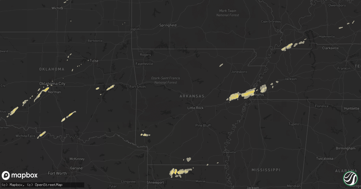
February 24 map
$229
one time, instant access
Download today. No call, no setup
Keep the $229
Bought the map and want the full workflow? Apply the entire $229 to a subscription within 7 days. None of it is wasted.
Every map, not just this one
This buys you this map. Subscription and you get every map we run, in the markets you choose from a few cities to whole states to nationwide. Plus real-time alerts the moment a storm fires.
Contact data
Name, contact info, occupancy, even credit band for addresses in the footprint. You go from where it hit to who to call.
Become the source they trust
Unlimited branding weather history reports on demand. You already have the documented answer ready for the property owner, and you are the one who showed up with it.
Property data and RoofTrace estimates
Pull up any address you have got, its value and the exact code rules for that jurisdiction, straight from One Click Code. Then RoofTrace estimates the squares, pitch, and roof value, priced the way you price.
Storm reports in Kentucky
Kentucky
| Date | Description |
|---|---|
| 02/24/201112:55 AM CST | One tree down on brown creek road near 451 and hal rogers parkway at mile marker 56. |
| 02/24/201112:53 AM CST | Estimated 58 mph wind gust in ned. |
| 02/24/201112:10 AM CST | A tree fell on a carport damaging both carport and boat being housed inside the carport. Another tree also fell on a building at another site in keavy and damaged that |
| 02/24/201112:10 AM CST | Some small trees were blown down along hwy 92e near monticello. |
| 02/23/201111:50 PM CST | A screen door was torn from a home along hwy 92e in monticello. A number of power outages were also reported in and around monticello. Multiple trees had been blown dow |
| 02/23/201111:35 PM CST | Nashville tn wfo conducted a storm survey in pickett county tn and clinton county ky. The survey found that a microburst produced straight line winds of 80 mph and dama |
| 02/23/201111:23 PM CST | Extremely heavy rains...sustained high winds with stronger gusts. |
| 02/23/201111:07 PM CST | Trees were downed on highway 33 near the mercer county line. |
| 02/23/201111:00 PM CST | Trees were downed across main roadways in and near columbia. |
| 02/23/201110:58 PM CST | Large trees down on battlefield road in the park. Some of the trees are up to 22 inches in diameter. |
| 02/23/201110:55 PM CST | Tree down blocking state highway 2784 near ky 70 |
| 02/23/201110:20 PM CST | A garage was damaged on littrell road. |
| 02/23/201110:15 PM CST | Trees down in western parts of barren county. |
| 02/23/201110:15 PM CST | Two barns were destroyed near railton. |
| 02/23/201110:10 PM CST | Corrected time on previous lsr. Time was 1110 pm est...not 1010 pm est. Several barns damaged or destroyed...several trees down. Estimated winds of 90 to 100 mph. |
| 02/23/201110:10 PM CST | Tree down across highway 100. |
| 02/23/201110:00 PM CST | Barn roof damage near charlie ragland road and us 31e |
| 02/23/201110:00 PM CST | Cinder block wall of a car wash was blown in. |
| 02/23/201110:00 PM CST | Barn roof damage on parkers grove road |
| 02/23/20119:50 PM CST | Power outages in western williamson county |
| 02/23/20119:42 PM CST | 60 mph gust measured at wky met lab. Sustained 45 mph. |
| 02/23/20119:35 PM CST | A double wide was damaged near oakville. An adult female was trapped inside. The extent of any injuries is unknown at this time. |
| 02/23/20119:17 PM CST | Power outages on the n side of leitchfield for about an hour due to t-storm winds |
| 02/23/20119:10 PM CST | Several barns damaged or destroyed...several trees down. Estimated winds of 90 to 100 mph. |
| 02/23/20119:00 PM CST | Concentrated straight-line wind damage occurred 5 miles west of crofton along the consolation loop and hwy 800. Peak wind 85 mph. Path width 3/4 of a mile and length 2 |
| 02/23/20118:56 PM CST | Butler county department of highways reported trees across al emery road and brooklyn chapel road near brooklyn. |
| 02/23/20118:50 PM CST | A barn and shed were destroyed near the intersection of highway 431 and highway 2371. A double wide sustained some siding damage just south of this. |
| 02/23/20118:50 PM CST | Tree down on highway 431. |
| 02/23/20118:30 PM CST | Late report...winds estimated 60 to 65 mph. |
| 02/23/20118:30 PM CST | A local report indicates 62 MPH wind near CENTRAL CITY |
| 02/23/20118:19 PM CST | 10 power poles snapped and debris and electrical lines lying across princeton road on the northwest side of town. |
| 02/23/20117:55 PM CST | Ef2 tornado touched down 2.5 miles ne of gracey along quinsberry lane...and travelled 5.5 miles to near dawson springs road 3.5 miles nw of hopkinsville. Peak wind 115 |
| 02/23/20117:55 PM CST | Wind measured around the 68/80 bypass on the east side of town. Measured winds 65 mph at lovers lane. |
| 02/23/20117:45 PM CST | Several trees and tree limbs down or broken. Some shingles off several homes on highway 139. |
| 02/23/20117:08 PM CST | Several downed trees with wind gusts 45 to 50 mph. |
| 02/23/20116:51 PM CST | Quarter size hail reported 1 mile south of town. Visibility near zero with very strong winds. |
| 02/23/20116:50 PM CST | Late report...tree down on home in the reidland area along hwy 131/said road. |
| 02/23/20116:49 PM CST | A local report indicates 1.00 inch wind near WINGO |
| 02/23/20116:36 PM CST | Carport blown across lone oak road beside orileys auto. Street lights out at intersection of interstate 24 and highway 62. |
| 02/23/20116:35 PM CST | Late report...ef1 tornado with peak wind 95 mph. Path average path width 100 yards. Path length 7.8 miles with no injuries or fatalities. Initial touchdown 2nw of fulto |
| 02/23/20116:18 PM CST | Peak wind 85 mph. Damage area was 150 yards wide and 75 yards long. 1 grain bin destroyed. A grain bin... Machinery shed...carport...vehicle and house were damaged. Bar |
| 02/23/20116:15 PM CST | Ef0 tornado touched down near intersection of 1099 and 125...and traveled east 1 mile to the high school. Path width 50 yards. Peak wind 80 mph. Some windows blown out |
All States Impacted by Hail Map on February 24, 2011
Cities Impacted by Hail Map on February 24, 2011
- Carnegie, OK
- Springer, OK
- Davis, OK
- Somerville, TN
- Mason, TN
- Terral, OK
- Ryan, OK
- Columbus, KS
- Garnett, KS
- Homer, LA
- Apache, OK
- Forrest City, AR
- Colt, AR
- Proctor, AR
- Memphis, TN
- Turrell, AR
- Widener, AR
- Edmondson, AR
- Marion, AR
- Heth, AR
- Earle, AR
- West Memphis, AR
- Crawfordsville, AR
- Parkin, AR
- Sulphur, OK
- Goodwin, AR
- Palestine, AR
- Wynne, AR
- Lockesburg, AR
- Mineral Springs, AR
- Tipton, OK
- Frederick, OK
- Mcalester, OK
- Indianola, OK
- Dougherty, OK
- Checotah, OK
- Eufaula, OK
- Mountain Park, OK
- Snyder, OK
- Roosevelt, OK
- Union City, TN
- Hickman, KY
- Fulton, KY
- Haynesville, LA
- Horatio, AR
- Anadarko, OK
- Grady, AR
- Star City, AR
- Oklahoma City, OK
- Lisbon, LA
- Dubach, LA
- Morgantown, KY
- Mill Creek, OK
- Roff, OK
- Arlington, TN
- Atoka, TN
- Millington, TN
- Brighton, TN
- Chickasha, OK
- Pocasset, OK
- Verden, OK
- Union City, OK
- Mustang, OK
- Arcadia, LA
- Athens, LA
- Potwin, KS
- El Dorado, KS
- Benton, KS
- Towanda, KS
- Belton, KY
- Dunmor, KY
- Nashville, AR
- Mayfield, KY
- Sedalia, KY
- Wingo, KY
- Minden, LA
- Scammon, KS
- Hardin, KY
- Benton, KY
- Parkdale, AR
- Wilmot, AR
- Ringgold, TX
- Burns, KS
- Burden, KS
- Porum, OK
- Stigler, OK
- Clinton, KY
- Water Valley, KY
- South Fulton, TN
- Amber, OK
- Minco, OK
- Brownsville, TN
- Stanton, TN
- Blanchard, OK
- Cement, OK
- Newcastle, OK
- Tuttle, OK
- Pawnee, OK
- Glencoe, OK
- Stuart, OK
- Drumright, OK
- Frankston, TX
- Spearsville, LA
- Farmerville, LA
- Bernice, LA
- Stillwater, OK
- Fitzhugh, OK
- Wichita, KS
- Mannford, OK
- Munford, TN
- Drummonds, TN
- Jetson, KY
- Strawberry, AR
- Smithville, AR
- Cave City, AR
- Lawton, OK
- El Dorado, AR
- Sand Springs, OK
- Kincaid, KS
- Marion, LA
- Wheatley, AR
- Brinkley, AR
- Cushing, OK
- Anguilla, MS
- Silver City, MS
- Louise, MS
- Hamburg, AR
- Bastrop, LA
- Moro, AR
- Luther, OK
- Kirksey, KY
- Almo, KY
- Farmington, KY
- Murray, KY


