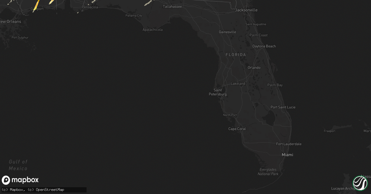
Hail Map in Florida on February 23, 2016
Get this storm
February 23 map
$229
one time, instant access
Download today. No call, no setup
Keep the $229
Bought the map and want the full workflow? Apply the entire $229 to a subscription within 7 days. None of it is wasted.
Every map, not just this one
This buys you this map. Subscription and you get every map we run, in the markets you choose from a few cities to whole states to nationwide. Plus real-time alerts the moment a storm fires.
Contact data
Name, contact info, occupancy, even credit band for addresses in the footprint. You go from where it hit to who to call.
Become the source they trust
Unlimited branding weather history reports on demand. You already have the documented answer ready for the property owner, and you are the one who showed up with it.
Property data and RoofTrace estimates
Pull up any address you have got, its value and the exact code rules for that jurisdiction, straight from One Click Code. Then RoofTrace estimates the squares, pitch, and roof value, priced the way you price.
Storm reports in Florida
Florida
| Date | Description |
|---|---|
| 02/23/20165:10 AM CST | Div of forestry reported two trees down in the bell area of gilchrist county. One located off sw 10th street. Time estimated by radar. |
| 02/23/20165:10 AM CST | Gilchrist county road department reported multiple trees down in roadways across the southwest and northwest portions of the county. |
| 02/23/20165:05 AM CST | Dispatch reported a large limb downed on a powerline knocking out power for a small neighborhood near wannee conservation area. Time estimated by radar. |
| 02/23/20164:04 AM CST | Tree down on i-10 near mile marker 265 |
| 02/23/20163:15 AM CST | Pine tree down on lake road |
| 02/23/20163:05 AM CST | Tree down blocking northbound lane near intersection of highway 221 and highway 8 south of greenville. |
| 02/23/20162:34 AM CST | Tree down at chinook trail and mlk jr memorial road. |
| 02/23/20162:20 AM CST | Tree down along shell point road and spring creek highway |
| 02/23/20162:16 AM CST | Powerline down east of veterans memorial rd. |
| 02/23/20162:10 AM CST | Tree down at doomar dr and miccosukee rd |
| 02/23/20162:08 AM CST | Tree down near the entrance to the wade wehunt pool in myers park. Report received via twitter from tallahasee parks and recreation. |
| 02/23/20162:07 AM CST | Tree down on powerline at mabry st and bell vue way. |
| 02/23/20161:20 AM CST | One report of tree down on county road 333 |
| 02/23/201612:30 AM CST | Scattered trees and power lines down throughout the county |
| 02/23/201612:20 AM CST | Tree blown down across the road at blue spring rd and calhoun rd. |
| 02/23/201612:00 AM CST | Tree blown down on a residence in the cottondale area. |
| 02/22/201611:55 PM CST | Trees down in various parts of bay county including the youngstown area. |
| 02/22/201611:35 PM CST | Reports of trees and power lines down in the panama city area. |
| 02/22/201611:31 PM CST | Tree blown down near frankford ave and west beach dr. |
| 02/22/201611:30 PM CST | Several trees blown down in washington county. |
| 02/22/201611:30 PM CST | Tree blown down on highway 162. |
| 02/22/201611:30 PM CST | Measured wind gust at wunderground site kflpanam37. |
| 02/22/201611:15 PM CST | Large trees blown down in graceville park. |
| 02/22/201611:00 PM CST | State highway 79 shut down due to downed power lines. |
| 02/22/201610:50 PM CST | Scattered reports of trees blown down across portions of holmes county. |
| 02/22/201610:35 PM CST | Peak gust to 54 knots or 62 mph. |
| 02/22/201610:30 PM CST | Couple reports of trees down in the defuniak springs area. |
| 02/22/20169:15 PM CST | Power lines down near highway 331 and county road 1084 |
| 02/22/20168:20 PM CST | 1 mile w of yniestra on i-10. Car blown off interstate... Trees blocking lanes of hwy. And damage to fencing. |
| 02/22/20168:18 PM CST | Intersection of 14th and san miguel closed due to debris on roadway. |
| 02/22/20168:14 PM CST | Two buildings destroyed at the ge plant. |
| 02/22/20168:10 PM CST | Gladstone dr. Home damaged... Garage destroyed. |
| 02/22/20168:06 PM CST | Dunwoody dr.... Trees down on cars... Trees blocking road in all directions. |
| 02/22/20168:00 PM CST | Dunwoody drive...trees down on cars...trees blocking road in all directions. |
All States Impacted by Hail Map on February 23, 2016
Cities Impacted by Hail Map on February 23, 2016
- Natchez, MS
- Olla, LA
- Jena, LA
- Trout, LA
- Grove Hill, AL
- Thomasville, AL
- Deville, LA
- Pineville, LA
- Norman Park, GA
- Moultrie, GA
- Altha, FL
- Clarksville, FL
- Grand Ridge, FL
- Marianna, FL
- Hermanville, MS
- Morgan, GA
- Sneads, FL
- Chattahoochee, FL
- Natchitoches, LA
- Westville, FL
- Samson, AL
- Geneva, AL
- Milton, FL
- Bagdad, FL
- Long Beach, MS
- Gulfport, MS
- Pass Christian, MS
- Saucier, MS
- Biloxi, MS
- Belle Rose, LA
- Donaldsonville, LA
- Jackson, MS
- Clinton, MS
- Converse, LA
- Leesburg, GA
- Gilbert, LA
- Fort Necessity, LA
- Wisner, LA
- Moss Point, MS
- Nathalie, VA
- Ridgeland, MS
- Climax, GA
- Bainbridge, GA
- Dothan, AL
- Pine Hill, AL
- Lower Peach Tree, AL
- Orange Beach, AL
- Richton, MS
- Oak Ridge, LA
- Colfax, LA
- Atlanta, LA
- Montgomery, LA
- Dry Prong, LA
- Arlington, GA
- Winnfield, LA
- Malone, FL
- Gordon, AL
- Jakin, GA
- Donalsonville, GA
- Bascom, FL
- Shelbyville, TX
- Coushatta, LA
- Robeline, LA
- Pleasant Hill, LA
- Marthaville, LA
- Pelican, LA
- Covington, LA
- Wilmer, AL
- Georgetown, LA
- Blakely, GA
- Jackson, AL
- Campti, LA
- State Line, MS
- Tullos, LA
- Bogalusa, LA
- Pollock, LA
- Lorman, MS
- Fayette, MS
- Bush, LA
- Vancleave, MS
- Ferriday, LA
- Damascus, GA
- Colquitt, GA
- Newellton, LA
- Defuniak Springs, FL
- Harrisonburg, LA
- Lucedale, MS
- Oakfield, GA
- Camden, AL
- Ponce De Leon, FL
- Columbia, AL
- Napoleonville, LA
- Pierre Part, LA
- Saint James, LA
- Clayton, LA
- Ashford, AL
- Webb, AL
- Madison, MS
- Flora, MS
- Saint Joseph, LA
- Citronelle, AL
- Cowarts, AL
- Pensacola, FL
- Bonifay, FL
- Pansey, AL
- Chatom, AL
- Fruitdale, AL
- Catherine, AL
- Millry, AL
- Port Gibson, MS
- Pearl, MS
- Florence, MS
- Brandon, MS
- Garyville, LA
- Gramercy, LA
- Paulina, LA
- Cloutierville, LA
- Aimwell, LA
- Enterprise, LA
- Frankville, AL


