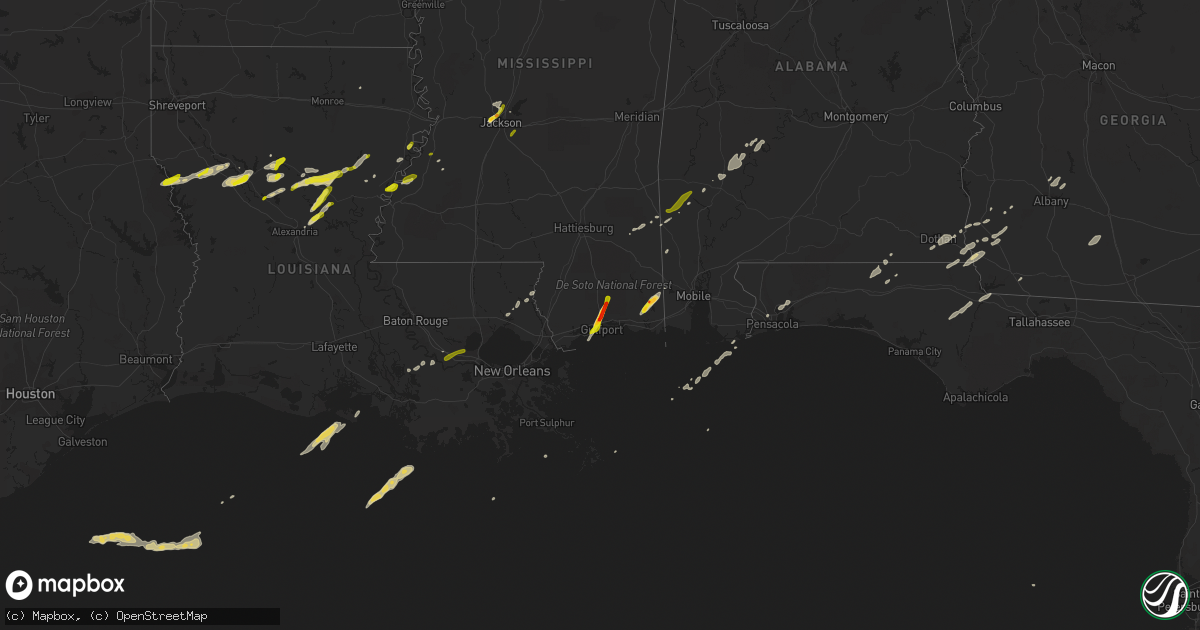
Hail Map on February 23, 2016
Get this storm
February 23 map
$229
one time, instant access
Download today. No call, no setup
Keep the $229
Bought the map and want the full workflow? Apply the entire $229 to a subscription within 7 days. None of it is wasted.
Every map, not just this one
This buys you this map. Subscription and you get every map we run, in the markets you choose from a few cities to whole states to nationwide. Plus real-time alerts the moment a storm fires.
Contact data
Name, contact info, occupancy, even credit band for addresses in the footprint. You go from where it hit to who to call.
Become the source they trust
Unlimited branding weather history reports on demand. You already have the documented answer ready for the property owner, and you are the one who showed up with it.
Property data and RoofTrace estimates
Pull up any address you have got, its value and the exact code rules for that jurisdiction, straight from One Click Code. Then RoofTrace estimates the squares, pitch, and roof value, priced the way you price.
States Impacted by Hail Map on February 23, 2016
Storm reports
Virginia
| Date | Description |
|---|---|
| 02/23/20162:25 AM CST | Also mentioned several 3-4in branches down around property. |
Alabama
| Date | Description |
|---|---|
| 02/23/20165:53 PM CST | A shed and storage building was heavily damaged 3/4 miles north of highway 56 and 1 mile east of the al/ms line. |
| 02/23/20164:36 PM CST | Shingles off roof of homes. Windows broken. Car windows broken. Trash cans and patio furniture blown around. Possible tornado. Updated information. |
| 02/23/20164:22 PM CST | One home with minor roof damage. One shed with a section of its roof removed. Numerous trees uprooted and snapped. A 4.8 mile long path on a just west of due north orie |
| 02/23/20164:20 PM CST | Possible roof damage. Radar tds signature at 425 pm cdt. Time estimated by radar. |
| 02/23/20163:59 PM CST | Shingles off roof of homes. Windows broken. Car windows broken. Trash cans and patio furniture blown around. Updated information. Time estimated by radar. Updated to fi |
| 02/23/20164:14 AM CST | Tree fell onto home and damaged portion of roof. Tree fell and damaged portion of barn. Power lines down. Oak tree about 13 inches in diameter snapped. 4 pine trees dow |
| 02/23/20164:04 AM CST | A brief weak tornado touched down along cr 97 and moved east-northeast through a largely rural and wooded area. It lifted along peaceful valley rd. The majority of the |
| 02/23/20161:45 AM CST | Multiple trees down along highway 31 near the cullman and morgan county line. |
| 02/22/201611:20 PM CST | Trees blown down near a residence in columbia. Public post to wtvy facebook. |
| 02/22/201611:02 PM CST | A short tornado path was observed along cr-65 just to the east of its intersection with highway 95. Many large trees were snapped or uprooted along this short path. |
| 02/22/201610:54 PM CST | A short tornado track was determined along cr-53 just north of its intersection with cr-26. This was a concentrated area of tree damage. |
| 02/22/201610:49 PM CST | Damage to 5 residences and numerous trees and power lines down northeast of headland. Debris signature on radar at the time. |
| 02/22/201610:38 PM CST | This tornado was the fifth tornado to be spawned by the same thunderstorm. The tornado initially developed near cr-83 and the city limits of headland where large trees |
| 02/22/201610:38 PM CST | Updated kinsey report...additional media reports of damage in the kinsey area with numerous trees and power lines down and carports destroyed. There was a debris signat |
| 02/22/201610:35 PM CST | Large pine tree down at hazelwood and kent in dothan. |
| 02/22/201610:34 PM CST | Rated ef1 with a path length of 3.8 miles. This was the fourth tornado to develop in northwest houston county. The tornado began just south of westgate parkway and then |
| 02/22/201610:33 PM CST | Numerous reports of damage on the northwest side of dothan including many trees damaged and structural damage as well. In the vicinity of the walmart. There was a debri |
| 02/22/201610:32 PM CST | Wtvy reports damage to northside walmart with possible roof damage and damage to doors. Also reports of power lines snapped in half and trees down in the area. |
| 02/22/201610:32 PM CST | 8 power poles snapped on technology drive and trees also brought down power lines at westgate parkway and provincial street. |
| 02/22/201610:31 PM CST | Rated ef1 with a path length of 1.9 miles. Damage was focused at the athletic center of a private school and a nearby neighborhood. Concrete block baseball dugout was d |
| 02/22/201610:28 PM CST | Tree blown into the roadway west main at john d odom. |
| 02/22/201610:28 PM CST | Powerlines down on murphy mill road. Also power lines down on westgate at technology. |
| 02/22/201610:24 PM CST | This tornado...rated ef1...initially developed in houston county...briefly crossed into dale county...before crossing back into houston county and causing damage in the |
| 02/22/201610:20 PM CST | Trees blown down across county highway 105. |
| 02/22/201610:15 PM CST | This was a weak tornado just north of the houston-geneva county border. It removed metal roofing from several barns and porches. Multiple trees were blown down. Path le |
| 02/22/201610:05 PM CST | Roof damage reported in hartford |
| 02/22/20169:55 PM CST | Numerous trees reported down in geneva county across various parts of the county. Also many power outages reported by wiregrass electric coop. |
| 02/22/20169:40 PM CST | Trees down across county highway 65. |
| 02/22/20169:39 PM CST | Trees blown down across johnny johnson rd in the general vicinity of open pond road. |
| 02/22/20169:12 PM CST | Tree down hwy 154 at mile marker 6... Across road. |
| 02/22/20166:58 PM CST | Trees down on sumter county road 9. One large tree across county road 9 north of the intersection of county road 10. |
| 02/22/20166:47 PM CST | Trees down on sumter county road 9. One large tree across county road 9 north of the intersection of county road 10. Corrected - time estimated by radar. |
| 02/22/20166:30 PM CST | Large tree down across hwy. 69 1 mile s. Of coffeeville. |
| 02/22/20166:30 PM CST | Tree down on residence at 155 maple dr. |
| 02/22/20166:30 PM CST | Tree down hwy 154 at mile marker 6... Across road. |
| 02/22/20166:20 PM CST | Tree on residence at 155 maple dr. |
| 02/22/20166:03 PM CST | Dual-pol tornado debris signature detected from kgwx nexrad. |
| 02/22/20166:03 PM CST | Damage to the roof of a home. Trees and power lines down. Dual-pol tornado debris signature detected from kgwx nexrad. Updated location and information. |
| 02/22/20166:01 PM CST | One home with minor roof damage...and one garage had a part of its tin peeled back. Numerous trees uprooted. 2.2 mile long path on a north-northwest orientation. |
South Carolina
| Date | Description |
|---|---|
| 02/23/20165:09 AM CST | Edgefield county dispatch reported several trees down in and around the town of edgefield. Streets include sweetwater rd old chappell ferry rd and walker rd. Time estim |
Mississippi
| Date | Description |
|---|---|
| 02/23/20165:48 PM CST | Trees down on stateline battles rd. Near greene county. Residents unable to get out of driveway. |
| 02/23/20165:47 PM CST | Trees and debris at 6 henderson james rd. Near greene county line. |
| 02/23/20165:45 PM CST | A local report indicates 1.75 inch wind near WADE |
| 02/23/20165:45 PM CST | A tornado touchdown occurred in a heavily wooded area near the green/wayne county line. Ef-1 damage was observed as numerous large diameter...greater than 2 feet...hard |
| 02/23/20165:45 PM CST | Tree down along hwy 17 |
| 02/23/20165:40 PM CST | Tornado damage...trees down between avera and knobtown ms. |
| 02/23/20165:39 PM CST | Several pine trees uprooted and snapped...laying in the same direction. |
| 02/23/20165:38 PM CST | Several pine trees uprooted or snapped...laying in the same direction. |
| 02/23/20165:36 PM CST | Several pine trees uprooted or snapped laying in the same direction. A 40 x 52 storage building was destroyed with damage to siding of a mobile home. |
| 02/23/20165:35 PM CST | Downburst winds on the leading edge of a bow echo. Large pine trees uprooted or snapped...with trees laying in the same direction. |
| 02/23/20165:32 PM CST | A brief tornado touchdown occurred in the vicinity of shady hollow road. A couple of trees with large branches were sheared in a forested area several dozen yards to th |
| 02/23/20165:26 PM CST | Two trees down on pleasant grove sandersville rd. Near jack clark rd. |
| 02/23/20165:25 PM CST | Barn destroyed about 1 mile s. Of neely-avera rd. And 1/4 mile e. Of hwy 63. |
| 02/23/20165:25 PM CST | A tornado touched down along ms-63 southeast of the community of avera. A homestead was affected with metal roofing material from a barn lofted into an adjacent tree. A |
| 02/23/20165:21 PM CST | A severe thunderstorm blew farm equipment around...an aluminum boat into a pond...and a gate off a fence. In addition...tops were blown off several large oak trees. |
| 02/23/20165:15 PM CST | A tree was down on mcfarland road. |
| 02/23/20165:11 PM CST | Tree down on brown drive in the powers community. |
| 02/23/20165:08 PM CST | Minor roof damage to a home on gaines brewer road. A small greenhouse was also damaged. Time estimated from radar. |
| 02/23/20164:46 PM CST | Brief ef-0 rated tornado with max winds of 80 mph in southwest simpson county...snapped and uprooted softwood trees |
| 02/23/20164:46 PM CST | Trees down on corinth road...elizabeth avenue...and north main street. Powerlines down on elizabeth avenue. |
| 02/23/20164:42 PM CST | Ef-0 rated tornado with maximum winds of 85 mph and a path length of 1.2 miles and width of 100 yds...trees snapped and uprooted in a concentric pattern...a sign and fe |
| 02/23/20164:40 PM CST | Trees down in benton. |
| 02/23/20164:32 PM CST | Tornado began near entrekin road and ended near highway 13 snapping a few trees and a power pole along the way. Max winds of 75 mph. Path length of 3.9 miles and max wi |
| 02/23/20164:29 PM CST | Ef-1 tornado with maximum winds of 90 mph and a path length of 1.4 miles and width of 75 yards. Numerous trees were snapped along with some roof and fence damage. |
| 02/23/20164:22 PM CST | Reports of damage around purvis oloh road and mcraney road. Trees and powerlines down. Tornado debris signature observed in dual-pol radar data. |
| 02/23/20164:17 PM CST | *** 1 fatal *** ef-2 rated damage with path width of 115 yds has been found by the nws storm survey team...double wide mobile home was destroyed on sones road west of p |
| 02/23/20164:15 PM CST | *** 1 fatal *** ef-2 rated damage with max wind 115 mph has been found by the nws storm survey team...double wide mobile home was destroyed on sones road west of purvis |
| 02/23/20164:10 PM CST | Quarter to golfball sized hail reported in lyman. |
| 02/23/20164:07 PM CST | This brief tornado touchdown snapped and uprooted several trees just south of clear creek road in southwest lamar county. |
| 02/23/20164:00 PM CST | A local report indicates 1.00 inch wind near GULFPORT |
| 02/23/20163:57 PM CST | Preliminary damage to trees and structures consistent with low end ef-1. More details will be provided upon completion of survey. |
| 02/23/20163:57 PM CST | Emergency manager reported multiple structures with damage near henlefield |
| 02/23/20163:55 PM CST | Pea to quarter sized hail fell for a short duration |
| 02/23/20163:54 PM CST | This tornado started in pearl river county and crossed into southwest marion county where it snapped numerous softwood and hardwood trees. The tornado also caused roof |
| 02/23/20163:49 PM CST | Information from damage survey indicates an ef1 tornado with estimated wind speed of 105 mph began near donley burks road west of highway 43 and tracked northeast endin |
| 02/23/20163:45 PM CST | Ef-1 tornado with maximum winds of 90 mph and a path length of 0.5 miles and max width of 75 yards. Multiple trees were uprooted and a few structures heavily damaged. |
| 02/22/201610:50 PM CST | Large tree along stone blvd split in half on mississippi state campus. Also large limbs down on greensboro street in starkville. Both reports and pictures relayed via s |
| 02/22/201610:21 PM CST | A shed was damaged at a lumber business off ms hwy 12 |
| 02/22/201610:07 PM CST | Power lines downed across ms hwy 19 between zama and four corners |
| 02/22/20169:57 PM CST | Reported along ms hwy 468 |
| 02/22/20169:55 PM CST | Few trees down near hwy 49 around dabbs creek. |
| 02/22/20169:50 PM CST | Trees downed in the singleton area |
| 02/22/20169:48 PM CST | Trees downed in kosciusko and along ms hwy 35 south of kosciusko |
| 02/22/20169:45 PM CST | Tree across hwy 469 |
| 02/22/20169:40 PM CST | Shingles were blown off the roof of a home |
| 02/22/20169:25 PM CST | Tree down on a house on twin harbor place |
| 02/22/20169:18 PM CST | A few windshields were cracked along hwy 49 |
| 02/22/20168:45 PM CST | Two trees were down on geoghegan road. |
| 02/22/20168:45 PM CST | A tree was down on poplar hill road. |
| 02/22/20168:45 PM CST | A local report indicates 1.00 inch wind near 7 NNE PORT GIBSON |
| 02/22/20168:40 PM CST | Tree downed onto utility equipment along ms 547 |
| 02/22/20168:39 PM CST | Tree and power line down on grange hall rd |
| 02/22/20166:01 PM CST | A chicken pen was damaged. Trees were down on highway 13. Trees were also down on havard and entrekin roads. Possible tornado. |
Louisiana
| Date | Description |
|---|---|
| 02/23/20165:30 PM CST | Trees downed on highway 190 near thompson street. |
| 02/23/20165:30 PM CST | Trees downed on highway 190 near thompson road |
| 02/23/20165:30 PM CST | Mostly trees snapped and minor shingle damage. 50-75 yards wide before dissipating. Also ef-0 in madisonville 50 yards wide. Damage to boat shed and some fascia off roo |
| 02/23/20165:25 PM CST | A local report indicates 1.25 inch wind near NATCHITOCHES |
| 02/23/20165:23 PM CST | Hail lasted seven minutes and partially covered the ground. |
| 02/23/20165:07 PM CST | A local report indicates 1.00 inch wind near 3 SE PLEASANT HILL |
| 02/23/20165:02 PM CST | Draw bridge of causeway weather equipment measured a sustained wind speed of 60 mph with a gust of 120 mph. This was very close to the circulation of a storm with a his |
| 02/23/20164:40 PM CST | Madisonville mayor reported large metal canopy blown off at madisonville boat launch. One home near the boat launch was reported to have some damage. Event time estimat |
| 02/23/20164:35 PM CST | Widespread structural damage through laplace to homes and businesses. Numerous homes with major damage. Nws survey team will investigate. |
| 02/23/20164:35 PM CST | Preliminary estimate of 130 mph over 1/4 mile wide path. More details will be provided upon completion of survey. |
| 02/23/20164:15 PM CST | Nws storm survey found trees snapped and uprooted near mile marker 12 on interstate 55. Winds estimated at 100 mph rating the tornado an ef1. Width of 200 yards and a p |
| 02/23/20164:05 PM CST | Radar confirmed tornado. |
| 02/23/20163:38 PM CST | *** 2 fatal *** updated information from damage survey indicates that an upper end ef2 tornado touched down about 3 mile west of plattenville and tracked northeast for |
| 02/23/20163:38 PM CST | Emergency manager reported several powerlines downed in convent. |
| 02/23/20163:31 PM CST | *** 2 fatal *** the maximum wind and ef scale for assumption parish to st james parish strong tornado has been increased slightly to lower end ef3 tornado...versus prev |
| 02/23/20163:30 PM CST | Camp moved 6 inches... Minor roof damage to a few structures... Powerlines and pole down |
| 02/23/20163:23 PM CST | Tornado confirmed by radar tds. Emergency manager received multiple reports of tree and structure damage and is investigating. |
| 02/23/20163:20 PM CST | Possible tornado damage on highway 405 in white castle. Power poles downed and roof damage. |
| 02/23/20162:37 PM CST | Storm survey confirms ef1 tornado occurred between baldwin and franklin. The tornado touched down in a sugar cane field and traveled 2.6 miles before disipating in anot |
| 02/23/20162:36 PM CST | Report of multiple mobile homes damage and power lines down between baldwin and franklin. Time estimated from radar. |
| 02/23/20161:14 PM CST | Trailer received moderate damage and was rolled over. In addition multiple trees were damaged. |
| 02/23/20161:14 PM CST | Damage was mainly to an unsecured trailer and to some weak trees. More details will follow later upon conclusion of survey. |
| 02/23/20161:14 PM CST | Information from damage survey indicates an ef0 tornado with estimated wind speed of 85 mph began 3 and half miles east northeast of montpelier near green lane and trac |
| 02/23/20161:02 PM CST | Report of utility pole down on landry rd. Time estimated from radar. |
| 02/23/201612:45 PM CST | Preliminary estimated 120 mph with a 1/4 mile wide path. More details will be provided at the conclusion of the survey. |
| 02/23/201612:45 PM CST | Large delivery truck flipped on its side near highway 1036 near charles holden road. |
| 02/23/201612:17 PM CST | Tornado crossed hoo shoo too road east of south tiger bend road. |
| 02/23/201612:10 PM CST | Trained spotter reported tornado crossed i-10 near exit 171. |
| 02/23/201612:05 PM CST | Significant damage to golds gym in prairieville. |
| 02/23/201611:42 AM CST | Em said resident reports roof damage and power pole damage on richland rd. Possible tornado. 6 homes received minor damage. 3 utility poles and service lines down. |
| 02/23/201611:42 AM CST | Significant damage to golds gym in prairieville. |
| 02/23/201611:11 AM CST | Estimated 80 mph along a short path between highway 48 and airline highway in the vicinity of salvador road. More details will be sent at the conclusion of the survey. |
| 02/23/201610:56 AM CST | Report of bay doors and workshop damaged in boutte. Also report of vinyl siding lost on a home in ama along with another home in ama having their patio cover ripped off |
| 02/22/20167:52 PM CST | Quarter size hail reported at the 84 quick stop. |
| 02/22/20167:47 PM CST | Tree down across hwy 17 near the intersection of hwy 588. |
| 02/22/20167:35 PM CST | A local report indicates 1.00 inch wind near WISNER |
| 02/22/20167:15 PM CST | Dime to quarter size. |
| 02/22/20167:14 PM CST | Damage was mainly to an unsecured trailer and to some weak trees. More details will follow later upon conclusion of survey. |
| 02/22/20166:51 PM CST | Photo of quarter sized hail posted to twitter. |
| 02/22/20166:50 PM CST | Photo of hail from kalb-tv facebook page. |
| 02/22/20166:00 PM CST | Photo of hail from kalb-tv facebook page. |
Georgia
| Date | Description |
|---|---|
| 02/23/20165:20 AM CST | Tree down on golf course road. Time estimated by radar. |
| 02/23/20164:40 AM CST | Georgia power reported power lines down on belair road in the augusta area. Public report of estimated winds around 60 mph. |
| 02/23/20163:55 AM CST | Gas station awning damaged off i-75 exit 22. |
| 02/23/20163:55 AM CST | Trees down along val del road. |
| 02/23/20163:55 AM CST | Tree down on west adair street |
| 02/23/20163:02 AM CST | Tree down near intersection of 3rd street and 12th ave |
| 02/23/20162:39 AM CST | Tree on powerline. |
| 02/23/20162:26 AM CST | Powerline down. |
| 02/23/20162:26 AM CST | 3 to 4 trees down throughout thomasville. |
| 02/23/20162:10 AM CST | Roof partially blown off lighthouse church near sylvester. Reported by wfxl-tv. |
| 02/23/20161:49 AM CST | Trees down along providence road. Tds signature noted on radar. |
| 02/23/20161:47 AM CST | Several pecan trees were blown down in a field along highway 27 about 11 miles south of bainbridge |
| 02/23/20161:45 AM CST | Rated ef1 with estimated max winds of 90 mph. 12.9 mile track with max width of 400 yards. The tornado touched down southwest of whigham and travelled northeast... Cros |
| 02/23/20161:26 AM CST | There was minor roof damage to a structure near the palmer hotel |
| 02/23/20161:06 AM CST | Tree down on spring creek road. |
| 02/23/201612:40 AM CST | Metal roof blown off a pole barn on highway 33 between cofer and landfill roads. |
| 02/23/201612:33 AM CST | Tree uprooted just west of elmodel with other large limbs blown down in the area |
| 02/23/201612:30 AM CST | A few trees blown down in northern worth county. |
| 02/23/201612:26 AM CST | Tornado touched down briefly along gray moss rd with a path length of less than 0.5 mi. Rated ef1. There was significant damage to a mobile home roof...along with the c |
| 02/23/201612:26 AM CST | Roof off of brick house and mobile home severely damaged and debris in trees on gray moss rd. No injuries. |
| 02/23/201612:22 AM CST | Large pine tree blown down in northwest albany per public post to walb-tv facebook page. |
| 02/23/201612:22 AM CST | Two trees were reported to have fallen on a home on the 2800 block of doublegate drive |
| 02/23/201612:22 AM CST | Tree blown down off stocks dairy road per a public post to walb-tv facebook page. |
| 02/23/201612:20 AM CST | Tree down on the 5400 block of old dawson road |
| 02/23/201612:15 AM CST | A few trees were blown down along highway 216 just into baker county. |
| 02/23/201612:10 AM CST | Tree blown down on hickory ridge court. |
| 02/23/201612:05 AM CST | A few trees were blown down just into early county along highway 27. |
| 02/23/201612:00 AM CST | Broadcast media reports multiple trees down along bobby locke road just off sasser herod road. Walb-tv report. |
| 02/22/201611:55 PM CST | Rated ef1 with a path length of 5.1 miles. Damage was primarily to pine and pecan trees. A portion of the southern end was a focused area of uprooted and snapped mature |
| 02/22/201611:50 PM CST | Tree down on power line near arlington resulting in power outage |
| 02/22/201611:15 PM CST | Trees downed around highway 37 near fort gaines. |
| 02/22/201611:07 PM CST | This tornado began around grimsley road with tree damage noted in surrounding fields. It then moved northeast... Crossing state highway 39 to the northwest of blakely. |
Texas
| Date | Description |
|---|---|
| 02/23/20166:45 AM CST | Thunderstorm wind damage to a health clinic. |
Florida
| Date | Description |
|---|---|
| 02/23/20165:10 AM CST | Div of forestry reported two trees down in the bell area of gilchrist county. One located off sw 10th street. Time estimated by radar. |
| 02/23/20165:10 AM CST | Gilchrist county road department reported multiple trees down in roadways across the southwest and northwest portions of the county. |
| 02/23/20165:05 AM CST | Dispatch reported a large limb downed on a powerline knocking out power for a small neighborhood near wannee conservation area. Time estimated by radar. |
| 02/23/20164:04 AM CST | Tree down on i-10 near mile marker 265 |
| 02/23/20163:15 AM CST | Pine tree down on lake road |
| 02/23/20163:05 AM CST | Tree down blocking northbound lane near intersection of highway 221 and highway 8 south of greenville. |
| 02/23/20162:34 AM CST | Tree down at chinook trail and mlk jr memorial road. |
| 02/23/20162:20 AM CST | Tree down along shell point road and spring creek highway |
| 02/23/20162:16 AM CST | Powerline down east of veterans memorial rd. |
| 02/23/20162:10 AM CST | Tree down at doomar dr and miccosukee rd |
| 02/23/20162:08 AM CST | Tree down near the entrance to the wade wehunt pool in myers park. Report received via twitter from tallahasee parks and recreation. |
| 02/23/20162:07 AM CST | Tree down on powerline at mabry st and bell vue way. |
| 02/23/20161:20 AM CST | One report of tree down on county road 333 |
| 02/23/201612:30 AM CST | Scattered trees and power lines down throughout the county |
| 02/23/201612:20 AM CST | Tree blown down across the road at blue spring rd and calhoun rd. |
| 02/23/201612:00 AM CST | Tree blown down on a residence in the cottondale area. |
| 02/22/201611:55 PM CST | Trees down in various parts of bay county including the youngstown area. |
| 02/22/201611:35 PM CST | Reports of trees and power lines down in the panama city area. |
| 02/22/201611:31 PM CST | Tree blown down near frankford ave and west beach dr. |
| 02/22/201611:30 PM CST | Measured wind gust at wunderground site kflpanam37. |
| 02/22/201611:30 PM CST | Tree blown down on highway 162. |
| 02/22/201611:30 PM CST | Several trees blown down in washington county. |
| 02/22/201611:15 PM CST | Large trees blown down in graceville park. |
| 02/22/201611:00 PM CST | State highway 79 shut down due to downed power lines. |
| 02/22/201610:50 PM CST | Scattered reports of trees blown down across portions of holmes county. |
| 02/22/201610:35 PM CST | Peak gust to 54 knots or 62 mph. |
| 02/22/201610:30 PM CST | Couple reports of trees down in the defuniak springs area. |
| 02/22/20169:15 PM CST | Power lines down near highway 331 and county road 1084 |
| 02/22/20168:20 PM CST | 1 mile w of yniestra on i-10. Car blown off interstate... Trees blocking lanes of hwy. And damage to fencing. |
| 02/22/20168:18 PM CST | Intersection of 14th and san miguel closed due to debris on roadway. |
| 02/22/20168:14 PM CST | Two buildings destroyed at the ge plant. |
| 02/22/20168:10 PM CST | Gladstone dr. Home damaged... Garage destroyed. |
| 02/22/20168:06 PM CST | Dunwoody dr.... Trees down on cars... Trees blocking road in all directions. |
| 02/22/20168:00 PM CST | Dunwoody drive...trees down on cars...trees blocking road in all directions. |
Cities Impacted by Hail Map on February 23, 2016
- Natchez, MS
- Olla, LA
- Jena, LA
- Trout, LA
- Grove Hill, AL
- Thomasville, AL
- Deville, LA
- Pineville, LA
- Norman Park, GA
- Moultrie, GA
- Altha, FL
- Clarksville, FL
- Grand Ridge, FL
- Marianna, FL
- Hermanville, MS
- Morgan, GA
- Sneads, FL
- Chattahoochee, FL
- Natchitoches, LA
- Westville, FL
- Samson, AL
- Geneva, AL
- Milton, FL
- Bagdad, FL
- Long Beach, MS
- Gulfport, MS
- Pass Christian, MS
- Saucier, MS
- Biloxi, MS
- Belle Rose, LA
- Donaldsonville, LA
- Jackson, MS
- Clinton, MS
- Converse, LA
- Leesburg, GA
- Gilbert, LA
- Fort Necessity, LA
- Wisner, LA
- Moss Point, MS
- Nathalie, VA
- Ridgeland, MS
- Climax, GA
- Bainbridge, GA
- Dothan, AL
- Pine Hill, AL
- Lower Peach Tree, AL
- Orange Beach, AL
- Richton, MS
- Oak Ridge, LA
- Colfax, LA
- Atlanta, LA
- Montgomery, LA
- Dry Prong, LA
- Arlington, GA
- Winnfield, LA
- Malone, FL
- Gordon, AL
- Jakin, GA
- Donalsonville, GA
- Bascom, FL
- Shelbyville, TX
- Coushatta, LA
- Robeline, LA
- Pleasant Hill, LA
- Marthaville, LA
- Pelican, LA
- Covington, LA
- Wilmer, AL
- Georgetown, LA
- Blakely, GA
- Jackson, AL
- Campti, LA
- State Line, MS
- Tullos, LA
- Bogalusa, LA
- Pollock, LA
- Lorman, MS
- Fayette, MS
- Bush, LA
- Vancleave, MS
- Ferriday, LA
- Damascus, GA
- Colquitt, GA
- Newellton, LA
- Defuniak Springs, FL
- Harrisonburg, LA
- Lucedale, MS
- Oakfield, GA
- Camden, AL
- Ponce De Leon, FL
- Columbia, AL
- Napoleonville, LA
- Pierre Part, LA
- Saint James, LA
- Clayton, LA
- Ashford, AL
- Webb, AL
- Madison, MS
- Flora, MS
- Saint Joseph, LA
- Citronelle, AL
- Cowarts, AL
- Pensacola, FL
- Bonifay, FL
- Pansey, AL
- Chatom, AL
- Fruitdale, AL
- Catherine, AL
- Millry, AL
- Port Gibson, MS
- Pearl, MS
- Florence, MS
- Brandon, MS
- Garyville, LA
- Gramercy, LA
- Paulina, LA
- Cloutierville, LA
- Aimwell, LA
- Enterprise, LA
- Frankville, AL