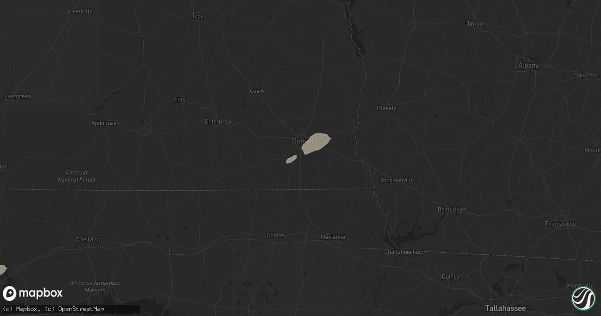
Hail Map in Dothan, AL on February 23, 2016
Get this storm
February 23 map
$229
one time, instant access
Download today. No call, no setup
Keep the $229
Bought the map and want the full workflow? Apply the entire $229 to a subscription within 7 days. None of it is wasted.
Every map, not just this one
This buys you this map. Subscription and you get every map we run, in the markets you choose from a few cities to whole states to nationwide. Plus real-time alerts the moment a storm fires.
Contact data
Name, contact info, occupancy, even credit band for addresses in the footprint. You go from where it hit to who to call.
Become the source they trust
Unlimited branding weather history reports on demand. You already have the documented answer ready for the property owner, and you are the one who showed up with it.
Property data and RoofTrace estimates
Pull up any address you have got, its value and the exact code rules for that jurisdiction, straight from One Click Code. Then RoofTrace estimates the squares, pitch, and roof value, priced the way you price.
Storm reports in Dothan, AL
Dothan, AL
| Date | Description |
|---|---|
| 02/22/201610:38 PM CST | Updated kinsey report...additional media reports of damage in the kinsey area with numerous trees and power lines down and carports destroyed. There was a debris signat |
| 02/22/201610:35 PM CST | Large pine tree down at hazelwood and kent in dothan. |
| 02/22/201610:34 PM CST | Rated ef1 with a path length of 3.8 miles. This was the fourth tornado to develop in northwest houston county. The tornado began just south of westgate parkway and then |
| 02/22/201610:33 PM CST | Numerous reports of damage on the northwest side of dothan including many trees damaged and structural damage as well. In the vicinity of the walmart. There was a debri |
| 02/22/201610:32 PM CST | 8 power poles snapped on technology drive and trees also brought down power lines at westgate parkway and provincial street. |
| 02/22/201610:32 PM CST | Wtvy reports damage to northside walmart with possible roof damage and damage to doors. Also reports of power lines snapped in half and trees down in the area. |
| 02/22/201610:31 PM CST | Rated ef1 with a path length of 1.9 miles. Damage was focused at the athletic center of a private school and a nearby neighborhood. Concrete block baseball dugout was d |
| 02/22/201610:28 PM CST | Tree blown into the roadway west main at john d odom. |
| 02/22/201610:24 PM CST | This tornado...rated ef1...initially developed in houston county...briefly crossed into dale county...before crossing back into houston county and causing damage in the |
All States Impacted by Hail Map on February 23, 2016
All Cities Impacted by Hail Map on February 23, 2016
- Natchez, MS
- Olla, LA
- Jena, LA
- Trout, LA
- Grove Hill, AL
- Thomasville, AL
- Deville, LA
- Pineville, LA
- Norman Park, GA
- Moultrie, GA
- Altha, FL
- Clarksville, FL
- Grand Ridge, FL
- Marianna, FL
- Hermanville, MS
- Morgan, GA
- Sneads, FL
- Chattahoochee, FL
- Natchitoches, LA
- Westville, FL
- Samson, AL
- Geneva, AL
- Milton, FL
- Bagdad, FL
- Long Beach, MS
- Gulfport, MS
- Pass Christian, MS
- Saucier, MS
- Biloxi, MS
- Belle Rose, LA
- Donaldsonville, LA
- Jackson, MS
- Clinton, MS
- Converse, LA
- Leesburg, GA
- Gilbert, LA
- Fort Necessity, LA
- Wisner, LA
- Moss Point, MS
- Nathalie, VA
- Ridgeland, MS
- Climax, GA
- Bainbridge, GA
- Dothan, AL
- Pine Hill, AL
- Lower Peach Tree, AL
- Orange Beach, AL
- Richton, MS
- Oak Ridge, LA
- Colfax, LA
- Atlanta, LA
- Montgomery, LA
- Dry Prong, LA
- Arlington, GA
- Winnfield, LA
- Malone, FL
- Gordon, AL
- Jakin, GA
- Donalsonville, GA
- Bascom, FL
- Shelbyville, TX
- Coushatta, LA
- Robeline, LA
- Pleasant Hill, LA
- Marthaville, LA
- Pelican, LA
- Covington, LA
- Wilmer, AL
- Georgetown, LA
- Blakely, GA
- Jackson, AL
- Campti, LA
- State Line, MS
- Tullos, LA
- Bogalusa, LA
- Pollock, LA
- Lorman, MS
- Fayette, MS
- Bush, LA
- Vancleave, MS
- Ferriday, LA
- Damascus, GA
- Colquitt, GA
- Newellton, LA
- Defuniak Springs, FL
- Harrisonburg, LA
- Lucedale, MS
- Oakfield, GA
- Camden, AL
- Ponce De Leon, FL
- Columbia, AL
- Napoleonville, LA
- Pierre Part, LA
- Saint James, LA
- Clayton, LA
- Ashford, AL
- Webb, AL
- Madison, MS
- Flora, MS
- Saint Joseph, LA
- Citronelle, AL
- Cowarts, AL
- Pensacola, FL
- Bonifay, FL
- Pansey, AL
- Chatom, AL
- Fruitdale, AL
- Catherine, AL
- Millry, AL
- Port Gibson, MS
- Pearl, MS
- Florence, MS
- Brandon, MS
- Garyville, LA
- Gramercy, LA
- Paulina, LA
- Cloutierville, LA
- Aimwell, LA
- Enterprise, LA
- Frankville, AL


