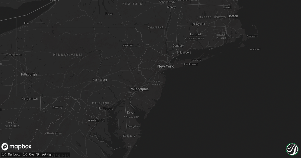
Hail Map in New Jersey on February 21, 2023
Get this storm
February 21 map
$229
one time, instant access
Download today. No call, no setup
Keep the $229
Bought the map and want the full workflow? Apply the entire $229 to a subscription within 7 days. None of it is wasted.
Every map, not just this one
This buys you this map. Subscription and you get every map we run, in the markets you choose from a few cities to whole states to nationwide. Plus real-time alerts the moment a storm fires.
Contact data
Name, contact info, occupancy, even credit band for addresses in the footprint. You go from where it hit to who to call.
Become the source they trust
Unlimited branding weather history reports on demand. You already have the documented answer ready for the property owner, and you are the one who showed up with it.
Property data and RoofTrace estimates
Pull up any address you have got, its value and the exact code rules for that jurisdiction, straight from One Click Code. Then RoofTrace estimates the squares, pitch, and roof value, priced the way you price.
Storm reports in New Jersey
New Jersey
| Date | Description |
|---|---|
| 02/21/20233:55 PM CST | Public reported quarter size hail in toms river. |
| 02/21/20233:04 PM CST | Report from mping: quarter |
| 02/21/20232:50 PM CST | Possible tornado in quaker bridge. Report of trees and wires on a car. |
| 02/21/20232:47 PM CST | Report from mping: quarter |
| 02/21/20232:45 PM CST | Tree damage reported in residential areas of east windsor twp near wayne way & dorchester drive; chestnut drive & glen oak; and elm drive & primrose lane. This area was |
| 02/21/20232:40 PM CST | Nws employee reports damage on quakerbridge road. Possible tornado. |
| 02/21/20232:40 PM CST | Route 1 closed at intersection of franklin corner road due to power lines down. |
| 02/21/20232:39 PM CST | Broadcast media reports large trees down on dunbar drive and conover road in west windsor... Nj. Possible tornado. |
| 02/21/20232:30 PM CST | A local report indicates 1.00 inch wind near PENNINGTON |
| 02/21/20232:30 PM CST | A local report indicates 1.00 inch wind near LAWRENCEVILLE |


