Hail Map in Alabama on January 22, 2012
Get this storm
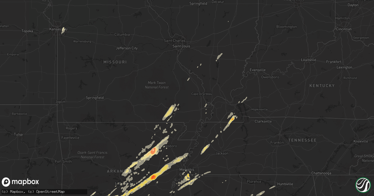
January 22 map
$229
one time, instant access
Download today. No call, no setup
Keep the $229
Bought the map and want the full workflow? Apply the entire $229 to a subscription within 7 days. None of it is wasted.
Every map, not just this one
This buys you this map. Subscription and you get every map we run, in the markets you choose from a few cities to whole states to nationwide. Plus real-time alerts the moment a storm fires.
Contact data
Name, contact info, occupancy, even credit band for addresses in the footprint. You go from where it hit to who to call.
Become the source they trust
Unlimited branding weather history reports on demand. You already have the documented answer ready for the property owner, and you are the one who showed up with it.
Property data and RoofTrace estimates
Pull up any address you have got, its value and the exact code rules for that jurisdiction, straight from One Click Code. Then RoofTrace estimates the squares, pitch, and roof value, priced the way you price.
Storm reports in Alabama
Alabama
| Date | Description |
|---|---|
| 01/22/20125:47 AM CST | Trees and power lines down on alabama highway 76 near desoto caverns park. |
| 01/22/20125:37 AM CST | One home had one-fifth of its roof peeled off. A dozen pine trees were uprooted near lee road and highway 76. Possible tornado. |
| 01/22/20125:35 AM CST | The tornado touched down just west of the intersection of al-76 and cr-175 oakdale road...and moved ene from there...remaining very close to al-76. A house and storage |
| 01/22/20125:20 AM CST | Wklf radio studio destroyed...and 302 foot transmission tower was toppled at the intersection of alabama highway 22 and county road 37. The strength of the tornado was |
| 01/22/20125:05 AM CST | Major structual damage reported in maplesville with people trapped in homes. |
| 01/22/20124:50 AM CST | Major stuctural damage reported near the 500 block of u.s. Highway 31 in fultondale. |
| 01/22/20124:37 AM CST | Multiple trees down blocking the roadway on the intersection of alabama highway 5 and county road 16. Possible tornado. |
| 01/22/20124:36 AM CST | Possible tornado - cr hwy 183- many trees blocking hwy sprott to sr 82 - oakmulgee damage as well |
| 01/22/20124:29 AM CST | Major structual damage reported on old springville road. Injuries unknown at this time. |
| 01/22/20124:27 AM CST | Major structural damage reported in trussville with multiple trees downed. |
| 01/22/20124:17 AM CST | Public reported a tornado on roulain road in the margaret community. |
| 01/22/20124:15 AM CST | Trees down and damage to homes near balboa court. |
| 01/22/20124:11 AM CST | Extensive damage with multiple trees and power lines down in center point. Possible tornado. |
| 01/22/20124:10 AM CST | Several homes destroyed in the paradise valley area in clay. Time estimated from radar. |
| 01/22/20124:05 AM CST | Quarter size hail reported in center point. |
| 01/22/20124:00 AM CST | Pawnee village road completely impassible in tarrant. |
| 01/22/20124:00 AM CST | Structure damage and numerous trees down in the 8800 block of taylors ferry road. Possible tornado. |
| 01/22/20123:54 AM CST | Major stuctural damage reported near the 500 block of u.s. Highway 31 in fultondale. |
| 01/22/20123:43 AM CST | Trees down blocking camp oliver road by stringfellow hill road west of oak grove. |
| 01/22/20123:31 AM CST | Trees down across taylors ferry road. Possible tornado. |
| 01/22/20123:26 AM CST | Trees down on toadvine road. Possible tornado. |
| 01/22/20123:24 AM CST | Multiple trees down on taylors ferry road. |
| 01/22/20123:23 AM CST | Reports of trees down and possible structural damage near smithville baptist church on toadvine road near oak grove. Possible tornado. Time estimated from radar. |
| 01/22/20123:21 AM CST | Several trees were snapped off or uprooted and a shed was destroyed.the path length was about 1 mile and the width was 50 yards. This occurred near highway 11 and count |
| 01/22/20123:20 AM CST | Several trees were snapped off or uprooted and a shed was destroyed.the path length was about 1 mile and the width was 50 yards. This occurred near highway 11 and count |
| 01/22/20123:20 AM CST | Several trees blown were down and a shed destroyed. |
| 01/22/20123:09 AM CST | *** 1 fatal *** the tornado started in extreme eastern tuscaloosa county and moved into jefferson county. Numerous trees were snapped off and uprooted along the path. O |
| 01/22/20123:09 AM CST | Roof reported off a home on gray drive in the mount olive community. Possible tornado. |
| 01/22/20123:00 AM CST | F2 tornado on watermelon road. Dozens of pines were snapped and several campers were rolled over. 3 h-frame transmission lines were snapped. The path was about one half |
| 01/22/20122:45 AM CST | Large trees down blocking the roadway on larry lake road...as well as a roof ripped off a home in the mount olive area of coker. |
| 01/22/20122:45 AM CST | Tornado spotted on the ground on lake tuscaloosa tierce patton road. |
| 01/22/20122:40 AM CST | Huge trees down on state highway 171 near crawford drive. Possible tornado. |
| 01/22/20122:40 AM CST | Dozens of trees were uprooted near koffman ranch road. One well constructed single family home lost its entie roof. The path length was about one half mile and was 400 |
| 01/22/20122:36 AM CST | Significant damage to a home off of marby heights drive. Possible tornado. |
| 01/22/20122:36 AM CST | The tornado touched down along s h and g drive causing significant roof damage to one single family residence. As the tornado continued northeast towards marby heights |
| 01/22/20122:25 AM CST | Trees down on highway 140 and holeman church road. Time estimated from radar. |
| 01/22/20121:15 AM CST | Brief quarter sized hail was reported. |
| 01/22/201212:34 AM CST | Tree knocked down on hwy 172 near bear creek bridge. |
All States Impacted by Hail Map on January 22, 2012
Cities Impacted by Hail Map on January 22, 2012
- Cotton Plant, AR
- Brinkley, AR
- Wheatley, AR
- Romance, AR
- Rose Bud, AR
- Searcy, AR
- Hampton, AR
- Royal, AR
- Bonnerdale, AR
- Chunky, MS
- Meridian, MS
- Collinsville, MS
- Bailey, MS
- Louann, AR
- Epes, AL
- Boligee, AL
- York, AL
- Livingston, AL
- Byhalia, MS
- Olive Branch, MS
- Lonoke, AR
- Perryville, MO
- Malvern, AR
- Winchester, AR
- Tillar, AR
- Monticello, AR
- Pickens, AR
- Poyen, AR
- Leola, AR
- Donaldson, AR
- Decatur, MS
- Camden, AR
- Smackover, AR
- Clanton, AL
- Wilmar, AR
- Fountain Hill, AR
- Joiner, AR
- Frenchmans Bayou, AR
- Tyronza, AR
- Bassett, AR
- Turrell, AR
- Earle, AR
- Gilmore, AR
- Alligator, MS
- Clarksdale, MS
- Shelby, MS
- Duncan, MS
- Bearden, AR
- Fordyce, AR
- Rosston, AR
- Chidester, AR
- Sarah, MS
- Coldwater, MS
- Kingsland, AR
- Sheridan, AR
- Redfield, AR
- Jefferson, AR
- Doniphan, MO
- Fairdealing, MO
- Grandin, MO
- Poplar Bluff, MO
- Ellsinore, MO
- Williamsville, MO
- Alexander, AR
- Benton, AR
- Grenada, MS
- Coffeeville, MS
- Tillatoba, MS
- Scobey, MS
- Sylacauga, AL
- Rockford, AL
- Weogufka, AL
- Benton, KY
- Hardin, KY
- Collierville, TN
- Magnolia, AR
- Traskwood, AR
- Bryant, AR
- Tunica, MS
- Imboden, AR
- Black Rock, AR
- Weiner, AR
- Little Rock, AR
- Pine Bluff, AR
- Ward, AR
- Drew, MS
- Tutwiler, MS
- Lyon, MS
- Gunnison, MS
- Vance, MS
- Lambert, MS
- Mound Bayou, MS
- Horn Lake, MS
- Lake Cormorant, MS
- Nesbit, MS
- Spruce Pine, AL
- Phil Campbell, AL
- Star City, AR
- Rison, AR
- Grady, AR
- Yorktown, AR
- Mayfield, KY
- Sedalia, KY
- Farmington, KY
- Kirksey, KY
- Trinity, AL
- Decatur, AL
- Tanner, AL
- Centreville, AL
- Maplesville, AL
- Thorsby, AL
- Randolph, AL
- Marion, AL
- Lawley, AL
- Des Arc, AR
- England, AR
- Wynne, AR
- Colt, AR
- Palestine, AR
- Humnoke, AR
- Biscoe, AR
- De Valls Bluff, AR
- Carlisle, AR
- Tucker, AR
- Stuttgart, AR
- Hazen, AR
- El Dorado, AR
- Vilonia, AR
- Conway, AR
- Mount Vernon, AR
- El Paso, AR
- Murray, KY
- Hazel, KY
- Gould, AR
- Altheimer, AR
- Waldo, AR
- Thornton, AR
- Ivan, AR
- Independence, MO
- Hermitage, AR
- Moulton, AL
- Southaven, MS
- Memphis, TN
- Dermott, AR
- Hamburg, AR
- Crossett, AR
- Strong, AR
- Jersey, AR
- Montrose, AR
- Garland City, AR
- Lewisville, AR
- Newport, AR
- Tuckerman, AR
- Hope, AR
- Emmet, AR
- Prescott, AR
- Rochester, IN
- Macy, IN
- Mount Hope, AL
- Dresden, TN
- Palmersville, TN
- Pocahontas, AR
- Scott, AR
- Beech Grove, AR
- Pleasant Plains, AR
- Alicia, AR
- Bono, AR
- Bradford, AR
- Swifton, AR
- Walnut Ridge, AR
- Cash, AR
- Judsonia, AR
- Thida, AR
- Oil Trough, AR
- Bald Knob, AR
- Philadelphia, MS
- De Kalb, MS
- Union, MS
- Hernando, MS
- Banks, AR
- Harrell, AR
- Halls, TN
- Gates, TN
- Brownsville, TN
- Ripley, TN
- Hodges, AL
- Senatobia, MS
- Dundee, MS
- Princeton, KY
- Fredonia, KY
- Kuttawa, KY
- Eddyville, KY
- Tuscaloosa, AL
- Adger, AL
- Brookwood, AL
- Northport, AL
- Arkadelphia, AR
- Prattsville, AR
- Walls, MS
- Robinsonville, MS
- Oxly, MO
- Waltonville, IL
- Corning, AR
- Wayland, MI
- Success, AR
- Gillett, AR
- Cuba, AL
- Lauderdale, MS
- Almyra, AR
- Logansport, IN
- Twelve Mile, IN
- Moro, AR
- Gurdon, AR
- Okolona, AR
- Coker, AL
- Charleston, MO
- Rosie, AR
- Sulphur Rock, AR
- Batesville, AR
- Ripley, MS
- Almo, KY
- Henning, TN
- Friendship, TN
- Tremont, MS
- Helena, AR
- Carrollton, AL
- Reform, AL
- Gordo, AL
- Cabot, AR
- North Little Rock, AR
- Jacksonville, AR
- Sherwood, AR
- Little Rock Air Force Base, AR
- Bellefontaine, MS
- Eupora, MS
- Cottage Grove, TN
- Letona, AR
- Pangburn, AR
- McRae, AR
- Harrisburg, AR
- Russellville, AL
- Town Creek, AL
- Puryear, TN
- Marion, MS
- Little Rock, MS
- Hickory, MS
- Floral, AR
- East Prairie, MO
- Alamo, TN
- Covington, TN
- Parkin, AR
- Fulton, MS
- Nettleton, MS
- Porterville, MS
- Bessemer, AL
- Oakman, AL
- Stewardson, IL
- Smithville, AR
- Mount Vernon, IL
- Rector, AR
- Lafe, AR
- Sawyerville, AL
- Forkland, AL
- Toomsuba, MS
- Peach Orchard, AR
- Delaplaine, AR
- Biggers, AR
- Charleston, MS
- Oakland, MS
- Kansas City, MO
- Kirby, AR
- Amity, AR
- Springville, AL
- Austin, AR
- Jonesboro, AR
- Bluff City, AR
- Mabelvale, AR
- Hensley, AR
- Vina, AL
- Amory, MS
- Hackleburg, AL
- Hamilton, AL
- Sharon, TN
- Rutherford, TN
- Dyer, TN
- Marked Tree, AR
- Goodwin, AR
- Cherry Valley, AR
- Wilson, AR
- Forrest City, AR
- Fisher, AR
- Corinth, MS
- Rienzi, MS
- Griffithville, AR
- Amagon, AR
- Merigold, MS
- Lees Summit, MO
- Bluford, IL
- Stamps, AR
- Taylor, AR
- De Witt, AR
- Warren, AR
- Trenton, TN
- Beebe, AR
- Heber Springs, AR
- Newark, AR
- Paragould, AR
- Greensboro, AL
- Brent, AL
- Newbern, AL
- Jemison, AL
- Ravenden Springs, AR
- Grand Junction, TN
- Moscow, TN
- Higginson, AR
- Watson, AR
- Steeleville, IL
- Sparta, IL
- Nashville, AR
- Moundville, AL
- Augusta, AR
- Cascilla, MS
- Pinson, AL
- Osceola, AR
- Clarendon, AR
- White Hall, AR
- Dyess, AR
- Gainesville, AL
- Fouke, AR
- Texarkana, AR
- New Edinburg, AR
- Buckner, AR
- Willisville, AR
- Waynesboro, MS
- Cord, AR
- Strawberry, AR
- Charlotte, AR
- Saffell, AR
- Harviell, MO
- Naylor, MO
- Crumrod, AR
- Fosters, AL
- Martin, TN
- Wappapello, MO
- Greenville, MO
- Holly Springs, MS
- Rossville, TN
- Glenwood, AR
- Ethel, AR
- Cutler, IL
- Coulterville, IL
- Gardendale, AL


