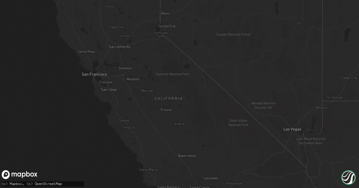
Hail Map in California on October 15, 2022
Get this storm
October 15 map
$229
one time, instant access
Download today. No call, no setup
Keep the $229
Bought the map and want the full workflow? Apply the entire $229 to a subscription within 7 days. None of it is wasted.
Every map, not just this one
This buys you this map. Subscription and you get every map we run, in the markets you choose from a few cities to whole states to nationwide. Plus real-time alerts the moment a storm fires.
Contact data
Name, contact info, occupancy, even credit band for addresses in the footprint. You go from where it hit to who to call.
Become the source they trust
Unlimited branding weather history reports on demand. You already have the documented answer ready for the property owner, and you are the one who showed up with it.
Property data and RoofTrace estimates
Pull up any address you have got, its value and the exact code rules for that jurisdiction, straight from One Click Code. Then RoofTrace estimates the squares, pitch, and roof value, priced the way you price.
Storm reports in California
California
| Date | Description |
|---|---|
| 10/15/20223:41 PM CDT | A power line and possibly a power pole were blown down by thunderstorm winds. |
| 10/15/20221:50 PM CDT | 10-15 powerlines down due to thunderstorm winds... Timing based on radar. |
| 10/15/20227:11 AM CDT | At 1211 PM PDT, a severe thunderstorm was located over El Centro Naval Airfield, or near Imperial, moving northwest at 25 mph. HAZARD...60 mph wind gusts and quarter size hail. SOURCE...Radar indicated. IMPACT...Hail damage to vehicles is expected. Expect wind damage to roofs, siding, and trees. Locations impacted include... El Centro, Imperial, El Centro Naval Airfield and Seeley. This includes the following highways...CA Interstate 8 between mile markers 30 and 35.CA Route 78 between mile markers 11 and 13.CA Route 111 between mile markers 13 and 16. |
| 10/15/20226:58 AM CDT | At 1157 AM MST/1157 AM PDT/, a severe thunderstorm was located 9 miles southwest of Martinez Lake, moving northwest at 20 mph. HAZARD...60 mph wind gusts and quarter size hail. SOURCE...Radar indicated. IMPACT...Hail damage to vehicles is expected. Expect wind damage to roofs, siding, and trees. This severe thunderstorm will remain over mainly rural areas of southwestern La Paz, western Yuma and east central Imperial Counties. |
| 10/15/20226:34 AM CDT | At 1133 AM PDT, a severe thunderstorm was located over Calexico, moving northwest at 25 mph. HAZARD...60 mph wind gusts and quarter size hail. SOURCE...Radar indicated. IMPACT...Hail damage to vehicles is expected. Expect wind damage to roofs, siding, and trees. Locations impacted include... El Centro, Calexico, Imperial, Plaster City, Mt. Signal, El Centro Naval Airfield, Heber, Dixieland and Seeley.This includes the following highways...CA Interstate 8 between mile markers 19 and 42.CA Route 111 between mile markers 1 and 9.CA Route 86 between mile markers 1 and 14. |
| 10/15/20226:16 AM CDT | At 1116 AM MST/1116 AM PDT/, a severe thunderstorm was located near Araby, or 9 miles northwest of Fortuna Foothills, moving northwest at 25 mph. HAZARD...60 mph wind gusts and quarter size hail. SOURCE...Radar indicated. IMPACT...Hail damage to vehicles is expected. Expect wind damage to roofs, siding, and trees. Locations impacted include... Winterhaven, Blaisdell and Kinter. This includes AZ Route 95 between mile markers 29 and 39. |
| 10/15/20223:18 AM CDT | At 816 PM PDT, a severe thunderstorm was located near Apple Valley, moving southwest at 50 mph. HAZARD...60 mph wind gusts and penny size hail. SOURCE...Radar indicated. IMPACT...Expect damage to roofs, siding, and trees. Locations impacted include... San Bernardino, Victorville, Hesperia, Apple Valley, I-15 Through The Cajon Pass, Lake Arrowhead. |
| 10/15/20222:38 AM CDT | At 737 PM PDT, severe thunderstorms were located along a line extending from 11 miles northeast of Owl Canyon Campground to 8 miles southwest of Newberry Springs, moving southwest at 25 mph. HAZARD...60 mph wind gusts. SOURCE...Radar indicated. IMPACT...Expect damage to roofs and trees. Locations impacted include... Barstow, Daggett, I-15 Between Victorville And Barstow, Owl Canyon Campground, Hwy 247 Between Lucerne Valley And Barstow, Lenwood and Nebo Center.This includes the following roads... Interstate 15 in California between mile markers 81 and 90. Interstate 40 in California between mile markers 1 and 17. |
| 10/14/20229:47 PM CDT | At 247 PM PDT, a severe thunderstorm was located 10 miles southeast of Holtville, or 14 miles east of Calexico, moving northwest at 15 mph. HAZARD...60 mph wind gusts and penny size hail. SOURCE...Radar indicated. IMPACT...Expect damage to roofs, siding, and trees. Locations impacted include... El Centro, Calexico, Imperial, Holtville, El Centro Naval Airfield, Bonds Corner, Heber, Alamorio, Dixieland and Seeley.This includes the following highways...CA Interstate 8 between mile markers 25 and 64.CA Route 78 between mile markers 19 and 25.CA Route 111 between mile markers 1 and 19. |
| 10/14/20228:19 PM CDT | At 119 PM PDT, a severe thunderstorm was located 15 miles northwest of Gordon's Well, or 25 miles east of Brawley, moving northwest at 25 mph. HAZARD...60 mph wind gusts and quarter size hail. SOURCE...Radar indicated. IMPACT...Hail damage to vehicles is expected. Expect wind damage to roofs, siding, and trees. Locations impacted include... Glamis and Wiest. This includes the following highways...CA Route 78 between mile markers 20 and 43.CA Route 111 between mile markers 25 and 31. |
| 10/14/20228:07 PM CDT | At 107 PM PDT, a severe thunderstorm was located 22 miles southeast of Desert Center, moving northwest at 35 mph. HAZARD...60 mph wind gusts and quarter size hail. SOURCE...Radar indicated. IMPACT...Hail damage to vehicles is expected. Expect wind damage to roofs, siding, and trees. Locations impacted include... Desert Center.This includes the following highways...CA Interstate 10 between mile markers 91 and 118.CA Route 177 between mile markers 1 and 7. |
All States Impacted by Hail Map on October 15, 2022
Cities Impacted by Hail Map on October 15, 2022
- Charlotte, AR
- Cord, AR
- Sulphur Rock, AR
- Batesville, AR
- Newark, AR
- Manila, AR
- Caraway, AR
- Hagarville, AR
- Lamar, AR
- Tyronza, AR
- Oakland, AR
- Yellville, AR
- Lakeview, AR
- Mountain Home, AR
- Bull Shoals, AR
- Midway, AR
- Wiseman, AR
- Horseshoe Bend, AR
- Center Ridge, AR
- Hartman, AR
- Leedey, OK
- Calumet, OK
- El Reno, OK
- Welling, OK
- Fort Gibson, OK
- Park Hill, OK
- Tahlequah, OK
- Leslie, AR
- Maricopa, AZ
- Leachville, AR
- Cabot, AR
- Memphis, TN
- Butler, OK
- Fort Smith, AR
- Claude, TX
- Jessieville, AR
- Redfield, AR
- Danville, AR
- Ola, AR
- Rover, AR
- Plainview, AR
- Calico Rock, AR
- Norfork, AR
- Hernando, MS
- San Tan Valley, AZ
- Stilwell, OK
- Mansfield, AR
- Wilson, OK
- Ozark, AR
- Bunch, OK
- Cookson, OK
- Hoxie, AR
- Lynn, AR
- Alicia, AR
- Swifton, AR
- Arnett, OK
- Vici, OK
- Turrell, AR
- Henderson, AR
- Weatherford, OK
- Geary, OK
- Cash, AR
- Custer City, OK
- Thomas, OK
- Arapaho, OK
- Clinton, OK
- Arlington, AZ
- Tonopah, AZ
- Buckeye, AZ
- Winkelman, AZ
- Vian, OK
- Sallisaw, OK
- Sheridan, AR
- Hensley, AR
- Jonesboro, AR
- Sherrill, AR
- Pottsboro, TX
- Sayre, OK
- Piedmont, OK
- North Little Rock, AR
- Little Rock, AR
- Gans, OK
- Muldrow, OK
- Lawton, OK
- Pettigrew, AR
- Briscoe, TX
- Sweetwater, OK
- Wheeler, TX
- Carter, OK
- Phoenix, AZ
- Ozone, AR
- Deer, AR
- Oark, AR
- Taloga, OK
- Greenfield, OK
- Watonga, OK
- Van Buren, AR
- Oxford, AR
- Salem, AR
- Hydro, OK
- Forrest City, AR
- Wynne, AR
- Cedarville, AR
- Altus, AR
- Harriet, AR
- Mount Judea, AR
- Rudy, AR
- Alma, AR
- Dyer, AR
- Charleston, AR
- Pelsor, AR
- Marshall, AR
- Uniontown, AR
- Dover, AR
- Witts Springs, AR
- Lavaca, AR
- Mulberry, AR
- Saint Joe, AR
- Mountainburg, AR
- Cecil, AR
- Clarksville, AR
- Chester, AR
- Ponca, AR
- Bradenton, FL
- Sarasota, FL
- Winslow, AR
- Bluffton, AR
- Reydon, OK
- West Fork, AR
- Elizabeth, AR
- England, AR
- Bryant, AR
- Mabelvale, AR
- Scott, AR
- Benton, AR
- Hot Springs Village, AR
- Paron, AR
- Lonsdale, AR
- Alexander, AR
- Perryville, AR
- Waldron, AR
- Mesa, AZ
- Eloy, AZ
- Picacho, AZ
- Vilonia, AR
- Enola, AR
- Greenbrier, AR
- Crawford, OK
- Cheyenne, OK
- Pindall, AR
- Everton, AR
- Elk City, OK
- Dardanelle, AR
- Casa, AR
- Belleville, AR
- Ardmore, OK
- Canehill, AR
- Natural Dam, AR
- Prairie Grove, AR
- Edmond, OK
- Gilbert, AZ
- Chandler, AZ
- Imperial, CA
- Germantown, TN
- Collierville, TN
- Hulbert, OK
- Wideman, AR
- Viola, AR
- Bexar, AR
- Corn, OK
- Myrtle, MO
- Hardy, AR
- Sturkie, AR
- Camp, AR
- Ravenden, AR
- Pocahontas, AR
- Mammoth Spring, AR
- Warner, OK
- Porum, OK
- Webbers Falls, OK
- Gore, OK
- Council Hill, OK
- Checotah, OK
- Braggs, OK
- Oktaha, OK
- Muskogee, OK
- Boynton, OK
- Valley Springs, AR
- Hammon, OK
- Fountain Hills, AZ
- Scottsdale, AZ
- Joiner, AR
- Dyess, AR
- Cordell, OK
- Russellville, AR
- Malvern, AR
- Carlisle, AR
- Henning, TN
- Winterhaven, CA
- Yuma, AZ
- Hackett, AR
- Cameron, OK
- Concord, AR
- Gatewood, MO
- Couch, MO
- Mountain View, OK
- Damascus, AR
- Bee Branch, AR
- Ravenden Springs, AR
- Doniphan, MO
- Glencoe, AR
- Thayer, MO
- Hartford, AR
- Winfield, KS
- Rock, KS
- Letona, AR
- Augusta, AR
- Lepanto, AR
- Pleasant Plains, AR
- Heber Springs, AR
- Osceola, AR
- Weiner, AR
- Bradford, AR
- Harrisburg, AR
- Keiser, AR
- Searcy, AR
- Fisher, AR
- Etowah, AR
- Floral, AR
- Beedeville, AR
- Cherry Valley, AR
- Judsonia, AR
- Hickory Ridge, AR
- Pangburn, AR
- Bald Knob, AR
- Oil Trough, AR
- Rose Bud, AR
- McCrory, AR
- Newport, AR
- Trumann, AR
- Marked Tree, AR
- Amagon, AR
- Wellton, AZ
- Lelia Lake, TX
- Springfield, AR
- Plumerville, AR
- Booneville, AR
- Ward, AR
- Lonoke, AR
- Brawley, CA
- Decatur, TX
- Minco, OK
- Springer, OK
- Davis, OK
- Dougherty, OK
- Sulphur, OK
- Dill City, OK
- Sentinel, OK
- Gotebo, OK
- Hobart, OK
- Canute, OK
- Lone Wolf, OK
- Des Arc, AR
- Quitman, AR
- Binger, OK
- Austin, AR
- Greenwood, AR
- Bigelow, AR
- Roland, AR
- Naples, FL
- Hickory Plains, AR
- Coolidge, AZ
- Little Rock Air Force Base, AR
- Jacksonville, AR
- Barling, AR
- Paradise Valley, AZ
- Roosevelt, OK
- Arkoma, OK
- Spiro, OK
- Pocola, OK
- Midland, AR
- Huntington, AR
- Atoka, OK
- Calexico, CA
- Solgohachia, AR
- Morrilton, AR
- Heber, CA
- El Centro, CA
- Hedley, TX
- Olive Branch, MS
- Hughes, AR
- Tecumseh, OK
- Ringling, OK
- Rocky, OK
- Florence, AZ
- Foss, OK
- Atkins, AR
- Widener, AR
- Gracemont, OK
- Carnegie, OK
- Lookeba, OK
- Fort Cobb, OK
- Heth, AR
- Farmersville, TX
- Greenville, TX
- Celeste, TX
- Guy, AR
- Clarendon, TX
- Sherwood, AR
- Conway, AR
- Cibola, AZ
- Griffithville, AR
- Peel, AR
- Queen Creek, AZ
- Casa Grande, AZ
- Rio Verde, AZ
- Fort Mcdowell, AZ
- Camargo, OK
- Bethany, OK
- Oklahoma City, OK
- Yukon, OK
- Jones, OK
- Lexington, OK
- Newalla, OK
- Konawa, OK
- Norman, OK
- Asher, OK
- Wanette, OK
- Macomb, OK
- Noble, OK
- Mcloud, OK
- Maud, OK
- Choctaw, OK
- Tucson, AZ
- Alvord, TX
- Chico, TX


