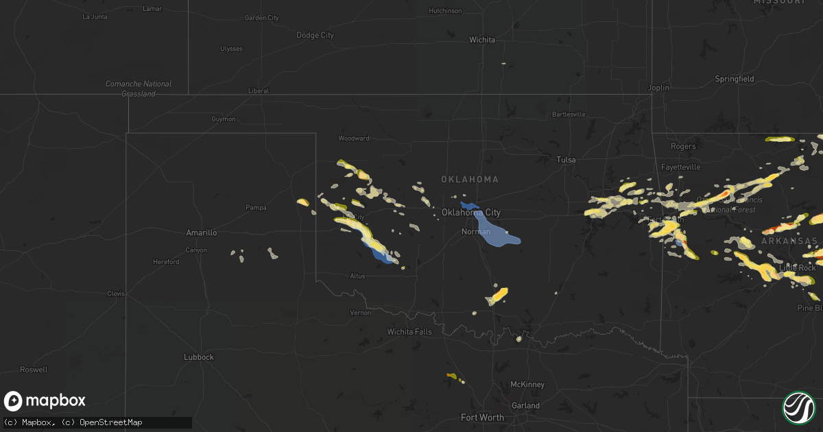
Hail Map in Oklahoma on October 15, 2022
Get this storm
October 15 map
$229
one time, instant access
Download today. No call, no setup
Keep the $229
Bought the map and want the full workflow? Apply the entire $229 to a subscription within 7 days. None of it is wasted.
Every map, not just this one
This buys you this map. Subscription and you get every map we run, in the markets you choose from a few cities to whole states to nationwide. Plus real-time alerts the moment a storm fires.
Contact data
Name, contact info, occupancy, even credit band for addresses in the footprint. You go from where it hit to who to call.
Become the source they trust
Unlimited branding weather history reports on demand. You already have the documented answer ready for the property owner, and you are the one who showed up with it.
Property data and RoofTrace estimates
Pull up any address you have got, its value and the exact code rules for that jurisdiction, straight from One Click Code. Then RoofTrace estimates the squares, pitch, and roof value, priced the way you price.
Storm reports in Oklahoma
Oklahoma
| Date | Description |
|---|---|
| 10/15/20226:58 PM CDT | A local report indicates 1.00 inch wind near 1 ENE CHECOTAH |
| 10/15/20226:58 AM CDT | At 1158 PM CDT, severe thunderstorms were located along a line extending from 3 miles south of Mountain View to 12 miles east of Roosevelt to near Cooperton, moving east at 30 mph. HAZARD...60 mph wind gusts and quarter size hail. SOURCE...Radar indicated. IMPACT...Hail damage to vehicles is expected. Expect wind damage to roofs, siding, and trees. Locations impacted include... Carnegie, Mountain View, Fort Cobb, Cooperton, Meers, Lake Lawtonka, Boone, southwestern Fort Sill and Wichita Mountains Wildlife Refuge. |
| 10/15/20226:41 AM CDT | At 1140 PM CDT, a severe thunderstorm was located 4 miles east of Hobart, moving southeast at 20 mph. HAZARD...60 mph wind gusts and quarter size hail. SOURCE...Radar indicated. IMPACT...Hail damage to vehicles is expected. Expect wind damage to roofs, siding, and trees. Locations impacted include... Hobart, Gotebo and Cooperton. |
| 10/15/20226:26 AM CDT | At 1126 PM CDT, a severe thunderstorm was located 4 miles southwest of Cheyenne, moving southeast at 10 mph. HAZARD...Ping pong ball size hail and 60 mph wind gusts. SOURCE...Radar indicated. IMPACT...People and animals outdoors will be injured. Expect hail damage to roofs, siding, windows, and vehicles. Expect wind damage to roofs, siding, and trees. Locations impacted include... Cheyenne and Berlin. |
| 10/15/20226:12 AM CDT | At 1112 PM CDT, a severe thunderstorm was located over southeastern Oklahoma City, or near Stella, moving east at 25 mph. HAZARD...60 mph wind gusts. SOURCE...Radar indicated. IMPACT...Expect damage to roofs, siding, and trees. Locations impacted include... Southeastern Oklahoma City, Norman, Shawnee, Tecumseh, Pink, Tribbey, Etowah, Brooksville, Macomb, Stella, Dale, Newalla, Lake Thunderbird, Bethel Acres and Little Axe. |
| 10/15/20226:07 AM CDT | At 1107 PM CDT, a severe thunderstorm was located near Sentinel, moving southeast at 25 mph. HAZARD...60 mph wind gusts and quarter size hail. SOURCE...Radar indicated. IMPACT...Hail damage to vehicles is expected. Expect wind damage to roofs, siding, and trees. Locations impacted include... Hobart, Sentinel, Dill City, Gotebo and Rocky. |
| 10/15/20226:00 AM CDT | At 1059 PM CDT, a severe thunderstorm was located 8 miles southwest of Burns Flat, moving southeast at 15 mph. HAZARD...60 mph wind gusts and half dollar size hail. SOURCE...The Elk City measured a 59 mph wind gust. IMPACT...Hail damage to vehicles is expected. Expect wind damage to roofs, siding, and trees. Locations impacted include... Burns Flat, Sentinel, Dill City and Bessie. |
| 10/15/20225:41 AM CDT | At 1040 PM CDT, a severe thunderstorm was located near Elk City, moving east at 15 mph. HAZARD...Quarter size hail. SOURCE...Radar indicated. IMPACT...Damage to vehicles is expected. Locations impacted include... Canute and Foss. |
| 10/15/20225:37 AM CDT | At 1037 PM CDT, severe thunderstorms were located along a line extending from 3 miles north of Edmond to near Oklahoma City to 5 miles southeast of Mustang, moving east at 40 mph. HAZARD...60 mph wind gusts. SOURCE...Radar indicated. IMPACT...Expect damage to roofs, siding, and trees. Locations impacted include... Oklahoma City, northern Norman, Edmond, Moore, Midwest City, Del City, Choctaw, The Village, Harrah, Spencer, Nichols Hills, Jones, Nicoma Park, Luther, Valley Brook, Arcadia, Stella, Tinker Air Force Base, Stanley Draper Lake and Newalla. |
| 10/15/20225:19 AM CDT | At 1019 PM CDT, severe thunderstorms were located along a line extending from near Edmond to near Oklahoma City to 4 miles northwest of Mustang, moving east at 25 mph. HAZARD...60 mph wind gusts. SOURCE...Radar indicated. IMPACT...Expect damage to roofs, siding, and trees. Locations impacted include... Oklahoma City, Edmond, Midwest City, Del City, Yukon, Bethany, Choctaw, Warr Acres, The Village, Piedmont, Spencer, Nichols Hills, Jones, Nicoma Park, Valley Brook, Arcadia, Tinker Air Force Base, Forest Park, Woodlawn Park and Lake Aluma. |
| 10/15/20225:15 AM CDT | At 1015 PM CDT, a severe thunderstorm was located 6 miles northeast of Sayre, moving southeast at 10 mph. HAZARD...Quarter size hail. SOURCE...Radar indicated. IMPACT...Damage to vehicles is expected. Locations impacted include... Elk City and Sayre. |
| 10/15/20225:13 AM CDT | At 1013 PM CDT, a severe thunderstorm was located 3 miles east of Lake Tenkiller State Park, moving east at 20 mph. HAZARD...60 mph wind gusts and half dollar size hail. SOURCE...Radar indicated. IMPACT...Hail damage to vehicles is expected. Expect wind damage to roofs, siding, and trees. Locations in or near the path include... Sallisaw... Vian... Marble City... Brushy Lake State Park... Brushy... Lake Tenkiller State Park... Box... |
| 10/15/20225:03 AM CDT | At 1002 PM CDT, a severe thunderstorm was located 3 miles north of Bunch, moving east at 20 mph. Another severe thunderstorm was located 5 miles northwest of Natural Dam, moving east at 20 mph. HAZARD...60 mph wind gusts and half dollar size hail. SOURCE...Radar indicated. IMPACT...Hail damage to vehicles is expected. Expect wind damage to roofs, siding, and trees. Locations in or near the path include... Stilwell... Mountainburg... Natural Dam... Chester... Adair State Park... Lee Creek... Devils Den State Park... Bunch... Strickler... Blackburn... Odell... This includes Interstate 49 between mile markers 30 and 46. |
| 10/15/20224:44 AM CDT | At 944 PM CDT, a severe thunderstorm was located near Calumet, moving southeast at 25 mph. HAZARD...60 mph wind gusts and quarter size hail. SOURCE...Radar indicated. IMPACT...Hail damage to vehicles is expected. Expect wind damage to roofs, siding, and trees. Locations impacted include... El Reno, Yukon, Piedmont, Union City, Geary, Okarche, Calumet, Concho and Richland. |
| 10/15/20224:30 AM CDT | At 930 PM CDT, a severe thunderstorm was located 6 miles southwest of Cheyenne, moving southeast at 15 mph. HAZARD...Quarter size hail. SOURCE...Radar indicated. IMPACT...Damage to vehicles is expected. Locations impacted include... Cheyenne, Berlin and Dempsey. |
| 10/15/20224:26 AM CDT | At 926 PM CDT, a severe thunderstorm was located over Oliver, or 10 miles west of Waldron, moving east at 20 mph. HAZARD...60 mph wind gusts and quarter size hail. SOURCE...Radar indicated. IMPACT...Hail damage to vehicles is expected. Expect wind damage to roofs, siding, and trees. Locations impacted include... Waldron... Beauchamp... Cardiff... Oliver... Morgan Springs... Bates... Cauthron... Winfield... Hon... Liberty... Y City... Needmore... Boles... Parks... Elm Park... |
| 10/15/20224:22 AM CDT | At 922 PM CDT, a severe thunderstorm was located 5 miles northeast of Butler, moving northeast at 10 mph. HAZARD...Quarter size hail. SOURCE...Radar indicated. IMPACT...Damage to vehicles is expected. This severe thunderstorm will remain over mainly rural areas of north central Custer County. |
| 10/15/20223:50 AM CDT | At 850 PM CDT, a severe thunderstorm was located near Reydon, moving east at 15 mph. HAZARD...Quarter size hail. SOURCE...Radar indicated. IMPACT...Damage to vehicles is expected. Locations impacted include... Cheyenne, Reydon, Strong City and Berlin. |
| 10/15/20223:14 AM CDT | At 814 PM CDT, a severe thunderstorm was located 5 miles east of Watonga, moving east at 15 mph. HAZARD...Quarter size hail. SOURCE...Radar indicated. IMPACT...Damage to vehicles is expected. Locations impacted include... Omega. |
| 10/15/20222:48 AM CDT | At 748 PM CDT, severe thunderstorms were located along a line extending from 6 miles north of Putnam to 5 miles northeast of Butler to 5 miles southwest of Foss Reservoir, moving east at 20 mph. HAZARD...Ping pong ball size hail and 60 mph wind gusts. SOURCE...Radar indicated. IMPACT...People and animals outdoors will be injured. Expect hail damage to roofs, siding, windows, and vehicles. Expect wind damage to roofs, siding, and trees. Locations impacted include... Clinton, Thomas, Arapaho, Hammon, Custer City, Butler, Oakwood, Putnam, Foss Reservoir, Fay and Stafford. |
| 10/15/20222:19 AM CDT | At 719 PM CDT, a severe thunderstorm was located near Camargo, moving southeast at 25 mph. HAZARD...60 mph wind gusts and half dollar size hail. SOURCE...Radar indicated. IMPACT...Hail damage to vehicles is expected. Expect wind damage to roofs, siding, and trees. Locations impacted include... Camargo. |
| 10/15/20222:17 AM CDT | At 717 PM CDT, a severe thunderstorm was located near Springer, moving northeast at 35 mph. HAZARD...60 mph wind gusts and half dollar size hail. SOURCE...Radar indicated. IMPACT...Hail damage to vehicles is expected. Expect wind damage to roofs, siding, and trees. Locations impacted include... Ardmore, Sulphur, Roff, Springer, Mill Creek, Dougherty, Gene Autry, Hickory, Pontotoc, Lake Of The Arbuckles, Turner Falls, Connerville and Scullin. |
| 10/15/20222:13 AM CDT | At 713 PM CDT, a severe thunderstorm was located 4 miles west of Warner, moving east at 30 mph. HAZARD...60 mph wind gusts and quarter size hail. SOURCE...Broadcast media. IMPACT...Hail damage to vehicles is expected. Expect wind damage to roofs, siding, and trees. Locations in or near the path include... Warner... Gore... Webbers Falls... Oktaha... Rentiesville... Greenleaf State Park... Lake Tenkiller State Park... Keefeton...This includes Interstate 40 in Oklahoma between mile markers 266 and293. |
| 10/15/20222:02 AM CDT | At 702 PM CDT, a severe thunderstorm was located 7 miles southeast of Harmon, moving east at 15 mph. HAZARD...60 mph wind gusts and half dollar size hail. SOURCE...Radar indicated. IMPACT...Hail damage to vehicles is expected. Expect wind damage to roofs, siding, and trees. Locations impacted include... Vici and Camargo. |
| 10/15/20221:31 AM CDT | At 631 PM CDT, a severe thunderstorm was located 7 miles northeast of Pumpkin Center, moving northeast at 15 mph. HAZARD...60 mph wind gusts and quarter size hail. SOURCE...Radar indicated. IMPACT...Hail damage to vehicles is expected. Expect wind damage to roofs, siding, and trees. Locations in or near the path include... Tahlequah... Eldon... |
| 10/15/20221:30 AM CDT | At 629 PM CDT, a severe thunderstorm was located near Harmon, moving northeast at 10 mph. HAZARD...60 mph wind gusts and quarter size hail. SOURCE...Radar indicated. IMPACT...Hail damage to vehicles is expected. Expect wind damage to roofs, siding, and trees. Locations impacted include... Vici and Harmon. |
| 10/15/20221:27 AM CDT | At 626 PM CDT, a severe thunderstorm was located 5 miles north of Lake Eufaula State Park, moving east at 15 mph. HAZARD...60 mph wind gusts and quarter size hail. SOURCE...Radar indicated. IMPACT...Hail damage to vehicles is expected. Expect wind damage to roofs, siding, and trees. Locations in or near the path include... Checotah... Oktaha... Council Hill... Rentiesville... Lake Eufaula State Park... Pierce... Onapa... This includes Interstate 40 in Oklahoma between mile markers 253 and275. |
| 10/15/202212:57 AM CDT | At 556 PM CDT, a severe thunderstorm was located near Warner, moving east at 15 mph. HAZARD...60 mph wind gusts and half dollar size hail. SOURCE...Radar indicated. IMPACT...Hail damage to vehicles is expected. Expect wind damage to roofs, siding, and trees. Locations in or near the path include... Warner... Gore... Webbers Falls... This includes Interstate 40 in Oklahoma between mile markers 272 and291. |
| 10/15/202212:44 AM CDT | At 544 PM CDT, a severe thunderstorm was located near Bonanza, moving northeast at 25 mph. HAZARD...60 mph wind gusts and half dollar size hail. SOURCE...Radar indicated. IMPACT...Hail damage to vehicles is expected. Expect wind damage to roofs, siding, and trees. Locations in or near the path include... Fort Smith... Barling... Fort Smith Regional Airport... Rye Hill...This includes Interstate 540 between mile markers 8 and 14. |
| 10/15/202212:31 AM CDT | A local report indicates 1.00 inch wind near 3 S MEERS |
| 10/15/202212:27 AM CDT | At 527 PM CDT, a severe thunderstorm was located 5 miles northwest of Keefeton, moving east at 15 mph. HAZARD...60 mph wind gusts and half dollar size hail. SOURCE...Radar indicated. IMPACT...Hail damage to vehicles is expected. Expect wind damage to roofs, siding, and trees. Locations in or near the path include... Muskogee... Braggs... Greenleaf State Park... Summit... |
| 10/14/202211:19 PM CDT | Measured by personal weather station. |
| 10/14/202211:05 PM CDT | Large tree limb down in the roadway near 24th ne and wheaton dr. |
| 10/14/202210:45 PM CDT | Elk city mesonet. |
| 10/14/202210:21 PM CDT | Wiley post asos. |
| 10/14/202210:08 PM CDT | Mping report. |
| 10/14/202210:08 PM CDT | A local report indicates 1.00 inch wind near 3 NNW BOX |
| 10/14/20229:54 PM CDT | Near paradise hill. |
| 10/14/20227:49 PM CDT | Corrects previous hail report from 1 s hammon. |
| 10/14/20227:45 PM CDT | A local report indicates 1.00 inch wind near 1 S HAMMON |
| 10/14/20227:44 PM CDT | A local report indicates 1.75 inch wind near 1 ESE LAKE OF THE ARBUC |
| 10/14/20227:43 PM CDT | Report received via social media. |
| 10/14/20227:35 PM CDT | A local report indicates 1.25 inch wind near DOUGHERTY |
All States Impacted by Hail Map on October 15, 2022
Cities Impacted by Hail Map on October 15, 2022
- Charlotte, AR
- Cord, AR
- Sulphur Rock, AR
- Batesville, AR
- Newark, AR
- Manila, AR
- Caraway, AR
- Hagarville, AR
- Lamar, AR
- Tyronza, AR
- Oakland, AR
- Yellville, AR
- Lakeview, AR
- Mountain Home, AR
- Bull Shoals, AR
- Midway, AR
- Wiseman, AR
- Horseshoe Bend, AR
- Center Ridge, AR
- Hartman, AR
- Leedey, OK
- Calumet, OK
- El Reno, OK
- Welling, OK
- Fort Gibson, OK
- Park Hill, OK
- Tahlequah, OK
- Leslie, AR
- Maricopa, AZ
- Leachville, AR
- Cabot, AR
- Memphis, TN
- Butler, OK
- Fort Smith, AR
- Claude, TX
- Jessieville, AR
- Redfield, AR
- Danville, AR
- Ola, AR
- Rover, AR
- Plainview, AR
- Calico Rock, AR
- Norfork, AR
- Hernando, MS
- San Tan Valley, AZ
- Stilwell, OK
- Mansfield, AR
- Wilson, OK
- Ozark, AR
- Bunch, OK
- Cookson, OK
- Hoxie, AR
- Lynn, AR
- Alicia, AR
- Swifton, AR
- Arnett, OK
- Vici, OK
- Turrell, AR
- Henderson, AR
- Weatherford, OK
- Geary, OK
- Cash, AR
- Custer City, OK
- Thomas, OK
- Arapaho, OK
- Clinton, OK
- Arlington, AZ
- Tonopah, AZ
- Buckeye, AZ
- Winkelman, AZ
- Vian, OK
- Sallisaw, OK
- Sheridan, AR
- Hensley, AR
- Jonesboro, AR
- Sherrill, AR
- Pottsboro, TX
- Sayre, OK
- Piedmont, OK
- North Little Rock, AR
- Little Rock, AR
- Gans, OK
- Muldrow, OK
- Lawton, OK
- Pettigrew, AR
- Briscoe, TX
- Sweetwater, OK
- Wheeler, TX
- Carter, OK
- Phoenix, AZ
- Ozone, AR
- Deer, AR
- Oark, AR
- Taloga, OK
- Greenfield, OK
- Watonga, OK
- Van Buren, AR
- Oxford, AR
- Salem, AR
- Hydro, OK
- Forrest City, AR
- Wynne, AR
- Cedarville, AR
- Altus, AR
- Harriet, AR
- Mount Judea, AR
- Rudy, AR
- Alma, AR
- Dyer, AR
- Charleston, AR
- Pelsor, AR
- Marshall, AR
- Uniontown, AR
- Dover, AR
- Witts Springs, AR
- Lavaca, AR
- Mulberry, AR
- Saint Joe, AR
- Mountainburg, AR
- Cecil, AR
- Clarksville, AR
- Chester, AR
- Ponca, AR
- Bradenton, FL
- Sarasota, FL
- Winslow, AR
- Bluffton, AR
- Reydon, OK
- West Fork, AR
- Elizabeth, AR
- England, AR
- Bryant, AR
- Mabelvale, AR
- Scott, AR
- Benton, AR
- Hot Springs Village, AR
- Paron, AR
- Lonsdale, AR
- Alexander, AR
- Perryville, AR
- Waldron, AR
- Mesa, AZ
- Eloy, AZ
- Picacho, AZ
- Vilonia, AR
- Enola, AR
- Greenbrier, AR
- Crawford, OK
- Cheyenne, OK
- Pindall, AR
- Everton, AR
- Elk City, OK
- Dardanelle, AR
- Casa, AR
- Belleville, AR
- Ardmore, OK
- Canehill, AR
- Natural Dam, AR
- Prairie Grove, AR
- Edmond, OK
- Gilbert, AZ
- Chandler, AZ
- Imperial, CA
- Germantown, TN
- Collierville, TN
- Hulbert, OK
- Wideman, AR
- Viola, AR
- Bexar, AR
- Corn, OK
- Myrtle, MO
- Hardy, AR
- Sturkie, AR
- Camp, AR
- Ravenden, AR
- Pocahontas, AR
- Mammoth Spring, AR
- Warner, OK
- Porum, OK
- Webbers Falls, OK
- Gore, OK
- Council Hill, OK
- Checotah, OK
- Braggs, OK
- Oktaha, OK
- Muskogee, OK
- Boynton, OK
- Valley Springs, AR
- Hammon, OK
- Fountain Hills, AZ
- Scottsdale, AZ
- Joiner, AR
- Dyess, AR
- Cordell, OK
- Russellville, AR
- Malvern, AR
- Carlisle, AR
- Henning, TN
- Winterhaven, CA
- Yuma, AZ
- Hackett, AR
- Cameron, OK
- Concord, AR
- Gatewood, MO
- Couch, MO
- Mountain View, OK
- Damascus, AR
- Bee Branch, AR
- Ravenden Springs, AR
- Doniphan, MO
- Glencoe, AR
- Thayer, MO
- Hartford, AR
- Winfield, KS
- Rock, KS
- Letona, AR
- Augusta, AR
- Lepanto, AR
- Pleasant Plains, AR
- Heber Springs, AR
- Osceola, AR
- Weiner, AR
- Bradford, AR
- Harrisburg, AR
- Keiser, AR
- Searcy, AR
- Fisher, AR
- Etowah, AR
- Floral, AR
- Beedeville, AR
- Cherry Valley, AR
- Judsonia, AR
- Hickory Ridge, AR
- Pangburn, AR
- Bald Knob, AR
- Oil Trough, AR
- Rose Bud, AR
- McCrory, AR
- Newport, AR
- Trumann, AR
- Marked Tree, AR
- Amagon, AR
- Wellton, AZ
- Lelia Lake, TX
- Springfield, AR
- Plumerville, AR
- Booneville, AR
- Ward, AR
- Lonoke, AR
- Brawley, CA
- Decatur, TX
- Minco, OK
- Springer, OK
- Davis, OK
- Dougherty, OK
- Sulphur, OK
- Dill City, OK
- Sentinel, OK
- Gotebo, OK
- Hobart, OK
- Canute, OK
- Lone Wolf, OK
- Des Arc, AR
- Quitman, AR
- Binger, OK
- Austin, AR
- Greenwood, AR
- Bigelow, AR
- Roland, AR
- Naples, FL
- Hickory Plains, AR
- Coolidge, AZ
- Little Rock Air Force Base, AR
- Jacksonville, AR
- Barling, AR
- Paradise Valley, AZ
- Roosevelt, OK
- Arkoma, OK
- Spiro, OK
- Pocola, OK
- Midland, AR
- Huntington, AR
- Atoka, OK
- Calexico, CA
- Solgohachia, AR
- Morrilton, AR
- Heber, CA
- El Centro, CA
- Hedley, TX
- Olive Branch, MS
- Hughes, AR
- Tecumseh, OK
- Ringling, OK
- Rocky, OK
- Florence, AZ
- Foss, OK
- Atkins, AR
- Widener, AR
- Gracemont, OK
- Carnegie, OK
- Lookeba, OK
- Fort Cobb, OK
- Heth, AR
- Farmersville, TX
- Greenville, TX
- Celeste, TX
- Guy, AR
- Clarendon, TX
- Sherwood, AR
- Conway, AR
- Cibola, AZ
- Griffithville, AR
- Peel, AR
- Queen Creek, AZ
- Casa Grande, AZ
- Rio Verde, AZ
- Fort Mcdowell, AZ
- Camargo, OK
- Bethany, OK
- Oklahoma City, OK
- Yukon, OK
- Jones, OK
- Lexington, OK
- Newalla, OK
- Konawa, OK
- Norman, OK
- Asher, OK
- Wanette, OK
- Macomb, OK
- Noble, OK
- Mcloud, OK
- Maud, OK
- Choctaw, OK
- Tucson, AZ
- Alvord, TX
- Chico, TX


