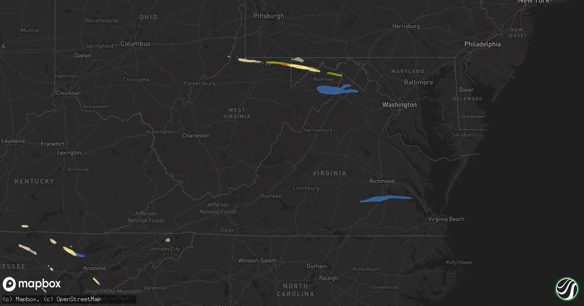
Hail Map in Virginia on September 25, 2022
Get this storm
September 25 map
$229
one time, instant access
Download today. No call, no setup
Keep the $229
Bought the map and want the full workflow? Apply the entire $229 to a subscription within 7 days. None of it is wasted.
Every map, not just this one
This buys you this map. Subscription and you get every map we run, in the markets you choose from a few cities to whole states to nationwide. Plus real-time alerts the moment a storm fires.
Contact data
Name, contact info, occupancy, even credit band for addresses in the footprint. You go from where it hit to who to call.
Become the source they trust
Unlimited branding weather history reports on demand. You already have the documented answer ready for the property owner, and you are the one who showed up with it.
Property data and RoofTrace estimates
Pull up any address you have got, its value and the exact code rules for that jurisdiction, straight from One Click Code. Then RoofTrace estimates the squares, pitch, and roof value, priced the way you price.
Storm reports in Virginia
Virginia
| Date | Description |
|---|---|
| 09/25/20225:33 PM CDT | Reports of multiple trees down across accomack county. |
| 09/25/20225:20 PM CDT | Weatherflow site at onancock reported a wind gust to 67 kt. Site is elevated at 46 ft. |
| 09/25/20225:17 PM CDT | Weatherflow site at plantation flats reported a wind gust to 51 kt. |
| 09/25/20224:33 PM CDT | Nws employee reported a tree down at busch gardens that snapped the sky ride cable and is blocking the train track. Time estimated via radar. |
| 09/25/20224:04 PM CDT | Tree down in the 1800 block of lawrence drive near the intersection of coleman drive and mountain valley road. Both lanes block by the downed tree. |
| 09/25/20224:04 PM CDT | Tree down in the 1800 block of lawrence drive near the |
| 09/25/20224:02 PM CDT | Report from mping: 1-inch tree limbs broken; shingles blown off. |
| 09/25/20223:45 PM CDT | Tree down on telephone line in the 700 block of bouldin road near the intersection of soapstone road and brookwood lane. |
| 09/25/20223:44 PM CDT | Corrects previous tstm wnd dmg report from 5 nnw matoaca. Off duty nws employee reports trees and power lines down at the intersection of woodpecker and bradley bridge. |
| 09/25/20223:42 PM CDT | Report from mping: trees uprooted or snapped. Time estimated via radar. |
| 09/25/20223:36 PM CDT | Tree down on power lines in the 3100 block of soapstone road in ridgeway. |
| 09/25/20223:29 PM CDT | Tree down in the 3400 block of soapstone road completely blocking the road. |
| 09/25/20222:55 PM CDT | Tree down along union cemetery road. Time estimated from radar. |
| 09/25/20222:55 PM CDT | Tree downed on church street near washington avenue. Time estimated from radar. |
| 09/25/20222:44 PM CDT | Off duty nws employee reports trees and power lines down at the intersection of woodpecker and bradley bridge. |
| 09/25/20222:42 PM CDT | Many limbs and a few trees down. |
| 09/25/20222:14 PM CDT | Several trees snapped and large limbs blown down. |
| 09/25/20222:14 PM CDT | Tree downed on mollies creek road. Time estimated from radar. |
| 09/25/20222:02 PM CDT | A few live powerlines blocking both lanes of colonial highway between hazel drive and clinton drive. Time estimated from radar. |
| 09/25/20221:40 PM CDT | Corrects previous tstm wnd dmg report from evington. Wset meteorologists received a report of good-sized tree limbs snapped off trees near the intersection of va highwa |
| 09/25/20221:15 PM CDT | Wset meteorologists received a report of good-sized tree limbs snapped off trees near the intersection of va highway 24 and the city of evington. |
| 09/25/202212:37 PM CDT | Tree down onto powerlines along airport rd |
| 09/25/202212:33 PM CDT | A tree blew down near the 500 block of old bethel church rd. |
| 09/25/202212:29 PM CDT | A power pole snapped in half on hunting rd. |
| 09/25/202212:27 PM CDT | Large tree down near intersection of round hill rd and northwestern pike |
| 09/25/202212:23 PM CDT | A tree blew down near cherokee trail and shenandoah trail. |
| 09/25/202212:23 PM CDT | Tree down near intersection of back mountain rd and homestead farm ln |
| 09/25/20227:10 AM CDT | At 1210 PM EDT, a severe thunderstorm was located near Paw Paw, moving east at 45 mph. HAZARD...60 mph wind gusts and quarter size hail. SOURCE...Radar indicated. IMPACT...Damaging winds will cause some trees and large branches to fall. This could injure those outdoors, as well as damage homes and vehicles. Roadways may become blocked by downed trees. Localized power outages are possible. Unsecured light objects may become projectiles. Locations impacted include... Martinsburg, Greenwood, Inwood, Winebrenners Cross, Glengary, Shanghai, Gerrardstown, Vanville, Ridgeway, Bunker Hill, Bloomery, Arden, Largent, Valley High, Unger, Martinsburg Airport and Ridge. |
| 09/25/20221:54 AM CDT | At 654 PM EDT, severe thunderstorms were located along a line extending from 9 miles southeast of Bristol Va to Elizabethton to near Erwin, moving southeast at 45 mph. HAZARD...60 mph wind gusts. SOURCE...Radar indicated. IMPACT...Expect damage to roofs, siding, and trees. Locations impacted include... Johnson City, Bristol Tn, Bristol Va, Elizabethton, Erwin, Jonesborough, Central, Midway, Pine Crest and Hampton.This includes Interstate 26 in Tennessee between mile markers 16 and36. |
| 09/25/20221:27 AM CDT | At 627 PM EDT, severe thunderstorms were located along a line extending from near Parksley to near Onancock to Onley, moving east at 45 mph. HAZARD...60 mph wind gusts. SOURCE...Radar indicated. IMPACT...Expect damage to trees and powerlines. Severe thunderstorms will be near... Parksley around 630 PM EDT.Other locations impacted by these severe thunderstorms includeHallwood, Melfa, Mappsville, Accomac, Wallops Island,Temperanceville, Nelsonia, Locustville, Modest Town and Clam. |
| 09/25/20221:23 AM CDT | At 623 PM EDT, a severe thunderstorm was located 9 miles southwest of Kingsport, moving east at 45 mph. HAZARD...60 mph wind gusts and quarter size hail. SOURCE...Radar indicated. IMPACT...Hail damage to vehicles is expected. Expect wind damage to roofs, siding, and trees. Locations impacted include... Johnson City, Kingsport, Jonesborough, Gray, Oak Grove, Central, Spurgeon, Midway, Colonial Heights and Pine Crest.This includes the following highways... Interstate 26 in Tennessee between mile markers 1 and 25. Interstate 81 in Tennessee between mile markers 42 and 64. |
| 09/25/20221:07 AM CDT | At 607 PM EDT, severe thunderstorms were located along a line extending from 11 miles northwest of Nassawadox to near Cape Charles to 9 miles northeast of Grand View, moving east at 55 mph. HAZARD...60 mph wind gusts. SOURCE...Radar indicated. IMPACT...Expect damage to trees and powerlines. Severe thunderstorms will be near... Cape Charles, Cheriton and Bay View around 610 PM EDT. Exmore, Nassawadox and Willis Wharf around 620 PM EDT.Other locations impacted by these severe thunderstorms includeCapeville, Birdsnest, Kiptopeke State Park, Melfa, Jamesville, SilverBeach, Eastville, Wachapreague, Machipongo and Wardtown. |
| 09/25/202212:35 AM CDT | At 535 PM EDT, severe thunderstorms were located along a line extending from near Glenns to near Queens Lake to near Busch Gardens, moving east at 60 mph. HAZARD...60 mph wind gusts and penny size hail. SOURCE...Radar indicated. IMPACT...Expect damage to trees and powerlines. Severe thunderstorms will be near... Gloucester Courthouse, Gloucester Point, Hayes and Wicomico around 540 PM EDT. Virginia Institute For Marine Sciences and Blakes around 545 PM EDT. Mathews, Seaford, Mobjack, Gwynn, Achilles and Bavon around 550 PM EDT.Other locations impacted by these severe thunderstorms includeLackey, Ruff, Beulah, Moon, Laban, Glass, Naxera, Harcum, FortNonsense and Clay Bank. |
| 09/24/202211:18 PM CDT | At 418 PM EDT, severe thunderstorms were located along a line extending from near Scotts Fork to near Mannboro to near Spainville, moving east at 50 mph. HAZARD...60 mph wind gusts. SOURCE...Radar indicated. IMPACT...Expect damage to trees and powerlines. Severe thunderstorms will be near... Sutherland, Dewitt and Chesterfield Court House around 440 PM EDT. Dinwiddie and Chester around 445 PM EDT. Colonial Heights, Virginia State University, Ettrick and Matoaca around 450 PM EDT. Petersburg, Hopewell and Fort Lee around 455 PM EDT. Prince George and Carson around 500 PM EDT.Other locations impacted by these severe thunderstorms include NorthWellville, Birchett Estate, Addison, Earls, Ammon, Wharfs Store,Petersburg National Battlefield, Darvills, Pocahontas State Park andChurch Road. |
| 09/24/202210:24 PM CDT | At 324 PM EDT, a severe thunderstorm was located over Hat Creek, or near Brookneal, moving east at 40 mph. HAZARD...60 mph wind gusts and quarter size hail. SOURCE...Radar indicated. IMPACT...Hail damage to vehicles is expected. Expect wind damage to roofs, siding, and trees. Locations impacted include... Brookneal... Keysville... Charlotte Court House... Phenix... Red House... Drakes Branch... and Pamplin City. |
| 09/24/20229:57 PM CDT | At 257 PM EDT, a severe thunderstorm was located near Rustburg, moving east at 65 mph. HAZARD...60 mph wind gusts and quarter size hail. SOURCE...Radar indicated. IMPACT...Hail damage to vehicles is expected. Expect wind damage to roofs, siding, and trees. Locations impacted include... Altavista... Appomattox... Hurt... Dillwyn... Red House... Concord... and Rustburg.This includes The following Location Lynchburg Airport. |
All States Impacted by Hail Map on September 25, 2022
Cities Impacted by Hail Map on September 25, 2022
- Clarington, OH
- Friendsville, MD
- Crossville, TN
- Crab Orchard, TN
- Townsend, TN
- Maryville, TN
- Walland, TN
- Grand Junction, TN
- Greenville, TX
- Culleoka, TN
- Columbia, TN
- Lewisville, AR
- Fouke, AR
- Bradley, AR
- Garland City, AR
- Stamps, AR
- Magnolia, AR
- Mount Holly, AR
- El Dorado, AR
- Hampton, AR
- Texarkana, AR
- Ramer, TN
- Selmer, TN
- Williston Park, NY
- Albertson, NY
- East Meadow, NY
- Carle Place, NY
- Woodbury, NY
- Plainview, NY
- Hempstead, NY
- Roslyn, NY
- Roslyn Heights, NY
- Mineola, NY
- Hicksville, NY
- Garden City, NY
- Old Westbury, NY
- Glen Head, NY
- Westbury, NY
- Jericho, NY
- Syosset, NY
- Uniondale, NY
- West Hempstead, NY
- New Hyde Park, NY
- Manhasset, NY
- Piney Flats, TN
- Bluff City, TN
- Robbins, TN
- Guys, TN
- Jamestown, TN
- Accident, MD
- Grantsville, MD
- Burkesville, KY
- Tompkinsville, KY
- Cookeville, TN
- Livingston, TN
- Hilham, TN
- Camden, AR
- Huntsville, TN
- Sunbright, TN
- Roma, TX
- Burton, WV
- Fairview, WV
- Wana, WV
- Metz, WV
- Hundred, WV
- New Martinsville, WV
- Littleton, WV
- McHenry, MD
- Swanton, MD
- Chidester, AR
- Dayton, TN
- Gainesboro, TN
- Emory, TX
- Texarkana, TX
- Queen City, TX
- Windsor, NY
- Monterey, TN
- Rickman, TN
- Terrell, TX
- Quinlan, TX
- Wills Point, TX
- Stephens, AR
- Barton, MD
- Westernport, MD
- Rawlings, MD
- Bruceton Mills, WV
- Terra Alta, WV
- Bloomington, MD
- Briceville, TN
- Saltillo, TX
- Ridgeley, WV
- Keyser, WV
- Proctor, WV
- Louann, AR
- Ozan, AR
- Kirkwood, NY
- Zapata, TX
- Okolona, AR
- Oakland, MD
- Lone Oak, TX
- Mount Vernon, TX
- Pikeville, TN
- Points, WV
- Paw Paw, WV
- Slanesville, WV
- Capon Bridge, WV
- Maidsville, WV
- Rivesville, WV
- Morgantown, WV
- Fort Lee, VA
- Williamsburg, VA
- Hopewell, VA
- Colonial Heights, VA
- Charles City, VA
- Blackstone, VA
- Sutherland, VA
- Petersburg, VA
- Church Road, VA
- Wilsons, VA
- Disputanta, VA
- Ford, VA
- Spring Grove, VA
- Prince George, VA
- Augusta, WV
- Star Tannery, VA
- Delray, WV
- Winchester, VA
- Romney, WV
- Boyce, VA
- Rio, WV
- Shanks, WV
- Clear Brook, VA
- Moorefield, WV
- Stephens City, VA
- Strasburg, VA
- Berryville, VA
- Baker, WV
- Yellow Spring, WV
- Gore, VA
- Wardensville, WV
- High View, WV
- Lonaconing, MD
- Albright, WV
- Granville, WV
- Springfield, WV
- Levels, WV
- Cross Junction, VA
- Bloomery, WV
- Caryville, TN
- Clinton, TN
- Rocky Top, TN


