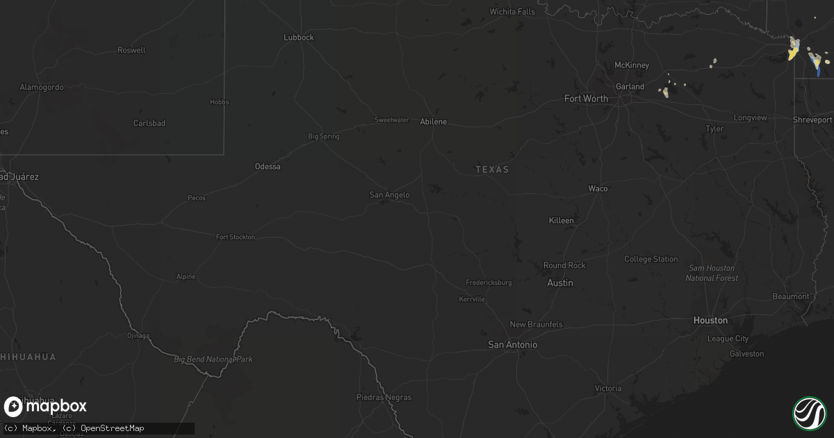
Hail Map in Texas on September 25, 2022
Get this storm
September 25 map
$229
one time, instant access
Download today. No call, no setup
Keep the $229
Bought the map and want the full workflow? Apply the entire $229 to a subscription within 7 days. None of it is wasted.
Every map, not just this one
This buys you this map. Subscription and you get every map we run, in the markets you choose from a few cities to whole states to nationwide. Plus real-time alerts the moment a storm fires.
Contact data
Name, contact info, occupancy, even credit band for addresses in the footprint. You go from where it hit to who to call.
Become the source they trust
Unlimited branding weather history reports on demand. You already have the documented answer ready for the property owner, and you are the one who showed up with it.
Property data and RoofTrace estimates
Pull up any address you have got, its value and the exact code rules for that jurisdiction, straight from One Click Code. Then RoofTrace estimates the squares, pitch, and roof value, priced the way you price.
Storm reports in Texas
Texas
| Date | Description |
|---|---|
| 09/25/20226:18 PM CDT | Damage to exterior brick façade of an apartment complex. |
| 09/25/20225:30 PM CDT | Social media picture of a 70+ ft tall red cedar tree snapped in north oak cliff. |
| 09/25/20225:30 PM CDT | Delayed report... Significant portions of an apartment complex roof removed... Displacing several families. |
| 09/25/20224:40 PM CDT | A 30x40 foot barn and several small cow shelters damaged. |
| 09/25/20224:30 PM CDT | Large limb and power lines down. |
| 09/25/20224:27 PM CDT | Social media photo of hail near intersection of us hwy 59 and fm 2148. |
| 09/25/202212:18 AM CDT | At 516 PM CDT, a severe thunderstorm was located near Dallas, moving south at 15 mph. HAZARD...60 mph wind gusts and penny size hail. SOURCE...Radar indicated. IMPACT...Expect damage to roofs, siding, and trees. Locations impacted include... Dallas, Duncanville, Cedar Hill, and surrounding areas. |
| 09/24/202211:18 PM CDT | At 418 PM CDT, a severe thunderstorm was located over Addison, moving south at 10 mph. HAZARD...60 mph wind gusts. SOURCE...Radar indicated. IMPACT...Expect damage to roofs, siding, and trees. Locations impacted include... Dallas, Plano, Garland, Irving, Mesquite, Carrollton, Richardson, and surrounding areas. |
| 09/24/202211:09 PM CDT | At 409 PM CDT, a severe thunderstorm was located over Texarkana, moving southeast at 15 mph. HAZARD...60 mph wind gusts and penny size hail. SOURCE...Radar indicated. IMPACT...Expect damage to roofs, siding, and trees. Locations impacted include... Texarkana, Wake Village, Fouke, Mandeville, Genoa, Mount Pleasant and Pleasant Hill. |
All States Impacted by Hail Map on September 25, 2022
Cities Impacted by Hail Map on September 25, 2022
- Clarington, OH
- Friendsville, MD
- Crossville, TN
- Crab Orchard, TN
- Townsend, TN
- Maryville, TN
- Walland, TN
- Grand Junction, TN
- Greenville, TX
- Culleoka, TN
- Columbia, TN
- Lewisville, AR
- Fouke, AR
- Bradley, AR
- Garland City, AR
- Stamps, AR
- Magnolia, AR
- Mount Holly, AR
- El Dorado, AR
- Hampton, AR
- Texarkana, AR
- Ramer, TN
- Selmer, TN
- Williston Park, NY
- Albertson, NY
- East Meadow, NY
- Carle Place, NY
- Woodbury, NY
- Plainview, NY
- Hempstead, NY
- Roslyn, NY
- Roslyn Heights, NY
- Mineola, NY
- Hicksville, NY
- Garden City, NY
- Old Westbury, NY
- Glen Head, NY
- Westbury, NY
- Jericho, NY
- Syosset, NY
- Uniondale, NY
- West Hempstead, NY
- New Hyde Park, NY
- Manhasset, NY
- Piney Flats, TN
- Bluff City, TN
- Robbins, TN
- Guys, TN
- Jamestown, TN
- Accident, MD
- Grantsville, MD
- Burkesville, KY
- Tompkinsville, KY
- Cookeville, TN
- Livingston, TN
- Hilham, TN
- Camden, AR
- Huntsville, TN
- Sunbright, TN
- Roma, TX
- Burton, WV
- Fairview, WV
- Wana, WV
- Metz, WV
- Hundred, WV
- New Martinsville, WV
- Littleton, WV
- McHenry, MD
- Swanton, MD
- Chidester, AR
- Dayton, TN
- Gainesboro, TN
- Emory, TX
- Texarkana, TX
- Queen City, TX
- Windsor, NY
- Monterey, TN
- Rickman, TN
- Terrell, TX
- Quinlan, TX
- Wills Point, TX
- Stephens, AR
- Barton, MD
- Westernport, MD
- Rawlings, MD
- Bruceton Mills, WV
- Terra Alta, WV
- Bloomington, MD
- Briceville, TN
- Saltillo, TX
- Ridgeley, WV
- Keyser, WV
- Proctor, WV
- Louann, AR
- Ozan, AR
- Kirkwood, NY
- Zapata, TX
- Okolona, AR
- Oakland, MD
- Lone Oak, TX
- Mount Vernon, TX
- Pikeville, TN
- Points, WV
- Paw Paw, WV
- Slanesville, WV
- Capon Bridge, WV
- Maidsville, WV
- Rivesville, WV
- Morgantown, WV
- Fort Lee, VA
- Williamsburg, VA
- Hopewell, VA
- Colonial Heights, VA
- Charles City, VA
- Blackstone, VA
- Sutherland, VA
- Petersburg, VA
- Church Road, VA
- Wilsons, VA
- Disputanta, VA
- Ford, VA
- Spring Grove, VA
- Prince George, VA
- Augusta, WV
- Star Tannery, VA
- Delray, WV
- Winchester, VA
- Romney, WV
- Boyce, VA
- Rio, WV
- Shanks, WV
- Clear Brook, VA
- Moorefield, WV
- Stephens City, VA
- Strasburg, VA
- Berryville, VA
- Baker, WV
- Yellow Spring, WV
- Gore, VA
- Wardensville, WV
- High View, WV
- Lonaconing, MD
- Albright, WV
- Granville, WV
- Springfield, WV
- Levels, WV
- Cross Junction, VA
- Bloomery, WV
- Caryville, TN
- Clinton, TN
- Rocky Top, TN


