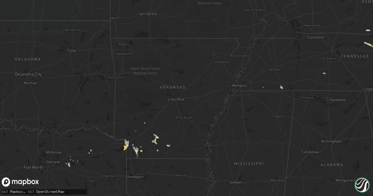
Hail Map in Arkansas on September 25, 2022
Get this storm
September 25 map
$229
one time, instant access
Download today. No call, no setup
Keep the $229
Bought the map and want the full workflow? Apply the entire $229 to a subscription within 7 days. None of it is wasted.
Every map, not just this one
This buys you this map. Subscription and you get every map we run, in the markets you choose from a few cities to whole states to nationwide. Plus real-time alerts the moment a storm fires.
Contact data
Name, contact info, occupancy, even credit band for addresses in the footprint. You go from where it hit to who to call.
Become the source they trust
Unlimited branding weather history reports on demand. You already have the documented answer ready for the property owner, and you are the one who showed up with it.
Property data and RoofTrace estimates
Pull up any address you have got, its value and the exact code rules for that jurisdiction, straight from One Click Code. Then RoofTrace estimates the squares, pitch, and roof value, priced the way you price.
Storm reports in Arkansas
Arkansas
| Date | Description |
|---|---|
| 09/25/20225:00 PM CDT | Trees down near count road 2 and hwy. 160e. |
| 09/25/20224:40 PM CDT | Trees downed near hwy. 29 north of bradley... Arkansas. |
| 09/25/20224:10 PM CDT | Several trees down across the northern and northwest part of the county. |
| 09/25/20224:00 PM CDT | Texarkana regional airport. |
| 09/25/20223:45 PM CDT | Three chicken houses roofs partially torn off. |
| 09/25/20223:00 PM CDT | Barn severely damaged. |
| 09/25/20222:45 PM CDT | Corrects previous tstm wnd dmg report from 7 ese emmet. Three chicken houses roofs partially torn off. |
| 09/25/202212:02 AM CDT | At 501 PM CDT, a severe thunderstorm was located near Bussey, or 8 miles south of Stamps, moving south at 20 mph. HAZARD...60 mph wind gusts and penny size hail. SOURCE...Radar indicated. IMPACT...Expect damage to roofs, siding, and trees. Locations impacted include... Springhill, Stamps, Lewisville, Cullen, Taylor, Buckner, Bussey, Canfield, Smithland, Macedonia, Welcome, Mount Vernon, Lerch, McKamie, Walkerville, Cornelius, State Line, Horsehead and Mars Hill. |
| 09/24/202211:39 PM CDT | At 439 PM CDT, a severe thunderstorm was located near Fouke, or 16 miles southwest of Lewisville, moving southeast at 25 mph. HAZARD...60 mph wind gusts and quarter size hail. SOURCE...Radar indicated. IMPACT...Hail damage to vehicles is expected. Expect wind damage to roofs, siding, and trees. Locations impacted include... Bradley, Ida, Canfield, Canale, Pleasant Valley, Gin City, Fort Lynn and Kiblah. |
| 09/24/202211:12 PM CDT | At 412 PM CDT, a severe thunderstorm was located near Bussey, or 8 miles south of Stamps, moving southeast at 15 mph. HAZARD...60 mph wind gusts and nickel size hail. SOURCE...Radar indicated. IMPACT...Expect damage to roofs, siding, and trees. Locations impacted include... Stamps, Taylor, Bussey, Smithland, Macedonia, Cornelius, Lerch, McKamie, State Line, Horsehead and Mars Hill. |
| 09/24/20229:10 PM CDT | At 210 PM CDT, a severe thunderstorm was located near Poison Springs State Park, or 10 miles northwest of Camden, moving southeast at 20 mph. HAZARD...60 mph wind gusts. SOURCE...Radar indicated. IMPACT...Expect damage to roofs, siding, and trees. Locations impacted include... Camden... Chidester... Poison Springs State Park... Cullendale... Highland Industrial Park... East Camden... Harmony Grove... Fairview in Ouachita County... Locust Bayou... Warner... Bragg City... Buena Vista... Elliot... |
All States Impacted by Hail Map on September 25, 2022
Cities Impacted by Hail Map on September 25, 2022
- Clarington, OH
- Friendsville, MD
- Crossville, TN
- Crab Orchard, TN
- Townsend, TN
- Maryville, TN
- Walland, TN
- Grand Junction, TN
- Greenville, TX
- Culleoka, TN
- Columbia, TN
- Lewisville, AR
- Fouke, AR
- Bradley, AR
- Garland City, AR
- Stamps, AR
- Magnolia, AR
- Mount Holly, AR
- El Dorado, AR
- Hampton, AR
- Texarkana, AR
- Ramer, TN
- Selmer, TN
- Williston Park, NY
- Albertson, NY
- East Meadow, NY
- Carle Place, NY
- Woodbury, NY
- Plainview, NY
- Hempstead, NY
- Roslyn, NY
- Roslyn Heights, NY
- Mineola, NY
- Hicksville, NY
- Garden City, NY
- Old Westbury, NY
- Glen Head, NY
- Westbury, NY
- Jericho, NY
- Syosset, NY
- Uniondale, NY
- West Hempstead, NY
- New Hyde Park, NY
- Manhasset, NY
- Piney Flats, TN
- Bluff City, TN
- Robbins, TN
- Guys, TN
- Jamestown, TN
- Accident, MD
- Grantsville, MD
- Burkesville, KY
- Tompkinsville, KY
- Cookeville, TN
- Livingston, TN
- Hilham, TN
- Camden, AR
- Huntsville, TN
- Sunbright, TN
- Roma, TX
- Burton, WV
- Fairview, WV
- Wana, WV
- Metz, WV
- Hundred, WV
- New Martinsville, WV
- Littleton, WV
- McHenry, MD
- Swanton, MD
- Chidester, AR
- Dayton, TN
- Gainesboro, TN
- Emory, TX
- Texarkana, TX
- Queen City, TX
- Windsor, NY
- Monterey, TN
- Rickman, TN
- Terrell, TX
- Quinlan, TX
- Wills Point, TX
- Stephens, AR
- Barton, MD
- Westernport, MD
- Rawlings, MD
- Bruceton Mills, WV
- Terra Alta, WV
- Bloomington, MD
- Briceville, TN
- Saltillo, TX
- Ridgeley, WV
- Keyser, WV
- Proctor, WV
- Louann, AR
- Ozan, AR
- Kirkwood, NY
- Zapata, TX
- Okolona, AR
- Oakland, MD
- Lone Oak, TX
- Mount Vernon, TX
- Pikeville, TN
- Points, WV
- Paw Paw, WV
- Slanesville, WV
- Capon Bridge, WV
- Maidsville, WV
- Rivesville, WV
- Morgantown, WV
- Fort Lee, VA
- Williamsburg, VA
- Hopewell, VA
- Colonial Heights, VA
- Charles City, VA
- Blackstone, VA
- Sutherland, VA
- Petersburg, VA
- Church Road, VA
- Wilsons, VA
- Disputanta, VA
- Ford, VA
- Spring Grove, VA
- Prince George, VA
- Augusta, WV
- Star Tannery, VA
- Delray, WV
- Winchester, VA
- Romney, WV
- Boyce, VA
- Rio, WV
- Shanks, WV
- Clear Brook, VA
- Moorefield, WV
- Stephens City, VA
- Strasburg, VA
- Berryville, VA
- Baker, WV
- Yellow Spring, WV
- Gore, VA
- Wardensville, WV
- High View, WV
- Lonaconing, MD
- Albright, WV
- Granville, WV
- Springfield, WV
- Levels, WV
- Cross Junction, VA
- Bloomery, WV
- Caryville, TN
- Clinton, TN
- Rocky Top, TN


