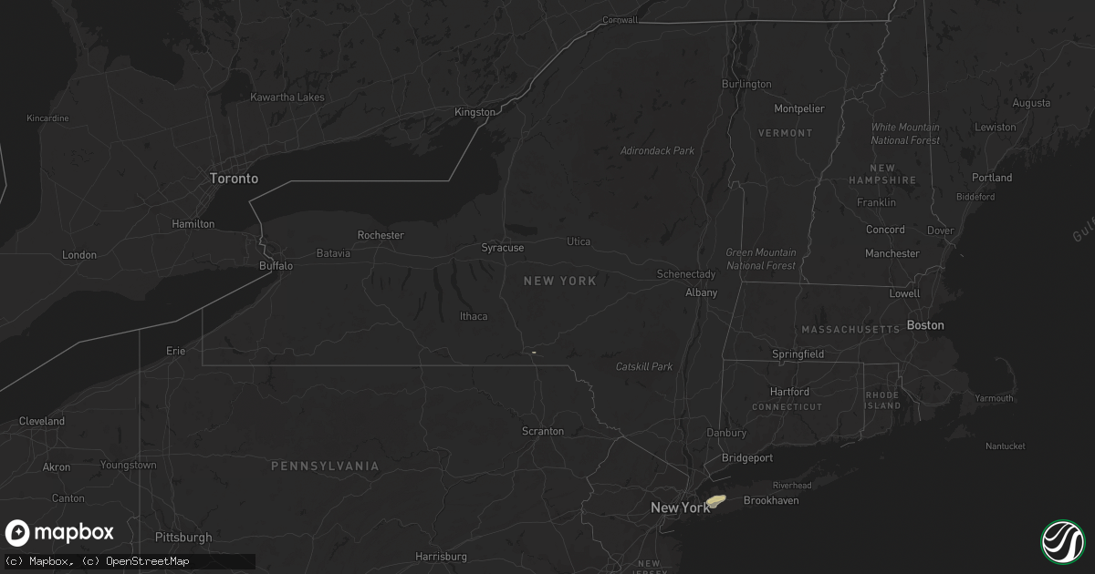
Hail Map in New York on September 25, 2022
Get this storm
September 25 map
$229
one time, instant access
Download today. No call, no setup
Keep the $229
Bought the map and want the full workflow? Apply the entire $229 to a subscription within 7 days. None of it is wasted.
Every map, not just this one
This buys you this map. Subscription and you get every map we run, in the markets you choose from a few cities to whole states to nationwide. Plus real-time alerts the moment a storm fires.
Contact data
Name, contact info, occupancy, even credit band for addresses in the footprint. You go from where it hit to who to call.
Become the source they trust
Unlimited branding weather history reports on demand. You already have the documented answer ready for the property owner, and you are the one who showed up with it.
Property data and RoofTrace estimates
Pull up any address you have got, its value and the exact code rules for that jurisdiction, straight from One Click Code. Then RoofTrace estimates the squares, pitch, and roof value, priced the way you price.
Storm reports in New York
New York
| Date | Description |
|---|---|
| 09/25/20224:45 PM CDT | Corrects the time from the previous tstm wnd dmg report from 1 nnw beerston. Trees and wires down near intersection of walton mountain rd and state route 10. |
| 09/25/20224:40 PM CDT | Multiple trees |
| 09/25/20224:40 PM CDT | Reports of around 30 or more trees down on south river road. |
| 09/25/20224:40 PM CDT | Broadcast meteorologist passed along a picture received on social media of a portion of a metal roof partially torn off of an automotive repair shop. |
| 09/25/20224:40 PM CDT | Multiple trees and utility lines down on bobs brook road. |
| 09/25/20224:30 PM CDT | Trees and wires down near intersection of walton mountain rd and state route 10. |
| 09/25/20223:47 PM CDT | A local report indicates 1.00 inch wind near 5 S SANITARIA SPGS |
| 09/25/20226:14 AM CDT | At 1113 PM EDT, a severe thunderstorm was located over Riverhead, moving east at 30 mph. HAZARD...60 mph wind gusts. SOURCE...Radar indicated. IMPACT...Expect damage to trees and power lines. This severe thunderstorm will be near... Mattituck around 1125 PM EDT. Shinnecock Hills around 1130 PM EDT. Peconic around 1135 PM EDT. Southold around 1140 PM EDT. Sag Harbor and Bridgehampton around 1145 PM EDT. East Hampton around 1155 PM EDT. |
| 09/25/20225:35 AM CDT | At 1035 PM EDT, a severe thunderstorm was located over Ronkonkoma, moving east at 35 mph. HAZARD...60 mph wind gusts and penny size hail. SOURCE...Radar indicated. IMPACT...Expect damage to trees and power lines. This severe thunderstorm will be near... Farmingville around 1040 PM EDT. Medford and Port Jefferson around 1045 PM EDT. Middle Island and Mount Sinai around 1050 PM EDT. Shirley and Mastic around 1055 PM EDT. Brookhaven National Laboratory around 1100 PM EDT. Manorville and Wading River around 1105 PM EDT. Calverton around 1110 PM EDT. Riverhead and Westhampton around 1115 PM EDT. |
| 09/25/20225:07 AM CDT | At 1007 PM EDT, a severe thunderstorm was located over Brookville, or over Westbury, moving east at 35 mph. HAZARD...60 mph wind gusts and penny size hail. SOURCE...Radar indicated. IMPACT...Expect damage to trees and power lines. This severe thunderstorm will be near... Levittown and Hicksville around 1010 PM EDT. Plainview and Syosset around 1015 PM EDT. Melville and Cold Spring Harbor around 1020 PM EDT. Huntington Station and Deer Park around 1025 PM EDT. Northport and Dix Hills around 1030 PM EDT. Brentwood and Commack around 1035 PM EDT. Hauppauge and Smithtown around 1040 PM EDT. Centereach and Stony Brook around 1045 PM EDT. |
| 09/25/20225:03 AM CDT | At 1003 PM EDT, a severe thunderstorm was located over Brookville, or over Westbury, moving east at 35 mph. HAZARD...60 mph wind gusts and penny size hail. SOURCE...Radar indicated. IMPACT...Expect damage to trees and power lines. This severe thunderstorm will be near... Bayville around 1010 PM EDT. Huntington Station and Plainview around 1015 PM EDT. |
| 09/24/202210:20 PM CDT | Numerous large trees down... Including a very large oak tree split near its base along with a metal fence blown down behind tennis courts and outdoor scaffolding bent a |
| 09/24/202210:18 PM CDT | Damage to greenhouse and multiple trees down off of kirkup lane. |
| 09/24/202210:09 PM CDT | Trees and wires reported down. |
| 09/24/20229:35 PM CDT | Wires down across road and mulitple power lines reported down in town. |
| 09/24/20229:33 PM CDT | Tree down with multiple wires down with utility crews responding due to power outages. |
| 09/24/20229:32 PM CDT | Large trees down on wires and across the street on sequams lane north. |
| 09/24/20229:24 PM CDT | Large tree limbs reported down. |
| 09/24/20229:10 PM CDT | Downed tree near northern boulevard with all lanes blocked. |
| 09/24/20229:08 PM CDT | Tree down on mill river road with cones put in place around tree. |
All States Impacted by Hail Map on September 25, 2022
Cities Impacted by Hail Map on September 25, 2022
- Clarington, OH
- Friendsville, MD
- Crossville, TN
- Crab Orchard, TN
- Townsend, TN
- Maryville, TN
- Walland, TN
- Grand Junction, TN
- Greenville, TX
- Culleoka, TN
- Columbia, TN
- Lewisville, AR
- Fouke, AR
- Bradley, AR
- Garland City, AR
- Stamps, AR
- Magnolia, AR
- Mount Holly, AR
- El Dorado, AR
- Hampton, AR
- Texarkana, AR
- Ramer, TN
- Selmer, TN
- Williston Park, NY
- Albertson, NY
- East Meadow, NY
- Carle Place, NY
- Woodbury, NY
- Plainview, NY
- Hempstead, NY
- Roslyn, NY
- Roslyn Heights, NY
- Mineola, NY
- Hicksville, NY
- Garden City, NY
- Old Westbury, NY
- Glen Head, NY
- Westbury, NY
- Jericho, NY
- Syosset, NY
- Uniondale, NY
- West Hempstead, NY
- New Hyde Park, NY
- Manhasset, NY
- Piney Flats, TN
- Bluff City, TN
- Robbins, TN
- Guys, TN
- Jamestown, TN
- Accident, MD
- Grantsville, MD
- Burkesville, KY
- Tompkinsville, KY
- Cookeville, TN
- Livingston, TN
- Hilham, TN
- Camden, AR
- Huntsville, TN
- Sunbright, TN
- Roma, TX
- Burton, WV
- Fairview, WV
- Wana, WV
- Metz, WV
- Hundred, WV
- New Martinsville, WV
- Littleton, WV
- McHenry, MD
- Swanton, MD
- Chidester, AR
- Dayton, TN
- Gainesboro, TN
- Emory, TX
- Texarkana, TX
- Queen City, TX
- Windsor, NY
- Monterey, TN
- Rickman, TN
- Terrell, TX
- Quinlan, TX
- Wills Point, TX
- Stephens, AR
- Barton, MD
- Westernport, MD
- Rawlings, MD
- Bruceton Mills, WV
- Terra Alta, WV
- Bloomington, MD
- Briceville, TN
- Saltillo, TX
- Ridgeley, WV
- Keyser, WV
- Proctor, WV
- Louann, AR
- Ozan, AR
- Kirkwood, NY
- Zapata, TX
- Okolona, AR
- Oakland, MD
- Lone Oak, TX
- Mount Vernon, TX
- Pikeville, TN
- Points, WV
- Paw Paw, WV
- Slanesville, WV
- Capon Bridge, WV
- Maidsville, WV
- Rivesville, WV
- Morgantown, WV
- Fort Lee, VA
- Williamsburg, VA
- Hopewell, VA
- Colonial Heights, VA
- Charles City, VA
- Blackstone, VA
- Sutherland, VA
- Petersburg, VA
- Church Road, VA
- Wilsons, VA
- Disputanta, VA
- Ford, VA
- Spring Grove, VA
- Prince George, VA
- Augusta, WV
- Star Tannery, VA
- Delray, WV
- Winchester, VA
- Romney, WV
- Boyce, VA
- Rio, WV
- Shanks, WV
- Clear Brook, VA
- Moorefield, WV
- Stephens City, VA
- Strasburg, VA
- Berryville, VA
- Baker, WV
- Yellow Spring, WV
- Gore, VA
- Wardensville, WV
- High View, WV
- Lonaconing, MD
- Albright, WV
- Granville, WV
- Springfield, WV
- Levels, WV
- Cross Junction, VA
- Bloomery, WV
- Caryville, TN
- Clinton, TN
- Rocky Top, TN


