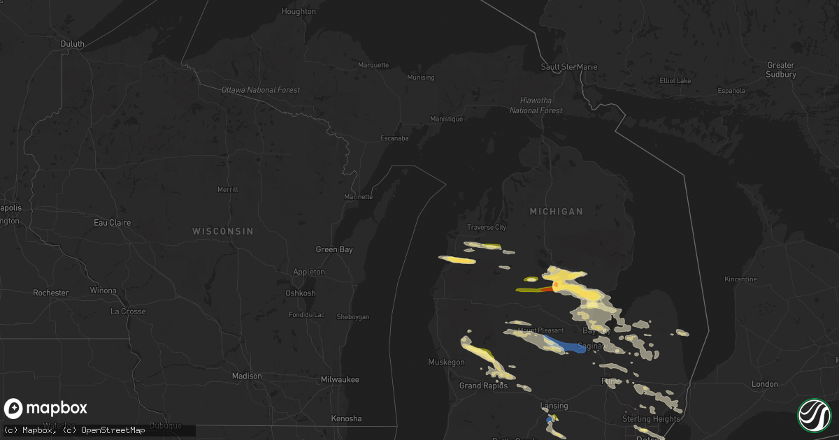
Hail Map in Michigan on September 21, 2022
Get this storm
September 21 map
$229
one time, instant access
Download today. No call, no setup
Keep the $229
Bought the map and want the full workflow? Apply the entire $229 to a subscription within 7 days. None of it is wasted.
Every map, not just this one
This buys you this map. Subscription and you get every map we run, in the markets you choose from a few cities to whole states to nationwide. Plus real-time alerts the moment a storm fires.
Contact data
Name, contact info, occupancy, even credit band for addresses in the footprint. You go from where it hit to who to call.
Become the source they trust
Unlimited branding weather history reports on demand. You already have the documented answer ready for the property owner, and you are the one who showed up with it.
Property data and RoofTrace estimates
Pull up any address you have got, its value and the exact code rules for that jurisdiction, straight from One Click Code. Then RoofTrace estimates the squares, pitch, and roof value, priced the way you price.
Storm reports in Michigan
Michigan
| Date | Description |
|---|---|
| 09/21/202210:23 AM CDT | A local report indicates 1.00 inch wind near 4 NNW DETROIT |
| 09/21/20229:38 AM CDT | Mping report. Time estimated from radar. |
| 09/21/20228:59 AM CDT | Numerous trees and power lines down. |
| 09/21/20228:26 AM CDT | Trees over the road on lincoln road east of baldwin rd. |
| 09/21/20228:26 AM CDT | Multple tree limbs and power lines down across the county. |
| 09/21/20228:00 AM CDT | Half dollar sized hail called in from public source. |
| 09/21/20227:53 AM CDT | Report from mping: half dollar |
| 09/21/20227:47 AM CDT | A local report indicates 1.75 inch wind near 1 W SAND LAKE |
| 09/21/20227:45 AM CDT | 1 inch hail measured around 845 am near 22 mile road and simmons ave. |
| 09/21/20227:33 AM CDT | Delayed report. Three different photos of severe hail in the grant area. One measured 1.25 inch. One may have been golf ball size. |
| 09/21/20227:30 AM CDT | Report relayed by local broadcast media. |
| 09/21/20227:20 AM CDT | Bear lake area. Report relayed by local broadcast media. |
| 09/21/20227:09 AM CDT | At 1208 PM EDT, severe thunderstorms were located along a line extending from near Forestville to 7 miles north of Deckerville to near Cass City, moving southeast at 40 mph. HAZARD...60 mph wind gusts and quarter size hail. SOURCE...Radar indicated. IMPACT...Hail damage to vehicles is expected. Expect wind damage to roofs, siding, and trees. Severe thunderstorms will be near... Forestville around 1215 PM EDT. Sandusky and Deckerville around 1230 PM EDT. Carsonville around 1240 PM EDT. Applegate around 1245 PM EDT. Port Sanilac around 1250 PM EDT. Lexington around 1255 PM EDT.Other locations impacted by these severe thunderstorms includeMcGregor, Snover, Juhl, Elmer, New Greenleaf, Tyre, Decker, Palms,Watertown and Forester. |
| 09/21/20227:06 AM CDT | A local report indicates 1.75 inch wind near 2 ESE SKEELS |
| 09/21/20227:00 AM CDT | Public reports of hail estimated near ping-pong ball sized around 8:00 am. |
| 09/21/20226:19 AM CDT | At 1119 AM EDT, a severe thunderstorm was located near Detroit Zoo, or near Southfield, moving southeast at 50 mph. HAZARD...60 mph wind gusts and quarter size hail. SOURCE...Radar indicated. IMPACT...Hail damage to vehicles is expected. Expect wind damage to roofs, siding, and trees. This severe thunderstorm will be near... Downtown Detroit and Belle Isle around 1130 AM EDT. Grosse Pointe around 1135 AM EDT.Other locations impacted by this severe thunderstorm include HighlandPark, Madison Heights, Redford, Berkley, Oak Park, Hazel Park,Lathrup Village, Northeast Detroit, Northwest Detroit and HarperWoods.People attending the North American International Auto Show shouldseek safe shelter immediately! |
| 09/21/20226:15 AM CDT | At 1113 AM EDT, severe thunderstorms were located along a line extending from near Emmett to near Armada to Sterling Heights, moving southeast at 35 mph. HAZARD...60 mph wind gusts and penny size hail. SOURCE...Radar indicated. IMPACT...Expect damage to roofs, siding, and trees. Severe thunderstorms will be near... Richmond around 1120 AM EDT. Mount Clemens and New Baltimore around 1125 AM EDT. St. Clair Shores and Marysville around 1130 AM EDT. St. Clair around 1135 AM EDT. Marine City around 1140 AM EDT. Algonac and Harsens Island around 1145 AM EDT.Other locations impacted by these severe thunderstorms includeAnchorville, North Street, Adair, Shelby Township, Rattle Run,Goodells, Ray Center, Utica, Smiths Creek and Washington. |
| 09/21/20225:46 AM CDT | At 1045 AM EDT, severe thunderstorms were located along a line extending from 6 miles southwest of Leslie to near Albion, moving southeast at 40 mph. HAZARD...60 mph wind gusts and quarter size hail. SOURCE...Radar indicated. IMPACT...Hail damage to vehicles is expected. Expect wind damage to roofs, siding, and trees. Locations impacted include... Jackson... Brooklyn... Grass Lake... Vandercook Lake... Leoni... Spring Arbor... Napoleon... Sandstone... Norvell... Pulaski... Concord... Horton... Parma... Hanover... Jackson County Airpo... Oak Point... Tompkins... Rives Junction... Sunset Beach... Michigan Center... |
| 09/21/20225:28 AM CDT | At 1027 AM EDT, severe thunderstorms were located along a line extending from near East Lansing to 5 miles west of Eaton Rapids, moving southeast at 40 mph. HAZARD...Quarter size hail. SOURCE...Public. IMPACT...Damage to vehicles is expected. Locations impacted include... Lansing... Mason... Eaton Rapids... East Lansing... Williamston... Leslie... Stockbridge... Edgemont Park... Aurelius... Onondaga... Bunker Hill... Brookfield... Webberville... Dimondale... Dansville... Eden... Fitchburg... Okemos... Bell Oak... Holt... |
| 09/21/20224:38 AM CDT | At 937 AM EDT, severe thunderstorms were located along a line extending from Unionville to near Quanicassee to Saginaw, moving east at 60 mph. HAZARD...60 mph wind gusts and quarter size hail. SOURCE...Radar indicated. IMPACT...Hail damage to vehicles is expected. Expect wind damage to roofs, siding, and trees. Severe thunderstorms will be near... Akron and Fairgrove around 945 AM EDT. Caro and Reese around 950 AM EDT. Vassar and Millington around 1000 AM EDT. Kingston around 1005 AM EDT. Mayville around 1010 AM EDT.Other locations impacted by these severe thunderstorms include EastDayton, Deford, Tuscola, Wilmot, Gilford, Watrousville, Richville,Fostoria and Silverwood. |
| 09/21/20224:36 AM CDT | At 936 AM EDT, severe thunderstorms were located along a line extending from 5 miles southeast of Carson City to 5 miles southeast of Saranac, moving east at 35 mph. HAZARD...60 mph wind gusts and quarter size hail. SOURCE...Radar indicated. IMPACT...Hail damage to vehicles is expected. Expect wind damage to roofs, siding, and trees. Locations impacted include... St. Johns... Grand Ledge... Elsie... DeWitt... Capital Region Inter... Eureka... Ovid... Fowler... Westphalia... Maple Rapids... Hubbardston... Eagle... Wacousta... Abrams Municipal Air... Bath... |
| 09/21/20224:24 AM CDT | At 923 AM EDT, severe thunderstorms were located along a line extending from near Freeland to Merrill to Ithaca, moving east at 50 mph. HAZARD...60 mph wind gusts and quarter size hail. SOURCE...Radar indicated. IMPACT...Hail damage to vehicles is expected. Expect wind damage to roofs, siding, and trees. Severe thunderstorms will be near... Freeland around 930 AM EDT. Saginaw, St. Charles, Zilwaukee and Bridgeport around 940 AM EDT. Marion Springs around 945 AM EDT. Frankenmuth, Chesaning and Oakley around 955 AM EDT. Birch Run around 1000 AM EDT.Other locations impacted by these severe thunderstorms include Brant,Nelson, Carrollton, Garfield, Arthur, Fenmore, Burt, Buena VistaTownship, Gera and Poseyville. |
| 09/21/20224:22 AM CDT | At 922 AM EDT, a severe thunderstorm was located near Sebewaing, moving east at 50 mph. HAZARD...60 mph wind gusts and quarter size hail. SOURCE...Radar indicated. IMPACT...Hail damage to vehicles is expected. Expect wind damage to roofs, siding, and trees. This severe thunderstorm will be near... Unionville around 925 AM EDT. Sebewaing around 930 AM EDT. Pigeon and Owendale around 935 AM EDT. Gagetown around 940 AM EDT. Elkton around 945 AM EDT.Other locations impacted by this severe thunderstorm includePinnebog, Colling, Colwood, Wisner, Ivanhoe, Bay Port, Ellington,Bach and Bay Park. |
| 09/21/20224:17 AM CDT | At 917 AM EDT, severe thunderstorms were located along a line extending from near Breckenridge to 5 miles southwest of Alma, moving east at 40 mph. HAZARD...60 mph wind gusts and quarter size hail. SOURCE...Radar indicated. IMPACT...Hail damage to vehicles is expected. Expect wind damage to roofs, siding, and trees. Locations impacted include... Alma... Ithaca... St. Louis... Breckenridge... Wheeler... Sumner... North Star... Ashley... Perrinton... Gratiot Community Ai... Bannister... Pompeii... Middleton... |
| 09/21/20224:11 AM CDT | At 911 AM EDT, a severe thunderstorm was located near Linwood, or 9 miles north of Auburn, moving east at 20 mph. HAZARD...60 mph wind gusts and quarter size hail. SOURCE...Radar indicated. IMPACT...Hail damage to vehicles is expected. Expect wind damage to roofs, siding, and trees. This severe thunderstorm will be near... Linwood around 920 AM EDT. Kawkawlin around 925 AM EDT. Bay City around 935 AM EDT. Essexville around 945 AM EDT.Other locations impacted by this severe thunderstorm include MountForest, Crump, Willard and Bay City State Recreation Area. |
| 09/21/20224:10 AM CDT | At 909 AM EDT, severe thunderstorms were located along a line extending from 5 miles northeast of Greenville to near East Grand Rapids, moving east at 50 mph. HAZARD...Ping pong ball size hail and 60 mph wind gusts. SOURCE...Radar indicated. IMPACT...People and animals outdoors will be injured. Expect hail damage to roofs, siding, windows, and vehicles. Expect wind damage to roofs, siding, and trees. Locations impacted include... Ionia... Greenville... Portland... Belding... Lake Odessa... Saranac... Carson City... Orleans... Sidney... Sebewa... Lyons... Sheridan... Muir... Mulliken... Pewamo... Hubbardston... Clarksville... Palo... Ionia County Airport... Butternut... |
| 09/21/20224:01 AM CDT | At 900 AM EDT, severe thunderstorms were located along a line extending from 7 miles northwest of Greenville to near Jenison, moving east at 40 mph. HAZARD...60 mph wind gusts and quarter size hail. SOURCE...Radar indicated. IMPACT...Hail damage to vehicles is expected. Expect wind damage to roofs, siding, and trees. Locations impacted include... Grand Rapids... Wyoming... Kentwood... Walker... Grandville... East Grand Rapids... Rockford... Lowell... Caledonia... Gerald R. Ford Inter... Ada... Grattan... Cutlerville... Wells Airport... Belmont... Alto... Alaska... Cannonsburg... Cascade... Dutton... |
| 09/21/20223:51 AM CDT | At 850 AM EDT, a severe thunderstorm was located 7 miles south of Lake Isabella, or 9 miles west of Mount Pleasant, moving east at 65 mph. HAZARD...60 mph wind gusts and quarter size hail. SOURCE...Radar indicated. IMPACT...Hail damage to vehicles is expected. Expect wind damage to roofs, siding, and trees. Locations impacted include... Mount Pleasant... Shepherd... Breckenridge... Lake Isabella... Wheeler... Winn... Mount Pleasant Munic... |
| 09/21/20223:35 AM CDT | At 834 AM EDT, a severe thunderstorm was located over Skidway Lake, or near Alger, moving east at 50 mph. HAZARD...Quarter size hail. SOURCE...Radar indicated. IMPACT...Damage to vehicles is expected. Locations impacted include... Alger, Oscoda, East Tawas, Tawas City, Standish, Au Gres, Sterling, Au Sable, Maple Ridge, Whittemore, Omer, Twining, Turner, Skidway Lake, Tawas Point State Park, Plainfield Township, National City, Selkirk, Wilber and Prescott. |
| 09/21/20223:31 AM CDT | At 831 AM EDT, a severe thunderstorm was located near Lake Isabella, or 14 miles northwest of Mount Pleasant, moving east at 45 mph. HAZARD...60 mph wind gusts and quarter size hail. SOURCE...Radar indicated. IMPACT...Hail damage to vehicles is expected. Expect wind damage to roofs, siding, and trees. Locations impacted include... Mount Pleasant... Rosebush... Lake Isabella... Remus... Barryton... Delwin... Beal City... Mount Pleasant Munic... Weidman... |
| 09/21/20223:30 AM CDT | At 829 AM EDT, a severe thunderstorm was located near Grant, or near Newaygo, moving southeast at 45 mph. HAZARD...Ping pong ball size hail and 60 mph wind gusts. SOURCE...Radar indicated. IMPACT...People and animals outdoors will be injured. Expect hail damage to roofs, siding, windows, and vehicles. Expect wind damage to roofs, siding, and trees. Locations impacted include... Greenville... Newaygo... Howard City... Grant... Cedar Springs... Sidney... Sand Lake... Pierson... Langston... Gowen... Trufant... Turk Lake... Coral... Greenville Municipal... Kings Corner... |
| 09/21/20222:59 AM CDT | At 758 AM EDT, a severe thunderstorm was located near Skeels, or 8 miles northwest of Gladwin, moving east at 40 mph. HAZARD...Quarter size hail. SOURCE...Radar indicated. IMPACT...Damage to vehicles is expected. Locations impacted include... Gladwin, Wooden Shoe Village, Hockaday, Rhodes, Skeels, Bowmanville and Winegars. |
| 09/20/202211:15 PM CDT | At 415 AM EDT, severe thunderstorms were located along a line extending from 22 miles northwest of Lower Tahquamenon Falls State Park to 9 miles northwest of Newberry, moving east at 45 mph. HAZARD...60 mph wind gusts and half dollar size hail. SOURCE...Radar indicated. IMPACT...Hail damage to vehicles is expected. Expect wind damage to roofs, siding, and trees. Locations impacted include... Sault Ste. Marie, Paradise, Whitefish Point, Point Iroquois, Kinross, Bay Mills, Rudyard, Dafter, Hulbert, Brimley State Park, Bayview Campground, Strongs, Lower Tahquamenon Falls State Park, Brimley, Eckerman, Raco, Mackinaw Lake, Platt Lake and Kincheloe. |
| 09/20/202211:14 PM CDT | At 414 AM EDT, a severe thunderstorm was located 8 miles southeast of Muskallonge State Park, or 16 miles north of Newberry, moving east at 40 mph. HAZARD...Half dollar size hail. SOURCE...Radar indicated. IMPACT...Damage to vehicles is expected. This severe thunderstorm will remain over mainly rural areas of northern Luce County, including the following locations... Pine Stump Junction and Betsy Lake. |
| 09/20/202210:55 PM CDT | At 355 AM EDT, a severe thunderstorm was located 7 miles east of Grand Marais, moving southeast at 45 mph. HAZARD...Half dollar size hail. SOURCE...Radar indicated. IMPACT...Damage to vehicles is expected. This severe thunderstorm will be near... Muskallonge State Park around 405 AM EDT. |
All States Impacted by Hail Map on September 21, 2022
Cities Impacted by Hail Map on September 21, 2022
- Fife Lake, MI
- Manton, MI
- Thompsonville, MI
- Kingsley, MI
- Interlochen, MI
- Grawn, MI
- Buckley, MI
- Merrill, MI
- Remus, MI
- Mecosta, MI
- Mount Pleasant, MI
- Blanchard, MI
- Saint Louis, MI
- Elwell, MI
- Ithaca, MI
- Lakeview, MI
- Alma, MI
- Wheeler, MI
- Breckenridge, MI
- Edmore, MI
- Shepherd, MI
- Vestaburg, MI
- Stanwood, MI
- Riverdale, MI
- Montrose, MI
- Greenville, MI
- Weidman, MI
- Lake, MI
- Rodney, MI
- Barryton, MI
- Arco, ID
- Ubly, MI
- Owendale, MI
- Cass City, MI
- Gagetown, MI
- Mesick, MI
- Copemish, MI
- Kaleva, MI
- Onekama, MI
- Harrietta, MI
- Brethren, MI
- Bear Lake, MI
- Saginaw, MI
- Middlefield, OH
- North Bloomfield, OH
- Casco, MI
- Ray, MI
- East China, MI
- Oxford, MI
- Leonard, MI
- New Haven, MI
- Romeo, MI
- Armada, MI
- New Baltimore, MI
- Fair Haven, MI
- Almont, MI
- Richmond, MI
- Metamora, MI
- Dryden, MI
- Harpursville, NY
- Elizaville, NY
- Sheffield, MA
- South Egremont, MA
- Great Barrington, MA
- Ancramdale, NY
- Ancram, NY
- Pine Plains, NY
- Copake Falls, NY
- Copake, NY
- Ionia, MI
- Wheeling, WV
- Pinconning, MI
- Pataskala, OH
- Johnstown, OH
- Granville, OH
- Alexandria, OH
- Potosi, MO
- Binghamton, NY
- Whitney Point, NY
- Castle Creek, NY
- Gladwin, MI
- Oracle, AZ
- Harrison, MI
- Falmouth, MI
- Marion, MI
- Vassar, MI
- Ashley Falls, MA
- Canaan, CT
- Salisbury, CT
- Mill River, MA
- Southfield, MA
- Butlerville, IN
- Holton, IN
- Howard City, MI
- Cedar Springs, MI
- Grant, MI
- Sand Lake, MI
- Newaygo, MI
- Fremont, MI
- Saint Louisville, OH
- Newark, OH
- Rockford, MI
- Belding, MI
- Cadillac, MI
- Holbrook, ID
- Columbus, MI
- Memphis, MI
- Lapeer, MI
- Sparta, MI
- Lowell, MI
- Belmont, MI
- Kent City, MI
- Ada, MI
- Lake City, MI
- West Chazy, NY
- Lyons, MI
- Portland, MI
- Saranac, MI
- Mayville, MI
- Stockton, UT
- Highland Park, MI
- Detroit, MI
- Utica, MI
- Macomb, MI
- Washington, MI
- Rives Junction, MI
- Grace, ID
- Horseheads, NY
- Breesport, NY
- Erin, NY
- Brooklyn, MI
- Jackson, MI
- Clarklake, MI
- Millington, MI
- Onondaga, MI
- White Cloud, MI
- Clifton Springs, NY
- Lowman, NY
- Agency, IA
- Eldon, IA
- Deckerville, MI
- Palms, MI
- Bay City, MI
- Essexville, MI
- Freedom, NY
- Fillmore, NY
- Farmersville Station, NY
- Houghton, NY
- Manchester, MI
- Onsted, MI
- Tipton, MI
- Oak Park, MI
- Southfield, MI
- Ferndale, MI
- Hazel Park, MI
- Marine City, MI
- Algonac, MI
- Burton, MI
- Davison, MI
- Flint, MI
- Grand Blanc, MI
- Clifford, MI
- Silverwood, MI
- Rhodes, MI
- Standish, MI
- Alger, MI
- West Branch, MI
- Prescott, MI
- Omer, MI
- Houghton Lake, MI
- Prudenville, MI
- Bentley, MI
- Sterling, MI
- Saint Helen, MI
- Eaton Rapids, MI
- Hope, IN
- Malad City, ID
- Kanab, UT
- Chenango Forks, NY
- Greene, NY
- Port Crane, NY
- Caro, MI
- Kingston, MI
- Marlette, MI
- North Branch, MI
- Deford, MI
- Brown City, MI
- Auburn, MI
- Unionville, MI
- Au Gres, MI
- Midland, MI
- Hope, MI
- Linwood, MI
- Munger, MI
- Sebewaing, MI
- Kawkawlin, MI
- Akron, MI
- Snover, MI
- Decker, MI
- Mason, MI
- Marana, AZ
- Rockland, ID
- Sandusky, MI
- Waterford, MI
- Bridgeport, MI
- Southington, OH
- Chazy, NY
- Plattsburgh, NY
- Fostoria, MI
- Fairgrove, MI
- Dimondale, MI
- Charlotte, MI
- Lansing, MI
- Grand Ledge, MI
- Bad Axe, MI
- Warren, OH
- Ravenna, OH
- Diamond, OH
- Newton Falls, OH
- Lake Milton, OH
- Pontiac, MI
- Auburn Hills, MI
- Amity, PA
- Washington, PA
- Newark Valley, NY
- Glen Aubrey, NY
- Endicott, NY
- Maine, NY
- Johnson City, NY
- Lisle, NY
- Huntsville, UT
- Hamtramck, MI
- Payson, UT
- Holt, MI
- Leslie, MI
- Downey, ID
- Arimo, ID
- Grosse Pointe, MI
- Hartford City, IN
- Vernon, UT
- Carrollton, MI
- Reese, MI
- Frankenmuth, MI
- Versailles, IN
- Mount Morris, MI
- Otisville, MI
- Clio, MI
- Columbiaville, MI
- Rochester, MI
- Etna Green, IN
- Morgan, UT
- Firth, ID
- Pocatello, ID
- Spanish Fork, UT
- Afton, NY
- Lewisville, OH
- Summerfield, OH
- Saint Charles, MI
- Freeland, MI
- Hemlock, MI
- Pierson, MI


