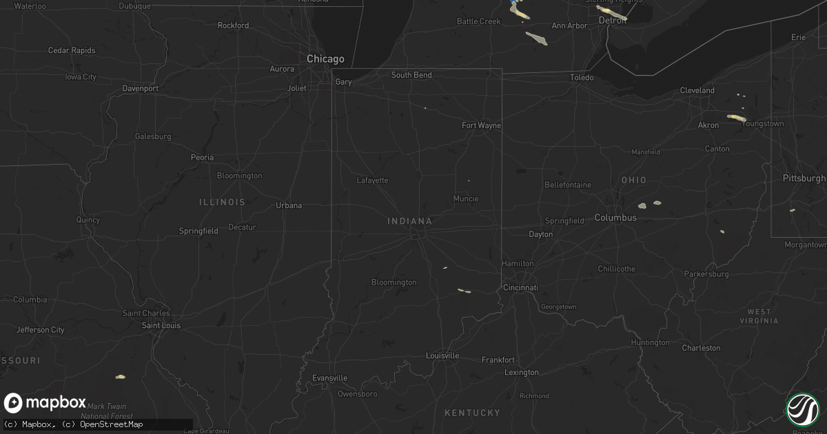
Hail Map in Indiana on September 21, 2022
Get this storm
September 21 map
$229
one time, instant access
Download today. No call, no setup
Keep the $229
Bought the map and want the full workflow? Apply the entire $229 to a subscription within 7 days. None of it is wasted.
Every map, not just this one
This buys you this map. Subscription and you get every map we run, in the markets you choose from a few cities to whole states to nationwide. Plus real-time alerts the moment a storm fires.
Contact data
Name, contact info, occupancy, even credit band for addresses in the footprint. You go from where it hit to who to call.
Become the source they trust
Unlimited branding weather history reports on demand. You already have the documented answer ready for the property owner, and you are the one who showed up with it.
Property data and RoofTrace estimates
Pull up any address you have got, its value and the exact code rules for that jurisdiction, straight from One Click Code. Then RoofTrace estimates the squares, pitch, and roof value, priced the way you price.
Storm reports in Indiana
Indiana
| Date | Description |
|---|---|
| 09/21/20226:45 PM CDT | Trees down on state route 56. Time estimated from radar. |
| 09/21/20226:44 PM CDT | Trees down on salem ridge road. Time estimated from radar. |
| 09/21/20226:17 PM CDT | Power pole down on us 50 near quickpix. Time estimated from radar. |
| 09/21/20226:14 PM CDT | Numerous trees down near south old michigan road and 100 south. Time estimated from radar. |
| 09/21/20225:21 PM CDT | Tree down over road |
| 09/21/20224:50 PM CDT | Trees and powerlines down in central decatur county. |
| 09/21/20224:25 PM CDT | Late report with further details on previous report of wind damage. 6 homes damaged from falling trees. One building on the southwest side of rushville with partial roo |
| 09/21/20224:25 PM CDT | Trees and powerlines down in rushville and to the south and east. |
| 09/21/20223:52 AM CDT | At 852 AM EDT, a severe thunderstorm was located near Bourbon, or 9 miles west of Warsaw, moving southeast at 40 mph. HAZARD...60 mph wind gusts and penny size hail. SOURCE...Radar indicated. IMPACT...Expect damage to roofs, siding, and trees. Locations impacted include... Warsaw, Winona Lake, Bourbon, Mentone, Tippecanoe, Silver Lake, Etna Green, Claypool, Burket, Sidney, Hoffman Lake, Atwood, Palestine, Beaver Dam Lake, Packerton, Old Tip Town, Sevastopol and Beaver Dam. |
| 09/21/20222:39 AM CDT | At 739 PM EDT, a severe thunderstorm was located near Dillsboro, moving east at 35 mph. HAZARD...60 mph wind gusts and penny size hail. SOURCE...Radar indicated. IMPACT...Expect damage to trees and power lines. Locations impacted include... Covington, Florence, Independence, Erlanger, Edgewood, Elsmere, Fort Mitchell, Villa Hills, Taylor Mill, Fort Wright, Lawrenceburg, Ludlow, Crescent Springs, Aurora, Walton, Crestview Hills, Park Hills, Lakeside Park, Rising Sun and Oakbrook. |
| 09/21/20221:28 AM CDT | At 628 PM EDT, a severe thunderstorm was located 7 miles east of Brookville, moving east at 20 mph. HAZARD...60 mph wind gusts and quarter size hail. SOURCE...Radar indicated. IMPACT...Minor hail damage to vehicles is possible. Expect wind damage to trees and power lines. Locations impacted include... Hamilton, Fairfield, Oxford, Seven Mile, Williamsdale, Darrtown, Reily, New Miami, Millville, Scipio, Mount Carmel, Collinsville, Mixersville, Mcgonigle, St. Charles and Layhigh. |
All States Impacted by Hail Map on September 21, 2022
Cities Impacted by Hail Map on September 21, 2022
- Fife Lake, MI
- Manton, MI
- Thompsonville, MI
- Kingsley, MI
- Interlochen, MI
- Grawn, MI
- Buckley, MI
- Merrill, MI
- Remus, MI
- Mecosta, MI
- Mount Pleasant, MI
- Blanchard, MI
- Saint Louis, MI
- Elwell, MI
- Ithaca, MI
- Lakeview, MI
- Alma, MI
- Wheeler, MI
- Breckenridge, MI
- Edmore, MI
- Shepherd, MI
- Vestaburg, MI
- Stanwood, MI
- Riverdale, MI
- Montrose, MI
- Greenville, MI
- Weidman, MI
- Lake, MI
- Rodney, MI
- Barryton, MI
- Arco, ID
- Ubly, MI
- Owendale, MI
- Cass City, MI
- Gagetown, MI
- Mesick, MI
- Copemish, MI
- Kaleva, MI
- Onekama, MI
- Harrietta, MI
- Brethren, MI
- Bear Lake, MI
- Saginaw, MI
- Middlefield, OH
- North Bloomfield, OH
- Casco, MI
- Ray, MI
- East China, MI
- Oxford, MI
- Leonard, MI
- New Haven, MI
- Romeo, MI
- Armada, MI
- New Baltimore, MI
- Fair Haven, MI
- Almont, MI
- Richmond, MI
- Metamora, MI
- Dryden, MI
- Harpursville, NY
- Elizaville, NY
- Sheffield, MA
- South Egremont, MA
- Great Barrington, MA
- Ancramdale, NY
- Ancram, NY
- Pine Plains, NY
- Copake Falls, NY
- Copake, NY
- Ionia, MI
- Wheeling, WV
- Pinconning, MI
- Pataskala, OH
- Johnstown, OH
- Granville, OH
- Alexandria, OH
- Potosi, MO
- Binghamton, NY
- Whitney Point, NY
- Castle Creek, NY
- Gladwin, MI
- Oracle, AZ
- Harrison, MI
- Falmouth, MI
- Marion, MI
- Vassar, MI
- Ashley Falls, MA
- Canaan, CT
- Salisbury, CT
- Mill River, MA
- Southfield, MA
- Butlerville, IN
- Holton, IN
- Howard City, MI
- Cedar Springs, MI
- Grant, MI
- Sand Lake, MI
- Newaygo, MI
- Fremont, MI
- Saint Louisville, OH
- Newark, OH
- Rockford, MI
- Belding, MI
- Cadillac, MI
- Holbrook, ID
- Columbus, MI
- Memphis, MI
- Lapeer, MI
- Sparta, MI
- Lowell, MI
- Belmont, MI
- Kent City, MI
- Ada, MI
- Lake City, MI
- West Chazy, NY
- Lyons, MI
- Portland, MI
- Saranac, MI
- Mayville, MI
- Stockton, UT
- Highland Park, MI
- Detroit, MI
- Utica, MI
- Macomb, MI
- Washington, MI
- Rives Junction, MI
- Grace, ID
- Horseheads, NY
- Breesport, NY
- Erin, NY
- Brooklyn, MI
- Jackson, MI
- Clarklake, MI
- Millington, MI
- Onondaga, MI
- White Cloud, MI
- Clifton Springs, NY
- Lowman, NY
- Agency, IA
- Eldon, IA
- Deckerville, MI
- Palms, MI
- Bay City, MI
- Essexville, MI
- Freedom, NY
- Fillmore, NY
- Farmersville Station, NY
- Houghton, NY
- Manchester, MI
- Onsted, MI
- Tipton, MI
- Oak Park, MI
- Southfield, MI
- Ferndale, MI
- Hazel Park, MI
- Marine City, MI
- Algonac, MI
- Burton, MI
- Davison, MI
- Flint, MI
- Grand Blanc, MI
- Clifford, MI
- Silverwood, MI
- Rhodes, MI
- Standish, MI
- Alger, MI
- West Branch, MI
- Prescott, MI
- Omer, MI
- Houghton Lake, MI
- Prudenville, MI
- Bentley, MI
- Sterling, MI
- Saint Helen, MI
- Eaton Rapids, MI
- Hope, IN
- Malad City, ID
- Kanab, UT
- Chenango Forks, NY
- Greene, NY
- Port Crane, NY
- Caro, MI
- Kingston, MI
- Marlette, MI
- North Branch, MI
- Deford, MI
- Brown City, MI
- Auburn, MI
- Unionville, MI
- Au Gres, MI
- Midland, MI
- Hope, MI
- Linwood, MI
- Munger, MI
- Sebewaing, MI
- Kawkawlin, MI
- Akron, MI
- Snover, MI
- Decker, MI
- Mason, MI
- Marana, AZ
- Rockland, ID
- Sandusky, MI
- Waterford, MI
- Bridgeport, MI
- Southington, OH
- Chazy, NY
- Plattsburgh, NY
- Fostoria, MI
- Fairgrove, MI
- Dimondale, MI
- Charlotte, MI
- Lansing, MI
- Grand Ledge, MI
- Bad Axe, MI
- Warren, OH
- Ravenna, OH
- Diamond, OH
- Newton Falls, OH
- Lake Milton, OH
- Pontiac, MI
- Auburn Hills, MI
- Amity, PA
- Washington, PA
- Newark Valley, NY
- Glen Aubrey, NY
- Endicott, NY
- Maine, NY
- Johnson City, NY
- Lisle, NY
- Huntsville, UT
- Hamtramck, MI
- Payson, UT
- Holt, MI
- Leslie, MI
- Downey, ID
- Arimo, ID
- Grosse Pointe, MI
- Hartford City, IN
- Vernon, UT
- Carrollton, MI
- Reese, MI
- Frankenmuth, MI
- Versailles, IN
- Mount Morris, MI
- Otisville, MI
- Clio, MI
- Columbiaville, MI
- Rochester, MI
- Etna Green, IN
- Morgan, UT
- Firth, ID
- Pocatello, ID
- Spanish Fork, UT
- Afton, NY
- Lewisville, OH
- Summerfield, OH
- Saint Charles, MI
- Freeland, MI
- Hemlock, MI
- Pierson, MI


