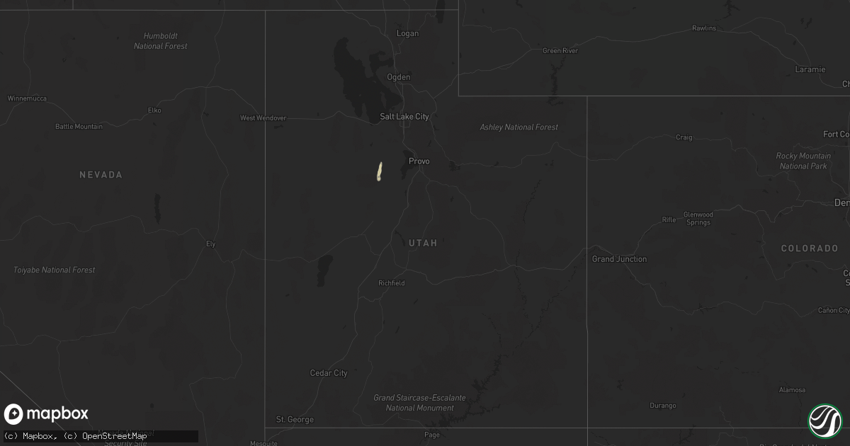
Hail Map in Utah on September 21, 2022
Get this storm
September 21 map
$229
one time, instant access
Download today. No call, no setup
Keep the $229
Bought the map and want the full workflow? Apply the entire $229 to a subscription within 7 days. None of it is wasted.
Every map, not just this one
This buys you this map. Subscription and you get every map we run, in the markets you choose from a few cities to whole states to nationwide. Plus real-time alerts the moment a storm fires.
Contact data
Name, contact info, occupancy, even credit band for addresses in the footprint. You go from where it hit to who to call.
Become the source they trust
Unlimited branding weather history reports on demand. You already have the documented answer ready for the property owner, and you are the one who showed up with it.
Property data and RoofTrace estimates
Pull up any address you have got, its value and the exact code rules for that jurisdiction, straight from One Click Code. Then RoofTrace estimates the squares, pitch, and roof value, priced the way you price.
Storm reports in Utah
Utah
| Date | Description |
|---|---|
| 09/21/20222:45 PM CDT | Measured from dpg14. |
| 09/21/20227:41 AM CDT | At 1240 PM MDT, a severe thunderstorm was located 11 miles northwest of Great Salt Lake South of the Causeway, or 34 miles west of Hill Air Force Base, moving north at 40 mph. HAZARD...60 mph wind gusts and quarter size hail. SOURCE...Radar indicated. IMPACT...Hail damage to vehicles is expected. Expect wind damage to roofs, siding, and trees. Locations impacted include... Great Salt Lake North of the Causeway, Great Salt Lake South of the Causeway and Hat Island. |
| 09/21/20227:26 AM CDT | At 1226 PM MDT, a severe thunderstorm was located 20 miles southwest of Nephi, moving northeast at 45 mph. HAZARD...60 mph wind gusts and quarter size hail. SOURCE...Radar indicated. IMPACT...Hail damage to vehicles is expected. Expect wind damage to roofs, siding, and trees. Locations impacted include... Nephi, Elberta, Mona and Leamington. This includes the following highways... Interstate 15 between mile markers 218 and 220, and between milemarkers 226 and 237. US Route 6 between mile markers 147 and 149. |
| 09/21/20222:17 AM CDT | At 716 PM MDT, a severe thunderstorm was located 22 miles south of Park Valley, or 38 miles southwest of Snowville, moving northeast at 30 mph. HAZARD...60 mph wind gusts. SOURCE...Mesonet weather station measured gust to 63 mph. IMPACT...Expect damage to roofs, siding, and trees. Locations impacted include... Great Salt Lake North of the Causeway and Locomotive Springs. |
| 09/20/202210:47 PM CDT | At 347 PM MDT, a severe thunderstorm was located 16 miles southwest of Snowville, moving northwest at 65 mph. HAZARD...70 mph wind gusts and ping pong ball size hail. SOURCE...Radar indicated. IMPACT...People and animals outdoors will be injured. Expect hail damage to roofs, siding, windows, and vehicles. Expect considerable tree damage. Wind damage is also likely to mobile homes, roofs, and outbuildings. Locations impacted include... Snowville, Curlew Junction and Locomotive Springs. This includes the following highways... Interstate 84 between mile markers 1 and 12. Utah Route 30 between mile markers 66 and 90. |
| 09/20/20229:58 PM CDT | At 257 PM MDT, a severe thunderstorm was located near Magna, or 8 miles west of West Valley City, moving north at 55 mph. HAZARD...60 mph wind gusts and quarter size hail. SOURCE...Radar indicated. IMPACT...Hail damage to vehicles is expected. Expect wind damage to roofs, siding, and trees. Locations impacted include... Salt Lake City, West Valley City, Layton, Hill Air Force Base, Clearfield, Kaysville, Syracuse, Clinton, South Weber, Magna, West Point, Sunset, Antelope Island State Park and Lake Point.This includes the following highways... Interstate 15 between mile markers 329 and 337. Interstate 84 near mile marker 86. Interstate 80 in Utah between mile markers 98 and 113. |
| 09/20/20229:32 PM CDT | At 232 PM MDT, a severe thunderstorm was located over Ophir, or 13 miles southeast of Tooele, moving north at 50 mph. HAZARD...60 mph wind gusts and quarter size hail. SOURCE...Radar indicated. IMPACT...Hail damage to vehicles is expected. Expect wind damage to roofs, siding, and trees. Locations impacted include... Salt Lake City, West Valley City, Tooele, West Jordan, South Jordan, Herriman, North Salt Lake, Stansbury Park, Cedar Fort, Ophir, Kearns, Salt Lake City International Airport, Magna, Bingham Canyon Mine, Oquirrh, Tooele Army Depot South, Camp Williams, Fairfield, Copperton and Lake Point.This includes Interstate 80 in Utah between mile markers 96 and 116. |
| 09/20/20229:18 PM CDT | At 218 PM MDT, a severe thunderstorm was located 15 miles north of Morgan, moving northeast at 25 mph. HAZARD...Ping pong ball size hail and 60 mph wind gusts. SOURCE...Radar indicated. IMPACT...People and animals outdoors will be injured. Expect hail damage to roofs, siding, windows, and vehicles. Expect wind damage to roofs, siding, and trees. Locations impacted include... Huntsville, Nordic Valley, Powder Mountain, Causey Reservoir, Pineview Reservoir and Avon. |
| 09/20/20229:11 PM CDT | At 210 PM MDT, a severe thunderstorm was located over Brigham Young University, or over Provo, moving northeast at 35 mph. HAZARD...60 mph wind gusts and quarter size hail. SOURCE...Radar indicated. IMPACT...Hail damage to vehicles is expected. Expect wind damage to roofs, siding, and trees. Locations impacted include... Provo, Heber City, Orem, Spanish Fork, Springville, Heber, Lindon, Mapleton, Daniel, Vineyard, Brigham Young University, Wasatch Mountain State Park, Palmyra, Timber Lakes, Lake Shore, Utah Lake, Midway, Charleston, Wallsburg and Deer Creek State Park.This includes the following highways... Interstate 15 between mile markers 257 and 271. US Route 6 between mile markers 174 and 177. US Route 40 between mile markers 11 and 25. |
| 09/20/20229:04 PM CDT | At 203 PM MDT, a severe thunderstorm was located 8 miles east of Vernon, or 26 miles east of Dugway English Village, moving north at 35 mph. HAZARD...60 mph wind gusts and quarter size hail. SOURCE...Radar indicated. IMPACT...Hail damage to vehicles is expected. Expect wind damage to roofs, siding, and trees. Locations impacted include... Ophir, Tooele Army Depot South, Rush Valley, Faust and Lofgreen. |
| 09/20/20228:59 PM CDT | At 159 PM MDT, a severe thunderstorm was located 13 miles west of Escalante, moving north at 30 mph. HAZARD...60 mph wind gusts and quarter size hail. SOURCE...Radar indicated. IMPACT...Hail damage to vehicles is expected. Expect wind damage to roofs, siding, and trees. Locations impacted include... Antimony. |
| 09/20/20228:48 PM CDT | At 148 PM MDT, a severe thunderstorm was located over Benjamin, or near Payson, moving northeast at 30 mph. HAZARD...60 mph wind gusts and quarter size hail. SOURCE...Radar indicated. IMPACT...Hail damage to vehicles is expected. Expect wind damage to roofs, siding, and trees. Locations impacted include... Provo, Payson, Orem, Spanish Fork, Pleasant Grove, Springville, Lindon, Santaquin, Mapleton, Salem, Elk Ridge, Woodland Hills, Vineyard, Brigham Young University, Palmyra, Benjamin, Lake Shore, Spring Lake, Utah Lake and West Mountain.This includes the following highways... Interstate 15 between mile markers 245 and 274. US Route 6 between mile markers 174 and 177. |
| 09/20/20228:29 PM CDT | At 129 PM MDT, a severe thunderstorm was located near Henrieville, or 20 miles southwest of Escalante, moving north at 35 mph. HAZARD...60 mph wind gusts and quarter size hail. SOURCE...Radar indicated. IMPACT...Hail damage to vehicles is expected. Expect wind damage to roofs, siding, and trees. This severe thunderstorm will remain over mainly rural areas of south central Garfield County.This includes Utah Route 12 between mile markers 33 and 57. |
| 09/20/20228:10 PM CDT | At 110 PM MDT, a severe thunderstorm was located near Hooper, or 8 miles west of Ogden, moving northeast at 30 mph. HAZARD...60 mph wind gusts and quarter size hail. SOURCE...Radar indicated. IMPACT...Hail damage to vehicles is expected. Expect wind damage to roofs, siding, and trees. Locations impacted include... Ogden, Brigham City, North Ogden, Hooper, Perry, Willard, Marriott-Slaterville, Mantua, South Willard, West Haven, Pleasant View, Farr West, Harrisville, Plain City, West Warren, Wilson, Liberty, Warren, West Weber and Slaterville.This includes Interstate 15 between mile markers 344 and 365. |
| 09/20/20227:44 PM CDT | Measured from groome site... Ur305. |
All States Impacted by Hail Map on September 21, 2022
Cities Impacted by Hail Map on September 21, 2022
- Fife Lake, MI
- Manton, MI
- Thompsonville, MI
- Kingsley, MI
- Interlochen, MI
- Grawn, MI
- Buckley, MI
- Merrill, MI
- Remus, MI
- Mecosta, MI
- Mount Pleasant, MI
- Blanchard, MI
- Saint Louis, MI
- Elwell, MI
- Ithaca, MI
- Lakeview, MI
- Alma, MI
- Wheeler, MI
- Breckenridge, MI
- Edmore, MI
- Shepherd, MI
- Vestaburg, MI
- Stanwood, MI
- Riverdale, MI
- Montrose, MI
- Greenville, MI
- Weidman, MI
- Lake, MI
- Rodney, MI
- Barryton, MI
- Arco, ID
- Ubly, MI
- Owendale, MI
- Cass City, MI
- Gagetown, MI
- Mesick, MI
- Copemish, MI
- Kaleva, MI
- Onekama, MI
- Harrietta, MI
- Brethren, MI
- Bear Lake, MI
- Saginaw, MI
- Middlefield, OH
- North Bloomfield, OH
- Casco, MI
- Ray, MI
- East China, MI
- Oxford, MI
- Leonard, MI
- New Haven, MI
- Romeo, MI
- Armada, MI
- New Baltimore, MI
- Fair Haven, MI
- Almont, MI
- Richmond, MI
- Metamora, MI
- Dryden, MI
- Harpursville, NY
- Elizaville, NY
- Sheffield, MA
- South Egremont, MA
- Great Barrington, MA
- Ancramdale, NY
- Ancram, NY
- Pine Plains, NY
- Copake Falls, NY
- Copake, NY
- Ionia, MI
- Wheeling, WV
- Pinconning, MI
- Pataskala, OH
- Johnstown, OH
- Granville, OH
- Alexandria, OH
- Potosi, MO
- Binghamton, NY
- Whitney Point, NY
- Castle Creek, NY
- Gladwin, MI
- Oracle, AZ
- Harrison, MI
- Falmouth, MI
- Marion, MI
- Vassar, MI
- Ashley Falls, MA
- Canaan, CT
- Salisbury, CT
- Mill River, MA
- Southfield, MA
- Butlerville, IN
- Holton, IN
- Howard City, MI
- Cedar Springs, MI
- Grant, MI
- Sand Lake, MI
- Newaygo, MI
- Fremont, MI
- Saint Louisville, OH
- Newark, OH
- Rockford, MI
- Belding, MI
- Cadillac, MI
- Holbrook, ID
- Columbus, MI
- Memphis, MI
- Lapeer, MI
- Sparta, MI
- Lowell, MI
- Belmont, MI
- Kent City, MI
- Ada, MI
- Lake City, MI
- West Chazy, NY
- Lyons, MI
- Portland, MI
- Saranac, MI
- Mayville, MI
- Stockton, UT
- Highland Park, MI
- Detroit, MI
- Utica, MI
- Macomb, MI
- Washington, MI
- Rives Junction, MI
- Grace, ID
- Horseheads, NY
- Breesport, NY
- Erin, NY
- Brooklyn, MI
- Jackson, MI
- Clarklake, MI
- Millington, MI
- Onondaga, MI
- White Cloud, MI
- Clifton Springs, NY
- Lowman, NY
- Agency, IA
- Eldon, IA
- Deckerville, MI
- Palms, MI
- Bay City, MI
- Essexville, MI
- Freedom, NY
- Fillmore, NY
- Farmersville Station, NY
- Houghton, NY
- Manchester, MI
- Onsted, MI
- Tipton, MI
- Oak Park, MI
- Southfield, MI
- Ferndale, MI
- Hazel Park, MI
- Marine City, MI
- Algonac, MI
- Burton, MI
- Davison, MI
- Flint, MI
- Grand Blanc, MI
- Clifford, MI
- Silverwood, MI
- Rhodes, MI
- Standish, MI
- Alger, MI
- West Branch, MI
- Prescott, MI
- Omer, MI
- Houghton Lake, MI
- Prudenville, MI
- Bentley, MI
- Sterling, MI
- Saint Helen, MI
- Eaton Rapids, MI
- Hope, IN
- Malad City, ID
- Kanab, UT
- Chenango Forks, NY
- Greene, NY
- Port Crane, NY
- Caro, MI
- Kingston, MI
- Marlette, MI
- North Branch, MI
- Deford, MI
- Brown City, MI
- Auburn, MI
- Unionville, MI
- Au Gres, MI
- Midland, MI
- Hope, MI
- Linwood, MI
- Munger, MI
- Sebewaing, MI
- Kawkawlin, MI
- Akron, MI
- Snover, MI
- Decker, MI
- Mason, MI
- Marana, AZ
- Rockland, ID
- Sandusky, MI
- Waterford, MI
- Bridgeport, MI
- Southington, OH
- Chazy, NY
- Plattsburgh, NY
- Fostoria, MI
- Fairgrove, MI
- Dimondale, MI
- Charlotte, MI
- Lansing, MI
- Grand Ledge, MI
- Bad Axe, MI
- Warren, OH
- Ravenna, OH
- Diamond, OH
- Newton Falls, OH
- Lake Milton, OH
- Pontiac, MI
- Auburn Hills, MI
- Amity, PA
- Washington, PA
- Newark Valley, NY
- Glen Aubrey, NY
- Endicott, NY
- Maine, NY
- Johnson City, NY
- Lisle, NY
- Huntsville, UT
- Hamtramck, MI
- Payson, UT
- Holt, MI
- Leslie, MI
- Downey, ID
- Arimo, ID
- Grosse Pointe, MI
- Hartford City, IN
- Vernon, UT
- Carrollton, MI
- Reese, MI
- Frankenmuth, MI
- Versailles, IN
- Mount Morris, MI
- Otisville, MI
- Clio, MI
- Columbiaville, MI
- Rochester, MI
- Etna Green, IN
- Morgan, UT
- Firth, ID
- Pocatello, ID
- Spanish Fork, UT
- Afton, NY
- Lewisville, OH
- Summerfield, OH
- Saint Charles, MI
- Freeland, MI
- Hemlock, MI
- Pierson, MI


