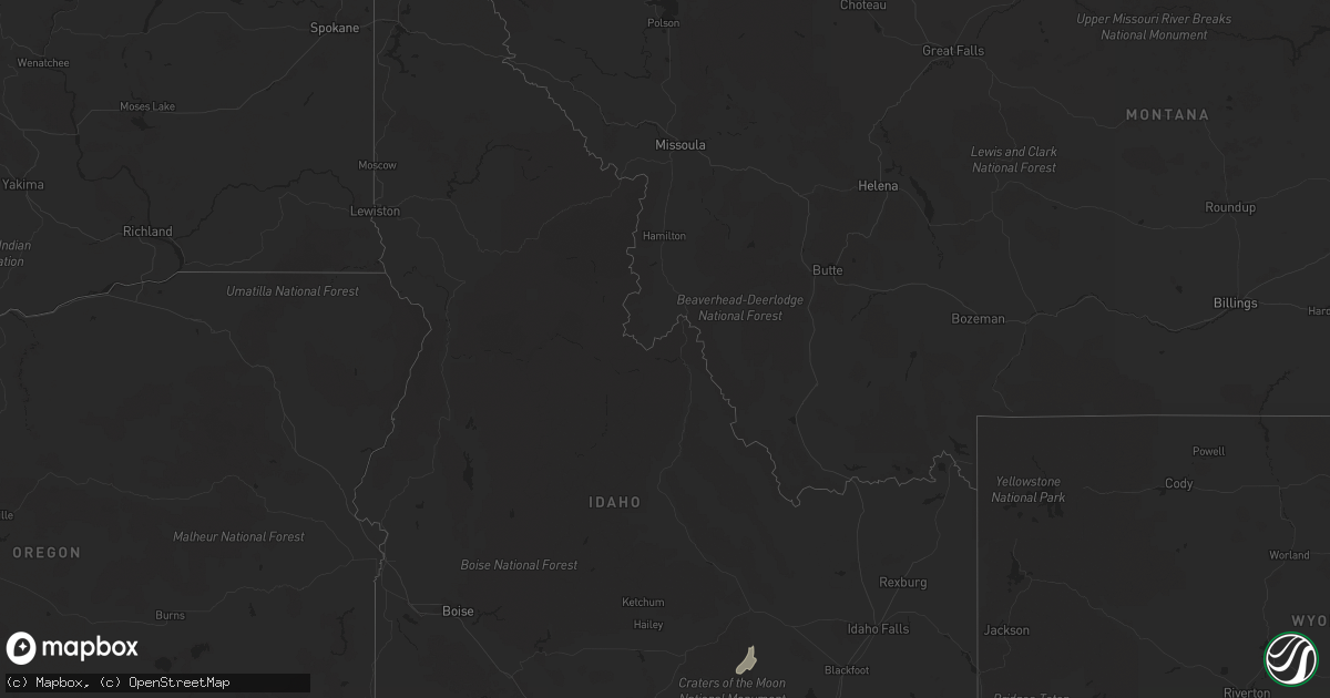
Hail Map in Idaho on September 21, 2022
Get this storm
September 21 map
$229
one time, instant access
Download today. No call, no setup
Keep the $229
Bought the map and want the full workflow? Apply the entire $229 to a subscription within 7 days. None of it is wasted.
Every map, not just this one
This buys you this map. Subscription and you get every map we run, in the markets you choose from a few cities to whole states to nationwide. Plus real-time alerts the moment a storm fires.
Contact data
Name, contact info, occupancy, even credit band for addresses in the footprint. You go from where it hit to who to call.
Become the source they trust
Unlimited branding weather history reports on demand. You already have the documented answer ready for the property owner, and you are the one who showed up with it.
Property data and RoofTrace estimates
Pull up any address you have got, its value and the exact code rules for that jurisdiction, straight from One Click Code. Then RoofTrace estimates the squares, pitch, and roof value, priced the way you price.
Storm reports in Idaho
Idaho
| Date | Description |
|---|---|
| 09/21/20226:00 PM CDT | Pilot gold id. |
| 09/21/20225:30 PM CDT | Itd inl puzzle. |
| 09/21/20225:20 PM CDT | Noaa arl frd dead man canyon. |
| 09/21/20223:44 PM CDT | Ohio gulch raws. |
| 09/21/20222:54 PM CDT | Itd timmerman hill. |
| 09/21/20221:42 PM CDT | Mesonet station pcki1 pole creek. |
| 09/21/20221:08 PM CDT | A local report indicates 61 MPH wind near 5 S TWIN FALLS |
| 09/21/20227:22 AM CDT | At 1221 PM MDT, a severe thunderstorm was located over Kimberly, or near Twin Falls, moving northeast at 60 mph. HAZARD...65 mph wind gusts. SOURCE...61 mph gust measured at Twin Falls Airport. IMPACT...Expect damage to roofs, siding, and trees. This severe thunderstorm will be near... Jerome, Eden and Minidoka National Monument around 1230 PM MDT. |
| 09/21/20222:46 AM CDT | At 746 PM MDT, a severe thunderstorm was located over Inkom, or 8 miles east of Pocatello, moving northeast at 45 mph. HAZARD...60 mph wind gusts and nickel size hail. SOURCE...Radar indicated. IMPACT...Expect damage to roofs, siding, and trees. Locations impacted include... Eastern Pocatello, Chesterfield Reservoir, Inkom, Portneuf Gap, Fort Hall Mount Putnam and Fort Hall Putnam Lodge. |
| 09/21/20222:05 AM CDT | At 704 PM MDT, a severe thunderstorm was located 11 miles south of Fort Hall Bannock Peak, or 22 miles southeast of Neeley, moving northeast at 35 mph. HAZARD...60 mph wind gusts and nickel size hail. SOURCE...Radar indicated. IMPACT...Expect damage to roofs, siding, and trees. Locations impacted include... Pauline, Arbon and Mink Creek Pass. |
| 09/21/20222:00 AM CDT | At 659 PM MDT, a severe thunderstorm was located near Fort Hall Bannock Peak, or 10 miles southeast of American Falls, moving northeast at 35 mph. HAZARD...60 mph wind gusts and nickel size hail. SOURCE...Radar indicated. IMPACT...Expect damage to roofs, siding, and trees. Locations impacted include... Pocatello, American Falls, Neeley, American Falls Reservoir, Chubbuck, Fort Hall Bannock Peak, Portneuf Gap, Fort Hall Bannock Creek Lodge, Pocatello Airport, Sterling and Mink Creek Pass. |
| 09/21/20221:53 AM CDT | At 652 PM MDT, a severe thunderstorm was located 8 miles southwest of Snowville, moving northeast at 30 mph. HAZARD...60 mph wind gusts. SOURCE...Radar indicated. IMPACT...Expect damage to roofs, siding, and trees. Locations impacted include... Snowville, Curlew Junction and Locomotive Springs. This includes the following highways... Interstate 84 between mile markers 0 and 18. Utah Route 30 between mile markers 71 and 90. |
| 09/21/20221:32 AM CDT | At 632 PM MDT, a severe thunderstorm was located near Rockland, or 17 miles south of Neeley, moving northeast at 35 mph. HAZARD...60 mph wind gusts and nickel size hail. SOURCE...Radar indicated. IMPACT...Expect damage to roofs, siding, and trees. Locations impacted include... American Falls, Neeley, western American Falls Reservoir, Rockland, Fort Hall Bannock Peak and Massacre Rocks. |
| 09/20/202211:44 PM CDT | At 444 PM MDT, a severe thunderstorm was located near Northwest Inl, or 9 miles west of Terreton, moving north at 35 mph. HAZARD...70 mph wind gusts and penny size hail. SOURCE...Radar indicated. IMPACT...Expect considerable tree damage. Damage is likely to mobile homes, roofs, and outbuildings. Locations impacted include... Dubois, Terreton, Mud Lake, Northwest Inl, Monteview and Small. |
| 09/20/202211:34 PM CDT | At 434 PM MDT, a severe thunderstorm was located 12 miles north of Juniper, or 22 miles east of Malta, moving north at 50 mph. HAZARD...60 mph wind gusts and quarter size hail. SOURCE...Radar indicated. IMPACT...Hail damage to vehicles is expected. Expect wind damage to roofs, siding, and trees. Locations impacted include... American Falls, Neeley, Rockland, Massacre Rocks, Sublett Reservoir and Roy. |
| 09/20/20229:26 PM CDT | At 226 PM MDT, a severe thunderstorm was located over Grace, or 10 miles southwest of Soda Springs, moving northeast at 35 mph. HAZARD...Quarter size hail. SOURCE...Radar indicated. IMPACT...Damage to vehicles is expected. Locations impacted include... Soda Springs, Blackfoot Reservoir, Grace, Henry and Niter. |
| 09/20/20228:00 PM CDT | Several scattered large trees damaged with a few down along east fork of rock creek. |
| 09/20/20227:50 PM CDT | Several large limbs down in a residence along rockland highway. Time estimated via radar. |
| 09/20/20227:19 PM CDT | Raft river raws. |
All States Impacted by Hail Map on September 21, 2022
Cities Impacted by Hail Map on September 21, 2022
- Fife Lake, MI
- Manton, MI
- Thompsonville, MI
- Kingsley, MI
- Interlochen, MI
- Grawn, MI
- Buckley, MI
- Merrill, MI
- Remus, MI
- Mecosta, MI
- Mount Pleasant, MI
- Blanchard, MI
- Saint Louis, MI
- Elwell, MI
- Ithaca, MI
- Lakeview, MI
- Alma, MI
- Wheeler, MI
- Breckenridge, MI
- Edmore, MI
- Shepherd, MI
- Vestaburg, MI
- Stanwood, MI
- Riverdale, MI
- Montrose, MI
- Greenville, MI
- Weidman, MI
- Lake, MI
- Rodney, MI
- Barryton, MI
- Arco, ID
- Ubly, MI
- Owendale, MI
- Cass City, MI
- Gagetown, MI
- Mesick, MI
- Copemish, MI
- Kaleva, MI
- Onekama, MI
- Harrietta, MI
- Brethren, MI
- Bear Lake, MI
- Saginaw, MI
- Middlefield, OH
- North Bloomfield, OH
- Casco, MI
- Ray, MI
- East China, MI
- Oxford, MI
- Leonard, MI
- New Haven, MI
- Romeo, MI
- Armada, MI
- New Baltimore, MI
- Fair Haven, MI
- Almont, MI
- Richmond, MI
- Metamora, MI
- Dryden, MI
- Harpursville, NY
- Elizaville, NY
- Sheffield, MA
- South Egremont, MA
- Great Barrington, MA
- Ancramdale, NY
- Ancram, NY
- Pine Plains, NY
- Copake Falls, NY
- Copake, NY
- Ionia, MI
- Wheeling, WV
- Pinconning, MI
- Pataskala, OH
- Johnstown, OH
- Granville, OH
- Alexandria, OH
- Potosi, MO
- Binghamton, NY
- Whitney Point, NY
- Castle Creek, NY
- Gladwin, MI
- Oracle, AZ
- Harrison, MI
- Falmouth, MI
- Marion, MI
- Vassar, MI
- Ashley Falls, MA
- Canaan, CT
- Salisbury, CT
- Mill River, MA
- Southfield, MA
- Butlerville, IN
- Holton, IN
- Howard City, MI
- Cedar Springs, MI
- Grant, MI
- Sand Lake, MI
- Newaygo, MI
- Fremont, MI
- Saint Louisville, OH
- Newark, OH
- Rockford, MI
- Belding, MI
- Cadillac, MI
- Holbrook, ID
- Columbus, MI
- Memphis, MI
- Lapeer, MI
- Sparta, MI
- Lowell, MI
- Belmont, MI
- Kent City, MI
- Ada, MI
- Lake City, MI
- West Chazy, NY
- Lyons, MI
- Portland, MI
- Saranac, MI
- Mayville, MI
- Stockton, UT
- Highland Park, MI
- Detroit, MI
- Utica, MI
- Macomb, MI
- Washington, MI
- Rives Junction, MI
- Grace, ID
- Horseheads, NY
- Breesport, NY
- Erin, NY
- Brooklyn, MI
- Jackson, MI
- Clarklake, MI
- Millington, MI
- Onondaga, MI
- White Cloud, MI
- Clifton Springs, NY
- Lowman, NY
- Agency, IA
- Eldon, IA
- Deckerville, MI
- Palms, MI
- Bay City, MI
- Essexville, MI
- Freedom, NY
- Fillmore, NY
- Farmersville Station, NY
- Houghton, NY
- Manchester, MI
- Onsted, MI
- Tipton, MI
- Oak Park, MI
- Southfield, MI
- Ferndale, MI
- Hazel Park, MI
- Marine City, MI
- Algonac, MI
- Burton, MI
- Davison, MI
- Flint, MI
- Grand Blanc, MI
- Clifford, MI
- Silverwood, MI
- Rhodes, MI
- Standish, MI
- Alger, MI
- West Branch, MI
- Prescott, MI
- Omer, MI
- Houghton Lake, MI
- Prudenville, MI
- Bentley, MI
- Sterling, MI
- Saint Helen, MI
- Eaton Rapids, MI
- Hope, IN
- Malad City, ID
- Kanab, UT
- Chenango Forks, NY
- Greene, NY
- Port Crane, NY
- Caro, MI
- Kingston, MI
- Marlette, MI
- North Branch, MI
- Deford, MI
- Brown City, MI
- Auburn, MI
- Unionville, MI
- Au Gres, MI
- Midland, MI
- Hope, MI
- Linwood, MI
- Munger, MI
- Sebewaing, MI
- Kawkawlin, MI
- Akron, MI
- Snover, MI
- Decker, MI
- Mason, MI
- Marana, AZ
- Rockland, ID
- Sandusky, MI
- Waterford, MI
- Bridgeport, MI
- Southington, OH
- Chazy, NY
- Plattsburgh, NY
- Fostoria, MI
- Fairgrove, MI
- Dimondale, MI
- Charlotte, MI
- Lansing, MI
- Grand Ledge, MI
- Bad Axe, MI
- Warren, OH
- Ravenna, OH
- Diamond, OH
- Newton Falls, OH
- Lake Milton, OH
- Pontiac, MI
- Auburn Hills, MI
- Amity, PA
- Washington, PA
- Newark Valley, NY
- Glen Aubrey, NY
- Endicott, NY
- Maine, NY
- Johnson City, NY
- Lisle, NY
- Huntsville, UT
- Hamtramck, MI
- Payson, UT
- Holt, MI
- Leslie, MI
- Downey, ID
- Arimo, ID
- Grosse Pointe, MI
- Hartford City, IN
- Vernon, UT
- Carrollton, MI
- Reese, MI
- Frankenmuth, MI
- Versailles, IN
- Mount Morris, MI
- Otisville, MI
- Clio, MI
- Columbiaville, MI
- Rochester, MI
- Etna Green, IN
- Morgan, UT
- Firth, ID
- Pocatello, ID
- Spanish Fork, UT
- Afton, NY
- Lewisville, OH
- Summerfield, OH
- Saint Charles, MI
- Freeland, MI
- Hemlock, MI
- Pierson, MI


