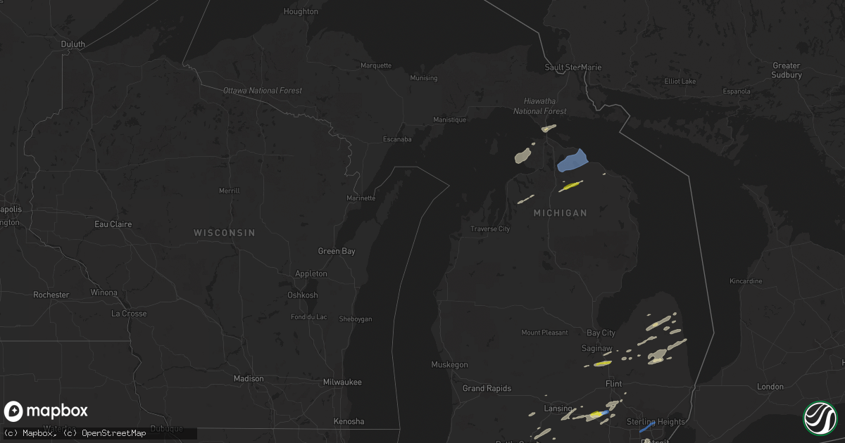
Hail Map in Michigan on September 14, 2021
Get this storm
September 14 map
$229
one time, instant access
Download today. No call, no setup
Keep the $229
Bought the map and want the full workflow? Apply the entire $229 to a subscription within 7 days. None of it is wasted.
Every map, not just this one
This buys you this map. Subscription and you get every map we run, in the markets you choose from a few cities to whole states to nationwide. Plus real-time alerts the moment a storm fires.
Contact data
Name, contact info, occupancy, even credit band for addresses in the footprint. You go from where it hit to who to call.
Become the source they trust
Unlimited branding weather history reports on demand. You already have the documented answer ready for the property owner, and you are the one who showed up with it.
Property data and RoofTrace estimates
Pull up any address you have got, its value and the exact code rules for that jurisdiction, straight from One Click Code. Then RoofTrace estimates the squares, pitch, and roof value, priced the way you price.
Storm reports in Michigan
Michigan
| Date | Description |
|---|---|
| 09/14/20216:44 PM CDT | Multiple large trees downed near chesnut st and addison st. |
| 09/14/20216:15 PM CDT | Several trees and power lines down in jefferson township. |
| 09/14/20216:11 PM CDT | Trees down on powerlines west of hillsdale. |
| 09/14/20216:00 PM CDT | Several trees and power lines down in allen township. |
| 09/14/20215:14 PM CDT | Corrected time...trees and wires downed near bridgehampton rd and worth st and also near main st and marlette st. |
| 09/14/20214:55 PM CDT | Photos submitted via social media of multiple half dollar sized hailstones.some just shy of walnut sized. |
| 09/14/20214:49 PM CDT | 10 inch tree limb downed. |
| 09/14/20214:49 PM CDT | Trees and wires downed near bridgehampton rd and worth st and also near main st and marlette st. |
| 09/14/20214:13 PM CDT | Trees downed near east dayton rd and bevens rd in wells twp. |
| 09/14/20213:54 PM CDT | Wires downed. |
| 09/14/20213:40 PM CDT | Corrects time of previous tstm wnd dmg report from cassopolis. Power line down. |
| 09/14/20213:40 PM CDT | Trees down. Times estimated by radar. |
| 09/14/20213:31 PM CDT | Large limbs downed on private residence. |
| 09/14/20213:29 PM CDT | Macomb county dispatch reports partial building collapse. |
| 09/14/20213:25 PM CDT | Macomb county dispatch reports trees and wires downed near schoenherr rd and clinton river rd in sterling heights. |
| 09/14/20213:17 PM CDT | Quarter sized hail reported near dixie hwy and canada rd. |
| 09/14/20213:12 PM CDT | Spotter reported measured 60 mph wind gust and penny sized hail. |
| 09/14/20213:06 PM CDT | Public reports tree down blocking road on chilson rd near chilson creek. |
| 09/14/20211:48 PM CDT | Lenawee county central dispatch reported mutiple trees and power lines down in and around hudson. |
| 09/14/20214:34 AM CDT | At 933 AM EDT, a severe thunderstorm was located over Pickerel Lake, or 15 miles northeast of Gaylord, moving northeast at 50 mph. HAZARD...60 mph wind gusts and quarter size hail. SOURCE...Radar indicated. IMPACT...Hail damage to vehicles is expected. Expect wind damage to roofs, siding, and trees. This severe thunderstorm will remain over mainly rural areas of southeastern Cheboygan and northeastern Otsego Counties, including the following locations... Pigeon River State Forest. |
| 09/14/20214:22 AM CDT | At 921 AM EDT, severe thunderstorms were located along a line extending from Alverno to near Black Lake to near Koehler Township, moving northeast at 60 mph. HAZARD...60 mph wind gusts and penny size hail. SOURCE...Radar indicated. IMPACT...Expect damage to roofs, siding, and trees. Severe thunderstorms will be near... Black Lake around 925 AM EDT. Nine Mile Point and Onaway State Park around 930 AM EDT. Huron Beach around 935 AM EDT. Forty Mile Point and P H Hoeft State Park around 940 AM EDT. |
| 09/14/20213:30 AM CDT | At 830 PM EDT, severe thunderstorms were located along a line extending from near Warren to Dearborn to near Romulus, moving east at 45 mph. HAZARD...60 mph wind gusts. SOURCE...Radar indicated. IMPACT...Expect damage to roofs, siding, and trees. Severe thunderstorms will be near... Warren around 835 PM EDT. Downtown Detroit and Detroit around 840 PM EDT. St. Clair Shores, Mount Clemens, Grosse Ile and Belle Isle around 845 PM EDT. Grosse Pointe around 850 PM EDT.Other locations impacted by these severe thunderstorms includeMelvindale, Gibraltar, Roseville, New Boston, Rockwood, Harper Woods,Westland, Grosse Pointe Shores, Ecorse and Center Line.People attending the Aretha Franklin Amphitheater, Fox Theatre,Comerica Park, the Garden Party on Belle Isle, and Little CaesarsArena should seek safe shelter immediately! |
| 09/14/20212:53 AM CDT | At 752 PM EDT, severe thunderstorms were located along a line extending from near Tecumseh to near Britton to near Morenci, moving east at 40 mph. HAZARD...60 mph wind gusts. SOURCE...Radar indicated. IMPACT...Expect damage to roofs, siding, and trees. Severe thunderstorms will be near... Deerfield around 800 PM EDT. Petersburg around 805 PM EDT. Milan and Dundee around 810 PM EDT. Ida around 815 PM EDT. Maybee around 820 PM EDT. Monroe and Carleton around 830 PM EDT. Luna Pier around 855 PM EDT.Other locations impacted by these severe thunderstorms includeNewport, Cone, Estral Beach, Toledo Beach, South Rockwood, WoodlandBeach, Stony Point, Bolles Harbor, Samaria and Azalia. |
| 09/14/20212:25 AM CDT | At 725 PM EDT, severe thunderstorms were located along a line extending from Onsted to near Clayton to near Pioneer, moving east at 35 mph. HAZARD...60 mph wind gusts. SOURCE...Radar indicated. IMPACT...Expect damage to roofs, siding, and trees. Severe thunderstorms will be near... Onsted and Clayton around 730 PM EDT. Adrian around 745 PM EDT. Tecumseh and Morenci around 750 PM EDT. Britton around 805 PM EDT. Blissfield around 830 PM EDT. Deerfield around 835 PM EDT.Other locations impacted by these severe thunderstorms includeSeneca, Manitou Beach-Devils Lake, Macon, Lime Creek, Munson, OgdenCenter, Canandaigua, Ridgeway, Palmyra and Tipton. |
| 09/14/20211:01 AM CDT | At 601 PM EDT, a severe thunderstorm was located over Hartland, moving east at 50 mph. HAZARD...70 mph wind gusts and quarter size hail. SOURCE...Radar indicated. IMPACT...Hail damage to vehicles is expected. Expect considerable tree damage. Wind damage is also likely to mobile homes, roofs, and outbuildings. This severe thunderstorm will be near... Milford around 610 PM EDT. Holly around 615 PM EDT. Ortonville and Clarkston around 625 PM EDT. Pontiac around 630 PM EDT. Oxford around 635 PM EDT. Rochester around 640 PM EDT.Other locations impacted by this severe thunderstorm includeRochester Hills, Keego Harbor, Lakeville, Waterford, Davisburg, HollyState Recreation Area, Commerce, Rose Center, Lake Orion and SylvanLake.People attending DTE Energy Music Theatre should seek safe shelterimmediately! |
| 09/14/202112:58 AM CDT | At 558 PM EDT, a severe thunderstorm was located near Marlette, moving northeast at 40 mph. HAZARD...60 mph wind gusts and quarter size hail. SOURCE...Radar indicated. IMPACT...Hail damage to vehicles is expected. Expect wind damage to roofs, siding, and trees. This severe thunderstorm will be near... Peck around 605 PM EDT. Sandusky around 615 PM EDT. Carsonville and Applegate around 625 PM EDT. Port Sanilac around 635 PM EDT.Other locations impacted by this severe thunderstorm includeForester, Juhl, Elmer, Richmondville, Watertown and McGregor. |
| 09/14/202112:49 AM CDT | At 549 PM EDT, a severe thunderstorm was located near Oak Grove, or near Howell, moving east at 50 mph. HAZARD...60 mph wind gusts and quarter size hail. SOURCE...Radar indicated. IMPACT...Hail damage to vehicles is expected. Expect wind damage to roofs, siding, and trees. This severe thunderstorm will be near... Hartland around 600 PM EDT.Other locations impacted by this severe thunderstorm include ParkersCorners, Plainfield, Island Lake State Recreation Area, Chilson,Conway Township, Tyrone Township and Deerfield Township. |
| 09/13/202111:19 PM CDT | At 418 PM EDT, severe thunderstorms were located along a line extending from near Cass City to near Vassar to near Birch Run, moving east at 40 mph. HAZARD...60 mph wind gusts and quarter size hail. SOURCE...Radar indicated. IMPACT...Hail damage to vehicles is expected. Expect wind damage to roofs, siding, and trees. Severe thunderstorms will be near... Cass City and Gagetown around 425 PM EDT. Vassar around 435 PM EDT. Kingston around 440 PM EDT. Mayville around 450 PM EDT. Clifford around 500 PM EDT.Other locations impacted by these severe thunderstorms include EastDayton, Deford, Tuscola, Wilmot, Ellington, Watrousville, Silverwood,Richville and Fostoria. |
| 09/13/202111:11 PM CDT | At 410 PM EDT, a severe thunderstorm was located over Detroit Zoo, or near Southfield, moving northeast at 40 mph. HAZARD...60 mph wind gusts and quarter size hail. SOURCE...Radar indicated. IMPACT...Hail damage to vehicles is expected. Expect wind damage to roofs, siding, and trees. This severe thunderstorm will be near... Royal Oak around 415 PM EDT. Warren around 420 PM EDT. Troy around 425 PM EDT. St. Clair Shores, Sterling Heights and Clinton around 435 PM EDT. Mount Clemens and Macomb Township around 440 PM EDT. New Baltimore around 455 PM EDT.Other locations impacted by this severe thunderstorm includeRoseville, Utica, Lathrup Village, Harper Woods, Pleasant Ridge,Grosse Pointe Shores, Center Line, Huntington Woods, Grosse PointeWoods and Chesterfield Township. |
| 09/13/202111:04 PM CDT | At 404 PM EDT, a severe thunderstorm was located over Ubly, moving northeast at 45 mph. HAZARD...60 mph wind gusts and quarter size hail. SOURCE...Radar indicated. IMPACT...Hail damage to vehicles is expected. Expect wind damage to roofs, siding, and trees. This severe thunderstorm will be near... Harbor Beach around 430 PM EDT.Other locations impacted by this severe thunderstorm include Redman,Parisville, White Rock, Ivanhoe, Rapson, New Greenleaf, Tyre, Ruth,Palms and Helena. |
| 09/13/202111:03 PM CDT | At 403 PM EDT, a severe thunderstorm was located near Dexter, moving northeast at 35 mph. HAZARD...60 mph wind gusts and quarter size hail. SOURCE...Radar indicated. IMPACT...Hail damage to vehicles is expected. Expect wind damage to roofs, siding, and trees. This severe thunderstorm will be near... Hamburg around 415 PM EDT. Brighton and Whitmore Lake around 420 PM EDT. South Lyon and Salem around 430 PM EDT. Milford and Northville around 440 PM EDT. Novi around 445 PM EDT.Other locations impacted by this severe thunderstorm include HudsonMills Metropark, Island Lake State Recreation Area, Delhi Mills, NewHudson, Barton Hills, Walled Lake, Pinckney State Recreation Area,Hudson Mills, Lakeland and Hell. |
| 09/13/202110:54 PM CDT | At 353 PM EDT, a severe thunderstorm was located near Chesaning, moving northeast at 40 mph. HAZARD...60 mph wind gusts and quarter size hail. SOURCE...Radar indicated. IMPACT...Hail damage to vehicles is expected. Expect wind damage to roofs, siding, and trees. This severe thunderstorm will be near... Bridgeport around 410 PM EDT. Birch Run around 415 PM EDT. Frankenmuth around 420 PM EDT.Other locations impacted by this severe thunderstorm include Fosters,Arthur, Burt, Gera, Layton Corners, Shiawassee National WildlifeRefuge and Buena Vista Township. |
| 09/13/202110:41 PM CDT | At 341 PM EDT, a severe thunderstorm was located near West Bloomfield, or near Novi, moving northeast at 40 mph. HAZARD...60 mph wind gusts and quarter size hail. SOURCE...Radar indicated. IMPACT...Hail damage to vehicles is expected. Expect wind damage to roofs, siding, and trees. This severe thunderstorm will be near... West Bloomfield around 345 PM EDT. Birmingham around 355 PM EDT. Pontiac around 400 PM EDT. Troy around 405 PM EDT. Rochester around 410 PM EDT. Macomb Township around 420 PM EDT. Romeo around 425 PM EDT.Other locations impacted by this severe thunderstorm includeFranklin, Keego Harbor, Waterford, Orchard Lake, Shelby Township,Commerce, Utica, Washington, Auburn Hills and Bingham Farms. |
| 09/13/20219:52 PM CDT | At 251 PM EDT, a severe thunderstorm was located over Clayton, or near Hudson, moving northeast at 45 mph. HAZARD...60 mph wind gusts and penny size hail. SOURCE...Radar indicated. IMPACT...Expect damage to roofs, siding, and trees. This severe thunderstorm will be near... Onsted around 305 PM EDT. Adrian around 310 PM EDT. Tecumseh around 320 PM EDT. Britton around 325 PM EDT. Saline and Milan around 340 PM EDT.Other locations impacted by this severe thunderstorm include ManitouBeach-Devils Lake, Pittsfield Township, Cone, Macon, Canandaigua,Bridgewater, Ridgeway, Palmyra, Pleasant Lake and Tipton. |
| 09/13/20218:01 PM CDT | Dispatch reports numerous trees and powerlines down in the whiteford and bedford areas. |
| 09/13/20218:01 PM CDT | Dispatch reports numerous trees and powerlines down in the whiteford and bedford areas. |
| 09/13/20217:50 PM CDT | 2 foot diameter tree down across road relayed via social media photos near vienna park in temperance. |
| 09/13/20217:37 PM CDT | Dispatch reports trees and wires down in the south rockwood area. |
| 09/13/20217:37 PM CDT | Dispatch reports trees and wires down in the south rockwood area. |
| 09/13/20217:36 PM CDT | Power line down. |
All States Impacted by Hail Map on September 14, 2021
Cities Impacted by Hail Map on September 14, 2021
- Lyons, OH
- Wauseon, OH
- Fowlerville, MI
- Converse, IN
- Marion, IN
- La Fontaine, IN
- Hoisington, KS
- Claflin, KS
- Great Bend, KS
- Walsenburg, CO
- Colorado Springs, CO
- Upton, WY
- Sturgis, MI
- White Pigeon, MI
- Constantine, MI
- Danville, IN
- Pendleton, IN
- Sandusky, MI
- Deckerville, MI
- Carsonville, MI
- Port Sanilac, MI
- Medina, OH
- Fenton, MI
- Howell, MI
- Cass City, MI
- Ubly, MI
- Muncie, IN
- Gaston, IN
- Yorktown, IN
- Alexandria, IN
- Marlette, MI
- Brown City, MI
- Peru, IN
- Herrick, IL
- Lakewood, IL
- Beecher City, IL
- Tower Hill, IL
- Cowden, IL
- Macksville, KS
- Haviland, KS
- Lewis, KS
- Hartland, MI
- Brighton, MI
- Highland, MI
- Hudson, MI
- Pittsford, MI
- Osseo, MI
- Gate, OK
- Middletown, IN
- La Junta, CO
- Elmore, OH
- Graytown, OH
- North Adams, MI
- Calhan, CO
- Yoder, CO
- Kinsley, KS
- Belpre, KS
- Las Animas, CO
- Denver, IN
- Terre Haute, IN
- Pawnee Rock, KS
- Larned, KS
- Shipshewana, IN
- Holyrood, KS
- Bushton, KS
- Lorraine, KS
- Cunningham, KS
- Kingman, KS
- Ordway, CO
- New Paris, IN
- Goshen, IN
- Daleville, IN
- Wabash, IN
- Coldwater, MI
- Quincy, MI
- Reading, MI
- Peyton, CO
- Marquette, KS
- Stafford, KS
- Walnut, KS
- Erie, KS
- Saint Paul, KS
- Niles, MI
- Edwardsburg, MI
- Vandalia, MI
- Cassopolis, MI
- Eagle, MI
- Harbor Springs, MI
- Louisville, IL
- Clay City, IL
- Sugar City, CO
- Mooreland, IN
- Springport, IN
- New Castle, IN
- Little River, KS
- Lindsborg, KS
- Windom, KS
- Dieterich, IL
- Wheeler, IL
- Newton, IL
- Hillsboro, IL
- Coffeen, IL
- Donnellson, IL
- Washington, MO
- Milton, KS
- Argonia, KS
- Norwich, KS
- Kingman, IN
- Bainbridge, IN
- Greencastle, IN
- Fillmore, IN
- Coatesville, IN
- Ceresco, MI
- Battle Creek, MI
- Marshall, MI
- Greensburg, KS
- Elbert, CO
- Franktown, CO
- Elizabeth, CO
- Losantville, IN
- Sterling, KS
- Lyons, KS
- Kewanna, IN
- Burnettsville, IN
- Lucerne, IN
- Royal Center, IN
- Albert, KS
- Moorcroft, WY
- Greenville, IL
- Garfield, KS
- Williamston, MI
- Okemos, MI
- Mason, MI
- Hagerstown, IN
- Kendall, KS
- St John, KS
- Kokomo, IN
- Collinsville, IL
- Hartford, IL
- Granite City, IL
- Maryville, IL
- Edwardsville, IL
- Glen Carbon, IL
- Amboy, IN
- Van Buren, IN
- Swayzee, IN
- Saint Ignace, MI
- Mackinac Island, MI
- Bellevue, MI
- Deepwater, MO
- Clinton, MO
- Syracuse, KS
- Millington, MI
- Vassar, MI
- Frankfort, IN
- Mount Hope, KS
- Colwich, KS
- Andale, KS
- Bad Axe, MI
- Sandoval, IL
- Carlyle, IL
- Centralia, IL
- Mcpherson, KS
- Ellsworth, KS
- Mason, IL
- Edgewood, IL
- Farina, IL
- Lerna, IL
- Trilla, IL
- Iola, KS
- Yates Center, KS
- Humboldt, KS
- Piqua, KS
- Onaway, MI
- Cambridge City, IN
- Jones, MI
- Granger, IN
- South Bend, IN
- Kinmundy, IL
- Alma, IL
- Sun City, KS
- Howe, IN
- Charlotte, MI
- Olivet, MI
- Eaton Rapids, MI
- Springport, MI
- West Liberty, IL
- Greentown, IN
- Sweetser, IN
- Vermontville, MI
- Anderson, IN
- Union City, MI
- Athens, MI
- New Haven, MO
- Logansport, IN
- Walton, IN
- Lafayette, IN
- Westpoint, IN
- Jewett, IL
- Effingham, IL
- Montrose, IL
- Markleville, IN
- Summitville, IN
- Amo, IN
- Sedgwick, KS
- Webberville, MI
- Dansville, MI
- Palms, MI
- Ruth, MI
- Detroit, MI
- Dearborn, MI
- Birch Run, MI
- Montrose, MI
- Chesaning, MI
- Burt, MI
- Sylvania, OH
- Berkey, OH
- Holland, OH
- Swanton, OH
- Metamora, OH
- Knightstown, IN
- Clayton, IN
- Middlebury, IN
- Boone, CO
- Idaville, IN
- Delphi, IN
- Twelve Mile, IN
- Cheraw, CO
- Kiowa, CO
- Saint Louis, MO
- Andrews, IN
- Huntington, IN
- Lagro, IN
- Caro, MI
- Decker, MI
- Deford, MI
- Belleville, IL
- Clarks Hill, IN
- Ingraham, IL
- Sailor Springs, IL
- Olney Springs, CO
- Rogers City, MI
- Manitou Beach, MI
- Addison, MI
- Fairmount, IN
- Xenia, IL
- Whitestown, IN
- Lebanon, IN
- Hillsdale, MI
- Burr Oak, MI
- Hume, IL
- Litchfield, MI
- Perrysville, IN
- Bunker Hill, IN
- Miami, IN
- Grissom Arb, IN
- Macy, IN
- Roann, IN
- Warren, IN
- Galveston, IN
- Newman, IL
- Offerle, KS
- Fostoria, MI
- Three Rivers, MI
- Jonesville, MI
- Allen, MI
- Spivey, KS
- Mayville, MI
- Clayton, MI
- Warrenton, MO
- Goodrich, MI
- Rocky Ford, CO
- East Leroy, MI
- Martinsville, IN
- Morgantown, IN
- Perry, MI
- Dearborn Heights, MI
- Garden City, MI
- Westland, MI
- Inkster, MI
- Perrysburg, OH
- Genoa, OH
- Woodville, OH
- Mullinville, KS
- Bucklin, KS
- Holly, MI
- Linden, MI
- Cloverdale, IN
- Putnamville, IN
- Jasper, MI
- Thorntown, IN
- Patoka, IL
- Odin, IL
- Hoffman, IL
- Central Lake, MI
- East Jordan, MI
- Boyne City, MI
- Monrovia, IN
- Mooresville, IN
- Monument, CO
- Jackson, MI
- Millstadt, IL
- Smithton, IL
- Freeburg, IL
- Mascoutah, IL
- Ellinwood, KS
- Notre Dame, IN
- Mishawaka, IN
- West Unity, OH
- Fayette, OH
- Archbold, OH
- Jonesboro, IN
- Dunbridge, OH
- Bowling Green, OH
- Geneseo, KS
- Pratt, KS
- Rochester, IN
- Bonnots Mill, MO
- Chamois, MO
- Applegate, MI
- Peck, MI
- Bridgeport, MI
- Frankenmuth, MI
- Linn, MO
- Flora, IN
- Camden, IN
- Wyandotte, MI
- Ecorse, MI
- Lincoln Park, MI
- Southgate, MI
- Colfax, IN
- Albers, IL
- New Baden, IL
- Indianapolis, IN
- Greenwood, IN
- Nekoma, KS
- Rush Center, KS
- Clifford, MI
- North Branch, MI
- Turon, KS
- Levering, MI
- Romulus, MI
- Flat Rock, MI
- Brownsburg, IN
- Pittsboro, IN
- Gays, IL
- Windsor, IL
- Toledo, OH
- Maumee, OH
- Monclova, OH
- Fremont, OH
- Oak Harbor, OH
- Port Clinton, OH
- Metcalf, IL
- Chrisman, IL
- Steedman, MO
- Portland, MO
- Bentley, KS
- Halstead, KS
- Tebbetts, MO
- Alexander, KS
- Silverwood, MI
- Pellston, MI
- Fulton, MI
- Vicksburg, MI
- Leonidas, MI
- Mendon, MI
- Sherwood, MI
- Colon, MI
- Harbor Beach, MI
- Millersburg, IN
- Lagrange, IN
- Topeka, IN
- Bristol, IN
- Leslie, MO
- Latham, KS
- Montrose, MO
- Wolverine, MI
- Osceola, MO
- Whiteland, IN
- Minden City, MI
- Royal Oak, MI
- Madison Heights, MI
- Troy, MI
- Sterling Heights, MI
- Oak Park, MI
- Berkley, MI
- Clawson, MI
- Southfield, MI
- Indian River, MI
- Cheboygan, MI
- Afton, MI
- Millersburg, MI
- Trinchera, CO
- Folsom, NM
- Raton, NM
- Haskins, OH
- Clay Center, OH
- Northwood, OH
- Rocky Ridge, OH
- Oregon, OH
- McClure, OH
- Waterville, OH
- Walbridge, OH
- Stony Ridge, OH
- Weston, OH
- Luckey, OH
- Rossford, OH
- Tontogany, OH
- Curtice, OH
- Pemberville, OH
- Martin, OH
- Millbury, OH
- Grand Rapids, OH
- Sylvia, KS
- Lakin, KS


