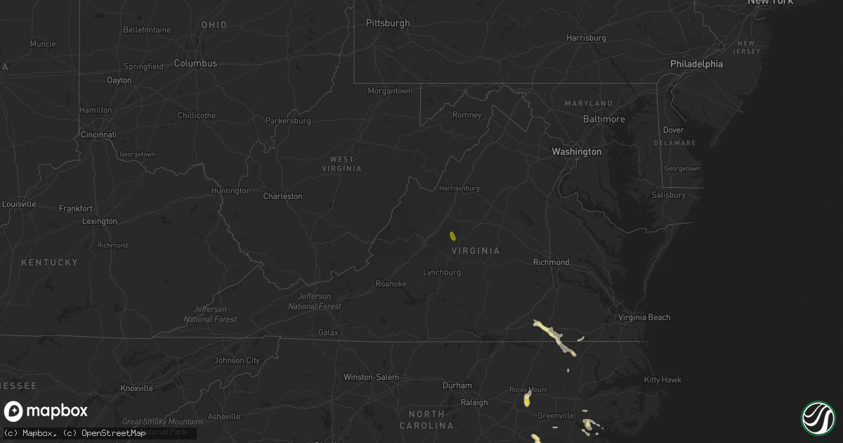
Hail Map in Virginia on September 9, 2019
Get this storm
September 9 map
$229
one time, instant access
Download today. No call, no setup
Keep the $229
Bought the map and want the full workflow? Apply the entire $229 to a subscription within 7 days. None of it is wasted.
Every map, not just this one
This buys you this map. Subscription and you get every map we run, in the markets you choose from a few cities to whole states to nationwide. Plus real-time alerts the moment a storm fires.
Contact data
Name, contact info, occupancy, even credit band for addresses in the footprint. You go from where it hit to who to call.
Become the source they trust
Unlimited branding weather history reports on demand. You already have the documented answer ready for the property owner, and you are the one who showed up with it.
Property data and RoofTrace estimates
Pull up any address you have got, its value and the exact code rules for that jurisdiction, straight from One Click Code. Then RoofTrace estimates the squares, pitch, and roof value, priced the way you price.
Storm reports in Virginia
Virginia
| Date | Description |
|---|---|
| 09/09/20196:30 PM CDT | Trees down causing several power outages near the intersection of route 607 and big horn road. |
| 09/09/20195:53 PM CDT | Corrects previous tstm wnd dmg report from 4 s rustburg. Corrects previous tstm wnd dmg report from 2 ssw rustburg. One tree down on brookneal highway near rustburg. Ti |
| 09/09/20195:53 PM CDT | One large tree down in the 4000 block of brookneal highway. |
| 09/09/20195:53 PM CDT | Corrects previous tstm wnd dmg report from rustburg. One large tree down in the 4000 block of brookneal highway. |
| 09/09/20195:44 PM CDT | Tree down on route 604. Time estimated by radar. |
| 09/09/20195:22 PM CDT | Tree down on church st in the town of appomattox. |
| 09/09/20195:20 PM CDT | Large limbs and a tree down on horseshoe rd. |
| 09/09/20195:20 PM CDT | Tree down at appomattox middle school. |
| 09/09/20195:11 PM CDT | One large tree down on oakville road. |
| 09/09/20195:08 PM CDT | More than a dozen trees down in the oakville area... Particularly on virginia highway 26 between oakville and appomattox. Highway 26 near oakville was blocked going tow |
| 09/09/20194:35 PM CDT | Multiple trees reported down in the gladstone area. |
| 09/09/20194:31 PM CDT | Multiple trees reported down in the piney river area. |
| 09/09/20194:30 PM CDT | Tree reported down on tye brook highway. |
| 09/09/20193:42 PM CDT | Damage to garage roof and walls reported on the 2100 block of cold springs road. |
| 09/09/20193:28 PM CDT | Tree reported down on wilda road. |
| 09/09/20193:16 PM CDT | Tree reported down on the 100 block of hammond lane. |
| 09/09/20192:22 AM CDT | At 721 PM EDT, a severe thunderstorm was located over Radium, or near Purdy, moving east at 15 mph. HAZARD...60 mph wind gusts and quarter size hail. SOURCE...Radar indicated. IMPACT...Minor damage to vehicles is possible. Expect wind damage to trees and powerlines. Locations impacted include... Purdy, Radium, Callaville, Bufford Crossroads, Pleasant Shade, Fields Crossroads, Durand, Slagles Lake and Cowie Corner. |
| 09/09/20191:42 AM CDT | At 642 PM EDT, severe thunderstorms were located along a line extending from near Spring Mills to near Red House to Pamplin City, moving south at 25 mph. HAZARD...60 mph wind gusts. SOURCE...Radar indicated. IMPACT...Expect damage to roofs, siding, and trees. Locations impacted include... Brookneal... Charlotte Court House... Phenix... Red House... and Rustburg. |
| 09/09/201912:48 AM CDT | At 546 PM EDT, a severe thunderstorm was located near Buffalo Springs, or five miles northwest of Bent Creek, moving south at 25 mph. HAZARD...60 mph wind gusts and quarter size hail. SOURCE...Radar indicated. IMPACT...Hail damage to vehicles is expected. Expect wind damage to roofs, siding, and trees. Locations impacted include... Appomattox... Bent Creek... Pamplin City... Appomattox National Historic Park... and Riverville. |
| 09/09/201912:24 AM CDT | At 524 PM EDT, a severe thunderstorm was located 7 miles east of Claresville, or 7 miles northwest of Boykins, moving southeast at 15 mph. HAZARD...60 mph wind gusts and half dollar size hail. SOURCE...Radar indicated. IMPACT...Minor damage to vehicles is possible. Expect wind damage to trees and powerlines. This severe thunderstorm will be near, Boykins around 555 PM EDT. Newsoms around 600 PM EDT.Other locations impacted by this severe thunderstorm includePendleton, Severn, Margarettsville, Branchville, Bryants Corner,Shiloh, Little Texas and Galatia. |
| 09/09/201912:15 AM CDT | At 515 PM EDT, a severe thunderstorm was located near Shipman, or 9 miles northeast of Clifford, moving southeast at 25 mph. HAZARD...60 mph wind gusts and quarter size hail. SOURCE...Radar indicated. IMPACT...Damaging winds will cause some trees and large branches to fall. This could injure those outdoors, as well as damage homes and vehicles. Roadways may become blocked by downed trees. Localized power outages are possible. Unsecured light objects may become projectiles. Locations impacted include... Shipman, Arrington, Lovingston, Norwood, Piney River, Five Forks, Tye River, Wingina, Gladstone, Elma and Buffalo Springs. |
| 09/08/201911:38 PM CDT | At 438 PM EDT, a severe thunderstorm was located near Stuarts Draft, or 11 miles southwest of Waynesboro, moving southeast at 25 mph. HAZARD...60 mph wind gusts and quarter size hail. SOURCE...Radar indicated. IMPACT...Damaging winds will cause some trees and large branches to fall. This could injure those outdoors, as well as damage homes and vehicles. Roadways may become blocked by downed trees. Localized power outages are possible. Unsecured light objects may become projectiles. Locations impacted include... Stuarts Draft, Sherando, Wintergreen, Montebello, Lyndhurst, Nellysford, Greenville, Lovingston, Bryant, Piney River, Roseland, Rockfish, Tyro, Greenfield, Jonesboro, Faber and Massies Mill. |
| 09/08/201911:01 PM CDT | At 401 PM EDT, a severe thunderstorm was located 7 miles west of Staunton, moving southeast at 20 mph. HAZARD...60 mph wind gusts and quarter size hail. SOURCE...Radar indicated. IMPACT...Damaging winds will cause some trees and large branches to fall. This could injure those outdoors, as well as damage homes and vehicles. Roadways may become blocked by downed trees. Localized power outages are possible. Unsecured light objects may become projectiles. Locations impacted include... Staunton, Stuarts Draft, Fishersville, Lyndhurst, Greenville, Middlebrook, Trimbles Mill, Christian, Mint Spring, Swoope and Summerdean. |
All States Impacted by Hail Map on September 9, 2019
Cities Impacted by Hail Map on September 9, 2019
- York, NE
- Letohatchee, AL
- Fort Deposit, AL
- Humboldt, NE
- Dawson, NE
- Greenville, MS
- Lake Village, AR
- Newton, TX
- Winona, KS
- New Raymer, CO
- Hill City, KS
- Lyons, GA
- Emerald Isle, NC
- Johnsonville, SC
- Little Rock, SC
- Hamer, SC
- Fairmont, NC
- Rowland, NC
- Eaton, CO
- Hollandale, MS
- Bennington, NE
- Kennard, NE
- Valley, NE
- Lumberton, NC
- Cedar Falls, IA
- Hudson, IA
- Waterloo, IA
- Jacksonville, NC
- Baton Rouge, LA
- Saint Gabriel, LA
- Prairieville, LA
- Castle Hayne, NC
- Wilmington, NC
- Vidalia, GA
- Monticello, MS
- Jayess, MS
- Petal, MS
- Hattiesburg, MS
- Cordova, SC
- Orangeburg, SC
- Mullins, SC
- Marion, SC
- Woodville, MS
- Hoxie, KS
- Cusseta, GA
- Monument, KS
- Grinnell, KS
- Wallace, KS
- Oakley, KS
- Holly, CO
- Granada, CO
- La Salle, CO
- Leakesville, MS
- Kinder, LA
- Dyersville, IA
- Earlville, IA
- Worthington, IA
- Farley, IA
- Hopkinton, IA
- Hayneville, AL
- Buena Vista, GA
- Grundy Center, IA
- Glenwood, GA
- Monona, IA
- Mead, NE
- Fremont, NE
- Arlington, NE
- Yutan, NE
- Wahoo, NE
- Lineville, AL
- Ashland, AL
- Talladega, AL
- Gresham, SC
- Galivants Ferry, SC
- Morehead City, NC
- Atlantic Beach, NC
- Kersey, CO
- Fort Morgan, CO
- Orchard, CO
- Weldona, CO
- Briggsdale, CO
- Joaquin, TX
- Lingle, WY
- Mchenry, IL
- Roxie, MS
- Hawk Springs, WY
- Whiteville, NC
- Hallsboro, NC
- Clarkton, NC
- Reynolds, GA
- Ideal, GA
- Ashland, NE
- Kinston, NC
- Ulysses, NE
- Jesup, IA
- Fairfax, SC
- Newport, NC
- Mechanicsville, IA
- Lisbon, IA
- Soso, MS
- Havelock, NC
- Rocky Mount, NC
- Elm City, NC
- Perry, IA
- Olla, LA
- Merino, CO
- Pine Bluff, AR
- Dadeville, AL
- Clanton, AL
- Luray, SC
- Estill, SC
- Brunson, SC
- Hampton, SC
- Pineview, GA
- Hawkinsville, GA
- Moselle, MS
- Ellisville, MS
- Greeley, CO
- Gill, CO
- Montrose, GA
- Taylorsville, MS
- Collins, MS
- Mount Olive, MS
- Luverne, AL
- Rutledge, AL
- Greenville, AL
- Ovett, MS
- Richton, MS
- Bogue Chitto, MS
- Ailey, GA
- Mount Vernon, GA
- Strawberry Point, IA
- Evergreen, AL
- Brewton, AL
- Columbia, MS
- Bassfield, MS
- Carson, MS
- Call, TX
- Buckhead, GA
- Scribner, NE
- Elkhorn, NE
- Dermott, AR
- Rayville, LA
- Lake Waccamaw, NC
- Richland, GA
- Castleberry, AL
- Fleming, CO
- Burgaw, NC
- Rolling Fork, MS
- Yazoo City, MS
- Holly Bluff, MS
- Silver Creek, MS
- Newhebron, MS
- Emporia, VA
- Branchville, VA
- Freeman, VA
- Margarettsville, NC
- Laurel, MS
- Waynesboro, MS
- Shubuta, MS
- Hubert, NC
- Sterling, CO
- Iliff, CO
- Stoneham, CO
- Snyder, CO
- Jena, LA
- Trout, LA
- Torrington, WY
- Yoder, WY
- Veteran, WY
- Omaha, GA
- Pittsview, AL
- Lumpkin, GA
- Fort Mitchell, AL
- Hermanville, MS
- Maplesville, AL
- Franklin, VA
- Union Church, MS
- Barneveld, WI
- Blue Mounds, WI
- Dublin, GA
- Camp Lejeune, NC
- Rupert, GA
- Bastrop, LA
- Woodstock, IL
- Platteville, CO
- Tarrytown, GA
- Sumrall, MS
- Natchez, MS
- Crosby, MS
- Minter, AL
- Rhine, GA
- Milan, GA
- Rochelle, GA
- Abbeville, GA
- Wilson, NC
- Morland, KS
- Cascade, IA
- Bernard, IA
- Anamosa, IA
- Rexford, KS
- Mauk, GA
- Cobbtown, GA
- Traer, IA
- Dysart, IA
- Statesboro, GA
- Verbena, AL
- Pinetown, NC
- Hamburg, AR
- Crossett, AR
- Pollock, LA
- Albany, GA
- Rupert, ID
- Pilger, NE
- Pink Hill, NC
- Kenansville, NC
- Beulaville, NC
- Billingsley, AL
- Madison, MS
- Canton, MS
- Shirley, AR
- Alamo, GA
- Murfreesboro, NC
- Winnfield, LA
- Kelly, LA
- Brainard, NE
- Staplehurst, NE
- Gresham, NE
- David City, NE
- Dwight, NE
- Bladenboro, NC
- Browns Valley, MN
- Sisseton, SD
- Monticello, IA
- Center Junction, IA
- Avoca, WI
- Tar Heel, NC
- Elizabethtown, NC
- Bath, NC
- Washington, NC
- Conrad, IA
- Union, IA
- New Providence, IA
- Eldora, IA
- Tifton, GA
- Preston, GA
- Council, NC
- Riegelwood, NC
- Fort Benning, GA
- Glen Haven, WI
- Portland, AR
- Thomasville, AL
- Kelly, NC
- Kelford, NC
- Lewiston Woodville, NC
- De Witt, IA
- Midway Park, NC
- Tarawa Terrace, NC
- Albertson, NC
- Sylvester, GA
- Baxley, GA
- Stratford, SD
- Janesville, IA
- Register, GA
- Deep Run, NC
- Snow Hill, NC
- La Grange, NC
- Pembroke, GA
- Fort Myers, FL
- Lehigh Acres, FL
- Waterloo, NE
- Deatsville, AL
- Marbury, AL
- Geismar, LA
- Madison, NE
- Ashburn, GA
- Dodson, LA
- Sikes, LA
- Harrells, NC
- Eastman, GA
- Penokee, KS
- Wilmot, AR
- Early Branch, SC
- Millen, GA
- Rentz, GA
- Waverly, IA
- Libertyville, IL
- Vernon Hills, IL
- Mundelein, IL
- Ithaca, NE
- Mount Olive, NC
- Pioneer, LA
- Reinbeck, IA
- Omaha, NE
- Danville, GA
- Hazlehurst, MS
- Georgetown, MS
- Jesup, GA
- Dumont, MN
- Sontag, MS
- Cheyenne, WY
- McRae Helena, GA
- Hazelton, ID
- Jerome, ID
- Savannah, GA
- Bloomingdale, GA
- Alma, GA
- Gunnison, MS
- Utica, MS
- Ryan, IA
- Manchester, IA
- Stanton, NE
- Meadville, MS
- Fitzgerald, GA
- Ahoskie, NC
- Pattison, MS
- Fayette, MS
- Lorman, MS
- Americus, GA
- Plains, GA
- Eatonton, GA
- La Porte City, IA
- Brenham, TX
- Alva, FL
- Clio, SC
- Albion, IA
- Cobb, GA
- Manning, SC
- Red Level, AL
- Andalusia, AL
- Butler, GA
- La Motte, IA
- Zwingle, IA
- Bellevue, IA
- Ruffin, SC
- Jackson, AL
- Grosse Tete, LA
- Plaquemine, LA
- Farmersburg, IA
- Andrews, TX
- Ralls, TX
- Ludowici, GA
- Eudora, AR
- Seale, AL
- Grady, AL
- Aurora, NC
- Edward, NC
- Blounts Creek, NC
- Allendale, SC
- Chula, GA
- Merryville, LA
- Shullsburg, WI
- Brookeland, TX
- Shell Rock, IA
- New Hartford, IA
- Livingston, LA
- Groton, SD
- Andover, SD
- Pierpont, SD
- Bentonia, MS
- De Berry, TX
- Carthage, TX
- Grayslake, IL
- Round Lake, IL
- Wauconda, IL
- Ingleside, IL
- Ellaville, GA
- Soperton, GA
- Brandon, IA
- Pinola, MS
- Currie, NC
- Beaufort, NC
- Shelby, NE
- Hemphill, TX
- Cameron, SC
- Mize, MS
- Verona, WI
- Round O, SC
- Utica, NE
- Rising City, NE
- Sandersville, GA
- Tennille, GA
- Flora, MS
- Arabi, GA
- Toomsboro, GA
- Clarence, IA
- Lowden, IA
- Crystal Lake, IL
- Fox Lake, IL
- Cary, IL
- Island Lake, IL
- Port Allen, LA
- Hatchechubbee, AL
- Brookhaven, MS
- Gurnee, IL
- Wadsworth, IL
- Wray, GA
- Columbus, NE
- Wisner, NE
- Box Springs, GA
- Brooklet, GA
- Union Springs, AL
- Highland Home, AL
- Greensboro, GA
- Gilbertville, IA
- Dike, IA
- Holland, IA
- Parkersburg, IA
- Buckingham, IA
- Dawson, IA
- Linden, IA
- Oak Vale, MS
- Winthrop, IA
- Quasqueton, IA
- Rowley, IA
- Belhaven, NC
- Jay Em, WY
- Pendleton, NC
- Conway, NC
- Clutier, IA
- Waco, NE
- Camden, AL
- Stella, NC
- Swansboro, NC
- Vinton, IA
- Mount Auburn, IA
- Coggon, IA
- Walker, IA
- Garrison, IA
- Smoaks, SC
- Bon Wier, TX
- Grove Hill, AL
- Oglethorpe, GA
- Quitman, LA
- Harpers Ferry, IA
- Sparta, GA
- Masonville, IA
- Hazleton, IA
- Independence, IA
- Metter, GA
- Mount Horeb, WI
- Peru, NE
- Brownville, NE
- Louin, MS
- Oakfield, GA
- Ayden, NC
- Delmar, IA
- Lost Nation, IA
- Wheatland, IA
- Selden, KS
- Florien, LA
- Many, LA
- Chesterfield, SC
- Rocky Point, NC
- Clinton, AR
- Richlands, NC
- Guttenberg, IA
- West Branch, IA
- Tipton, IA
- Iowa City, IA
- Baker, LA
- Walterboro, SC
- Hooper, NE
- Herman, NE
- Prattville, AL
- Drewryville, VA
- Boykins, VA
- Clio, AL
- Louisville, AL
- Saint Stephens, AL
- Harrisonburg, LA
- Grayson, LA
- Warwick, GA
- Leesburg, GA
- Colo, IA
- State Center, IA
- Richards, TX
- Wyoming, IA
- Oxford Junction, IA
- Ivanhoe, NC
- Atkinson, NC
- Port Wentworth, GA
- Pooler, GA
- Seminary, MS
- Plantersville, AL
- Islandton, SC
- Franklinton, LA
- Lamont, IA
- Dexter, IA
- Andersonville, GA
- Prentiss, MS
- Marshalltown, IA
- Beaman, IA
- Sylvania, GA
- Satartia, MS
- Ogden, IA
- Donnelly, MN
- Mansfield, LA
- Logansport, LA
- Twin Falls, ID
- Hansen, ID
- Filer, ID
- Paul, ID
- Eden, ID
- Kimberly, ID
- Earlham, IA
- Van Meter, IA
- Adair, IA
- Waukee, IA
- Bridgewater, IA
- Fontanelle, IA
- Casey, IA
- De Soto, IA
- Greenfield, IA
- Dallas Center, IA
- Adel, IA
- Anita, IA
- Clive, IA
- Stuart, IA
- Menlo, IA
- Urbandale, IA
- Massena, IA
- Minburn, IA
- Redfield, IA
- Ames, IA
- McCallsburg, IA
- Garden City, IA
- Boone, IA
- Gilbert, IA
- Radcliffe, IA
- Hubbard, IA
- Nevada, IA
- Story City, IA
- Roland, IA
- Clemons, IA
- Saint Anthony, IA
- Zearing, IA
- Liscomb, IA
- Morrison, IA
- Whitten, IA
- Collins, IA
- Maxwell, IA
- Corning, IA
- Aplington, IA
- Steamboat Rock, IA
- Wellsburg, IA
- Stanwood, IA
- Maquoketa, IA
- Spragueville, IA
- Des Moines, IA
- Norwalk, IA
- Tyro, VA
- Lyndhurst, VA
- Roseland, VA
- Raleigh, MS
- Morton, MS
- Brandon, MS
- Cross Plains, WI
- Middleton, WI
- Madison, WI
- Walworth, WI
- Williams Bay, WI
- Fontana, WI
- Hayti, SD
- Bristol, SD


