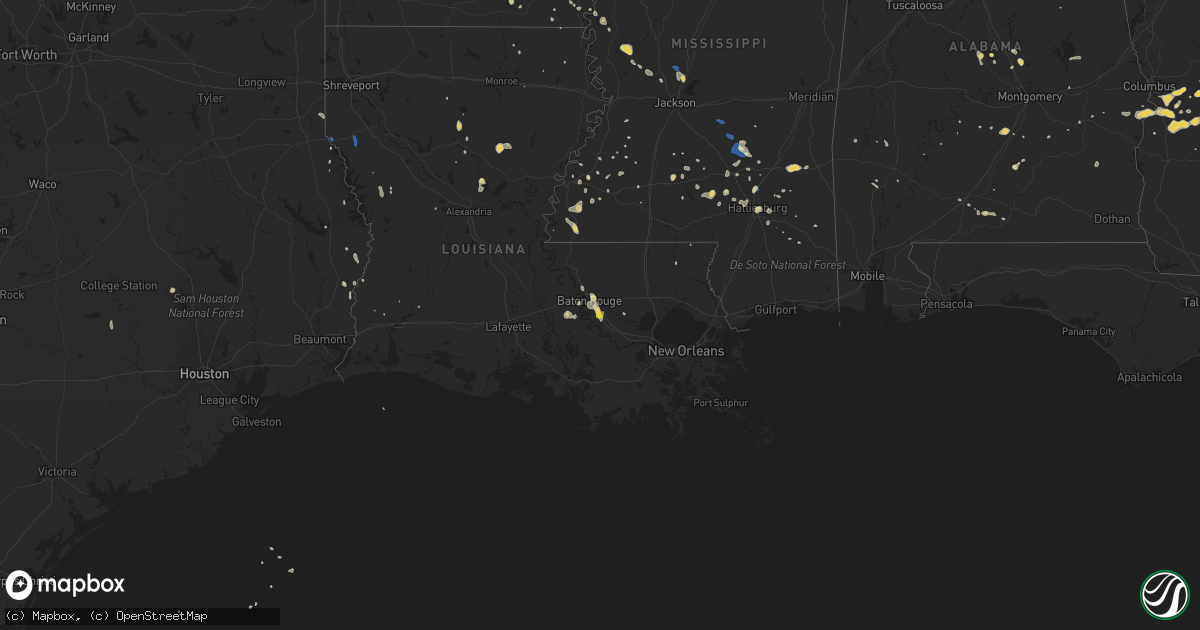
Hail Map on September 9, 2019
Get this storm
September 9 map
$229
one time, instant access
Download today. No call, no setup
Keep the $229
Bought the map and want the full workflow? Apply the entire $229 to a subscription within 7 days. None of it is wasted.
Every map, not just this one
This buys you this map. Subscription and you get every map we run, in the markets you choose from a few cities to whole states to nationwide. Plus real-time alerts the moment a storm fires.
Contact data
Name, contact info, occupancy, even credit band for addresses in the footprint. You go from where it hit to who to call.
Become the source they trust
Unlimited branding weather history reports on demand. You already have the documented answer ready for the property owner, and you are the one who showed up with it.
Property data and RoofTrace estimates
Pull up any address you have got, its value and the exact code rules for that jurisdiction, straight from One Click Code. Then RoofTrace estimates the squares, pitch, and roof value, priced the way you price.
States Impacted by Hail Map on September 9, 2019
Storm reports
South Carolina
| Date | Description |
|---|---|
| 09/09/20193:37 PM CDT | Public reported hail near the intersection of highway 301 and squirrel run lane. The hail lasted around 10 minutes and began covering the ground. The largest hailstones |
| 09/09/20192:58 PM CDT | A local business reports quarter-sized hail near the intersection of bells and low country highway. |
| 09/09/20192:58 PM CDT | Reports of multiple trees down along bells highway. |
| 09/09/20192:45 PM CDT | Schp reported a tree down at the 2100 block of benton farm road. |
| 09/08/201911:33 PM CDT | At 432 PM EDT, a severe thunderstorm was located just south of Orangeburg and near Cordova. Movement was southwest near 8 mph. HAZARD...60 mph wind gusts and nickel size hail. SOURCE...Radar indicated. IMPACT...Expect damage to roofs, siding, and trees. Locations impacted include... Rowesville, Cordova, and Cope. |
| 09/08/201910:18 PM CDT | At 317 PM EDT, a severe thunderstorm was located over Walterboro, moving south at 5 mph. HAZARD...60 mph wind gusts and quarter size hail. SOURCE...Radar indicated. IMPACT...Minor hail damage to vehicles is possible. Expect wind damage to trees and powerlines. Locations impacted include... Walterboro, Cottageville, Hendersonville, Round O, Green Pond, Ruffin, Jacksonboro and Ashepoo.This warning includes I-95 in South Carolina between mile markers 42and 64. |
| 09/08/20199:45 PM CDT | At 245 PM EDT, a severe thunderstorm was located near Allendale, moving southeast at 5 mph. HAZARD...60 mph wind gusts and quarter size hail. SOURCE...Radar indicated. IMPACT...Minor hail damage to vehicles is possible. Expect wind damage to trees and powerlines. Locations impacted include... Allendale, Hampton, Lake Warren State Park, Fairfax, Brunson, Gifford, Sycamore and Luray. |
Georgia
| Date | Description |
|---|---|
| 09/09/20195:00 PM CDT | Tree down. |
| 09/09/20192:49 PM CDT | Tree down near the intersection of louvale rd and jamestown rd. |
| 09/09/20192:46 PM CDT | A tree was reported down on 215 south near sibbie road. |
| 09/09/20192:40 PM CDT | A 911 call center reported a tree down at the 700 block of bowen lane. |
| 09/09/20192:38 PM CDT | Log truck toppled over by wind on mistletoe road... Near american legion road. |
| 09/09/20192:30 PM CDT | A 911 call center reported a tree down at old groveland rd and nevills groveland rd. |
| 09/09/20192:05 PM CDT | A tree was reported down on high 280 near sand grove baptist church. |
| 09/09/20191:47 PM CDT | Tree reported down on lotts creek rd. |
| 09/09/20191:40 PM CDT | Report of quarter-sized hail at the intersection of hunters way and lakeview rd. |
| 09/09/20191:39 PM CDT | A member of the public reported approximately quarter-sized hail near the intersection of lakeview and maria sorrell road. |
| 09/09/20191:35 PM CDT | A member of the public reported nickel to quarter-sized hail on akins pond road in the town of hopeulikit. |
| 09/09/20191:30 PM CDT | A member of the public reported quarter-sized hail near the hwy 80/25 split. |
| 09/09/20191:30 PM CDT | A report of a tree down on the side of the road near the hwy 80/25 split. |
| 09/09/20191:28 PM CDT | Tree reported down on the road on old glenwood rd. |
| 09/09/20191:25 PM CDT | Quarter size hail on middle ground road. |
| 09/09/20191:25 PM CDT | A tree was reported down on orphans cemetary road. |
| 09/09/20191:20 PM CDT | Public reported quarter to ping pong ball sized hail at the intersection of hamilton rd and thompson pond rd. |
| 09/09/201912:55 AM CDT | At 554 PM EDT, a severe thunderstorm was located near Marine Corps Logistics Base, or 8 miles east of Albany, moving southwest at 10 mph. HAZARD...60 mph wind gusts and nickel size hail. SOURCE...Radar indicated. IMPACT...Expect damage to roofs, siding, and trees. Locations impacted include... Albany, Turner City, East Albany, Marine Corps Logistics Base, Stocks, Pecan City and South Albany. |
| 09/08/201910:47 PM CDT | At 346 PM EDT, a severe thunderstorm was located over Browning, or near Abbeville, moving southwest at 10 mph. HAZARD...60 mph wind gusts and quarter size hail. SOURCE...Radar indicated. IMPACT...Hail damage to vehicles is expected. Expect wind damage to roofs, siding, and trees. Locations impacted include... Abbeville, Rhine, Browning and Antioch Church. |
| 09/08/201910:21 PM CDT | At 320 PM EDT, a severe thunderstorm was located near Eelbeck/West Fort Benning, or 8 miles northeast of Cusseta, moving southwest at 10 mph. HAZARD...60 mph wind gusts and quarter size hail. SOURCE...Radar indicated. IMPACT...Hail damage to vehicles is expected. Expect wind damage to roofs, siding, and trees. Locations impacted include... Cusseta, Brantley, Christopher and Eelbeck/West Fort Benning. |
| 09/08/201910:17 PM CDT | At 316 PM EDT, a severe thunderstorm was located near Richland, or near Preston, and is nearly stationary. HAZARD...60 mph wind gusts and nickel size hail. SOURCE...Radar indicated. IMPACT...Expect damage to roofs, siding, and trees. Locations impacted include... Lumpkin, Richland, Seminole and Brooklyn. |
| 09/08/201910:10 PM CDT | At 310 PM CDT, a severe thunderstorm was located 8 miles south of Fort Benning/lawson Army Air Fld, or 15 miles west of Cusseta, moving west at 5 mph. HAZARD...60 mph wind gusts. SOURCE...Radar indicated. IMPACT...Expect damage to roofs, siding, and trees. Locations impacted include... Russell County Sports Complex, Seale, Rutherford, Hatchechubbe, Uchee Creek, Fort Mitchell and Fort Mitchell Activity Center. |
| 09/08/20199:54 PM CDT | At 254 PM EDT, a severe thunderstorm was located over Friendship, or near Preston, moving southwest at 10 mph. HAZARD...60 mph wind gusts and quarter size hail. SOURCE...Radar indicated. IMPACT...Hail damage to vehicles is expected. Expect wind damage to roofs, siding, and trees. Locations impacted include... Preston, Plains, Church Hill, Friendship and Dumas. |
| 09/08/20199:51 PM CDT | At 251 PM EDT, a severe thunderstorm was located over Scotland, or near Alamo, moving southeast at 10 mph. HAZARD...60 mph wind gusts and quarter size hail. SOURCE...Radar indicated. IMPACT...Hail damage to vehicles is expected. Expect wind damage to roofs, siding, and trees. Locations impacted include... Alamo, Scotland, Towns, Little Ocmulgee State Park, Jordan and Spring Hill. |
| 09/08/20199:48 PM CDT | At 248 PM EDT, a severe thunderstorm was located near Westside, moving south at 10 mph. HAZARD...60 mph wind gusts and quarter size hail. SOURCE...Radar indicated. IMPACT...Minor hail damage to vehicles is possible. Expect wind damage to trees and powerlines. Locations impacted include... Statesboro, Metter, Claxton, Westside, Bay, Brooklet, Hagan and Pulaski.This warning includes I-16 between mile markers 101 and 137. |
| 09/08/20199:38 PM CDT | At 238 PM EDT, severe thunderstorms were located along a line extending from Cedar Creel to near Ideal, moving southwest at 10 mph. HAZARD...60 mph wind gusts and quarter size hail. SOURCE...Radar indicated. IMPACT...Hail damage to vehicles is expected. Expect wind damage to roofs, siding, and trees. Locations impacted include... Buena Vista, Ellaville, Ideal, Putnam, Brantley, Murrays Crossroads, Rupert, Garden Valley, Draneville, Zellobee, Tazewell, Doyle and Walls Crossing. |
| 09/08/20199:23 PM CDT | At 223 PM EDT, a severe thunderstorm was located over Glenwood, or near Alamo, moving southeast at 10 mph. HAZARD...60 mph wind gusts and quarter size hail. SOURCE...Radar indicated. IMPACT...Hail damage to vehicles is expected. Expect wind damage to roofs, siding, and trees. Locations impacted include... Alamo, Mount Vernon, Glenwood and Ailey. |
| 09/08/20199:15 PM CDT | At 215 PM EDT, a severe thunderstorm was located near Cedar Grove, or 9 miles north of Alamo, moving west at 10 mph. HAZARD...60 mph wind gusts and quarter size hail. SOURCE...Radar indicated. IMPACT...Hail damage to vehicles is expected. Expect wind damage to roofs, siding, and trees. Locations impacted include... Lowery and Cedar Grove. |
| 09/08/20199:10 PM CDT | At 210 PM EDT, a severe thunderstorm was located over Middleground, moving east at 5 mph. HAZARD...60 mph wind gusts and penny size hail. SOURCE...Radar indicated. IMPACT...Expect damage to trees and powerlines. Locations impacted include... Statesboro, Sylvania, Middleground, Newington, Oliver, Rocky Ford, Altman and Georgia Southern. |
Mississippi
| Date | Description |
|---|---|
| 09/09/20196:18 PM CDT | A few trees down with one down on a vehicle. A few others had the tops blown out. Power lines were down along with dime to penny size hail. |
| 09/09/20196:08 PM CDT | Tree down at stokes road and cloud road. |
| 09/09/20195:40 PM CDT | Few trees down on chapel hill road. |
| 09/09/20195:35 PM CDT | Powerline down at gunter road and old natchez trace. Due to outflow winds and likely sub severe wind gusts. |
| 09/09/20195:22 PM CDT | Tree down on n old canton road. Due to outflow winds and likely sub severe wind gusts. |
| 09/09/20195:07 PM CDT | Trees down s of polkville. |
| 09/09/20194:52 PM CDT | Tree down on columbia avenue. |
| 09/09/20194:50 PM CDT | Several trees down along hwy 503. |
| 09/09/20194:30 PM CDT | Around 5-6 trees down... With some large limbs downed as well. Mainly on rural roads near magee... South of mendenhall and near the braxton area. |
| 09/09/20194:06 PM CDT | Tree down along hwy 84 east of collins at cutoff rd. |
| 09/09/20194:02 PM CDT | Trees and power lines down in the mize area. |
| 09/09/20193:45 PM CDT | Fencing blown down along with damage to the batting cages. |
| 09/09/20193:00 PM CDT | Trees reported down on old highway 84 loop road and pleasant grove road. |
| 09/09/20192:50 PM CDT | Trees down on hwy 11 @ beasly rd. There is also damage to moselle elementary school. |
| 09/09/20192:49 PM CDT | *** 1 inj *** an awning was downed at moselle elementary school... Striking a teacher. The teacher sustained a minor injury... But refused to be transported to the loca |
| 09/09/20191:10 AM CDT | At 609 PM CDT, a severe thunderstorm was located over Holly Bluff, or 10 miles east of Rolling Fork, moving northwest at 25 mph. HAZARD...60 mph wind gusts and penny size hail. SOURCE...Radar indicated. IMPACT...Expect damage to roofs, siding, and trees. This severe thunderstorm will be near... Rolling Fork around 630 PM CDT. Anguilla around 635 PM CDT. Nitta Yuma around 645 PM CDT. Delta City around 650 PM CDT. Panther Burn around 655 PM CDT. |
| 09/09/20191:08 AM CDT | At 608 PM CDT, a severe thunderstorm was located near Myrleville, or 12 miles northwest of Canton, moving north at 20 mph. HAZARD...60 mph wind gusts and penny size hail. SOURCE...Radar indicated. IMPACT...Expect damage to roofs, siding, and trees. This severe thunderstorm will be near... Benton around 630 PM CDT.Other locations impacted by this severe thunderstorm include Eden. |
| 09/08/201911:45 PM CDT | At 445 PM CDT, a severe thunderstorm was located over Robinwood, or 21 miles east of Brookhaven, moving west at 20 mph. HAZARD...60 mph wind gusts and penny size hail. SOURCE...Radar indicated. IMPACT...Expect damage to roofs, siding, and trees. This severe thunderstorm will be near... Monticello around 450 PM CDT. Topeka around 500 PM CDT.Other locations impacted by this severe thunderstorm include SilverCreek. |
| 09/08/201911:44 PM CDT | At 444 PM CDT, a severe thunderstorm was located near White Oak, or 9 miles northeast of Mendenhall, moving northwest at 15 mph. HAZARD...60 mph wind gusts and penny size hail. SOURCE...Radar indicated. IMPACT...Expect damage to roofs, siding, and trees. This severe thunderstorm will be near... Johns and Cato around 515 PM CDT.Other locations impacted by this severe thunderstorm includePolkville and Puckett. |
| 09/08/201911:09 PM CDT | At 409 PM CDT, a severe thunderstorm was located near Magee, moving west at 25 mph. HAZARD...60 mph wind gusts and penny size hail. SOURCE...Radar indicated. IMPACT...Expect damage to roofs, siding, and trees. This severe thunderstorm will be near... Magee around 415 PM CDT. Sanatorium and Martinville around 425 PM CDT. Mendenhall around 440 PM CDT. Pinola around 450 PM CDT.Other locations impacted by this severe thunderstorm include D'Lo. |
| 09/08/201911:06 PM CDT | At 406 PM CDT, a severe thunderstorm was located over Prentiss, or 16 miles west of Collins, moving west at 25 mph. HAZARD...60 mph wind gusts and quarter size hail. SOURCE...Radar indicated. IMPACT...Hail damage to vehicles is expected. Expect wind damage to roofs, siding, and trees. This severe thunderstorm will be near... Prentiss around 410 PM CDT. Progress around 420 PM CDT. Monticello around 440 PM CDT.Other locations impacted by this severe thunderstorm includeBassfield, New Hebron and Silver Creek. |
| 09/08/201910:55 PM CDT | At 355 PM CDT, a severe thunderstorm was located near Taylorsville, or 11 miles east of Magee, moving northwest at 25 mph. HAZARD...60 mph wind gusts. SOURCE...Radar indicated. IMPACT...Expect damage to roofs, siding, and trees. This severe thunderstorm will be near... Center Ridge around 400 PM CDT.Other locations impacted by this severe thunderstorm include Mize. |
| 09/08/20199:43 PM CDT | At 243 PM CDT, a severe thunderstorm was located 7 miles east of Mill Creek, or 11 miles west of Waynesboro, moving west at 10 mph. HAZARD...60 mph wind gusts. SOURCE...Radar indicated. IMPACT...Expect damage to roofs, siding, and trees. This severe thunderstorm will remain over mainly rural areas of northwestern Wayne County. |
Idaho
| Date | Description |
|---|---|
| 09/09/20192:54 AM CDT | At 752 PM MDT, a severe thunderstorm was located near Hazelton or 14 miles northwest of Burley, moving northeast at 30 mph. HAZARD...Quarter size hail. SOURCE...Radar indicated with a history of large hail near Hazelton. IMPACT...Damage to vehicles is expected. Locations impacted include... Rupert, Paul, Acequia and Kimama. |
| 09/09/20192:36 AM CDT | At 735 PM MDT, a severe thunderstorm was located over Eden, or 14 miles east of Twin Falls, moving east at 30 mph. HAZARD...Quarter size hail. SOURCE...Radar indicated. IMPACT...Damage to vehicles is expected. This severe thunderstorm will be near... Hazelton around 740 PM MDT. Milner Dam around 750 PM MDT. |
| 09/09/20191:53 AM CDT | At 653 PM MDT, a severe thunderstorm was located near Magic Valley Regional Airport, or 8 miles southwest of Twin Falls, moving northeast at 30 mph. HAZARD...Quarter size hail. SOURCE...Radar indicated. IMPACT...Damage to vehicles is expected. This severe thunderstorm will be near... Magic Valley Regional Airport around 700 PM MDT. Twin Falls around 710 PM MDT. Kimberly and Hansen around 720 PM MDT. Eden, Hazelton and Minidoka National Monument around 740 PM MDT. |
| 09/08/20198:46 PM CDT | Hail at north wilson fire reported by fire crew. |
| 09/08/20198:38 PM CDT | A local report indicates 1.00 inch wind near EDEN |
| 09/08/20198:25 PM CDT | Hail picture in the kimberly/hansen area on twitter. |
| 09/08/20198:03 PM CDT | A local report indicates 1.00 inch wind near 6 SSW TWIN FALLS |
| 09/08/20198:01 PM CDT | A local report indicates 1.00 inch wind near 7 SW TWIN FALLS |
| 09/08/20197:56 PM CDT | A local report indicates 1.25 inch wind near 7 N HOLLISTER |
Nebraska
| Date | Description |
|---|---|
| 09/09/20196:15 AM CDT | At 1115 PM CDT, a severe thunderstorm was located over Mead, or 24 miles west of Omaha, moving east at 40 mph. HAZARD...60 mph wind gusts. SOURCE...Radar indicated. IMPACT...Expect damage to roofs, siding, and trees. Locations impacted include... Valley, Yutan, Mead, Ithaca, Leshara and Two Rivers State Recreation Area. |
| 09/09/201912:45 AM CDT | Broken branches in maple tree and bradford pear tree. Also trampoline was thrown. |
| 09/08/201911:25 PM CDT | Delayed report via social media. Leaning electric poles along hwy 77. Large tree split in half. Estimated 60 mph. |
Alabama
| Date | Description |
|---|---|
| 09/09/20195:32 PM CDT | Tree down on highland road. |
| 09/09/20193:07 PM CDT | Two trees down blocking the road on county road 23. |
| 09/09/20191:58 AM CDT | Delayed report: a few trees were blown near cane creek gardens. |
| 09/09/201912:54 AM CDT | At 553 PM CDT, a severe thunderstorm was located 12 miles southwest of Red Level, or 13 miles southeast of Evergreen, moving west at 15 mph. HAZARD...60 mph wind gusts and quarter size hail. SOURCE...Radar indicated. IMPACT...Hail damage to vehicles is expected. Expect wind damage to roofs, siding, and trees. Locations impacted include... Evergreen. |
| 09/09/201912:13 AM CDT | At 513 PM CDT, a severe thunderstorm was located near Ashland, and is nearly stationary. HAZARD...60 mph wind gusts and nickel size hail. SOURCE...Radar indicated. IMPACT...Expect damage to roofs, siding, and trees. Locations impacted include... Ashland, Waldo, Chandler Springs and Gunthertown. |
| 09/08/20199:53 PM CDT | At 252 PM CDT, a severe thunderstorm was located over Titus, or 13 miles northwest of Wetumpka, moving north at 5 mph. HAZARD...60 mph wind gusts and penny size hail. SOURCE...Radar indicated. IMPACT...Expect damage to roofs, siding, and trees. Locations impacted include... Deatsville, Jordan Lake, Marbury, Welona, Titus, Weoka Mills, Mitchell Lake, Holtville and Mitchell Dam. |
| 09/08/20199:27 PM CDT | At 226 PM CDT, a severe thunderstorm was located 8 miles west of Rutledge, or 10 miles west of Luverne, moving northwest at 10 mph. HAZARD...60 mph wind gusts. SOURCE...Radar indicated. IMPACT...Expect damage to roofs, siding, and trees. Locations impacted include... Greenville, Luverne, Brantley, Rutledge, Glenwood, Petrey and Highland Home. |
| 09/08/20199:19 PM CDT | At 219 PM CDT, a severe thunderstorm was located over Louisville, or near Clio, moving north at 5 mph. HAZARD...60 mph wind gusts. SOURCE...Radar indicated. IMPACT...Expect damage to roofs, siding, and trees. Locations impacted include... Clio, Clayton, Louisville, Tyler Crossroads, Texasville, Blue Springs State Park and Millers Ford. |
Kansas
| Date | Description |
|---|---|
| 09/09/20195:30 PM CDT | Hail was measured to be 1.125 inches |
| 09/09/20194:23 AM CDT | At 923 PM CDT, a severe thunderstorm was located 6 miles east of Russell Springs, or 17 miles northwest of Scott State Lake, moving east at 15 mph. HAZARD...Golf ball size hail and 60 mph wind gusts. SOURCE...Radar indicated. IMPACT...People and animals outdoors will be injured. Expect hail damage to roofs, siding, windows, and vehicles. Expect wind damage to roofs, siding, and trees. This severe thunderstorm will remain over mainly rural areas of east central Logan County. |
| 09/09/20193:50 AM CDT | At 850 PM CDT, a severe thunderstorm was located 6 miles northeast of Morland, or 9 miles northwest of Hill City, moving northeast at 30 mph. HAZARD...60 mph wind gusts and quarter size hail. SOURCE...Radar indicated. IMPACT...Hail damage to vehicles is expected. Expect wind damage to roofs, siding, and trees. Locations impacted include... Morland. |
| 09/09/20193:43 AM CDT | At 843 PM CDT, a severe thunderstorm was located 10 miles east of Wallace, or 19 miles east of Sharon Springs, and is nearly stationary. HAZARD...Two inch hail and 60 mph wind gusts. SOURCE...Radar indicated. IMPACT...People and animals outdoors will be injured. Expect hail damage to roofs, siding, windows, and vehicles. Expect wind damage to roofs, siding, and trees. This severe thunderstorm will remain over mainly rural areas of west central Logan County. |
| 09/09/20193:26 AM CDT | At 826 PM CDT, a severe thunderstorm was located 8 miles south of Oakley, moving east at 25 mph. HAZARD...Golf ball size hail and 60 mph wind gusts. SOURCE...Radar indicated. IMPACT...People and animals outdoors will be injured. Expect hail damage to roofs, siding, windows, and vehicles. Expect wind damage to roofs, siding, and trees. Locations impacted include... Gove.This includes Interstate 70 in Kansas between mile markers 96 and 98. |
| 09/09/20192:57 AM CDT | At 757 PM CDT, a severe thunderstorm was located 5 miles west of Russell Springs, or 25 miles southwest of Oakley, moving northeast at 20 mph. HAZARD...Two inch hail and 60 mph wind gusts. SOURCE...Radar indicated. IMPACT...People and animals outdoors will be injured. Expect hail damage to roofs, siding, windows, and vehicles. Expect wind damage to roofs, siding, and trees. Locations impacted include... Russell Springs. |
| 09/09/20192:19 AM CDT | At 718 PM CDT, a severe thunderstorm was located 8 miles west of Russell Springs, or 22 miles east of Sharon Springs, moving northeast at 20 mph. HAZARD...Two inch hail and 60 mph wind gusts. SOURCE...Radar indicated. IMPACT...People and animals outdoors will be injured. Expect hail damage to roofs, siding, windows, and vehicles. Expect wind damage to roofs, siding, and trees. Locations impacted include... Russell Springs. |
| 09/09/20191:56 AM CDT | At 656 PM CDT, a severe thunderstorm was located 8 miles east of Wallace, or 16 miles east of Sharon Springs, moving northeast at 15 mph. HAZARD...60 mph wind gusts and half dollar size hail. SOURCE...Trained weather spotters. IMPACT...Hail damage to vehicles is expected. Expect wind damage to roofs, siding, and trees. This severe thunderstorm will remain over mainly rural areas of west central Logan County. |
| 09/09/20191:27 AM CDT | At 627 PM CDT, a severe thunderstorm was located 4 miles north of Russell Springs, or 19 miles southwest of Oakley, moving northeast at 15 mph. HAZARD...60 mph wind gusts and quarter size hail. SOURCE...Radar indicated. IMPACT...Hail damage to vehicles is expected. Expect wind damage to roofs, siding, and trees. Locations impacted include... Winona, Monument and Russell Springs. |
| 09/09/20191:15 AM CDT | At 614 PM CDT, a severe thunderstorm was located near Hoxie, moving northeast at 20 mph. HAZARD...Ping pong ball size hail and 60 mph wind gusts. SOURCE...Radar indicated. IMPACT...People and animals outdoors will be injured. Expect hail damage to roofs, siding, windows, and vehicles. Expect wind damage to roofs, siding, and trees. Locations impacted include... Hoxie and Tasco. |
| 09/09/201912:58 AM CDT | At 558 PM CDT, a severe thunderstorm was located 4 miles east of Menlo, or 10 miles west of Hoxie, moving northeast at 50 mph. HAZARD...Two inch hail and 60 mph wind gusts. SOURCE...Radar indicated. IMPACT...People and animals outdoors will be injured. Expect hail damage to roofs, siding, windows, and vehicles. Expect wind damage to roofs, siding, and trees. Locations impacted include... Selden, Jennings, Dresden, Leoville and Seguin. |
| 09/09/201912:29 AM CDT | At 529 PM CDT, a severe thunderstorm was located 5 miles southeast of Russell Springs, or 15 miles northwest of Scott State Lake, moving northeast at 25 mph. HAZARD...Ping pong ball size hail and 60 mph wind gusts. SOURCE...Radar indicated. IMPACT...People and animals outdoors will be injured. Expect hail damage to roofs, siding, windows, and vehicles. Expect wind damage to roofs, siding, and trees. This severe thunderstorm will remain over mainly rural areas of east central Logan County. |
| 09/09/201912:21 AM CDT | At 521 PM CDT, a severe thunderstorm was located 7 miles northeast of Russell Springs, or 15 miles southwest of Oakley, moving northeast at 25 mph. HAZARD...60 mph wind gusts and half dollar size hail. SOURCE...Radar indicated. IMPACT...Hail damage to vehicles is expected. Expect wind damage to roofs, siding, and trees. Locations impacted include... Oakley and Monument. This includes Interstate 70 in Kansas between mile markers 66 and 75. |
| 09/09/201912:08 AM CDT | At 508 PM CDT, a severe thunderstorm was located 6 miles north of Grinnell, moving northeast at 15 mph. HAZARD...60 mph wind gusts and half dollar size hail. SOURCE...Radar indicated. IMPACT...Hail damage to vehicles is expected. Expect wind damage to roofs, siding, and trees. Locations impacted include... Hoxie and Seguin. |
| 09/08/201910:23 PM CDT | At 322 PM CDT, a severe thunderstorm was located near Oneida, moving northeast at 50 mph. HAZARD...60 mph wind gusts. SOURCE...Radar indicated. At 318 PM CDT...A personal weather station reported wind gusts to 55 mph 3 miles northeast of Centralia. IMPACT...Expect damage to roofs, siding, and trees. Locations impacted include... Sabetha, Seneca, Bern, Oneida and Woodlawn. |
| 09/08/20198:38 PM CDT | Dime to quarter size hail covering the ground to a depth of at least 1 inch near the intersection of county road 160 and k25 at 738 pm mdt... 838 pm cdt. |
| 09/08/20197:49 PM CDT | Time estimated by radar. |
| 09/08/20197:16 PM CDT | Time estimated by radar. |
South Dakota
| Date | Description |
|---|---|
| 09/09/20196:55 PM CDT | Radar estimated time. Reported with video. Location is approximately where the video was taken. |
| 09/09/20193:40 PM CDT | Nws storm survey confirmed a tornado started 1e of thomas and moved northeast across clear lake. The tornado damaged outbuildings on a farm on the north side of clear l |
| 09/09/20193:57 AM CDT | At 856 PM CDT, severe thunderstorms were located along a line extending from Halls Landing to near Beardsley, moving east at 30 mph. HAZARD...60 mph wind gusts and penny size hail. SOURCE...Radar indicated. IMPACT...Expect damage to roofs, siding, and trees. Locations impacted include... Wheaton, Graceville, Beardsley, Dumont, Barry, Siloah Country Church, Silver Bridge, Mud Lake Landing, Traverse Country Park, Trinity Lutheran Country Church, Halls Landing, Lake Traverse, Collis, Rainbow Island and Big Stone Lake. |
| 09/09/20192:46 AM CDT | At 746 PM CDT, a severe thunderstorm was located over Andover, or 9 miles east of Groton, moving east at 25 mph. HAZARD...60 mph wind gusts and quarter size hail. SOURCE...Radar indicated. IMPACT...Hail damage to vehicles is expected. Expect wind damage to roofs, siding, and trees. Locations impacted include... Bristol, Pierpont and Andover. |
| 09/08/20198:26 PM CDT | A local report indicates a tornado near 7 NE BRISTOL |
| 09/08/20198:03 PM CDT | Confirmed touchdown east of andover. |
| 09/08/20198:03 PM CDT | Damage to farm... Quonset... Shelter belt... Other buildings. |
Minnesota
| Date | Description |
|---|---|
| 09/09/20194:21 AM CDT | At 921 PM CDT, a severe thunderstorm was located over Collis, or 11 miles south of Wheaton, moving east at 35 mph. HAZARD...60 mph wind gusts and nickel size hail. SOURCE...Radar indicated. IMPACT...Expect damage to roofs, siding, and trees. Locations impacted include... Donnelly and Fish Lake. This includes U.S. Highway 59 between mile markers 169 and 177. |
| 09/09/20194:16 AM CDT | At 915 PM CDT, a severe thunderstorm was located near Dumont, or 36 miles south of Wahpeton, moving northeast at 35 mph. HAZARD...60 mph wind gusts and penny size hail. SOURCE...Radar indicated. IMPACT...Expect damage to roofs, siding, and trees. This severe thunderstorm will be near... Norcross around 940 PM CDT. Herman around 945 PM CDT. Barrett and Elbow Lake around 1000 PM CDT. |
| 09/08/20198:50 PM CDT | Trees down in rosebud county park. |
Colorado
| Date | Description |
|---|---|
| 09/09/20194:13 AM CDT | A local report indicates 1.00 inch wind near PAWNEE PASS |
| 09/09/20193:45 AM CDT | A local report indicates 1.50 inch wind near 6 SSW NEW RAYMER |
New Mexico
| Date | Description |
|---|---|
| 09/09/20196:05 PM CDT | White sands missile range - stallion wit. |
Texas
| Date | Description |
|---|---|
| 09/09/20194:27 PM CDT | At hearne municipal airport |
| 09/09/20194:05 PM CDT | Report of utility poles down near the intersection of w carson st and finfeather rd. Estimated wind gust of 60 mph. |
| 09/09/20193:58 PM CDT | Asos station kcll easterwood field airport. Aircraft was damaged. |
| 09/09/20192:55 PM CDT | Tree blown down on hwy63 |
| 09/08/201911:56 PM CDT | At 456 PM CDT, a severe thunderstorm was located 10 miles west of Huntsville State Park, or 12 miles southwest of Huntsville, moving northwest at 20 mph. HAZARD...60 mph wind gusts and quarter size hail. SOURCE...Radar indicated. IMPACT...Hail damage to vehicles is expected. Expect wind damage to roofs, siding, and trees. This severe thunderstorm will remain over mainly rural areas of east central Grimes, northwestern Montgomery and southwestern Walker Counties. |
| 09/08/201911:27 PM CDT | At 427 PM CDT, a severe thunderstorm was located over Hearne, moving north at 25 mph. HAZARD...60 mph wind gusts. SOURCE...Radar indicated. IMPACT...Expect damage to roofs, siding, and trees. Locations impacted include... Hearne and Calvert. |
Wisconsin
| Date | Description |
|---|---|
| 09/09/20193:54 AM CDT | Delayed report: large uprooted and snapped trees along the northern shoreline of geneva lake. |
| 09/09/20192:27 AM CDT | At 725 PM CDT, severe thunderstorms were located along a line extending from Ossian to near Clermont to near Arlington, moving east at 55 mph. HAZARD...60 mph wind gusts. SOURCE...Winds of 55 mph were reported in Waterloo at 655 pm. Oelwein recently reported a wind gust near 40 mph. IMPACT...Expect damage to roofs, siding, and trees. Severe thunderstorms will be near... Postville and Volga around 735 PM CDT. Monona around 740 PM CDT. Waukon and Elkader around 745 PM CDT. Garnavillo around 755 PM CDT. Guttenberg, Lansing and Harpers Ferry around 800 PM CDT.Other locations impacted by these severe thunderstorms includeVolney, Mederville, Giard, Watson, Red Barn Campground, County RoadsX 16 And W 48 and Highway 13 And County C 24. |
| 09/08/201911:39 PM CDT | Wmtv nbc 15 reported 72 mph gust from rooftop observation site. |
| 09/08/201911:39 PM CDT | Report of large tree uprooted near bill lister memorial field. Reports of tree limbs down in hill farms neighborhood. |
Arkansas
| Date | Description |
|---|---|
| 09/09/20193:40 PM CDT | Roof damage in pine bluff... Ar. |
| 09/09/201912:31 AM CDT | At 531 PM CDT, a severe thunderstorm was located near Parnell, or near Jacksonville, moving northwest at 15 mph. HAZARD...60 mph wind gusts and quarter size hail. SOURCE...Radar indicated. IMPACT...Hail damage to vehicles is expected. Expect wind damage to roofs, siding, and trees. Locations impacted include... Sherwood... Jacksonville... Cabot... Little Rock AFB... Vilonia... Austin in Lonoke County... Parnell... Gravel Ridge... South Bend... Olmstead... Gibson... Hamlet... Saltillo... Macon... Otto... Cato...This includes US Highway 67 between mile markers 7 and 21. |
| 09/09/201912:25 AM CDT | At 525 PM CDT, a severe thunderstorm was located over Protho Junction, or over North Little Rock, moving northwest at 15 mph. HAZARD...60 mph wind gusts and quarter size hail. SOURCE...Radar indicated. IMPACT...Hail damage to vehicles is expected. Expect wind damage to roofs, siding, and trees. Locations impacted include... Little Rock... North Little Rock... Sherwood... Jacksonville... Maumelle... Downtown Little Rock... North Little Rock Airport... Little Rock AFB... Argenta... Burns Park... Gravel Ridge... Morgan... Marche... Oak Grove in Pulaski County... Olmstead... Protho Junction... Gibson... Sweet Home... Lakewood... Camp Robinson...This includes the following highways... Interstate 30 between mile markers 138 and 142. Interstate 40 between mile markers 142 and 162. Interstate 430 near mile marker 12. Interstate 530 near mile marker 1. Interstate 630 between mile markers 1 and 2. Interstate 440 between mile markers 1 and 14. US Highway 67 between mile markers 1 and 9. |
| 09/08/201910:34 PM CDT | At 334 PM CDT, a severe thunderstorm was located near Pine Bluff, moving northwest at 15 mph. HAZARD...60 mph wind gusts and quarter size hail. SOURCE...Radar indicated. IMPACT...Hail damage to vehicles is expected. Expect wind damage to roofs, siding, and trees. Locations impacted include... Pine Bluff... White Hall... Altheimer... Warbritton... Pine Bluff Arsenal... Madding... Sherrill... Tucker... Glenlake... Pastoria... Rob Roy... Dexter...This includes Interstate 530 between mile markers 44 and 46. |
| 09/08/20199:50 PM CDT | Power poles down behind the dermott police department. |
| 09/08/20197:52 PM CDT | A tree fell on two cars at dermott villas. |
| 09/08/20197:50 PM CDT | Trees and powerlines down with some roads blocked in the area. |
| 09/08/20197:40 PM CDT | A couple powerpoles snapped along us 165 s... Just north of parkdale. Report and picture relayed via social media. |
Illinois
| Date | Description |
|---|---|
| 09/09/20192:10 AM CDT | Delayed report. Report of a tree down near the intersection of fisher rd and welt rd. Time estimated from radar. |
| 09/09/20191:25 AM CDT | Large tree down on highway 20. |
Louisiana
| Date | Description |
|---|---|
| 09/09/20196:37 PM CDT | Penny to quarter size hail was reported in bullion crossing neighborhood in prairieville. |
| 09/09/20196:37 PM CDT | Nickel to quarter size hail reported by public along swamp road in prarieville - report relayed via media |
| 09/09/20196:09 PM CDT | Tree down on burlington loop off of route 165. Another tree caught on fire after taking a lightning strike on hog rd. |
| 09/09/20195:40 PM CDT | 5 adjacent power poles down along hwy 594 in ouachita parish just north of ouachita high school |
| 09/09/20195:25 PM CDT | Tree down and power pole bent in neighborhood near the north gate of barksdale air force base. |
| 09/09/20195:02 PM CDT | Microburst with max gust of 95 mph caused a 2.5 by 1.2 mile swath of damage near start including numerous downed hardwood limbs and some snapped or uprooted hardwood tr |
| 09/09/20195:00 PM CDT | Corrects previous tstm wnd dmg report from 1 sw start. Downed power-lines and a few uprooted trees from us road 133 to brimberry road. Many large tree limbs snapped off |
| 09/09/20195:00 PM CDT | Downed power-lines and some uprooted trees from us road 133 to brimberry road. Some of the trees/large tree branches fell on homes. |
| 09/09/20194:50 PM CDT | Corrects previous tstm wnd dmg report from 1 wnw girard. Downed power-lines and some uprooted trees from girard road to tupelo drive. Some of the trees/large tree branc |
| 09/09/20194:50 PM CDT | Downed power-lines and some uprooted trees from girard road to tupelo drive. Some of the trees/large tree branches fell on homes. |
| 09/09/20194:45 PM CDT | Two trees down. |
| 09/09/20194:43 PM CDT | Tree down on route 175 southeast of mansfield. |
| 09/09/20191:47 AM CDT | At 647 PM CDT, a severe thunderstorm was located over Merrydale, or near Baton Rouge, moving north at 15 mph. HAZARD...60 mph wind gusts and quarter size hail. SOURCE...Radar indicated. IMPACT...Hail damage to vehicles is expected. Expect wind damage to roofs, siding, and trees. Locations impacted include... Baton Rouge, Zachary, Baker, Denham Springs, Merrydale, Brownfields, Greenwell Spring and Baton Rouge Airport. |
| 09/09/20191:34 AM CDT | At 634 PM CDT, a severe thunderstorm was located over Prairieville, or near Oak Hills Place, moving northwest at 10 mph. HAZARD...60 mph wind gusts and quarter size hail. SOURCE...Radar indicated. IMPACT...Hail damage to vehicles is expected. Expect wind damage to roofs, siding, and trees. Locations impacted include... Baton Rouge, Oak Hills Place, St. Gabriel, Prairieville, Westminster, Old Jefferson, Village St. George, Inniswold, Shenandoah and Gardere. |
| 09/09/201912:48 AM CDT | At 547 PM CDT, a severe thunderstorm was located near Olla, or 14 miles south of Columbia, moving west at 15 mph. HAZARD...60 mph wind gusts. SOURCE...Radar indicated. IMPACT...Expect damage to roofs, siding, and trees. Locations impacted include... Olla, Clarks, Urania, Spaulding, Burlington, Standard and Kelly. |
| 09/08/201911:37 PM CDT | At 436 PM CDT, a severe thunderstorm was located near Logansport, or 14 miles northeast of Center, moving north at 20 mph. HAZARD...60 mph wind gusts. SOURCE...Radar indicated. IMPACT...Expect damage to roofs, siding, and trees. Locations impacted include... Logansport, Joaquin, Huxley, Keachi, Longstreet, Stanley and Deadwood. |
| 09/08/201911:28 PM CDT | At 428 PM CDT, a severe thunderstorm was located near Converse, or 13 miles south of Mansfield, moving northwest at 20 mph. HAZARD...60 mph wind gusts. SOURCE...Radar indicated. IMPACT...Expect damage to roofs, siding, and trees. Locations impacted include... Mansfield, Converse, Pleasant Hill, South Mansfield and Pelican. |
Florida
| Date | Description |
|---|---|
| 09/09/20195:15 PM CDT | Trained spotter reports estimated wind gusts to 50 mph. |
Virginia
| Date | Description |
|---|---|
| 09/09/20196:30 PM CDT | Trees down causing several power outages near the intersection of route 607 and big horn road. |
| 09/09/20195:53 PM CDT | One large tree down in the 4000 block of brookneal highway. |
| 09/09/20195:53 PM CDT | Corrects previous tstm wnd dmg report from 4 s rustburg. Corrects previous tstm wnd dmg report from 2 ssw rustburg. One tree down on brookneal highway near rustburg. Ti |
| 09/09/20195:53 PM CDT | Corrects previous tstm wnd dmg report from rustburg. One large tree down in the 4000 block of brookneal highway. |
| 09/09/20195:44 PM CDT | Tree down on route 604. Time estimated by radar. |
| 09/09/20195:22 PM CDT | Tree down on church st in the town of appomattox. |
| 09/09/20195:20 PM CDT | Large limbs and a tree down on horseshoe rd. |
| 09/09/20195:20 PM CDT | Tree down at appomattox middle school. |
| 09/09/20195:11 PM CDT | One large tree down on oakville road. |
| 09/09/20195:08 PM CDT | More than a dozen trees down in the oakville area... Particularly on virginia highway 26 between oakville and appomattox. Highway 26 near oakville was blocked going tow |
| 09/09/20194:35 PM CDT | Multiple trees reported down in the gladstone area. |
| 09/09/20194:31 PM CDT | Multiple trees reported down in the piney river area. |
| 09/09/20194:30 PM CDT | Tree reported down on tye brook highway. |
| 09/09/20193:42 PM CDT | Damage to garage roof and walls reported on the 2100 block of cold springs road. |
| 09/09/20193:28 PM CDT | Tree reported down on wilda road. |
| 09/09/20193:16 PM CDT | Tree reported down on the 100 block of hammond lane. |
| 09/09/20192:22 AM CDT | At 721 PM EDT, a severe thunderstorm was located over Radium, or near Purdy, moving east at 15 mph. HAZARD...60 mph wind gusts and quarter size hail. SOURCE...Radar indicated. IMPACT...Minor damage to vehicles is possible. Expect wind damage to trees and powerlines. Locations impacted include... Purdy, Radium, Callaville, Bufford Crossroads, Pleasant Shade, Fields Crossroads, Durand, Slagles Lake and Cowie Corner. |
| 09/09/20191:42 AM CDT | At 642 PM EDT, severe thunderstorms were located along a line extending from near Spring Mills to near Red House to Pamplin City, moving south at 25 mph. HAZARD...60 mph wind gusts. SOURCE...Radar indicated. IMPACT...Expect damage to roofs, siding, and trees. Locations impacted include... Brookneal... Charlotte Court House... Phenix... Red House... and Rustburg. |
| 09/09/201912:48 AM CDT | At 546 PM EDT, a severe thunderstorm was located near Buffalo Springs, or five miles northwest of Bent Creek, moving south at 25 mph. HAZARD...60 mph wind gusts and quarter size hail. SOURCE...Radar indicated. IMPACT...Hail damage to vehicles is expected. Expect wind damage to roofs, siding, and trees. Locations impacted include... Appomattox... Bent Creek... Pamplin City... Appomattox National Historic Park... and Riverville. |
| 09/09/201912:24 AM CDT | At 524 PM EDT, a severe thunderstorm was located 7 miles east of Claresville, or 7 miles northwest of Boykins, moving southeast at 15 mph. HAZARD...60 mph wind gusts and half dollar size hail. SOURCE...Radar indicated. IMPACT...Minor damage to vehicles is possible. Expect wind damage to trees and powerlines. This severe thunderstorm will be near, Boykins around 555 PM EDT. Newsoms around 600 PM EDT.Other locations impacted by this severe thunderstorm includePendleton, Severn, Margarettsville, Branchville, Bryants Corner,Shiloh, Little Texas and Galatia. |
| 09/09/201912:15 AM CDT | At 515 PM EDT, a severe thunderstorm was located near Shipman, or 9 miles northeast of Clifford, moving southeast at 25 mph. HAZARD...60 mph wind gusts and quarter size hail. SOURCE...Radar indicated. IMPACT...Damaging winds will cause some trees and large branches to fall. This could injure those outdoors, as well as damage homes and vehicles. Roadways may become blocked by downed trees. Localized power outages are possible. Unsecured light objects may become projectiles. Locations impacted include... Shipman, Arrington, Lovingston, Norwood, Piney River, Five Forks, Tye River, Wingina, Gladstone, Elma and Buffalo Springs. |
| 09/08/201911:38 PM CDT | At 438 PM EDT, a severe thunderstorm was located near Stuarts Draft, or 11 miles southwest of Waynesboro, moving southeast at 25 mph. HAZARD...60 mph wind gusts and quarter size hail. SOURCE...Radar indicated. IMPACT...Damaging winds will cause some trees and large branches to fall. This could injure those outdoors, as well as damage homes and vehicles. Roadways may become blocked by downed trees. Localized power outages are possible. Unsecured light objects may become projectiles. Locations impacted include... Stuarts Draft, Sherando, Wintergreen, Montebello, Lyndhurst, Nellysford, Greenville, Lovingston, Bryant, Piney River, Roseland, Rockfish, Tyro, Greenfield, Jonesboro, Faber and Massies Mill. |
| 09/08/201911:01 PM CDT | At 401 PM EDT, a severe thunderstorm was located 7 miles west of Staunton, moving southeast at 20 mph. HAZARD...60 mph wind gusts and quarter size hail. SOURCE...Radar indicated. IMPACT...Damaging winds will cause some trees and large branches to fall. This could injure those outdoors, as well as damage homes and vehicles. Roadways may become blocked by downed trees. Localized power outages are possible. Unsecured light objects may become projectiles. Locations impacted include... Staunton, Stuarts Draft, Fishersville, Lyndhurst, Greenville, Middlebrook, Trimbles Mill, Christian, Mint Spring, Swoope and Summerdean. |
Missouri
| Date | Description |
|---|---|
| 09/08/201911:41 PM CDT | At 441 PM CDT, a severe thunderstorm was located over Clarinda, or 15 miles west of Bedford, moving northeast at 30 mph. HAZARD...60 mph wind gusts. SOURCE...Radar indicated. IMPACT...Expect damage to roofs, siding, and trees. Locations impacted include... Clarinda, Villisca, Braddyville, Shambaugh and Hepburn. |
North Carolina
| Date | Description |
|---|---|
| 09/09/20195:57 PM CDT | A local report indicates 1.00 inch wind near KELLY |
| 09/09/20195:42 PM CDT | Quarter sized hail reported on pender avenue. |
| 09/09/20195:35 PM CDT | Minor roof damage to wilson center. |
| 09/09/20195:32 PM CDT | Report of strong winds with debris in the air at patsy lane and gordon road. Dime sized hail also reported. |
| 09/09/20195:28 PM CDT | Report of strong winds with debris in the air at patsy lane and gordon road. Dime sized hail also reported. |
| 09/09/20195:12 PM CDT | Damage to scotts hill market on hwy 17. Time estimated by radar. |
| 09/09/20193:50 PM CDT | A couple of trees down causing power outages. |
| 09/09/20193:40 PM CDT | Pea to quarter size hail. |
| 09/09/20195:11 AM CDT | At 1011 AM EDT, a severe thunderstorm was located over Claresville, or 7 miles southeast of Emporia, moving southeast at 25 mph. HAZARD...60 mph wind gusts and quarter size hail. SOURCE...Radar indicated. IMPACT...Minor damage to vehicles is possible. Expect wind damage to trees and powerlines. This severe thunderstorm will be near, Boykins around 1040 AM EDT. Conway around 1050 AM EDT. Murfreesboro, Chowan University and Como around 1100 AM EDT.Other locations impacted by this severe thunderstorm includeMilwaukee, Pendleton, Menola, Mapleton, Bryants Corner, Union,Riddicksville, Sunbeam, Saint John and Severn. |
| 09/09/20194:46 AM CDT | At 946 PM EDT, a severe thunderstorm was located over Clio, or 8 miles east of Bennettsville, moving west at 15 mph. HAZARD...60 mph wind gusts and quarter size hail. SOURCE...Radar indicated. IMPACT...Minor hail damage to vehicles is possible. Expect wind damage to trees and power lines. Locations impacted include... Bennettsville, Mccoll, Clio, Blenheim and Tatum. |
| 09/09/20194:34 AM CDT | At 934 AM EDT, a severe thunderstorm was located over Emporia, moving southeast at 20 mph. HAZARD...60 mph wind gusts and quarter size hail. SOURCE...Radar indicated. IMPACT...Minor damage to vehicles is possible. Expect wind damage to trees and powerlines. This severe thunderstorm will be near, Green Plain around 945 AM EDT. Claresville around 955 AM EDT.Other locations impacted by this severe thunderstorm include AdamsGrove, Grizzard, Lanes Corner, Bryants Corner, Emporia Reservoir,Mason, Durand, Branchville, Drewryville and Shiloh. |
| 09/09/20194:25 AM CDT | At 925 PM EDT, a severe thunderstorm was located near Raemon, or 10 miles north of Dillon, moving southwest at 20 mph. HAZARD...60 mph wind gusts and quarter size hail. SOURCE...Radar indicated. IMPACT...Minor hail damage to vehicles is possible. Expect wind damage to trees and power lines. Locations impacted include... Rowland, Clio, Raemon, Purvis, Dunbar, Minturn and Little Rock. |
| 09/09/20193:25 AM CDT | At 824 PM EDT, a severe thunderstorm was located near Elm City, or near Rocky Mount, moving south at 20 mph. HAZARD...60 mph wind gusts and quarter size hail. SOURCE...Radar indicated. IMPACT...Hail damage to vehicles is expected. Expect wind damage to roofs, siding, and trees. Locations impacted include... Wilson, Elm City, Sharpsburg, Pinetops, Stantonsburg, Black Creek, Macclesfield, Saratoga, Tar River Reservoir and Willbanks. |
| 09/09/20193:19 AM CDT | At 818 PM EDT, a severe thunderstorm was located near Elkton, or near Whiteville, moving west at 20 mph. HAZARD...60 mph wind gusts and quarter size hail. SOURCE...Radar indicated. IMPACT...Minor hail damage to vehicles is possible. Expect wind damage to trees and power lines. Locations impacted include... Whiteville, Chadbourn, Boardman, Hallsboro, Redbug, Elkton, Emerson, Council, Southeastern Community College, Clarendon, Evergreen, Brunswick, Clarkton and Columbus Regional Healthcare System. |
| 09/09/20191:52 AM CDT | At 652 PM EDT, a severe thunderstorm was located over Kelly, or 17 miles southeast of Elizabethtown, moving west at 10 mph. HAZARD...60 mph wind gusts and quarter size hail. SOURCE...Radar indicated. IMPACT...Minor hail damage to vehicles is possible. Expect wind damage to trees and power lines. Locations impacted include... Rowan, Carvers, Lisbon, Lagoon, Emerson, Council, Kelly and White Lake. |
| 09/09/20191:19 AM CDT | At 619 PM EDT, a severe thunderstorm was located over Wilmington International Airport, or near Wilmington, moving south at 15 mph. HAZARD...60 mph wind gusts and quarter size hail. SOURCE...Trained weather spotters. IMPACT...Minor hail damage to vehicles is possible. Expect wind damage to trees and power lines. Locations impacted include... Wilmington, Leland, Wrightsville Beach, South Masonboro Island, North Masonboro Island, Figure Eight Island, Hightsville, Cape Fear Community College North Campus, Wilmington International Airport, Myrtle Grove, Murrayville, Masonboro, Castle Hayne, Ogden, Mayfaire, Wrightsboro, Silver Lake, Windemere, Bayshore and Porters Neck. |
| 09/09/201912:34 AM CDT | At 533 PM EDT, a severe thunderstorm was located over Rocky Point, or 9 miles south of Burgaw, moving southeast at 20 mph. HAZARD...60 mph wind gusts and penny size hail. SOURCE...Radar indicated. IMPACT...Expect wind damage to trees and power lines. Locations impacted include... Wilmington, Burgaw, Wrightsville Beach, Surf City, Figure Eight Island, Hampstead, Topsail Beach, Maple Hill, Long Creek, Cape Fear Community College North Campus, Ashton, Rocky Point, Murrayville, Castle Hayne, Scotts Hill, Ogden, Woodside, White Stocking, Mayfaire and Montague. |
| 09/09/201912:18 AM CDT | At 517 PM EDT, a severe thunderstorm was located over Verona, or over New River Station, moving southeast at 10 mph. HAZARD...60 mph wind gusts and quarter size hail. SOURCE...Radar indicated. IMPACT...Hail damage to vehicles is expected. Expect wind damage to roofs, siding, and trees. Locations impacted include... Jacksonville, North Topsail Beach, New River Station, Camp Lejeune Center, Folkstone, Verona, Dixon, Onslow Beach, Sneads Ferry, Sea View Pier, Holly Ridge and Haws Run. |
| 09/08/201911:32 PM CDT | At 432 PM EDT, a severe thunderstorm was located over Murfreesboro, moving southeast at 15 mph. HAZARD...60 mph wind gusts and quarter size hail. SOURCE...Radar indicated. IMPACT...Minor damage to vehicles is possible. Expect wind damage to trees and powerlines. This severe thunderstorm will be near, Ahoskie, Winton and Cofield around 500 PM EDT.Other locations impacted by this severe thunderstorm include Tunis,Eure, Oak Villa, Bartonsville, Chowan Beach, Rays Beach, Mapleton,Barretts Crossroad, Brantleys Grove and Union. |
| 09/08/20197:20 PM CDT | Several large trees down |
Iowa
| Date | Description |
|---|---|
| 09/09/20196:33 PM CDT | Several tree limbs... A few large ones... Down throughout the town of shell rock. Some were blocking street. Delayed report and time estimated by radar. |
| 09/09/20196:32 PM CDT | Large tree limb down on a home in clarksville. Delayed report and time estimated by radar. |
| 09/09/20196:25 PM CDT | Trained spotter reports tree damage around conrad and a couple power lines down. Delayed report. Time estimated from radar. |
| 09/09/20196:15 PM CDT | Several large tree limbs down throughout parkersburg and a couple trees reported to have fallen on homes. Delayed report and time estimated by radar. |
| 09/09/20195:50 PM CDT | 10 inch tree limb down on older tree. 3 to 4 inch tree limbs down on newer trees. |
| 09/09/20195:46 PM CDT | Power pole broken at intersection of white pole road and adair street. |
| 09/09/20195:43 PM CDT | Report via social media. |
| 09/09/20195:11 PM CDT | Wall of a building pushed in 6 ft. Damage to the walls and doors. Contents inside blown around. Also trees down. Reported by ames police department. Delayed report. Tim |
| 09/09/20195:01 PM CDT | Large tree down at 10th street and division. |
| 09/09/20194:48 PM CDT | Telephone pole leaned over. No passing sign leaned over. Delayed report. Time estimated from radar. |
| 09/09/20194:43 PM CDT | Branches down in clarinda. One branch fell on power line. |
| 09/09/20194:41 PM CDT | 120th and o ave in page county between stanton and bethesda. Wind damage to 2 large metal buildings and various tree damage. |
| 09/09/20194:38 PM CDT | Updated information: emergency manager drone photos and survey indicate localized downburst wind damage with small areas of flattened crops. Wind caused metal building |
| 09/09/20194:35 PM CDT | 12 inch diameter tree snapped. Relayed by dallas county emergency management. Time estimated from radar. |
| 09/09/20194:08 PM CDT | Several 4 to 6 inch tree limbs down. |
| 09/09/20194:00 PM CDT | Law enforcement reports 4 to 6 inch tree limbs down in menlo. Time estimated from radar. |
| 09/09/20194:30 AM CDT | At 929 PM CDT, severe thunderstorms were located along a line extending from near Lamont to Quasqueton, moving east at 40 mph. At 915 PM, a trained spotter reported wind gusts of 60 MPH and several tree branches down in Independence. HAZARD...60 mph wind gusts. SOURCE...Trained weather spotters. IMPACT...Expect damage to roofs, siding, and trees. Locations impacted include... Manchester, Edgewood, Quasqueton, Lamont, Greeley, Dundee, Delaware, Masonville, Oneida, Winthrop Golf Course, Delaware County Fairgrounds, Manchester Airport, Coffins Grove Park, Twin Bridges Park and Backbone State Park. |
| 09/09/20193:58 AM CDT | At 858 PM CDT, severe thunderstorms were located along a line extending from near Fairbank to near Jesup to near Mount Auburn, moving east at 30 mph. HAZARD...60 mph wind gusts. SOURCE...Radar indicated. IMPACT...Expect damage to roofs, siding, and trees. Locations impacted include... Jesup, La Porte City, Dunkerton and Gilbertville. This includes Interstate 380 between mile markers 56 and 66. |
| 09/09/20193:57 AM CDT | At 856 PM CDT, severe thunderstorms were located along a line extending from near Jesup to near Dysart, moving northeast at 35 mph. HAZARD...60 mph wind gusts. SOURCE...Radar indicated. IMPACT...Expect damage to roofs, siding, and trees. Locations impacted include... Independence, Jesup, Urbana, Dysart, Winthrop, Hazleton, Quasqueton, Brandon, Rowley, Aurora, Mount Auburn, Stanley, Wapsipinicon Golf Course, Fontana County Park, Otterville, Minne Estema Park, Jakway Park, Cheney, Lime Creek County Park and Rodgers Park.This includes Interstate 380 between mile markers 42 and 55. |
| 09/09/20193:55 AM CDT | Dsm public safety reports tree fell on power line causing power flashes in south des moines. |
| 09/09/20193:50 AM CDT | Reports trees down in neighborhood; strong winds over 60 mph. |
| 09/09/20193:37 AM CDT | At 836 PM CDT, a severe thunderstorm was located 9 miles north of State Center, or 14 miles northeast of Nevada, moving northeast at 45 mph. HAZARD...60 mph wind gusts. SOURCE...Radar indicated. IMPACT...Expect damage to roofs, siding, and trees. Locations impacted include... Eldora, Grundy Center, Ackley, Wellsburg, Zearing, Union, Steamboat Rock, Liscomb, Holland, New Providence, Whitten, Clemons, St. Anthony, Pine Lake State Park, Eldora Municipal Airport and Ackley Municipal Airport. |
| 09/09/20193:03 AM CDT | At 803 PM CDT, severe thunderstorms were located along a line extending from near Fredericksburg to 6 miles northwest of Uni-Dome And McLeod Center to near Reinbeck, moving east at 40 mph. HAZARD...60 mph wind gusts. SOURCE...Radar indicated. IMPACT...Expect damage to roofs, siding, and trees. Locations impacted include... Waterloo, Cedar Falls, Waverly, Evansdale, Jesup, La Porte City, Hudson, Sumner, Denver, Traer, Reinbeck, Dysart, Tripoli, Shell Rock, Dike, Elk Run Heights, Waterloo Municipal Airport, Crossroads Mall, Uni-Dome And McLeod Center and Janesville.This includes Interstate 380 between mile markers 56 and 73. |
| 09/09/20192:47 AM CDT | At 747 PM CDT, a severe thunderstorm was located over Jordan Creek Town Center, or over Clive, moving northeast at 50 mph. HAZARD...60 mph wind gusts. SOURCE...Radar indicated. IMPACT...Expect damage to roofs, siding, and trees. Locations impacted include... Des Moines, West Des Moines, Ankeny, Urbandale, Johnston, Clive, Waukee, Grimes, Adel, Windsor Heights, Polk City, Saylorville, Granger, De Soto, Van Meter, Jordan Creek Town Center, Saylorville Lake, Merle Hay Mall, Big Creek Lake and Drake Stadium And Knapp Center.This includes the following highways... Interstate 35 between mile markers 67 and 72, and between milemarkers 87 and 101. Interstate 80 between mile markers 112 and 138. Interstate 235 between mile markers 1 and 7. |
| 09/09/20192:42 AM CDT | At 741 PM CDT, a severe thunderstorm was located near Conrad, or 8 miles north of Marshalltown, moving northeast at 35 mph. HAZARD...60 mph wind gusts. SOURCE...Radar indicated. IMPACT...Expect damage to roofs, siding, and trees. Locations impacted include... Marshalltown, Grundy Center, Traer, Reinbeck, Dike, Conrad, Gladbrook, Holland, Beaman, Lincoln, Green Mountain, Morrison, Marshalltown Municipal Airport, Union Grove State Park and Tf Clark State Park. |
| 09/09/20192:33 AM CDT | At 732 PM CDT, a severe thunderstorm was located near Allison, moving northeast at 85 mph. HAZARD...60 mph wind gusts. SOURCE...Trained weather spotters. At 707 pm trained spotters reported 60 mph wind and damage to large tree limbs south of Hubbard. IMPACT...Expect damage to roofs, siding, and trees. Locations impacted include... Waverly, Allison, Parkersburg, Ackley, Clarksville, Shell Rock, Greene, Aplington, Wellsburg, Dumont, Plainfield, Stout, Frederika, Geneva, Bristow, Bradford, Hansell, Aredale, Allison Municipal Airport and Waverly Municipal Airport. |
| 09/09/20192:21 AM CDT | At 721 PM CDT, severe thunderstorms were located along a line extending from Fairbank to Jesup to near La Porte City, moving east at 35 mph. HAZARD...60 mph wind gusts. SOURCE...Radar indicated. IMPACT...Expect damage to roofs, siding, and trees. Locations impacted include... Independence, Jesup, Fairbank, Winthrop, Hazleton, Quasqueton, Lamont, Brandon, Rowley, Aurora, Stanley, Lime Creek County Park, Winthrop Golf Course, Wapsipinicon Golf Course, Fontana County Park, Littleton, Buchanan County Fairgrounds, Otterville, Independence Airport and Jakway Park.This includes Interstate 380 between mile markers 49 and 55. |
| 09/09/20192:10 AM CDT | At 710 PM CDT, a severe thunderstorm was located 7 miles west of La Porte City, or 10 miles south of Waterloo, moving northeast at 35 mph. HAZARD...70 mph wind gusts. SOURCE...Radar indicated. IMPACT...Expect considerable tree damage. Damage is likely to mobile homes, roofs, and outbuildings. Locations impacted include... Waterloo, Evansdale, Jesup, La Porte City, Elk Run Heights, Washburn, Raymond and Gilbertville.This includes Interstate 380 between mile markers 56 and 69. |
| 09/09/20192:05 AM CDT | At 705 PM CDT, a severe thunderstorm was located 12 miles southwest of Eldora, moving northeast at 50 mph. HAZARD...60 mph wind gusts. SOURCE...Radar indicated. IMPACT...Expect damage to roofs, siding, and trees. Locations impacted include... Iowa Falls, Eldora, Ackley, Hubbard, Wellsburg, Steamboat Rock, New Providence, Garden City, Owasa, Pine Lake State Park, Iowa Falls Municipal Airport, Eldora Municipal Airport and Ackley Municipal Airport. |
| 09/09/20192:00 AM CDT | Corrects previous report. Grain bin collapsed... Multiple trees down. Time estimated from radar. |
| 09/09/20191:48 AM CDT | At 647 PM CDT, severe thunderstorms were located along a line extending from near Tripoli to near Elk Run Heights, moving east at 50 mph. HAZARD...60 mph wind gusts. SOURCE...Radar indicated. IMPACT...Expect damage to roofs, siding, and trees. Locations impacted include... Fairbank, Hazleton, Stanley, Fontana County Park and Fontana Park. |
| 09/09/20191:45 AM CDT | At 645 PM CDT, severe thunderstorms were located along a line extending from near Nashua to near Tripoli to near Evansdale, moving northeast at 50 mph. HAZARD...60 mph wind gusts and penny size hail. SOURCE...Radar indicated. IMPACT...Expect damage to roofs, siding, and trees. Severe thunderstorms will be near... Fredericksburg around 700 PM CDT. New Hampton around 705 PM CDT. Oelwein around 710 PM CDT. West Union around 720 PM CDT. Fayette and Arlington around 725 PM CDT. Other locations impacted by these severe thunderstorms includeDonnan, Eldorado, Randalia, Highways 3 And 187, Republic, WaucomaCampground and County Road W 33 And 187. |
| 09/09/20191:25 AM CDT | At 624 PM CDT, a severe thunderstorm was located near Shell Rock, or 9 miles southwest of Waverly, moving northeast at 50 mph. HAZARD...60 mph wind gusts and penny size hail. SOURCE...Radar indicated. IMPACT...Expect damage to roofs, siding, and trees. Locations impacted include... Waterloo, Cedar Falls, Waverly, Evansdale, Hudson, Sumner, Denver, Tripoli, Shell Rock, Elk Run Heights, Crossroads Mall, Waterloo Municipal Airport, Uni-Dome And McLeod Center, Janesville, Dunkerton, Readlyn, Raymond, Plainfield, Frederika and George Wyth State Park.This includes Interstate 380 between mile markers 69 and 73. |
| 09/09/20191:13 AM CDT | Iowa dot rwis at us 61 and highway 64. |
| 09/09/20191:05 AM CDT | Several trees snapped in delmar. |
| 09/09/20191:00 AM CDT | Trees down. Time estimated from radar. |
| 09/09/201912:54 AM CDT | At 553 PM CDT, a severe thunderstorm was located 9 miles west of Adel, moving northeast at 50 mph. HAZARD...60 mph wind gusts. SOURCE...Radar indicated. IMPACT...Expect damage to roofs, siding, and trees. Locations impacted include... West Des Moines, Ankeny, Urbandale, Johnston, Clive, Waukee, Grimes, Perry, Adel, Polk City, Saylorville, Dallas Center, Earlham, Granger, Panora, De Soto, Woodward, Van Meter, Saylorville Lake and Big Creek Lake.This includes the following highways... Interstate 35 near mile marker 93. Interstate 80 between mile markers 98 and 117, and between milemarkers 126 and 130. |
| 09/09/201912:53 AM CDT | At 553 PM CDT, severe thunderstorms were located along a line extending from 7 miles east of Big Wall Lake to 6 miles east of Eldora to 7 miles southeast of State Center, moving northeast at 50 mph. HAZARD...60 mph wind gusts and penny size hail. SOURCE...Radar indicated. IMPACT...Expect damage to roofs, siding, and trees. Locations impacted include... Iowa Falls, Hampton, Eldora, Grundy Center, Allison, Parkersburg, Reinbeck, Ackley, State Center, Clarksville, Shell Rock, Dike, Sheffield, Greene, Aplington, Conrad, Gladbrook, Alden, Wellsburg and Dumont.This includes Interstate 35 between mile markers 155 and 175. |
| 09/09/201912:48 AM CDT | Few large 5 inch tree limbs down in town. Time estimated from radar. |
| 09/09/201912:30 AM CDT | A few branches and limbs down. Time estimated from radar. |
| 09/09/201912:29 AM CDT | Report via social media. Several large tree branches down in town. Time estimated from radar. |
| 09/09/201912:25 AM CDT | At 525 PM CDT, a severe thunderstorm was located over Greenfield, moving northeast at 55 mph. HAZARD...60 mph wind gusts and penny size hail. SOURCE...Radar indicated. IMPACT...Expect damage to roofs, siding, and trees. Locations impacted include... Creston, Winterset, Greenfield, Stuart, Green Valley Lake, Adair, Fontanelle, Dexter, Casey, Orient, Massena, Menlo, Cumberland, Bridgewater, Macksburg, Cromwell, Greenfield Municipal Airport, Nodaway Park, Green Valley Lake State Park and Winterset-Madison County Airport.This includes Interstate 80 between mile markers 75 and 99. |
| 09/09/201912:21 AM CDT | Tree down on a power line. |
| 09/09/201912:20 AM CDT | At 519 PM CDT, severe thunderstorms were located along a line extending from 8 miles west of Jewell Junction to near Roland to 10 miles west of Baxter, moving northeast at 55 mph. HAZARD...60 mph wind gusts and penny size hail. SOURCE...Radar indicated. IMPACT...Expect damage to roofs, siding, and trees. Locations impacted include... Nevada, Iowa Falls, Eldora, Story City, Ackley, State Center, Roland, Jewell Junction, Colo, Hubbard, Alden, Zearing, Radcliffe, Ellsworth, Collins, Stanhope, Union, Williams, McCallsburg and Steamboat Rock.This includes Interstate 35 between mile markers 117 and 148. |
| 09/09/201912:03 AM CDT | At 503 PM CDT, a severe thunderstorm was located 7 miles northwest of Lake Icaria, or 10 miles northwest of Corning, moving northeast at 50 mph. HAZARD...60 mph wind gusts and penny size hail. SOURCE...Radar indicated. IMPACT...Expect damage to roofs, siding, and trees. Locations impacted include... Greenfield, Anita, Adair, Fontanelle, Massena, Cumberland, Bridgewater, Wiota, Carbon, Lake Anita State Park, Greenfield Municipal Airport, Nodaway Park and Anita Municipal Airport.This includes Interstate 80 between mile markers 66 and 77. |
| 09/09/201912:00 AM CDT | Large tree down. |
| 09/08/201911:47 PM CDT | At 445 PM CDT, a severe thunderstorm was located over Clarinda, or 14 miles west of Bedford, moving northeast at 30 mph. HAZARD...60 mph wind gusts and penny size hail. SOURCE...Trained weather spotters. A 60mph wind gust was reported at the Clarinda Airport. IMPACT...Expect damage to roofs, siding, and trees. Locations impacted include... Corning, Bedford, Lenox, Lake Icaria, New Market, Clearfield, Prescott, Gravity, Nodaway, Sharpsburg, Kent, Conway, Carbon, Lake Of Three Fires State Park, Corning Municipal Airport and Lake Icaria State Park. |
| 09/08/201911:39 PM CDT | At 439 PM CDT, severe thunderstorms were located along a line extending from near Perry to near Granger to Waukee, moving northeast at 30 mph. HAZARD...60 mph wind gusts and penny size hail. SOURCE...Radar indicated. IMPACT...Expect damage to roofs, siding, and trees. Locations impacted include... Ames, Ankeny, Urbandale, Johnston, Clive, Boone, Grimes, Nevada, Polk City, Huxley, Saylorville, Madrid, Ogden, Slater, Granger, Gilbert, Woodward, Iowa State Center, Saylorville Lake and Big Creek Lake.This includes the following highways... Interstate 35 between mile markers 90 and 117. Interstate 80 between mile markers 126 and 132. |
| 09/08/201911:06 PM CDT | At 406 PM CDT, a severe thunderstorm was located over Stuart, or 13 miles northeast of Greenfield, moving northeast at 50 mph. HAZARD...60 mph wind gusts and nickel size hail. SOURCE...Radar indicated. IMPACT...Expect damage to roofs, siding, and trees. Locations impacted include... West Des Moines, Urbandale, Clive, Waukee, Grimes, Perry, Adel, Stuart, Dallas Center, Earlham, Granger, Panora, De Soto, Woodward, Van Meter, Jordan Creek Town Center, Lake Panorama, Redfield, Dexter and Diamondhead Lake.This includes Interstate 80 between mile markers 97 and 122. |
| 09/08/201910:49 PM CDT | At 349 PM CDT, a severe thunderstorm was located near Greenfield, moving northeast at 45 mph. HAZARD...60 mph wind gusts and penny size hail. SOURCE...Radar indicated. IMPACT...Expect damage to roofs, siding, and trees. Locations impacted include... Greenfield, Stuart, Fontanelle, Casey, Menlo, Bridgewater, Greenfield Municipal Airport and Nodaway Park.This includes Interstate 80 between mile markers 81 and 98. |
| 09/08/201910:24 PM CDT | At 324 AM CDT, a severe thunderstorm was located 7 miles southwest of Norwalk, moving northeast at 20 mph. HAZARD...60 mph wind gusts and quarter size hail. SOURCE...Radar indicated. IMPACT...Hail damage to vehicles is expected. Expect wind damage to roofs, siding, and trees. Locations impacted include... Des Moines, West Des Moines, Urbandale, Clive, Waukee, Norwalk, Pleasant Hill, Grimes, Windsor Heights, Southridge Mall, Iowa State Fairgrounds, Principal Park, Des Moines Int'l Airport, Drake Stadium And Knapp Center, Jordan Creek Town Center, Valley West Mall, Merle Hay Mall, Iowa Events Center, Martensdale and Cumming.This includes the following highways... Interstate 35 between mile markers 55 and 72. Interstate 80 between mile markers 116 and 128. Interstate 235 between mile markers 1 and 12. |
| 09/08/20199:55 PM CDT | Delayed report from social media. A few trees and branches down in masonville... Along with 2.2 inches of rain in an hour. Time estimated from radar. |
| 09/08/20199:30 PM CDT | Trees down that knocked power off. Some trees landed on cars in town. |
| 09/08/20199:15 PM CDT | A local report indicates 60 MPH wind near 1 W INDEPENDENCE |
| 09/08/20199:15 PM CDT | Power pole down. Time estimated from radar. |
| 09/08/20199:15 PM CDT | Several small to medium size branches down. |
| 09/08/20198:48 PM CDT | Report just northwest of la porte city on highway 218 near eagle road. |
| 09/08/20198:40 PM CDT | Damage to mobile home skirting. 2.5 inch tree limbs down. Time estimated by radar. |
| 09/08/20198:03 PM CDT | Trees blown down onto highway 76 |
| 09/08/20197:50 PM CDT | Social media report of estimated 60 mph gust. |
| 09/08/20197:43 PM CDT | Asos station kmiw marshalltown airport. |
| 09/08/20197:30 PM CDT | Shed knocked over. Time estimated from radar. |
| 09/08/20197:28 PM CDT | Report from mping: 1-inch tree limbs broken; shingles blown off. |
| 09/08/20197:27 PM CDT | A local report indicates 60 MPH wind near ELK RUN HEIGHTS |
| 09/08/20197:15 PM CDT | Tree limb down across road |
| 09/08/20197:07 PM CDT | Multiple trees down south of hubbard. One of the trees was 24 inches in diameter. Spotter estimated wind gust up to 60 mph. |
| 09/08/20197:02 PM CDT | Asos station kalo waterloo airport. |
Cities Impacted by Hail Map on September 9, 2019
- York, NE
- Letohatchee, AL
- Fort Deposit, AL
- Humboldt, NE
- Dawson, NE
- Greenville, MS
- Lake Village, AR
- Newton, TX
- Winona, KS
- New Raymer, CO
- Hill City, KS
- Lyons, GA
- Emerald Isle, NC
- Johnsonville, SC
- Little Rock, SC
- Hamer, SC
- Fairmont, NC
- Rowland, NC
- Eaton, CO
- Hollandale, MS
- Bennington, NE
- Kennard, NE
- Valley, NE
- Lumberton, NC
- Cedar Falls, IA
- Hudson, IA
- Waterloo, IA
- Jacksonville, NC
- Baton Rouge, LA
- Saint Gabriel, LA
- Prairieville, LA
- Castle Hayne, NC
- Wilmington, NC
- Vidalia, GA
- Monticello, MS
- Jayess, MS
- Petal, MS
- Hattiesburg, MS
- Cordova, SC
- Orangeburg, SC
- Mullins, SC
- Marion, SC
- Woodville, MS
- Hoxie, KS
- Cusseta, GA
- Monument, KS
- Grinnell, KS
- Wallace, KS
- Oakley, KS
- Holly, CO
- Granada, CO
- La Salle, CO
- Leakesville, MS
- Kinder, LA
- Dyersville, IA
- Earlville, IA
- Worthington, IA
- Farley, IA
- Hopkinton, IA
- Hayneville, AL
- Buena Vista, GA
- Grundy Center, IA
- Glenwood, GA
- Monona, IA
- Mead, NE
- Fremont, NE
- Arlington, NE
- Yutan, NE
- Wahoo, NE
- Lineville, AL
- Ashland, AL
- Talladega, AL
- Gresham, SC
- Galivants Ferry, SC
- Morehead City, NC
- Atlantic Beach, NC
- Kersey, CO
- Fort Morgan, CO
- Orchard, CO
- Weldona, CO
- Briggsdale, CO
- Joaquin, TX
- Lingle, WY
- Mchenry, IL
- Roxie, MS
- Hawk Springs, WY
- Whiteville, NC
- Hallsboro, NC
- Clarkton, NC
- Reynolds, GA
- Ideal, GA
- Ashland, NE
- Kinston, NC
- Ulysses, NE
- Jesup, IA
- Fairfax, SC
- Newport, NC
- Mechanicsville, IA
- Lisbon, IA
- Soso, MS
- Havelock, NC
- Rocky Mount, NC
- Elm City, NC
- Perry, IA
- Olla, LA
- Merino, CO
- Pine Bluff, AR
- Dadeville, AL
- Clanton, AL
- Luray, SC
- Estill, SC
- Brunson, SC
- Hampton, SC
- Pineview, GA
- Hawkinsville, GA
- Moselle, MS
- Ellisville, MS
- Greeley, CO
- Gill, CO
- Montrose, GA
- Taylorsville, MS
- Collins, MS
- Mount Olive, MS
- Luverne, AL
- Rutledge, AL
- Greenville, AL
- Ovett, MS
- Richton, MS
- Bogue Chitto, MS
- Ailey, GA
- Mount Vernon, GA
- Strawberry Point, IA
- Evergreen, AL
- Brewton, AL
- Columbia, MS
- Bassfield, MS
- Carson, MS
- Call, TX
- Buckhead, GA
- Scribner, NE
- Elkhorn, NE
- Dermott, AR
- Rayville, LA
- Lake Waccamaw, NC
- Richland, GA
- Castleberry, AL
- Fleming, CO
- Burgaw, NC
- Rolling Fork, MS
- Yazoo City, MS
- Holly Bluff, MS
- Silver Creek, MS
- Newhebron, MS
- Emporia, VA
- Branchville, VA
- Freeman, VA
- Margarettsville, NC
- Laurel, MS
- Waynesboro, MS
- Shubuta, MS
- Hubert, NC
- Sterling, CO
- Iliff, CO
- Stoneham, CO
- Snyder, CO
- Jena, LA
- Trout, LA
- Torrington, WY
- Yoder, WY
- Veteran, WY
- Omaha, GA
- Pittsview, AL
- Lumpkin, GA
- Fort Mitchell, AL
- Hermanville, MS
- Maplesville, AL
- Franklin, VA
- Union Church, MS
- Barneveld, WI
- Blue Mounds, WI
- Dublin, GA
- Camp Lejeune, NC
- Rupert, GA
- Bastrop, LA
- Woodstock, IL
- Platteville, CO
- Tarrytown, GA
- Sumrall, MS
- Natchez, MS
- Crosby, MS
- Minter, AL
- Rhine, GA
- Milan, GA
- Rochelle, GA
- Abbeville, GA
- Wilson, NC
- Morland, KS
- Cascade, IA
- Bernard, IA
- Anamosa, IA
- Rexford, KS
- Mauk, GA
- Cobbtown, GA
- Traer, IA
- Dysart, IA
- Statesboro, GA
- Verbena, AL
- Pinetown, NC
- Hamburg, AR
- Crossett, AR
- Pollock, LA
- Albany, GA
- Rupert, ID
- Pilger, NE
- Pink Hill, NC
- Kenansville, NC
- Beulaville, NC
- Billingsley, AL
- Madison, MS
- Canton, MS
- Shirley, AR
- Alamo, GA
- Murfreesboro, NC
- Winnfield, LA
- Kelly, LA
- Brainard, NE
- Staplehurst, NE
- Gresham, NE
- David City, NE
- Dwight, NE
- Bladenboro, NC
- Browns Valley, MN
- Sisseton, SD
- Monticello, IA
- Center Junction, IA
- Avoca, WI
- Tar Heel, NC
- Elizabethtown, NC
- Bath, NC
- Washington, NC
- Conrad, IA
- Union, IA
- New Providence, IA
- Eldora, IA
- Tifton, GA
- Preston, GA
- Council, NC
- Riegelwood, NC
- Fort Benning, GA
- Glen Haven, WI
- Portland, AR
- Thomasville, AL
- Kelly, NC
- Kelford, NC
- Lewiston Woodville, NC
- De Witt, IA
- Midway Park, NC
- Tarawa Terrace, NC
- Albertson, NC
- Sylvester, GA
- Baxley, GA
- Stratford, SD
- Janesville, IA
- Register, GA
- Deep Run, NC
- Snow Hill, NC
- La Grange, NC
- Pembroke, GA
- Fort Myers, FL
- Lehigh Acres, FL
- Waterloo, NE
- Deatsville, AL
- Marbury, AL
- Geismar, LA
- Madison, NE
- Ashburn, GA
- Dodson, LA
- Sikes, LA
- Harrells, NC
- Eastman, GA
- Penokee, KS
- Wilmot, AR
- Early Branch, SC
- Millen, GA
- Rentz, GA
- Waverly, IA
- Libertyville, IL
- Vernon Hills, IL
- Mundelein, IL
- Ithaca, NE
- Mount Olive, NC
- Pioneer, LA
- Reinbeck, IA
- Omaha, NE
- Danville, GA
- Hazlehurst, MS
- Georgetown, MS
- Jesup, GA
- Dumont, MN
- Sontag, MS
- Cheyenne, WY
- McRae Helena, GA
- Hazelton, ID
- Jerome, ID
- Savannah, GA
- Bloomingdale, GA
- Alma, GA
- Gunnison, MS
- Utica, MS
- Ryan, IA
- Manchester, IA
- Stanton, NE
- Meadville, MS
- Fitzgerald, GA
- Ahoskie, NC
- Pattison, MS
- Fayette, MS
- Lorman, MS
- Americus, GA
- Plains, GA
- Eatonton, GA
- La Porte City, IA
- Brenham, TX
- Alva, FL
- Clio, SC
- Albion, IA
- Cobb, GA
- Manning, SC
- Red Level, AL
- Andalusia, AL
- Butler, GA
- La Motte, IA
- Zwingle, IA
- Bellevue, IA
- Ruffin, SC
- Jackson, AL
- Grosse Tete, LA
- Plaquemine, LA
- Farmersburg, IA
- Andrews, TX
- Ralls, TX
- Ludowici, GA
- Eudora, AR
- Seale, AL
- Grady, AL
- Aurora, NC
- Edward, NC
- Blounts Creek, NC
- Allendale, SC
- Chula, GA
- Merryville, LA
- Shullsburg, WI
- Brookeland, TX
- Shell Rock, IA
- New Hartford, IA
- Livingston, LA
- Groton, SD
- Andover, SD
- Pierpont, SD
- Bentonia, MS
- De Berry, TX
- Carthage, TX
- Grayslake, IL
- Round Lake, IL
- Wauconda, IL
- Ingleside, IL
- Ellaville, GA
- Soperton, GA
- Brandon, IA
- Pinola, MS
- Currie, NC
- Beaufort, NC
- Shelby, NE
- Hemphill, TX
- Cameron, SC
- Mize, MS
- Verona, WI
- Round O, SC
- Utica, NE
- Rising City, NE
- Sandersville, GA
- Tennille, GA
- Flora, MS
- Arabi, GA
- Toomsboro, GA
- Clarence, IA
- Lowden, IA
- Crystal Lake, IL
- Fox Lake, IL
- Cary, IL
- Island Lake, IL
- Port Allen, LA
- Hatchechubbee, AL
- Brookhaven, MS
- Gurnee, IL
- Wadsworth, IL
- Wray, GA
- Columbus, NE
- Wisner, NE
- Box Springs, GA
- Brooklet, GA
- Union Springs, AL
- Highland Home, AL
- Greensboro, GA
- Gilbertville, IA
- Dike, IA
- Holland, IA
- Parkersburg, IA
- Buckingham, IA
- Dawson, IA
- Linden, IA
- Oak Vale, MS
- Winthrop, IA
- Quasqueton, IA
- Rowley, IA
- Belhaven, NC
- Jay Em, WY
- Pendleton, NC
- Conway, NC
- Clutier, IA
- Waco, NE
- Camden, AL
- Stella, NC
- Swansboro, NC
- Vinton, IA
- Mount Auburn, IA
- Coggon, IA
- Walker, IA
- Garrison, IA
- Smoaks, SC
- Bon Wier, TX
- Grove Hill, AL
- Oglethorpe, GA
- Quitman, LA
- Harpers Ferry, IA
- Sparta, GA
- Masonville, IA
- Hazleton, IA
- Independence, IA
- Metter, GA
- Mount Horeb, WI
- Peru, NE
- Brownville, NE
- Louin, MS
- Oakfield, GA
- Ayden, NC
- Delmar, IA
- Lost Nation, IA
- Wheatland, IA
- Selden, KS
- Florien, LA
- Many, LA
- Chesterfield, SC
- Rocky Point, NC
- Clinton, AR
- Richlands, NC
- Guttenberg, IA
- West Branch, IA
- Tipton, IA
- Iowa City, IA
- Baker, LA
- Walterboro, SC
- Hooper, NE
- Herman, NE
- Prattville, AL
- Drewryville, VA
- Boykins, VA
- Clio, AL
- Louisville, AL
- Saint Stephens, AL
- Harrisonburg, LA
- Grayson, LA
- Warwick, GA
- Leesburg, GA
- Colo, IA
- State Center, IA
- Richards, TX
- Wyoming, IA
- Oxford Junction, IA
- Ivanhoe, NC
- Atkinson, NC
- Port Wentworth, GA
- Pooler, GA
- Seminary, MS
- Plantersville, AL
- Islandton, SC
- Franklinton, LA
- Lamont, IA
- Dexter, IA
- Andersonville, GA
- Prentiss, MS
- Marshalltown, IA
- Beaman, IA
- Sylvania, GA
- Satartia, MS
- Ogden, IA
- Donnelly, MN
- Mansfield, LA
- Logansport, LA
- Twin Falls, ID
- Hansen, ID
- Filer, ID
- Paul, ID
- Eden, ID
- Kimberly, ID
- Earlham, IA
- Van Meter, IA
- Adair, IA
- Waukee, IA
- Bridgewater, IA
- Fontanelle, IA
- Casey, IA
- De Soto, IA
- Greenfield, IA
- Dallas Center, IA
- Adel, IA
- Anita, IA
- Clive, IA
- Stuart, IA
- Menlo, IA
- Urbandale, IA
- Massena, IA
- Minburn, IA
- Redfield, IA
- Ames, IA
- McCallsburg, IA
- Garden City, IA
- Boone, IA
- Gilbert, IA
- Radcliffe, IA
- Hubbard, IA
- Nevada, IA
- Story City, IA
- Roland, IA
- Clemons, IA
- Saint Anthony, IA
- Zearing, IA
- Liscomb, IA
- Morrison, IA
- Whitten, IA
- Collins, IA
- Maxwell, IA
- Corning, IA
- Aplington, IA
- Steamboat Rock, IA
- Wellsburg, IA
- Stanwood, IA
- Maquoketa, IA
- Spragueville, IA
- Des Moines, IA
- Norwalk, IA
- Tyro, VA
- Lyndhurst, VA
- Roseland, VA
- Raleigh, MS
- Morton, MS
- Brandon, MS
- Cross Plains, WI
- Middleton, WI
- Madison, WI
- Walworth, WI
- Williams Bay, WI
- Fontana, WI
- Hayti, SD
- Bristol, SD