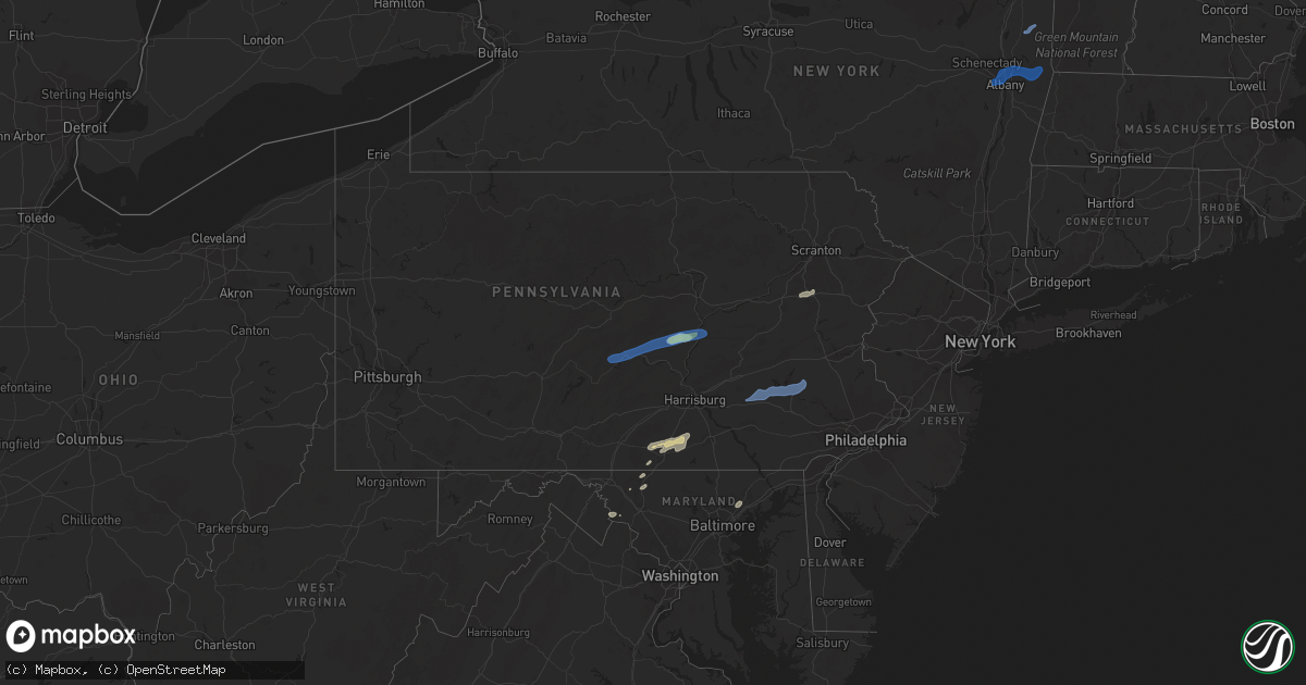
Hail Map in Pennsylvania on September 8, 2021
Get this storm
September 8 map
$229
one time, instant access
Download today. No call, no setup
Keep the $229
Bought the map and want the full workflow? Apply the entire $229 to a subscription within 7 days. None of it is wasted.
Every map, not just this one
This buys you this map. Subscription and you get every map we run, in the markets you choose from a few cities to whole states to nationwide. Plus real-time alerts the moment a storm fires.
Contact data
Name, contact info, occupancy, even credit band for addresses in the footprint. You go from where it hit to who to call.
Become the source they trust
Unlimited branding weather history reports on demand. You already have the documented answer ready for the property owner, and you are the one who showed up with it.
Property data and RoofTrace estimates
Pull up any address you have got, its value and the exact code rules for that jurisdiction, straight from One Click Code. Then RoofTrace estimates the squares, pitch, and roof value, priced the way you price.
Storm reports in Pennsylvania
Pennsylvania
| Date | Description |
|---|---|
| 09/08/20216:40 PM CDT | Trees and wires down along locust ridge road near arrowhead lake. Time based on radar. |
| 09/08/20215:10 PM CDT | Numerous trees down. |
| 09/08/20214:50 PM CDT | Numerous trees down between state rd and lower augusta. |
| 09/08/20214:45 PM CDT | Numerous trees and wires down along produce rd. Two trees down on a house. |
| 09/08/20214:40 PM CDT | Several trees down and two sheds destroyed. |
| 09/08/20214:35 PM CDT | Ef-0 tornado confirmed by nws storm survey southeast of freeburg near neitz valley road. |
| 09/08/20214:32 PM CDT | Ef-1 tornado confirmed by nws storm survey southeast of middleburg near route 104. |
| 09/08/20214:30 PM CDT | Multiple trees down. |
| 09/08/20214:30 PM CDT | Several trees down along route 104. |
| 09/08/20214:00 PM CDT | Tree and wires down. |
| 09/08/20214:00 PM CDT | Multiple trees down. |
| 09/08/20213:45 PM CDT | Numerous reports of trees and wires down across lewistown. |
| 09/08/20213:44 PM CDT | Trees and wires down. |
| 09/08/20216:27 AM CDT | At 1127 PM EDT, severe thunderstorms were located along a line extending from near Bath to near Zionsville, moving northeast at 35 mph. HAZARD...60 mph wind gusts and penny size hail. SOURCE...Radar indicated. IMPACT...Damage to roofs, siding, trees, and power lines is possible. Locations impacted include... Allentown, Easton, Bethlehem, Forks, Wilson, Hellertown, Nazareth, Bath, Harmony, Oxford, Alpha, Ferndale, Frenchtown, West Easton, Milford, Tatamy, Bloomsbury, Riegelsville, Steuben and Glendon.This includes the following highways... Northeast Extension between mile markers 45 and 47. Interstate 78 in Pennsylvania between mile markers 61 and 76. Interstate 78 in New Jersey between mile markers 0 and 10. |
| 09/08/20215:47 AM CDT | At 1047 PM EDT, severe thunderstorms were located along a line extending from near Lenhartsville to near Wyomissing, moving east at 40 mph. HAZARD...60 mph wind gusts and penny size hail. SOURCE...Radar indicated. IMPACT...Damage to roofs, siding, trees, and power lines is possible. Locations impacted include... Allentown, Reading, Bethlehem, Pottstown, Emmaus, Wyomissing, Northampton, Birdsboro, Kutztown, Fleetwood, Sinking Spring, Laureldale, East Greenville, Bath, Topton, Leesport, Shoemakersville, Bally, Bechtelsville and Lyons.This includes the following highways... Northeast Extension between mile markers 48 and 66. Interstate 78 in Pennsylvania between mile markers 34 and 60. Interstate 176 in Pennsylvania between mile markers 5 and 11. |
| 09/08/20215:11 AM CDT | At 1010 PM EDT, severe thunderstorms were located along a line extending from near Strausstown to near Schaefferstown, moving northeast at 40 mph. HAZARD...60 mph wind gusts and quarter size hail. SOURCE...Radar indicated. IMPACT...Minor damage to vehicles is possible. Wind damage to roofs, siding, trees, and power lines is possible. Locations impacted include... Reading, Wyomissing, Kutztown, Hamburg, Fleetwood, Sinking Spring, Laureldale, Womelsdorf, Wernersville, Robesonia, Leesport, Shoemakersville, Bernville, Lyons, Strausstown, Lenhartsville, Spring Ridge, Fairview Hgts, Shillington and West Reading.This includes Interstate 78 in Pennsylvania near mile marker 8, andbetween mile markers 10 and 41. |
| 09/08/20214:21 AM CDT | At 921 PM EDT, severe thunderstorms were located along a line extending from Carroll Valley to Wolfsville, moving northeast at 25 mph. HAZARD...60 mph wind gusts and quarter size hail. SOURCE...Radar indicated. IMPACT...Damaging winds will cause some trees and large branches to fall. This could injure those outdoors, as well as damage homes and vehicles. Roadways may become blocked by downed trees. Localized power outages are possible. Unsecured light objects may become projectiles. Locations impacted include... Thurmont, Emmitsburg, Taneytown, Wolfsville, Sabillasville, Harney, Rocky Ridge, Detour, Keysville, Keymar and Graceham. |
| 09/08/20213:55 AM CDT | At 855 PM EDT, a severe thunderstorm was located near Aspers, moving northeast at 35 mph. HAZARD...60 mph wind gusts and quarter size hail. SOURCE...Radar indicated. IMPACT...Hail damage to vehicles is expected. Expect wind damage to roofs, siding, and trees. This severe thunderstorm will be near... Aspers around 900 PM EDT. Hampton around 910 PM EDT. Dillsburg and Lake Meade around 920 PM EDT. Mechanicsburg and Siddonsburg around 930 PM EDT.Other locations impacted by this severe thunderstorm includeArendtsville, Franklintown, York Springs, Gardners, Wellsville,Heidlersburg, Biglerville, Idaville, Bendersville and Hunterstown.This includes The Pennsylvania Turnpike from mile markers 232 to 237. |
| 09/08/20212:59 AM CDT | At 759 PM EDT, severe thunderstorms were located along a line extending from near Pocono Pines to near McKeansburg, moving east at 35 mph. HAZARD...60 mph wind gusts and quarter size hail. SOURCE...Radar indicated. IMPACT...Minor damage to vehicles is possible. Wind damage to roofs, siding, trees, and power lines is possible. Locations impacted include... Lehighton, Mount Pocono, East Stroudsburg, Tobyhanna, Palmerton, Jim Thorpe, Hamburg, Slatington, Nesquehoning, Weatherly, Walnutport, Lenhartsville, Stormville, Neffs, Pocono Pines, Lake Harmony, New Tripoli, Skytop, Tannersville and Long Pond.This includes the following highways... Northeast Extension between mile markers 62 and 91. Interstate 78 in Pennsylvania between mile markers 33 and 47. Interstate 80 in Pennsylvania between mile markers 288 and 310. Interstate 380 in Pennsylvania between mile markers 0 and 13. |
| 09/08/20212:23 AM CDT | At 723 PM EDT, severe thunderstorms were located along a line extending from near Bear Creek Village to near White Haven to near Mcadoo, moving northeast at 60 mph. HAZARD...60 mph wind gusts and penny size hail. SOURCE...Radar indicated. IMPACT...Expect damage to roofs, siding, and trees. Locations impacted include... Hazleton, West Hazleton, Freeland, White Haven, Penn Lake Park, Bear Creek Village, Jeddo, Woodside-Drifton, Drifton and Stoddartsville. |
| 09/08/20212:17 AM CDT | At 717 PM EDT, severe thunderstorms were located along a line extending from White Haven to Tamaqua, moving east at 35 mph. HAZARD...60 mph wind gusts and quarter size hail. SOURCE...Radar indicated. IMPACT...Minor damage to vehicles is possible. Wind damage to roofs, siding, trees, and power lines is possible. Locations impacted include... Lehighton, Mount Pocono, Northampton, Tobyhanna, Palmerton, Jim Thorpe, Slatington, Nesquehoning, Weatherly, Walnutport, Neffs, Pocono Pines, Lake Harmony, New Tripoli, Skytop, Tannersville, Long Pond, Kresgeville, Sun Valley and Reeders.This includes the following highways... Northeast Extension between mile markers 62 and 97. Interstate 80 in Pennsylvania between mile markers 277 and 306. Interstate 380 in Pennsylvania between mile markers 0 and 13. |
| 09/08/202112:57 AM CDT | At 557 PM EDT, a severe thunderstorm was located over Trevorton, moving east at 35 mph. HAZARD...60 mph wind gusts and quarter size hail. SOURCE...Radar indicated. IMPACT...Hail damage to vehicles is expected. Expect wind damage to roofs, siding, and trees. This severe thunderstorm will be near... Leck Kill around 600 PM EDT. Shamokin, Marshallton, Fairview-Ferndale, Knoebels Grove and Elysburg around 610 PM EDT. Mount Carmel, Kulpmont, Wilburton Number One, Wilburton Number Two, Locustdale, Lavelle, Numidia, Slabtown and Beurys Lake around 620 PM EDT. Ashland, Aristes, Girardville and Fountain Springs around 630 PM EDT.Other locations impacted by this severe thunderstorm include Gordon,Edgewood, Park Place, Ringtown, Middleport, Cumbola, Marion Heights,Seven Points, Palo Alto and Shenandoah Heights.This includes Interstate 81 from mile markers 113 to 132. |
| 09/08/202112:11 AM CDT | At 511 PM EDT, a severe thunderstorm was located near Richfield, moving east at 40 mph. HAZARD...60 mph wind gusts. SOURCE...Radar indicated. IMPACT...Expect damage to roofs, siding, and trees. This severe thunderstorm will be near... Mount Pleasant Mills, Fremont, Middleburg and Meiserville around 520 PM EDT. Kreamer and Port Trevorton around 530 PM EDT. Selinsgrove, Hummels Wharf, Shamokin Dam, Kratzerville, Rebuck and Winfield around 540 PM EDT. Sunbury, Northumberland and Stonington around 550 PM EDT.Other locations impacted by this severe thunderstorm includeEdgewood, Beavertown, Seven Points, Freeburg, Snydertown, Herndon,Selinsgrove Airport and Dalmatia. |
| 09/07/202111:36 PM CDT | At 436 PM EDT, a severe thunderstorm was located over Highland Park, moving east at 45 mph. HAZARD...60 mph wind gusts. SOURCE...Radar indicated. IMPACT...Expect damage to roofs, siding, and trees. This severe thunderstorm will be near... Alfarata, Belltown and Reeds Gap State Park around 450 PM EDT. McClure and Mcalisterville around 500 PM EDT. Richfield, Beaver Springs, Paxtonville, Mount Pleasant Mills, Middleburg, Fremont and Troxelville around 510 PM EDT.Other locations impacted by this severe thunderstorm includeMifflintown, Beavertown, Maitland, Wagner, Barrville, Freeburg, EastSalem, Mifflin and Herndon. |
| 09/07/202110:37 PM CDT | At 336 PM EDT, severe thunderstorms were located along a line extending from near Franklindale to near Lincoln Falls to Barbours, moving east at 40 mph. HAZARD...60 mph wind gusts. SOURCE...Radar indicated. IMPACT...Expect damage to roofs, siding, and trees. Locations impacted include... Towanda, West Franklin, Wysox, Wilmot, Hollenback, North Towanda, Herrick, Wyalusing, Monroe and New Albany. |
| 09/07/202110:27 PM CDT | At 326 PM EDT, severe thunderstorms were located along a line extending from near Shunk to near Kettle Creek Gorge to near Barbours, moving east at 40 mph. HAZARD...60 mph wind gusts. SOURCE...Radar indicated. IMPACT...Expect damage to roofs, siding, and trees. Locations impacted include... Kettle Creek Gorge, Lincoln Falls, Barbours, Shunk, Loyalsockville, Dushore, Laporte, Forksville, Eagles Mere and Hillsgrove. |
| 09/07/20219:58 PM CDT | Tree on wires on angora road in lower alsace township. Time estimated from radar. |
| 09/07/20219:55 PM CDT | Wind gust measured at site ew3190 |
| 09/07/20219:50 PM CDT | Large branches and wires down in exeter township... Time estimated from radar. |
| 09/07/20219:48 PM CDT | Tree and wires down on 601 brobst street in shillington borough. Time estimated from radar. |
| 09/07/20219:43 PM CDT | Multiple large trees down. Time estimated from radar. |
| 09/07/20219:42 PM CDT | Tree down on garage... Time estimated from radar. |
| 09/07/20219:40 PM CDT | Tree on garage on cleveland avenue in spring township. Time estimated from radar. |
| 09/07/20219:40 PM CDT | Multiple trees and powerlines down on houses and vehicles. |
| 09/07/20219:32 PM CDT | Trees down on premises of wernersville state hospital. Time estimated from radar. |
| 09/07/20219:28 PM CDT | Tree and wires down in south heidelberg township. Time estimated from radar. |
| 09/07/20218:00 PM CDT | Tree down across north broadway at tribe lane. Time based on radar. |
| 09/07/20217:12 PM CDT | Tree limbs were downed onto wires near hemlock dr at sharbaugh rd. |
All States Impacted by Hail Map on September 8, 2021
Cities Impacted by Hail Map on September 8, 2021
- Dunn, NC
- Newton Grove, NC
- Fayetteville, NC
- New Oxford, PA
- Gettysburg, PA
- East Berlin, PA
- Abbottstown, PA
- Dover, PA
- Biglerville, PA
- Orrtanna, PA
- York Springs, PA
- Aspers, PA
- Yorktown, VA
- Seaford, VA
- Norfolk, VA
- Black Mountain, NC
- Louisburg, NC
- Cerro Gordo, NC
- Evergreen, NC
- Chadbourn, NC
- San Angelo, TX
- Benson, NC
- Four Oaks, NC
- Myersville, MD
- Rutherfordton, NC
- Middleburg, PA
- Mount Pleasant Mills, PA
- Port Trevorton, PA
- Selinsgrove, PA
- Freeburg, PA
- Richfield, PA
- Eden, TX
- Moncks Corner, SC
- Bonneau, SC
- Forest City, NC
- Carrollton, VA
- Sunset, SC
- Centre, AL
- Cedar Bluff, AL
- Leesburg, AL
- Brady, TX
- Camden, NC
- Kingsville, MD
- Lancaster, SC
- Wade, NC
- Chesterfield, SC
- Mertzon, TX
- Heath Springs, SC
- Hendersonville, NC
- Godwin, NC
- Cross, SC
- Saint Marys, GA
- Yulee, FL
- North Wilkesboro, NC
- Roaring River, NC
- Williamsburg, VA
- Mason, TX
- Perry Hall, MD
- Glen Arm, MD
- Hydes, MD
- Fork, MD
- Bostic, NC
- Ellenboro, NC
- Henderson, NC
- North Augusta, SC
- Horse Shoe, NC
- Mills River, NC
- Fort Eustis, VA
- Newport News, VA
- Smithfield, VA
- Surry, VA
- Clewiston, FL
- Monroe, NC
- Taylorsville, NC
- Hayes, VA
- Gloucester, VA
- Brookfield, CT
- Danbury, CT
- Christoval, TX
- Menard, TX
- Gustine, TX
- Hamilton, TX
- Jasper, FL
- Granite Falls, NC
- Union Mills, NC
- Warrenton, NC
- Fairfield, PA
- Sonora, TX
- Minonk, IL
- Littleton, NC
- Macon, NC
- Lawn, TX
- Ovalo, TX
- Mocksville, NC
- Fair Bluff, NC
- Orrum, NC
- Mill Spring, NC
- Carlton, TX
- La Place, LA
- Hiddenite, NC
- Cheraw, SC
- Loxahatchee, FL
- West Palm Beach, FL
- San Saba, TX
- Asheboro, NC
- Orlando, FL
- Lenoir, NC
- Lake Lure, NC
- Virginia Beach, VA
- Knoxville, MD
- Jefferson, MD
- Marion, NC
- Voss, TX
- Millersview, TX
- Miles, TX
- Fort Monroe, VA
- Sharpsburg, MD
- Keedysville, MD
- Thurmont, MD
- Emmitsburg, MD
- Sabillasville, MD
- Disputanta, VA
- Lawrenceville, GA
- Suwanee, GA
- Freeland, PA
- White Haven, PA
- Lake Harmony, PA
- Franklin, VA
- Beavertown, PA
- Goldsboro, TX
- Melvin, TX
- Burlington, VT
- Shelburne, VT
- Lake George, NY
- Fort Ann, NY
- Kattskill Bay, NY
- Queensbury, NY
- Greenwich, NY
- Watervliet, NY
- Petersburg, NY
- Waterford, NY
- Troy, NY
- Cohoes, NY
- Cropseyville, NY
- Slingerlands, NY
- Poestenkill, NY
- Averill Park, NY
- Wynantskill, NY
- Latham, NY
- Albany, NY
- Panacea, FL
- Yeagertown, PA
- McClure, PA
- Lewistown, PA
- McAlisterville, PA
- Mifflintown, PA
- McVeytown, PA
- Herndon, PA
- Beaver Springs, PA
- Cocolamus, PA
- Burnham, PA
- Belleville, PA
- Dornsife, PA
- Sunbury, PA
- Newmanstown, PA
- Lititz, PA
- Womelsdorf, PA
- Myerstown, PA
- Wernersville, PA
- Oley, PA
- Denver, PA
- Stevens, PA
- Reinholds, PA
- Lebanon, PA
- Fleetwood, PA
- Douglassville, PA
- Robesonia, PA
- Schaefferstown, PA
- Birdsboro, PA
- Reading, PA
- Temple, PA


